Your search criteria found 2308 images
Target is Earth
Go to PIAxxxxx:
Refine this list of images by:
Target:
Mission:
Spacecraft:
Instrument:
Click on an image for detailed information
Click on a column heading to sort in ascending or descending order
My
List
Addition Date TargetSort Descending Mission Instrument Size
Add Image to Favorite List 2004-07-13 Earth Jason-1
Altimeter
900x900x3
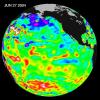
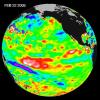
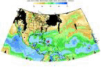
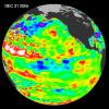
Recent sea level height data from NASA's U.S./France Jason altimetric satellite during a 10-day cycle ending June 27, 2004 shows that Pacific equatorial surface ocean heights and temperatures are near neutral.
PIA06381:
Pacific Decadal Oscillation Influences Drought (June 27, 2004)
Full Resolution:     TIFF (2.433 MB)     JPEG (115.5 kB)
Add Image to Favorite List 2004-07-21 Earth Terra
MISR
2927x1778x3
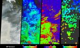
Large lightning-induced fires were active in Alaska and the Yukon Territory from mid-June to mid-July, 2004 as seen by NASA's Terra spacecraft.
PIA04363:
Smoke Signals from the Alaska and Yukon Fires
Full Resolution:     TIFF (7.759 MB)     JPEG (912.9 kB)
Add Image to Favorite List 2004-08-04 Earth Jason-1
Altimeter
900x900x3
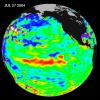
Sea-level height data from NASA's U.S./France Jason altimetric satellite during a 10-day cycle ending July 27, 2004, show weaker than normal trade winds in the western and central equatorial Pacific have triggered an eastward moving, warm Kelvin wave.
PIA06751:
Warm Pacific Water Wave Heads East, But No El Niņo Yet
Full Resolution:     TIFF (2.438 MB)     JPEG (110.9 kB)
Add Image to Favorite List 2004-08-18 Earth Terra
MISR
1526x1162x3
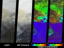
A look at smoke from the Chisholm forest fire, which ignited on May 23, 2001 about 160 kilometers north of Edmonton in Alberta, Canada, as seen by NASA's Terra spacecraft.
PIA04365:
Smoke Soars to Stratospheric Heights
Full Resolution:     TIFF (2.566 MB)     JPEG (395.6 kB)
Add Image to Favorite List 2004-09-01 Earth Terra
MISR
2544x1527x3
These views of the Russian Arctic were acquired by NASA's Terra spacecraft on July 11, 2004, when the brief arctic summer had transformed the frozen tundra and the thousands of lakes, channels, and rivers of the Lena Delta into a fertile wetland.
PIA04366:
A Summer View of Russia's Lena Delta and Olenek
Full Resolution:     TIFF (10.55 MB)     JPEG (608.1 kB)
Add Image to Favorite List 2004-09-03 Earth Shuttle Radar Topography Mission (SRTM)
C-Band Radar
X-Band Radar
8200x5389x3
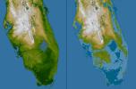
The very low topography of southern Florida is evident in this color-coded shaded relief map generated with data from NASA's Shuttle Radar Topography Mission.
PIA06666:
Southern Florida, Shaded Relief and Colored Height
Full Resolution:     TIFF (65.04 MB)     JPEG (5.819 MB)
Add Image to Favorite List 2004-09-14 Earth Terra
MISR
1693x1262x3
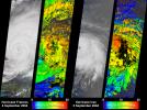
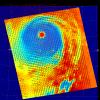
NASA's Terra spacecraft captured these images and cloud-top height retrievals of Hurricane Frances on September 4, 2004, when the eye sat just off the coast of eastern Florida, and Hurricane Ivan on September 5th.
PIA04367:
Cloud Height Maps for Hurricanes Frances and Ivan
Full Resolution:     TIFF (2.952 MB)     JPEG (578.8 kB)
Add Image to Favorite List 2004-09-15 Earth Shuttle Radar Topography Mission (SRTM)
C-Band Radar
X-Band Radar
9100x11220x3
The topography of the Gulf Coast states showing southern Louisiana, Mississippi, Alabama and the panhandle of Florida is well shown in this color-coded shaded relief map generated with data from NASA's Shuttle Radar Topography Mission.
PIA06667:
Gulf Coast, Shaded Relief and Colored Height
Full Resolution:     TIFF (236.5 MB)     JPEG (26.54 MB)
Add Image to Favorite List 2004-09-22 Earth Terra
ASTER
870x390x3
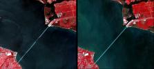
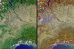
Interstate 10 across Pensacola Bay, Florida was severely damaged by Hurricane Ivan. This image was acquired by NASA's Terra satellite on September 21, 2004.
PIA06873:
Damage by Hurricane Ivan over Pensacola Bay, Florida
Full Resolution:     TIFF (723.5 kB)     JPEG (42.85 kB)
Add Image to Favorite List 2004-09-29 Earth Terra
MISR
3292x3608x3
These visualizations of Hurricane Jeanne on September 24, 2004 were captured by NASA's Terra spacecraft after the hurricane caused widespread destruction on Puerto Rico, Haiti and the Dominican Republic.
PIA04368:
Hurricane Jeanne Cloud Height and Motion
Full Resolution:     TIFF (16.71 MB)     JPEG (2.156 MB)
Add Image to Favorite List 2004-10-01 Earth Shuttle Radar Topography Mission (SRTM)
C-Band Imaging Radar
X-Band Radar
2300x1730x3
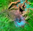
NASA's Shuttle Radar Topography Mission shows Mount Saint Helens, one of several prominent volcanoes of the Cascade Range that stretches from British Columbia, Canada, southward through Washington, Oregon, and into northern California.
PIA06668:
Mount Saint Helens, Washington, USA, SRTM Perspective: Shaded Relief and Colored Height
Full Resolution:     TIFF (10.69 MB)     JPEG (580.4 kB)
Add Image to Favorite List 2004-10-02 Earth Terra
MISR
1336x924x3
In the Arabian Sea, sunlight and nutrients has fueled a startling occurrence of colorful phytoplankton and bacterial assemblages, which is captured in these natural color images from NASA's Terra spacecraft October 2, 2004.
PIA04369:
Red Plankton in the Arabian Sea
Full Resolution:     TIFF (3.416 MB)     JPEG (118.9 kB)
Add Image to Favorite List 2002-06-14 Earth Aqua
AIRS
2144x1184x3
These four images of the Mediterranean were obtained concurrently on June 14, 2002 from the three instruments that make up the Atmospheric Infrared Sounder experiment system aboard NASA's Aqua spacecraft.
PIA00326:
AIRS First Light Data: Eastern Mediterranean, June 14, 2002
Full Resolution:     TIFF (4.752 MB)     JPEG (184.6 kB)
Add Image to Favorite List 2002-07-03 Earth Aqua
AIRS
362x814x3
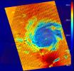
These four images of Tropical Cyclone Ramasun were obtained July 3, 2002 by the Atmospheric Infrared Sounder experiment system onboard NASA's Aqua spacecraft.
PIA00341:
AIRS First Light Data: Typhoon Ramasun, July 3, 2002
Full Resolution:     TIFF (680 kB)     JPEG (54.25 kB)
Add Image to Favorite List 2004-10-27 Earth Terra
MISR
1669x2088x3
Zambia, the Democratic Republic of the Congo, Mozambique, and Zimbabwe are shown in this MISR Mystery Quiz #20 captured by NASA's Terra spacecraft.
PIA04370:
Where on Earth...? MISR Mystery Image Quiz # 20:
Zambia, the Democratic Republic of the Congo, Mozambique, and Zimbabwe

Full Resolution:     TIFF (7.715 MB)     JPEG (668.9 kB)
Add Image to Favorite List 2004-11-10 Earth Terra
MISR
1723x1838x3
Heavy rainfall in southern Africa between December 2003 and April 2004 provided central Zambia with floodwaters needed to support the diverse uses of water within the Kafue Flats area as seen by NASA's Terra spacecraft.
PIA04371:
Floodwaters Renew Zambia's Kafue Wetland
Full Resolution:     TIFF (8.518 MB)     JPEG (716.8 kB)
Add Image to Favorite List 2002-07-13 Earth Aqua
AIRS
1536x1536x3
These images, taken over northern Europe on July 20, 2002, depict a few of the different views of Earth and its atmosphere that are produced by the Atmospheric Infrared Sounder experiment system operating on NASA's Aqua spacecraft.
PIA00345:
AIRS First Light Data: Northern Europe, July 20, 2002
Full Resolution:     TIFF (3.093 MB)     JPEG (182.1 kB)
Add Image to Favorite List 2004-11-16 Earth Jason-1
Altimeter
900x900x3
NASA's U.S./France Jason altimetric satellite during a 10-day cycle ending November 15, 2004 showed that the central equatorial Pacific continued to exhibit an area of higher-than-normal sea surface heights.
PIA05078:
El Nino: Pumping Up or Fizzling Out?
Full Resolution:     TIFF (1.575 MB)     JPEG (116.1 kB)
Add Image to Favorite List 2004-12-09 Earth Shuttle Radar Topography Mission (SRTM)
C-Band Radar
X-Band Radar
5200x4858x3
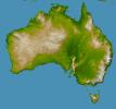
NASA's Shuttle Radar Topography Mission shows Australia, the world's smallest, flattest, and (after Antarctica) driest continent, but at 7.7 million square kilometers (3.0 million square miles) it is also the sixth largest country.
PIA06665:
Australia, Shaded Relief and Colored Height
Full Resolution:     TIFF (38.46 MB)     JPEG (3.481 MB)
Add Image to Favorite List 2004-12-09 Earth QuikScat
SeaWinds Scatterometer
1414x1540x3
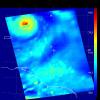
This image, produced from data collected on December 1, 2004, by the SeaWinds scatterometer instrument onboard NASA's QuikScat mission reveals the details of the surface winds and rain in Typhoon Nanmadol as it moves westward.
PIA07100:
Typhoon Nanmadol
Full Resolution:     TIFF (6.539 MB)     JPEG (1.741 MB)
Add Image to Favorite List 2004-12-14 Earth Shuttle Radar Topography Mission (SRTM)
C-Band Radar
X-Band Radar
4500x5800x3
New Zealand straddles the juncture of the Indo-Australian and Pacific tectonic plates, two of Earth's major crustal plates in this image from NASA's Shuttle Radar Topography Mission.
PIA06662:
New Zealand, SRTM Shaded Relief and Colored Height
Full Resolution:     TIFF (13.15 MB)     JPEG (1.272 MB)
Add Image to Favorite List 2010-02-19 Earth GRACE
K-Band Ranging System
1279x720x3
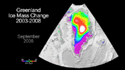
NASA's GRACE mission has become a key source of knowledge about global ice mass changes. Studies of Greenland using GRACE and other data indicate that between 2000 and 2008 the Greenland ice sheet lost as much as 1,500 gigatons of mass.
PIA12845:
Greenland Gains Some, Loses More Animation Icon
Full Resolution:     TIFF (2.766 MB)     JPEG (101.2 kB)
Add Image to Favorite List 2005-01-06 Earth Landsat
Shuttle Radar Topography Mission (SRTM)
Spaceborne Imaging Radar
C/X-Band Synthetic Aperture Radar
1414x810x3
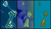
Bora Bora, Tahaa, and Raiatea (top to bottom) are Polynesian Islands about 220 kilometers (135 miles) west-northwest of Tahiti in the South Pacific. This image from NASA's Shuttle Radar Topography Mission.
PIA06660:
Bora Bora, Tahaa, and Raiatea, French Polynesia, Landsat and SIR-C Images Compared to SRTM Shaded Relief and Colored Height
Full Resolution:     TIFF (2.921 MB)     JPEG (158.8 kB)
Add Image to Favorite List 2005-01-06 Earth Shuttle Radar Topography Mission (SRTM)
Spaceborne Imaging Radar
C/X-Band Synthetic Aperture Radar
5342x1746x3
The Alpine fault runs parallel to, and just inland of, much of the west coast of New Zealand's South Island. This view was created from the near-global digital elevation model produced by NASA's Shuttle Radar Topography Mission.
PIA06661:
Alpine Fault, New Zealand, SRTM Shaded Relief and Colored Height
Full Resolution:     TIFF (22.84 MB)     JPEG (1.473 MB)
Add Image to Favorite List 2005-01-06 Earth Shuttle Radar Topography Mission (SRTM)
Spaceborne Imaging Radar
C/X-Band Synthetic Aperture Radar
2919x1565x3
The Davenport Ranges of central Australia have been inferred to be among the oldest persisting landforms on Earth as seen by NASA's Shuttle Radar Topography Mission.
PIA06663:
Davenport Ranges, Northern Territory, Australia, SRTM Shaded Relief and Colored Height
Full Resolution:     TIFF (10.79 MB)     JPEG (608.1 kB)
Add Image to Favorite List 2005-01-06 Earth Shuttle Radar Topography Mission (SRTM)
Spaceborne Imaging Radar
C/X-Band Synthetic Aperture Radar
1610x1100x3
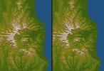
Australia is the only continent without any current volcanic activity, but it hosts one of the world's largest extinct volcanoes, the Tweed Volcano as seen by NASA's Shuttle Radar Topography Mission.
PIA06664:
Tweed Extinct Volcano, Australia, Stereo Pair of SRTM Shaded Relief and Colored Height
Full Resolution:     TIFF (4.368 MB)     JPEG (254.5 kB)
Add Image to Favorite List 2005-01-12 Earth Jason-1
Altimeter
1590x1800x3
Displayed in blue color is the height of sea surface (shown in blue) measured by NASA's Jason satellite two hours after the initial magnitude 9 earthquake hit the region (shown in red) southwest of Sumatra on December 26, 2004.
PIA07219:
NASA/French Satellite Data Reveal New Details of Tsunami
Full Resolution:     TIFF (1.269 MB)     JPEG (280 kB)
Add Image to Favorite List 2005-01-12 Earth Terra
MISR
1245x1090x3
On 26 December 2004, a magnitude 9.0 earthquake occurred off the west coast of Sumatra, Indonesia. These views were acquired by NASA's Terra spacecraft.
PIA04372:
Breaking Tsunami Waves along India's Eastern Coast Animation Icon
Full Resolution:     TIFF (3.174 MB)     JPEG (100.1 kB)
Add Image to Favorite List 2005-01-12 Earth Terra
ASTER
1320x1840x3
The island of Phuket on the Indian Ocean coast of Thailand is a major tourist destination and was also in the path of the tsunami that washed ashore on December 26, 2004. Images were acquired by NASA's Terra spacecraft.
PIA07227:
New NASA Imagery Sheds Additional Perspectives on Tsunami
Full Resolution:     TIFF (7.294 MB)     JPEG (481.9 kB)
Add Image to Favorite List 2005-01-14 Earth Shuttle Radar Topography Mission (SRTM)
C-Band Interferometric Radar
3000x5200x3
The topography of the island nation of Sri Lanka is well shown in this color-coded shaded relief map generated with digital elevation data from NASA's Shuttle Radar Topography Mission.
PIA06670:
Sri Lanka, Colored Height
Full Resolution:     TIFF (28.95 MB)     JPEG (3.425 MB)
Add Image to Favorite List 2005-01-14 Earth Shuttle Radar Topography Mission (SRTM)
Terra
ASTER
SIR-C/X-SAR
1987x1840x3
This image from NASA's Terra spacecraft shows the Indian Ocean coastline north of Phuket, Thailand is a major tourist destination that was in the path of the tsunami produced by a giant offshore earthquake on December 26, 2004.
PIA06671:
Tsunami Inundation, North of Phuket, Thailand
ASTER Images and SRTM Elevation Model

Full Resolution:     TIFF (10.98 MB)     JPEG (737.4 kB)
Add Image to Favorite List 2002-09-26 Earth Aqua
AIRS
674x740x3
Hurricane Isidore as seen by the Atmospheric Infrared Sounding System (AIRS) on NASA's Aqua in 2002.
PIA00350:
Hurricane Isadore
Full Resolution:     TIFF (1.498 MB)     JPEG (83.06 kB)
Add Image to Favorite List 2002-11-13 Earth Aqua
AIRS
960x1076x3
Mt. Etna, a volcano on the island of Sicily, erupted on October 26, 2002, as seen by the Atmospheric Infrared Sounding System (AIRS) on NASA's Aqua.
PIA00355:
Mt. Etna Eruption
Full Resolution:     TIFF (2.131 MB)     JPEG (120 kB)
Add Image to Favorite List 2005-01-26 Earth Terra
MISR
1516x1504x3
The initial tsunami waves resulting from the undersea earthquake that occurred at 00:58:53 UTC (Coordinated Universal Time) on 26 December 2004 off the island of Sumatra, Indonesia, as seen by NASA's Terra spacecraft.
PIA04373:
Deep Ocean Tsunami Waves off the Sri Lankan Coast
Full Resolution:     TIFF (6.162 MB)     JPEG (260.6 kB)
Add Image to Favorite List 2002-10-02 Earth Aqua
AIRS
699x419x3
Tropical Storm Isidore was born in mid-September, 2000 north of Venezuela. This images is from Atmospheric Infrared Sounding System (AIRS) on NASA's Aqua.
PIA00365:
Flooding Resulting From Hurricane Isidore, Comparing Data from September 12 and 28, 2002
Full Resolution:     TIFF (327.8 kB)     JPEG (71.12 kB)
Add Image to Favorite List 2002-12-19 Earth Aqua
AIRS
1280x1280x3
This image was made from data acquired by the Atmospheric Infrared Sounding System (AIRS) instrument suite aboard NASA's Aqua spacecraft in December, 2002, just as the eye of Supertyphoon Pongsona was about to pass over Guam.
PIA00367:
Supertyphoon Pongsona
Full Resolution:     TIFF (2.6 MB)     JPEG (132.5 kB)
Add Image to Favorite List 2003-03-11 Earth Aqua
AIRS
1003x946x3
Visible image of a California storm in March, 2003, as seen by the Atmospheric Infrared Sounder (AIRS) on NASA's Aqua satellite.
PIA00402:
Viewing a California Storm
Full Resolution:     TIFF (1.767 MB)     JPEG (140.5 kB)
Add Image to Favorite List 2003-06-02 Earth Aqua
AIRS
1437x921x3
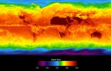
This image shows average temperatures in April, 2003, observed by AIRS at an infrared wavelength that senses either the Earth's surface or any intervening cloud.
PIA00427:
Global Average Brightness Temperature for April 2003
Full Resolution:     TIFF (2.867 MB)     JPEG (158.1 kB)
Add Image to Favorite List 2003-09-18 Earth Aqua
AIRS
489x471x3
This false-color image shows Hurricane Isabel viewed by the AIRS and AMSU-A instruments at 1:30 EDT in the morning of Thursday September 18, 2003.
PIA00428:
Hurricane Isabel
Full Resolution:     TIFF (393.3 kB)     JPEG (50.8 kB)
Add Image to Favorite List 2003-09-20 Earth Aqua
AIRS
Scatterometer (SeaWinds)
500x500x3
These two images show Hurricane Isabel as viewed by AIRS and SeaWinds scatterometers on NASA's ADEOS-2 and QuikScat satellites in September, 2003.
PIA00429:
Hurricane Isabel, AIRS Infrared and SeaWinds Scatterometer Data Combined
Full Resolution:     TIFF (252 kB)     JPEG (521 kB)
Add Image to Favorite List 2005-02-23 Earth Terra
MISR
1548x1224x3
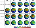
These 19 global panels show the %-year seasonal-average distribution of atmospheric aerosol amount across Africa and the Atlantic Ocean from data captured by NASA's Terra spacecraft.
PIA04374:
Five Years of MISR Global Aerosol Observations
Full Resolution:     TIFF (2.641 MB)     JPEG (369.7 kB)
Add Image to Favorite List 2005-03-03 Earth QuikScat
SeaWinds Scatterometer
1456x1548x3
The SeaWinds scatterometer aboard NASA's QuikScat satellite collected the data used to create this colorful image of Cyclone Olaf churning in the South Pacific on February 16, 2005.
PIA07415:
Cyclones in the Pacific
Full Resolution:     TIFF (4.757 MB)     JPEG (792.9 kB)
Add Image to Favorite List 2005-03-09 Earth Terra
MISR
1371x1181x3
Actinae, or radial symmetry, is shown in this MISR Mystery Quiz #21 captured by NASA's Terra spacecraft.
PIA04375:
Where on Earth...? MISR Mystery Image Quiz #21:
ACTINAE

Full Resolution:     TIFF (4.61 MB)     JPEG (257.9 kB)
Add Image to Favorite List 2003-09-20 Earth Aqua
AIRS
500x500x3
a Category 5 storm.
PIA00430:
Hurricane Isabel, Amount of Atmospheric Water Vapor Observed By AIRS
Full Resolution:     TIFF (482.7 kB)     JPEG (37.55 kB)
Add Image to Favorite List 2005-03-14 Earth Jason-1
Altimeter
900x900x3
Recent sea-level height data from NASA's U.S./France Jason altimetric satellite during a 10-day cycle ending February 22, 2005, showed that the central equatorial Pacific continues to exhibit an area of higher-than-normal sea surface heights.
PIA07456:
El Niņo: The Weak, Getting Weaker
Full Resolution:     TIFF (1.554 MB)     JPEG (116.5 kB)
Add Image to Favorite List 2005-03-16 Earth Shuttle Radar Topography Mission (SRTM)
C-Band Imaging Radar
X-Band Radar
6587x8336x3
The island of Ireland comprises a large central lowland of limestone with a relief of hills surrounded by a discontinuous border of coastal mountains which vary greatly in geological structure as seen by NASA's Shuttle Radar Topography Mission.
PIA06672:
Ireland, Shaded Relief and Colored Height
Full Resolution:     TIFF (96.97 MB)     JPEG (6.802 MB)
Add Image to Favorite List 2005-03-18 Earth Terra
ASTER
1595x1458x3
This NASA's Terra satellite image of Mount St. Helens was captured one week after the March 8, 2005 ash and steam eruption, the latest activity since the volcano's reawakening in September 2004.
PIA07478:
Mount St. Helens
Full Resolution:     TIFF (6.988 MB)     JPEG (598.9 kB)
Add Image to Favorite List 2004-09-15 Earth Aqua
AIRS
900x695x3
as seen by the Atmospheric Infrared Sounding System (AIRS) on NASA's Aqua.
PIA00431:
Hurricane Ivan as Observed by NASA's Spaceborne Atmospheric Infrared Sounder (AIRS)
Full Resolution:     TIFF (708.9 kB)     JPEG (149.8 kB)
Add Image to Favorite List 2005-03-23 Earth Terra
MISR
2076x1670x3
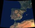
Data from a portion of the imagery acquired by NASA's Terra spacecraft during 2000-2002 were combined to create this cloud-free natural-color mosaic of southwestern Europe and northwestern Morocco and Algeria.
PIA04376:
Where Europe meets Africa
Full Resolution:     TIFF (5.048 MB)     JPEG (286.9 kB)
Add Image to Favorite List 2004-08-30 Earth Aqua
AIRS
500x342x3
Born in the Atlantic, Hurricane Frances became a category 4 hurricane on August 31, 2004, as seen by the Atmospheric Infrared Sounding System (AIRS) on NASA's Aqua.
PIA00433:
Hurricane Frances as Observed by NASA's Spaceborne Atmospheric Infrared Sounder (AIRS) - Total Water Vapor Time Series Animation Icon
Full Resolution:     TIFF (344.8 kB)     JPEG (36.3 kB)
Add Image to Favorite List 2005-04-13 Earth Terra
MISR
2037x1732x3
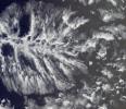
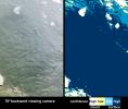
As it passed over Antarctica on December 16, 2004, NASA's Terra satellite captured this image showing a wavy pattern in a field of white.
PIA04377:
Waves on White: Ice or Clouds?
Full Resolution:     TIFF (10.6 MB)     JPEG (292.9 kB)
Add Image to Favorite List 2005-05-04 Earth Terra
MISR
1264x1445x3
Seasonal changes in Earth's surface albedo over a 5-year period are seen in these image summary maps from NASA's Terra spacecraft.
PIA04378:
Seasonal Changes in Earth's Surface Albedo
Full Resolution:     TIFF (5.485 MB)     JPEG (291.8 kB)
Add Image to Favorite List 2005-05-18 Earth Terra
MISR
1786x943x3
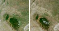
Despite good rainfall and record-setting snowstorms in the spring of 2005, most of northeastern Wyoming, the Black Hills, and western South Dakota remained in the midst of a severe drought. These images are from NASA's Terra spacecraft.
PIA04379:
Drought in the Black Hills
Full Resolution:     TIFF (5.06 MB)     JPEG (368.5 kB)
Add Image to Favorite List 2005-06-02 Earth Aura
MLS
1013x939x3
This image from the Microwave Limb Sounder instrument on NASA's Aura spacecraft depicts the relationship between nitrous oxide levels and ozone loss, 2004-2005 Arctic winter.
PIA07994:
Microwave Limb Sounder Measurements Depicting the Relationship Between Nitrous Oxide Levels and Ozone Loss, 2004-2005 Arctic Winter
Full Resolution:     TIFF (2.858 MB)     JPEG (93.72 kB)
Add Image to Favorite List 2005-06-02 Earth Aura
MLS
642x335x3
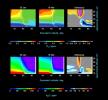
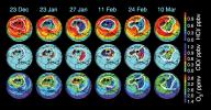
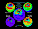
These data maps from the Microwave Limb Sounder on NASA's Aura spacecraft depict levels of hydrogen chloride, chlorine monoxide, and ozone at an altitude of approximately 19 km (490,000 ft) on selected days during the 2004-05 Arctic winter.
PIA07252:
Aura's Microwave Limb Sounder Estimates of Ozone Loss, 2004/2005 Arctic Winter
Full Resolution:     TIFF (646.1 kB)     JPEG (65.28 kB)
Add Image to Favorite List 2005-06-02 Earth Aura
Ozone Monitoring Instrument
2215x6554x3
Images from the Ozone Monitoring Instrument onboard NASA's Aura spacecraft shows the average total column ozone during the months of January and March, and the total column ozone on the single day of 11 March, 2005.
PIA07254:
Selected Measurements of Total Arctic Column Ozone Amounts from Aura's Ozone Monitoring Instrument, 2004-2005 Arctic Winter
Full Resolution:     TIFF (43.6 MB)     JPEG (1.489 MB)
Add Image to Favorite List 2005-06-02 Earth Aura
MLS
720x540x3
This still from an animation created from data from the Microwave Limb Sounder instrument on NASA's Aura spacecraft depicts the complex interaction of chemicals involved in the destruction of ozone during the 2005 Arctic winter.
PIA07255:
Aura Microwave Limb Sounder Animation Illustrating the Interaction Between Temperatures and Chemicals Involved in Ozone Destruction, 2004-2005 Arctic Winter Animation Icon
Full Resolution:     TIFF (1.168 MB)     JPEG (60.91 kB)
Add Image to Favorite List 2005-06-08 Earth Terra
MISR
1058x696x3
The lowlands of Lombardy and Piedmont in northwest Italy are some of the most highly developed irrigation areas in the world. These views of the region were acquired on May 8, 2005, by NASA's Terra spacecraft.
PIA04380:
Rice Cultivation in Northwest Italy
Full Resolution:     TIFF (2.212 MB)     JPEG (217.1 kB)
Add Image to Favorite List 2004-08-30 Earth Aqua
AIRS
490x471x3
This image shows Hurricane Frances in August 2004 as captured by instruments onboard two different NASA satellites: the AIRS infrared instrument onboard Aqua, and the SeaWinds scatterometer onboard QuikSCAT.
PIA00435:
Hurricane Frances as Observed by NASA's Spaceborne Atmospheric Infrared Sounder (AIRS) and SeaWinds Scatterometer
Full Resolution:     TIFF (693.4 kB)     JPEG (88.32 kB)
Add Image to Favorite List 2004-07-14 Earth Aqua
AIRS
1000x1000x3
Tropical Storm Blas as observed by the Atmospheric Infrared Sounder (AIRS) onboard NASA's Aqua in the year 2004.
PIA00436:
Tropical Storm Blas off the Pacific Coast of Mexico
Full Resolution:     TIFF (3.004 MB)     JPEG (121.3 kB)
Add Image to Favorite List 2005-06-22 Earth Terra
MISR
1362x1004x3
The Ganges Plain is shown in this MISR Mystery Quiz #22 captured by NASA's Terra spacecraft.
PIA04381:
Where on Earth...? MISR Mystery Image Quiz #22: Ganges Plain
Full Resolution:     TIFF (4.107 MB)     JPEG (295.8 kB)
Add Image to Favorite List 2004-07-23 Earth Aqua
AIRS
1000x1000x3
Hurricane Celia as observed by the Atmospheric Infrared Sounder (AIRS) onboard NASA's Aqua in the year 2004.
PIA00438:
Hurricane Celia off the Pacific Coast of Mexico
Full Resolution:     TIFF (3.004 MB)     JPEG (140.8 kB)
Add Image to Favorite List 2005-07-18 Earth QuikScat
SeaWinds Scatterometer
1280x1440x3
Typhoon Haitang is shown here churning steadily towards Taiwan and China. This image shows the storm's swirling wind patterns as observed by NASA's QuikScat satellite on July 14, 2005, at 19:19 UTC (14:19 Eastern Daylight Time).
PIA07968:
Super Typhoon Haitang
Full Resolution:     TIFF (5.536 MB)     JPEG (636.7 kB)
Add Image to Favorite List 2005-07-18 Earth QuikScat
SeaWinds Scatterometer
1535x1575x3
When NASA's Quick Scatterometer (QuikScat) captured this image on July 13, 2005, Emily was just a few hours away from becoming a hurricane.
PIA07969:
Hurricane Emily
Full Resolution:     TIFF (7.266 MB)     JPEG (561 kB)
Add Image to Favorite List 2005-08-25 Earth QuikScat
SeaWinds Scatterometer
835x773x3
Tropical Storm Katrina is shown here as observed by NASA's QuikScatsatellite on August 25, 2005, at 08:37 UTC (4:37 a.m. in Florida). At that time, the storm had 80 kilometers per hour (50 miles per hour; 43 knots) sustained winds.
PIA07432:
Tropical Storm Katrina
Full Resolution:     TIFF (1.939 MB)     JPEG (229.8 kB)
Add Image to Favorite List 2004-07-26 Earth Aqua
AIRS
1000x1000x3
Hurricane Darby as observed by the Atmospheric Infrared Sounder (AIRS) onboard NASA's Aqua in July, 2004.
PIA00439:
Hurricane Darby off the Pacific Coast of Mexico
Full Resolution:     TIFF (3.004 MB)     JPEG (139 kB)
Add Image to Favorite List 2005-07-28 Earth Terra
MISR
1222x3591x3
This image, captured by NASA's Terra satellite on July 20, 2005, shows the dust cloud just off the west coast of Africa near Mauritania and Senegal.
PIA03539:
Saharan Dust Cloud Sails Toward U.S.
Full Resolution:     TIFF (13.18 MB)     JPEG (208.9 kB)
Add Image to Favorite List 2005-08-03 Earth Terra
MISR
2390x1110x3
How precisely do the size of the aerosol particles comprising the dust that obscured the Red Sea on July 26, 2005? This image is from NASA's Terra spacecraft.
PIA04382:
The Size of Dust and Smoke
Full Resolution:     TIFF (7.968 MB)     JPEG (230.9 kB)
Add Image to Favorite List 2005-08-22 Earth Mars Reconnaissance Orbiter (MRO)
MARCI
85x75x3
Three days after the Mars Reconnaissance Orbiter's Aug. 12, 2005, launch, the NASA spacecraft was pointed toward Earth and the Mars Color Imager camera was powered up to acquire a suite of color and ultraviolet images of Earth and the Moon.
PIA04159:
Calibration Image of Earth by Mars Color Imager
Full Resolution:     TIFF (19.39 kB)     JPEG (870)
Add Image to Favorite List 2005-08-22 Earth Mars Reconnaissance Orbiter (MRO)
MARCI
700x80x1
Three days after NASA's Mars Reconnaissance Orbiter's Aug. 12, 2005, launch, the spacecraft was pointed toward Earth and the Mars Color Imager camera was powered up to acquire a suite of images of Earth and the Moon.
PIA04160:
Calibration View of Earth and the Moon by Mars Color Imager Animation Icon
Full Resolution:     TIFF (56.29 kB)     JPEG (1.314 kB)
Add Image to Favorite List 2005-08-24 Earth Aqua
AIRS
3200x2400x3
NASA's Atmospheric Infrared Sounder instrument is able to peel back cloud cover to reveal 3-D structure of a storm's water vapor content, information that can be used to improve weather forecast models.
PIA07938:
AIRS Storm Front Approaching California (animation) Animation Icon
Full Resolution:     TIFF (23.04 MB)     JPEG (629.5 kB)
Add Image to Favorite List 2005-08-29 Earth Shuttle Radar Topography Mission (SRTM)
C-Band Imaging Radar
X-Band Radar
3000x2519x3
The city of New Orleans, situated on the southern shore of Lake Pontchartrain, is shown in this radar image from NASA's Shuttle Radar Topography Mission. In this image bright areas show regions of high radar reflectivity, such as from urban areas.
PIA04174:
New Orleans Topography, Radar Image with Colored Height Animation Icon
Full Resolution:     TIFF (22.67 MB)     JPEG (1.437 MB)
Add Image to Favorite List 2005-08-29 Earth Shuttle Radar Topography Mission (SRTM)
C-Band Imaging Radar
X-Band Radar
1800x2061x3
The geography of the New Orleans and Mississippi delta region is well shown in this radar image from NASA's Shuttle Radar Topography Mission. In this image, bright areas show regions of high radar reflectivity, such as from urban areas.
PIA04175:
Mississippi Delta, Radar Image with Colored Height Animation Icon
Full Resolution:     TIFF (11.15 MB)     JPEG (781.5 kB)
Add Image to Favorite List 2005-08-29 Earth QuikScat
SeaWinds Scatterometer
1272x1531x3
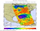
Nearly the whole of the Gulf of Mexico was churning with the powerful winds and rains of Hurricane Katrina on August 28, 2005, when NASA's QuikScat satellite captured this image.
PIA04176:
Hurricane Katrina
Full Resolution:     TIFF (5.849 MB)     JPEG (446.3 kB)
Add Image to Favorite List 2005-08-30 Earth Aqua
AIRS
900x695x3
Infrared image of Hurricane Katrina captured by the Atmospheric Infrared Sounder onboard NASA's Aqua satellite in August, 2005.
PIA04178:
Hurricane Katrina as Observed by NASA's Spaceborne Atmospheric Infrared Sounder (AIRS)
Full Resolution:     TIFF (1.879 MB)     JPEG (125 kB)
Add Image to Favorite List 2005-08-31 Earth Terra
MISR
3008x3164x3
This anaglyph from the MISR instrument aboard NASA's Terra spacecraft shows the strong convective development of Hurricane Katrina as it moved west through the Gulf of Mexico. 3D glasses are necessary to view this image.
PIA04383:
The Roiling Clouds of Katrina Animation Icon
Full Resolution:     TIFF (28.55 MB)     JPEG (525 kB)
Add Image to Favorite List 2005-09-07 Earth Terra
MISR
1050x1792x3
On Tuesday, August 30, 2005, NASA's Terra spacecraft retrieved cloud-top heights and cloud-tracked wind velocities for Tropical Storm Katrina, as the center of the storm was situated over the Tennessee Valley.
PIA04384:
Cloud Spirals and Outflow in Tropical Storm Katrina
Full Resolution:     TIFF (5.652 MB)     JPEG (452.3 kB)
Add Image to Favorite List 2005-09-21 Earth Terra
MISR
2820x1626x3
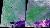
These views of the Louisiana and Mississippi regions were acquired before and one day after Katrina made landfall along the Gulf of Mexico coast. The images were acquired by NASA's Terra spacecraft on August 14 and August 30, 2005.
PIA04385:
Flooding in the Aftermath of Hurricane Katrina
Full Resolution:     TIFF (13.76 MB)     JPEG (1.053 MB)
Add Image to Favorite List 2005-09-21 Earth Jason-1
Altimeter
1650x1275x3
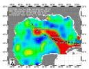
This sea surface height map of the Gulf of Mexico, with the Florida peninsula on the right and the Texas-Mexico Gulf Coast on the left, is based on altimeter data from four satellites including NASA's Topex/Poseidon and Jason.
PIA06428:
Rita Roars Through a Warm Gulf (September 21, 2005)
Full Resolution:     TIFF (6.322 MB)     JPEG (304.7 kB)
Add Image to Favorite List 2005-09-14 Earth Terra
ASTER
821x1200x3
Seventeen days after Hurricane Katrina flooded New Orleans, much of the city was still under water. In this pair of images from NASA's Terra satellite, the affected areas can clearly be seen.
PIA06429:
Hurricane Season 2005: Katrina
Full Resolution:     TIFF (2.959 MB)     JPEG (198.4 kB)
Add Image to Favorite List 2005-09-22 Earth Shuttle Radar Topography Mission (SRTM)
C-Band Imaging Radar
X-Band Imaging Radar
3621x1525x3
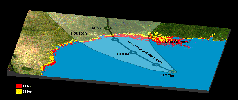
The Gulf Coast from the Mississippi Delta through the Texas coast is shown in this satellite image from NASA's Terra spacecraft, and the predicted storm track for Hurricane Rita acquired in February, 2000.
PIA06674:
Hurricane Rita Track
Radar Image with Topographic Overlay
Animation Icon
Full Resolution:     TIFF (16.57 MB)     JPEG (452.1 kB)
Add Image to Favorite List 2005-09-22 Earth Jason-1
Altimeter
825x638x3
This sea surface height map of the Gulf of Mexico, with the Florida peninsula on the right and the Texas-Mexico Gulf Coast on the left, is based on altimeter data from four satellites including NASA's Topex/Poseidon and Jason.
PIA06427:
Rita Roars Through a Warm Gulf (September 22, 2005)
Full Resolution:     TIFF (1.581 MB)     JPEG (106.3 kB)
Add Image to Favorite List 2005-09-26 Earth Jason-1
Altimeter
658x551x3
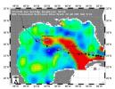
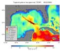
Tropical Cyclone Heat Potential (TCHP) field in the Gulf of Mexico during September 22, 2005. The path of Hurricane Rita is indicated with circles spaced every 3 hours with their size and color representing intensity seen by NASA's Jason satellite.
PIA06342:
NASA Data Helps Track Heat Potential Fueling Rita
Full Resolution:     TIFF (1.089 MB)     JPEG (60.83 kB)
Add Image to Favorite List 2005-10-12 Earth Terra
ASTER
1936x1860x3
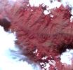
This image acquired by NASA's Terra spacecraft on Oct. 11, 2005, depicts a 30-kilometer (19-mile) wide region southeast of the epicenter of the magnitude 7.6 Pakistan earthquake, between Muzaffarabad and Uri in the Pir Punjal range of Kashmir.
PIA03028:
Landslide in Kashmir
Full Resolution:     TIFF (10.82 MB)     JPEG (487.5 kB)
Add Image to Favorite List 2005-10-12 Earth Terra
ASTER
2496x1523x3
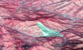
This 3D image was acquired by NASA's Terra spacecraft on October 11, 2005 with digital topography from the Shuttle Radar Topography Mission. It depicts a large landslide which occurred in Kashmir, Pakistan.
PIA03030:
Landslide in Kashmir (3-D Perspective)
Full Resolution:     TIFF (11.42 MB)     JPEG (461.1 kB)
Add Image to Favorite List 2005-10-12 Earth QuikScat
SeaWinds Scatterometer
3869x2421x3
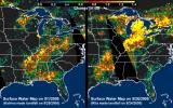
These images, derived from NASA QuikScat satellite data, show the extensive pattern of rain water deposited by Hurricanes Katrina and Rita on land surfaces over several states in the southern and eastern United States.
PIA03029:
Distribution Patterns of Land Surface Water from Hurricanes Katrina and Rita
Full Resolution:     TIFF (28.1 MB)     JPEG (1.148 MB)
Add Image to Favorite List 2005-10-13 Earth Landsat
Interferometric Synthetic Aperture Radar
1793x1706x3
This illustration depicts synthetic aperature radar patterns of seismic deformations associated with a model earthquake on the San Francisco section of the San Andreas Fault (depicted in yellow).
PIA03032:
New Forecast of San Francisco Earthquake Risk Animation Icon
Full Resolution:     TIFF (9.19 MB)     JPEG (411 kB)
Add Image to Favorite List 2005-10-21 Earth Jason-1
Altimeter
1650x1275x3
This sea surface height map of the Gulf of Mexico and the northwestern Caribbean Sea, with the Florida peninsula on the upper right, is based on altimeter data from three satellites including NASA's Jason-1.
PIA03055:
Wilma's Trek Through Warm Caribbean/Gulf Waters
Full Resolution:     TIFF (6.322 MB)     JPEG (373.6 kB)
Add Image to Favorite List 2005-10-21 Earth QuikScat
SeaWinds Scatterometer
1599x1566x3
The eye of Hurricane Wilma, a menacing Category 4 storm, approaches the northeastern tip of Mexico's Yucatan Peninsula in this October 21, 2005, image from NASA's QuikScat satellite, depicting relative wind speeds and direction.
PIA03056:
Wilma's Winds Whip Mexico's Yucatan
Full Resolution:     TIFF (2.508 MB)     JPEG (579.9 kB)
Add Image to Favorite List 2005-10-26 Earth Terra
MISR
1814x1310x3
NASA's Terra spacecraft acquired this sequence of images and cloud-top height observations for Hurricane Wilma as it progressed across the Caribbean in October 2005.
PIA04386:
Tracking Hurricane Wilma Across the Caribbean
Full Resolution:     TIFF (7.14 MB)     JPEG (597.7 kB)
Add Image to Favorite List 2005-12-09 Earth Shuttle Radar Topography Mission (SRTM)
C-Band Radar
X-Band Radar
1234x899x3
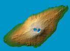
The recently active volcano Mt. Manaro is the dominant feature in this shaded relief image from NASA's Shuttle Radar Topography Mission of Ambae Island, part of the Vanuatu archipelago located 1400 miles northeast of Sydney, Australia.
PIA06675:
Ambae Island, Vanuatu (South Pacific)
Full Resolution:     TIFF (3.332 MB)     JPEG (125.8 kB)
Add Image to Favorite List 2005-11-23 Earth Terra
MISR
1720x1355x3
Oregon, California is shown in this MISR Mystery Quiz #23 captured by NASA's Terra spacecraft.
PIA04387:
Where on Earth...? MISR Mystery Image Quiz #23: Oregon, California
Full Resolution:     TIFF (7.003 MB)     JPEG (493.1 kB)
Add Image to Favorite List 2005-12-06 Earth GRACE
K-Band Ranging System
1302x1326x3
This image shows the effect of the December 2004 great Sumatra earthquake on the Earth's gravity field as observed by NASA's GRACE satellite.
PIA03625:
Earthquake Signal Visible in GRACE Data
Full Resolution:     TIFF (5.185 MB)     JPEG (150.8 kB)
Add Image to Favorite List 2005-12-22 Earth Stardust
714x481x3
This frame from an animation shows the return capsule separating from NASA's Stardust
spacecraft.
PIA03245:
Spacecraft -- Capsule Separation (Animation) Animation Icon
Full Resolution:     TIFF (1.032 MB)     JPEG (33.19 kB)
Add Image to Favorite List 2005-12-22 Earth Stardust
600x444x3
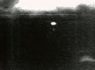
This shows images from NASA's Stardust taken through infrared range cameras during a recovery simulation at the Utah Test and Training Range on Dec 13, 2005.
Infrared cameras will track the landing.
PIA03247:
Rehearsal: Infrared Views of Landing and Retrieval (Animation) Animation Icon
Full Resolution:     TIFF (800.3 kB)     JPEG (22.8 kB)
Add Image to Favorite List 2005-12-22 Earth Stardust
717x417x3
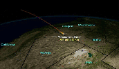
This frame from an animation illustrates the path NASA's Stardust return capsule will follow once it enters Earth's atmosphere.
PIA03248:
Entry, Descent, Landing Animation (Animation) Animation Icon
Full Resolution:     TIFF (898.3 kB)     JPEG (35.84 kB)
Add Image to Favorite List 2005-12-22 Earth Stardust
715x481x3
This frame from an animation illustrates the orbit path of NASA's Stardust spacecraft.
PIA03249:
Spacecraft Trajectory (Animation) Animation Icon
Full Resolution:     TIFF (1.033 MB)     JPEG (25.15 kB)
Add Image to Favorite List 2006-01-13 Earth Jason-1
Altimeter
900x900x3
The tropical Pacific Ocean is beginning to exhibit the characteristics of a developing La Niņa condition as NASA's Jason-1 satellite shows gradual cooling of the central equatorial Pacific.
PIA03665:
She's Back? La Niņa Developing?
Full Resolution:     TIFF (2.433 MB)     JPEG (116.8 kB)
Add Image to Favorite List 2006-01-17 Earth Stardust
Stardust Capsule
3008x2000x3
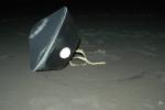
The capsule contains cometary and interstellar samples gathered by NASA's Stardust spacecraft.
PIA03669:
Sample Return Capsule
Full Resolution:     TIFF (18.05 MB)     JPEG (556.9 kB)
Add Image to Favorite List 2004-08-03 Earth Aqua
AIRS
792x998x3
Hurricane Alex captured on August 3, 2004, as observed by the Atmospheric Infrared Sounder (AIRS) onboard NASA's Aqua.
PIA00440:
Hurricane Alex, located about 80 miles south-southeast of Charleston, South Carolina, as observed by NASA's Spaceborne Atmospheric Infrared Sounder (AIRS).
Full Resolution:     TIFF (2.374 MB)     JPEG (102.7 kB)
Retrieve Previous Set  Jump to a Previous Set   Jump to a Previous Set   Jump to a Previous Set   Jump to a Previous Set   Jump to a Previous Set   Jump to a Previous Set   Jump to a Previous Set   Jump to a Previous Set   Current Set   Jump to a Following Set   Retrieve Next Set 
 1-100   101-200   201-300   301-400   401-500   501-600   601-700   701-800   801-900   901-1000 
Currently displaying images: 801 - 900 of 2308