 | 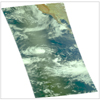 |
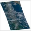
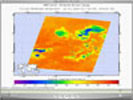
| Figure 1: July 19 Daylight Snapshot for PIA00438 | Figure 2: July 21 Daylight Snapshot for PIA00438 |
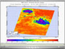
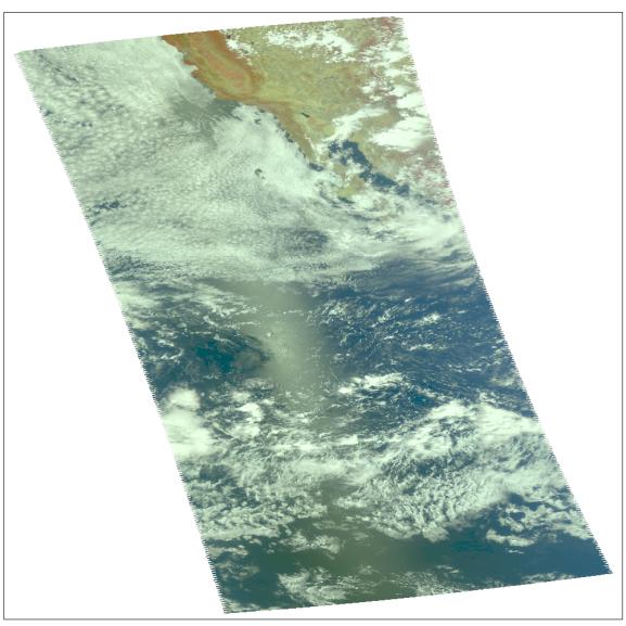
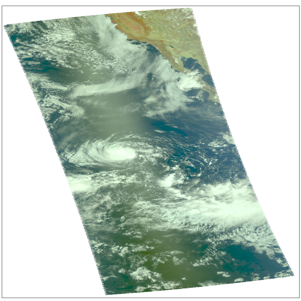
Hurricane Celia as observed by NASA's spaceborne Atmospheric Infrared Sounder (AIRS). This image shows Celia on July 23 in visible light, as you would perceive it from space. Located in the eastern north Pacific Ocean off the coast of Mexico, Celia's winds have now dissipated to highs of 40 mph. Celia was the first hurricane of the eastern north Pacific season. Figure 1 is a daylight snapshot taken on July 19; Celia as tropical storm, winds at 50mph. Figure 2 is a daylight snapshot taken on July 21; Celia has a small eye with an 80-90% closed eyewall; sustained winds at 75mph with gusts reaching 92mph; Celia is upgraded to hurricane status.The major contribution to radiation (infrared light) that AIRS channels sense comes from different levels in the atmosphere, depending upon the channel wavelength. To create the movies, a set of AIRS channels were selected which probe the atmosphere at progressively deeper levels. If there were no clouds, the color in each frame would be nearly uniform until the Earth's surface is encountered. The tropospheric air temperature warms at a rate of 6 K (about 11 F) for each kilometer of descent toward the surface. Thus the colors would gradually change from cold to warm as the movie progresses.
Clouds block the infrared radiation. Thus wherever there are clouds we can penetrate no deeper in infrared. The color remains fixed as the movie progresses, for that area of the image is "stuck" to the cloud top temperature. The coldest temperatures around 220 K (about -65 F) come from altitudes of about 10 miles.
We therefore see in a 'surface channel' at the end of the movie, signals from clouds as cold as 220 K and from Earth's surface at 310 K (about 100 F). The very coldest clouds are seen in deep convection thunderstorms over land.
Movies
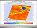
Quick Time Movie July 20
Quick Time Movie July 22 Celia located in upper left. The other intense convection area towards the center of the granule exhibits no circulation.
Quick Time Movie July 23 Dry air is now eating into Celia; the storm is becoming disorganized and weak.
About AIRS
The Atmospheric Infrared Sounder, AIRS, in conjunction with the Advanced Microwave Sounding Unit, AMSU, senses emitted infrared and microwave radiation from Earth to provide a three-dimensional look at Earth's weather and climate. Working in tandem, the two instruments make simultaneous observations all the way down to Earth's surface, even in the presence of heavy clouds. With more than 2,000 channels sensing different regions of the atmosphere, the system creates a global, three-dimensional map of atmospheric temperature and humidity, cloud amounts and heights, greenhouse gas concentrations, and many other atmospheric phenomena. Launched into Earth orbit in 2002, the AIRS and AMSU instruments fly onboard NASA's Aqua spacecraft and are managed by NASA's Jet Propulsion Laboratory in Pasadena, Calif., under contract to NASA. JPL is a division of the California Institute of Technology in Pasadena.
More information about AIRS can be found at http://airs.jpl.nasa.gov.
