Click on an image for detailed information
Click on a column heading to sort in ascending or descending order

My
List |
Addition Date
|
Target
|
Mission
|
Instrument
|
Size
|

|
1996-11-27 |
Toutatis
|
|
|
4096x3072x3 |
|
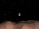
-
PIA00515:
-
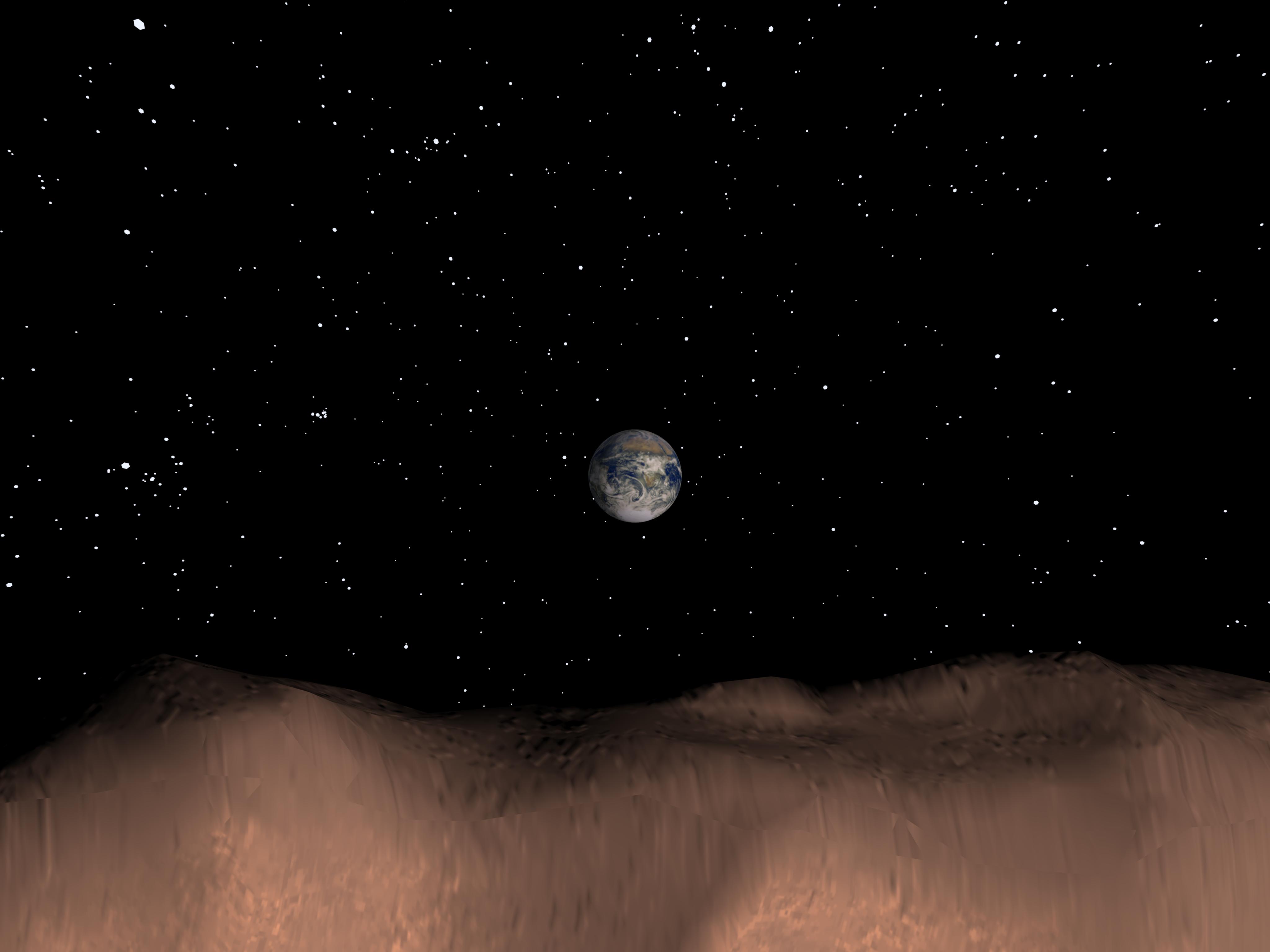
Computer Generated View of Earth as seen from the Asteroid Toutatis
Full Resolution:
TIFF
(4.795 MB)
JPEG
(307.3 kB)
|
|
|
2001-03-30 |
Earth
|
|
|
1352x1390x3 |
|
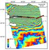
-
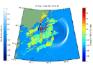
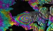
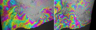
PIA00557:
-
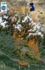
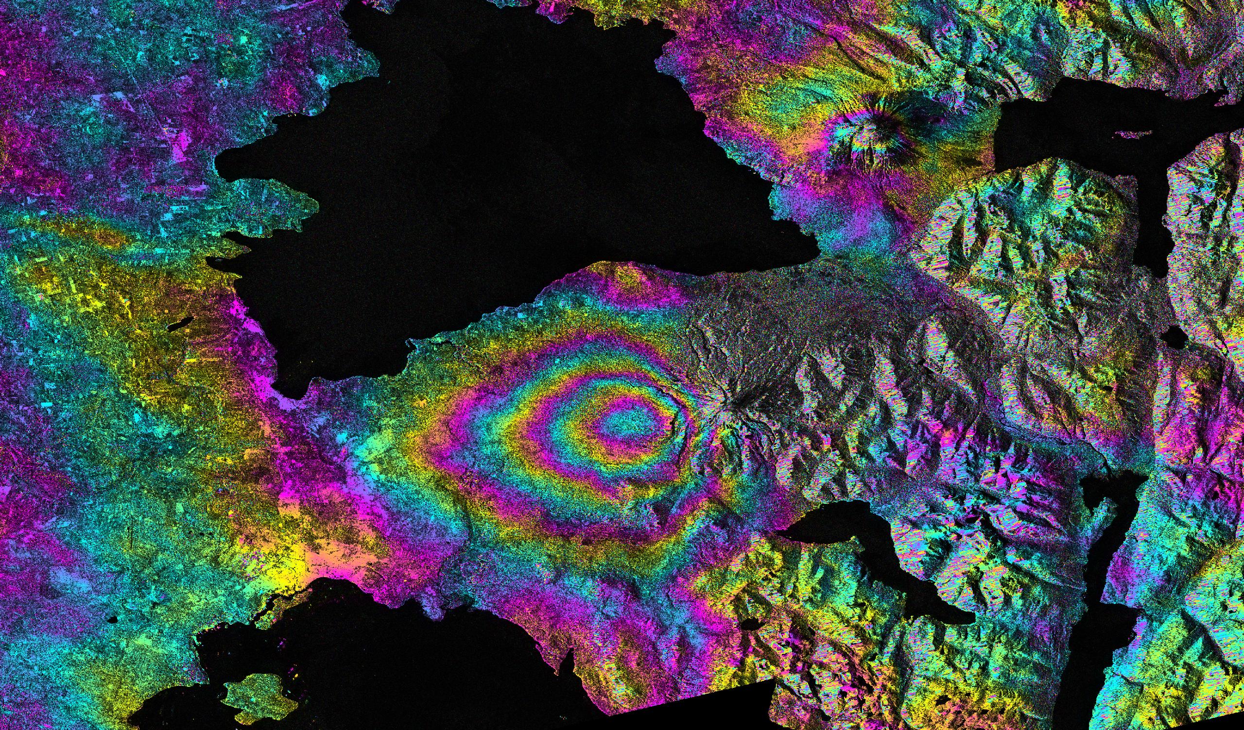
Izmit, Turkey 1999 Earthquake Interferogram
Full Resolution:
TIFF
(2.697 MB)
JPEG
(408.4 kB)
|
|
|
2010-05-27 |
Earth
|
|
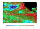
AVIRIS
|
324x523x3 |

|
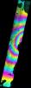
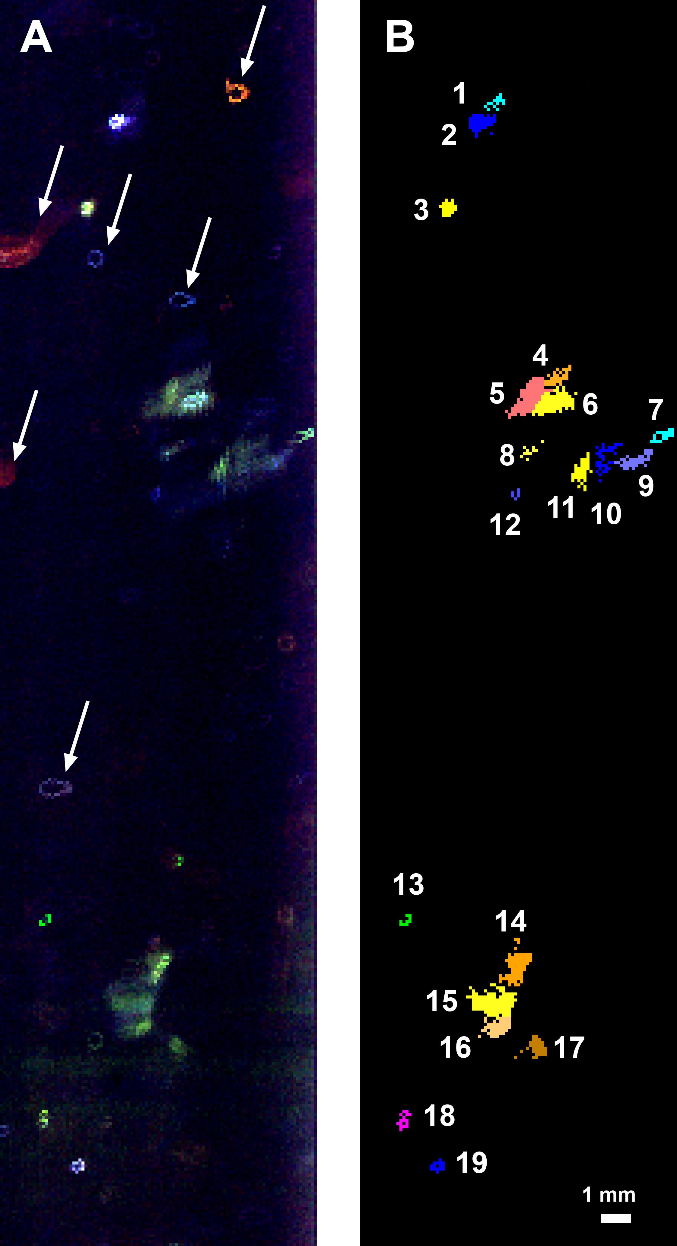
-
PIA13167:
-
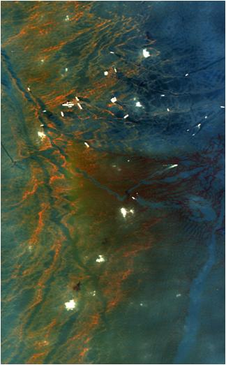
NASA's AVIRIS Aids in Gulf Oil Spill Response
Full Resolution:
TIFF
(509.1 kB)
JPEG
(29.06 kB)
|
|
|
2011-04-01 |
Earth
|
|
Advanced Synthetic Aperture Radar
|
2768x7680x3 |
|
-
PIA13976:
-
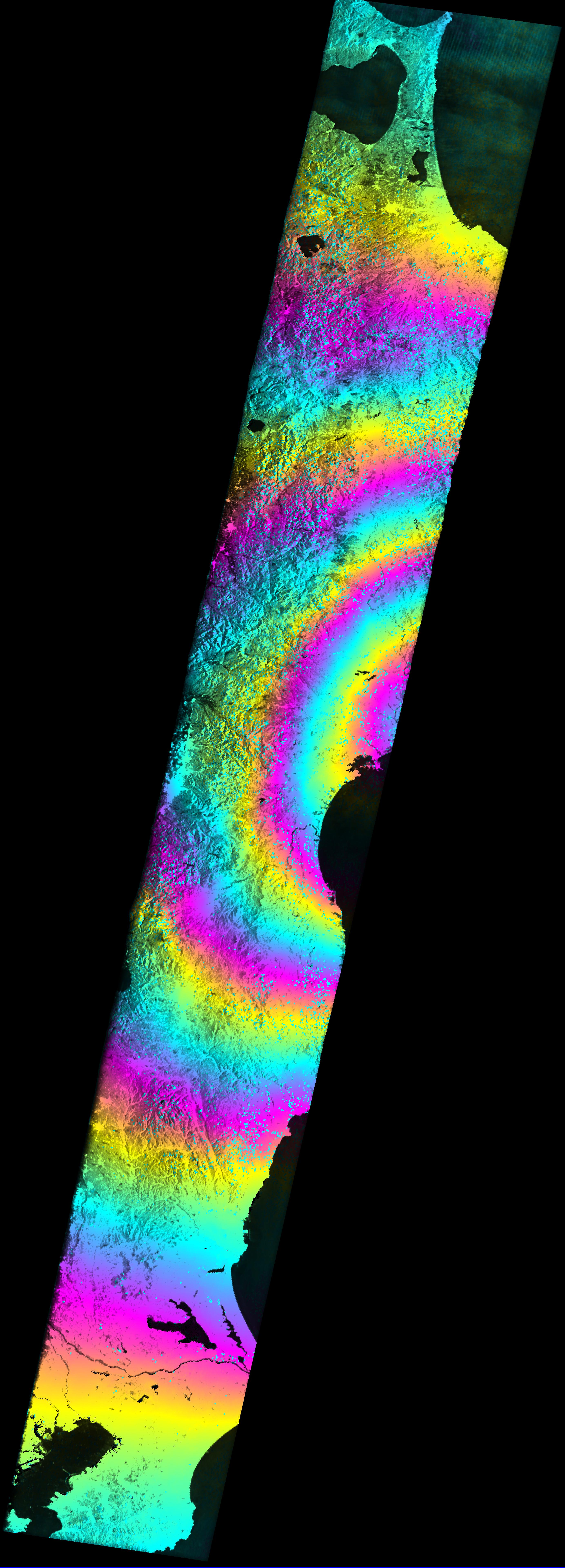
Satellite Radar Measures Tohoku, Japan Earthquake
Full Resolution:
TIFF
(63.77 MB)
JPEG
(1.95 MB)
|
|
|
2011-07-06 |
Earth
|
|
|
361x252x3 |
|
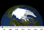
-
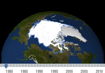
PIA14385:
-
Declining Arctic Sea Ice: 1979-2010

Full Resolution:
TIFF
(92.85 kB)
JPEG
(13.15 kB)
|
|
|
2012-02-16 |
Earth
|
|
|
1201x900x3 |
|
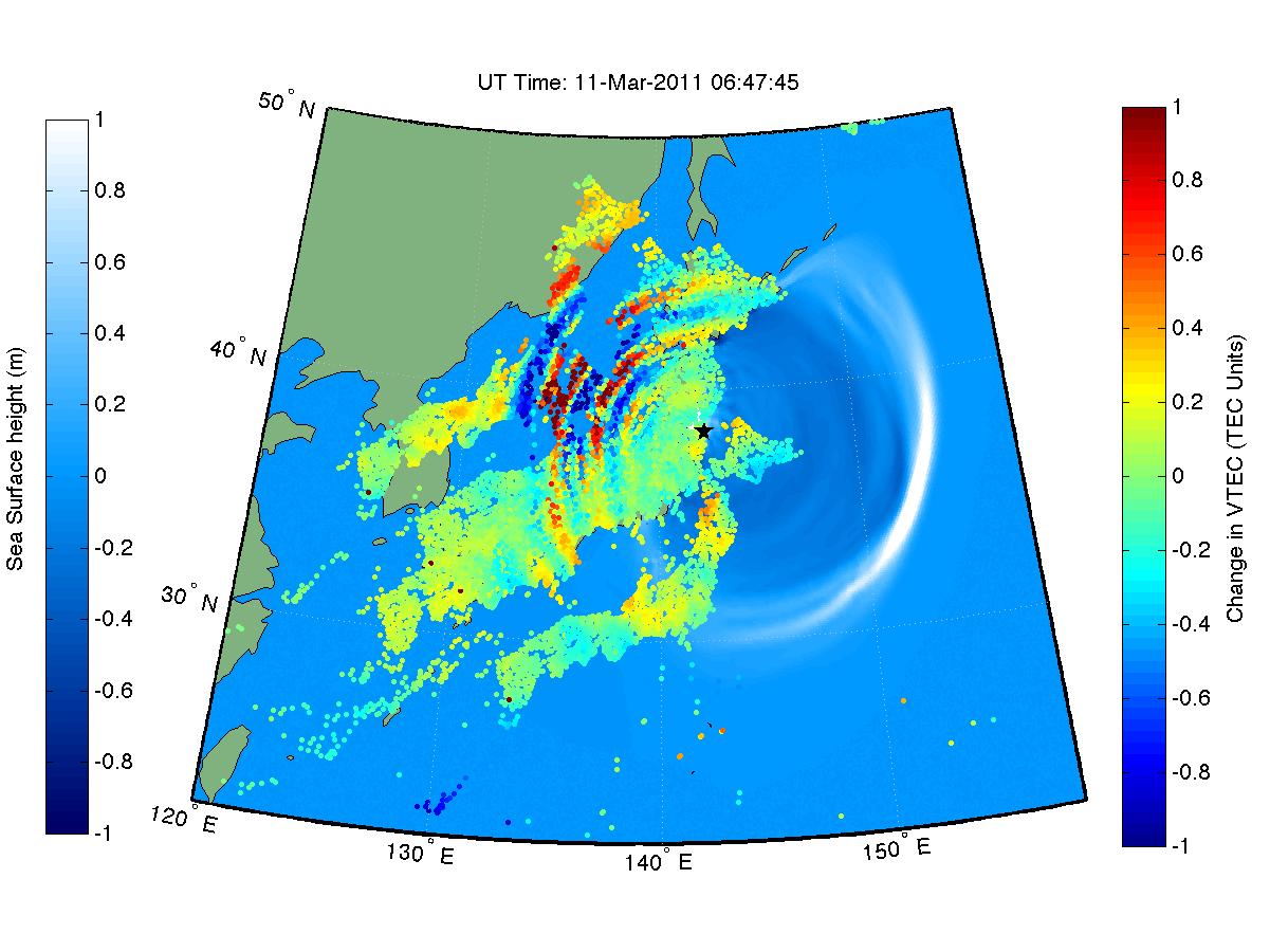
-
PIA14430:
-
NASA 'Sees' Tohoku-Oki Earthquake and Tsunami in Earth's Upper Atmosphere
Full Resolution:
TIFF
(1.084 MB)
JPEG
(136.1 kB)
|
|
|
2011-08-18 |
Earth
|
|
|
1192x1192x3 |
|
-
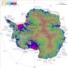
PIA14556:
-
NASA Research Leads to First Complete Map of Antarctic Ice Flows
Full Resolution:
TIFF
(4.268 MB)
JPEG
(240.9 kB)
|
|
|
2011-08-18 |
Earth
|
|
|
455x256x3 |
|
-
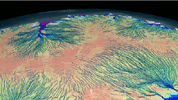
PIA14557:
-
Flow of Ice Across Antarctica
Full Resolution:
TIFF
(350 kB)
JPEG
(35.4 kB)
|
|
|
2012-02-06 |
Earth
|
|
|
1023x574x3 |
|
-
PIA13203:
-
Kamoamoa Flow Field Animation
Full Resolution:
TIFF
(1.764 MB)
JPEG
(72.41 kB)
|
|
|
2012-02-06 |
Earth
|
|
|
1023x578x3 |
|
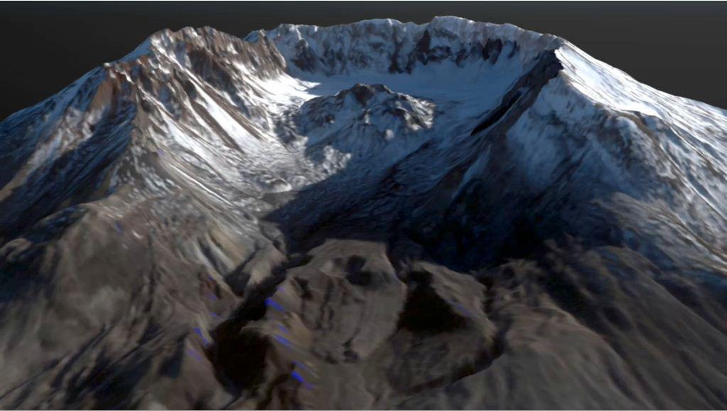
-
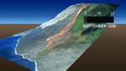
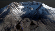
PIA15004:
-
Growth of the Mount St. Helens Lava Dome, September 24-October 14, 2004
Full Resolution:
TIFF
(1.776 MB)
JPEG
(73.99 kB)
|
|
|
2012-03-01 |
Earth
|
|
GOME-2
|
1403x763x3 |
|
-
PIA13960:
-
NASA Finds Sea Ice Driving Arctic Air Pollutants (Northwest Territories)
Full Resolution:
TIFF
(3.218 MB)
JPEG
(131.6 kB)
|
|
|
2012-03-01 |
Earth
|
|
GOME-2
|
1403x762x3 |
|
-
PIA13961:
-
NASA Finds Sea Ice Driving Arctic Air Pollutants (Alaskan North Slope)
Full Resolution:
TIFF
(3.214 MB)
JPEG
(138.2 kB)
|
|
|
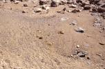
2012-09-27 |
Earth
|
|
|
965x720x3 |

|
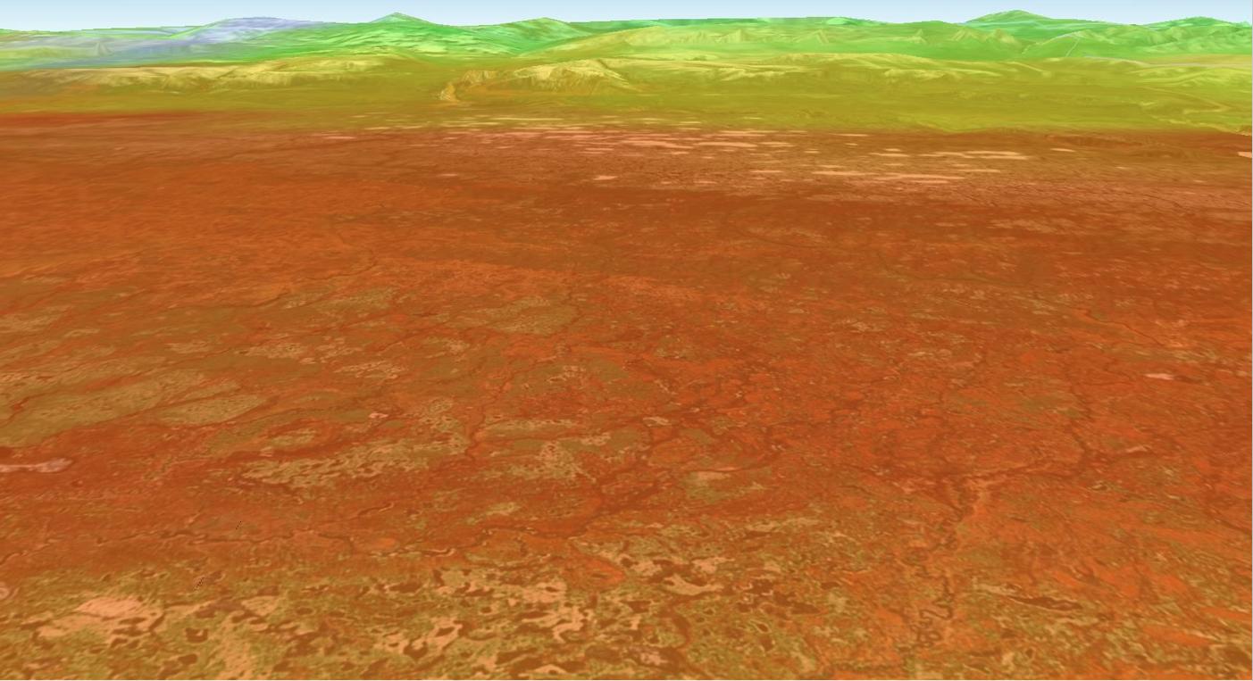
-
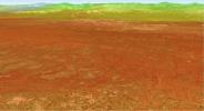
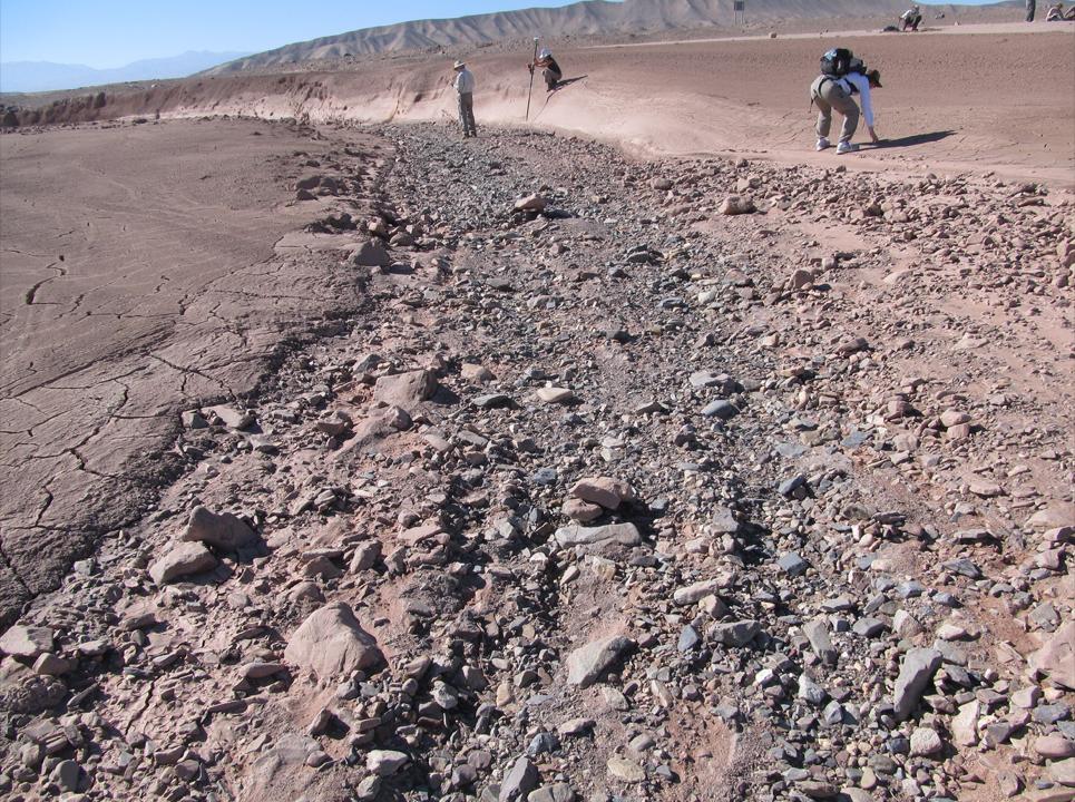
PIA16191:
-
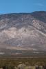
Dry Streambed on Alluvial Fan in Northern Chile
Full Resolution:
TIFF
(2.085 MB)
JPEG
(221.9 kB)
|
|
|
2013-03-20 |
Mars
|
|
|
726x400x3 |
|
-
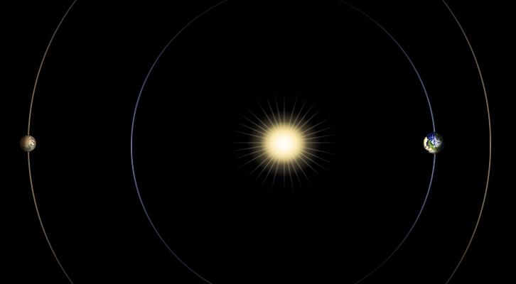
PIA16811:
-
Geometry of Mars Solar Conjunction
Full Resolution:
TIFF
(871.7 kB)
JPEG
(12.1 kB)
|
|
|
2013-02-16 |
Earth
|
|
|
3029x1080x3 |
|
-
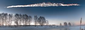
PIA16828:
-
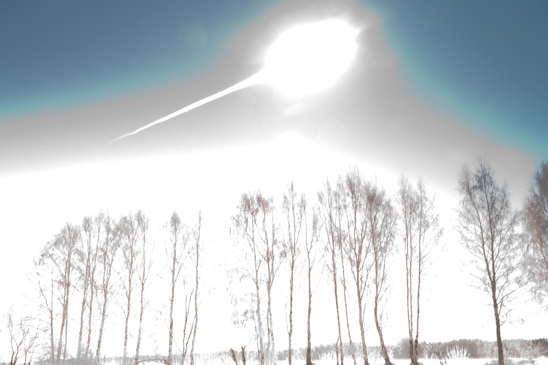
Fireball Streaking over Russia
Full Resolution:
TIFF
(9.819 MB)
JPEG
(382.3 kB)
|
|
|
2013-02-16 |
Earth
|
|
|
1920x1280x3 |
|
-
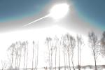
PIA16829:
-
Fireball Flash over Russia
Full Resolution:
TIFF
(7.376 MB)
JPEG
(199.8 kB)
|
|
|
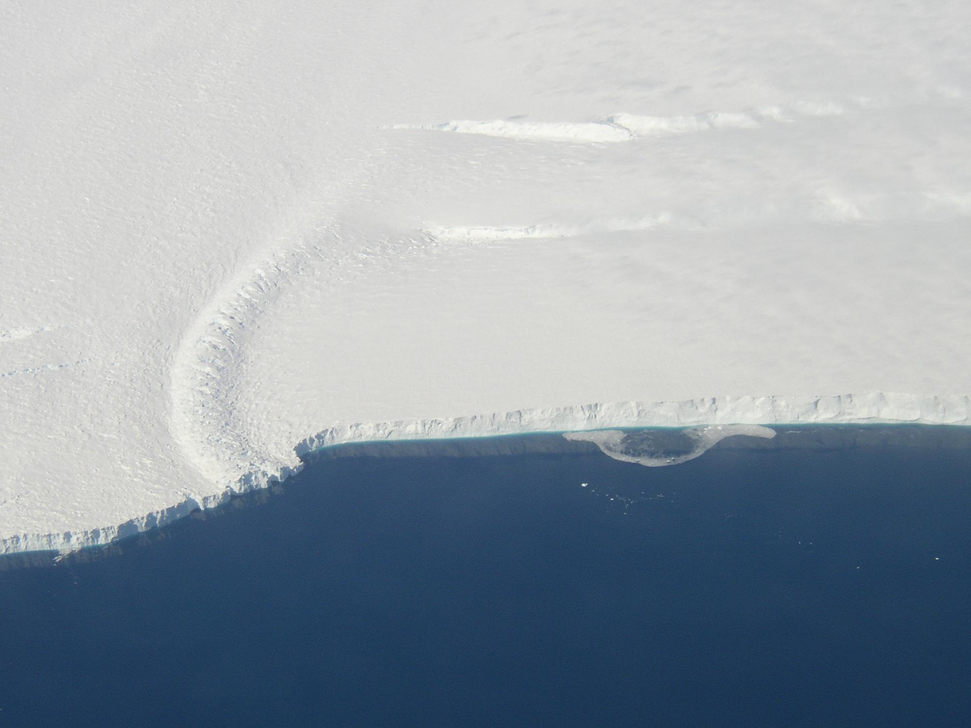
2013-06-13 |
Earth
|
|
|
3264x2448x3 |
|
-
PIA17281:
-
Ice Front at Venable Ice Shelf
Full Resolution:
TIFF
(23.98 MB)
JPEG
(803.2 kB)
|
|
|
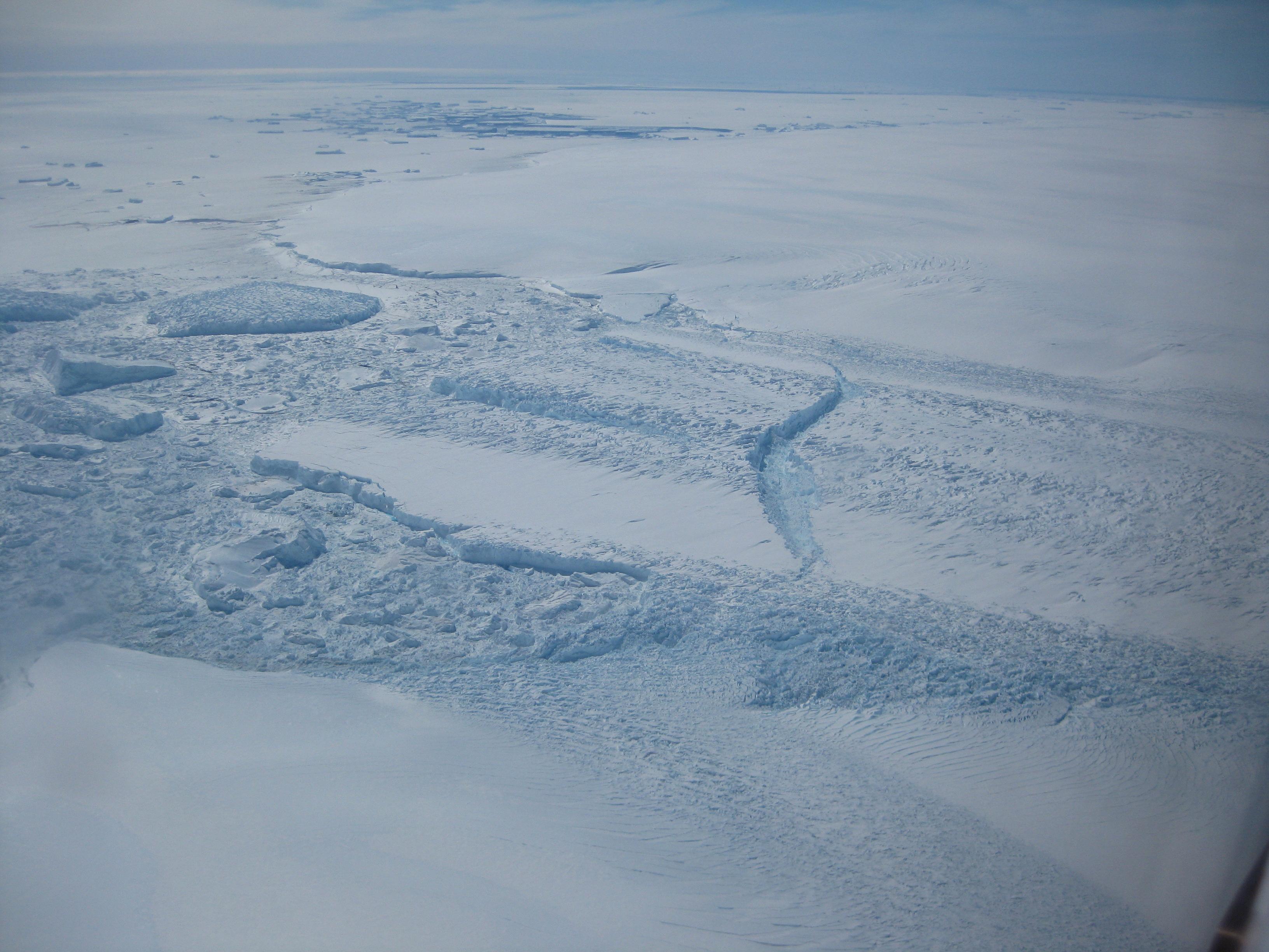
2013-06-13 |
Earth
|
|
|
3264x2448x3 |

|
-
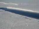
PIA17282:
-
Dibble Ice Shelf
Full Resolution:
TIFF
(23.98 MB)
JPEG
(800.2 kB)
|
|
|
2013-06-13 |
Earth
|
|
|
1984x1488x3 |
|
-
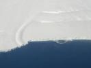
PIA17283:
-
Pine Island Glacier Ice Shelf
Full Resolution:
TIFF
(8.86 MB)
JPEG
(202.1 kB)
|
|
|
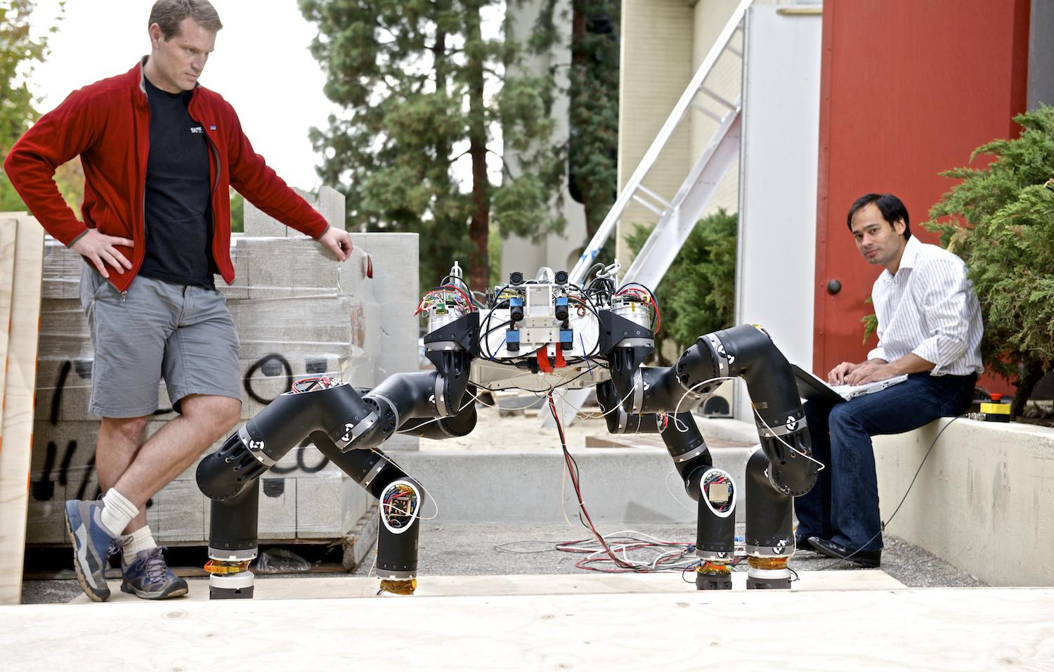
2014-07-16 |
Earth
|
|
RoboSimian
|
1500x1177x3 |
|
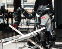
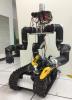
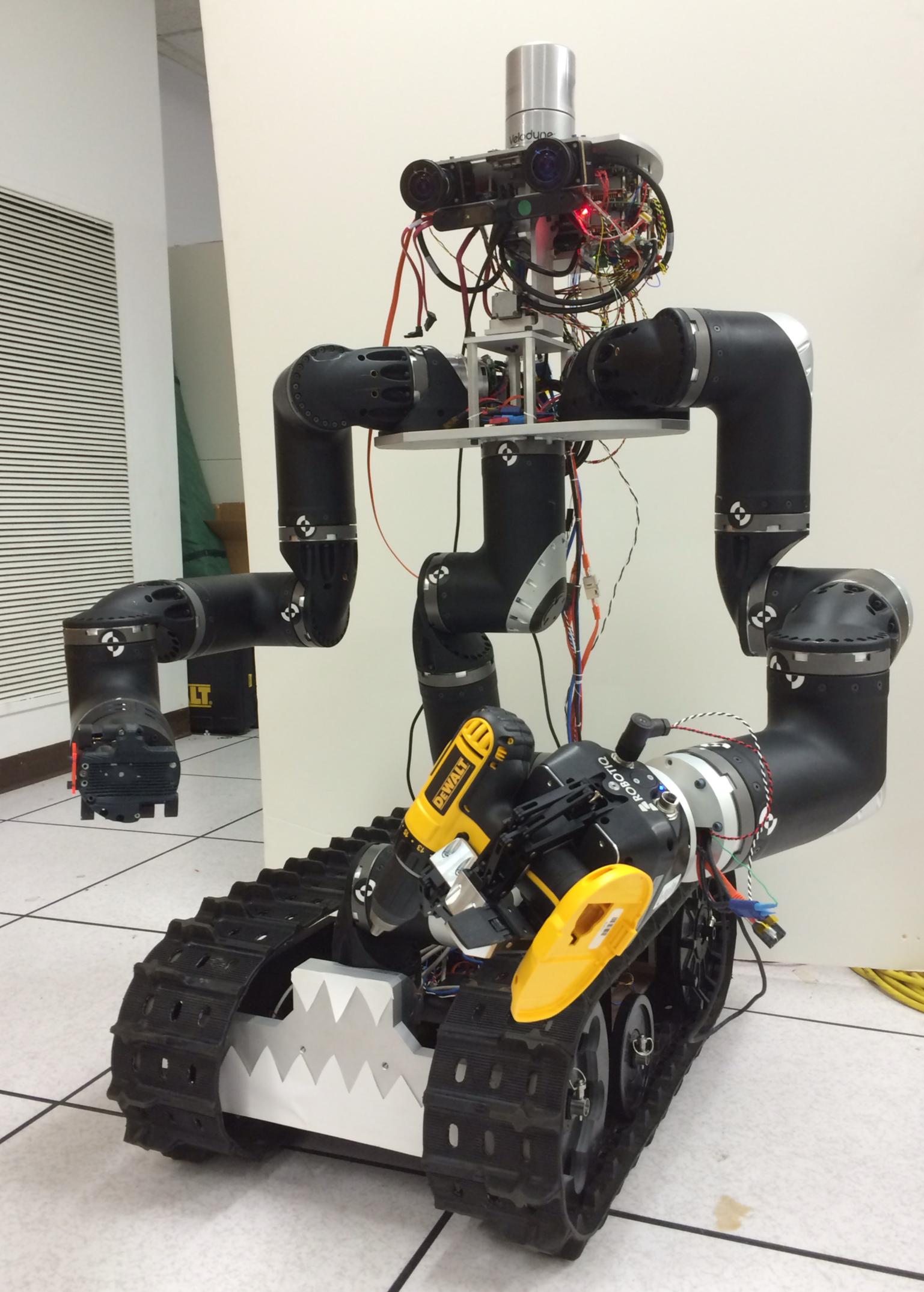
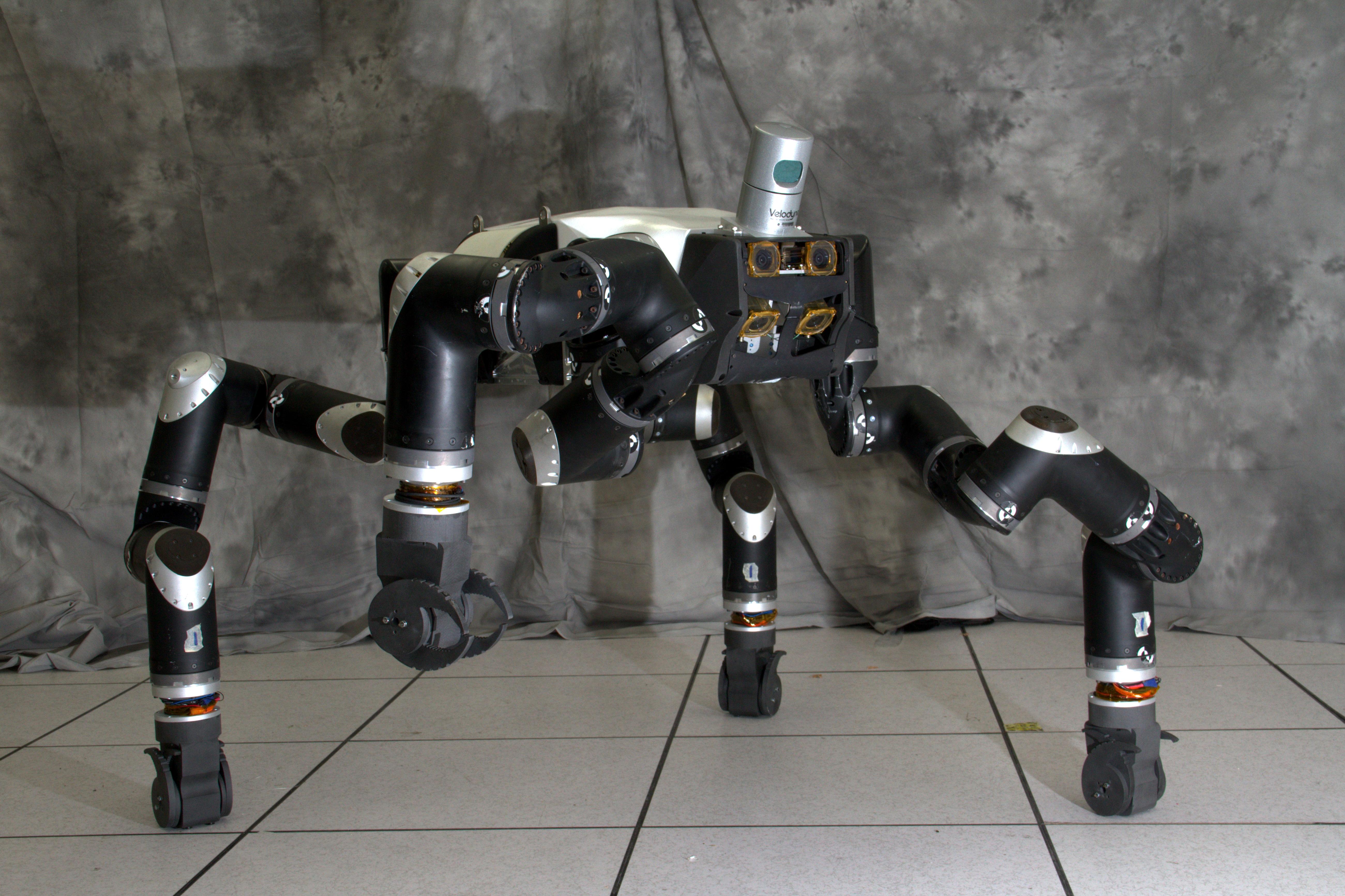
-
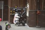
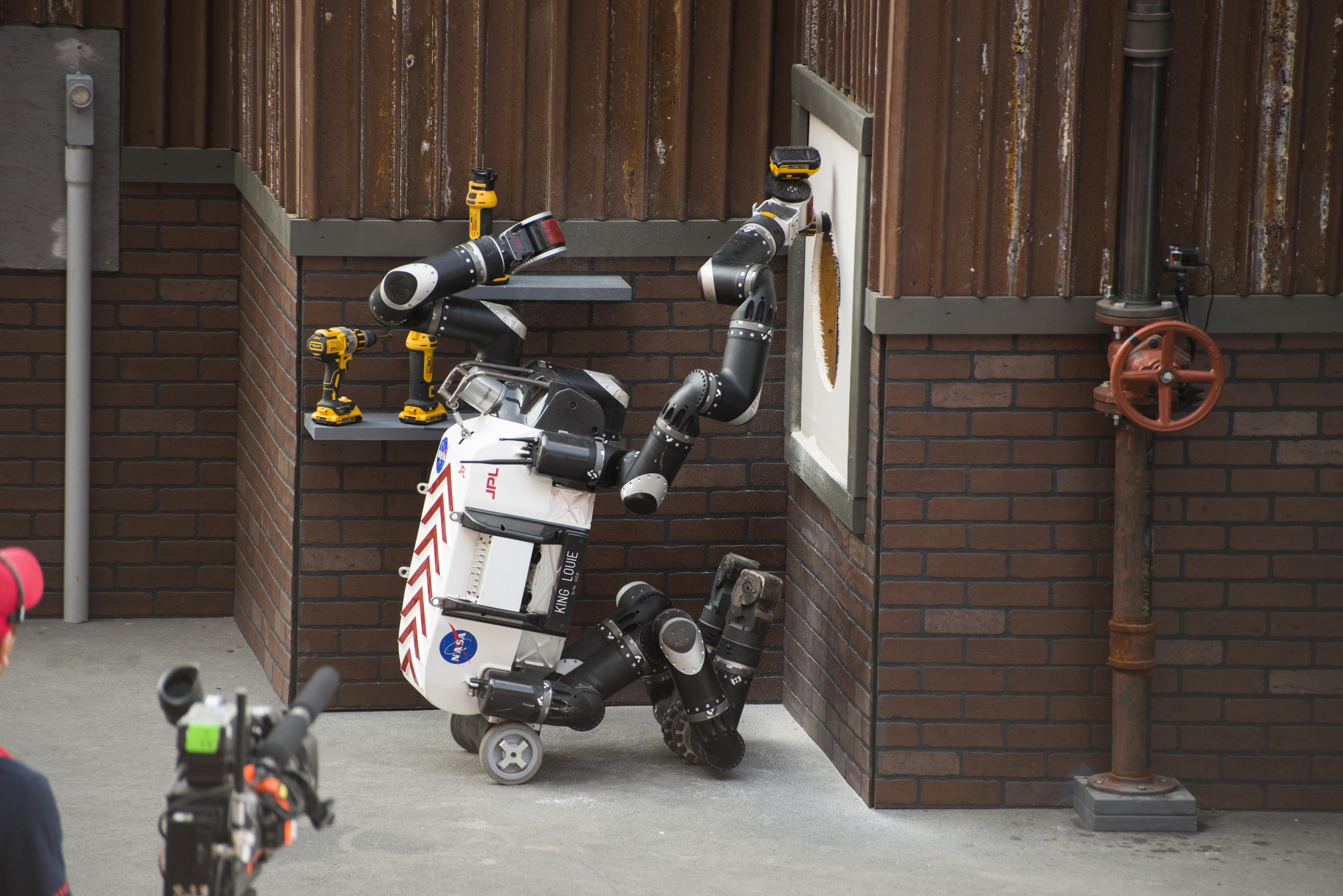
PIA18565:
-
RoboSimian Competes
Full Resolution:
TIFF
(5.299 MB)
JPEG
(196.5 kB)
|
|
|
2014-07-16 |
Earth
|
|
RoboSimian
|
2000x1335x3 |
|
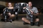
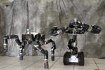
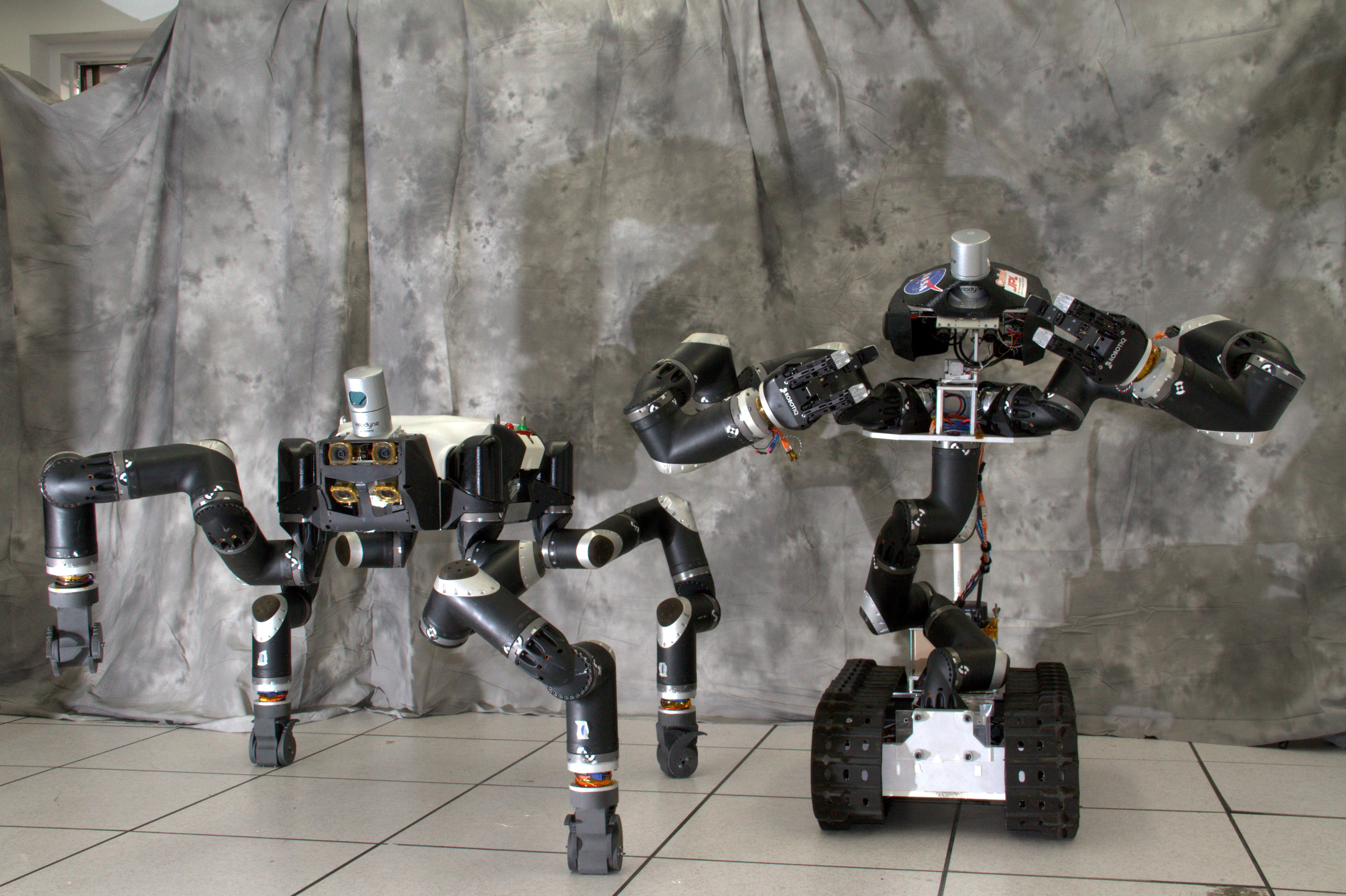
-
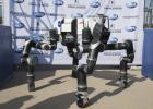
PIA18566:
-
RoboSimian and Friends
Full Resolution:
TIFF
(8.013 MB)
JPEG
(257.5 kB)
|
|
|
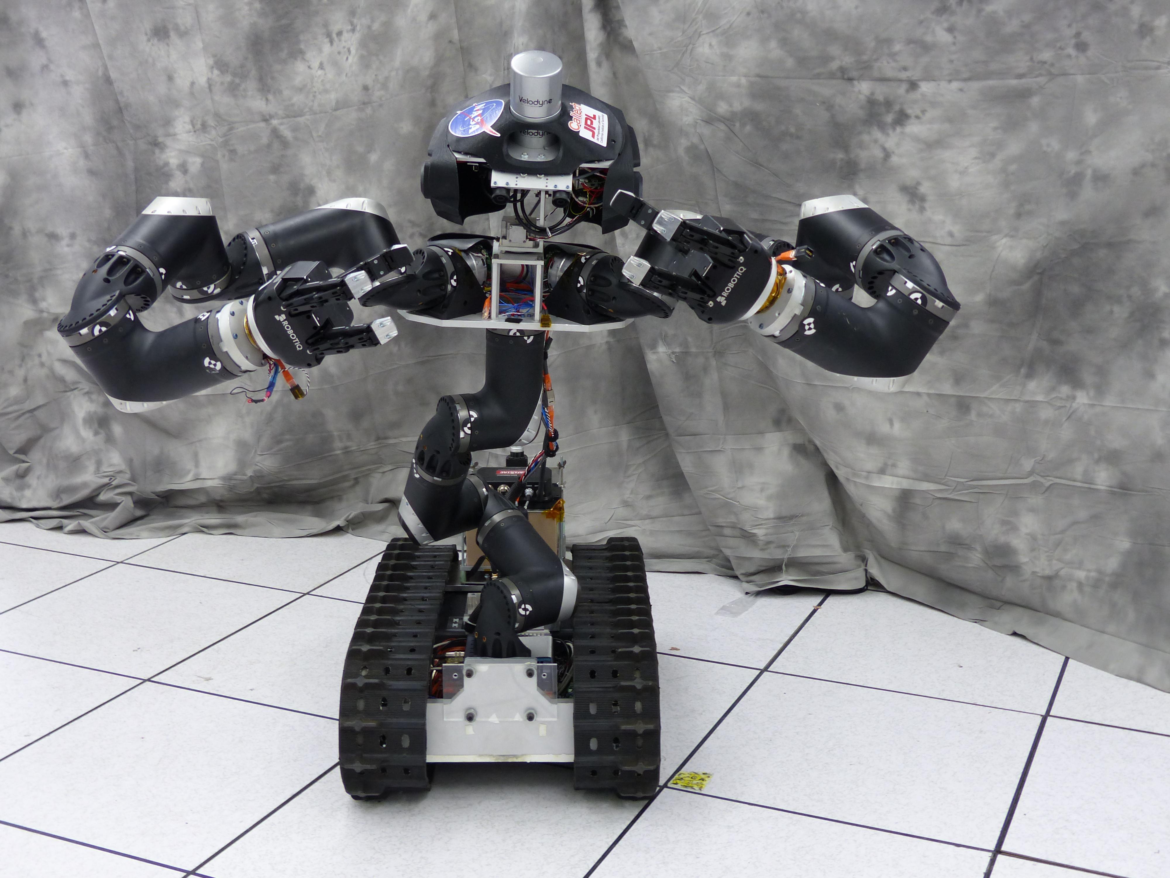
2014-07-16 |
Earth
|
|
RoboSimian
|
1500x956x3 |

|
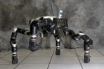
-
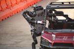
PIA18567:
-
RoboSimian's Inner Workings
Full Resolution:
TIFF
(4.304 MB)
JPEG
(209 kB)
|
|
|
2014-07-16 |
Earth
|
|
RoboSimian
|
1500x1001x3 |

|
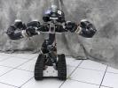
-
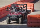
PIA18568:
-
Carrying RoboSimian
Full Resolution:
TIFF
(4.506 MB)
JPEG
(246 kB)
|
|
|
2014-07-28 |
Earth
|
|
|
3717x3583x3 |
|
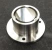
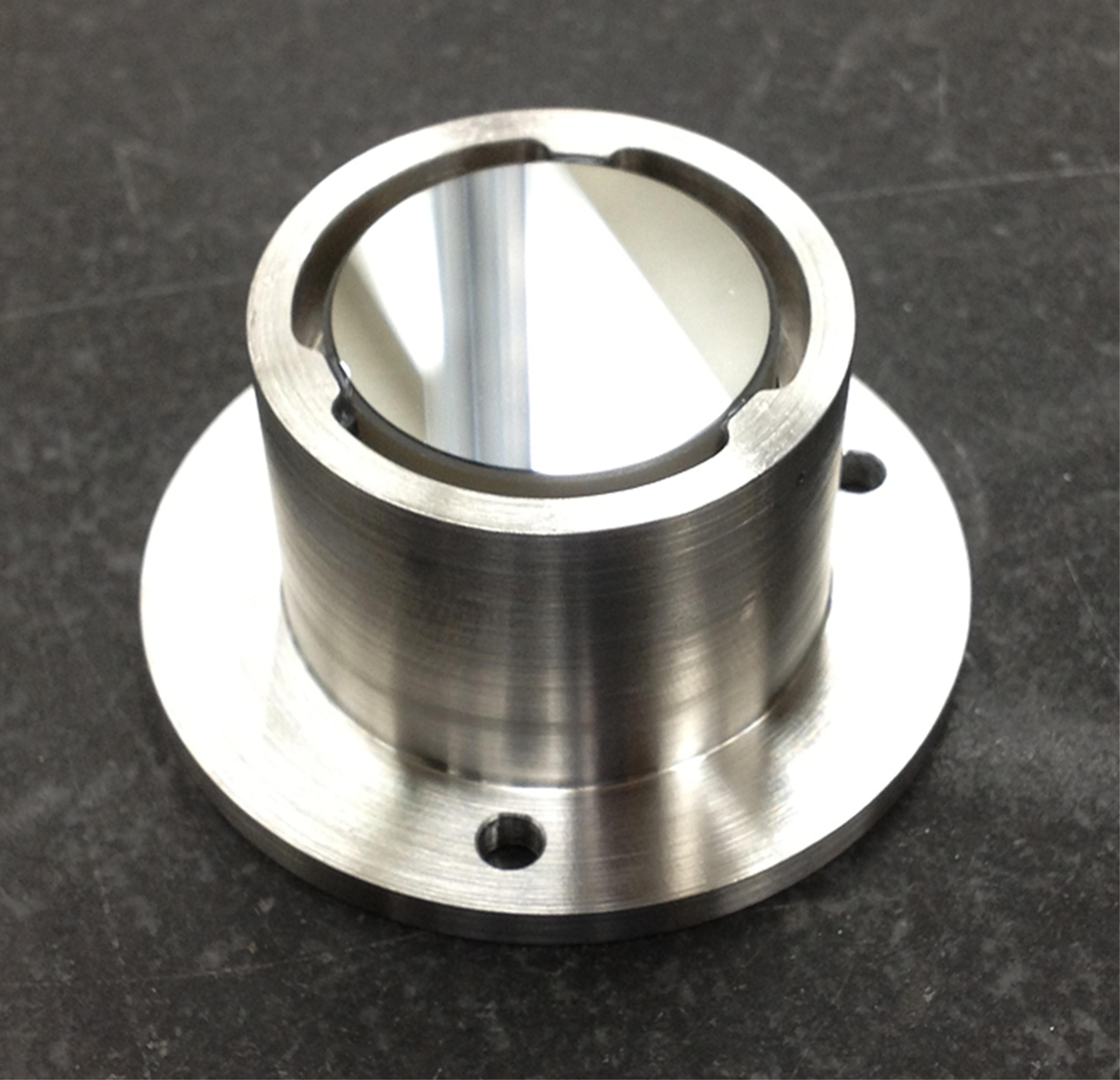
-
PIA18569:
-
Mirror Mount
Full Resolution:
TIFF
(39.97 MB)
JPEG
(553.3 kB)
|
|
|
2014-07-28 |
Earth
|
|
|
752x564x3 |

|
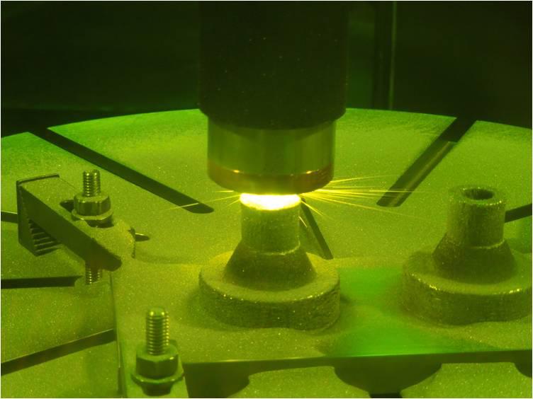
-
PIA18570:
-
Laser Printing of Gradient Metals
Full Resolution:
TIFF
(1.273 MB)
JPEG
(44.08 kB)
|
|
|
2014-07-24 |
Earth
|
|
|
3888x2592x3 |
|
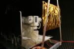
-
PIA18651:
-
OPALS Thermal Vacuum Testing
Full Resolution:
TIFF
(30.24 MB)
JPEG
(750.2 kB)
|
|
|
2014-08-21 |
Earth
|
|
|
1537x2148x3 |
|
-
PIA18667:
-
Surrogate Robot
Full Resolution:
TIFF
(9.908 MB)
JPEG
(273.9 kB)
|
|
|
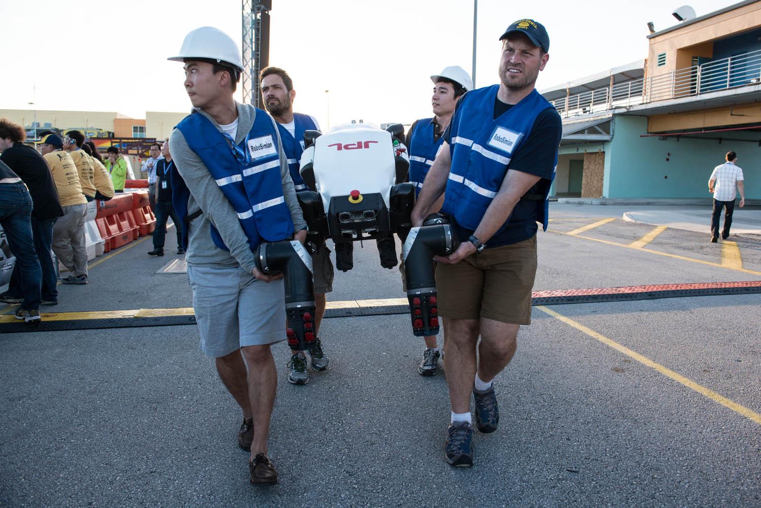
2014-12-09 |
Earth
|
|
RoboSimian
|
5202x3465x3 |
|
-
PIA18790:
-
JPL's RoboSimian and Surrogate Robots
Full Resolution:
TIFF
(54.1 MB)
JPEG
(2.003 MB)
|
|
|
2014-12-09 |
Earth
|
|
RoboSimian
|
5202x3465x3 |
|
-
PIA18791:
-
RoboSimian Gets Ready for Competition
Full Resolution:
TIFF
(54.1 MB)
JPEG
(1.615 MB)
|
|
|
2014-12-09 |
Earth
|
|
RoboSimian
|
4000x3000x3 |
|
-
PIA18792:
-
JPL's Surrogate Robot
Full Resolution:
TIFF
(36.01 MB)
JPEG
(936.9 kB)
|
|
|
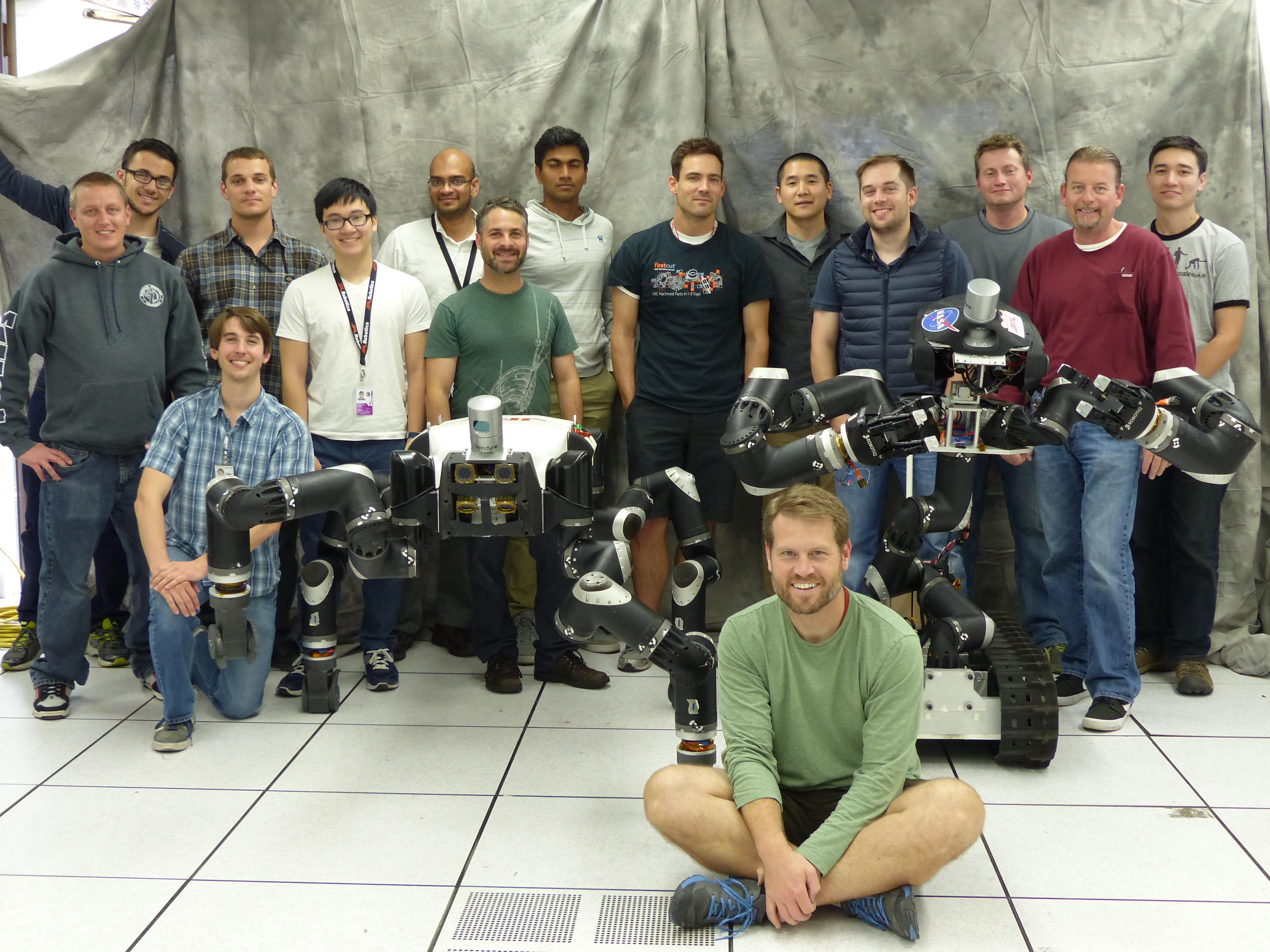
2014-12-09 |
Earth
|
|
RoboSimian
|
4000x3000x3 |
|
-
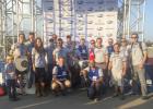
PIA18793:
-
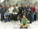
The JPL Team Behind RoboSimian and Surrogate
Full Resolution:
TIFF
(36.01 MB)
JPEG
(1.193 MB)
|
|
|
2015-01-22 |
Earth
|
|
SPIDER
|
673x379x3 |

|
-
PIA19177:
-
SPIDER Readied for Launch
Full Resolution:
TIFF
(765.7 kB)
JPEG
(54.71 kB)
|
|
|
2015-03-11 |
Earth
|
|
RoboSimian
|
5400x7200x3 |

|
-
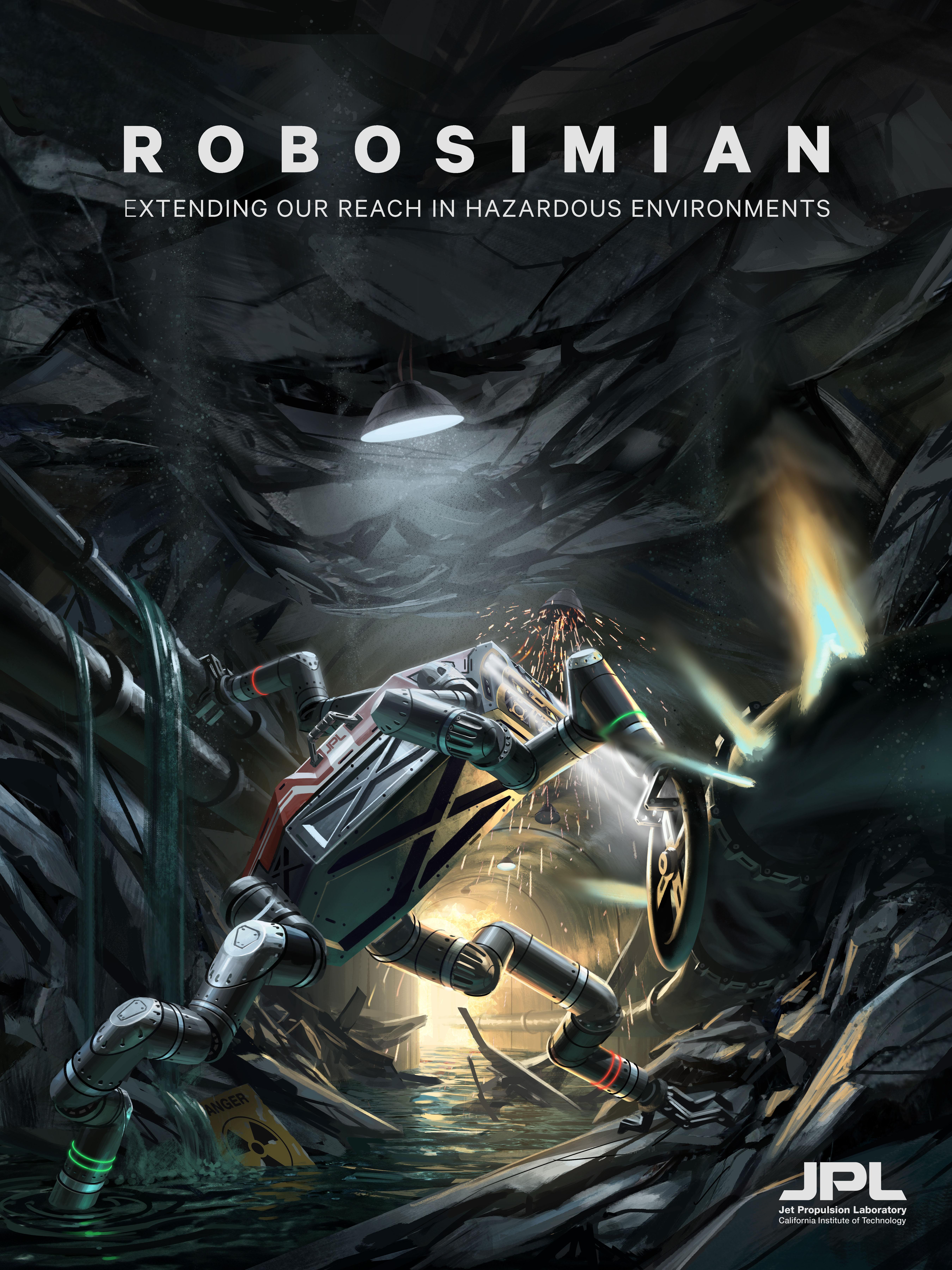
PIA19313:
-
RoboSimian 'Disaster Relief' Poster (Artist's Concept)
Full Resolution:
TIFF
(116.7 MB)
JPEG
(2.643 MB)
|
|
|
2015-03-11 |
Earth
|
|
RoboSimian
|
7200x5400x3 |

|
-
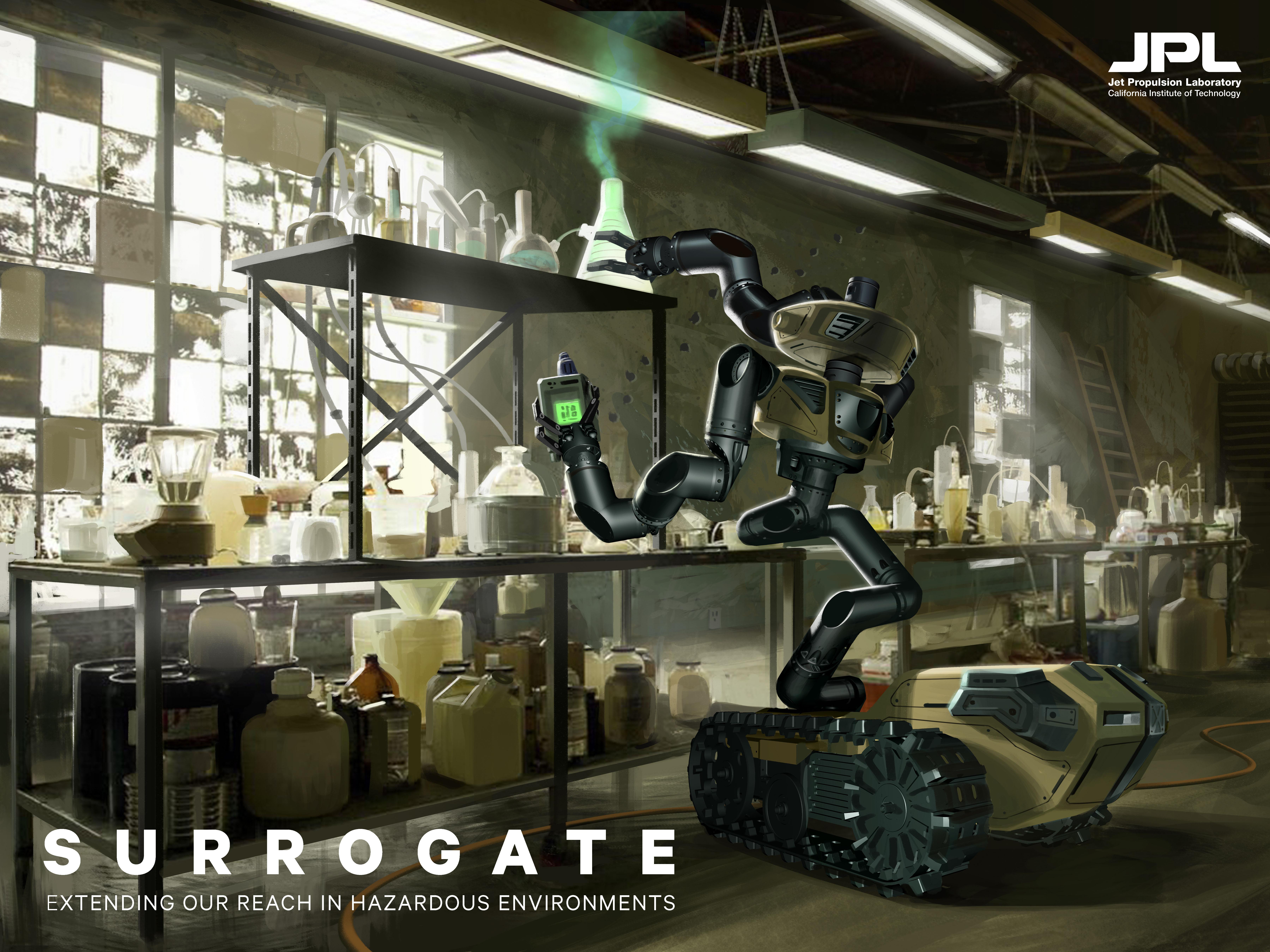
PIA19314:
-
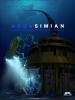
Surrogate Poster (Artist's Concept)
Full Resolution:
TIFF
(116.7 MB)
JPEG
(2.257 MB)
|
|
|
2015-03-11 |
Earth
|
|
RoboSimian
|
5400x7200x3 |
|
-
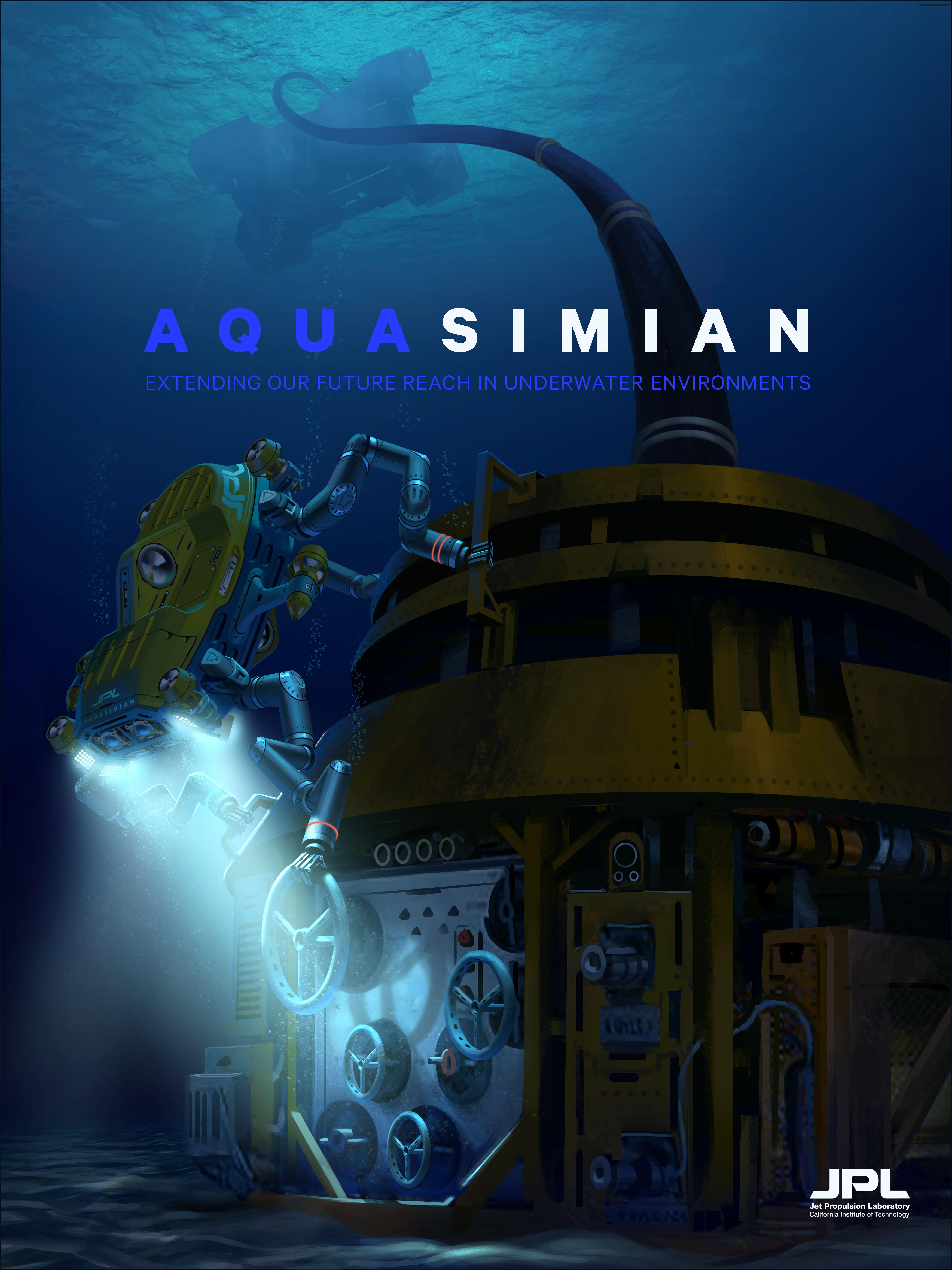
PIA19315:
-
AquaSimian Poster (Artist's Concept)
Full Resolution:
TIFF
(116.7 MB)
JPEG
(1.592 MB)
|
|
|
2015-04-09 |
Earth
|
|
LIDAR
|
1143x460x3 |
|
-
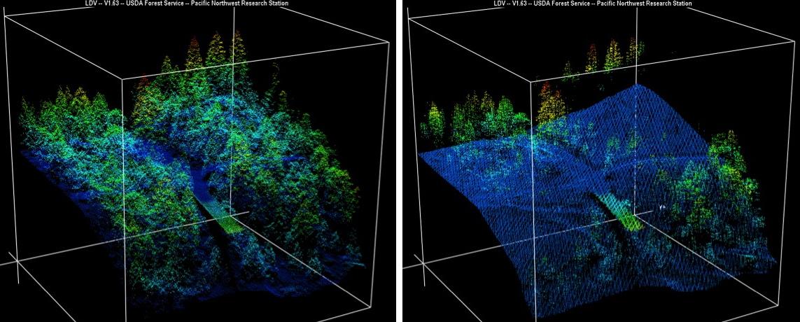
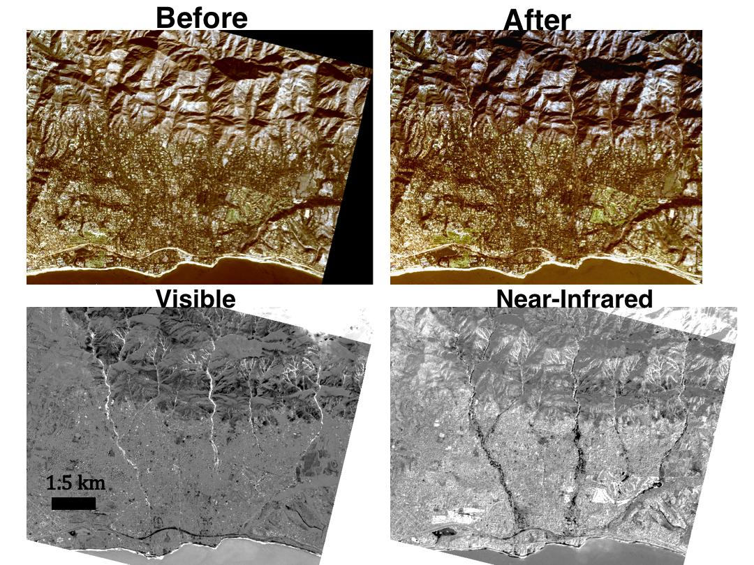
PIA19360:
-
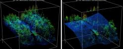
Before-and-After LIDAR Images from 2014 King Fire in El Dorado National Forest
Full Resolution:
TIFF
(1.578 MB)
JPEG
(98.8 kB)
|
|
|
2015-04-09 |
Earth
|
|
AVIRIS
|
1404x813x3 |
|
-
PIA19361:
-
NASA's AVIRIS Map shows Spectral Signature of 2013 Rim Fire
Full Resolution:
TIFF
(3.426 MB)
JPEG
(250.7 kB)
|
|
|
2015-04-14 |
Earth
|
|
|
4500x6000x3 |
|
-
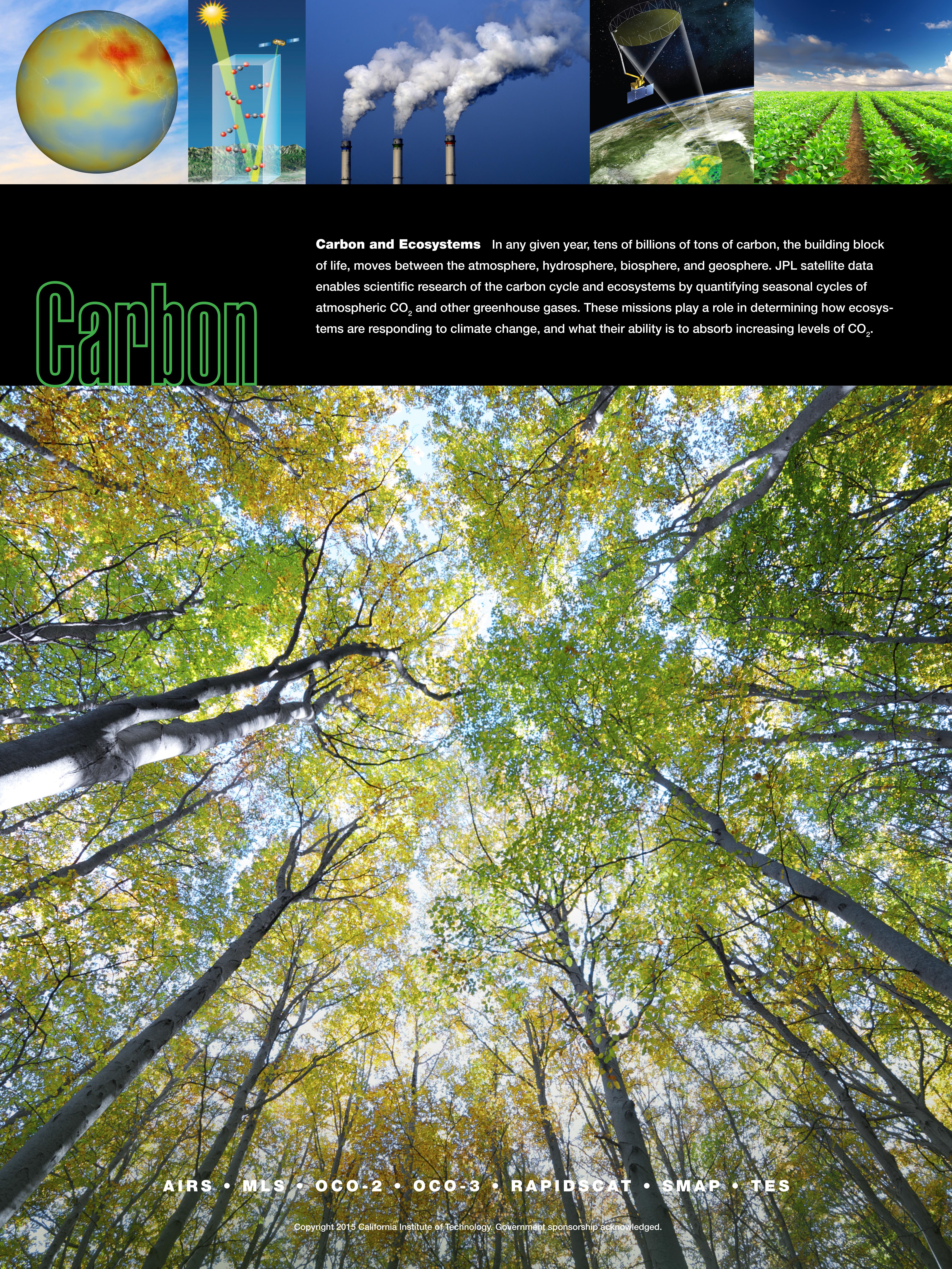
PIA18052:
-
Carbon & Ecosystems
Full Resolution:
TIFF
(81.05 MB)
JPEG
(4.764 MB)
|
|
|
2015-04-14 |
Earth
|
|
|
4500x6000x3 |
|
-
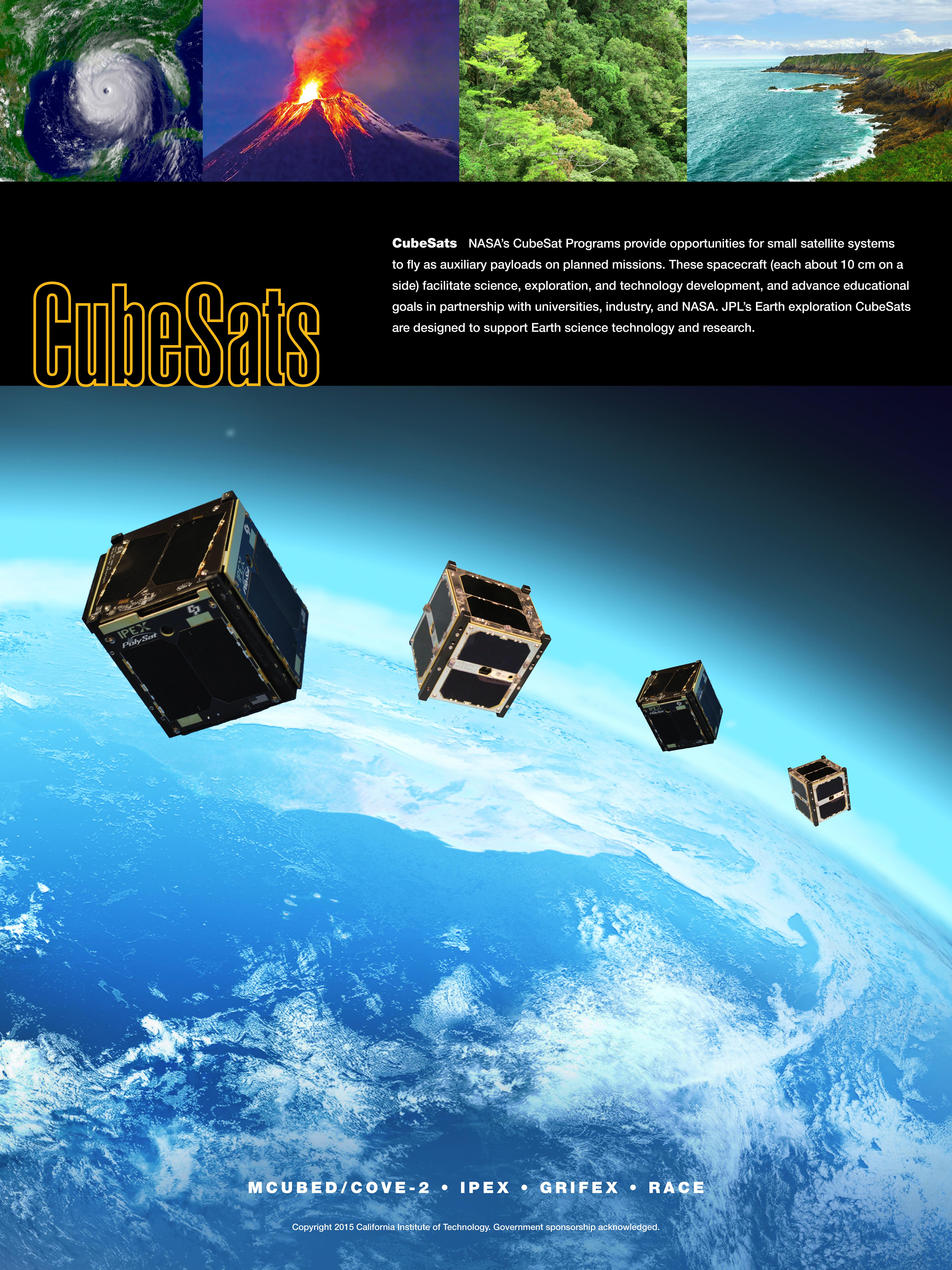
PIA18053:
-
CubeSats
Full Resolution:
TIFF
(81.05 MB)
JPEG
(2.639 MB)
|
|
|
2015-04-14 |
Earth
|
|
|
4500x6000x3 |

|
-
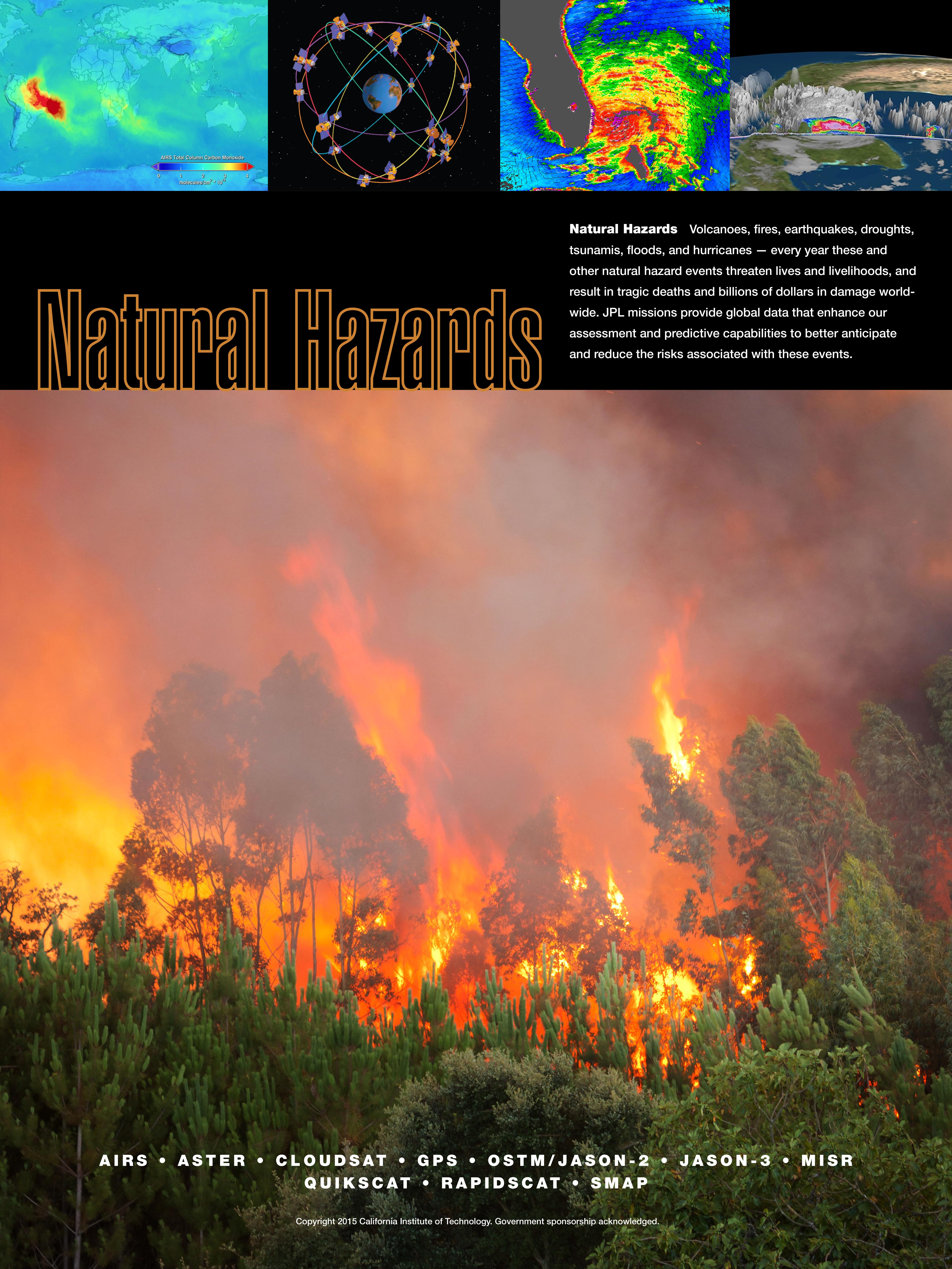
PIA18054:
-
Natural Hazards
Full Resolution:
TIFF
(81.05 MB)
JPEG
(2.267 MB)
|
|
|
2015-04-14 |
Earth
|
|
|
4500x6000x3 |
|
-
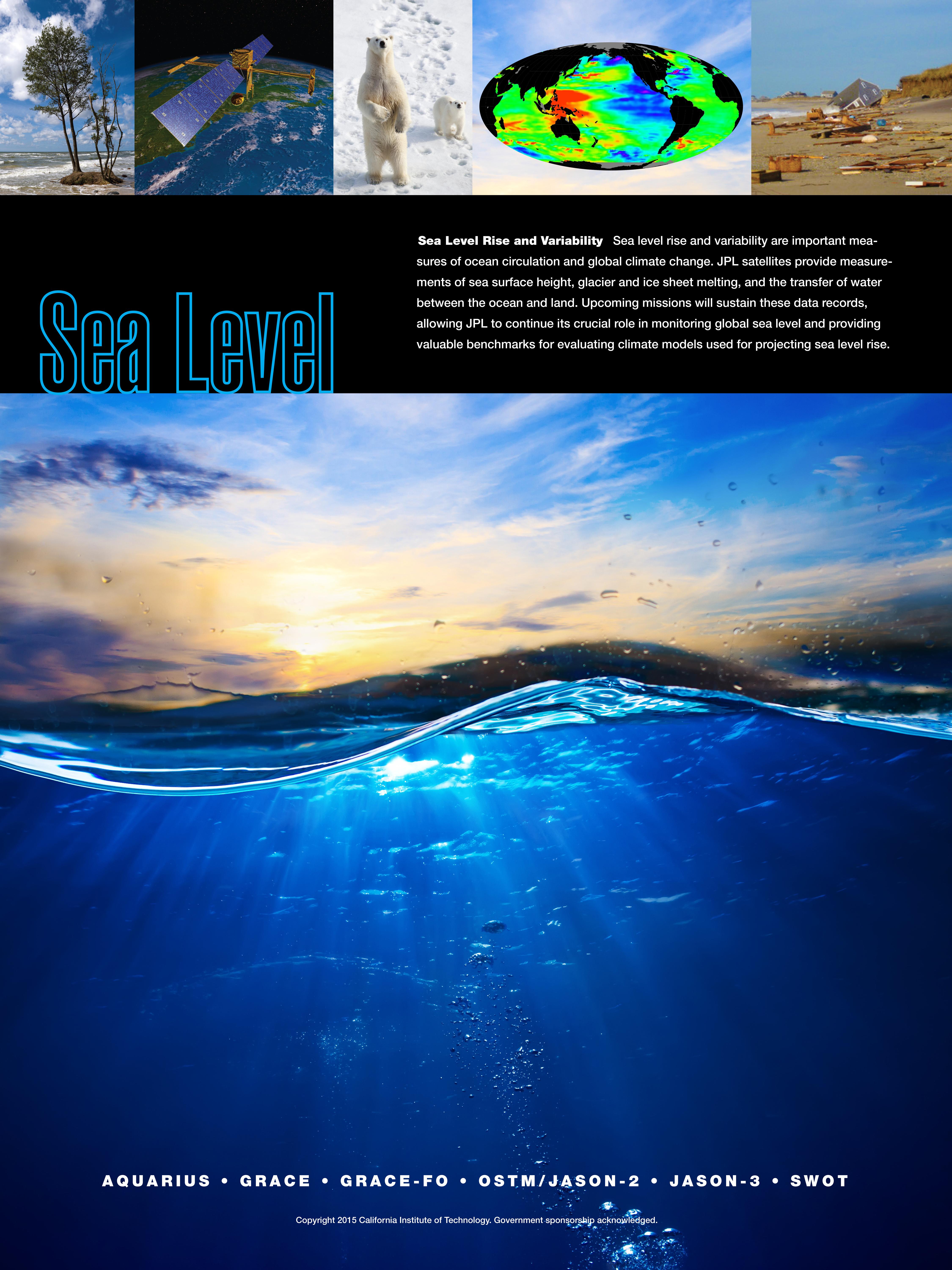
PIA18055:
-
Sea Level Rise & Variability
Full Resolution:
TIFF
(81.05 MB)
JPEG
(1.722 MB)
|
|
|
2015-04-14 |
Earth
|
|
|
4500x6000x3 |

|
-
PIA18056:
-
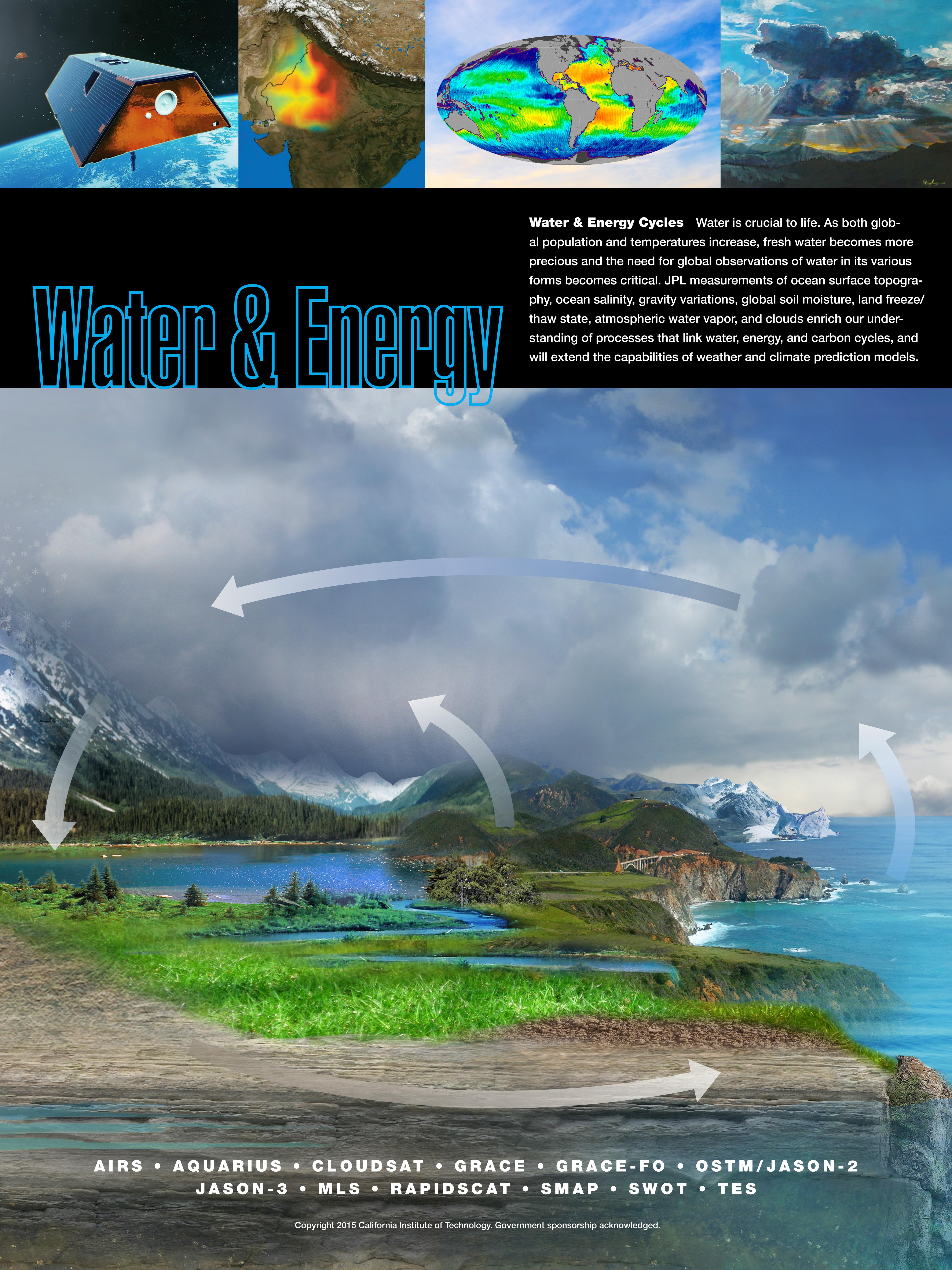
Water & Energy Cycles
Full Resolution:
TIFF
(81.05 MB)
JPEG
(2.646 MB)
|
|
|
2015-04-22 |
Earth
|
|
|
1271x671x3 |
|
-
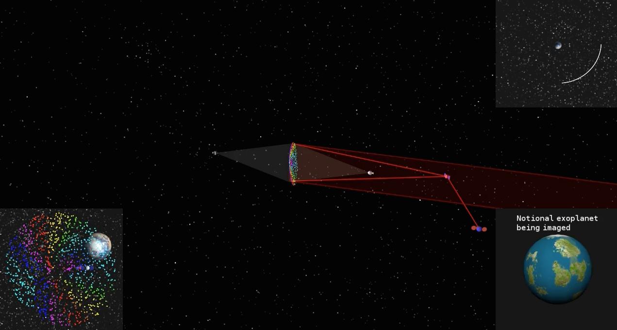
PIA19318:
-
Orbiting Rainbows Simulation
Full Resolution:
TIFF
(2.59 MB)
JPEG
(68.7 kB)
|
|
|
2015-04-29 |
Earth
|
|
C-SAR Sensor
|
2560x1504x3 |
|
-
PIA11434:
-
Ground Deformation from Chilean Volcanic Eruption Shown by Satellite Radar Image
Full Resolution:
TIFF
(11.55 MB)
JPEG
(1.664 MB)
|
|
|
2015-05-11 |
Earth
|
|
|
1041x694x3 |
|
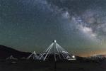
-
PIA19336:
-
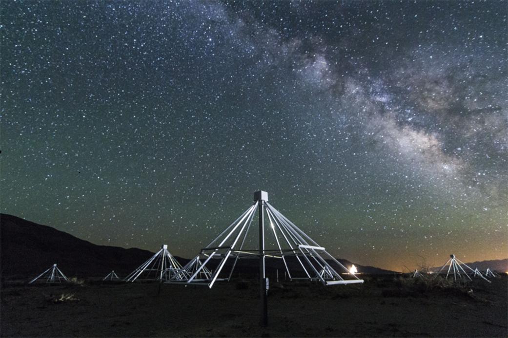
Scanning the Radio Sky
Full Resolution:
TIFF
(2.168 MB)
JPEG
(107.6 kB)
|
|
|
2015-06-09 |
Earth
|
|
RoboSimian
|
7360x4912x3 |
|
-
PIA19324:
-
RoboSimian Exits Vehicle
Full Resolution:
TIFF
(108.5 MB)
JPEG
(2.586 MB)
|
|
|
2015-06-09 |
Earth
|
|
RoboSimian
|
5476x3911x3 |
|
-
PIA19325:
-
RoboSimian Driving
Full Resolution:
TIFF
(64.28 MB)
JPEG
(1.673 MB)
|
|
|
2015-06-09 |
Earth
|
|
RoboSimian
|
7360x4912x3 |
|
-
PIA19326:
-
RoboSimian Cuts Hole in Wall
Full Resolution:
TIFF
(108.5 MB)
JPEG
(3.953 MB)
|
|
|
2015-06-09 |
Earth
|
|
RoboSimian
|
7360x4912x3 |

|
-
PIA19327:
-
Meeting RoboSimian
Full Resolution:
TIFF
(108.5 MB)
JPEG
(1.894 MB)
|
|
|
2015-06-09 |
Earth
|
|
RoboSimian
|
6681x4772x3 |
|
-
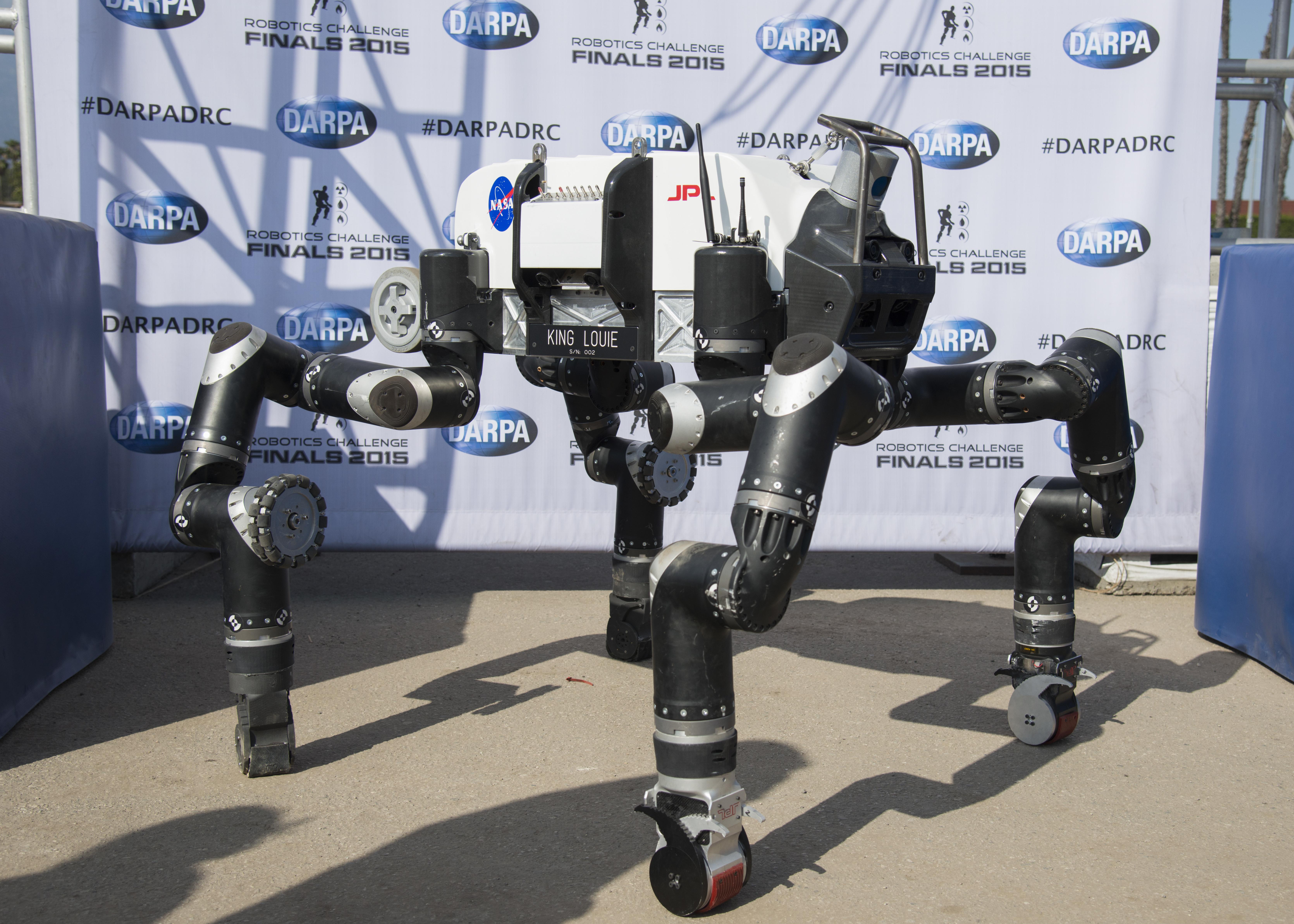
PIA19328:
-
RoboSimian at DARPA Robotics Challenge
Full Resolution:
TIFF
(95.68 MB)
JPEG
(2.553 MB)
|
|
|
2015-06-09 |
Earth
|
|
RoboSimian
|
2771x1979x3 |
|
-
PIA19329:
-
Team RoboSimian
Full Resolution:
TIFF
(16.46 MB)
JPEG
(704.6 kB)
|
|
|
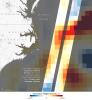
2015-07-10 |
Earth
|
|
California Laboratory for Atmospheric Remote Sensing (CLARS)
Hyperspectral Thermal Emission Spectrometer (HyTES)
|
828x634x3 |
|
-
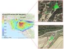
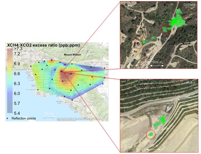
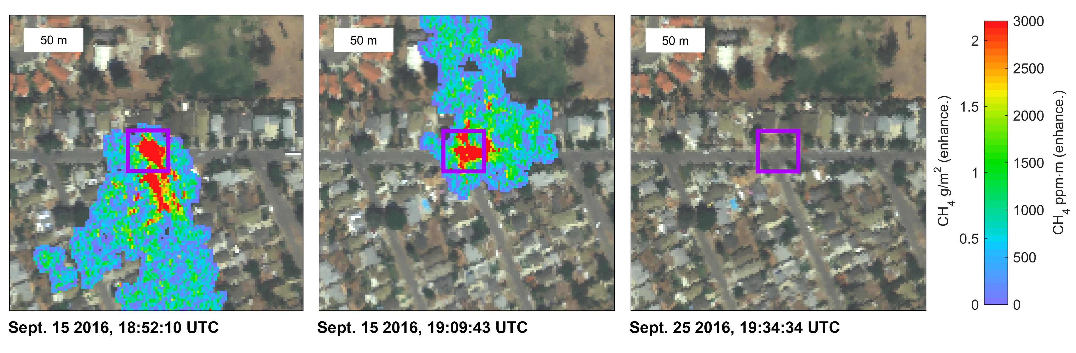
PIA19727:
-
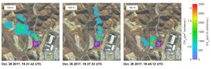
Urban Methane Point Sources Detected by Tiered System of Remote-sensing Observations
Full Resolution:
TIFF
(1.576 MB)
JPEG
(91.56 kB)
|
|
|
2015-11-23 |
Earth
|
|
|
3090x2506x3 |
|
-
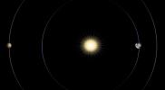
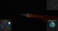
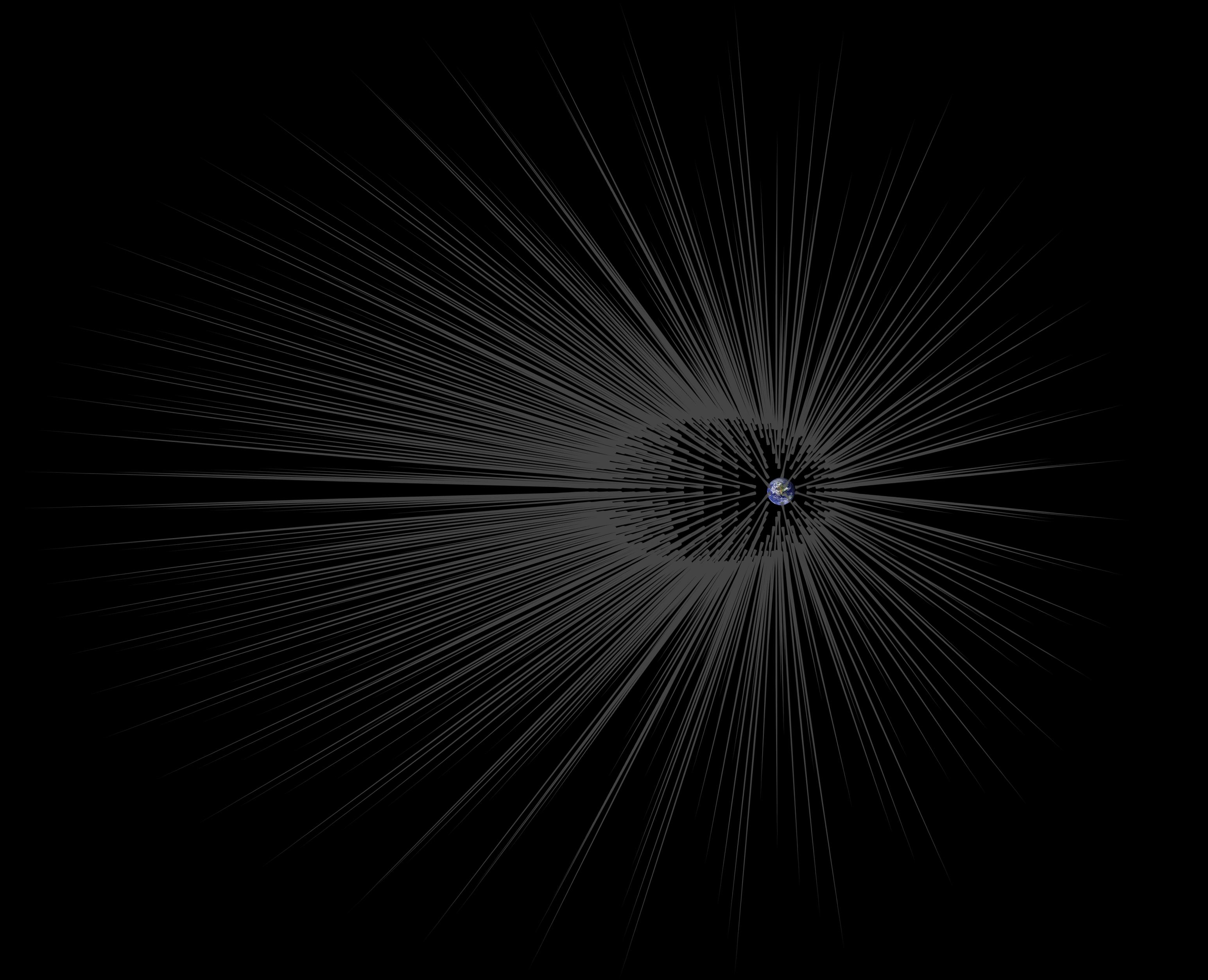
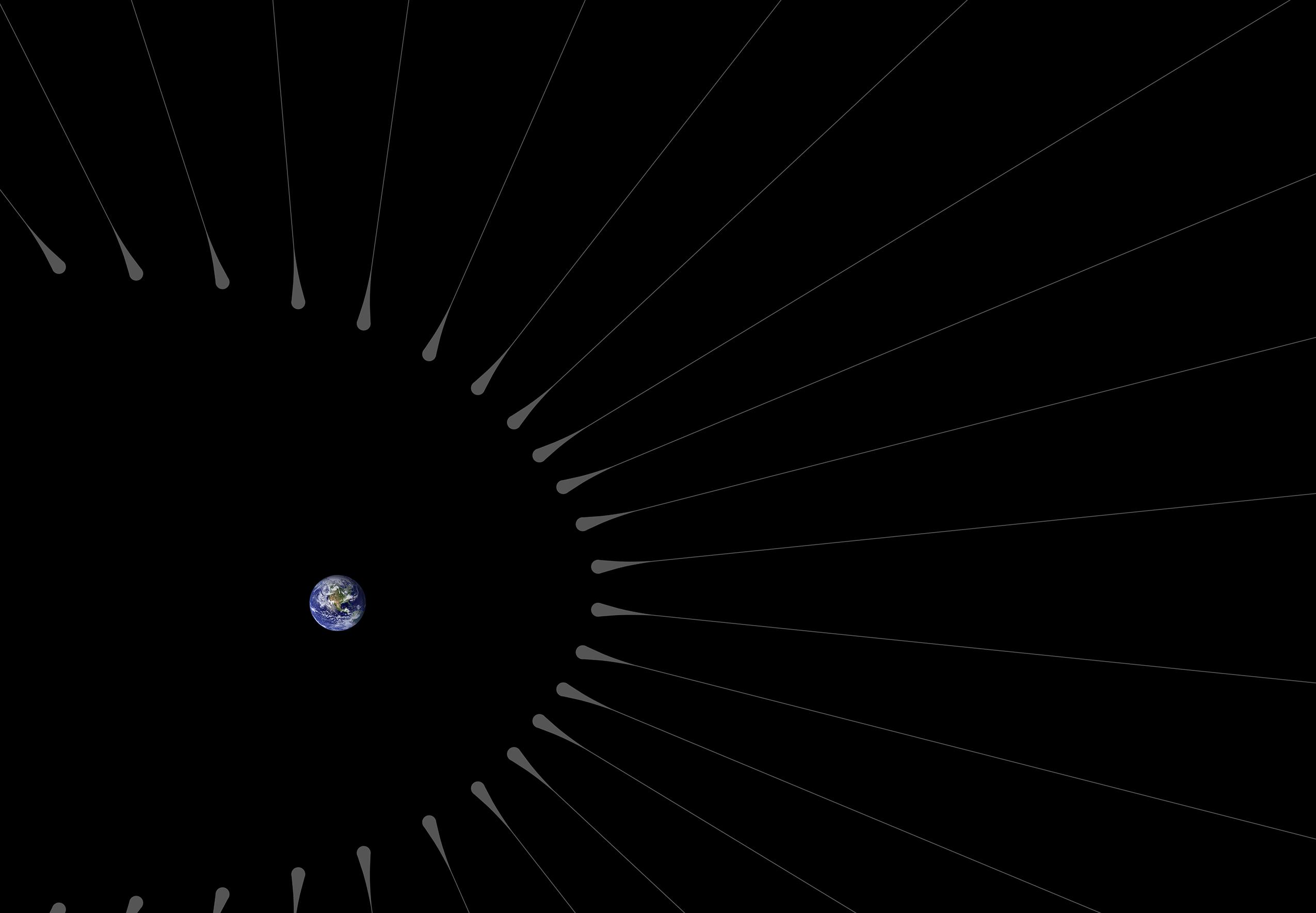
PIA20176:
-
Dark Matter 'Hairs' Around Earth
Full Resolution:
TIFF
(1.94 MB)
JPEG
(549.7 kB)
|
|
|
2015-11-23 |
Earth
|
|
|
2550x1769x3 |

|
-
PIA20177:
-
Dark Matter 'Hairs' Around Earth -- Close-up
Full Resolution:
TIFF
(432.9 kB)
JPEG
(129.3 kB)
|
|
|
2015-11-23 |
Earth
|
|
|
3090x2506x3 |
|
-
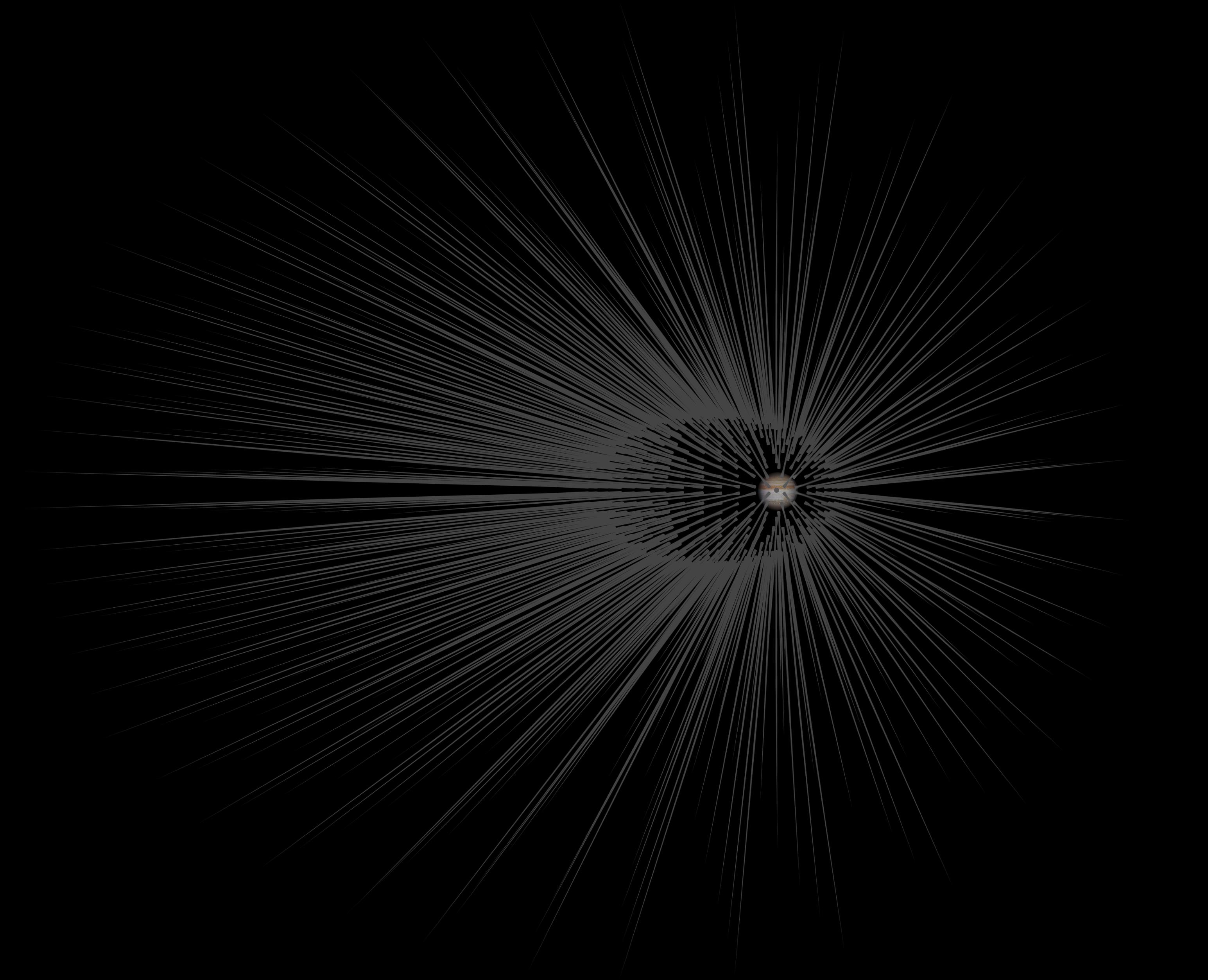
PIA20178:
-
Dark Matter 'Hairs' Around Jupiter
Full Resolution:
TIFF
(1.95 MB)
JPEG
(549.1 kB)
|
|
|
2016-10-07 |
Earth
|
|
HAMSR
|
3325x2160x3 |
|
-
PIA21093:
-
JPL's HAMSR Takes Hurricane Matthew's Temperature
Full Resolution:
TIFF
(8.53 MB)
JPEG
(533.2 kB)
|
|
|
2016-10-07 |
Earth
|
|
HAMSR
|
2888x1455x3 |
|
-
PIA21094:
-
JPL's HAMSR Looks Inside Hurricane Matthew's Spiral Cloud Bands
Full Resolution:
TIFF
(9.106 MB)
JPEG
(329.1 kB)
|
|
|
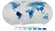
2024-04-26 |
Earth
|
|
|
1440x810x3 |
|
-
PIA26119:
-
Global Accounting of Earth's River Storage and Flow
Full Resolution:
TIFF
(1.377 MB)
JPEG
(104.8 kB)
|
|
|
2018-02-15 |
Earth
|
|
|
6176x4063x3 |
|
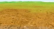
-
PIA22219:
-
Rock Stripe Pattern on Hawaii's Mauna Kea
Full Resolution:
TIFF
(75.31 MB)
JPEG
(3.928 MB)
|
|
|
2018-02-21 |
Earth
|
|
|
3778x2234x3 |
|
-
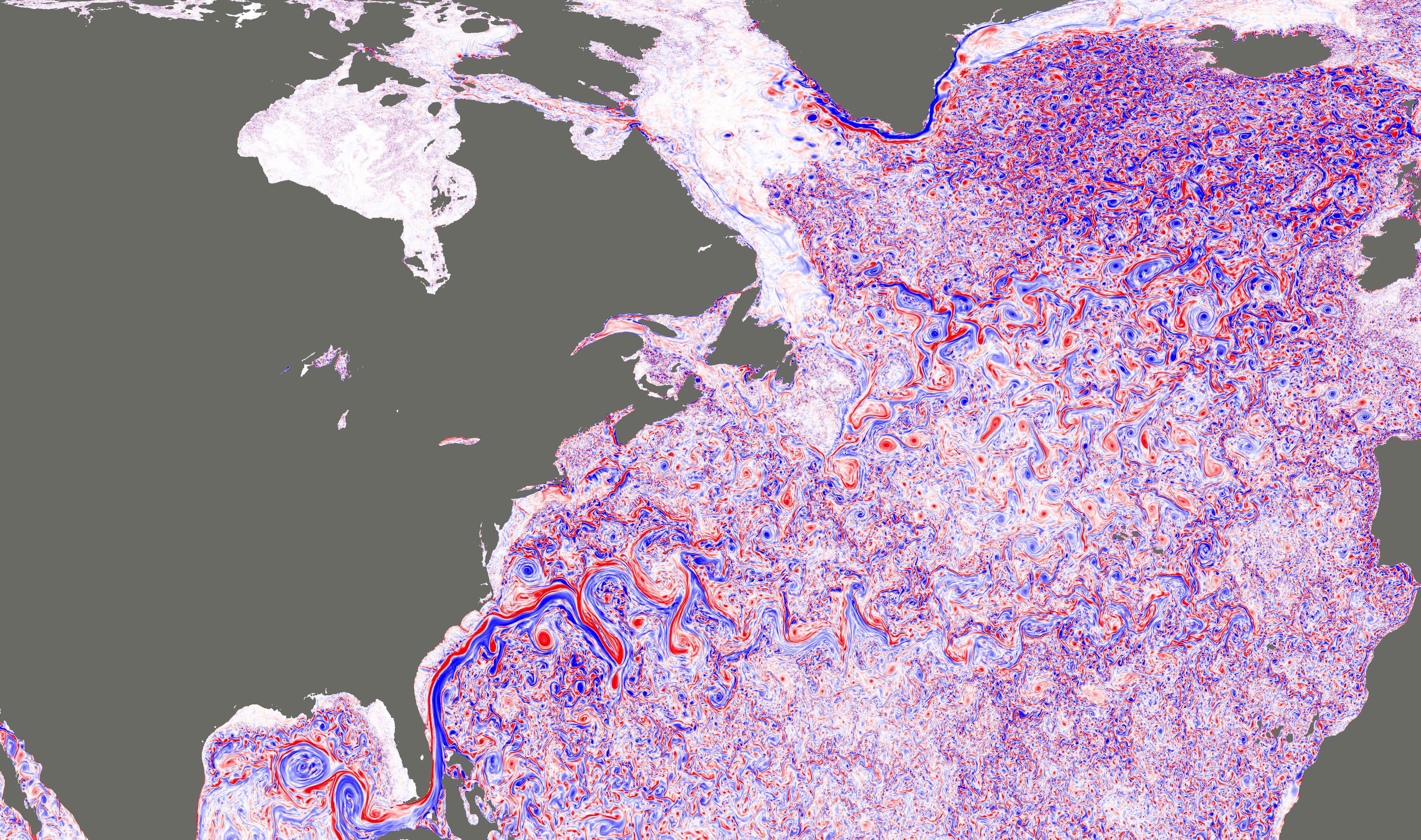
PIA22256:
-
NASA Simulation Shows Ocean Turbulence in the North Atlantic
Full Resolution:
TIFF
(17.06 MB)
JPEG
(2.186 MB)
|
|
|
2018-03-15 |
Earth
|
|
|
1080x810x3 |
|
-
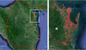
PIA22343:
-
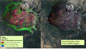
Mapping the Extent of California's Deadly Jan. 2018 Mudflows
Full Resolution:
TIFF
(1.773 MB)
JPEG
(224.5 kB)
|
|
|
2018-06-01 |
Earth
|
|
AVIRIS-NG
|
4500x1476x3 |
|
-
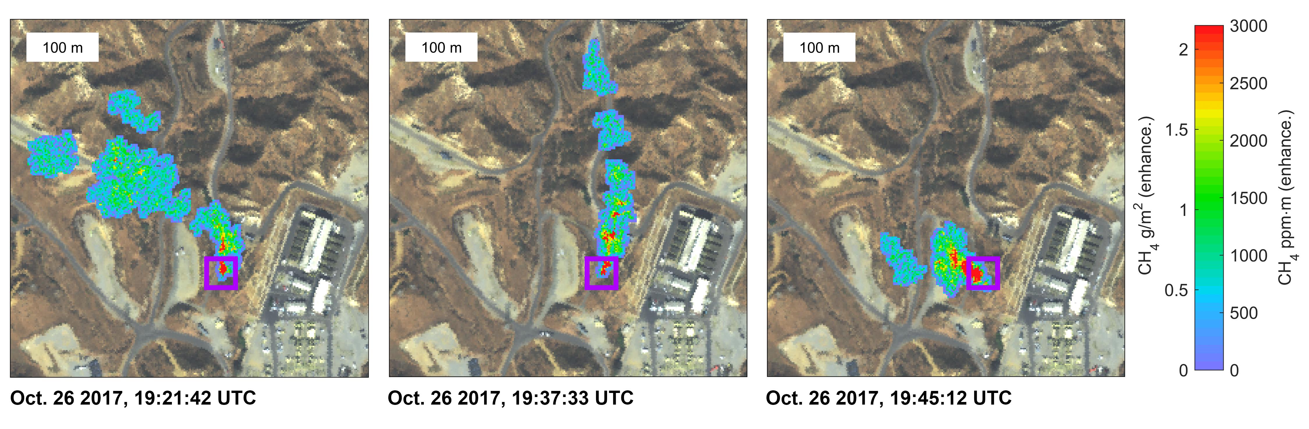
PIA22466:
-
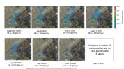
NASA Instrument Surveying California Methane Emission Sources
Full Resolution:
TIFF
(13.29 MB)
JPEG
(775.2 kB)
|
|
|
2018-06-01 |
Earth
|
|
AVIRIS-NG
|
4500x1476x3 |

|
-
PIA22467:
-
NASA Instrument Detects Methane Gas Leak
Full Resolution:
TIFF
(11.42 MB)
JPEG
(655.2 kB)
|
|
|
2019-11-05 |
Earth
|
|
|
1440x960x3 |

|
-
PIA23425:
-
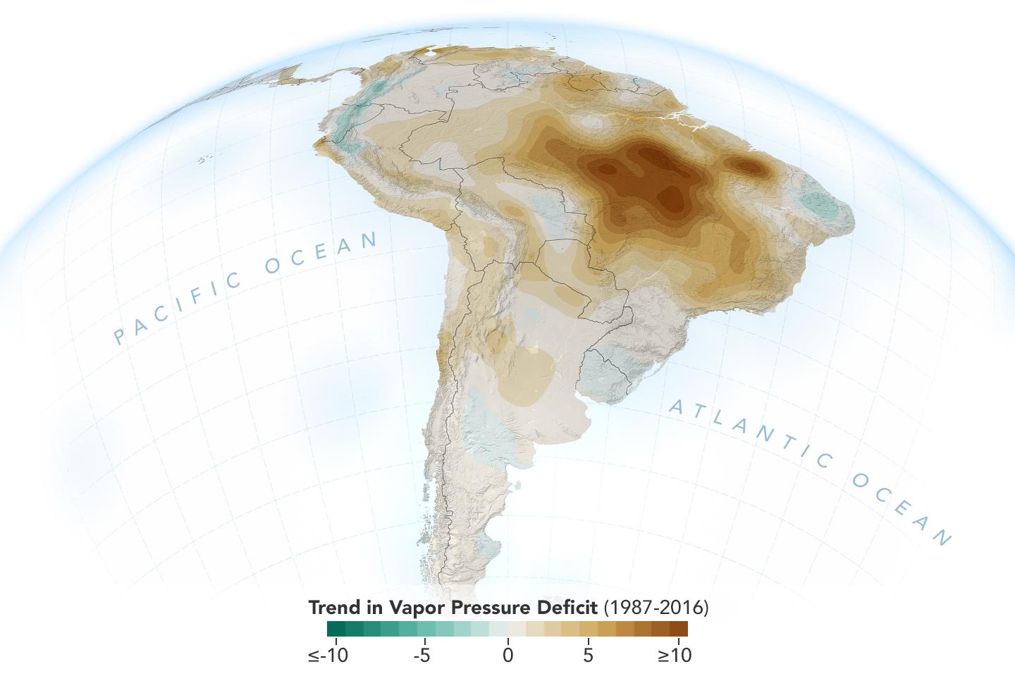
New Study Shows Atmosphere in the Amazon Drying Out
Full Resolution:
TIFF
(1.789 MB)
JPEG
(96.3 kB)
|
|
|
2020-04-15 |
Earth
|
|
|
1920x1080x3 |
|
-
PIA23686:
-
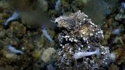
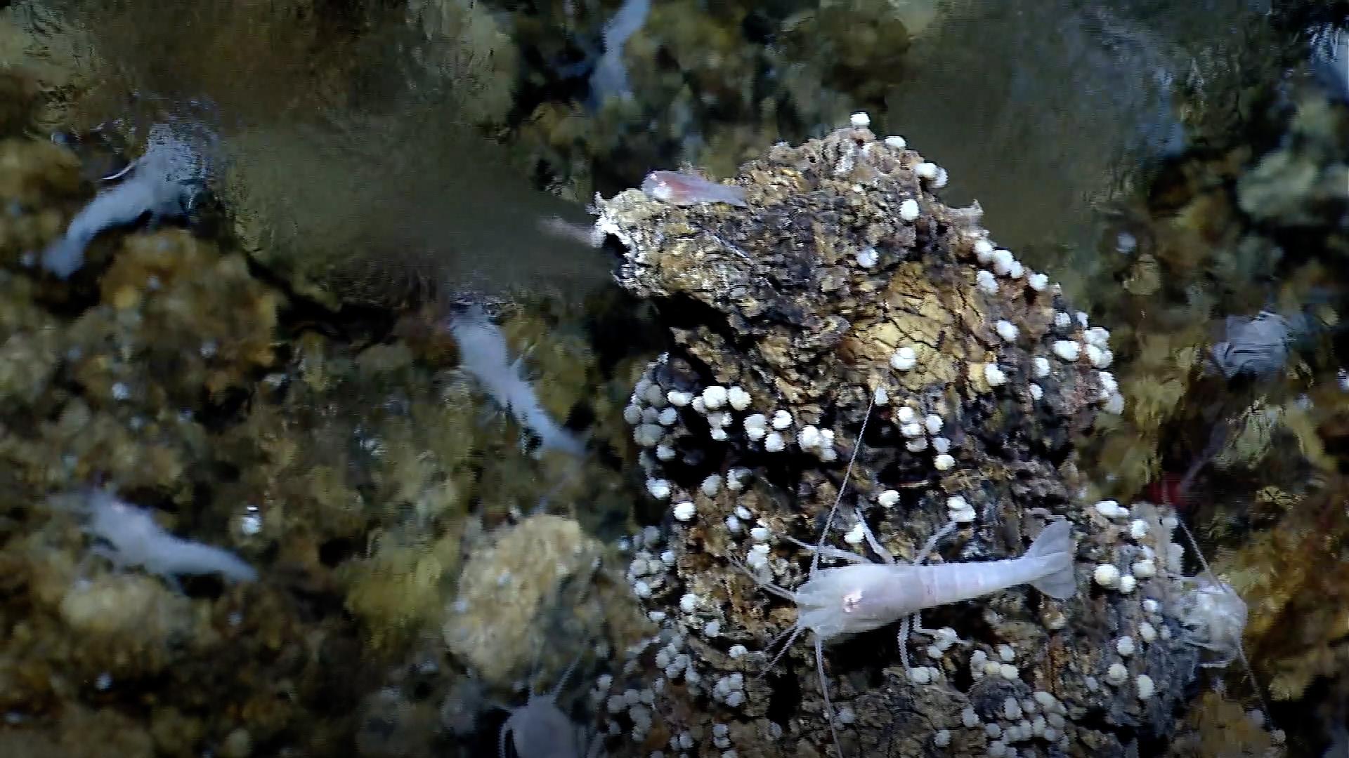
White Smoker Ocean Vents
Full Resolution:
TIFF
(6.172 MB)
JPEG
(270.2 kB)
|
|
|
2020-09-02 |
Earth
|
|
AVIRIS-NG
|
3999x2249x3 |
|
-
PIA24019:
-
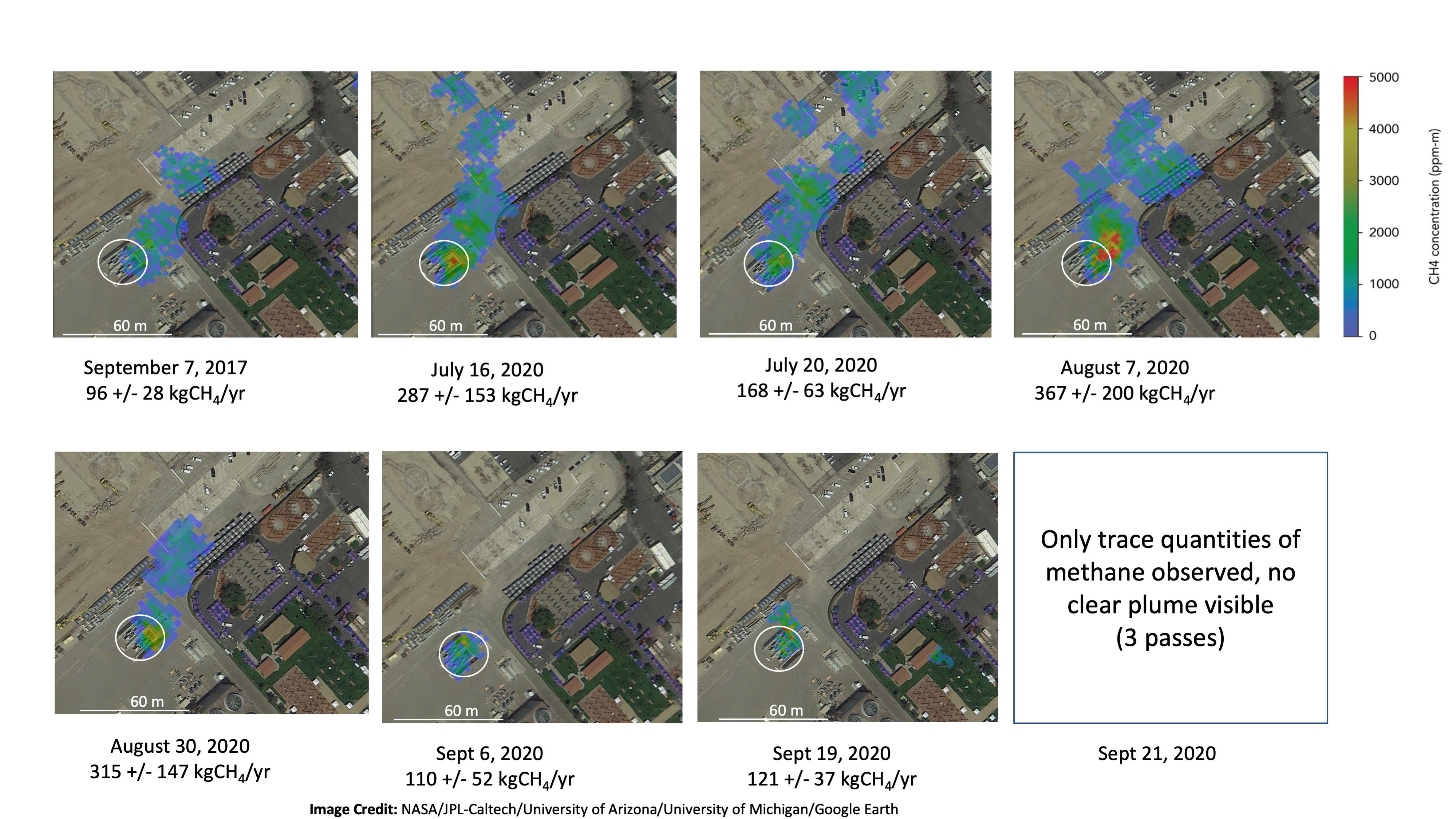
NASA Instrument Tracks Power Plant Methane Emissions
Full Resolution:
TIFF
(13.87 MB)
JPEG
(866 kB)
|
|
|
2020-09-15 |
Earth
|
|
UAVSAR
|
1280x720x3 |

|
-
PIA24102:
-
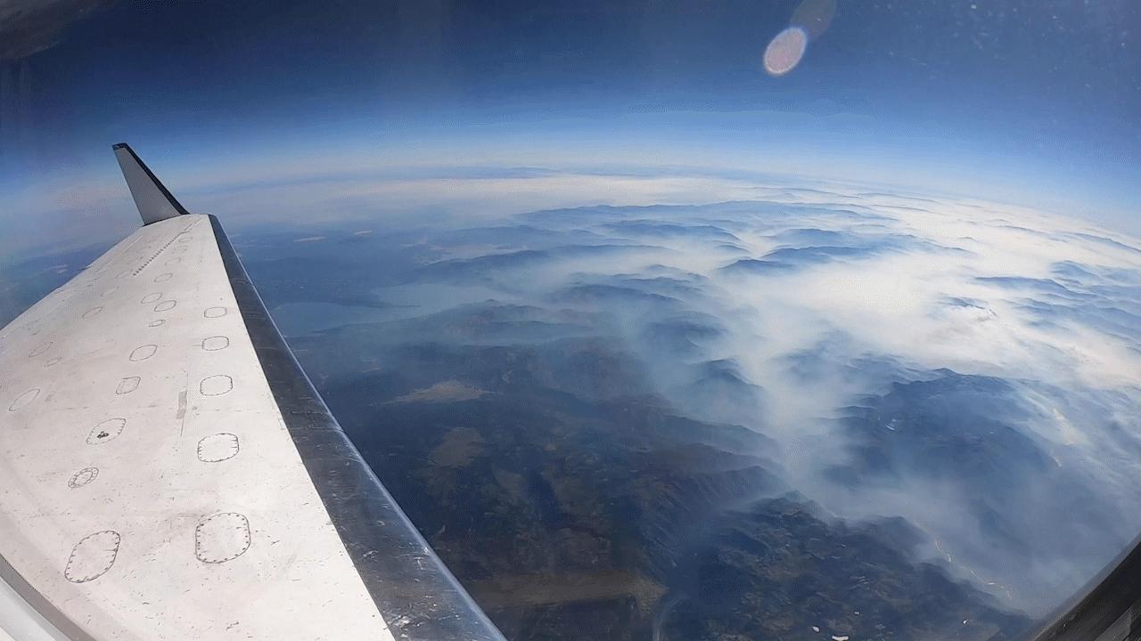
NASA's UAVSAR Flights Observe California Fires
Full Resolution:
TIFF
(2.43 MB)
JPEG
(81.83 kB)
|
|
|
2020-09-23 |
Earth
|
|
|
8000x5955x3 |
|
-
PIA23790:
-
OASIS Study Project (Illustration)
Full Resolution:
TIFF
(104.1 MB)
JPEG
(4.095 MB)
|
|
|
2021-01-27 |
Earth
|
|
|
1024x768x3 |

|
-
PIA24374:
-
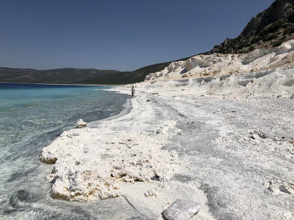
Lake Salda Rocks
Full Resolution:
TIFF
(2.36 MB)
JPEG
(146.1 kB)
|
|
|
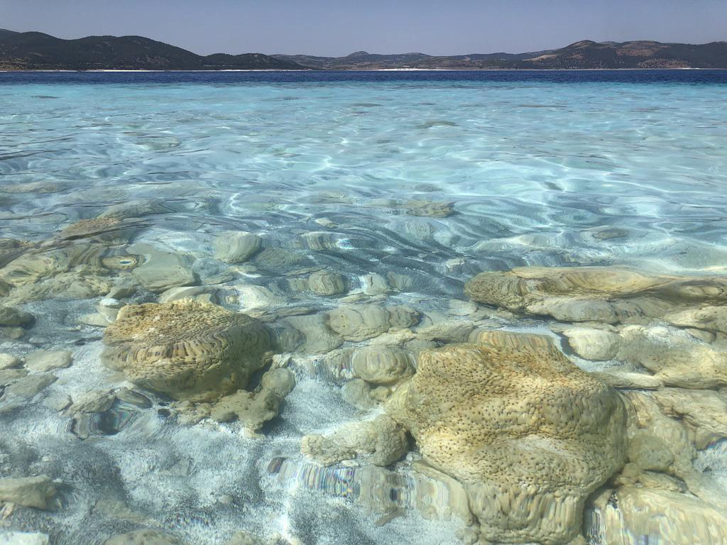
2021-01-27 |
Earth
|
|
|
1024x768x3 |

|
-
PIA24375:
-
Lake Salda Beach
Full Resolution:
TIFF
(2.112 MB)
JPEG
(189.6 kB)
|
|
|
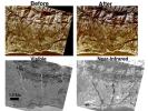
2021-04-07 |
Earth
|
|
WATSON
|
2048x1536x3 |

|
-
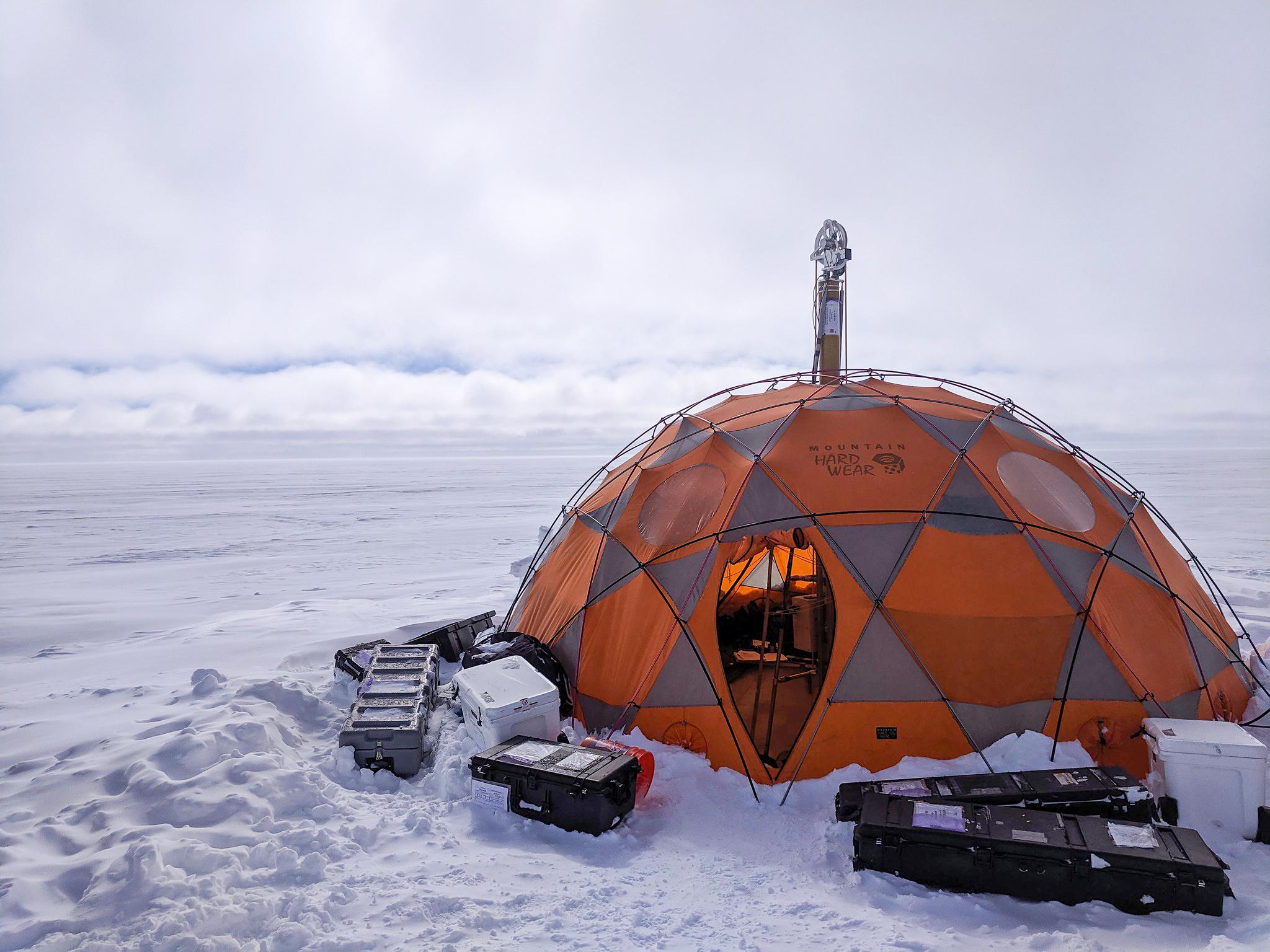
PIA24169:
-
WATSON's Field Test in Greenland
Full Resolution:
TIFF
(7.031 MB)
JPEG
(319.2 kB)
|
|
|
2021-04-07 |
Earth
|
|
WATSON
|
2048x1536x3 |

|
-
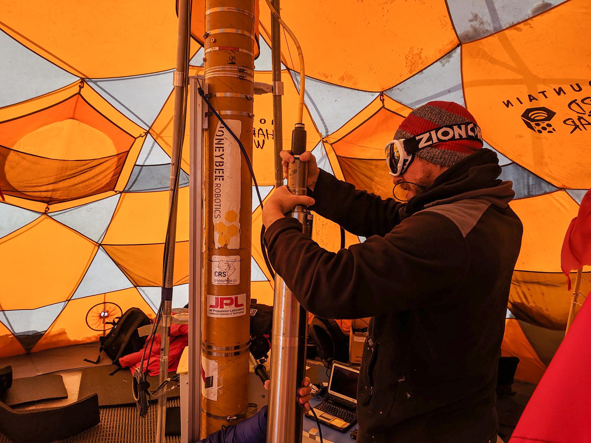
PIA24170:
-
Preparing WATSON for Borehole Descent
Full Resolution:
TIFF
(8.505 MB)
JPEG
(413.1 kB)
|
|
|
2021-04-07 |
Earth
|
|
WATSON
|
2244x4128x3 |
|
-
PIA24140:
-
Fluorescence Map of a Greenland Borehole
Full Resolution:
TIFF
(7.9 MB)
JPEG
(385.4 kB)
|
|
|
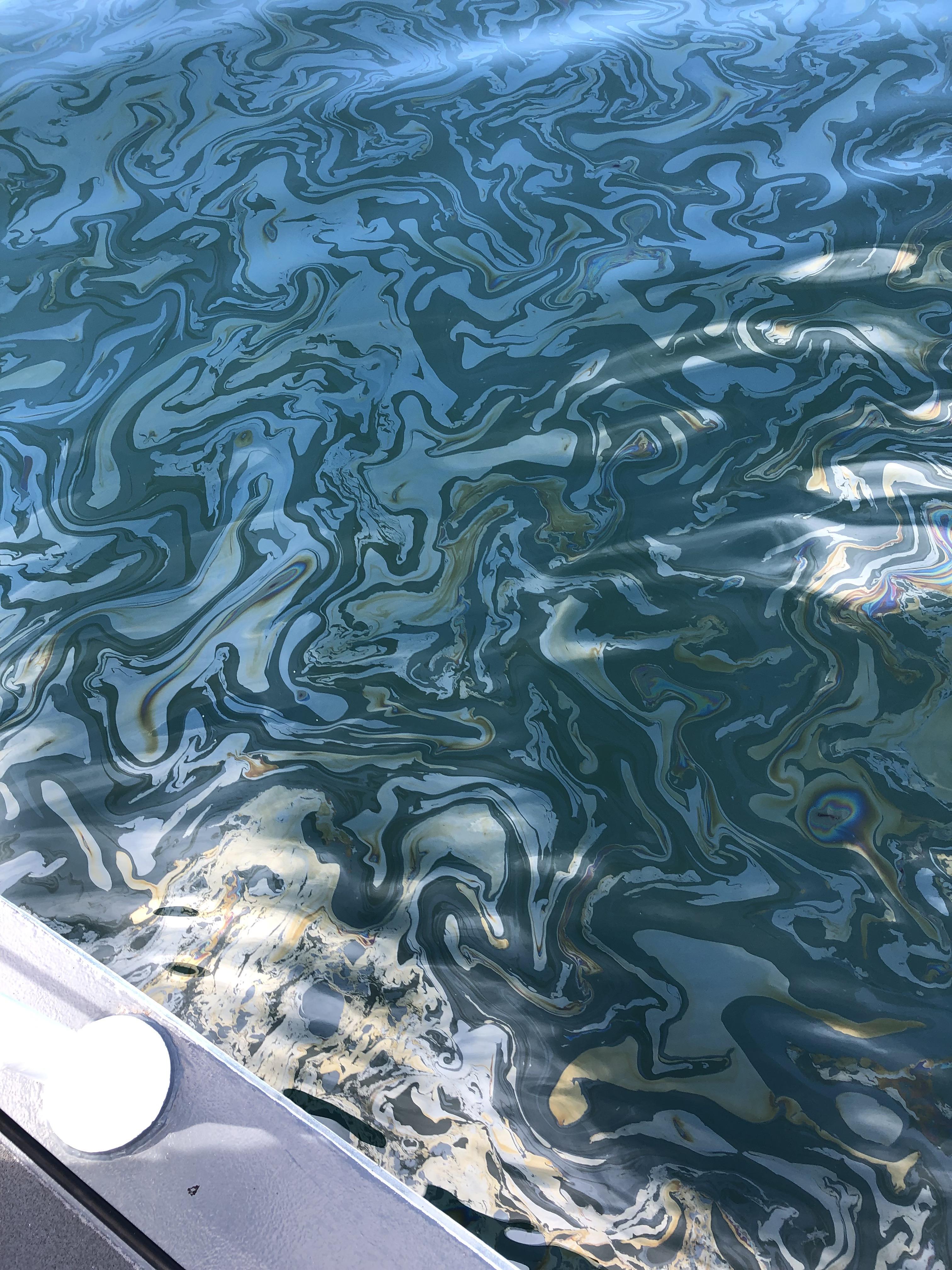
2021-10-13 |
Earth
|
|
UAVSAR
|
3300x2550x3 |
|
-
PIA23782:
-
UAVSAR Oil Slicks
Full Resolution:
TIFF
(13.21 MB)
JPEG
(2.027 MB)
|
|
|
2021-10-13 |
Earth
|
|
UAVSAR
|
4032x3024x3 |

|
-
PIA24901:
-
UAVSAR Flight Crew
Full Resolution:
TIFF
(22.67 MB)
JPEG
(1.01 MB)
|
|
|
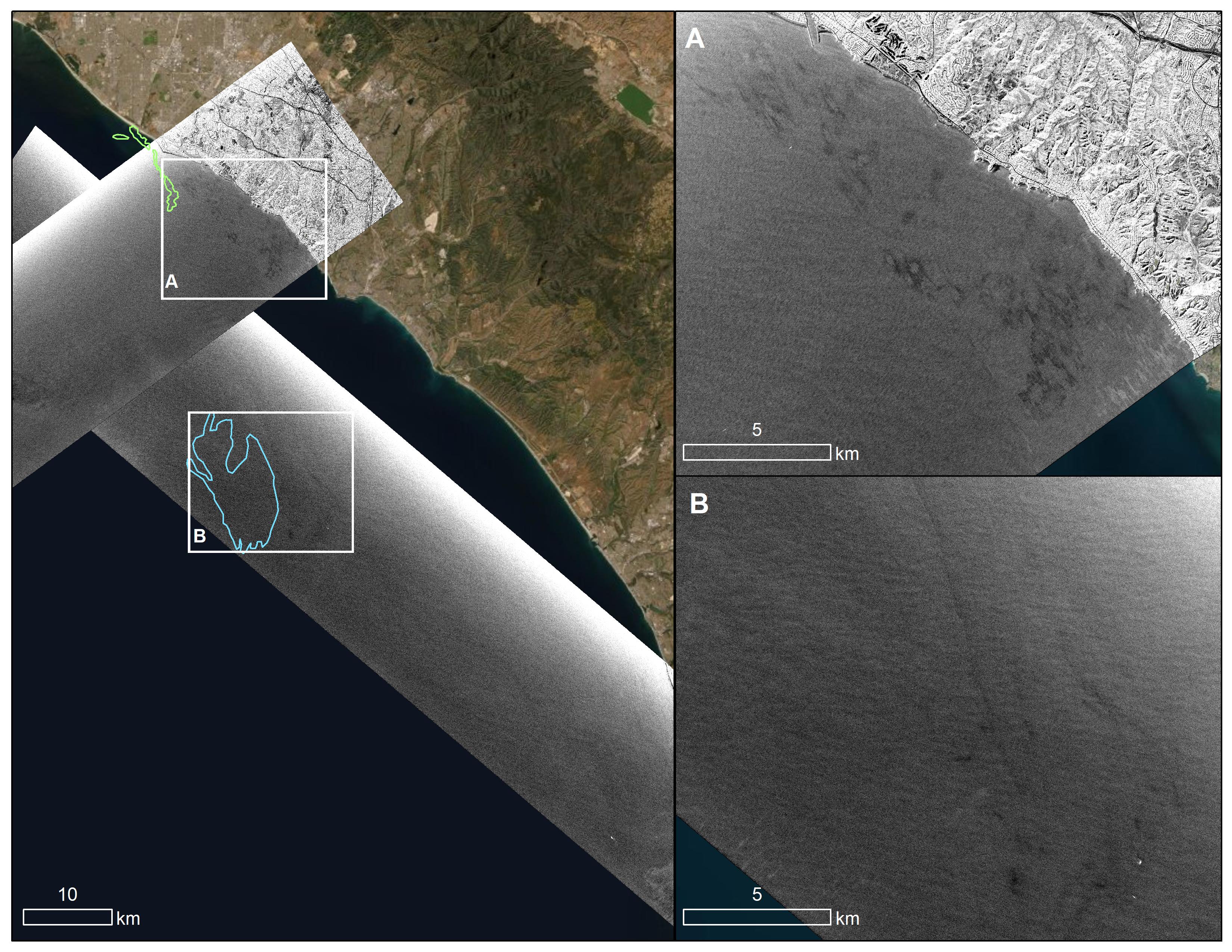
2021-12-13 |
Earth
|
|
UAVSAR
|
3024x4032x3 |

|
-
PIA23699:
-
Natural Oil Seepage Off California Coast
Full Resolution:
TIFF
(34.33 MB)
JPEG
(1.609 MB)
|
|
|
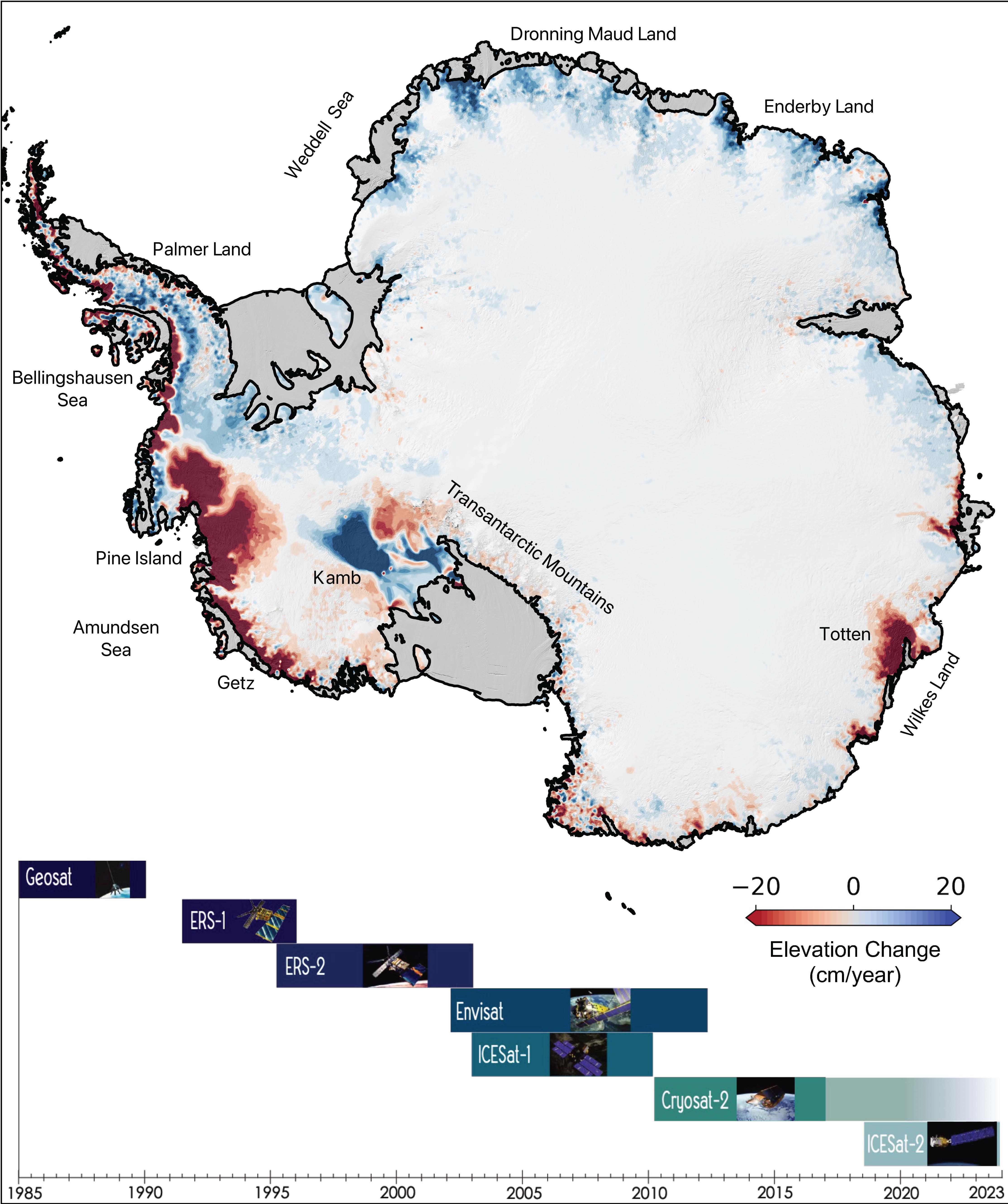
2022-08-10 |
Earth
|
|
|
4456x5324x3 |
|
-
PIA24990:
-
The Antarctic Ice Sheet's Changing Height
Full Resolution:
TIFF
(18.38 MB)
JPEG
(1.304 MB)
|
|
|
2022-12-19 |
Earth
|
|
UAVSAR
|
3750x3750x3 |

|
-
PIA25526:
-
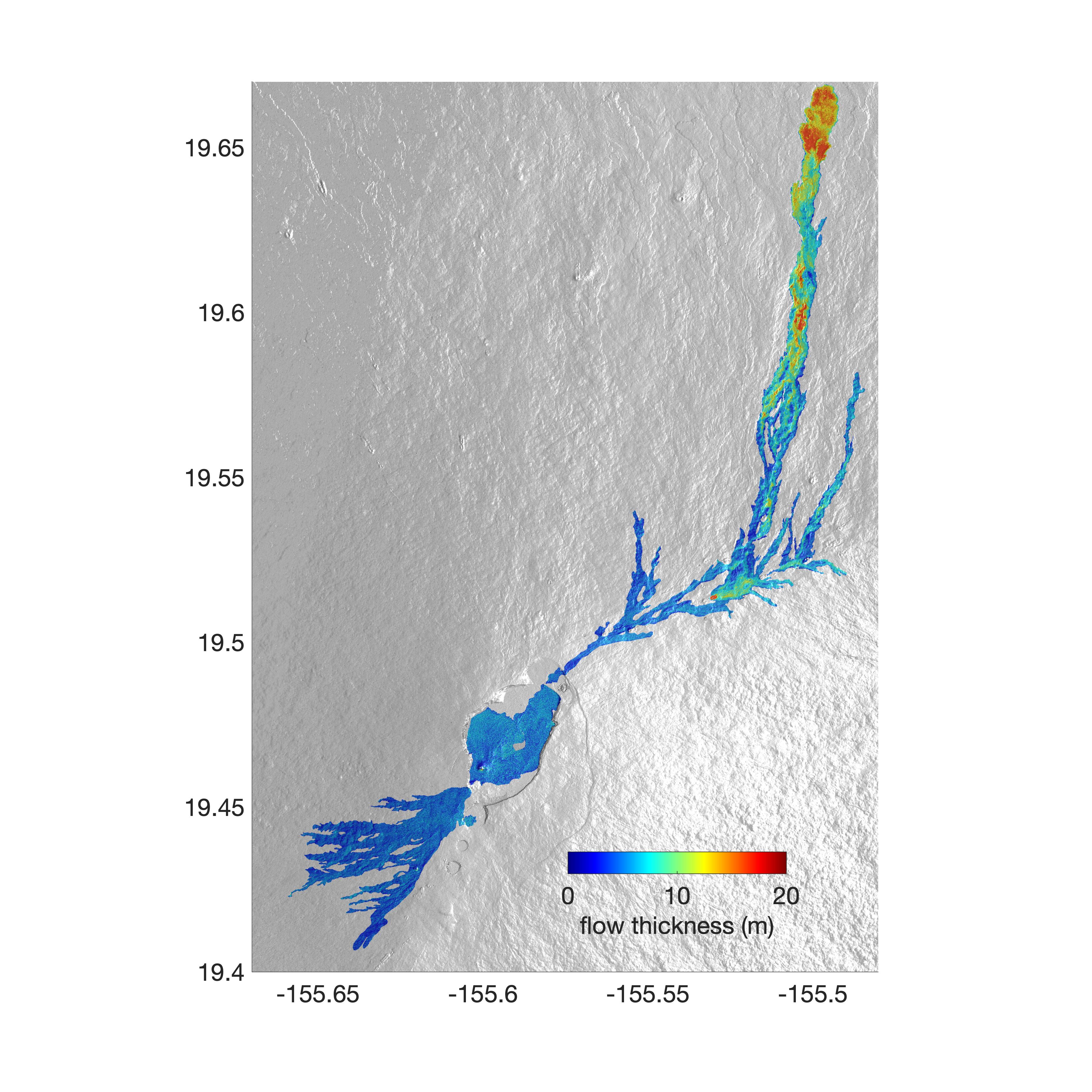
Airborne NASA Radar Maps Mauna Loa Lava Changes in Hawaii
Full Resolution:
TIFF
(11.11 MB)
JPEG
(1.418 MB)
|
|
|
2023-03-17 |
Earth
|
|
|
3300x2550x3 |
|
-
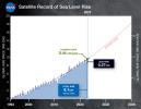
PIA25775:
-
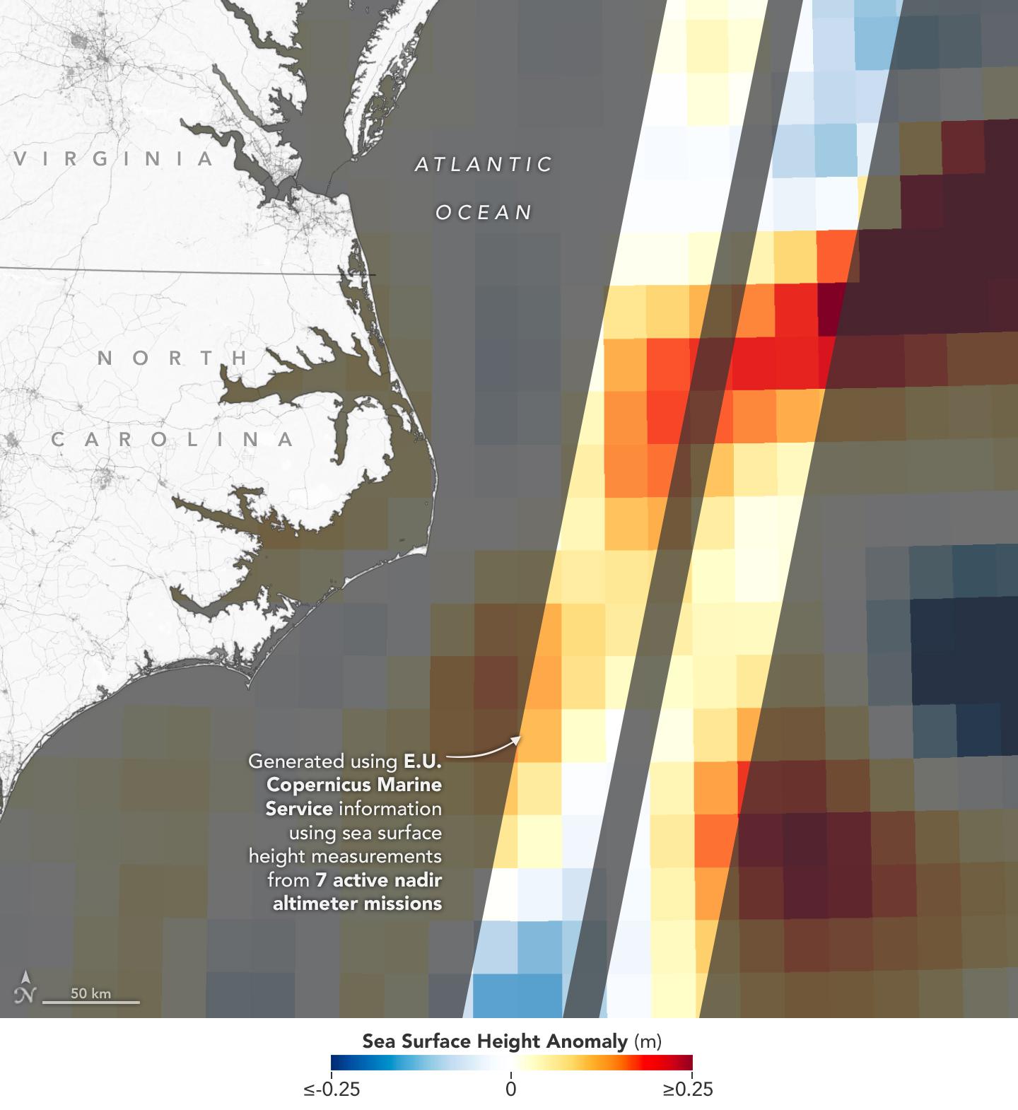
30 Years of Sea Level Rise
Full Resolution:
TIFF
(5.404 MB)
JPEG
(446.5 kB)
|
|
|
2023-03-24 |
Earth
|
|
|
1440x1570x3 |
|
-
PIA25773:
-
Sea Level Visualization of Gulf Stream
Full Resolution:
TIFF
(2.24 MB)
JPEG
(159 kB)
|
|
|
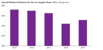
2023-05-15 |
Earth
|
|
|
1440x700x3 |
|
-
PIA25863:
-
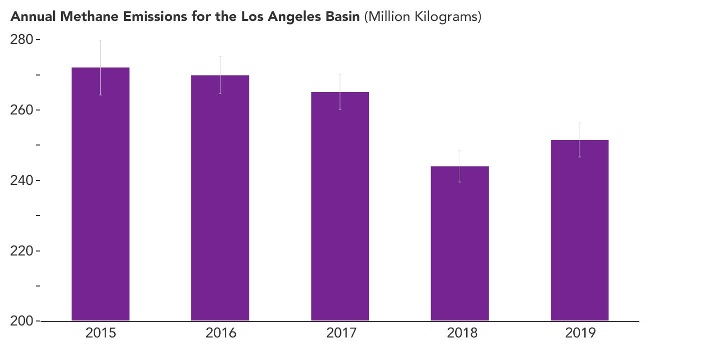
Declining Methane Emissions in the Los Angeles Basin
Full Resolution:
TIFF
(181.3 kB)
JPEG
(46.55 kB)
|
|
|
2023-05-15 |
Earth
|
|
|
1440x700x3 |

|
-
PIA25864:
-
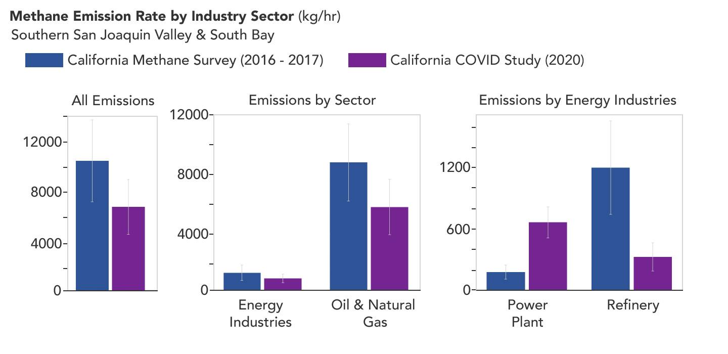
Declining Methane Emissions at California Oil Fields and Refineries
Full Resolution:
TIFF
(325.1 kB)
JPEG
(73.03 kB)
|
|
|
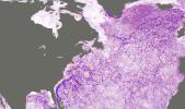
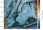
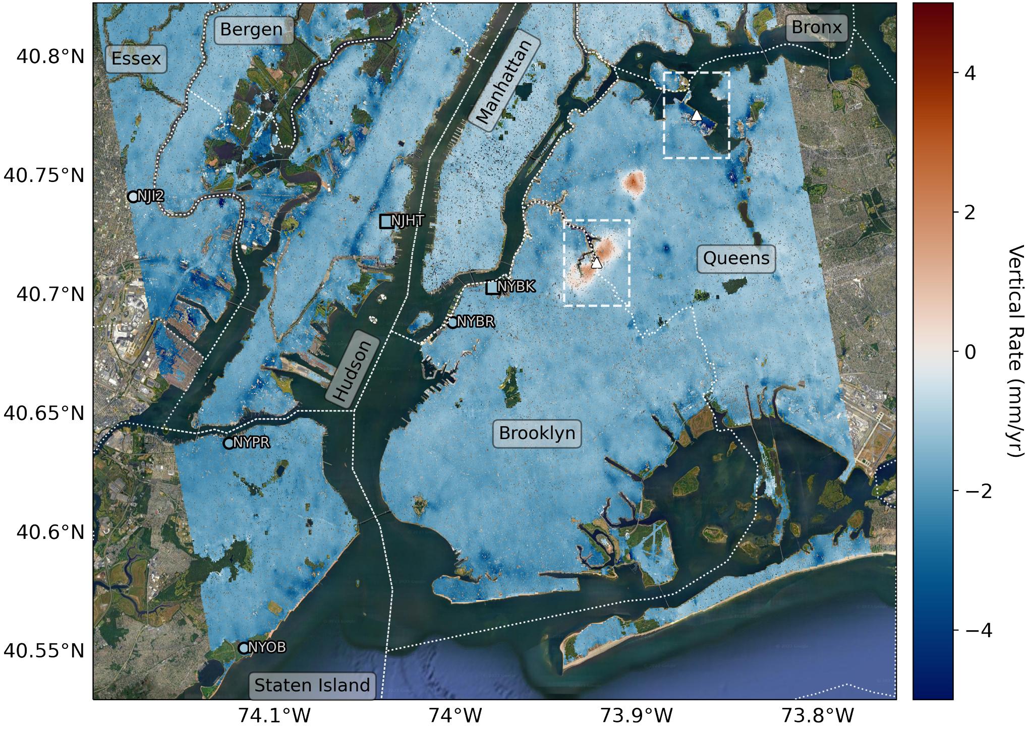
2023-09-27 |
Earth
|
|
InSAR
|
2036x1446x3 |
|
-
PIA25527:
-
Map of New York City Subsidence and Uplift
Full Resolution:
TIFF
(7.442 MB)
JPEG
(516.4 kB)
|
|
|
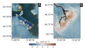
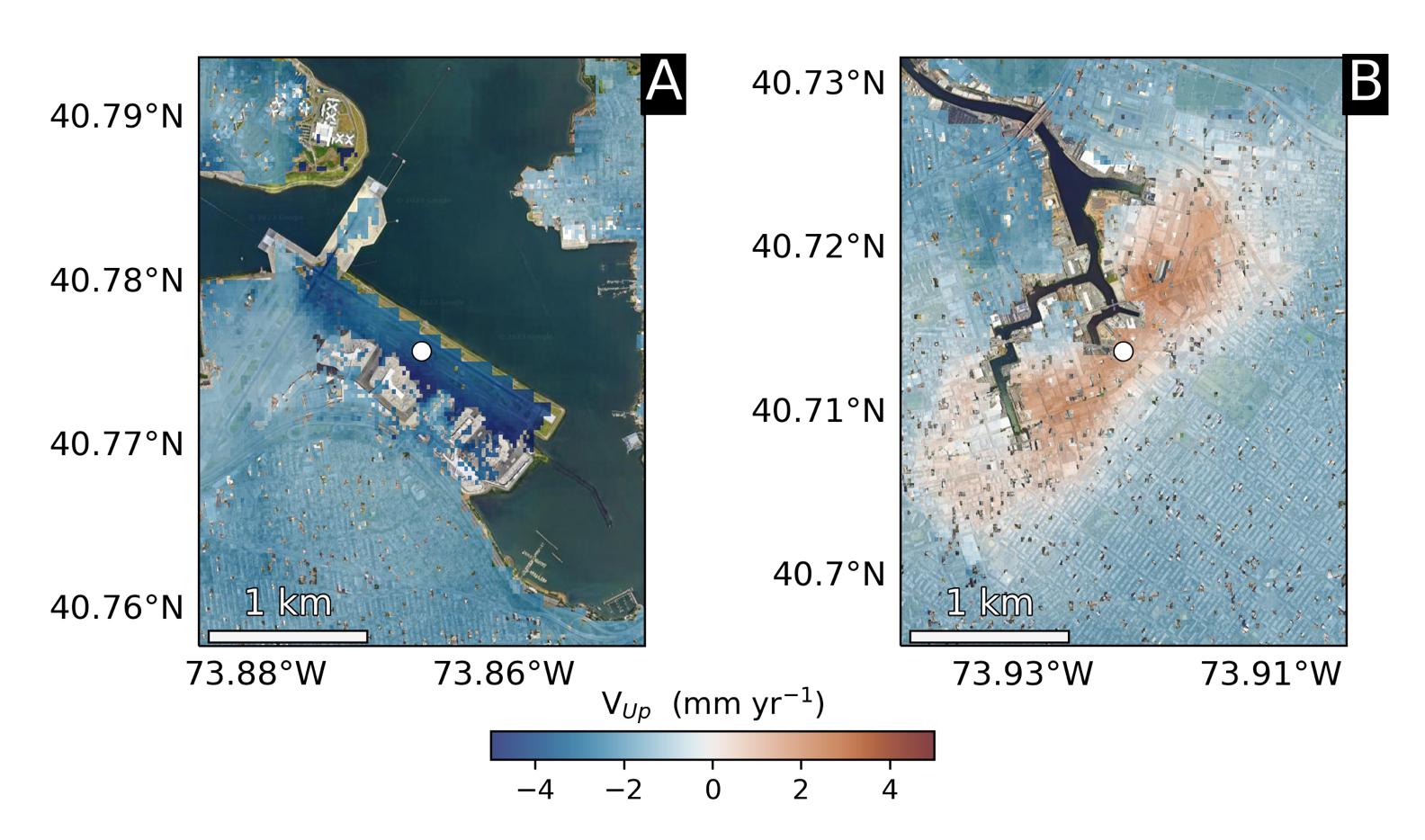
2023-09-27 |
Earth
|
|
InSAR
|
1584x934x3 |
|
-
PIA25528:
-
Hot Spots of Subsidence, Uplift in New York City
Full Resolution:
TIFF
(2.374 MB)
JPEG
(173.7 kB)
|
|
|
2024-07-19 |
Earth
|
|
|
1654x1578x3 |
|
-
PIA26120:
-
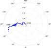
Meandering Path of Earth's Spin Axis
Full Resolution:
TIFF
(362.3 kB)
JPEG
(108.7 kB)
|
|
|
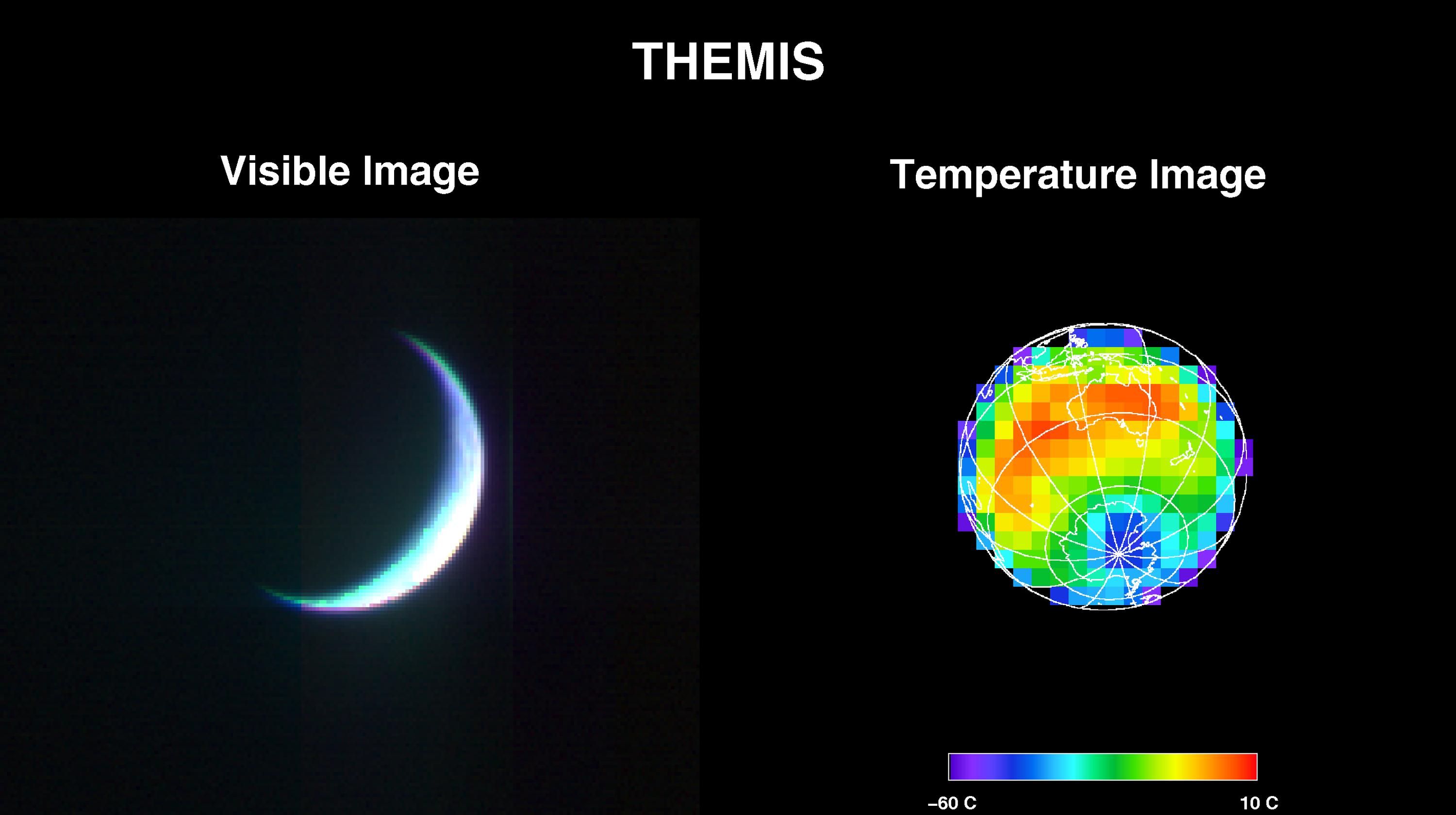
2001-04-26 |
Earth
|
2001 Mars Odyssey
|
THEMIS
|
3000x1681x3 |
|
-
PIA00558:
-
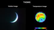
2001 Mars Odyssey Images Earth (Visible and Infrared)
Full Resolution:
TIFF
(2.994 MB)
JPEG
(217.5 kB)
|
|
|
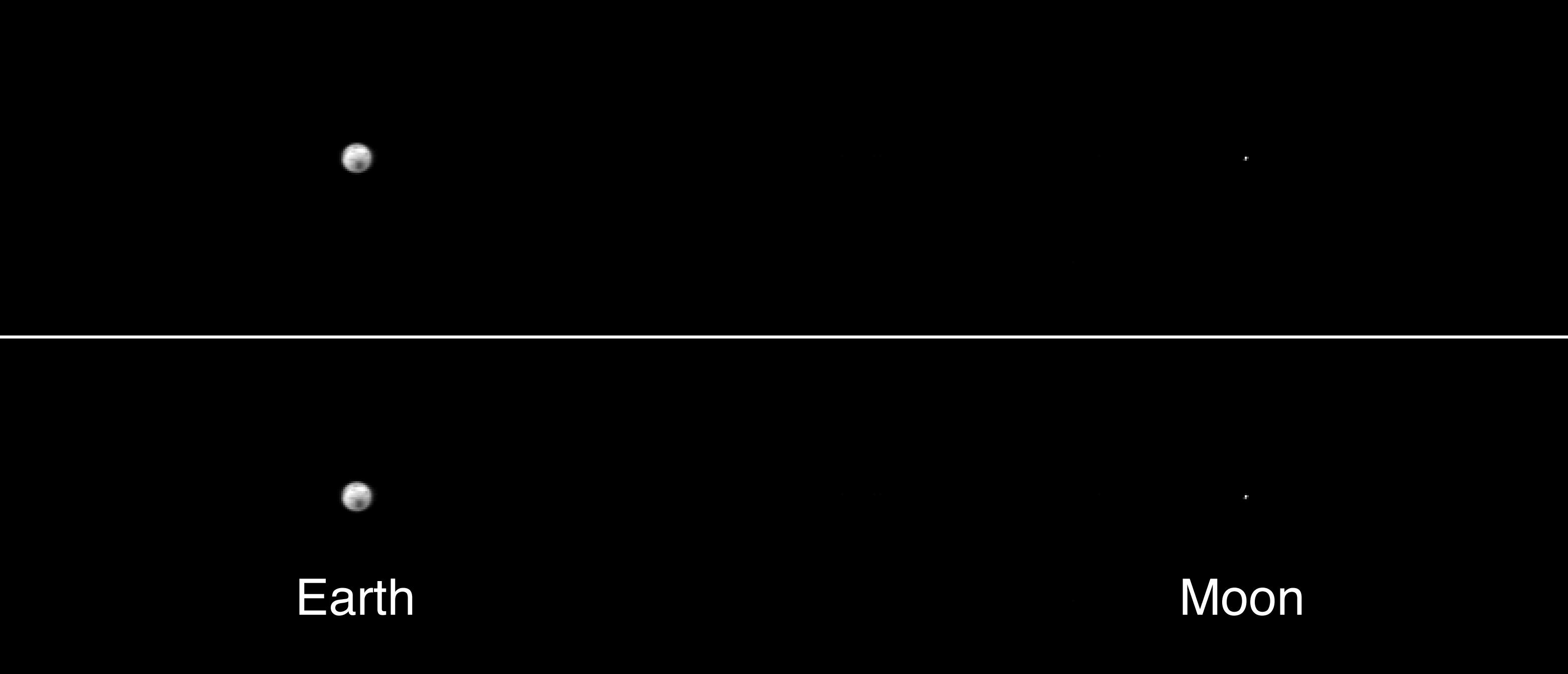
2001-05-01 |
Earth
|
2001 Mars Odyssey
|
THEMIS
|
3124x1342x1 |
|
-
PIA00559:
-
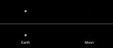
The Earth and Moon As Seen by 2001 Mars Odyssey's Thermal Emission Imaging System
Full Resolution:
TIFF
(101.6 kB)
JPEG
(69.4 kB)
|
|
|
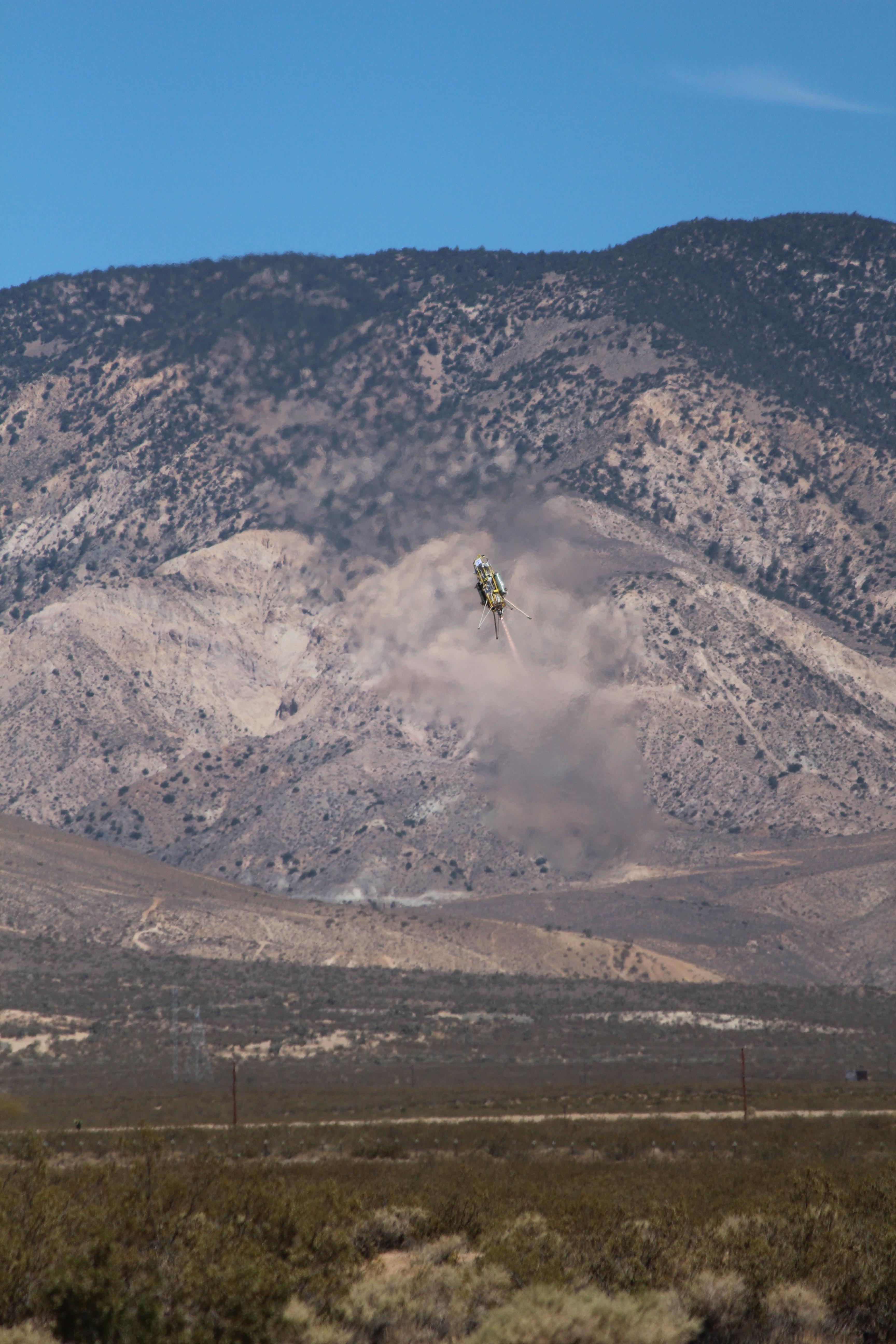
2012-09-13 |
Earth
|
ADAPT
|
|
3456x5184x3 |
|
-
PIA16119:
-
ADAPT Rocket Test
Full Resolution:
TIFF
(53.77 MB)
JPEG
(1.477 MB)
|
|
|
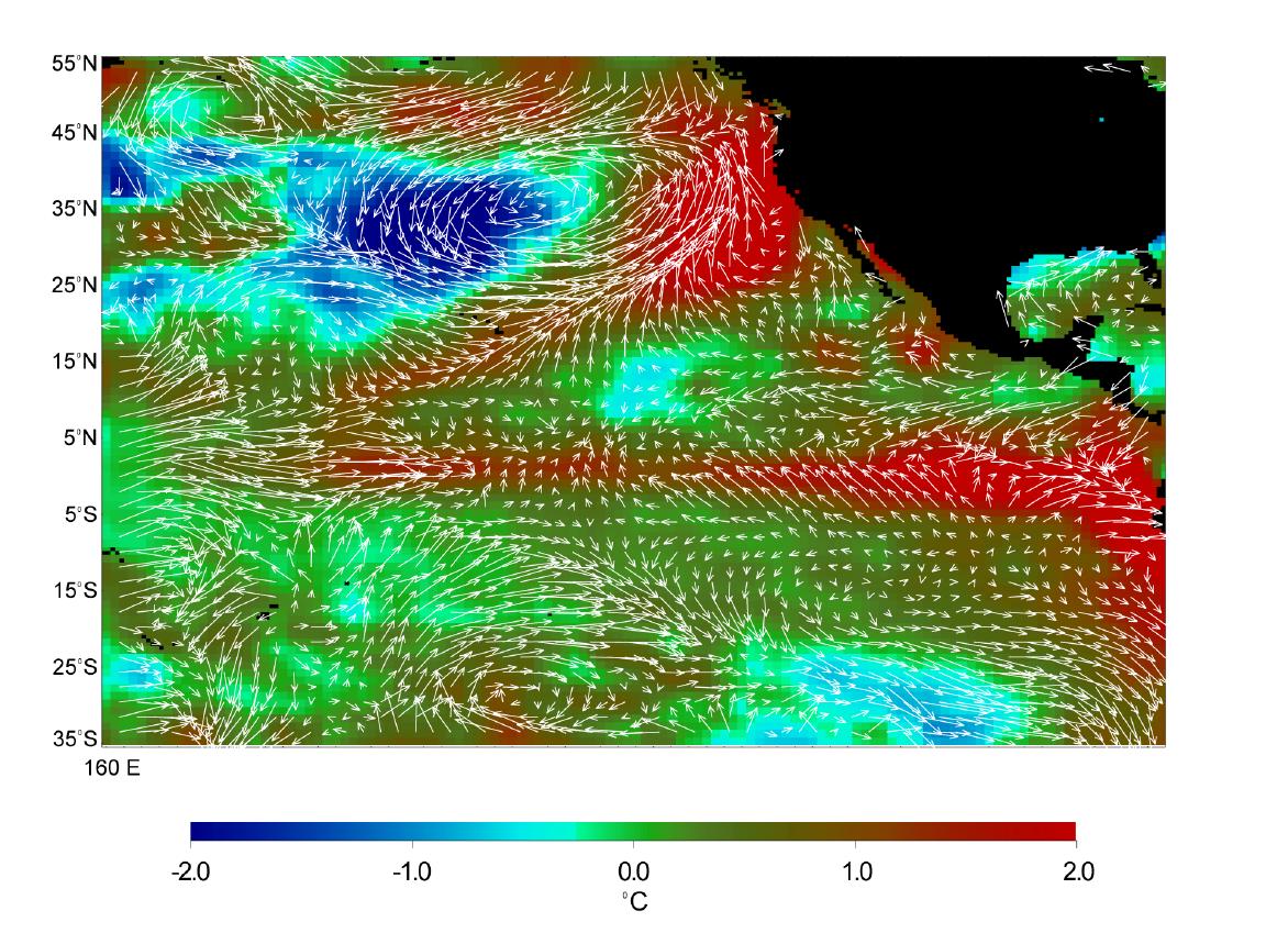
1998-07-03 |
Earth
|
Advanced Earth Observing Satellite (ADEOS)
|
MLS
|
1152x849x3 |
|
-
PIA01452:
-
Microwave Limb Sounder/El Ni�o Watch - 1997 Research Data Reveal Clues about El Ni�o's Influence
Full Resolution:
TIFF
(1.189 MB)
JPEG
(234.5 kB)
|
|
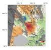
|
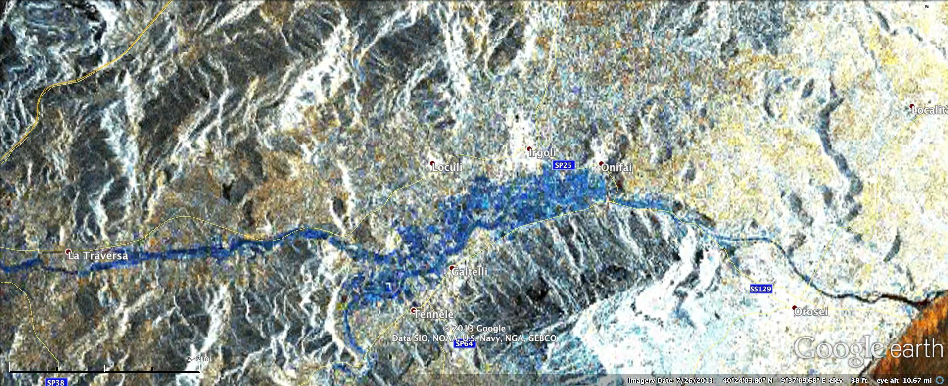
2011-03-10 |
Earth
|
ARIA
|
X-band interferometric synthetic aperture radar
|
2692x863x3 |
|
-
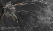
PIA13910:
-
INSAR Images Hawaii's Kilauea Volcano
Full Resolution:
TIFF
(6.977 MB)
JPEG
(732.1 kB)
|
|
|
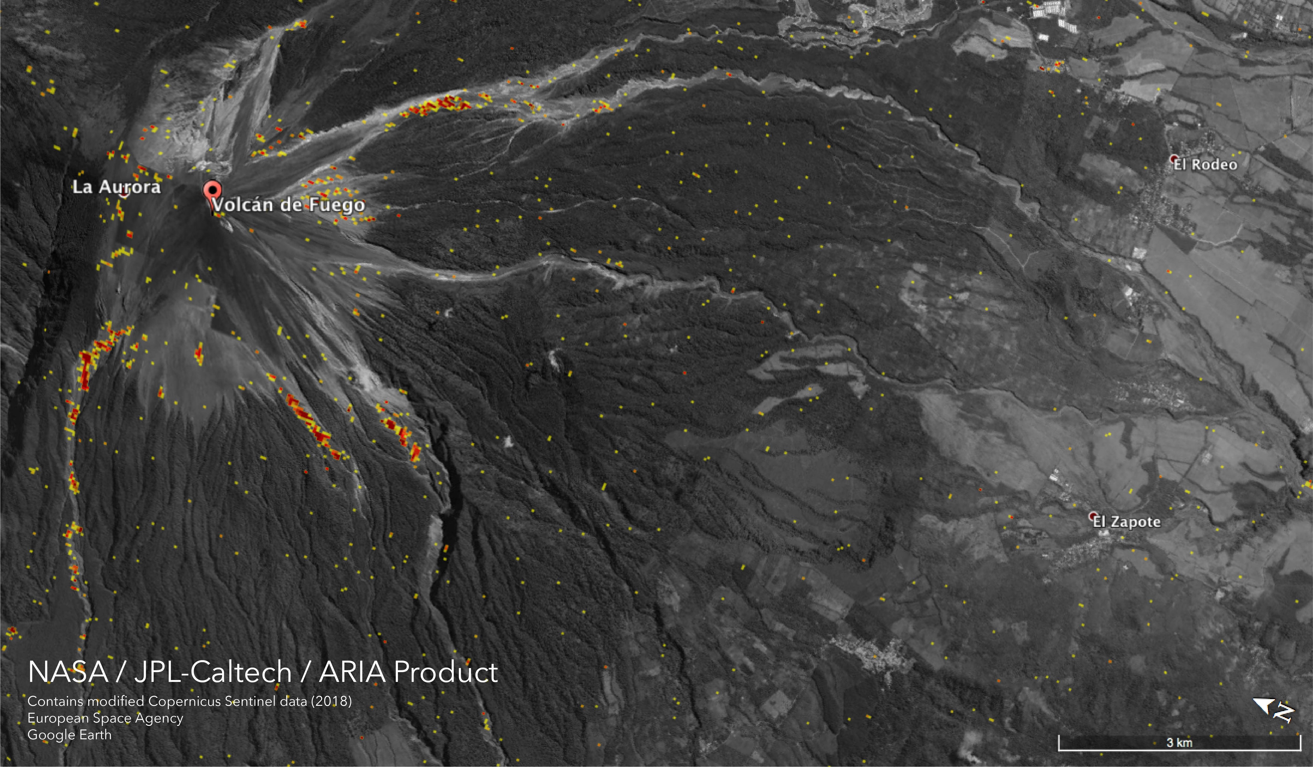
2018-06-15 |
Earth
|
ARIA
|
|
5493x3209x3 |
|
-
PIA22532:
-
NASA Damage Map Shows Effects of Destructive Guatemala Volcano Eruption
Full Resolution:
TIFF
(11.55 MB)
JPEG
(1.777 MB)
|
|
|
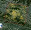
2013-11-13 |
Earth
|
ARIA
|
X-band interferometric synthetic aperture radar
|
1623x956x3 |
|
-
PIA17687:
-
NASA-Generated Damage Map To Assist With Typhoon Haiyan Disaster Response
Full Resolution:
TIFF
(4.657 MB)
JPEG
(212.5 kB)
|
|
|
2013-11-26 |
Earth
|
ARIA
|
X-band Interferometric Synthetic Aperture Radar
|
1916x780x3 |

|
-
PIA17738:
-
NASA Produces Map to Aid in Italian Flood Response
Full Resolution:
TIFF
(4.485 MB)
JPEG
(344.8 kB)
|
|
|
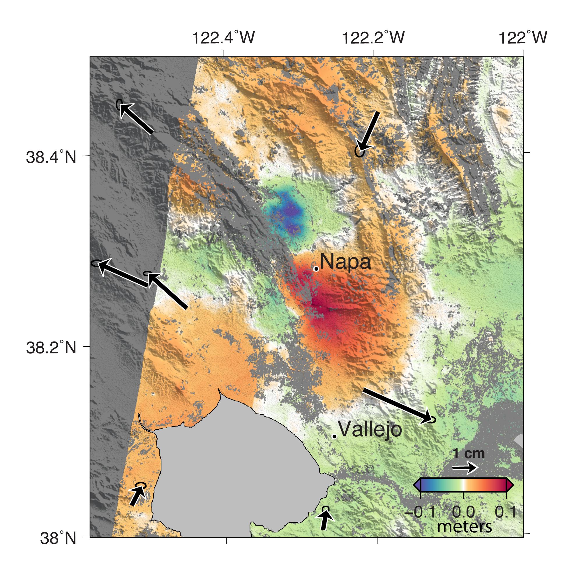
2014-09-04 |
Earth
|
ARIA
|
X-band Interferometric Synthetic Aperture Radar
|
2019x2004x3 |
|
-
PIA18798:
-
NASA Analyses of Global Positioning System Data and Italian Radar Satellite Data Reveal Napa Quake Ground Deformation
Full Resolution:
TIFF
(12.14 MB)
JPEG
(554.3 kB)
|
|
|
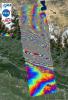
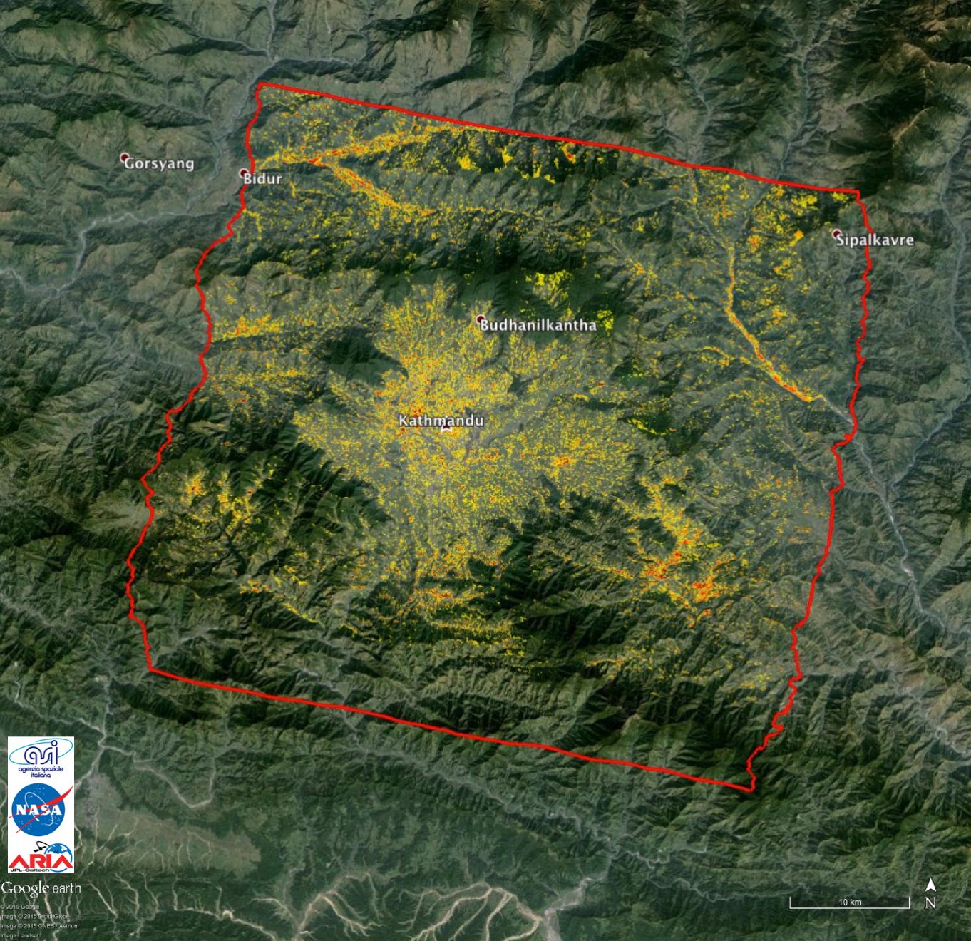
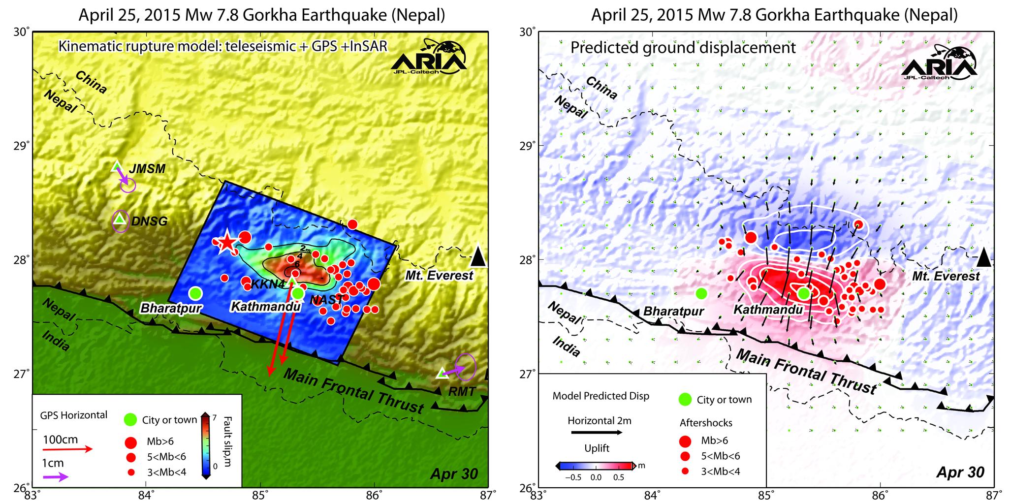
2015-05-01 |
Earth
|
ARIA
|
X-band Interferometric Synthetic Aperture Radar
|
1362x1320x3 |
|
-
PIA13911:
-
NASA-Generated Damage Map to Assist with 2015 Gorkha, Nepal Earthquake Disaster Response
Full Resolution:
TIFF
(5.396 MB)
JPEG
(349.8 kB)
|
|
|
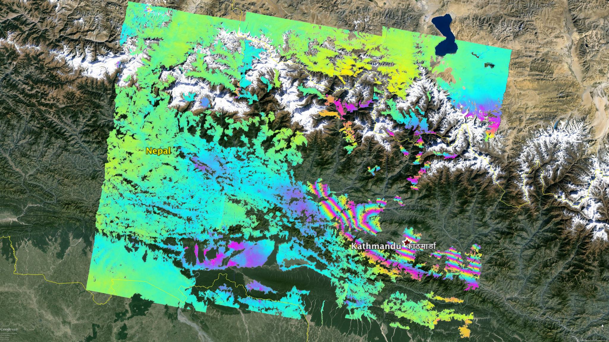
2015-05-02 |
Earth
|
ARIA
|
C-SAR Sensor
|
2048x1152x3 |

|
-
PIA19535:
-
NASA's ARIA Project Maps Deformation of Earth's Surface from Nepal Quake
Full Resolution:
TIFF
(7.08 MB)
JPEG
(600.1 kB)
|
|
|
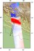
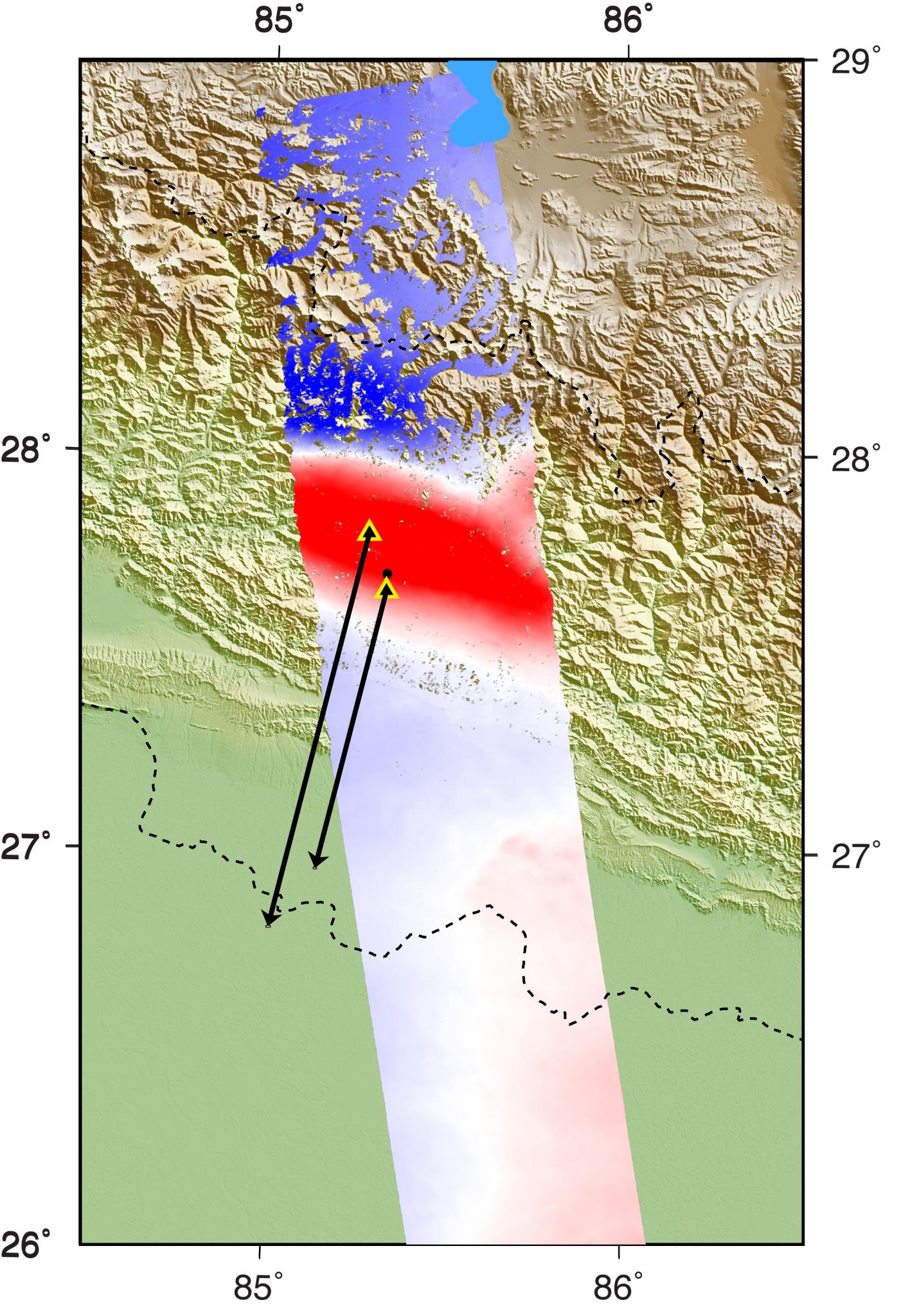
2015-05-04 |
Earth
|
ARIA
|
PALSAR-2
|
713x1047x3 |
|
-
PIA19383:
-
NASA's ARIA Project Provides New Look at Earth Surface Deformation from Nepal Quake
Full Resolution:
TIFF
(2.241 MB)
JPEG
(179.7 kB)
|
|
|
2015-05-04 |
Earth
|
ARIA
|
|
2054x1024x3 |

|
-
PIA19384:
-
NASA/Caltech Team Images Nepal Quake Fault Rupture, Surface Movements
Full Resolution:
TIFF
(6.313 MB)
JPEG
(364.2 kB)
|
|
|
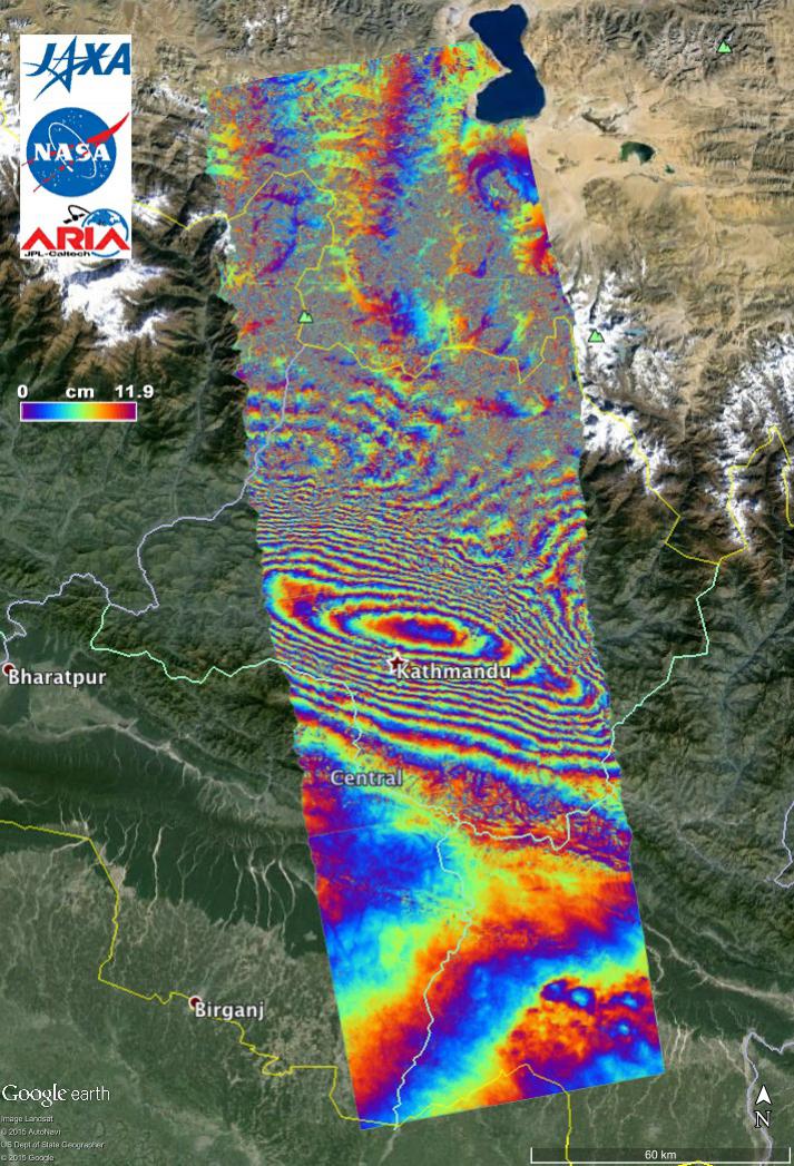
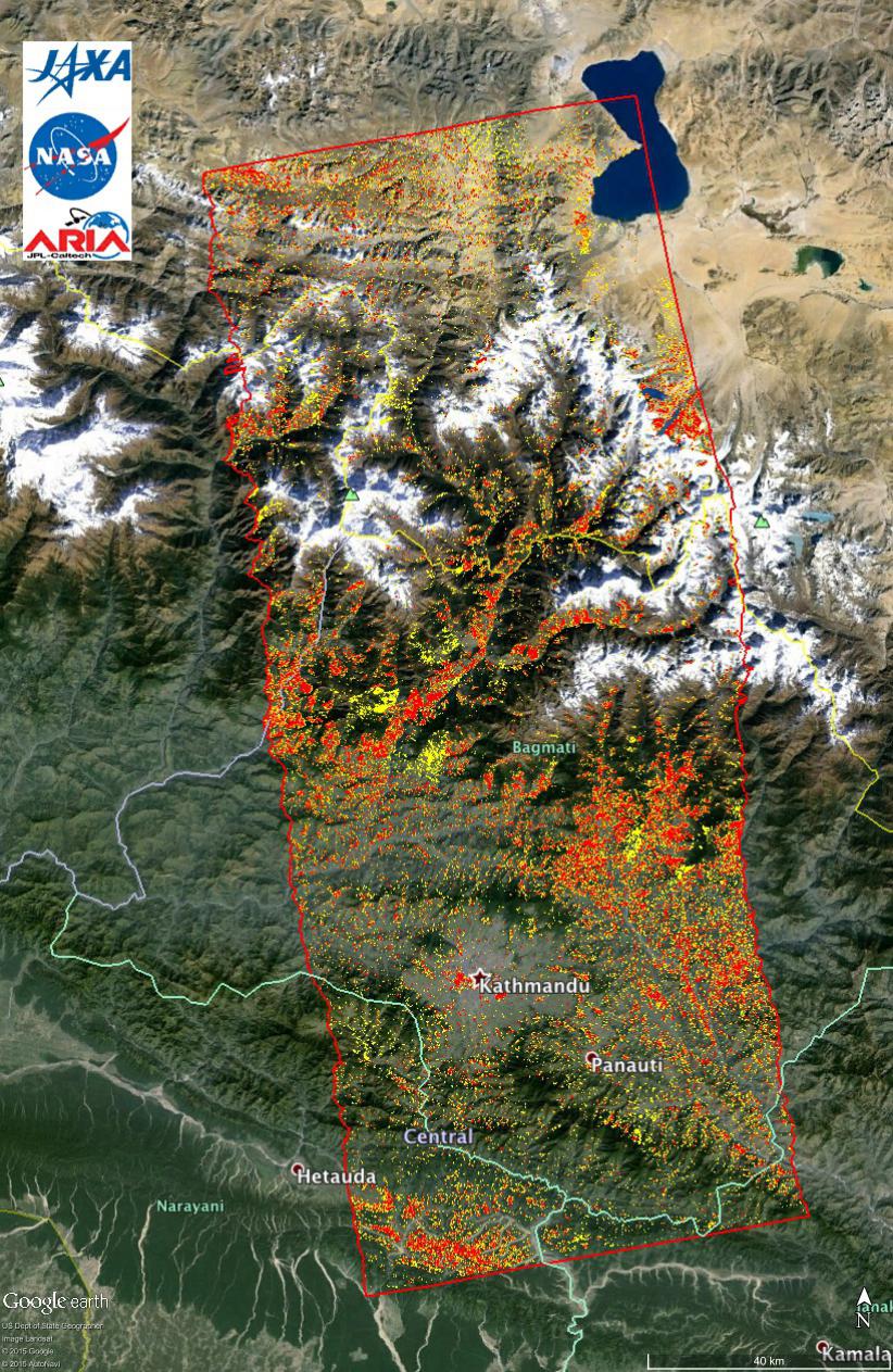
2015-05-07 |
Earth
|
ARIA
|
PALSAR-2
|
1402x2048x3 |
|
-
PIA14708:
-
Radar Shows Kathmandu Area Uplifted 5 Feet by Gorkha, Nepal Earthquake
Full Resolution:
TIFF
(8.617 MB)
JPEG
(460.9 kB)
|
|
|
2015-05-11 |
Earth
|
ARIA
|
PALSAR-2
|
822x1263x3 |
|
-
PIA14710:
-
New ALOS-2 Damage Map Assists 2015 Gorkha, Nepal Disaster Response
Full Resolution:
TIFF
(3.116 MB)
JPEG
(307.4 kB)
|


