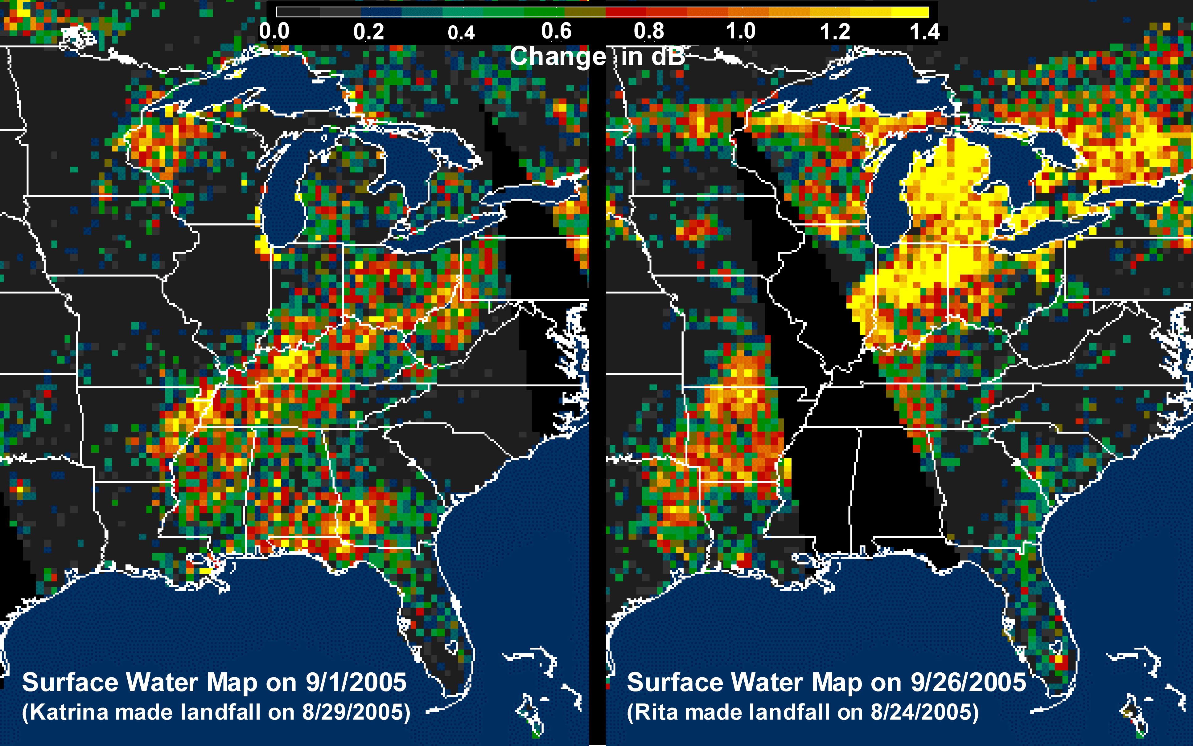
The above images, derived from NASA QuikScat satellite data, show the extensive pattern of rain water deposited by Hurricanes Katrina and Rita on land surfaces over several states in the southern and eastern United States. These results demonstrate the capability of satellite scatterometers to monitor changes in surface water on land.
The color scale depicts increases in radar backscatter (in decibels) between the current measurement and the mean of measurements obtained during the previous two weeks. The backscatter can be calibrated to measure increases in surface soil moisture resulting from rainfall. The yellow color corresponds to an increase of approximately 10 percent or more in surface soil moisture according to the calibration site of Lonoke, Ark.
The two hurricanes deposited excessive rainfall over extensive regions of the Mississippi River basin. Basins the size of the Mississippi can take up to several weeks before such excess rainfall significantly increases the amount of river discharge in large rivers such as the Mississippi. With hurricane season not over until November 30, the potential exists for significant flooding, particularly if new rain water is deposited by new hurricanes when river discharge peaks up as a result of previous rainfalls. River discharge should be closely monitored to account for this factor in evaluating potential flood conditions in the event of further hurricanes.
For more information about the storm, please visit the National Hurricane Center.
QuikScat Background
NASA's Quick Scatterometer (QuikScat) spacecraft was launched from Vandenberg Air Force Base, California on June 19, 1999. QuikScat carriesthe SeaWinds scatterometer, a specialized microwave radar that measures near-surface wind speed and direction under all weather and cloud conditions over the Earth's oceans. More information about the QuikScat mission and observations is available at http://winds.jpl.nasa.gov. QuikScat is managed for NASA's Science Mission Directorate, Washington, DC, by NASA's Jet Propulsion Laboratory, Pasadena, CA. JPL also built the SeaWinds radar instrument and is providing ground science processing systems. NASA's Goddard Space Flight Center, Greenbelt, MD, managed development of the satellite, designed and built by Ball Aerospace & Technologies Corp., Boulder, CO. The National Oceanic and Atmospheric Administration has contributed support to ground systems processing and related activities.
