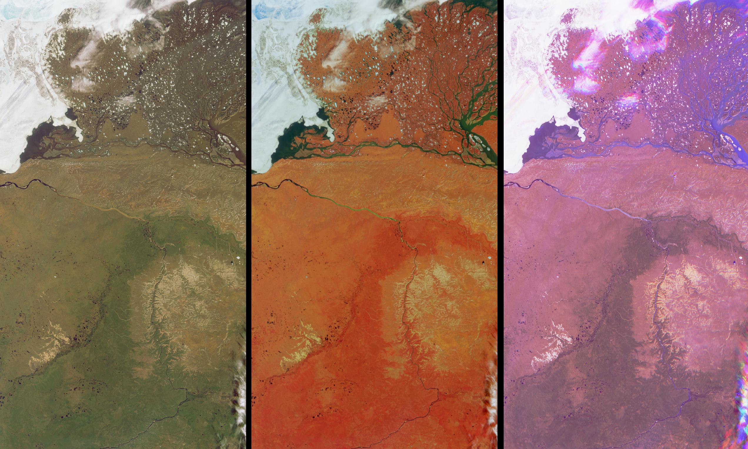
These views of the Russian Arctic were acquired by NASA's Multi-angle Imaging SpectroRadiometer (MISR) instrument on July 11, 2004, when the brief arctic summer had transformed the frozen tundra and the thousands of lakes, channels, and rivers of the Lena Delta into a fertile wetland, and when the usual blanket of thick snow had melted from the vast plains and taiga forests. This set of three images cover an area in the northern part of the Eastern Siberian Sakha Republic. The Olenek River wends northeast from the bottom of the images to the upper left, and the top portions of the images are dominated by the delta into which the mighty Lena River empties when it reaches the Laptev Sea. At left is a natural color image from MISR's nadir (vertical-viewing) camera, in which the rivers appear murky due to the presence of sediment, and photosynthetically-active vegetation appears green. The center image is also from MISR's nadir camera, but is a false color view in which the predominant red color is due to the brightness of vegetation at near-infrared wavelengths. The most photosynthetically active parts of this area are the Lena Delta, in the lower half of the image, and throughout the great stretch of land that curves across the Olenek River and extends northeast beyond the relatively barren ranges of the Volyoi mountains (the pale tan-colored area to the right of image center).
The right-hand image is a multi-angle false-color view made from the red band data of the 60ş backward, nadir, and 60ş forward cameras, displayed as red, green and blue, respectively. Water appears blue in this image because sun glitter makes smooth, wet surfaces look brighter at the forward camera's view angle. Much of the landscape and many low clouds appear purple since these surfaces are both forward and backward scattering, and clouds that are further from the surface appear in a different spot for each view angle, creating a rainbow-like appearance. However, the vegetated region that is darker green in the natural color nadir image, also appears to exhibit a faint greenish hue in the multi-angle composite. A possible explanation for this subtle green effect is that the taiga forest trees (or dwarf-shrubs) are not too dense here. Since the nadir camera is more likly to observe any gaps between the trees or shrubs, and since the vegetation is not as bright (in the red band) as the underlying soil or surface, the brighter underlying surface results in an area that is relatively brighter at the nadir view angle. Accurate maps of vegetation structural units are an essential part of understanding the seasonal exchanges of energy and water at the Earth's surface, and of preserving the biodiversity in these regions.
The Multiangle Imaging SpectroRadiometer observes the daylit Earth continuously and every 9 days views the entire globe between 82° north and 82° south latitude. These data products were generated from a portion of the imagery acquired during Terra orbit 24273. The panels cover an area of about 230 kilometers x 420 kilometers, and utilize data from blocks 30 to 34 within World Reference System-2 path 134.
MISR was built and is managed by NASA's Jet Propulsion Laboratory, Pasadena, CA, for NASA's Office of Earth Science, Washington, DC. The Terra satellite is managed by NASA's Goddard Space Flight Center, Greenbelt, MD. JPL is a division of the California Institute of Technology.
