 |  |  |
| Vis/NIR image close-up | AIRS infrared window channel | HSB microwave channel |
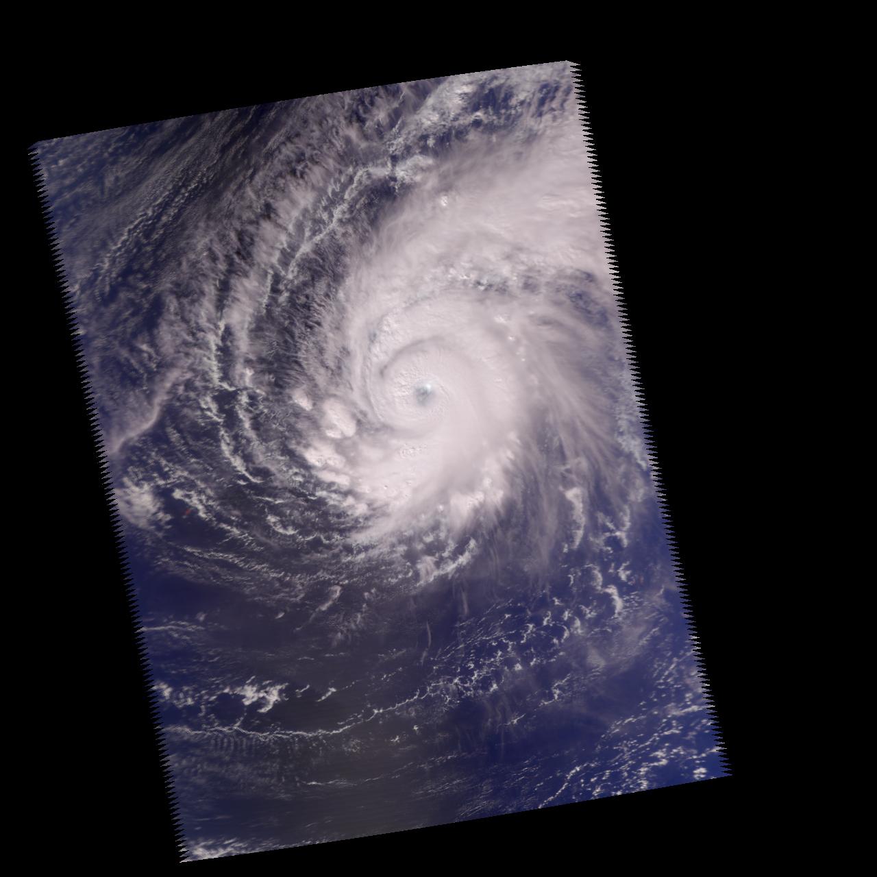
Three Different Views of Supertyphoon Pongsona, December 2002Packing gusts of 296.1 kilometers per hour (184 miles per hour) and sustained winds of 241.4 kilometers per hour (150 miles per hour), Supertyphoon Pongsona struck the U.S. Island of Guam on Sunday, December 8. The storm cut off electricity over the entire island along with telephone and water service, and President George W. Bush declared the U.S. territory a federal disaster area. Pongsona is the third typhoon to hit Guam since June, and the second cyclone of supertyphoon status to hit in five years.
These images were made from data acquired by the Atmospheric Infrared Sounding System (AIRS) instrument suite aboard NASA's Aqua spacecraft just as the eye of the storm was about to pass over Guam.
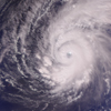
This image was made using visible/near-infrared data using the AIRS instrument. Its 2-kilometer (1.24-mile) resolution shows fine details of the cloud structure and can be used to help interpret the other images. It confirms that the eye was not cloud free at the time the data was acquired, and pinpoints towering thunderheads rising up in several areas of the spiral arms (see figure 1 for close-up).
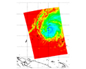
The image in figure 2 shows how the typhoon looks through an AIRS infrared "window" channel, which measures the temperature of the nearest impenetrable surface. Where the sky is clear, this window channel shows the surface of the Earth, otherwise it will show cloud tops. High cold clouds appear blue, while lower warmer clouds are green through orange. The Earth's surface, where it can be seen between the clouds, is warmest and appears red. Although the storm has a clearly defined eye, it is not cloud free and therefore shows up as yellow in this infrared image.
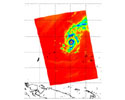
The image in figure 3 shows how the typhoon looks through a microwave channel of the Humidity Sounder for Brazil (HSB), a component of the AIRS instrument suite. This channel, which is sensitive to humidity, clouds and rain, sees through much of the clouds and reveals some of the inner structure of the storm. Here the eye is more clearly defined than in the infrared image and appears to be very large - perhaps 80.5 kilometers (50 miles) across. Rain areas appear as blue patches, and a very intense rain cell can be seen right over Guam itself. This cell is in the leading eye wall and is probably associated with the highest wind speeds. It is likely that much of the damage in Guam was caused by this particular part of the storm.
About Airs
The Atmospheric Infrared Sounder, AIRS, in conjunction with the Advanced Microwave Sounding Unit, AMSU, senses emitted infrared and microwave radiation from Earth to provide a three-dimensional look at Earth's weather and climate. Working in tandem, the two instruments make simultaneous observations all the way down to Earth's surface, even in the presence of heavy clouds. With more than 2,000 channels sensing different regions of the atmosphere, the system creates a global, three-dimensional map of atmospheric temperature and humidity, cloud amounts and heights, greenhouse gas concentrations, and many other atmospheric phenomena. The Humidity Sounder for Brazil, HSB, is a 4-channel microwave sounder provided by Brazil that obtained humidity profiles throughout the atmosphere even under conditions of heavy cloudiness and haze. The HSB provided high quality data until February 2003. Launched into Earth orbit in 2002, the AIRS, AMSU, and HSB instruments fly onboard NASA's Aqua spacecraft and are managed by NASA's Jet Propulsion Laboratory in Pasadena, Calif., under contract to NASA. JPL is a division of the California Institute of Technology in Pasadena.
More information about AIRS can be found at http://airs.jpl.nasa.gov.
 Planetary Data System


