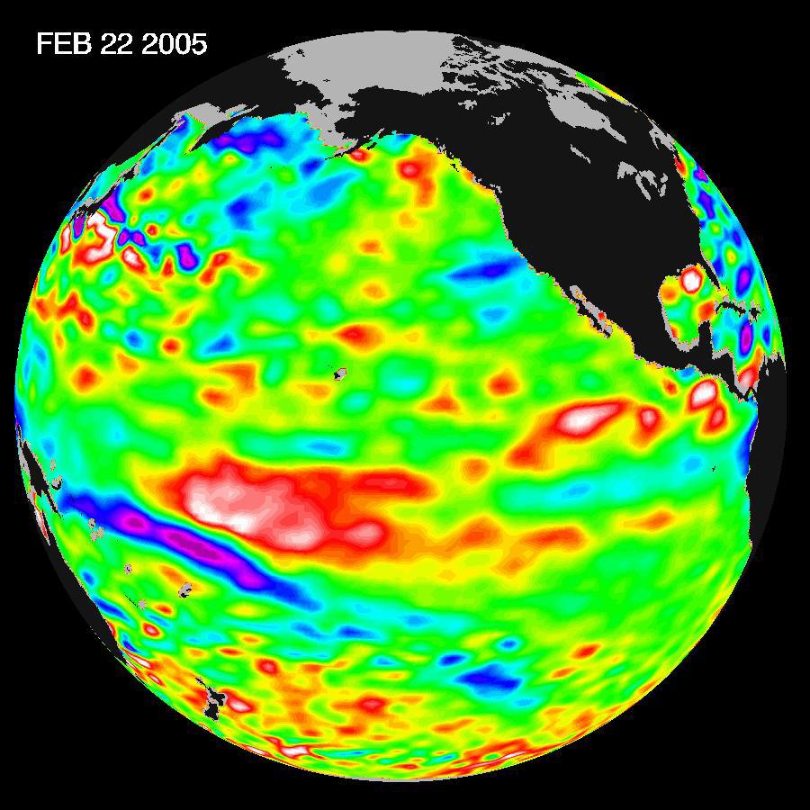
Recent sea-level height data from the U.S./France Jason altimetric satellite during a 10-day cycle ending February 22, 2005, show that the central equatorial Pacific continues to exhibit an area of higher-than-normal sea surface heights (warmer-than-normal sea surface temperatures), centered at 180 degrees West, the International Dateline. This feature contrasts with lower than normal sea levels, cooler ocean waters, in the eastern equatorial Pacific. This change indicates the weak El Nińo is dissipating, tending towards neutral conditions. Scientists will continue to monitor the Pacific closely for further signs of either El Nińo or La Nińa development.The image shows a red area in the central equatorial Pacific that is about 10 centimeters (4 inches) above normal. These red sea surface heights equate to sea surface temperature departures greater than one degree Celsius (two degrees Fahrenheit).These images show sea surface height anomalies with the seasonal cycle (the effects of summer, fall, winter, and spring) removed. The differences between what we see and what is normal for different times and regions are called anomalies, or residuals. When oceanographers and climatologists view these "anomalies" they can identify unusual patterns and can tell us how heat is being stored in the ocean to influence future planetary climate events. Each image is a 10-day average of data, ending on the date indicated.
The U.S. portion of the Jason mission is managed by JPL for NASA's Earth Science Enterprise, Washington, D.C. Research on Earth's oceans using Jason and other space-based capabilities is conducted by NASA's Earth Science Enterprise to better understand and protect our home planet.
To view the latest Jason-1 data see http://sealevel.jpl.nasa.gov/science/jason1-quick-look/.
