 | 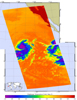 |
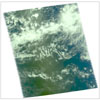
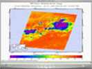
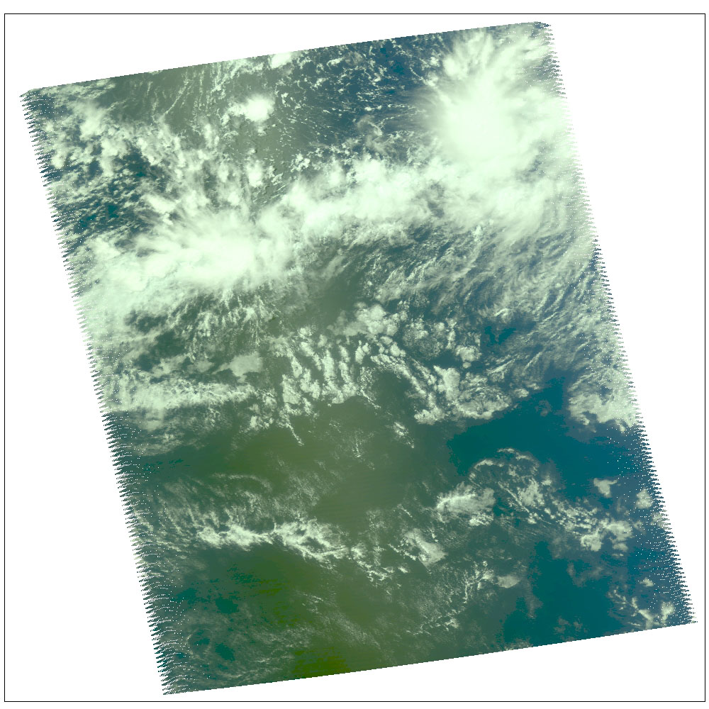
| Figure 1: AIRS VIS Daylight Snapshot July 26 | Figure 2: AIRS Infrared Image July 28 |
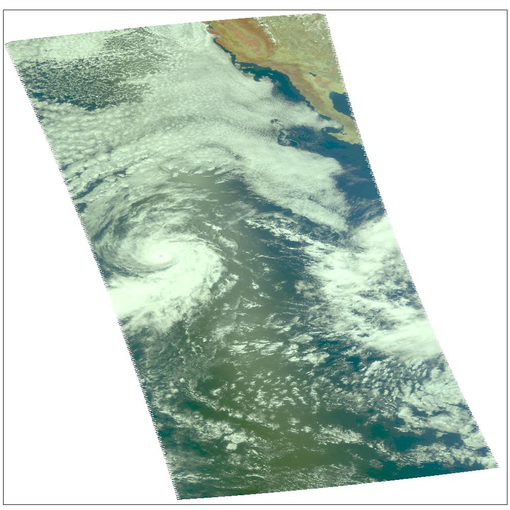
Hurricane Darby as observed by NASA's spaceborne Atmospheric Infrared Sounder (AIRS). This daylight image of Hurricane Darby on July 28 was made with the visible sensor in the AIRS instrument suite. After reaching sustained winds on July 27 of 100 knots (115 mph) with gusts to 120 knots (138 mph), the intensity of the storm is now lowered to 75 knots (86 mph). Located in the eastern north Pacific Ocean located about 1,165 miles west-southwest of the southern tip of Baja California, the storm continues its west/northwest path at 14 knots (16mph). Figure 1 is a daylight snapshot from AIRS visible/near-infrared sensor before Darby became a tropical storm. Darby is in the upper right-hand corner. Circulation is not apparent because the storm was not organized sufficiently to allow the nascent eye to appear. At this time, winds were approximately 35 mph. Figure 2 is an AIRS infrared image. Darby falls on the edge of two AIRS data granules, which have been "stitched" together in this image. Storm intensity is lowered to 75 knots (86 mph), down from 100 knots (115 mph).
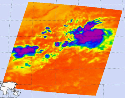
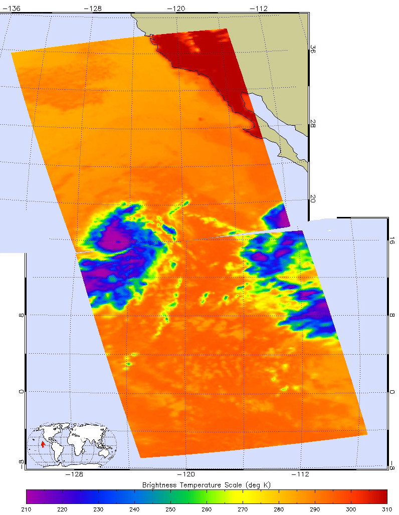
Frame from July 27 movie, slicing down the atmosphere with the AIRS infrared sensorThe major contribution to radiation (infrared light) that AIRS infrared channels sense comes from different levels in the atmosphere, depending upon the channel wavelength. To create the movies, a set of AIRS infrared channels were selected which probe the atmosphere at progressively deeper levels. If there were no clouds, the color in each frame would be nearly uniform until the Earth's surface is encountered. The tropospheric air temperature warms at a rate of 6 K (about 11 F) for each kilometer of descent toward the surface. Thus the colors would gradually change from cold to warm as the movie progresses.
Clouds block the infrared radiation. Thus wherever there are clouds we can penetrate no deeper in infrared. The color remains fixed as the movie progresses, for that area of the image is "stuck" to the cloud top temperature. The coldest temperatures around 220 K (about -65 F) come from altitudes of about 10 miles.
We therefore see in a 'surface channel' at the end of the movie, signals from clouds as cold as 220 K and from Earth's surface at 310 K (about 100 F). The very coldest clouds are seen in deep convection thunderstorms over land.
Movies
July 26 Spiral rain bands are visible
July 27 Spiral rain bands are visible, as well as water vapor stream coming in from the SW (band of convection cells leading to storm from lower right).
July 28 Darby is seen in the lower left, right on the edge of the AIRS data granule..
About AIRS
The Atmospheric Infrared Sounder, AIRS, in conjunction with the Advanced Microwave Sounding Unit, AMSU, senses emitted infrared and microwave radiation from Earth to provide a three-dimensional look at Earth's weather and climate. Working in tandem, the two instruments make simultaneous observations all the way down to Earth's surface, even in the presence of heavy clouds. With more than 2,000 channels sensing different regions of the atmosphere, the system creates a global, three-dimensional map of atmospheric temperature and humidity, cloud amounts and heights, greenhouse gas concentrations, and many other atmospheric phenomena. Launched into Earth orbit in 2002, the AIRS and AMSU instruments fly onboard NASA's Aqua spacecraft and are managed by NASA's Jet Propulsion Laboratory in Pasadena, Calif., under contract to NASA. JPL is a division of the California Institute of Technology in Pasadena.
More information about AIRS can be found at http://airs.jpl.nasa.gov.
