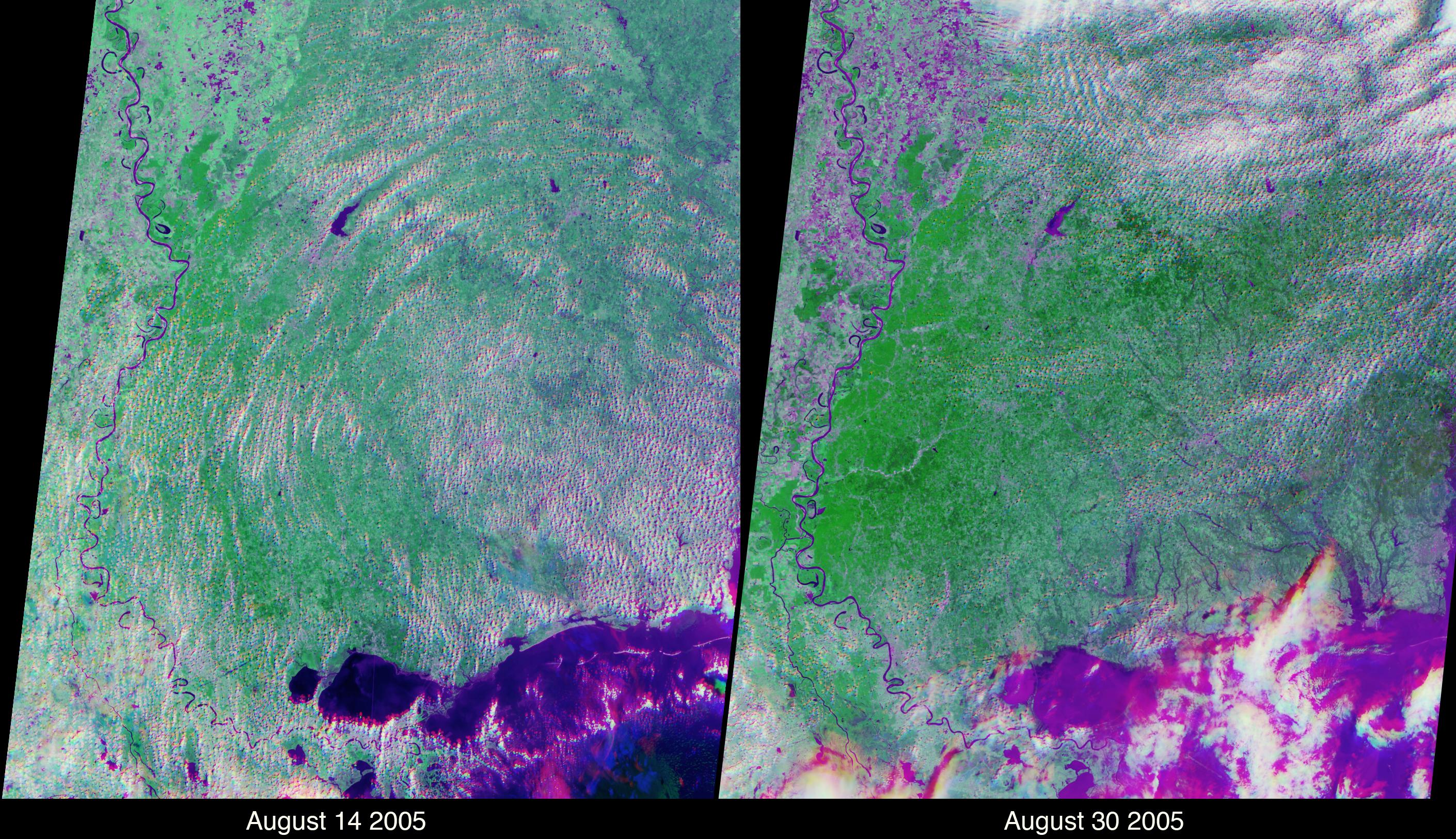
These views of the Louisiana and Mississippi regions were acquired before and one day after Katrina made landfall along the Gulf of Mexico coast, and highlight many of the changes to the rivers and vegetation that occurred between the two views. The images were acquired by NASA's Multi-angle Imaging SpectroRadiometer (MISR) on August 14 and August 30, 2005. These multiangular, multispectral false-color composites were created using red band data from MISR's 46° backward and forward-viewing cameras, and near-infrared data from MISR's nadir camera. Such a display causes water bodies and inundated soil to appear in blue and purple hues, and highly vegetated areas to appear bright green. The scene differentiation is a result of both spectral effects (living vegetation is highly reflective at near-infrared wavelengths whereas water is absorbing) and of angular effects (wet surfaces preferentially forward scatter sunlight). The two images were processed identically and extend from the regions of Greenville, Mississippi (upper left) to Mobile Bay, Alabama (lower right).
There are numerous rivers along the Mississippi coast that were not apparent in the pre-Katrina image; the most dramatic of these is a new inlet in the Pascagoula River that was not apparent before Katrina. The post-Katrina flooding along the edges of Lake Pontchartrain and the city of New Orleans is also apparent. In addition, the agricultural lands along the Mississippi floodplain in the upper left exhibit stronger near-infrared brightness before Katrina. After Katrina, many of these agricultural areas exhibit a stronger signal to MISR's oblique cameras, indicating the presence of inundated soil throughout the floodplain. Note that clouds appear in a different spot for each view angle due to a parallax effect resulting from their height above the surface.
The Multi-angle Imaging SpectroRadiometer observes the daylit Earth continuously, viewing the entire globe between 82° north and 82° south latitude every nine days. Each image covers an area of about 380 kilometers by 410 kilometers. The data products were generated from a portion of the imagery acquired during Terra orbits 30091 and 30324 and utilize data from blocks 64-67 within World Reference System-2 path 22.
MISR was built and is managed by NASA's Jet Propulsion Laboratory, Pasadena, CA, for NASA's Science Mission Directorate, Washington, DC. The Terra satellite is managed by NASA's Goddard Space Flight Center, Greenbelt, MD. JPL is managed for NASA by the California Institute of Technology.
 Planetary Data System


