My
List |
Addition Date
|
Target
|
Mission
|
Instrument
|
Size
|

|
1999-04-15 |
Earth
|
Airborne Synthetic Aperture Radar (AIRSAR)
|
AirSAR
|
1081x2137x3 |
|
-
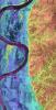
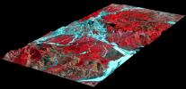
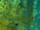
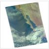
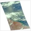
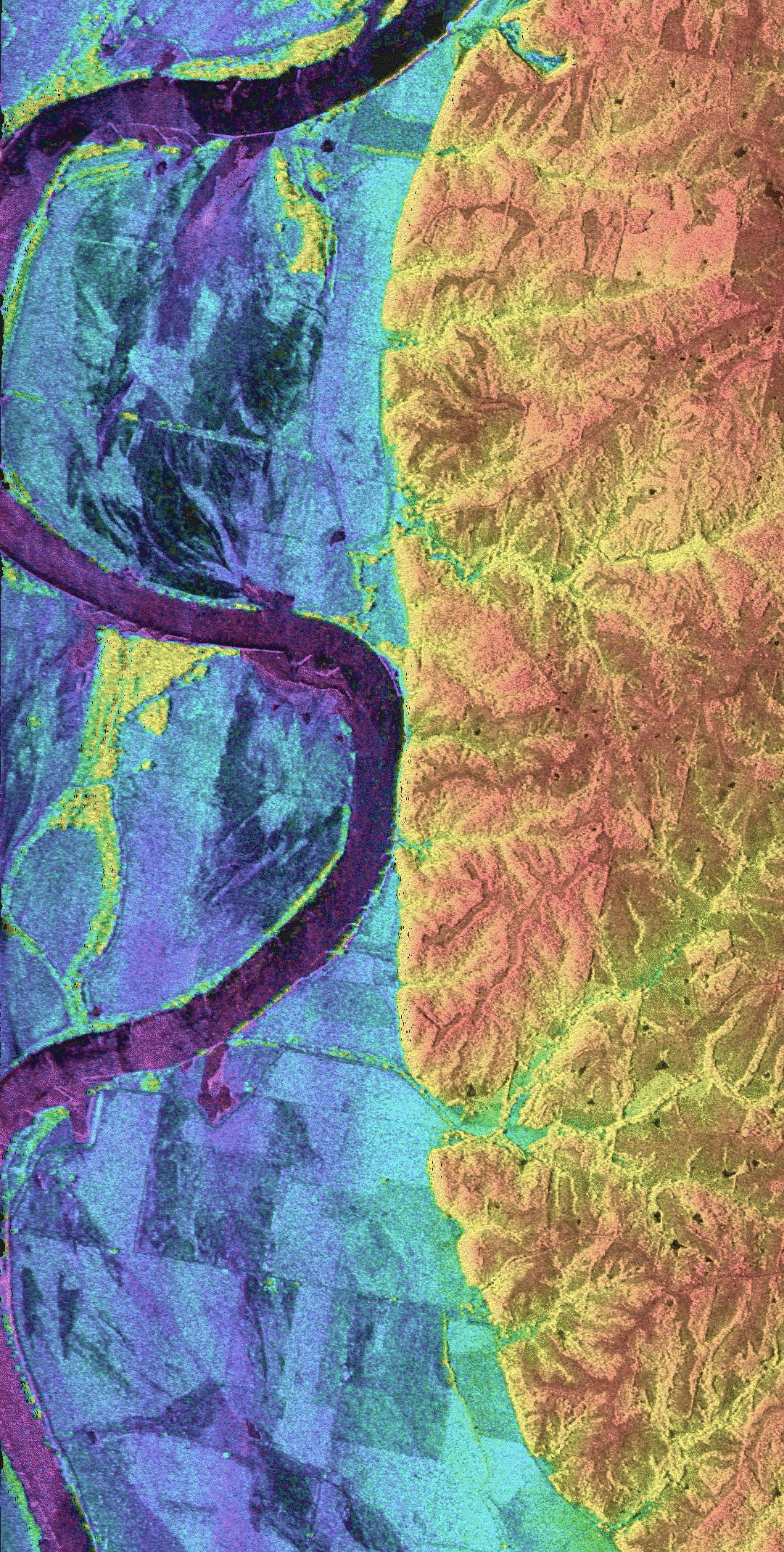
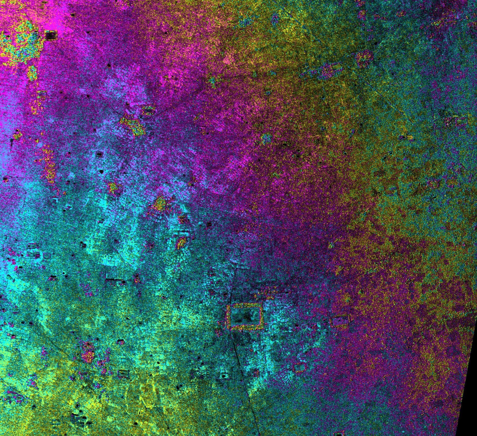
PIA01806:
-
Space Radar Image of Missouri River - TOPSAR
Full Resolution:
TIFF
(2.212 MB)
JPEG
(780.9 kB)
|
|
|
2000-12-11 |
Earth
|
Airborne Synthetic Aperture Radar (AIRSAR)
|
AirSAR
|
1992x2018x3 |
|
-
PIA02853:
-
Upolu Island, Western Samoa
Full Resolution:
TIFF
(3.49 MB)
JPEG
(1.528 MB)
|
|
|
2000-12-11 |
Earth
|
Airborne Synthetic Aperture Radar (AIRSAR)
|
AirSAR
|
2401x11984x3 |

|
-
PIA02854:
-
Upolu Island, Western Samoa
Full Resolution:
TIFF
(23.9 MB)
JPEG
(10.24 MB)
|
|
|
2001-03-07 |
Earth
|
Airborne Synthetic Aperture Radar (AIRSAR)
|
AirSAR
|
1321x825x3 |
|
-
PIA03157:
-
Altamaha River Delta, Georgia Sea Islands
Full Resolution:
TIFF
(2.847 MB)
JPEG
(205.7 kB)
|
|
|
2001-11-04 |
Earth
|
Airborne Synthetic Aperture Radar (AIRSAR)
|
AirSAR
|
899x630x3 |
|
-
PIA03507:
-
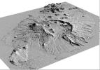
Perspective View of Umnak Island, Aleutian Islands, Alaska (#1)
Full Resolution:
TIFF
(1.274 MB)
JPEG
(141.8 kB)
|
|
|
2001-11-04 |
Earth
|
Airborne Synthetic Aperture Radar (AIRSAR)
|
AirSAR
|
899x630x3 |
|
-
PIA03508:
-
Perspective View of Umnak Island, Aleutian Islands, Alaska (#2)
Full Resolution:
TIFF
(918.8 kB)
JPEG
(96 kB)
|
|
|
2001-11-04 |
Earth
|
Airborne Synthetic Aperture Radar (AIRSAR)
|
AirSAR
|
3000x2878x3 |
|
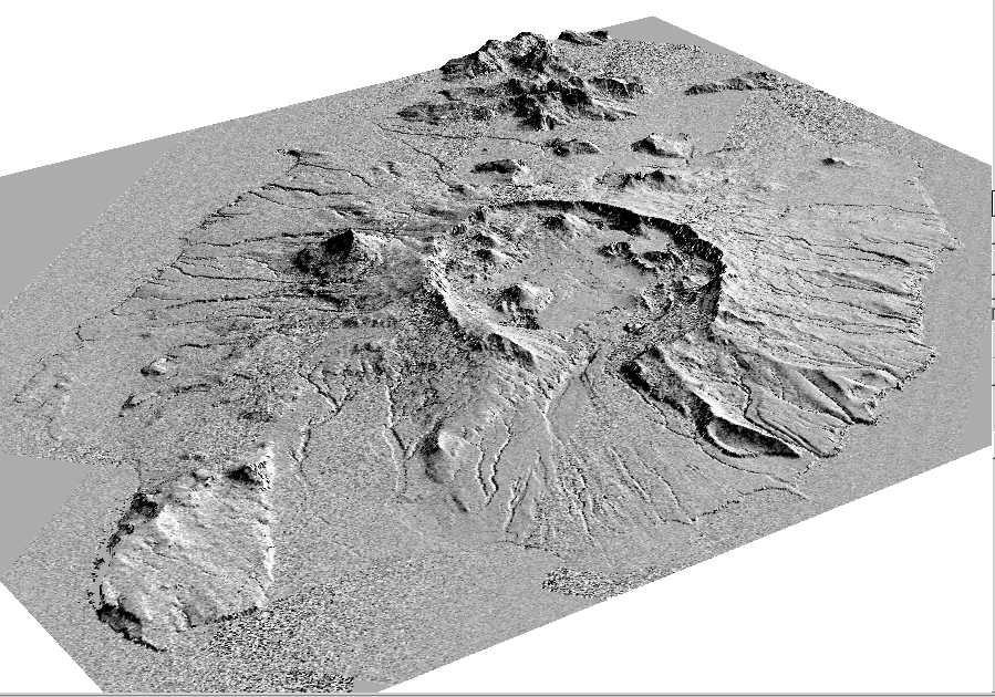
-
PIA03509:
-
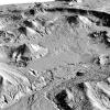
Shaded Relief Mosaic of Umnak Island, Aleutian Islands, Alaska
Full Resolution:
TIFF
(8.667 MB)
JPEG
(1.659 MB)
|
|
|
2001-11-04 |
Earth
|
Airborne Synthetic Aperture Radar (AIRSAR)
|
AirSAR
|
597x597x1 |
|
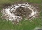
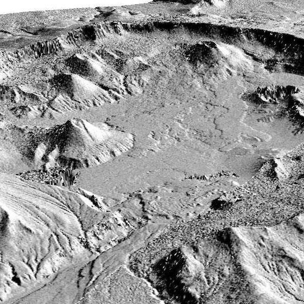
-
PIA03510:
-
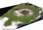
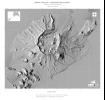
Perspective View of Okmok Volcano, Aleutian Islands, Alaska (#1)
Full Resolution:
TIFF
(435.5 kB)
JPEG
(120.8 kB)
|
|
|
2001-11-04 |
Earth
|
Airborne Synthetic Aperture Radar (AIRSAR)
|
AirSAR
|
899x630x1 |
|
-
PIA03511:
-
Perspective View of Okmok Volcano, Aleutian Islands, Alaska (#2)
Full Resolution:
TIFF
(511.1 kB)
JPEG
(149.9 kB)
|
|
|
2001-11-04 |
Earth
|
Airborne Synthetic Aperture Radar (AIRSAR)
|
AirSAR
|
1467x711x3 |
|
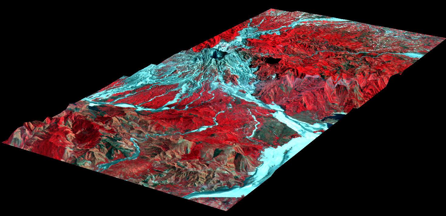
-
PIA03512:
-
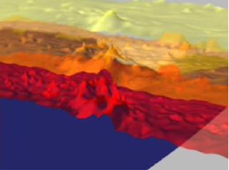
Mt. Pinatubo, Phillippines - Perspective View
Full Resolution:
TIFF
(1.938 MB)
JPEG
(172.5 kB)
|
|
|
2001-11-04 |
Earth
|
Airborne Synthetic Aperture Radar (AIRSAR)
|
AirSAR
|
1000x875x3 |
|
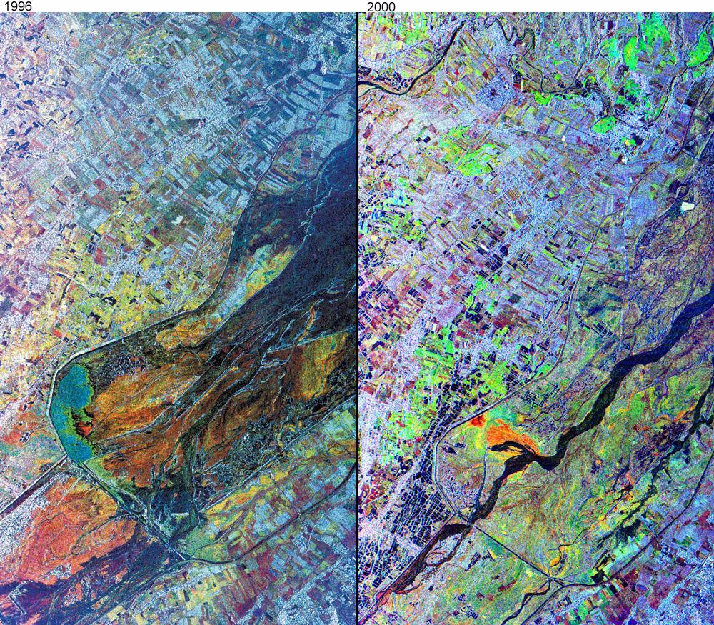
-
PIA03513:
-
Mt. Pinatubo, Phillipines - Comparison of November, 1996 and September, 2000
Full Resolution:
TIFF
(3.403 MB)
JPEG
(366.2 kB)
|
|
|
2002-10-11 |
Earth
|
Airborne Synthetic Aperture Radar (AIRSAR)
|
AirSAR
|
1064x976x3 |
|
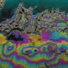
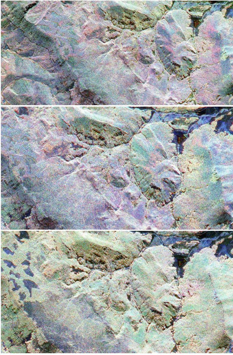
-
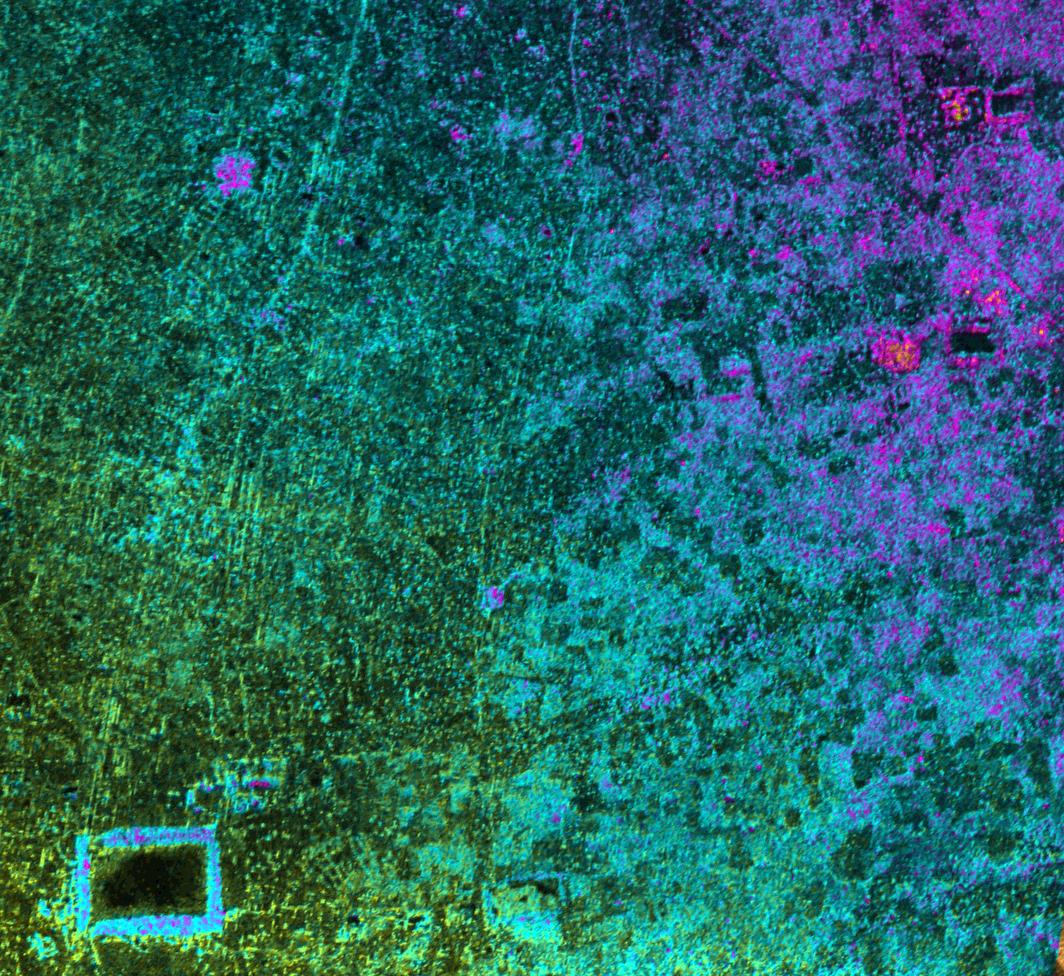
PIA03866:
-
Radar Image with Color as Height, Sman Teng, Temple, Cambodia
Full Resolution:
TIFF
(3.122 MB)
JPEG
(295.3 kB)
|
|
|
2002-10-11 |
Earth
|
Airborne Synthetic Aperture Radar (AIRSAR)
|
AirSAR
|
670x671x3 |
|
-
PIA03867:
-
Radar Image with Color as Height, Old Khmer Road, Cambodia
Full Resolution:
TIFF
(1.356 MB)
JPEG
(127.8 kB)
|
|
|
2002-10-11 |
Earth
|
Airborne Synthetic Aperture Radar (AIRSAR)
|
AirSAR
|
1288x976x3 |
|
-
PIA03868:
-
Radar Image with Color as Height, Lovea, Cambodia
Full Resolution:
TIFF
(3.777 MB)
JPEG
(360.3 kB)
|
|
|
2002-10-11 |
Earth
|
Airborne Synthetic Aperture Radar (AIRSAR)
|
AirSAR
|
1288x976x3 |
|
-
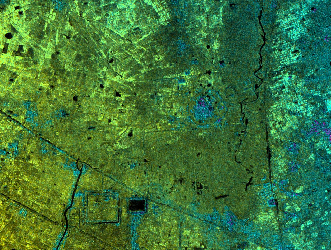
PIA03869:
-
Radar Image with Color as Height, Hariharalaya, Cambodia
Full Resolution:
TIFF
(3.778 MB)
JPEG
(440.6 kB)
|
|
|
2002-10-11 |
Earth
|
Airborne Synthetic Aperture Radar (AIRSAR)
|
AirSAR
|
949x867x3 |
|
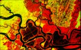
-
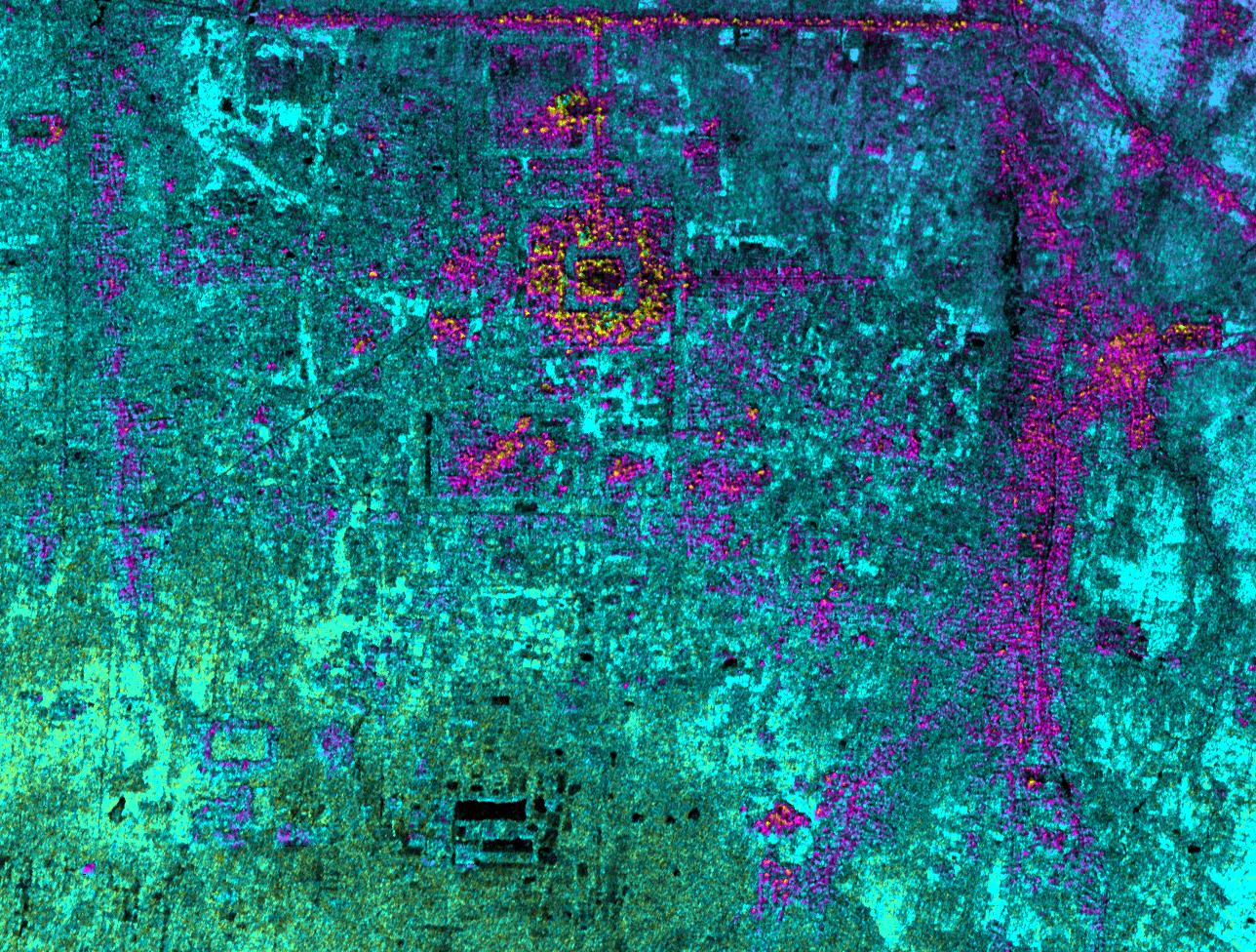
PIA03870:
-
Radar Image with Color as Height, Ancharn Kuy, Cambodia
Full Resolution:
TIFF
(2.476 MB)
JPEG
(312.7 kB)
|
|
|
2002-10-11 |
Earth
|
Airborne Synthetic Aperture Radar (AIRSAR)
|
AirSAR
|
1898x1734x3 |

|
-
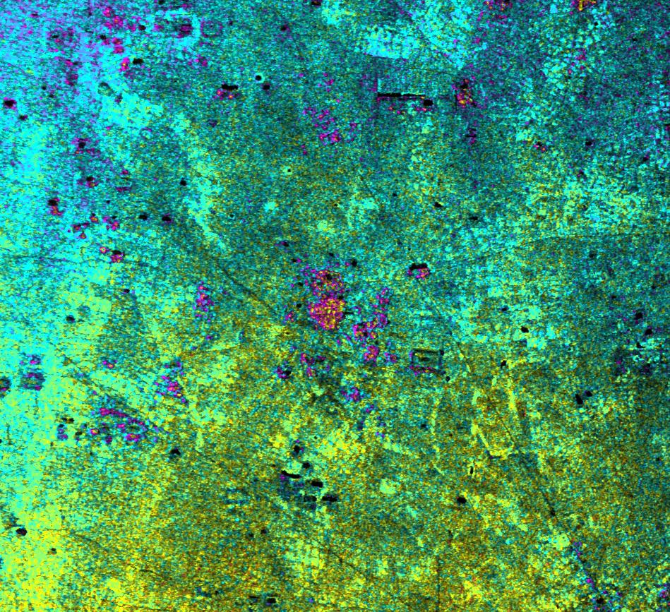
PIA03871:
-
Radar Image with Color as Height, Nokor Pheas Trapeng, Cambodia
Full Resolution:
TIFF
(3.296 MB)
JPEG
(1.12 MB)
|
|
|
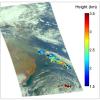
2003-03-25 |
Earth
|
Airborne Synthetic Aperture Radar (AIRSAR)
|
AirSAR
|
783x1192x3 |
|
-
PIA04266:
-
Fraser, Colorado
Full Resolution:
TIFF
(2.803 MB)
JPEG
(339 kB)
|
|
|
2002-06-14 |
Earth
|
Aqua
|
AIRS
|
2144x1184x3 |
|
-
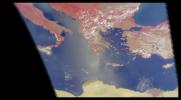
PIA00326:
-
AIRS First Light Data: Eastern Mediterranean, June 14, 2002
Full Resolution:
TIFF
(4.752 MB)
JPEG
(184.6 kB)
|
|
|
2002-07-03 |
Earth
|
Aqua
|
AIRS
|
362x814x3 |
|
-
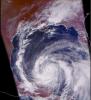
PIA00341:
-
AIRS First Light Data: Typhoon Ramasun, July 3, 2002
Full Resolution:
TIFF
(680 kB)
JPEG
(54.25 kB)
|
|
|
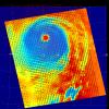
2002-07-13 |
Earth
|
Aqua
|
AIRS
|
1536x1536x3 |

|
-
PIA00345:
-
AIRS First Light Data: Northern Europe, July 20, 2002
Full Resolution:
TIFF
(3.093 MB)
JPEG
(182.1 kB)
|
|
|
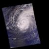
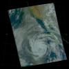
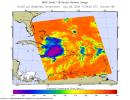
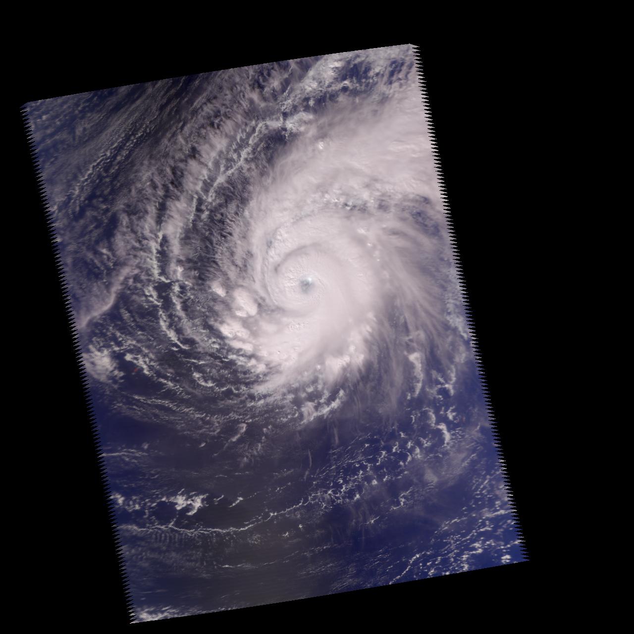
2002-09-26 |
Earth
|
Aqua
|
AIRS
|
674x740x3 |
|
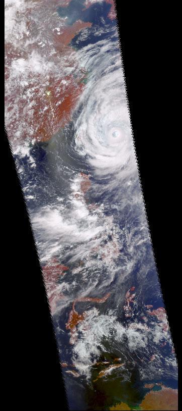
-
PIA00350:
-
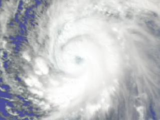
Hurricane Isadore
Full Resolution:
TIFF
(1.498 MB)
JPEG
(83.06 kB)
|
|
|
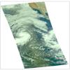
2002-11-13 |
Earth
|
Aqua
|
AIRS
|
960x1076x3 |
|
-
PIA00355:
-
Mt. Etna Eruption
Full Resolution:
TIFF
(2.131 MB)
JPEG
(120 kB)
|
|
|
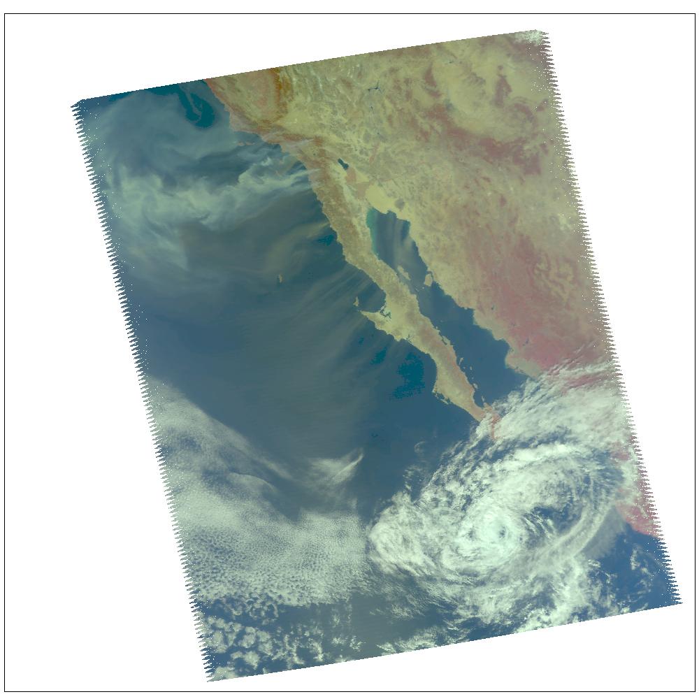
2002-10-02 |
Earth
|
Aqua
|
AIRS
|
699x419x3 |

|
-
PIA00365:
-
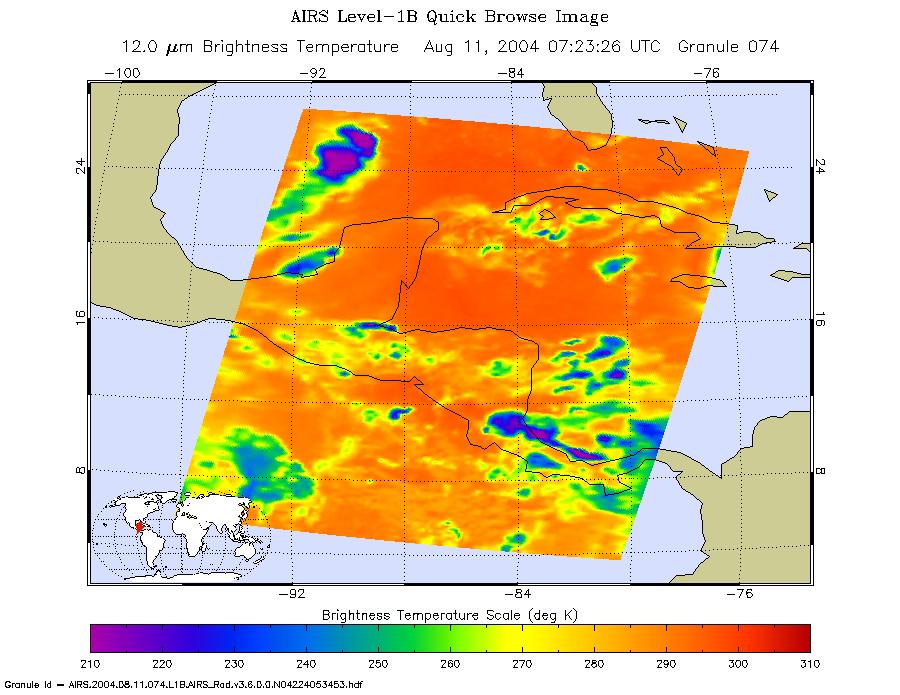
Flooding Resulting From Hurricane Isidore, Comparing Data from September 12 and 28, 2002
Full Resolution:
TIFF
(327.8 kB)
JPEG
(71.12 kB)
|
|
|
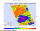
2002-12-19 |
Earth
|
Aqua
|
AIRS
|
1280x1280x3 |
|
-
PIA00367:
-
Supertyphoon Pongsona
Full Resolution:
TIFF
(2.6 MB)
JPEG
(132.5 kB)
|
|
|
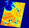
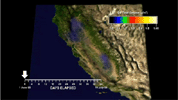
2003-03-11 |
Earth
|
Aqua
|
AIRS
|
1003x946x3 |

|
-
PIA00402:
-
Viewing a California Storm
Full Resolution:
TIFF
(1.767 MB)
JPEG
(140.5 kB)
|
|
|
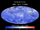
2003-06-02 |
Earth
|
Aqua
|
AIRS
|
1437x921x3 |
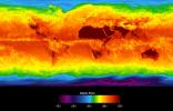
|
-
PIA00427:
-
Global Average Brightness Temperature for April 2003
Full Resolution:
TIFF
(2.867 MB)
JPEG
(158.1 kB)
|
|
|
2003-09-18 |
Earth
|
Aqua
|
AIRS
|
489x471x3 |
|
-
PIA00428:
-
Hurricane Isabel
Full Resolution:
TIFF
(393.3 kB)
JPEG
(50.8 kB)
|
|
|
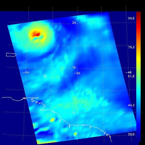
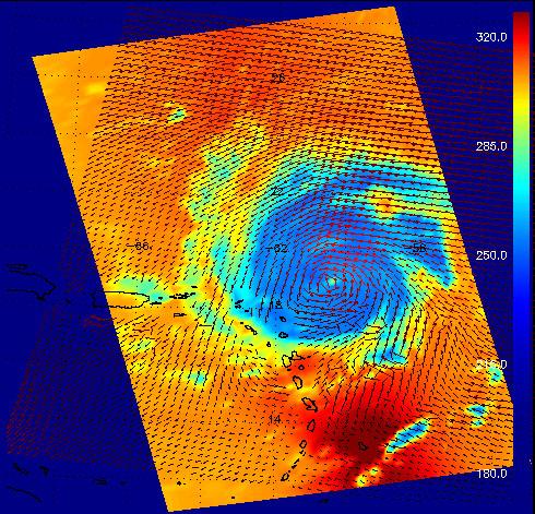
2003-09-20 |
Earth
|
Aqua
|
AIRS
Scatterometer (SeaWinds)
|
500x500x3 |
|
-
PIA00429:
-
Hurricane Isabel, AIRS Infrared and SeaWinds
Scatterometer Data Combined
Full Resolution:
TIFF
(252 kB)
JPEG
(521 kB)
|
|
|
2003-09-20 |
Earth
|
Aqua
|
AIRS
|
500x500x3 |
|
-
PIA00430:
-
Hurricane Isabel, Amount of Atmospheric Water Vapor Observed By AIRS
Full Resolution:
TIFF
(482.7 kB)
JPEG
(37.55 kB)
|
|
|
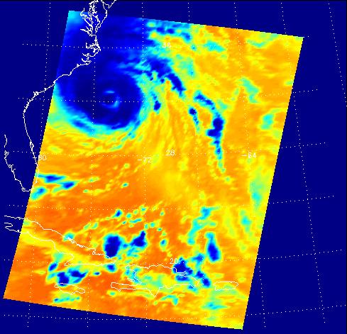
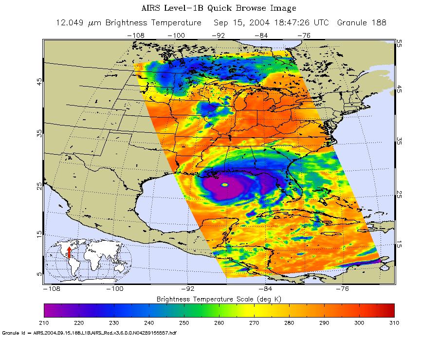
2004-09-15 |
Earth
|
Aqua
|
AIRS
|
900x695x3 |
|
-
PIA00431:
-
Hurricane Ivan as Observed by NASA's Spaceborne Atmospheric Infrared
Sounder (AIRS)
Full Resolution:
TIFF
(708.9 kB)
JPEG
(149.8 kB)
|
|
|
2004-08-30 |
Earth
|
Aqua
|
AIRS
|
500x342x3 |
|
-
PIA00433:
-
Hurricane Frances as Observed by NASA's Spaceborne Atmospheric Infrared
Sounder (AIRS) - Total Water Vapor Time Series

Full Resolution:
TIFF
(344.8 kB)
JPEG
(36.3 kB)
|
|
|
2004-08-30 |
Earth
|
Aqua
|
AIRS
|
490x471x3 |
|
-
PIA00435:
-
Hurricane Frances as Observed by NASA's Spaceborne Atmospheric Infrared Sounder (AIRS) and SeaWinds Scatterometer
Full Resolution:
TIFF
(693.4 kB)
JPEG
(88.32 kB)
|
|
|
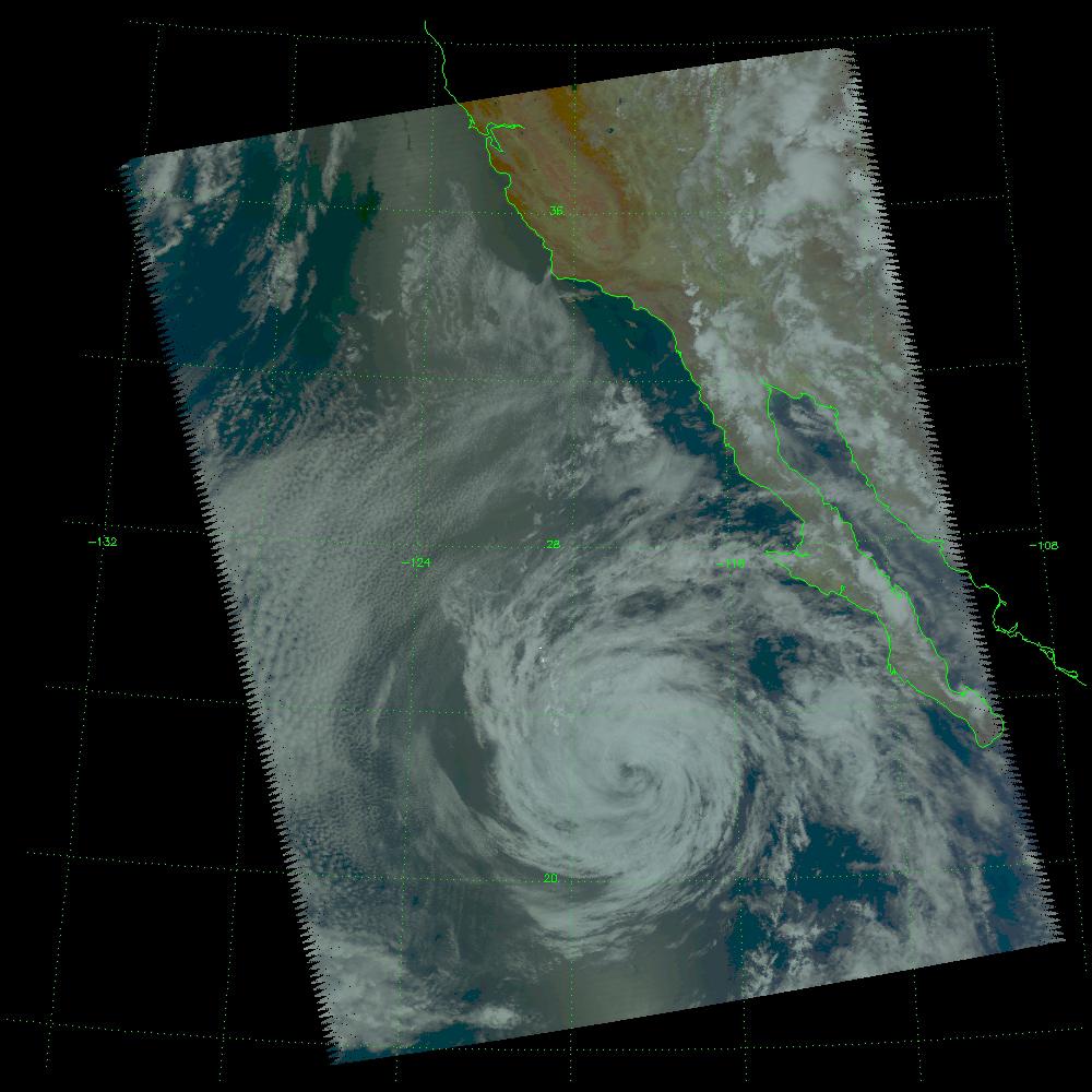
2004-07-14 |
Earth
|
Aqua
|
AIRS
|
1000x1000x3 |
|
-
PIA00436:
-
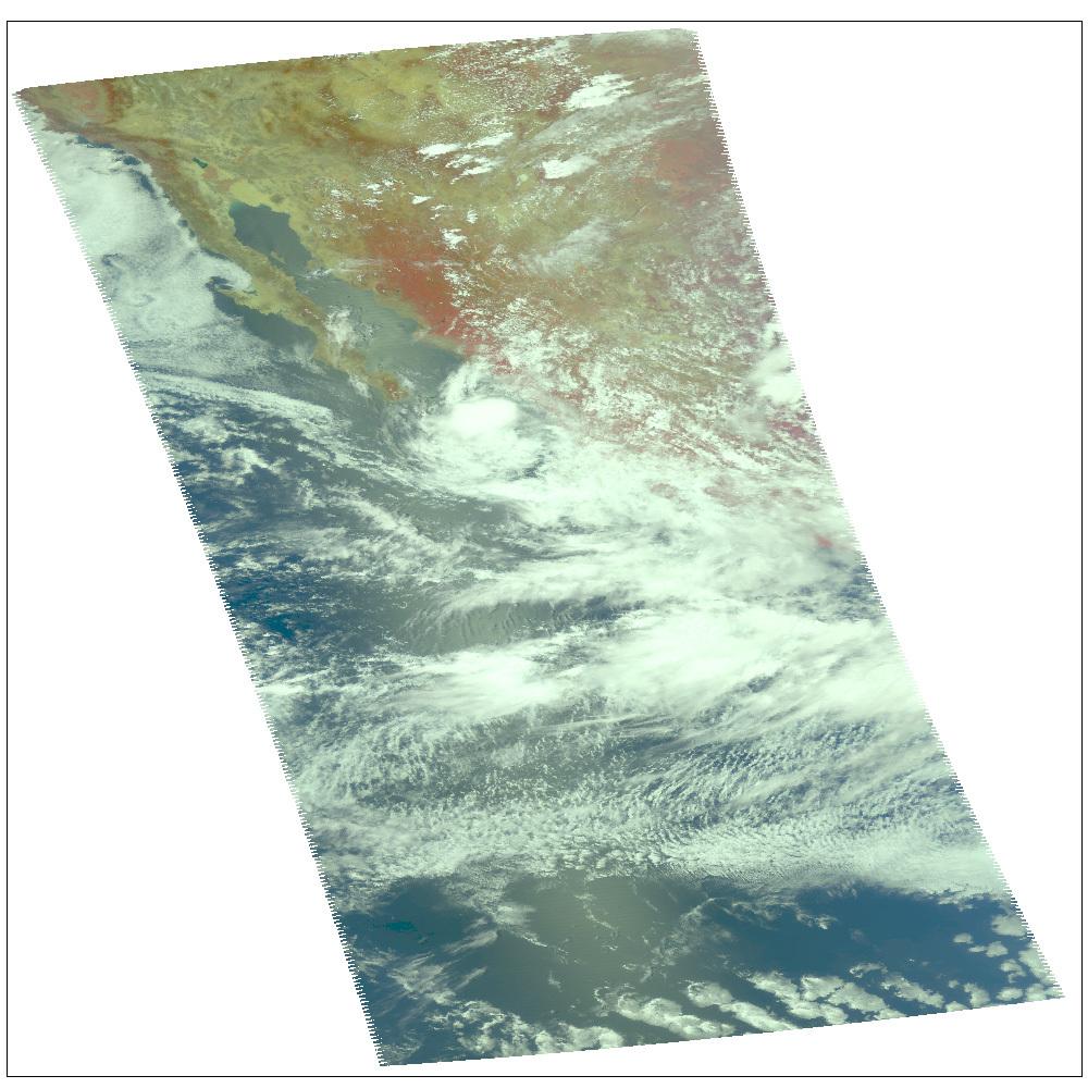
Tropical Storm Blas off the Pacific Coast of Mexico
Full Resolution:
TIFF
(3.004 MB)
JPEG
(121.3 kB)
|
|
|
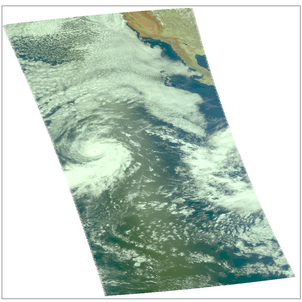
2004-07-23 |
Earth
|
Aqua
|
AIRS
|
1000x1000x3 |
|
-
PIA00438:
-
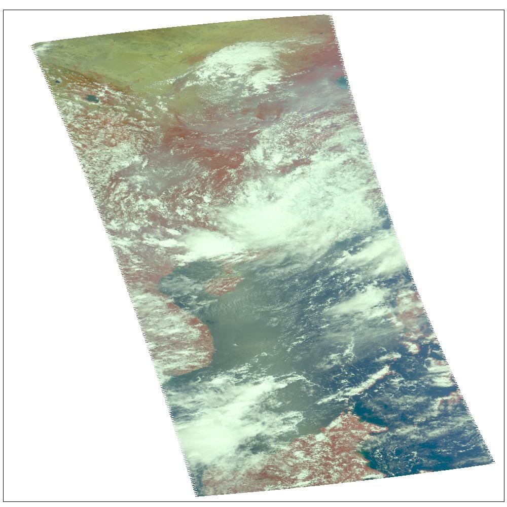
Hurricane Celia off the Pacific Coast of Mexico
Full Resolution:
TIFF
(3.004 MB)
JPEG
(140.8 kB)
|
|
|
2004-07-26 |
Earth
|
Aqua
|
AIRS
|
1000x1000x3 |
|
-
PIA00439:
-
Hurricane Darby off the Pacific Coast of Mexico
Full Resolution:
TIFF
(3.004 MB)
JPEG
(139 kB)
|
|
|
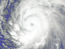
2005-08-24 |
Earth
|
Aqua
|
AIRS
|
3200x2400x3 |
|
-
PIA07938:
-
AIRS Storm Front Approaching California (animation)
Full Resolution:
TIFF
(23.04 MB)
JPEG
(629.5 kB)
|
|
|
2005-08-30 |
Earth
|
Aqua
|
AIRS
|
900x695x3 |
|
-
PIA04178:
-
Hurricane Katrina as Observed by NASA's Spaceborne Atmospheric Infrared Sounder (AIRS)
Full Resolution:
TIFF
(1.879 MB)
JPEG
(125 kB)
|
|
|
2004-08-03 |
Earth
|
Aqua
|
AIRS
|
792x998x3 |
|
-
PIA00440:
-
Hurricane Alex, located about 80 miles south-southeast of Charleston, South Carolina, as observed by NASA's Spaceborne Atmospheric Infrared
Sounder (AIRS).
Full Resolution:
TIFF
(2.374 MB)
JPEG
(102.7 kB)
|
|
|
2004-08-12 |
Earth
|
Aqua
|
AIRS
|
900x695x3 |
|
-
PIA00441:
-
Tropical Storm Bonnie as Observed by NASA's Spaceborne Atmospheric
Infrared Sounder (AIRS)
Full Resolution:
TIFF
(1.879 MB)
JPEG
(110 kB)
|
|
|
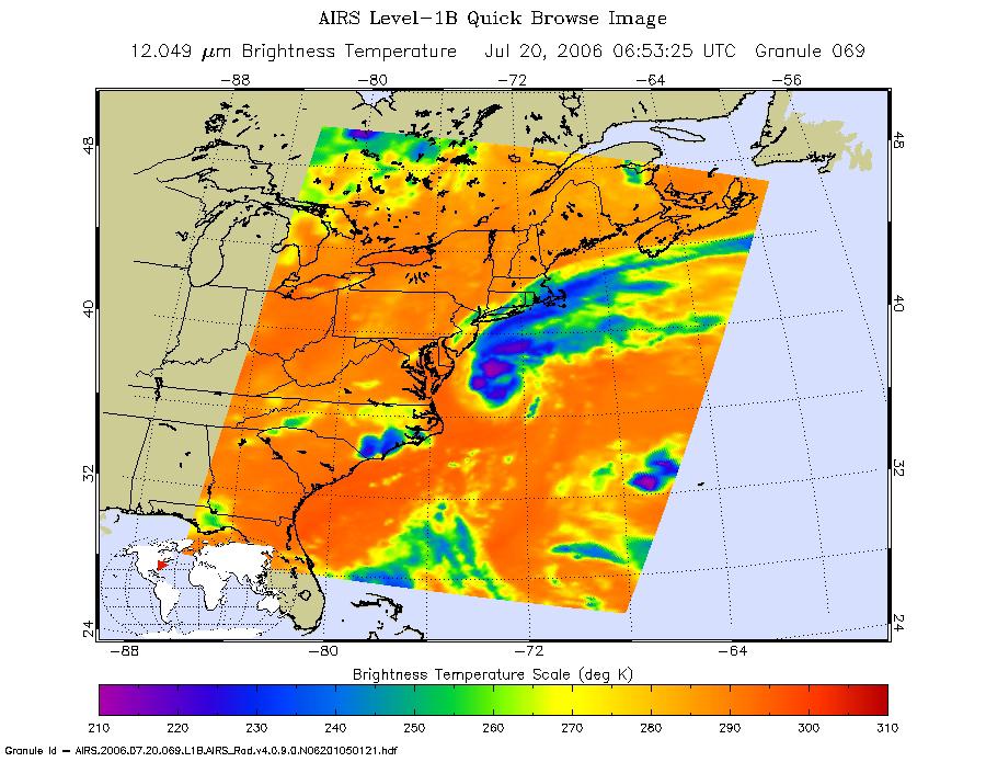
2006-07-20 |
Earth
|
Aqua
|
AIRS
|
900x695x3 |
|
-
PIA08613:
-
Tropical Storm Beryl as Observed by NASA's Spaceborne Atmospheric Infrared
Sounder (AIRS)
Full Resolution:
TIFF
(1.879 MB)
JPEG
(129.7 kB)
|
|
|
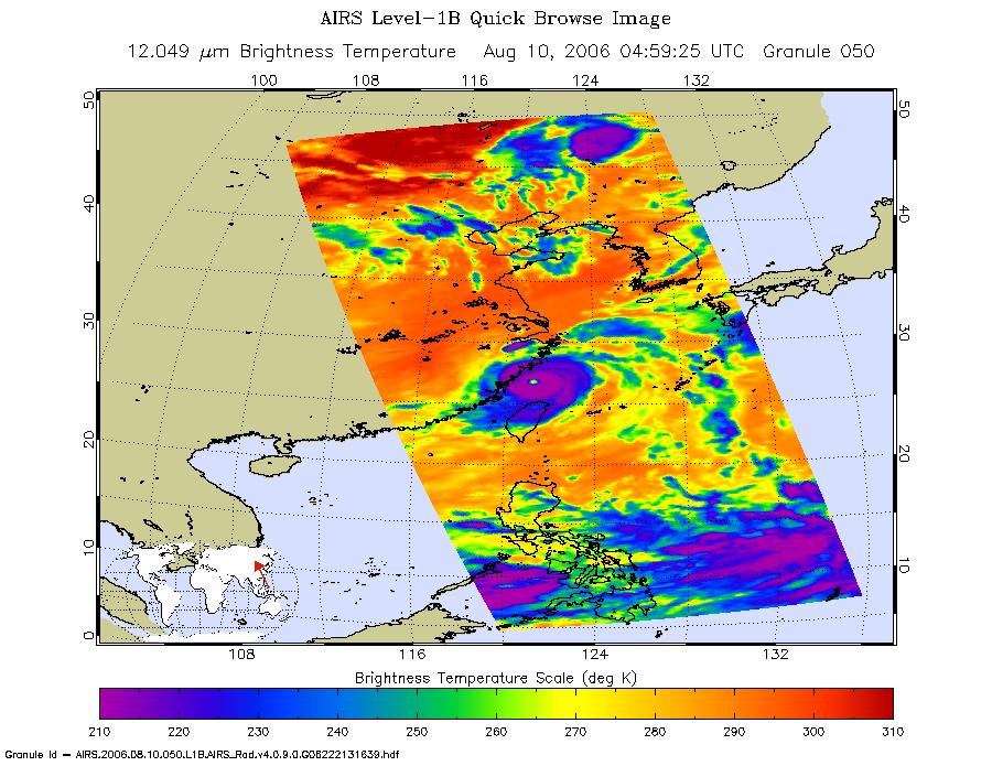
2006-08-10 |
Earth
|
Aqua
|
AIRS
|
900x695x3 |
|
-
PIA08652:
-
Typhoon Saomai as seen by AIRS
Full Resolution:
TIFF
(1.879 MB)
JPEG
(136.7 kB)
|
|
|
2007-01-19 |
Earth
|
Aqua
|
AIRS
|
504x360x3 |
|
-
PIA00523:
-
Average Tropical Relative Humidity from AIRS, Dec-Feb 2002-2005
Full Resolution:
TIFF
(545.1 kB)
JPEG
(31.59 kB)
|
|
|
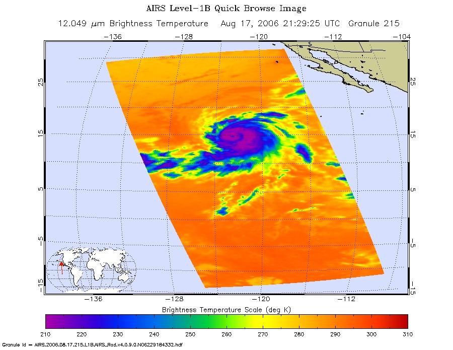
2006-08-17 |
Earth
|
Aqua
|
AIRS
|
900x695x3 |
|
-
PIA00507:
-
Hurricane Hector in the Eastern Pacific
Full Resolution:
TIFF
(1.879 MB)
JPEG
(104.8 kB)
|
|
|
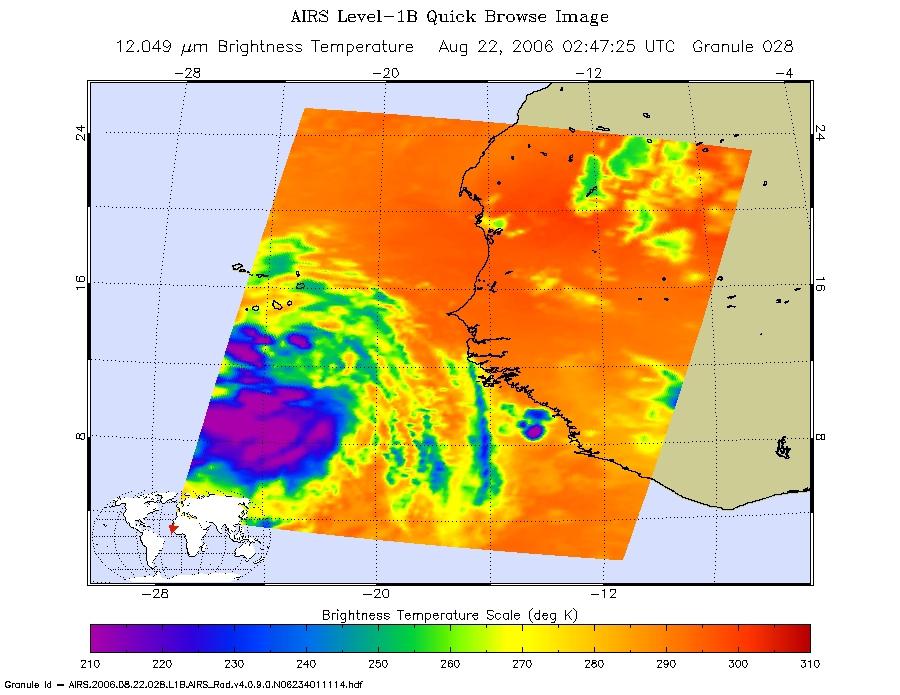
2006-08-22 |
Earth
|
Aqua
|
AIRS
|
900x695x3 |
|
-
PIA00508:
-
Tropical Depression Debbie in the Atlantic
Full Resolution:
TIFF
(1.879 MB)
JPEG
(98.1 kB)
|
|
|
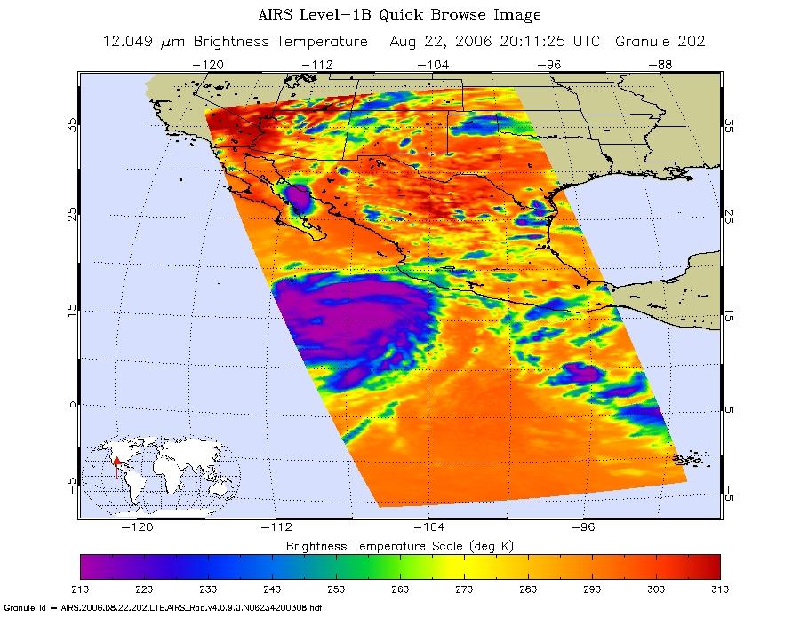
2006-08-22 |
Earth
|
Aqua
|
AIRS
|
900x695x3 |

|
-
PIA00509:
-
Hurricane Ileana in the Eastern Pacific
Full Resolution:
TIFF
(1.879 MB)
JPEG
(124.2 kB)
|
|
|
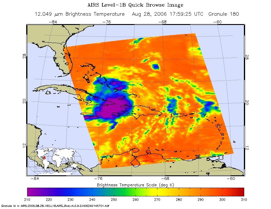
2006-08-28 |
Earth
|
Aqua
|
AIRS
|
900x695x3 |
|
-
PIA00510:
-
Tropical Storm Ernesto over Cuba
Full Resolution:
TIFF
(1.879 MB)
JPEG
(114.8 kB)
|
|
|
2006-08-29 |
Earth
|
Aqua
|
AIRS
|
900x695x3 |
|
-
PIA00511:
-
Typhoon Ioke in the Western Pacific
Full Resolution:
TIFF
(1.879 MB)
JPEG
(111.4 kB)
|
|
|
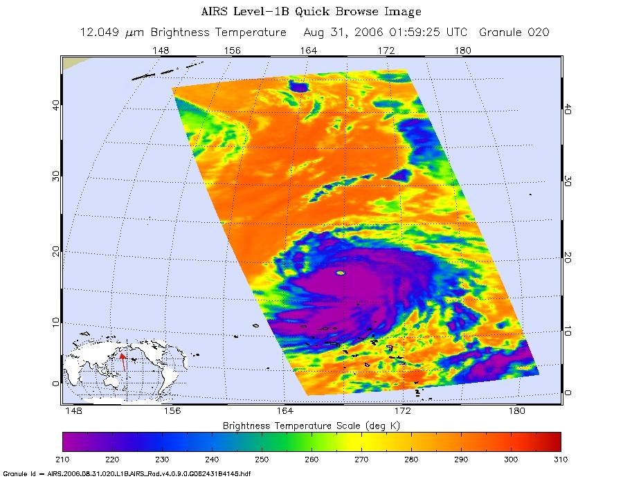
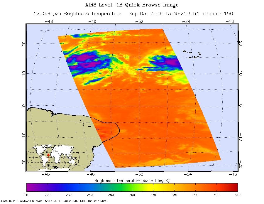
2006-09-03 |
Earth
|
Aqua
|
AIRS
|
900x695x3 |
|
-
PIA00512:
-
Tropical Depression 6 (Florence) in the Atlantic
Full Resolution:
TIFF
(1.879 MB)
JPEG
(102.3 kB)
|
|
|
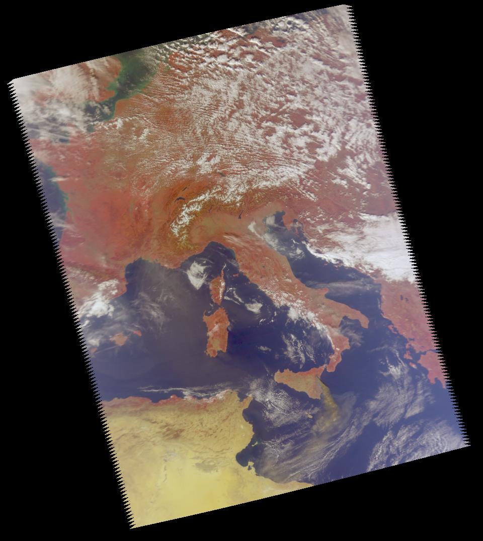
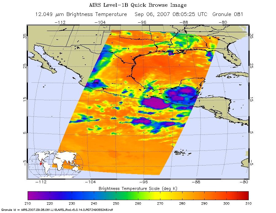
2002-09-08 |
Earth
|
Aqua
|
AIRS
|
641x469x3 |
|
-
PIA00513:
-
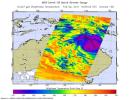
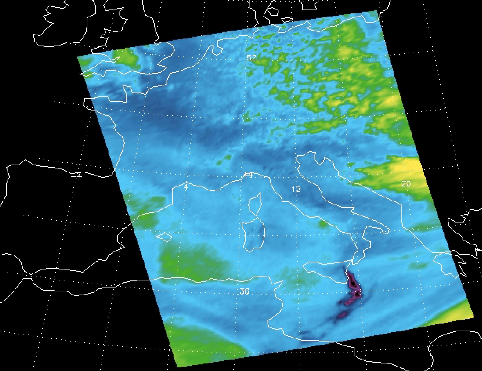
AIRS Retrieved Temperature Isotherms over Southern Europe
Full Resolution:
TIFF
(903.1 kB)
JPEG
(28.96 kB)
|
|
|
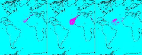
2005-07-15 |
Earth
|
Aqua
|
AIRS
|
480x187x3 |
|
-
PIA00448:
-
Sahara Dust Cloud
Full Resolution:
TIFF
(269.8 kB)
JPEG
(18.24 kB)
|
|
|
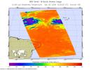
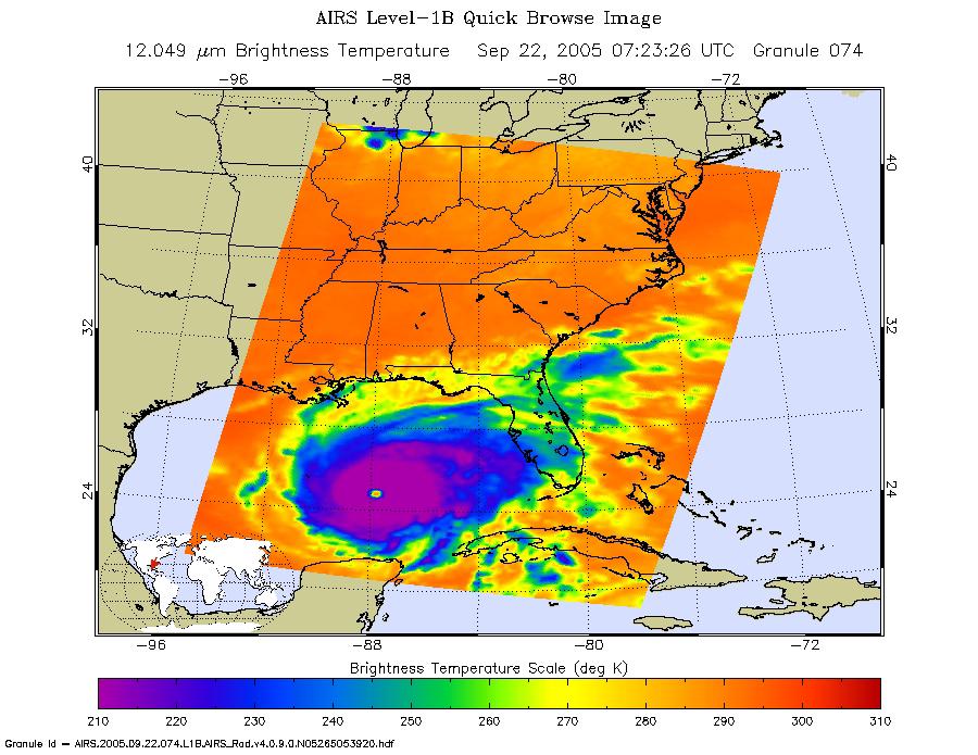
2005-09-22 |
Earth
|
Aqua
|
AIRS
|
900x695x3 |
|
-
PIA00449:
-
Hurricane Rita as Observed by NASA's Spaceborne Atmospheric Infrared Sounder (AIRS)
Full Resolution:
TIFF
(1.879 MB)
JPEG
(126.2 kB)
|
|
|
2007-05-18 |
Earth
|
Aqua
|
AIRS
|
1200x900x3 |

|
-
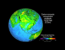
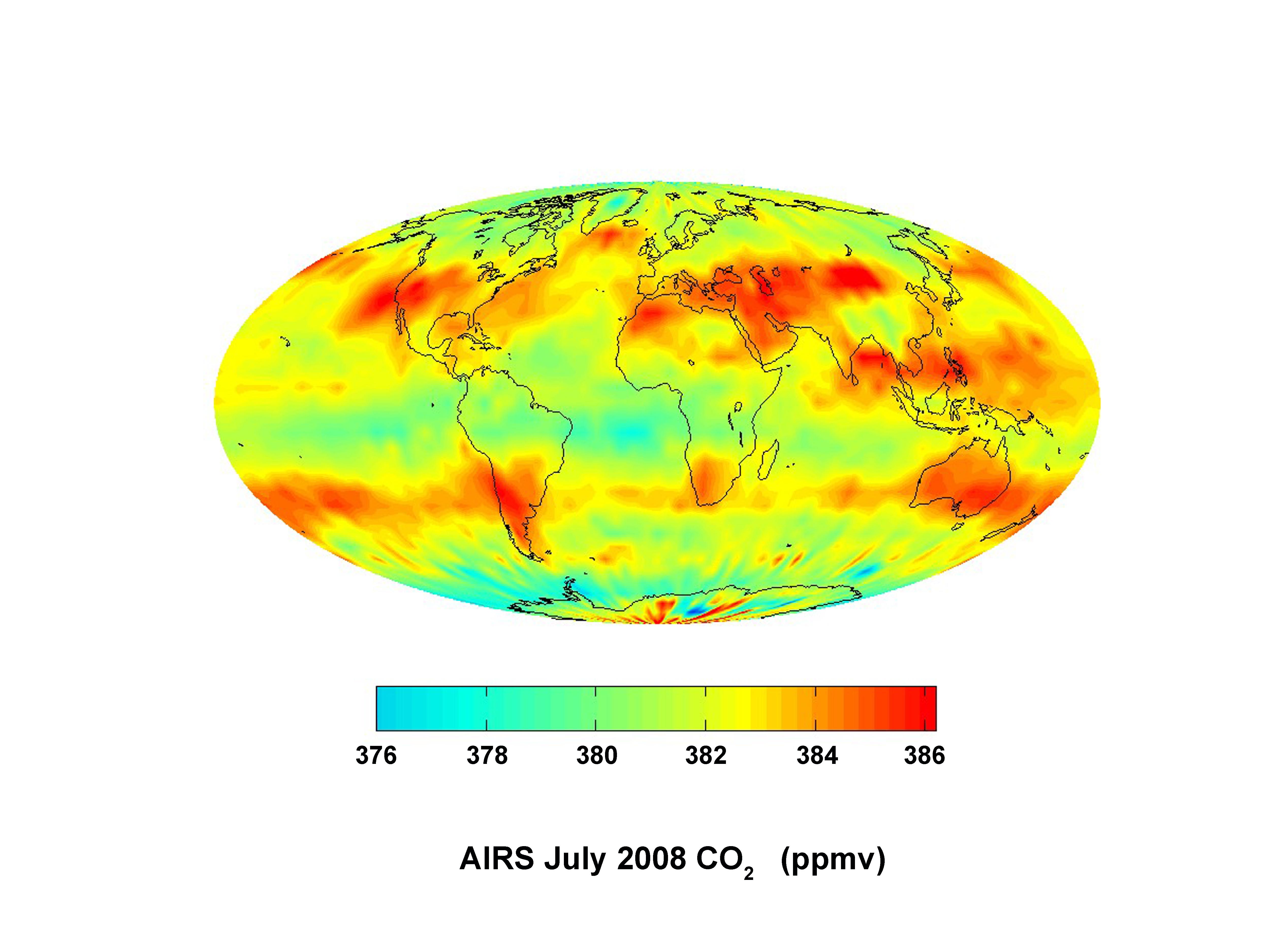
PIA09269:
-
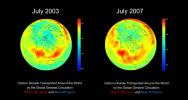
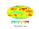
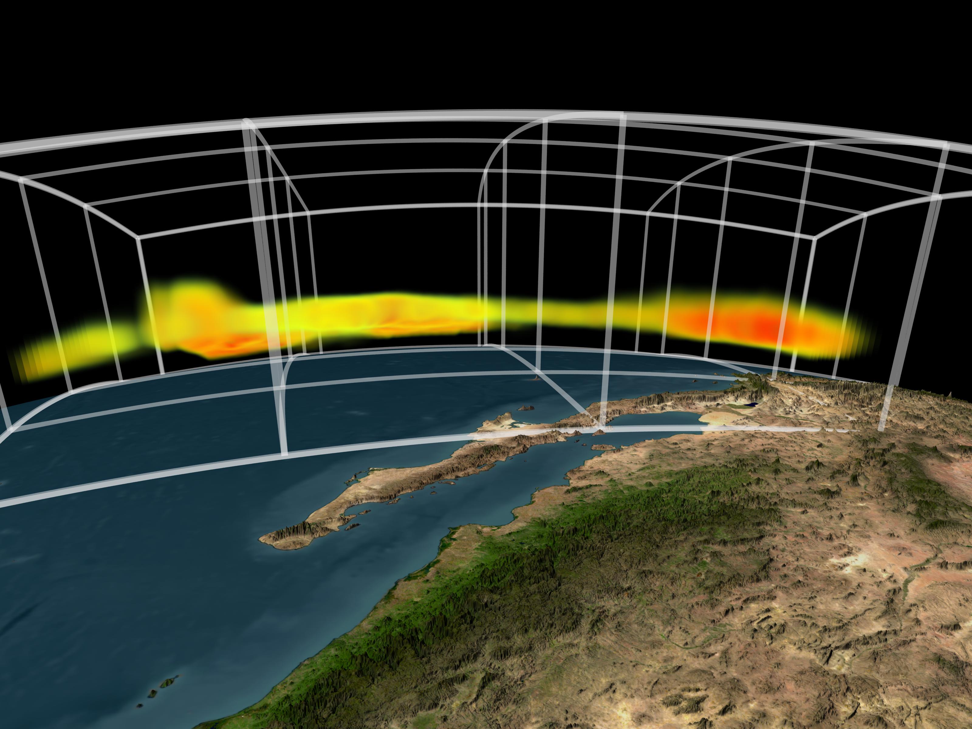
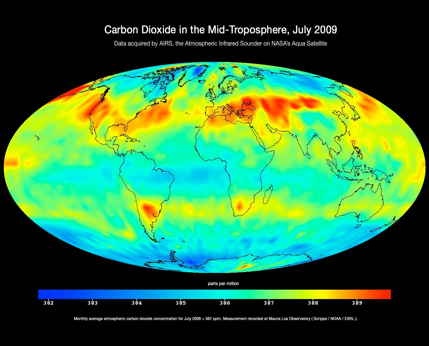
AIRS Global Map of Carbon Dioxide from Space
Full Resolution:
TIFF
(3.244 MB)
JPEG
(100.5 kB)
|
|
|
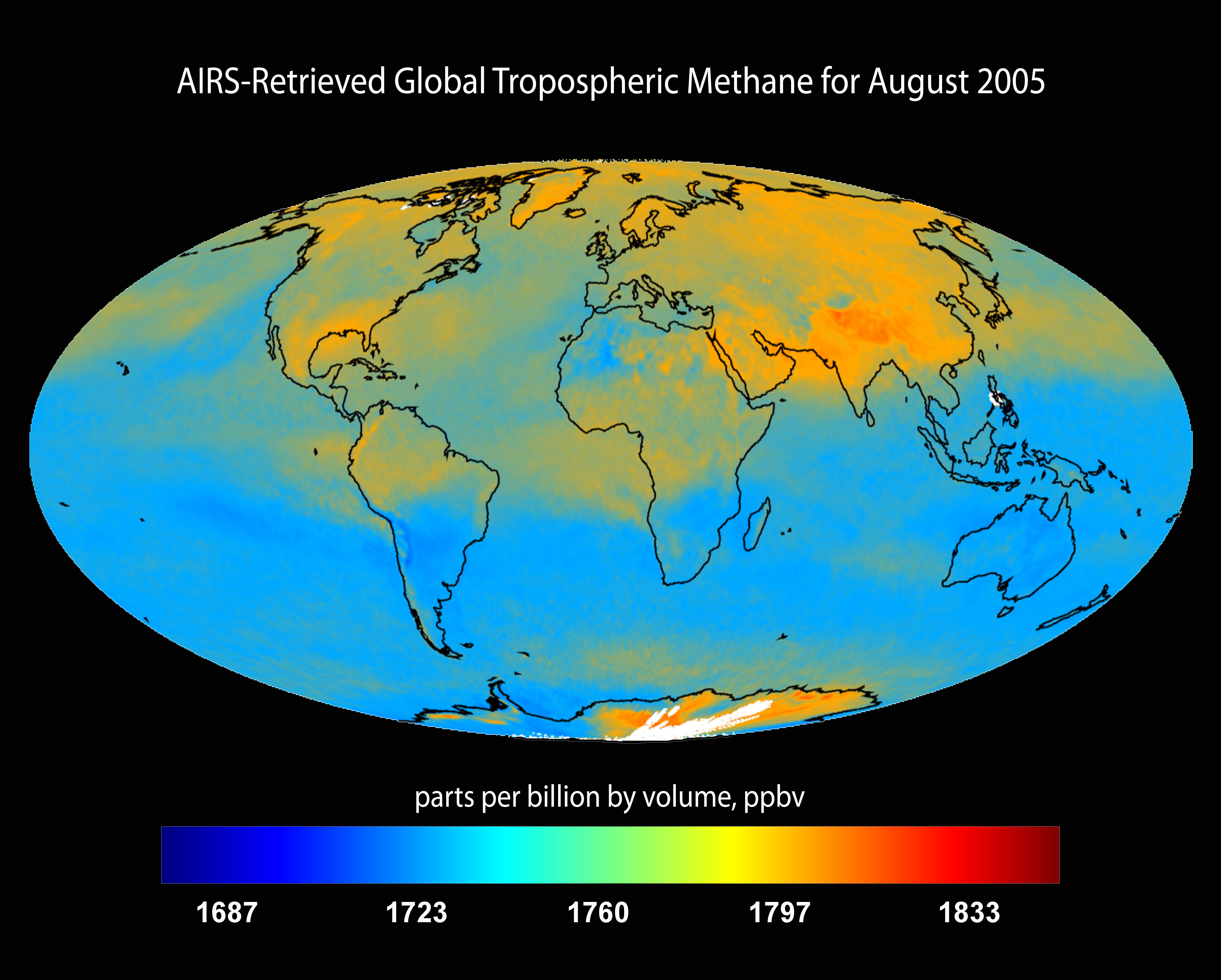
2007-07-24 |
Earth
|
Aqua
|
AIRS
|
6444x5172x3 |
|
-
PIA09941:
-
AIRS-Retrieved Global Tropospheric Methane for August 2005
Full Resolution:
TIFF
(99.99 MB)
JPEG
(1.271 MB)
|
|
|
2007-07-24 |
Earth
|
Aqua
|
AIRS
|
1980x1524x3 |
|
-
PIA09937:
-
Sulfur Dioxide Plume from Mt. Etna Eruption 2002 as Detected with AIRS Data
Full Resolution:
TIFF
(9.065 MB)
JPEG
(274.5 kB)
|
|
|
2007-07-24 |
Earth
|
Aqua
|
AIRS
|
2500x1875x3 |
|
-
PIA09936:
-
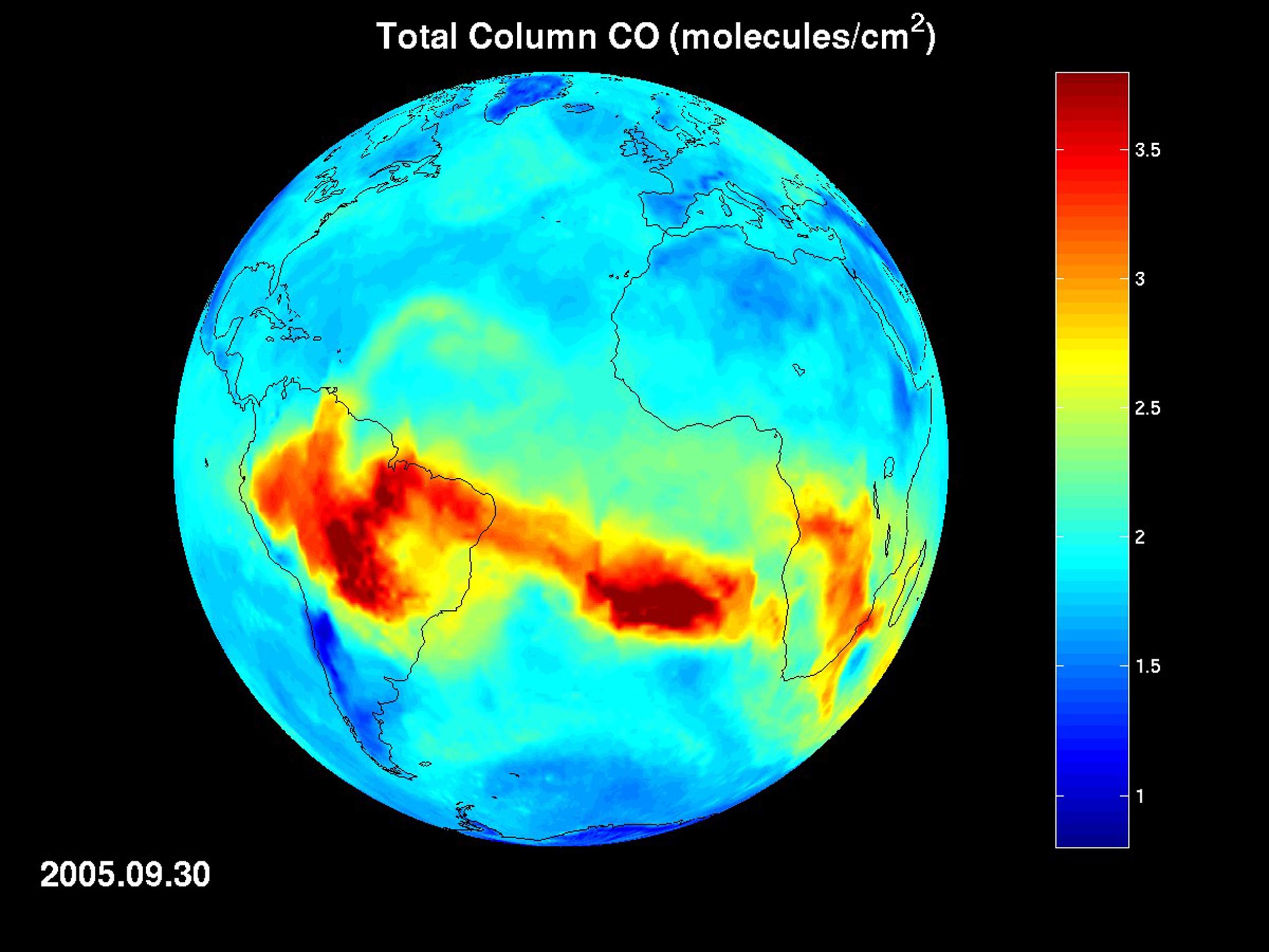
AIRS Map of Carbon Monoxide Draped on Globe: Time Series from 8/1/2005 to
9/30/2005
Full Resolution:
TIFF
(14.08 MB)
JPEG
(289.4 kB)
|
|
|
2007-07-24 |
Earth
|
Aqua
|
AIRS
|
2931x2223x3 |
|
-
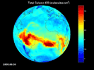
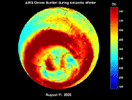
PIA09938:
-
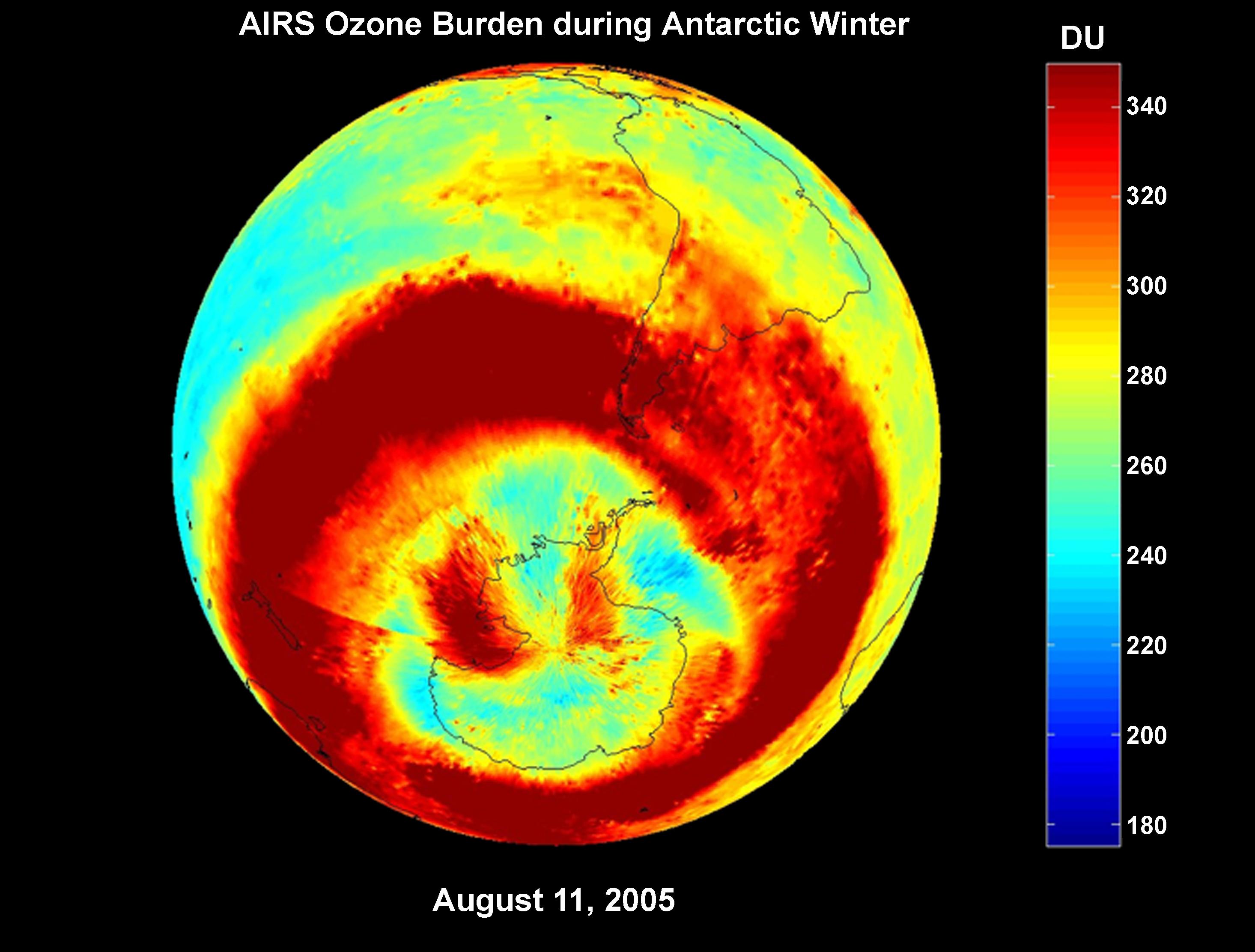
AIRS Ozone Burden During Antarctic Winter: Time Series from 8/1/2005 to
9/30/2005
Full Resolution:
TIFF
(19.55 MB)
JPEG
(358.8 kB)
|
|
|
2007-07-24 |
Earth
|
Aqua
|
AIRS
|
2102x1276x3 |
|
-
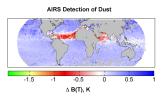
PIA09940:
-
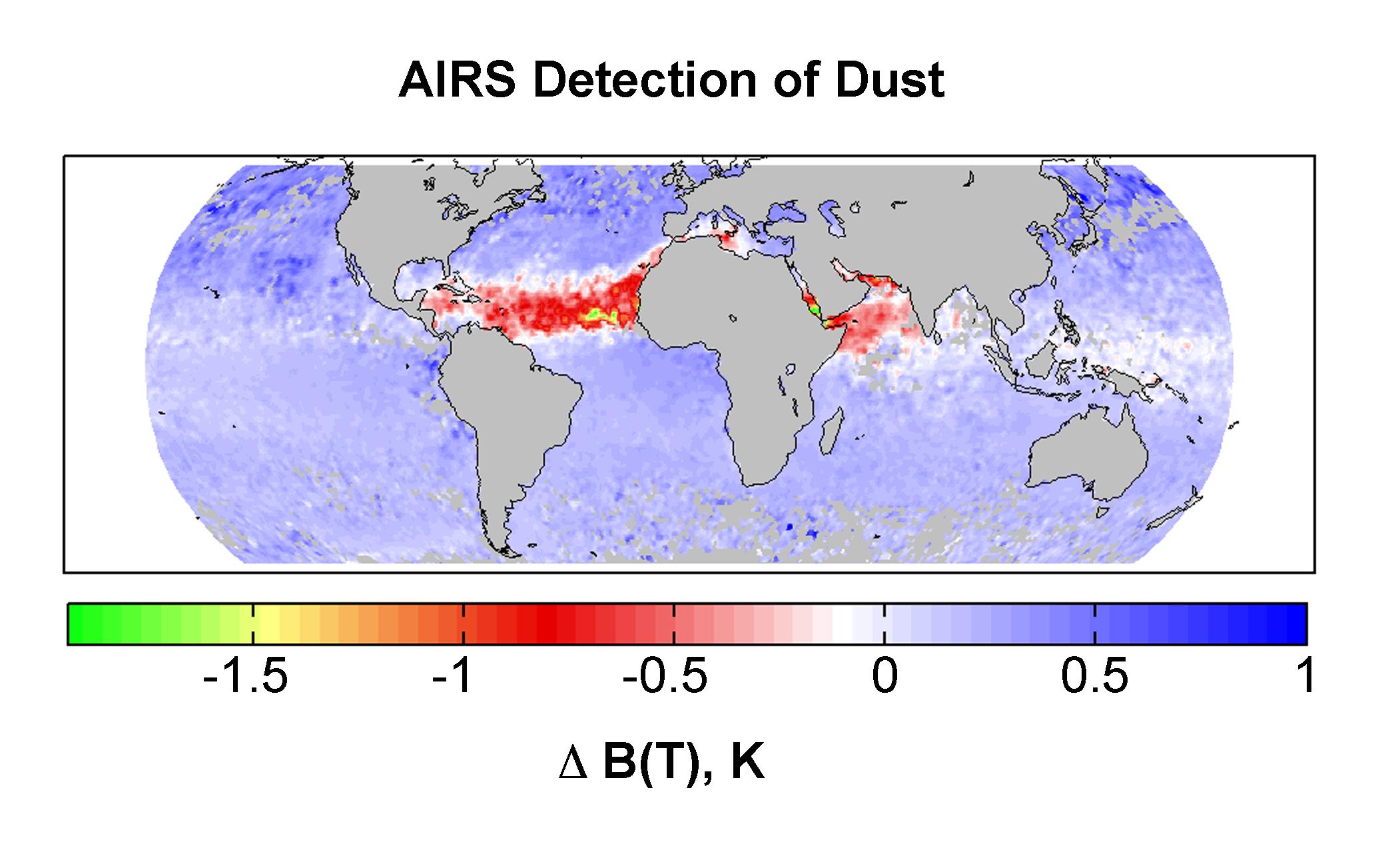
AIRS Detection of Dust: Global Map for July 2003
Full Resolution:
TIFF
(8.057 MB)
JPEG
(214.1 kB)
|
|
|
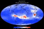
2007-09-11 |
Earth
|
Aqua
|
AIRS
|
1280x720x3 |
|
-
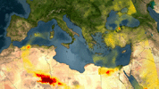
PIA09923:
-
Visualization of Fires in Greece as seen by the Atmospheric Infrared Sounder
Full Resolution:
TIFF
(2.768 MB)
JPEG
(115.7 kB)
|
|
|
2007-10-23 |
Earth
|
Aqua
|
AIRS
|
1000x1000x3 |
|
-
PIA10088:
-
Swirls of Smoke and Dust Blow Out to Sea
Full Resolution:
TIFF
(3.004 MB)
JPEG
(103.4 kB)
|
|
|
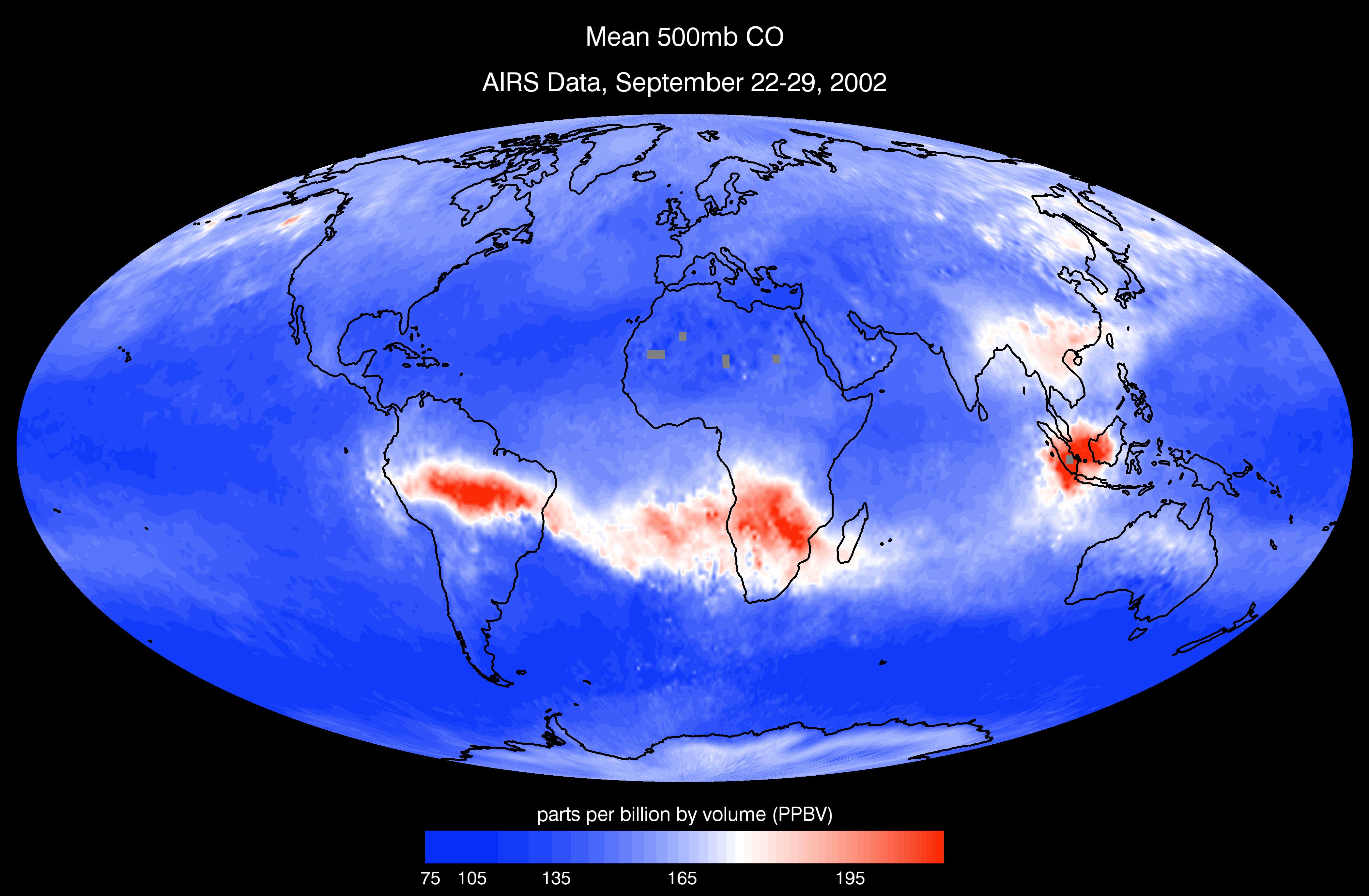
2008-03-12 |
Earth
|
Aqua
|
AIRS
|
4196x2747x3 |
|
-
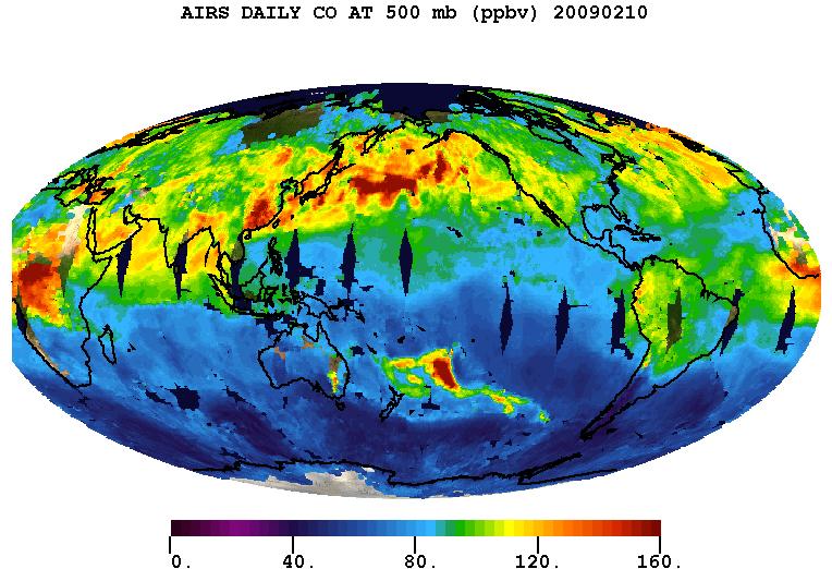
PIA10241:
-
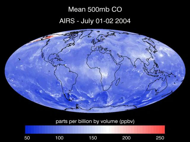
AIRS Mean Carbon Monoxide at 500 Millibar, September 22-29, 2002
Full Resolution:
TIFF
(34.58 MB)
JPEG
(798.8 kB)
|
|
|
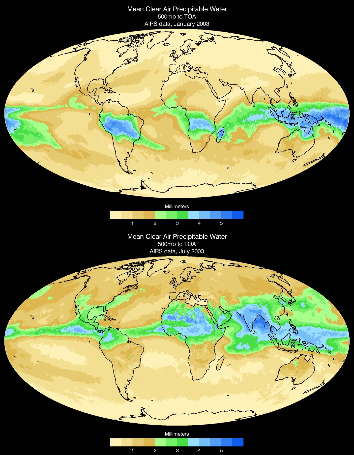
2008-03-17 |
Earth
|
Aqua
|
AIRS
|
1428x1836x3 |
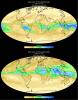
|
-
PIA10242:
-
Mean Clear Air Precipitable Water, 500mb to TOA from AIRS data
Full Resolution:
TIFF
(7.88 MB)
JPEG
(295.5 kB)
|
|
|
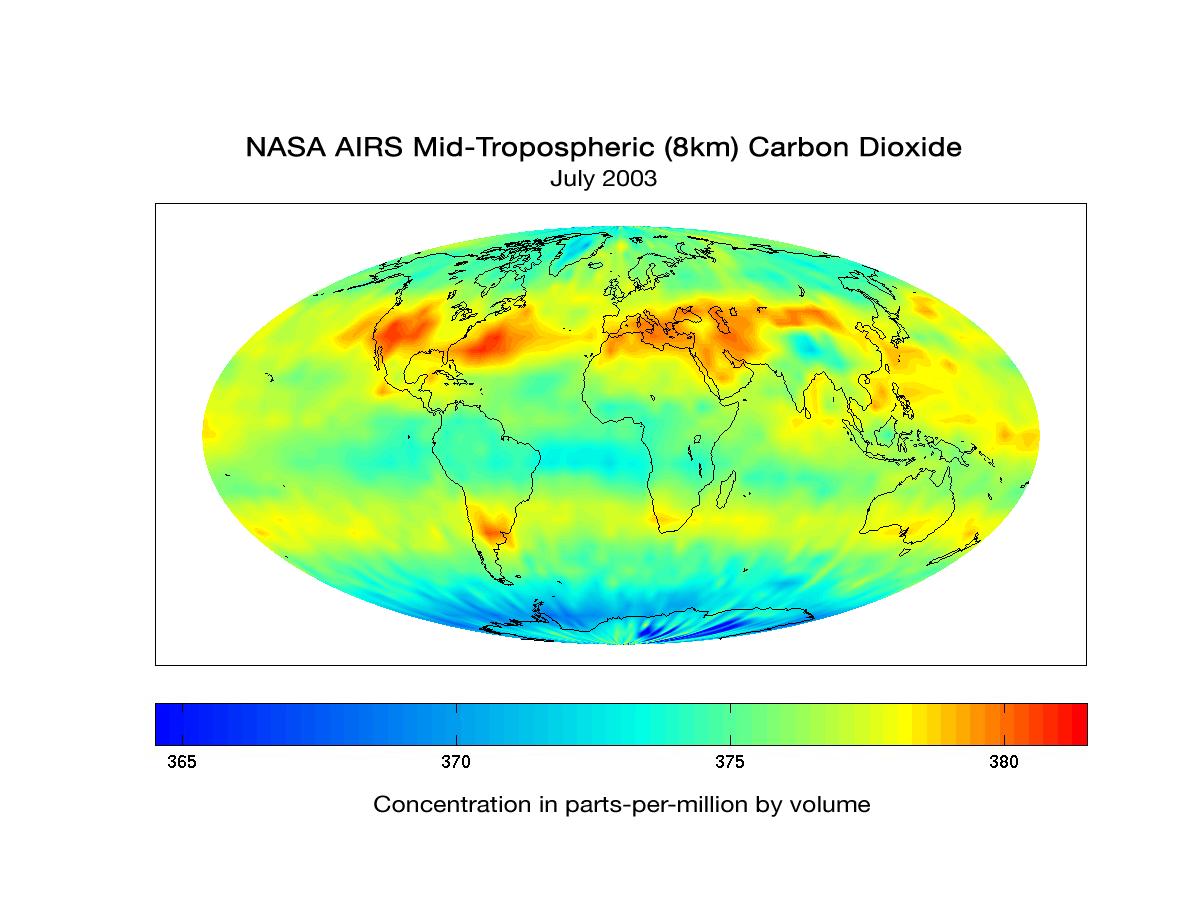
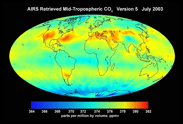
2007-05-16 |
Earth
|
Aqua
|
AIRS
|
720x486x3 |
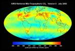
|
-
PIA10645:
-
AIRS Mid-Tropospheric CO2, Version 5, July 2003
Full Resolution:
TIFF
(1.051 MB)
JPEG
(53.1 kB)
|
|
|
2007-08-15 |
Earth
|
Aqua
|
AIRS
|
1000x1000x3 |
|
-
PIA10646:
-
Hurricane Dean
Full Resolution:
TIFF
(3.004 MB)
JPEG
(130.4 kB)
|
|
|
2007-08-15 |
Earth
|
Aqua
|
AIRS
|
1000x1000x3 |
|
-
PIA10647:
-
Tropical Storm Erin
Full Resolution:
TIFF
(3.004 MB)
JPEG
(123.6 kB)
|
|
|
2007-08-18 |
Earth
|
Aqua
|
AIRS
|
1000x1000x3 |
|
-
PIA10648:
-
Typhoon Sepat
Full Resolution:
TIFF
(3.004 MB)
JPEG
(130.3 kB)
|
|
|
2007-09-03 |
Earth
|
Aqua
|
AIRS
|
900x695x3 |
|
-
PIA10649:
-
Hurricane Felix
Full Resolution:
TIFF
(1.879 MB)
JPEG
(124.9 kB)
|
|
|
2008-07-22 |
Earth
|
Aqua
|
AIRS
|
1026x577x3 |
|
-
PIA10973:
-
Carbon Monoxide from California's Wildfire -
a Visualization Created Using Data from NASA's Atmospheric Infrared Sounder
Full Resolution:
TIFF
(1.779 MB)
JPEG
(61.13 kB)
|
|
|
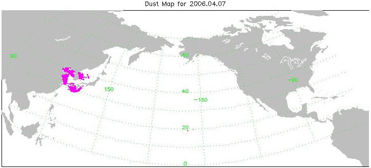
2008-08-06 |
Earth
|
Aqua
|
AIRS
|
727x329x3 |
|
-
PIA11009:
-
Transport of Dust from China Dust Storm of April 2006
Full Resolution:
TIFF
(718.7 kB)
JPEG
(30.38 kB)
|
|
|
2008-08-13 |
Earth
|
Aqua
|
AIRS
|
321x239x3 |
|
-
PIA11032:
-
Hurricane Isabel Isotherms
Full Resolution:
TIFF
(230.6 kB)
JPEG
(8.968 kB)
|
|
|
2008-08-13 |
Earth
|
Aqua
|
AIRS
|
319x240x3 |
|
-
PIA11033:
-
Supertyphoon Pongsona Isotherms
Full Resolution:
TIFF
(230.2 kB)
JPEG
(9.715 kB)
|
|
|
2008-08-14 |
Earth
|
Aqua
|
AIRS
|
640x480x3 |
|
-
PIA11034:
-
Transport of Carbon Monoxide Generated by Alaska Fires, July 2004
Full Resolution:
TIFF
(922.8 kB)
JPEG
(44.52 kB)
|
|
|
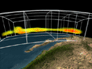
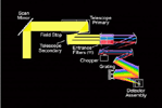
2008-09-17 |
|
Aqua
|
AIRS
|
722x485x3 |
|
-
PIA11170:
-
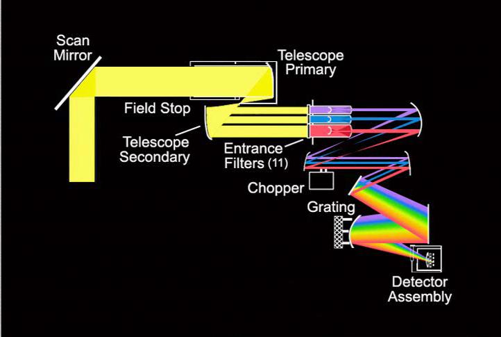
Light Travels Through AIRS Optics
Full Resolution:
TIFF
(1.052 MB)
JPEG
(32.19 kB)
|
|
|
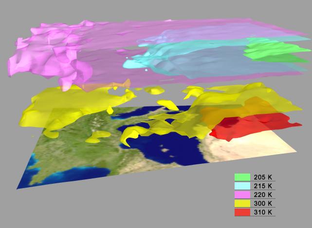
2008-09-17 |
Earth
|
Aqua
|
AIRS
|
638x478x3 |

|
-
PIA11171:
-
AIRS Collects Data and Creates a Temperature Profile
Full Resolution:
TIFF
(916.1 kB)
JPEG
(39.04 kB)
|
|
|
2008-09-22 |
Earth
|
Aqua
|
AIRS
|
1777x948x3 |
|
-
PIA11186:
-
AIRS Global Distribution of Mid-Tropospheric Carbon Dioxide at 8-13 km Altitudes
Full Resolution:
TIFF
(5.062 MB)
JPEG
(146.6 kB)
|
|
|
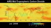
2008-09-24 |
Earth
|
Aqua
|
AIRS
|
5000x3750x3 |
|
-
PIA11194:
-
Global Carbon Dioxide Transport from AIRS Data, July 2008
Full Resolution:
TIFF
(56.25 MB)
JPEG
(715.3 kB)
|
|
|
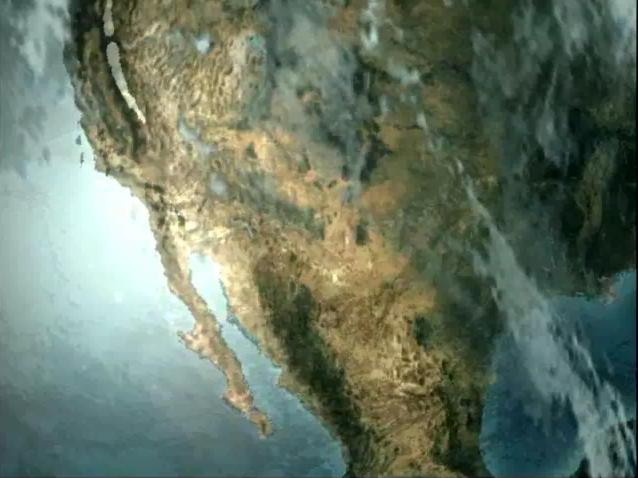
2008-11-03 |
Earth
|
Aqua
|
AIRS
|
3840x2160x3 |
|
-
PIA11395:
-
AIRS Carbon Dioxide with Mauna Loa Carbon Dioxide Overlaid
Full Resolution:
TIFF
(24.88 MB)
JPEG
(534 kB)
|
|
|
2008-11-18 |
Earth
|
Aqua
|
AIRS
|
1024x576x3 |
|
-
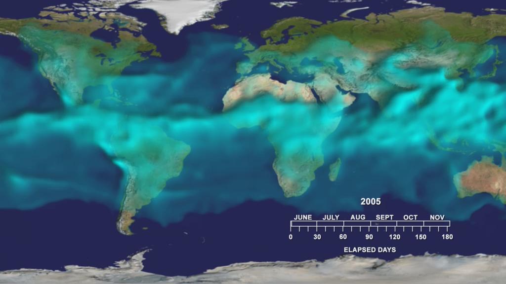
PIA11424:
-
Water Vapor Transport, June through November 2005 (Movie)
Full Resolution:
TIFF
(1.772 MB)
JPEG
(54.12 kB)
|
|
|
2009-02-19 |
Earth
|
Aqua
|
AIRS
|
764x522x3 |
|
-
PIA11807:
-
Carbon Monoxide from the Australian Fires of Feb 2009 as seen by AIRS
Full Resolution:
TIFF
(1.198 MB)
JPEG
(92.37 kB)
|
|
|
2009-06-30 |
Earth
|
Aqua
|
AIRS
|
1600x1025x3 |
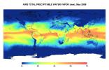
|
-
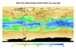
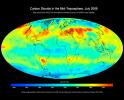
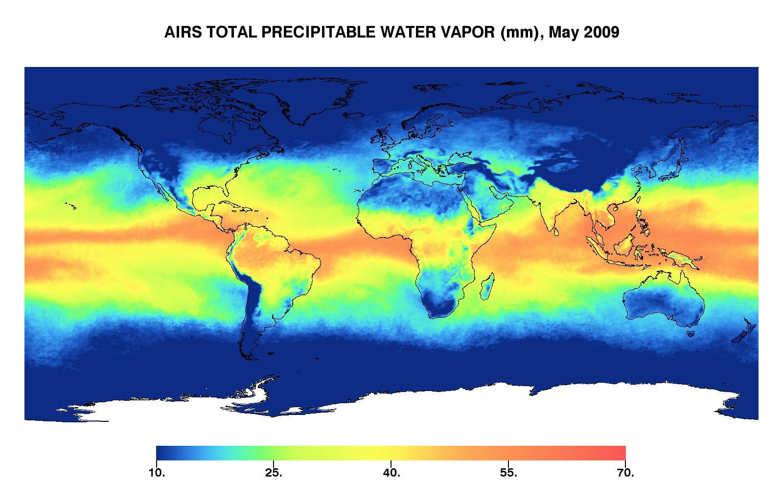
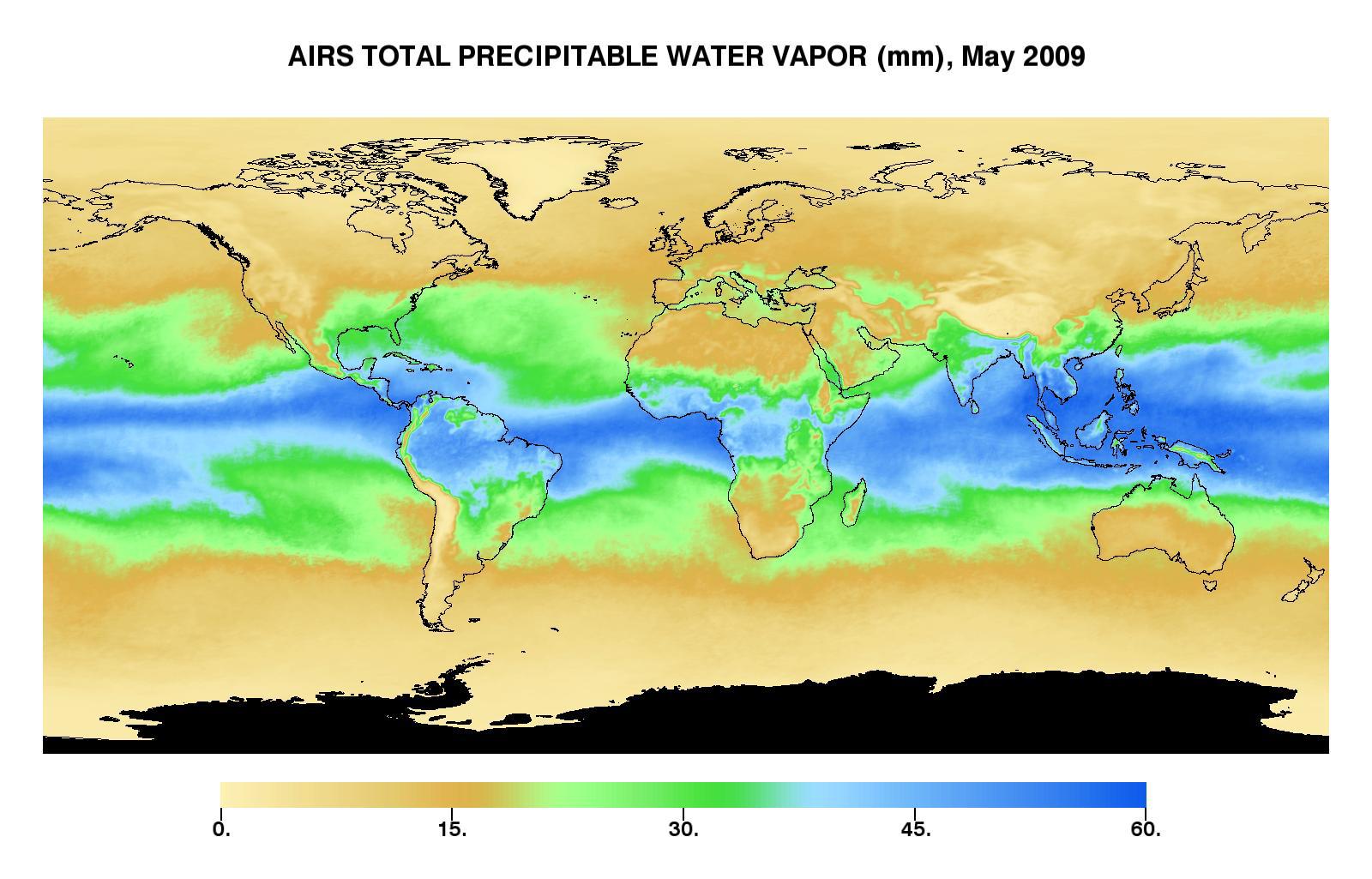
PIA12096:
-
Global Total Precipitable Water Vapor for May 2009
Full Resolution:
TIFF
(4.928 MB)
JPEG
(173.4 kB)
|
|
|
2009-06-30 |
Earth
|
Aqua
|
AIRS
|
1600x1025x3 |
|
-
PIA12097:
-
Global Total Precipitable Water Vapor for May 2009
Full Resolution:
TIFF
(4.928 MB)
JPEG
(187.7 kB)
|
|
|
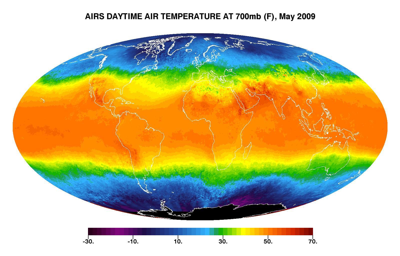
2009-06-30 |
Earth
|
Aqua
|
AIRS
|
1600x1025x3 |
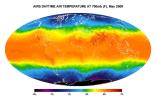
|
-
PIA12098:
-
Global Daytime Air Temperature for May 2009
Full Resolution:
TIFF
(4.928 MB)
JPEG
(198.8 kB)
|
|
|
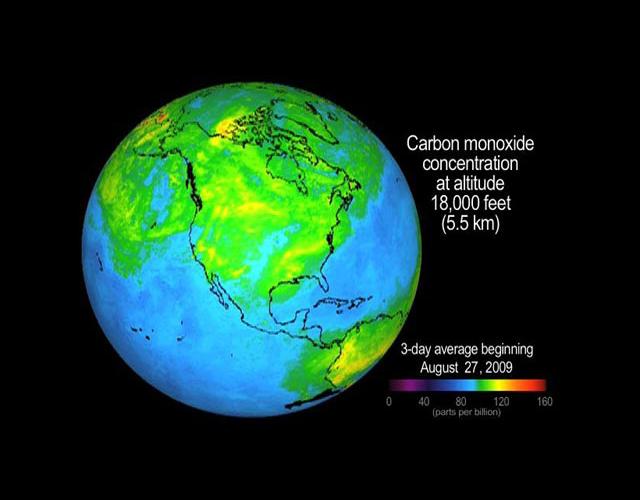
2009-09-04 |
Earth
|
Aqua
|
AIRS
|
640x500x3 |
|
-
PIA12195:
-
Concentration and Transport of Carbon Monoxide from the California Wildfires
Full Resolution:
TIFF
(961.2 kB)
JPEG
(32.29 kB)
|
|
|
2009-09-24 |
Earth
|
Aqua
|
AIRS
|
1000x1000x3 |
|
-
PIA12239:
-
Australia's Red Dawn
Full Resolution:
TIFF
(3.004 MB)
JPEG
(138.4 kB)
|
|
|
2009-11-09 |
Earth
|
Aqua
|
AIRS
|
1460x1179x3 |
|
-
PIA12339:
-
Global Carbon Dioxide Transport from AIRS Data, July 2009
Full Resolution:
TIFF
(5.174 MB)
JPEG
(184.8 kB)
|
|
|
2010-04-15 |
Earth
|
Aqua
|
AIRS
|
900x695x3 |
|
-
PIA13041:
-
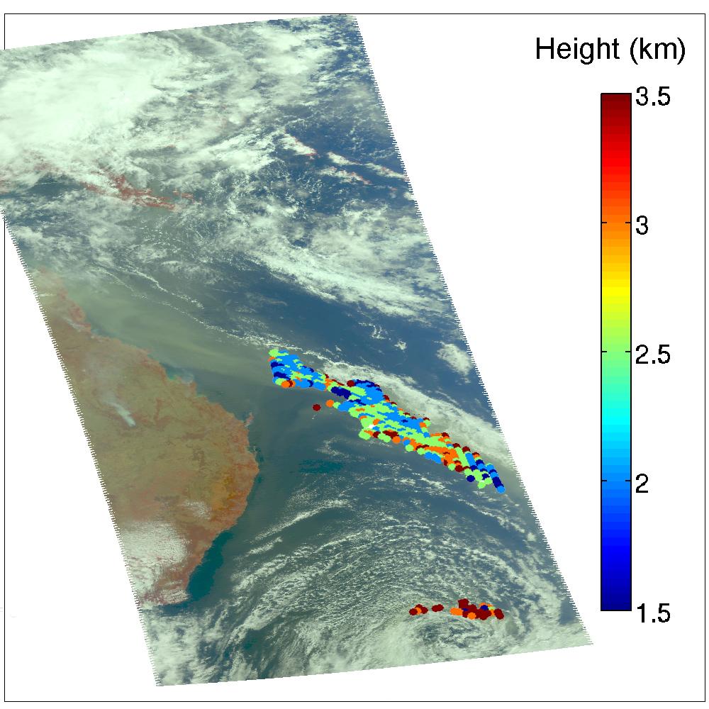
NASA's AIRS Instrument Captures Ash Cloud from Icelandic Volcano
Full Resolution:
TIFF
(1.879 MB)
JPEG
(102.3 kB)
|
|
|
2010-05-17 |
Earth
|
Aqua
|
AIRS
|
2417x1887x3 |
|
-
PIA13142:
-
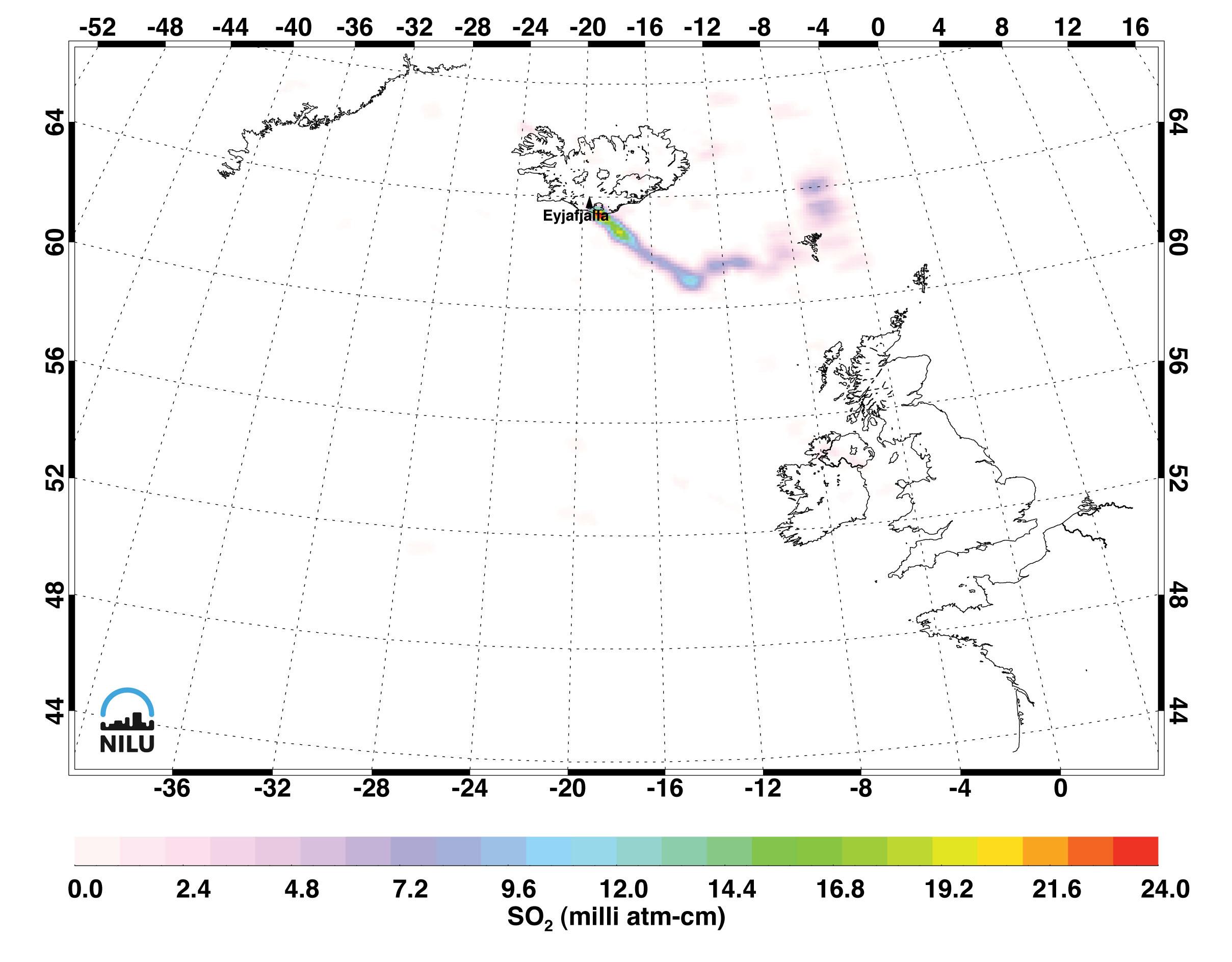
Sulfur Dioxide in Iceland's Eyjafjallajökull Volcanic Cloud as seen by AIRS
Full Resolution:
TIFF
(13.7 MB)
JPEG
(322.9 kB)
|
|
|
2010-08-19 |
Earth
|
Aqua
|
AIRS
|
1200x901x3 |

|
-
PIA13342:
-
NASA's AIRS Detects Extent of Pakistan Flooding
Full Resolution:
TIFF
(1.084 MB)
JPEG
(109.2 kB)
|
|
|
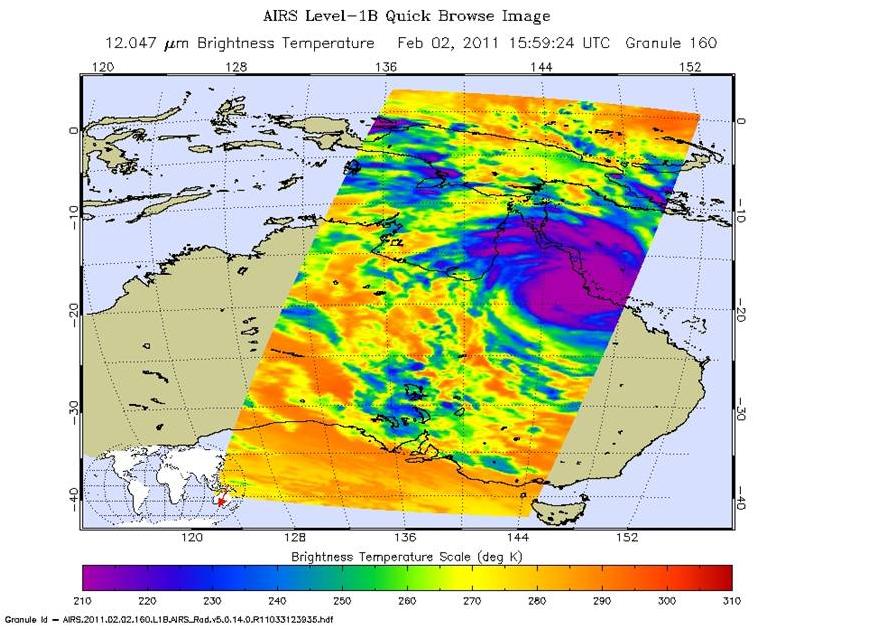
2011-02-03 |
Earth
|
Aqua
|
AIRS
|
882x630x3 |
|
-
PIA13836:
-
Yasi's Fury Rakes Northeastern Australia
Full Resolution:
TIFF
(1.669 MB)
JPEG
(105.4 kB)
|
|
|
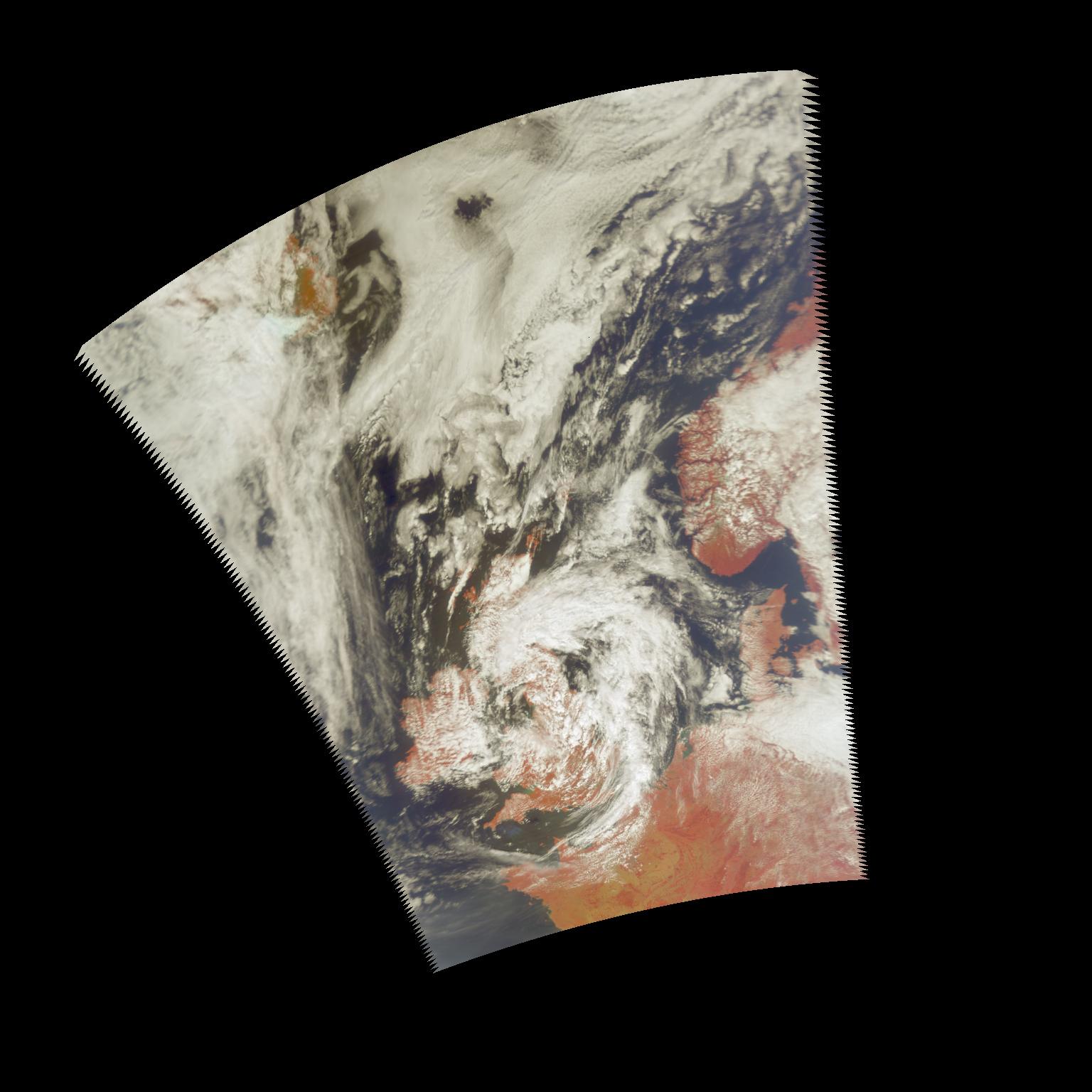
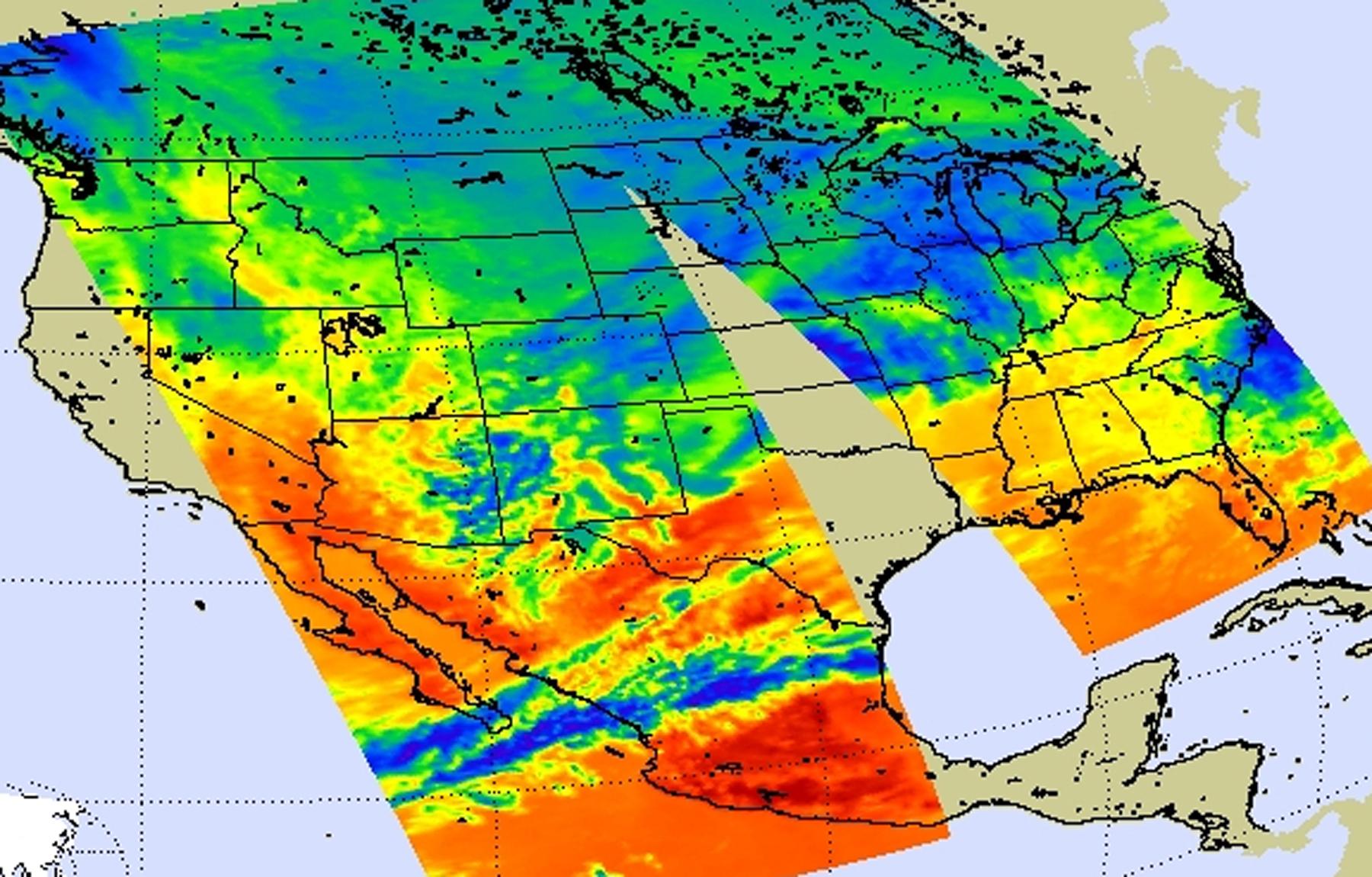
2011-02-02 |
Earth
|
Aqua
|
AIRS
|
1800x1150x3 |
|
-
PIA13831:
-
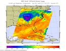
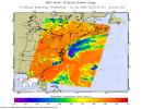
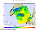
NASA's AIRS Instrument Captures Data on Monster Winter Storm Affecting 30 States
Full Resolution:
TIFF
(6.219 MB)
JPEG
(286.1 kB)
|
|
|
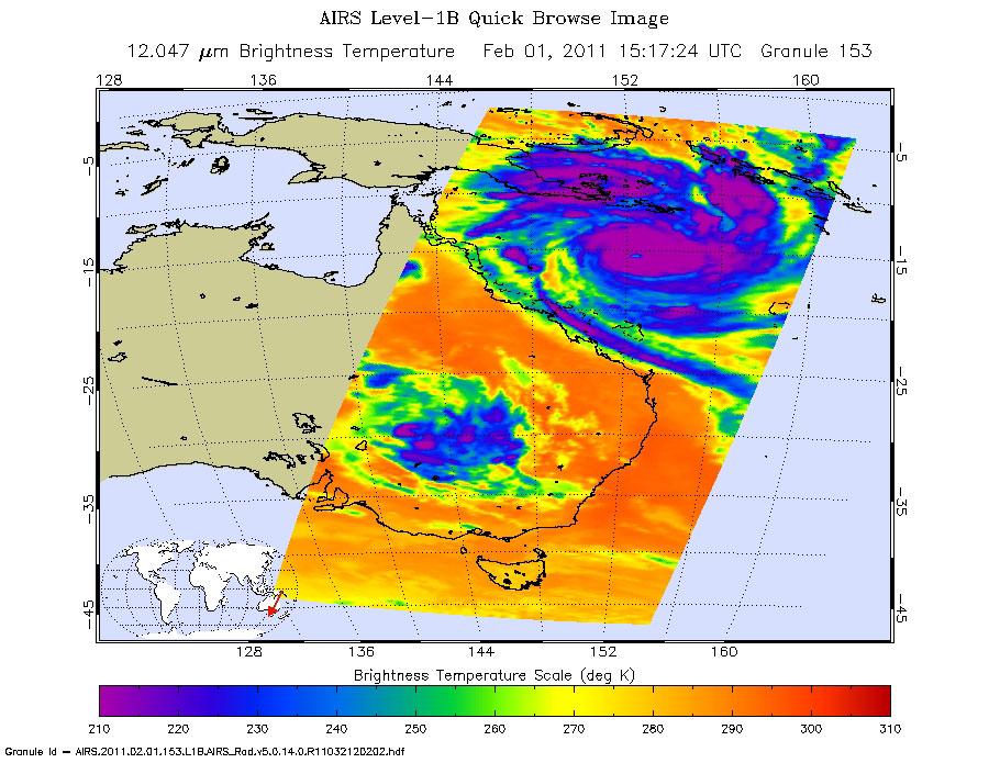
2011-02-02 |
Earth
|
Aqua
|
AIRS
|
900x695x3 |
|
-
PIA13834:
-
Monster Cyclone Yasi Eyes Australia in NASA Image
Full Resolution:
TIFF
(1.879 MB)
JPEG
(128.3 kB)
|
|
|
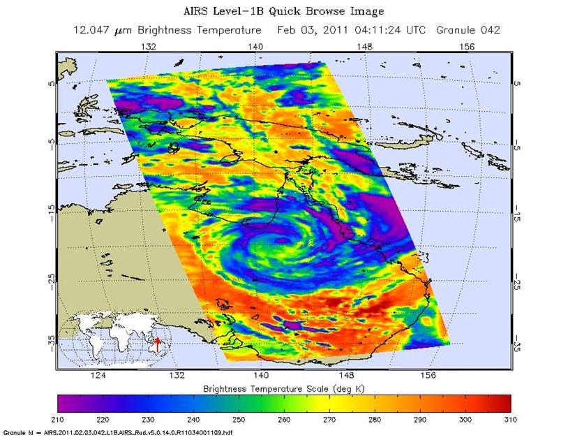
2011-02-04 |
Earth
|
Aqua
|
AIRS
|
814x630x3 |
|
-
PIA13838:
-
Tropical Cyclone Yasi Spins Through Australia's Interior
Full Resolution:
TIFF
(1.54 MB)
JPEG
(103.9 kB)
|
|
|
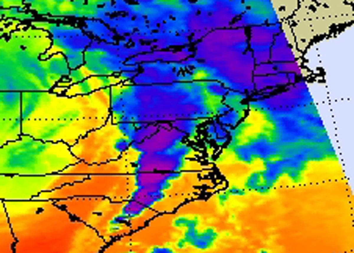
2011-04-18 |
Earth
|
Aqua
|
AIRS
|
1200x860x3 |
|
-
PIA14042:
-
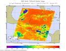
NASA's AIRS Instrument Images April 16, 2011 Severe Storm/Tornado Outbreak
Full Resolution:
TIFF
(3.1 MB)
JPEG
(130.1 kB)
|
|
|
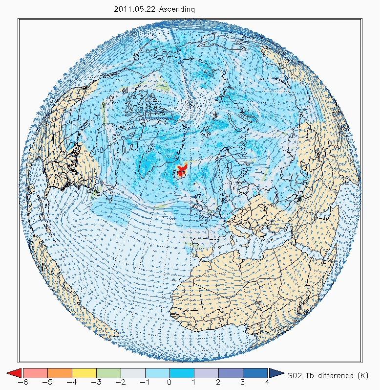
2011-05-28 |
Earth
|
Aqua
|
AIRS
|
780x797x3 |
|
-
PIA14173:
-
NASA's AIRS Sees Sulfur Dioxide Plume from Iceland's Grímsvötn Volcano
Full Resolution:
TIFF
(1.867 MB)
JPEG
(215.3 kB)
|
|
|
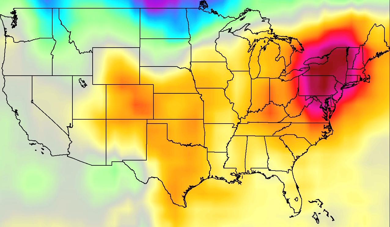
2011-07-26 |
Earth
|
Aqua
|
AIRS
|
1276x744x3 |
|
-
PIA14480:
-
NASA AIRS Movies Show Evolution of U.S. 2011 Heat Wave
Full Resolution:
TIFF
(2.851 MB)
JPEG
(114.3 kB)
|
|
|
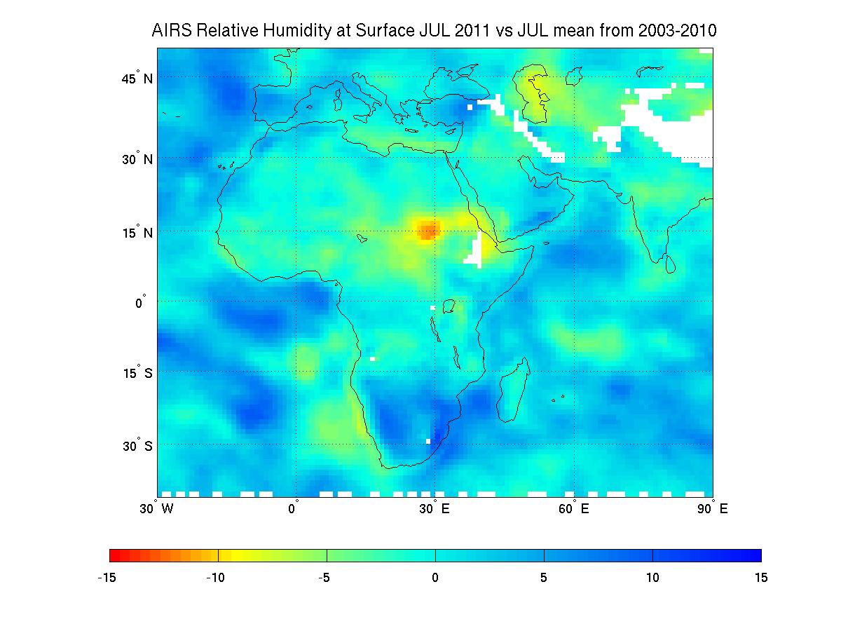
2011-07-28 |
Earth
|
Aqua
|
AIRS
|
1200x900x3 |
|
-
PIA14488:
-
NASA Satellite Tracks Severity of African Drought
Full Resolution:
TIFF
(3.244 MB)
JPEG
(119.7 kB)
|
|
|
2011-07-29 |
Earth
|
Aqua
|
AIRS
|
927x1000x3 |
|
-
PIA14499:
-
NASA Satellite Tracks Texas-Bound Tropical Storm Don
Full Resolution:
TIFF
(2.785 MB)
JPEG
(105.6 kB)
|
|
|
2011-08-02 |
Earth
|
Aqua
|
AIRS
|
1000x1000x3 |
|
-
PIA14515:
-
NASA Image Shows a Slightly Stronger Emily
Full Resolution:
TIFF
(3.004 MB)
JPEG
(135.7 kB)
|
|
|
2011-08-03 |
Earth
|
Aqua
|
AIRS
|
900x695x3 |
|
-
PIA14516:
-
NASA Image Captures Emily's Trek Toward Hispaniola
Full Resolution:
TIFF
(1.879 MB)
JPEG
(116.6 kB)
|
|
|
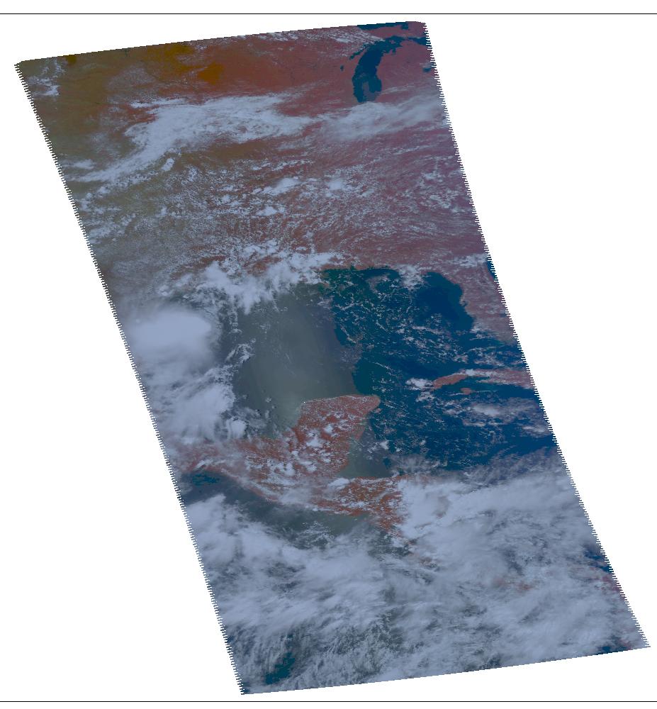
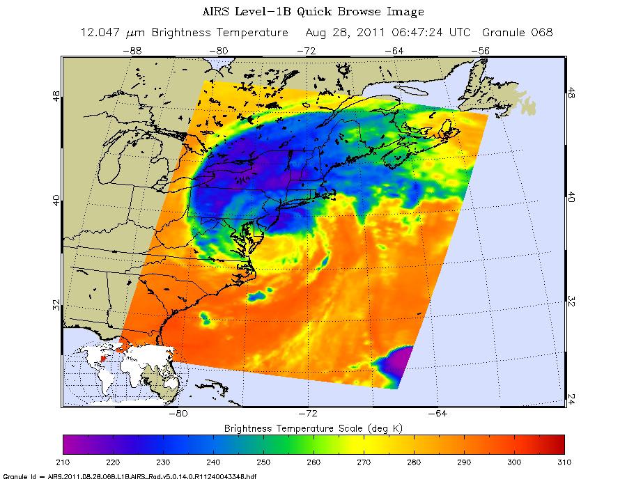
2011-08-28 |
Earth
|
Aqua
|
AIRS
|
900x695x3 |
|
-
PIA14743:
-
NASA Satellite Shows a Mean Irene's Fury
Full Resolution:
TIFF
(1.879 MB)
JPEG
(123.8 kB)
|
 Planetary Data System


