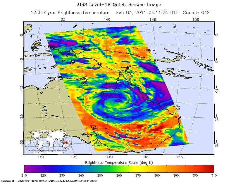
The Atmospheric Infrared Sounder (AIRS) instrument on NASA's Aqua spacecraft captured this infrared image of Tropical Cyclone Yasi at 11:11 p.m. EST Feb. 2, 2011 (04:11 UTC). Yasi has moved further inland and is gradually weakening. At 10 p.m. EST Feb. 2, the storm had maximum sustained winds of 60 knots (111 kilometers per hour, or about 70 miles per hour, equivalent to a strong tropical storm. According to the Joint Typhoon Warning Center, despite crossing Australia's Great Dividing Range, the system has maintained clear organization, as seen in the AIRS image. The AIRS data show that the storm's cloud tops have warmed substantially and there has been a significant decrease in convection. The storm will continue on its course until dissipation deep in the Australian interior.
About AIRS
The Atmospheric Infrared Sounder, AIRS, in conjunction with the Advanced Microwave Sounding Unit, AMSU, senses emitted infrared and microwave radiation from Earth to provide a three-dimensional look at Earth's weather and climate. Working in tandem, the two instruments make simultaneous observations all the way down to Earth's surface, even in the presence of heavy clouds. With more than 2,000 channels sensing different regions of the atmosphere, the system creates a global, three-dimensional map of atmospheric temperature and humidity, cloud amounts and heights, greenhouse gas concentrations, and many other atmospheric phenomena. Launched into Earth orbit in 2002, the AIRS and AMSU instruments fly onboard NASA's Aqua spacecraft and are managed by NASA's Jet Propulsion Laboratory in Pasadena, Calif., under contract to NASA. JPL is a division of the California Institute of Technology in Pasadena.
For more information on AIRS, visit http://airs.jpl.nasa.gov/. For more information on NASA's research of hurricanes/tropical cyclones, visit http://www.nasa.gov/mission_pages/hurricanes/main/index.html.
