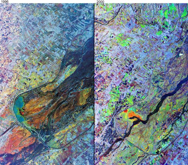
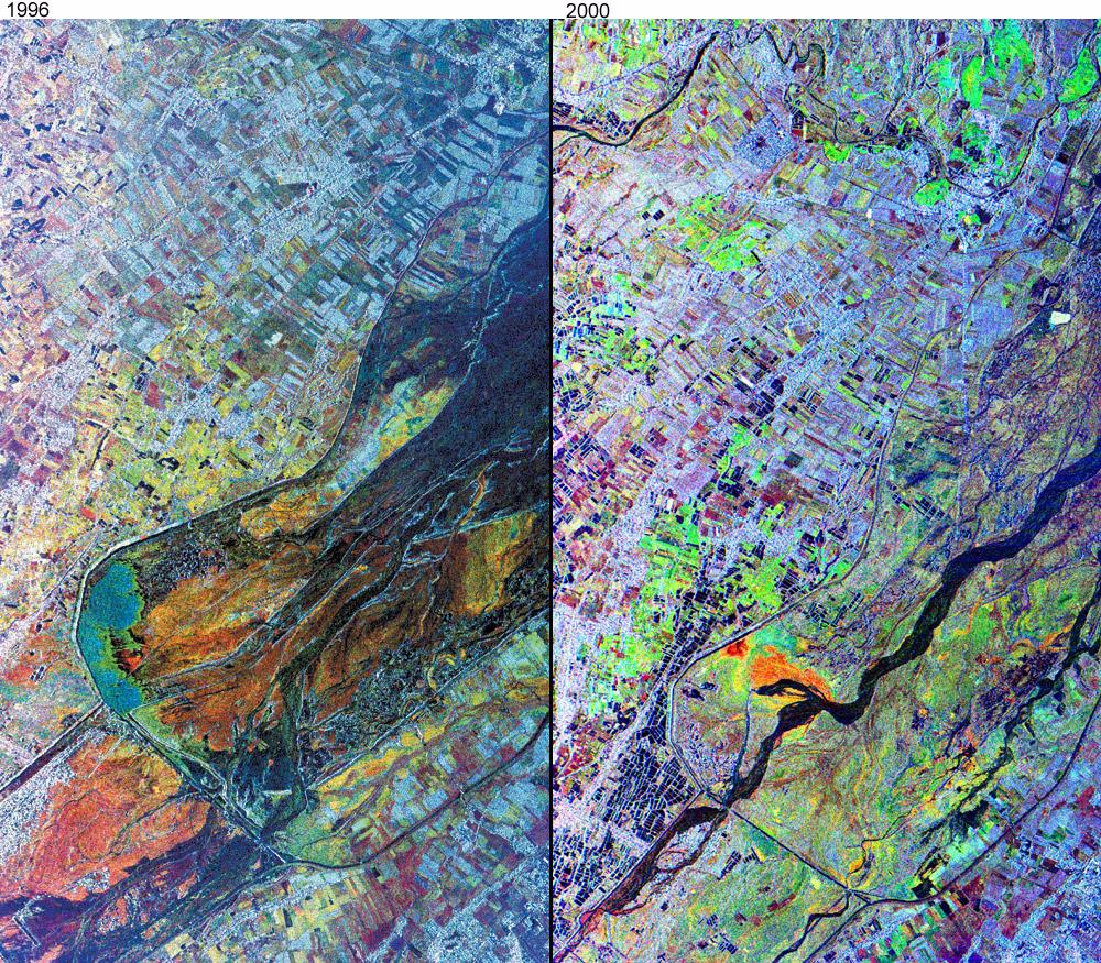
The effects of the June 15, 1991, eruption of Mt. Pinatubo continue to affect the lives of people living near the volcano on the island of Luzon in the Philippines. The eruption produced a large amount of volcanic debris that was deposited on the flanks of the volcano as part of pyroclastic flows. This debris consists of unconsolidated ash and boulders, and following heavy rains, it mixes with the rain run-off to form volcanic mudflows called lahars. Lahars are moving rivers of concrete slurry that are highly erosive. They can sweep down existing river valleys, carving deep canyons where the slopes are steep, or depositing a mixture of fine ash and larger rocks on the gentler slopes. The deposits left from a lahar soon solidify into a material similar to concrete, but while they are moving, lahars are dynamic features, and in a single river valley, the active channel may change locations within a few minutes or hours. These changes represent a significant natural hazard to local communities.
These images from the NASA's airborne imaging radar AIRSAR instrument show two snapshots in the evolution of the lahars in the lower Pasig-Potrero River, just north of the town of Bacalor, east of the summit of the volcano. These images were collected on November 29, 1996 and September 25, 2000. The radar is particularly good at picking out spatial variations in the average particle size of the lahar deposits, which show up as a variety of different colored units at lower right. The active river channel is dark in both images, and is particularly well-defined in the September 2000 image. In the November 1996 image, the area of the flooded channel is much wider, so that the radar images are quite effective at showing where the drier surface materials are located.
Also visible as a series of linear features in both images is a series of concrete dikes that have been constructed to protect the adjacent agricultural land from the lahar deposits. Some of this land has recently been developed as fish ponds, which are visible in the lower left of the 2000 image as a series of small, dark blue rectangles.
Scientists have been using airborne radar data collected by NASA's AIRSAR instrument in their studies of the aftereffects of the Mt. Pinatubo eruption. AIRSAR collected imaging radar data over the volcano during a mission to the Pacific Rim region in late 1996 and on a follow-up mission to the area in late 2000. These data sets, along with remote sensing data collected from satellites, provide valuable information about the dynamic landscape and its hazards.
AIRSAR collects radar interferometry used to produce digital elevation models. By comparing topographic data collected in 1996 and again in 2000, volcanologists can study how the shape and size of the volcano is changing. The detailed topography is also used to determine the highest risk areas for lahars to flow.
AIRSAR flies aboard a NASA DC-8 based at NASA's Dryden Flight Research Center, Edwards, Calif. Built, operated and managed by the Jet Propulsion Laboratory, Pasadena, Calif., AIRSAR is part of NASA's Earth Science Enterprise program. JPL is a division of the California Institute of Technology in Pasadena.
 Planetary Data System


