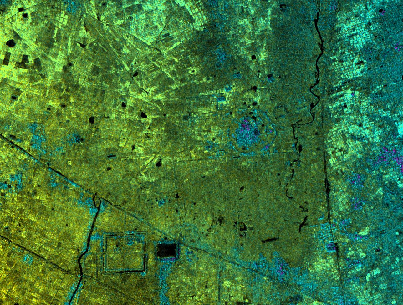
This image of Lovea, Cambodia, was acquired by NASA's Airborne Synthetic Aperture Radar (AIRSAR). Lovea, the roughly circular feature in the middle-right of the image, rises some 5 meters (16.4 feet) above the surrounding terrain. Lovea is larger than many of the other mound sites with a diameter of greater than 300 meters (984.3 feet). However, it is one of a number highlighted by the radar imagery. The present-day village of Lovea does not occupy all of the elevated area. However, at the center of the mound is an ancient spirit post honoring the legendary founder of the village. The mound is surrounded by earthworks and has vestiges of additional curvilinear features. Today, as in the past, these harnessed water during the rainy season, and conserved it during the long dry months of the year.
The village of Lovea located on the mound was established in pre-Khmer times, probably before 500 A.D. In the lower left portion of the image is a large trapeng and square moat. These are good examples of construction during the historical 9th to 14th Century A.D. Khmer period; construction that honored and protected earlier circular villages. This suggests a cultural and technical continuity between prehistoric circular villages and the immense urban site of Angkor. This connection is one of the significant finds generated by NASA's radar imaging of Angkor. It shows that the city of Angkor was a particularly Khmer construction. The temple forms and water management structures of Angkor were the result of pre-existing Khmer beliefs and methods of water management.
Image dimensions are approximately 6.3 by 4.7 kilometers (3.9 by 2.9 miles). North is at top. Image brightness is from the C-band (5.6 centimeters, or 2.2 inches wavelength) radar backscatter, which is a measure of how much energy the surface reflects back toward the radar. Color is used to represent elevation contours. One cycle of color represents 20 meters (65.6 feet) of elevation change; that is, going from blue to red to yellow to green and back to blue again corresponds to 20 meters (65.6 feet) of elevation change.
AIRSAR flies aboard a NASA DC-8 based at NASA's Dryden Flight Research Center, Edwards, Calif. In the TOPSAR mode, AIRSAR collects radar interferometry data from two spatially separated antennas (2.6 meters, or 8.5 feet). Information from the two antennas is used to form radar backscatter imagery and to generate highly accurate elevation data. Built, operated and managed by JPL, AIRSAR is part of NASA's Earth Science Enterprise program. JPL is a division of the California Institute of Technology in Pasadena.
 Planetary Data System


