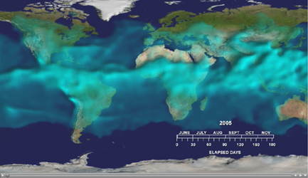
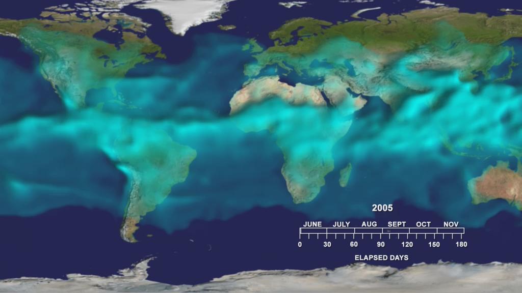
This visualization shows variations in the three dimensional distribution of water vapor in the atmosphere during the summer and fall of 2005. Water vapor at higher altitudes appears brighter.
The visualization highlights an often overlooked but important player in the climate system: water vapor. Water vapor frequently condenses into familiar—and visible—clouds and rain. Water vapor is also the most significant greenhouse gas in the atmosphere, about twice as important as the more familiar carbon dioxide.
This movie shows the variations in the height of a surface representing a constant value of water vapor during the summer and fall of 2005. This water vapor surface is highest in the tropics where vapor amounts are largest. The greatest heights (about 3.2 km or 2 miles) occur over south Asia where monsoon thunderstorms carry water vapor high into the atmosphere. Other thunderstorms over Africa and South America lift water vapor there. In some regions of the tropics—such as off the west coast of South America— the height of the surface is lower. This indicates drier air brought downward to the surface in these regions. The concentration over the northern hemisphere show tendrils of water vapor being pulled from tropical storms into higher latitudes. Some of this water vapor may condense as rain or snow, far from the warm tropics where it originated.
About AIRS
The Atmospheric Infrared Sounder, AIRS, in conjunction with the Advanced Microwave Sounding Unit, AMSU, senses emitted infrared and microwave radiation from Earth to provide a three-dimensional look at Earth's weather and climate. Working in tandem, the two instruments make simultaneous observations all the way down to Earth's surface, even in the presence of heavy clouds. With more than 2,000 channels sensing different regions of the atmosphere, the system creates a global, three-dimensional map of atmospheric temperature and humidity, cloud amounts and heights, greenhouse gas concentrations, and many other atmospheric phenomena. Launched into Earth orbit in 2002, the AIRS and AMSU instruments fly onboard NASA's Aqua spacecraft and are managed by NASA's Jet Propulsion Laboratory in Pasadena, Calif., under contract to NASA. JPL is a division of the California Institute of Technology in Pasadena.
More information about AIRS can be found at http://airs.jpl.nasa.gov.
