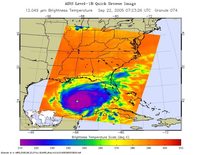
Microwave ImageRita was a category 5 hurricane with sustained winds of 150 mph and a central pressure of 897 millibar at the time the data used to create these AIRS images were retrieved. Storm position is approximately 470 southeast of Galveston, Texas.
The image above shows how the storm looks through an AIRS Infrared window channel. Window channels measure the temperature of the cloud tops or the surface of the Earth in cloud-free regions. The lowest temperatures in dark purple are associated with high, cold cloud tops that make up the top of the hurricane. The infrared signal does not penetrate through clouds, so the purple color indicates the cool cloud tops of the storm.
The infrared image reveals a very well developed eye at the center of the storm. The red at the center of the eye indicates medium altitude clouds are obscuring the eye, and the blue ring delineates the towering thunderstorms of the eye wall ring. In cloud-free areas, the infrared signal is retrieved at the Earth's surface, revealing warmer temperatures except over open water (which appears colder due to lower emissivity). Cooler areas are pushing to purple and warmer areas are pushing to red. Green generally indicates the presence of clouds. Notice that some high cold clouds as indicated in the infrared do not show up much in the microwave. Microwaves are strongly affected by rain and ice crystals, so some high clouds are almost certainly not raining and may be pretty thin (like cirrus).
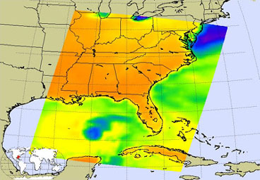
In the microwave image created from the AIRS microwave sensor (see figure 1), the large blue swath that previously extended into the Gulf is gone (refer to AIRS Image Log). The big blue swath was a relatively clear area ahead of Rita that was over the Gulf and the Atlantic. Now Rita has moved closer to land and all the area over the ocean is taken up by the storm. If there is clear air in front, it is over land and thus will show up hot because of the emissivity of the land. Green generally indicates the presence of clouds. The blue areas around the eye are indicative of very high, cold cloud tops crowned by ice. These cloud towers are indicative of strong convection and rain - these are strong high altitude thunderstorms in the eye wall.
About AIRS
The Atmospheric Infrared Sounder, AIRS, in conjunction with the Advanced Microwave Sounding Unit, AMSU, senses emitted infrared and microwave radiation from Earth to provide a three-dimensional look at Earth's weather and climate. Working in tandem, the two instruments make simultaneous observations all the way down to Earth's surface, even in the presence of heavy clouds. With more than 2,000 channels sensing different regions of the atmosphere, the system creates a global, three-dimensional map of atmospheric temperature and humidity, cloud amounts and heights, greenhouse gas concentrations, and many other atmospheric phenomena. Launched into Earth orbit in 2002, the AIRS and AMSU instruments fly onboard NASA's Aqua spacecraft and are managed by NASA's Jet Propulsion Laboratory in Pasadena, Calif., under contract to NASA. JPL is a division of the California Institute of Technology in Pasadena.
More information about AIRS can be found at http://airs.jpl.nasa.gov.
