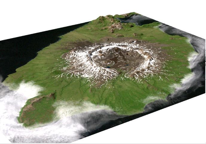
This image is a perspective view of Umnak Island, one of Alaska's Aleutian Islands. The active Okmok volcano appears in the center of the island.
The image was created by draping a Landsat 7 Thematic Mapper image over a digital elevation mosaic derived from Airsar data.
This work was conducted as part of a NASA-funded Alaska Digital Elevation Model Project at the Alaska Synthetic Aperture Radar Facility (ASF) at the University of Alaska Geophysical Institute in Fairbanks, Alaska.
Airsar collected the Alaska data as part of its PacRim 2000 Mission, which took the instrument to French Polynesia, American and Western Samoa, Fiji, New Zealand, Australia, New Guinea, Indonesia, Malaysia, Cambodia, Philippines, Taiwan, South Korea, Japan, Northern Marianas, Guam, Palau, Hawaii and Alaska. Airsar, part of NASA's Airborne Science Program, is managed for NASA's Earth Science Enterprise by JPL. JPL is a division of the California Institute of Technology in Pasadena.