 |  |
| Animation | AIRS False-color Image |
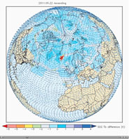
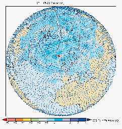
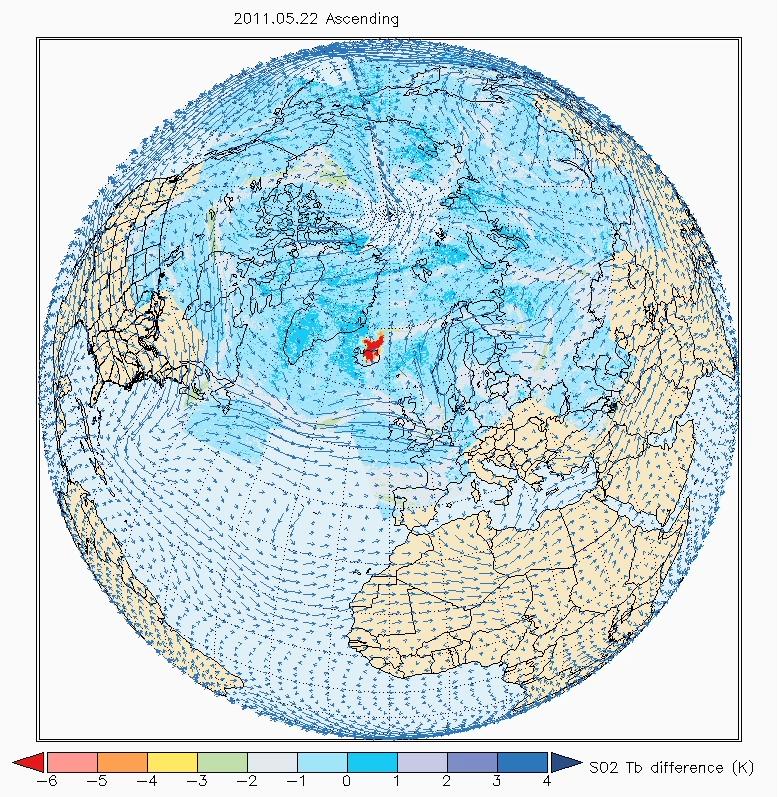
Click on an individual imageOne year after the Eyjaföjallajkull volcano in Iceland erupted, the Grímsvötn volcano under the Vatnajökull ice cap in Iceland erupted on Saturday, May 21, 2011. In this animation, made with data from the Atmospheric Infrared Sounder (AIRS) instrument on NASA's Aqua spacecraft, a large plume of sulfur dioxide can be seen as it is released into the atmosphere. Corrosive sulfur dioxide aerosols in the upper atmosphere can damage aircraft windows, necessitating their costly replacement, even if they do not pose a hazard to aircraft operations at altitude. In the movie, created by Andrey Savtchenko of NASA's Goddard Earth Sciences Data and Information Services Center (GES DISC) from AIRS infrared radiances, the development of the plume (colored red in the animation) spreads over thousands of miles in opposing directions, moved along by the complex polar winds in the upper troposphere. The plume can be seen over the northern regions of Canada and Russia. Five days after the eruption, the plume is still clearly visible over Canada, where it then heads eastward, carried by the polar jet stream. The upper atmospheric winds initially pushed the plume north and then helped to dissipate it. The sulfur dioxide-driven brightness temperature differences used in the animation are made with AIRS near-real time data, whereas the winds are from the GEOS-5 experimental forecast. "Descending" and "ascending" refer to Aqua's orbital node, resulting in Aqua's flying over Iceland in the early morning and the afternoon, correspondingly.
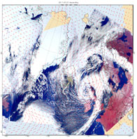
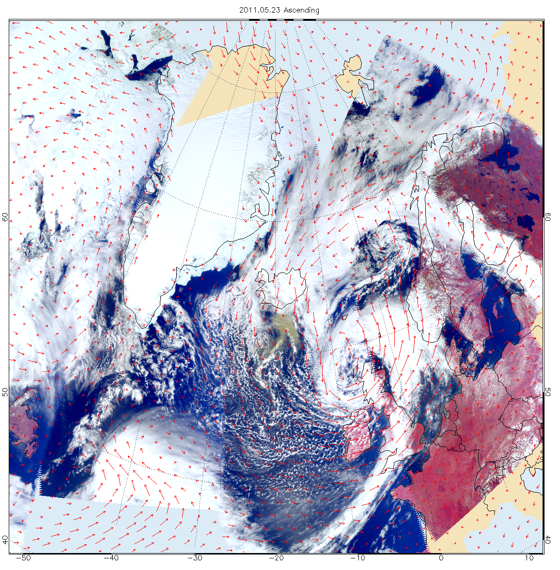
The second image, acquired May 23, 2011, combines a high-resolution false-color image from the AIRS instruments' visible sensor with GEOS-5 winds at 850 millibars. Unlike the sulfur dioxide plume in the upper troposphere, heavier ash particles are seen to be transported by lower-troposphere winds southward from Iceland.
For more information, see http://disc.sci.gsfc.nasa.gov/gesNews/AIRS_and_Grimsvotn_volcano.
About AIRS
The Atmospheric Infrared Sounder, AIRS, in conjunction with the Advanced Microwave Sounding Unit, AMSU, senses emitted infrared and microwave radiation from Earth to provide a three-dimensional look at Earth's weather and climate. Working in tandem, the two instruments make simultaneous observations all the way down to Earth's surface, even in the presence of heavy clouds. With more than 2,000 channels sensing different regions of the atmosphere, the system creates a global, three-dimensional map of atmospheric temperature and humidity, cloud amounts and heights, greenhouse gas concentrations, and many other atmospheric phenomena. Launched into Earth orbit in 2002, the AIRS and AMSU instruments fly onboard NASA's Aqua spacecraft and are managed by NASA's Jet Propulsion Laboratory in Pasadena, Calif., under contract to NASA. JPL is a division of the California Institute of Technology in Pasadena.
More information about AIRS can be found at http://airs.jpl.nasa.gov.