 |  |  |  |
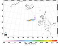
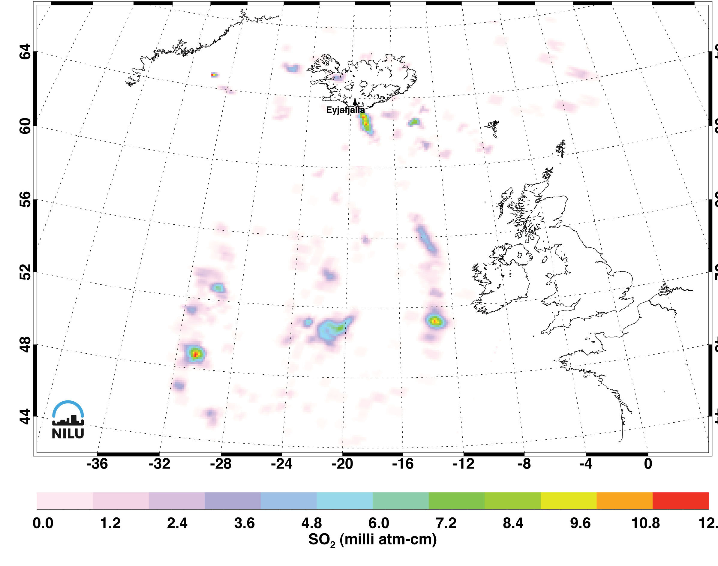
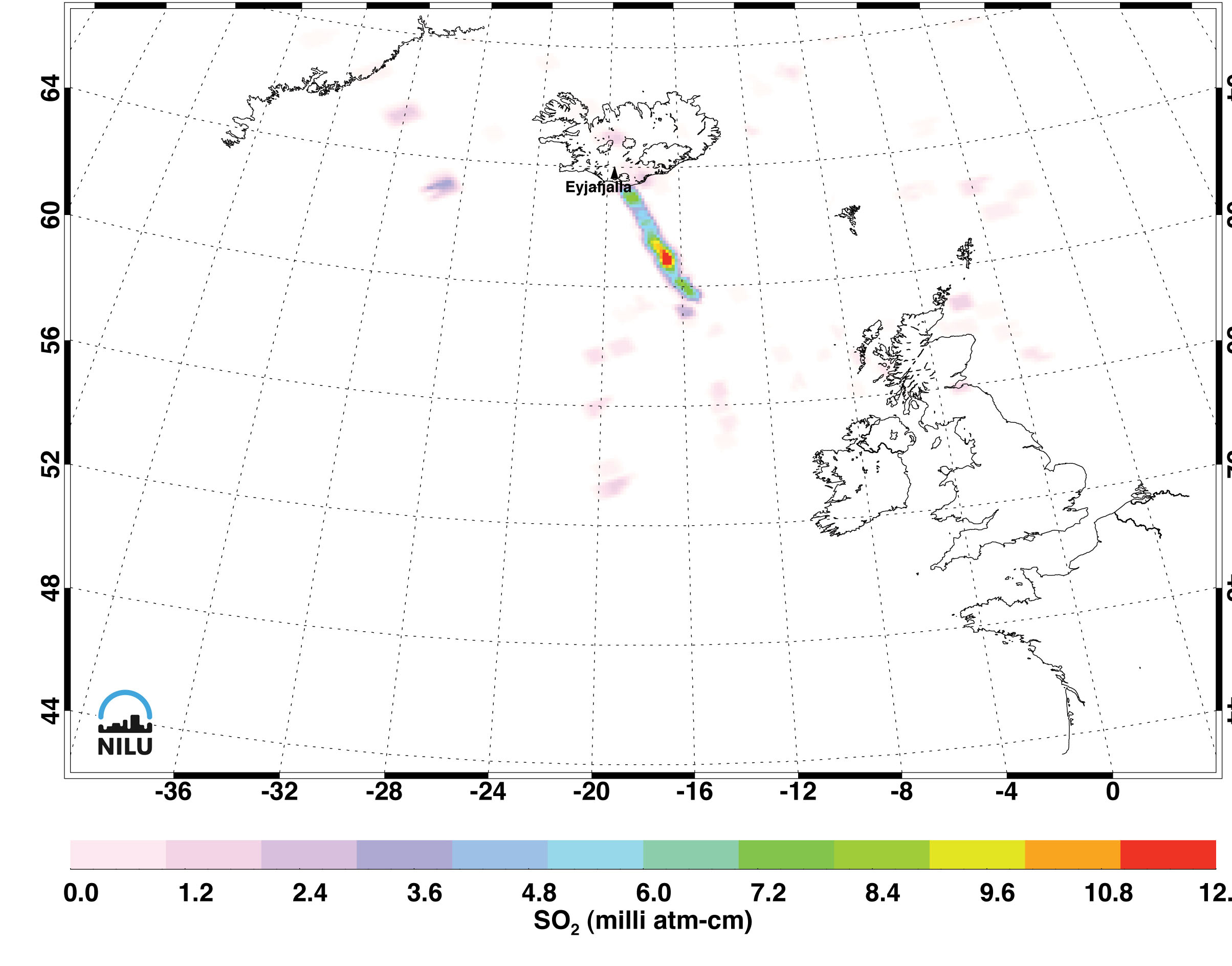
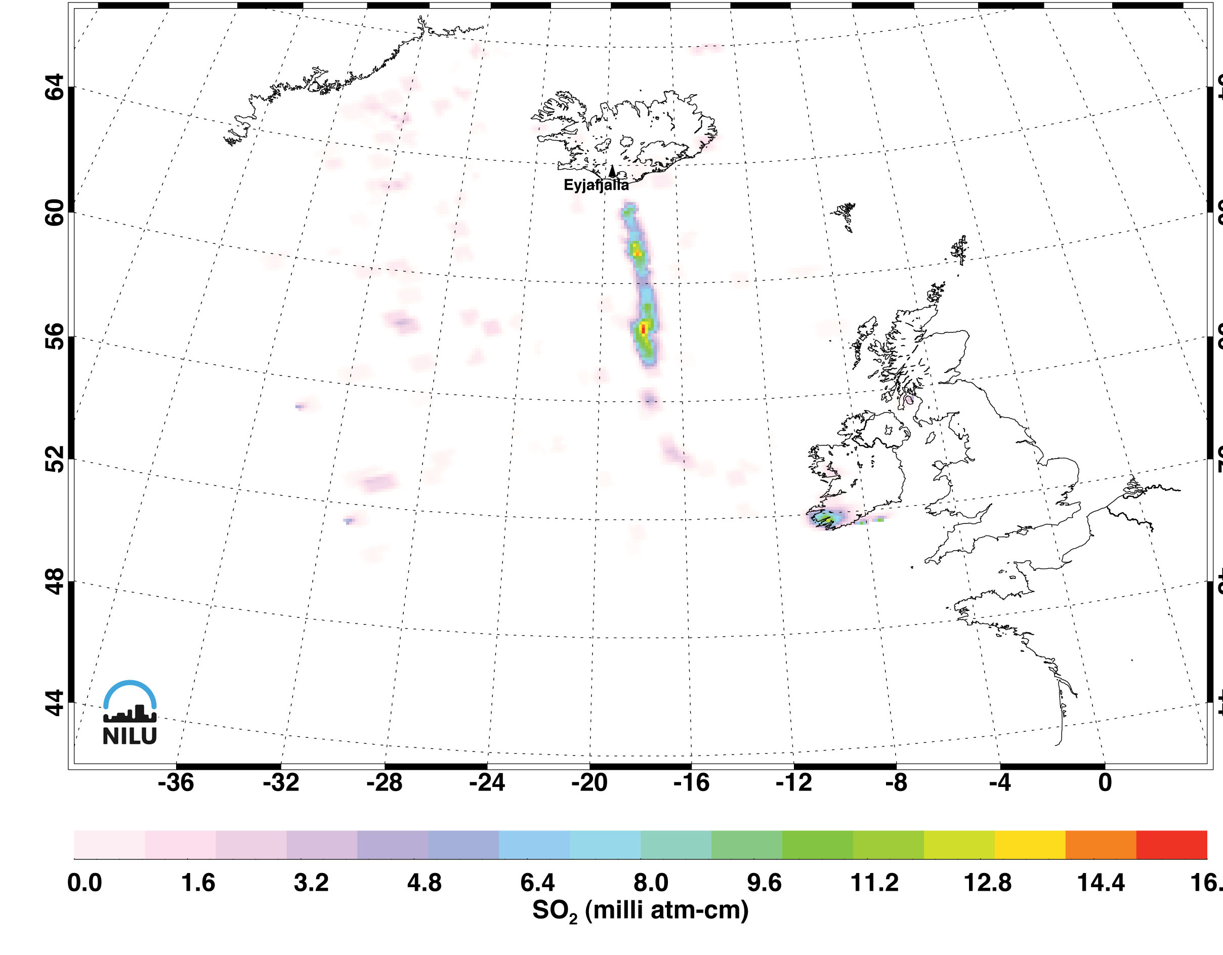
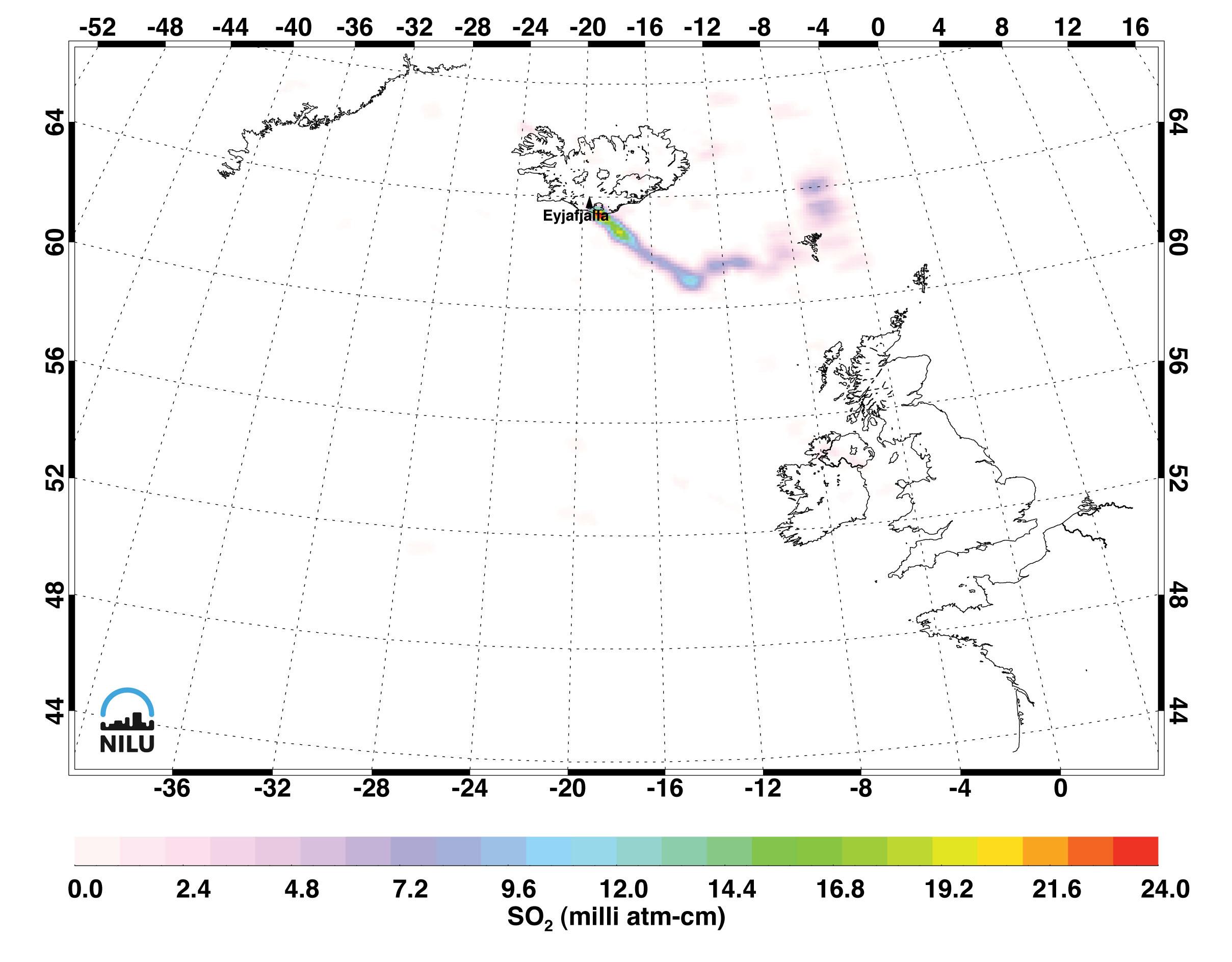
| May 9, 2010 | May 10, 2010
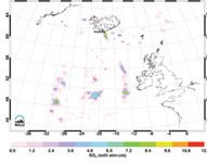
1:30 am local time | May 10, 2010
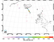
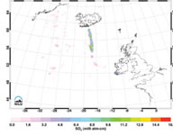
1:30 pm local time | May 11, 2010 |
Click on individual image for larger viewThe eruptions of Iceland's Eyjafjallajökull (pronounced "Aya-fyatla-jo-kutl") volcano in May 2010 sent clouds of ash into the atmosphere, disrupting air travel in Northern Europe and around the world. Images made with data from the Atmospheric Infrared Sounder (AIRS) on NASA's Aqua satellite, show sulfur dioxide released from the volcanic eruption of Eyjafjallajökull. The measurements are of sulfur dioxide partial column abundance in units of milli-atm-cm, or Dobson Units (DU), determined from AIRS spectra that utilizes the strong 1363 cm-1 sulfur dioxide band.
The AIRS retrievals show sulfur dioxide residing in the atmosphere's upper troposphere/lower stratosphere, a region which includes aviation altitudes. Since late April, Eyjafjallajökull has been emitting copious amounts of sulfur dioxide as well as ash. For the period of May 9-11, the AIRS retrievals indicate total masses of 0.01-0.02 Tg (SO2).
Sulfur dioxide burden retrievals and image creation are by Dr. Fred Prata of the Norwegian Institute for Air Research (NILU).
NASA works with other agencies on using satellite observations to aid in the detection and monitoring of aviation hazards caused by volcanic ash. The ingestion of ash particles from such clouds can result in engine failure for aircraft. More information on this NASA program is found on the web page at http://science.larc.nasa.gov/asap/research-ash.html.
About AIRS
The Atmospheric Infrared Sounder, AIRS, in conjunction with the Advanced Microwave Sounding Unit, AMSU, senses emitted infrared and microwave radiation from Earth to provide a three-dimensional look at Earth's weather and climate. Working in tandem, the two instruments make simultaneous observations all the way down to Earth's surface, even in the presence of heavy clouds. With more than 2,000 channels sensing different regions of the atmosphere, the system creates a global, three-dimensional map of atmospheric temperature and humidity, cloud amounts and heights, greenhouse gas concentrations, and many other atmospheric phenomena. Launched into Earth orbit in 2002, the AIRS and AMSU instruments fly onboard NASA's Aqua spacecraft and are managed by NASA's Jet Propulsion Laboratory in Pasadena, Calif., under contract to NASA. JPL is a division of the California Institute of Technology in Pasadena.
More information about AIRS can be found at http://airs.jpl.nasa.gov.

