Your search criteria found 2607 images
Target is Earth (and available satellites)
Go to PIAxxxxx:
Refine this list of images by:
Target:
Mission:
Spacecraft:
Instrument:
Click on an image for detailed information
Click on a column heading to sort in ascending or descending order
My
List
Addition DateSort Ascending Target Mission Instrument Size
Add Image to Favorite List 2013-11-05 Earth Terra
ASTER
3684x3780x3
This image, acquired by NASA's Terra spacecraft, shows the Namib Desert, a coastal desert in southern Africa. This portion in central Namibia consists entirely of linear and longitudinal sand dunes.
PIA17632:
Namib Desert, Namibia
Full Resolution:     TIFF (41.79 MB)     JPEG (2.037 MB)
Add Image to Favorite List 2013-10-26 Earth GRACE
K-Band Ranging System
1297x708x3
This frame from NASA's Grace animation illustrates the highs and lows of combined land water storage (includes snow, soil moisture, and surface water) over the continental United States.
PIA14268:
GRACE Land Water Storage Monthly Changes over the United States, 2003 – Early 2013 Animation Icon
Full Resolution:     TIFF (690.1 kB)     JPEG (464 kB)
Add Image to Favorite List 2013-10-24 Earth Terra
MISR
1013x795x3
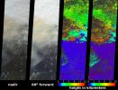
NASA's Terra spacecraft passed over the Blue Mountains to the west and north of Sydney, A mild winter and an extremely hot September in Australia have led to an early start to the fire season.
PIA17577:
MISR Stereo Imagery of Blue Mountain Fires in New South Wales, Australia
Full Resolution:     TIFF (2.417 MB)     JPEG (114.4 kB)
Add Image to Favorite List 2013-10-23 Earth Terra
ASTER
1063x932x3
This image, acquired by NASA's Terra spacecraft, is of the ancient city of Uruk is located in present-day Iraq, on an abandoned channel of the Euphrates River.
PIA17576:
Ancient Uruk, Iraq
Full Resolution:     TIFF (2.973 MB)     JPEG (306.8 kB)
Add Image to Favorite List 2013-10-21 Earth Juno
JunoCam
1406x1420x1
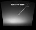
On Oct. 9, NASA's Juno spacecraft flew past Earth, using our home planet's gravity to get the final boost it needed to reach Jupiter. The JunoCam instrument captured this monochrome view of Earth.
PIA17542:
Earth from Juno
Full Resolution:     TIFF (1.999 MB)     JPEG (214.4 kB)
Add Image to Favorite List 2013-10-18 Earth MESSENGER
MDIS - Wide Angle
1024x1024x1
Home
PIA17540:
Home
Full Resolution:     TIFF (1.05 MB)     JPEG (167.9 kB)
Add Image to Favorite List 2013-10-17 Earth Terra
ASTER
1866x1632x3
This image, acquired by NASA's Terra spacecraft, is of Canyonlands National Park, Utah, a showcase of geology in the southwest desert of the United States.
PIA17539:
Canyonlands National Park, Utah
Full Resolution:     TIFF (9.139 MB)     JPEG (910.1 kB)
Add Image to Favorite List 2013-10-09 Earth Juno
8500x4781x3
This trio of NASA's Junocam views of Earth was taken during Juno's close flyby on October 9, 2013.
PIA14447:
Earth Triptych from NASA's Juno Spacecraft
Full Resolution:     TIFF (122 MB)     JPEG (1.705 MB)
Add Image to Favorite List 2013-09-26 Earth Terra
ASTER
1460x1470x3
This image, acquired by NASA's Terra spacecraft, shows Kathmandu, the capital of Nepal, with a population of about 2.5 million inhabitants for the greater metropolitan area.
PIA17513:
Kathmandu, Nepal
Full Resolution:     TIFF (6.441 MB)     JPEG (572.8 kB)
Add Image to Favorite List 2013-09-24 Earth Terra
ASTER
1540x1472x3
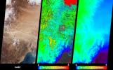
This image, acquired by NASA's Terra spacecraft, shows the epicenter of a magnitude 7.7 earthquake which struck south-central Pakistan on Sept. 24, 2013, in Pakistan's Makran fold belt.
PIA17505:
Region Hit by Large Pakistan Quake as Shown by NASA Spacecraft
Full Resolution:     TIFF (6.803 MB)     JPEG (654.9 kB)
Add Image to Favorite List 2013-09-24 Earth Terra
ASTER
2003x3287x3
This image, acquired by NASA's Terra spacecraft, shows the Cordoba province of northern Argentina, struck by wildfires caused by high temperatures and strong winds.
PIA17504:
NASA Spacecraft Images Destructive Argentine Wildfire
Full Resolution:     TIFF (19.76 MB)     JPEG (1.663 MB)
Add Image to Favorite List 2013-09-12 Earth Terra
ASTER
3906x4518x3
This image, acquired by NASA's Terra spacecraft, shows the Rim Fire in and around Yosemite National Park in California after it was 80 percent contained.
PIA15639:
NASA Spacecraft Captures New Image of Third-Largest Wildfire in California History
Full Resolution:     TIFF (52.96 MB)     JPEG (1.606 MB)
Add Image to Favorite List 2013-09-11 Earth Terra
ASTER
2982x3573x3
In the desert of southern Kuwait, three oil fields spread out across the empty landscape as seen by NASA's Terra spacecraft.
PIA17459:
Kuwait Oil Fields
Full Resolution:     TIFF (31.98 MB)     JPEG (1.46 MB)
Add Image to Favorite List 2013-09-09 Earth OSTM/Jason-2
Altimeter
1100x960x3
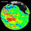
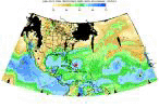
New data from NASA's Jason-2 satellite show near-normal sea surface heights in the equatorial Pacific Ocean persisting for a 16th straight month.
PIA17454:
'La Nada' Climate Pattern Lingers in the Pacific
Full Resolution:     TIFF (3.169 MB)     JPEG (108.7 kB)
Add Image to Favorite List 2013-08-29 Earth Landsat
2180x1453x3
This image acquired by NASA's Landsat 8 satellite shows the Zambezi (also Zambeze), the fourth largest river in Africa, and the largest east-flowing waterway.
PIA18155:
Zambezi River Delta
Full Resolution:     TIFF (9.507 MB)     JPEG (347.9 kB)
Add Image to Favorite List 2013-08-27 Earth Aqua
AIRS
1279x713x3
This frame from a movie was produced with data from NASA's Aqua spacecraft showing the spread of carbon monoxide pollution across North America from fires in the Western U.S., including the Beaver Creek Fire in Idaho and the Rim Fire in California.
PIA17433:
NASA's AIRS Instrument Sees Spread of Pollution from Western Wildfires Animation Icon
Full Resolution:     TIFF (2.737 MB)     JPEG (60.04 kB)
Add Image to Favorite List 2013-08-27 Earth Terra
MISR
1551x1258x3
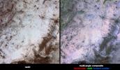
This visible image of California's Rim Fire was acquired Aug. 23, 2013 by the Multi-angle Imaging SpectroRadiometer (MISR) instrument on NASA's Terra spacecraft, showing extensive, brownish smoke.
PIA17429:
NASA's Terra Spacecraft Eyes Smoke Plumes from Massive Rim Fire Near Yosemite
Full Resolution:     TIFF (5.856 MB)     JPEG (320.4 kB)
Add Image to Favorite List 2013-08-27 Earth Terra
MISR
704x968x3
This image from the MISR instrument onboard NASA's Terra spacecraft shows a 121-by-165-mile (194-by-266 kilometer) portion of California's Rim fire where the smoke is the thickest.
PIA17428:
NASA's Terra Spacecraft Measures Height of California Rim Fire Smoke Plumes
Full Resolution:     TIFF (2.045 MB)     JPEG (140.8 kB)
Add Image to Favorite List 2013-08-27 Earth Aqua
AIRS
879x600x3
The plume of carbon monoxide pollution from the Rim Fire burning in and near Yosemite National Park, Calif., shows a three-day running average of daily measurements from NASA's Aqua spacecraft.
PIA17427:
NASA's Aqua Spacecraft Images Pollution from California's Rim Fire
Full Resolution:     TIFF (1.583 MB)     JPEG (101.7 kB)
Add Image to Favorite List 2013-08-23 Earth Terra
ASTER
1026x949x3
This image, acquired by NASA's Terra spacecraft, is of the CERN Large Hadron Collider, the world's largest and highest-energy particle accelerator laying beneath the French-Swiss border northwest of Geneva (yellow circle).
PIA17434:
CERN Collider, France-Switzerland
Full Resolution:     TIFF (2.922 MB)     JPEG (325.5 kB)
Add Image to Favorite List 2013-08-22 Earth CloudSat
Cloud Profiling Radar (CPR)
MODIS
1199x206x3
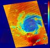
NASA's CloudSat satellite flew over Typhoon Utor in the West Pacific on Aug. 11, 2013 at 0518 UTC, passing within about 6.2 miles (10 kilometers) from the center of the storm, and revealing the structure of the storm's eye and eyewall.
PIA17413:
NASA's CloudSat Eyes Powerful Typhoon Utor
Full Resolution:     TIFF (741.5 kB)     JPEG (52.9 kB)
Add Image to Favorite List 2013-08-16 Earth Terra
ASTER
2523x2922x3
Radially symmetrical, star dunes dominate the Grand Erg Oriental of the Algerian Sahara, as depicted in this image acquired October 27, 2012 acquired by NASA's Terra spacecraft.
PIA17411:
Star Dunes, Algeria
Full Resolution:     TIFF (22.12 MB)     JPEG (1.491 MB)
Add Image to Favorite List 2013-07-22 Earth Cassini-Huygens
ISS - Wide Angle
941x826x3
The cameras on NASA's Cassini spacecraft captured this rare look at Earth and its moon from Saturn orbit on July 19, 2013. The image has been magnified five times.
PIA17170:
One Special Day in the Life of Planet Earth -- Close-Up
Full Resolution:     TIFF (2.333 MB)     JPEG (16.07 kB)
Add Image to Favorite List 2013-07-22 Earth Cassini-Huygens
Imaging Science Subsystem
984x984x3
The cameras on NASA's Cassini spacecraft captured this rare look at Earth and its moon from Saturn orbit on July 19, 2013.
PIA14949:
One Special Day in the Life of Planet Earth
Full Resolution:     TIFF (2.906 MB)     JPEG (16.8 kB)
Add Image to Favorite List 2013-07-22 Earth MESSENGER
MDIS - Wide Angle
1024x1380x3
Looking Back at Us
PIA17388:
Looking Back at Us
Full Resolution:     TIFF (4.241 MB)     JPEG (77.1 kB)
Add Image to Favorite List 2013-07-20 Earth Terra
MISR
752x904x3
NASA's MISR instrument onbard NASA's Terra spacecraft captured a stereo view of Mountain Fire near Idyllwild, Calif. in July, 2013.
PIA17384:
NASA's MISR Instrument Captures Stereo View of Mountain Fire Near Idyllwild, Calif.
Full Resolution:     TIFF (2.04 MB)     JPEG (94.13 kB)
Add Image to Favorite List 2013-07-20 Earth Terra
MISR
904x755x3
NASA's Terra spacecraft passed over the Mountain Fire near Idyllwild, Calif., on Jul. 17, 2013. Los Angeles and the Pacific Ocean can been seen to the left and the Salton Sea is the dark feature in the right center of the image.
PIA17383:
NASA's MISR Instrument Captures View of Mountain Fire Near Idyllwild, Calif.
Full Resolution:     TIFF (2.048 MB)     JPEG (104 kB)
Add Image to Favorite List 2013-07-15 Earth Terra
ASTER
2626x3773x3
This image acquired by NASA's Terra spacecraft shows the Sulaiman fold-thrust belt in northwestern Pakistan, a linear or arcuate belt in which compression has produced a combination of thrust faults and folds.
PIA17391:
Sulaiman Fold Belt, Pakistan
Full Resolution:     TIFF (29.73 MB)     JPEG (1.861 MB)
Add Image to Favorite List 2013-07-09 Earth Terra
ASTER
1578x1716x3
This image from NASA's Terra spacecraft shows the town of Kirkenes in northernmost Norway, with its 3400 inhabitants, as they prepare for an expected boom as a shipping hub, as global warming has led to the opening up of the Northern Sea Route.
PIA17312:
Kirkenes, Norway
Full Resolution:     TIFF (8.127 MB)     JPEG (659.2 kB)
Add Image to Favorite List 2013-07-08 Earth CSIRO Parkes Observatory
Parks Telescope
3220x2225x3
This image shows the Parkes telescope in Australia, part of the Commonwealth Scientific and Industrial Research Organization. Researchers used the telescope to detect the first population of radio bursts known to originate from beyond our galaxy.
PIA17248:
Parkes Telescope
Full Resolution:     TIFF (21.5 MB)     JPEG (882.5 kB)
Add Image to Favorite List 2013-07-08 Earth Terra
ASTER
3558x1900x3
This image, acquired by NASA's Terra satellite on July 6, 2013, shows heavy rains, which began in mid-June, resulting in major flooding along the Parana River in Argentina.
PIA17376:
Flooding Along Parana River
Full Resolution:     TIFF (20.29 MB)     JPEG (1.439 MB)
Add Image to Favorite List 2013-07-02 Earth Terra
MISR
1526x1220x3
NASA's Terra spacecraft passed over the Silver Fire in western New Mexico on June 7, 2013. It has since consumed more than 137,000 acres of timber in a rugged area of the Gila National Forest that has not seen large fires for nearly a century.
PIA17294:
NASA Spacecraft Images New Mexico Wildfire
Full Resolution:     TIFF (5.587 MB)     JPEG (227.9 kB)
Add Image to Favorite List 2013-06-27 Earth Seasat
999x654x3
Seasat, built and managed by NASA's Jet Propulsion Laboratory, was launched thirty-five years ago, on June 27, 1978. It was the first satellite designed for remote sensing of the Earth's oceans using many ground-breaking technologies.
PIA15816:
Seasat Celebrates Landmark in Remote-Sensing History Animation Icon
Full Resolution:     TIFF (1.961 MB)     JPEG (21.08 kB)
Add Image to Favorite List 2013-06-25 Earth Terra
ASTER
1158x2904x3
This image from NASA's Terra spacecraft shows North Stradbroke Island, 30 km southeast of Brisbane, Australia, one of the largest sand islands in the world.
PIA17112:
North Stradbroke Island, Australia
Full Resolution:     TIFF (10.09 MB)     JPEG (421.3 kB)
Add Image to Favorite List 2013-06-21 Earth Terra
ASTER
2616x1746x3
This image, acquired by NASA's Terra spacecraft, is of the Carstens, Calif. wildfire which continues to burn in the foothills west of Yosemite National Park. Vegetation is displayed in green and burned and bare areas are dark to light gray.
PIA17292:
NASA Spacecraft Images Wildfire Near Yosemite National Park
Full Resolution:     TIFF (13.71 MB)     JPEG (958.7 kB)
Add Image to Favorite List 2013-06-14 Earth Terra
MISR
803x432x3
NASA's Terra satellite passed over the Silver Fire in New Mexico June 12, 2013. By combining information from different MISR cameras, scientists have produced a 3D image of the smoke plume associated with the Silver Fire.
PIA17287:
Pyrocumulus Clouds Tower Over Silver Fire in New Mexico
Full Resolution:     TIFF (1.041 MB)     JPEG (27.54 kB)
Add Image to Favorite List 2013-06-13 Earth Aqua
Terra
MODIS
MODIS
1659x1452x3
Rates of basal melt of Antarctic ice shelves (melting of the shelves from underneath) overlaid on a 2009 mosaic of Antarctica created from data from NASA's Terra and Aqua spacecraft.
PIA17284:
Rates of Basal Melt of Antarctic Ice Shelves
Full Resolution:     TIFF (7.23 MB)     JPEG (358.1 kB)
Add Image to Favorite List 2013-06-13 Earth 1984x1488x3
This photo shows the ice front of the ice shelf in front of Pine Island Glacier, a major glacier system of West Antarctica.
PIA17283:
Pine Island Glacier Ice Shelf
Full Resolution:     TIFF (8.86 MB)     JPEG (202.1 kB)
Add Image to Favorite List 2013-06-13 Earth 3264x2448x3
This photo, aken onboard a National Science Foundation/NASA chartered Twin Otter aircraft, shows the ice front of Dibble Ice Shelf, East Antarctica, a significant melt water producer from the Wilkes Land region, East Antarctica.
PIA17282:
Dibble Ice Shelf
Full Resolution:     TIFF (23.98 MB)     JPEG (800.2 kB)
Add Image to Favorite List 2013-06-13 Earth 3264x2448x3
This photo, taken onboard the Chilean Navy P3 aircraft, shows the ice front of Venable Ice Shelf, West Antarctica, in October 2008. It is an example of a small-size ice shelf that is a large melt water producer.
PIA17281:
Ice Front at Venable Ice Shelf
Full Resolution:     TIFF (23.98 MB)     JPEG (803.2 kB)
Add Image to Favorite List 2013-06-13 Earth GRACE
K-Band Ranging System
2168x2430x3
Groundwater storage trends around the United States as measured by the NASA/German Aerospace Center Gravity Recovery and Climate Experiment (GRACE) satellites between 2003 and 2012.
PIA16840:
GRACE Measures Groundwater Changes Across the U.S.
Full Resolution:     TIFF (15.81 MB)     JPEG (518.9 kB)
Add Image to Favorite List 2013-06-07 Earth Earth Observing-1 (EO-1)
Hyperion Hyperspectral Imager
1200x1166x3
NASA's Earth Observing-1 (EO-1) spacecraft observed Copahue volcano, a 2965 meter high volcano on the Chile-Argentina border, on Jun. 4, 2013. Having recently displayed signs of unrest, the volcano is under close scrutiny by local volcanologists.
PIA17234:
NASA's Earth Observing-1 Keeps Watchful Eye on South American Volcano Copahue
Full Resolution:     TIFF (4.199 MB)     JPEG (167.7 kB)
Add Image to Favorite List 2013-06-05 Earth Terra
ASTER
1402x883x3
This image from NASA's Terra spacecraft shows the town of Kourou, which sits at the mouth of the Kourou River, French Guiana.
PIA17099:
Kouru, French Guiana
Full Resolution:     TIFF (3.716 MB)     JPEG (179.8 kB)
Add Image to Favorite List 2013-06-05 Earth Terra
ASTER
922x637x3
The Newcastle-Moore EF-5 tornado ripped through central Oklahoma on May 20, 2013, killing 24 people and leaving behind more than $2 billion in damage. This image was acquired NASA's Terra spacecraft on June 2, 2013.
PIA16488:
NASA Spacecraft Captures Swath of Destruction from Deadly Oklahoma Tornado
Full Resolution:     TIFF (1.763 MB)     JPEG (160.5 kB)
Add Image to Favorite List 2013-05-23 Earth Jason-3
8192x8192x3
Artist's concept of U.S.-European Jason-3 Ocean Altimetry Satellite over the Amazon
PIA14441:
Artist's Concept of U.S.-European Jason-3 Ocean Altimetry Satellite over the Amazon
Full Resolution:     TIFF (201.4 MB)     JPEG (3.898 MB)
Add Image to Favorite List 2013-05-23 Earth Jason-3
8192x8192x3
Artist's concept of U.S.-European Jason-3 Ocean Altimetry Satellite over France.
PIA14440:
Artist's Concept of U.S.-European Jason-3 Ocean Altimetry Satellite over France
Full Resolution:     TIFF (201.4 MB)     JPEG (4.08 MB)
Add Image to Favorite List 2013-05-23 Earth Jason-3
8192x8192x3
Artist's concept of the U.S.-European Jason-3 spacecraft over the California coast. Jason-3 will precisely measure the height of the ocean surface, allowing scientists to monitor ocean circulation and sea level.
PIA14439:
Artist's Concept of U.S.-European Jason-3 Ocean Altimetry Satellite over California
Full Resolution:     TIFF (201.4 MB)     JPEG (4.259 MB)
Add Image to Favorite List 2013-05-22 Earth Aqua
AIRS
1960x1482x3
This map created with data from the AIRS on NASA's Aqua satellite shows the concentration of carbon dioxide in Earth's mid-troposphere, located roughly between 3 to 6 miles (5 to 9 kilometers) in altitude.
PIA14437:
Carbon Dioxide in Earth's Mid-Troposphere, April 2013 Monthly Average
Full Resolution:     TIFF (2.909 MB)     JPEG (260.8 kB)
Add Image to Favorite List 2013-05-22 Earth Aqua
AIRS
2084x1946x3
This plot shows the concentration of carbon dioxide in Earth's mid-troposphere at various latitudes as measured by NASA's Aqua satellite. The colored lines represent different latitude bands that circle Earth, called 'zones'.
PIA14436:
Zonally Averaged Carbon Dioxide Concentration from Earth's Mid-Troposphere at Different Latitudes, 2002 to 2013
Full Resolution:     TIFF (12.17 MB)     JPEG (346.7 kB)
Add Image to Favorite List 2013-05-22 Earth Aqua
AIRS
1976x1900x3
This graph made with data from the AIRS instrument on NASA's Aqua satellite shows the concentration of carbon dioxide in Earth's mid-troposphere, located roughly between 3 to 6 miles (5 to 9 kilometers) in altitude.
PIA14435:
Concentration of Atmospheric Carbon Dioxide from Earth's Mid-Troposphere, 2002 to 2013
Full Resolution:     TIFF (11.27 MB)     JPEG (185.8 kB)
Add Image to Favorite List 2013-05-21 Earth Terra
ASTER
2020x3315x3
Alaska's Pavlof volcano, located along Alaska's Aleutian Peninsula, sent a low-level ash plume north-northeast about 37.3 miles (60 kilometers) on May 19, 2013, when this image was acquired NASA's Terra spacecraft.
PIA16995:
Prolific Alaska Volcano Spews Ash in New Eruption
Full Resolution:     TIFF (20.1 MB)     JPEG (882.9 kB)
Add Image to Favorite List 2013-05-21 Earth Terra
ASTER
1576x1453x3
This image from NASA's Terra spacecraft shows Moscow, the capital city of Russia, the northernmost megacity in the world, the most populous in Europe, and with a population of over 11,000,000, the 6th largest city proper in the world.
PIA16988:
Moscow, Russia
Full Resolution:     TIFF (6.872 MB)     JPEG (859.8 kB)
Add Image to Favorite List 2013-05-13 Earth Aqua
MODIS
1500x1686x3
The quick dry-out of vegetation in Southern California this year is depicted in this pair of images from the Moderate Resolution Imaging Spectroradiometer (MODIS) sensor on NASA's Aqua spacecraft.
PIA17053:
MODIS Satellite See Double Jeopardy for Socal Fire Season
Full Resolution:     TIFF (7.59 MB)     JPEG (220.7 kB)
Add Image to Favorite List 2013-05-13 Earth Aqua
OSCAT
MODIS
OSCAT Scatterometer
1034x1692x3
Extensive and persistent rains between Jan. 24 and Jan. 27, 2013, significantly increased soil moisture and enhanced vegetation growth in Southern California based on data from NASA's Aqua spacecraft and ISRO's Oceansat-2 satellite.
PIA17052:
Satellites See Double Jeopardy for Socal Fire Season
Full Resolution:     TIFF (5.251 MB)     JPEG (212.1 kB)
Add Image to Favorite List 2013-05-02 Earth Airborne Snow Observatory
1648x2546x3
NASA Airborne Snow Observatory measurements of snow water equivalent (top image) and snow albedo, or reflectivity (bottom image) for the Tuolumne River Basin in California's Sierra Nevada on April 21, 2013.
PIA17773:
Snow Water Equivalent for Tuolumne River Basin
Full Resolution:     TIFF (12.59 MB)     JPEG (1.068 MB)
Add Image to Favorite List 2013-05-02 Earth Airborne Snow Observatory
910x1178x3
A natural color image of Mt. Lyell, the highest point in the Tuolumne River Basin (top image) is compared with a three-dimensional color composite image of Mt. Lyell from NASA's Airborne Snow Observatory depicting snow depth (bottom image).
PIA17772:
Snow Depth Depicted on Mt. Lyell by NASA's Airborne Snow Observatory
Full Resolution:     TIFF (3.217 MB)     JPEG (170 kB)
Add Image to Favorite List 2013-05-02 Earth Airborne Snow Observatory
4000x3000x3
Mt. Dana and Dana Plateau in the Tuolumne River Basin within Yosemite National Park, Calif., as seen out the window of a Twin Otter aircraft carrying NASA's Airborne Snow Observatory on April 3, 2013.
PIA17771:
Tuolumne River Basin seen by NASA's Airborne Snow Observatory
Full Resolution:     TIFF (36.01 MB)     JPEG (1.478 MB)
Add Image to Favorite List 2013-05-02 Earth Terra
ASTER
718x2376x3
This image from NASA's Terra spacecraft shows Macquarie Island which lies halfway between New Zealand and Antarctica, and is part of Tasmania.
PIA16980:
Macquarie Island, Australia
Full Resolution:     TIFF (5.12 MB)     JPEG (158.9 kB)
Add Image to Favorite List 2013-04-22 Earth Terra
ASTER
1531x1472x3
This image from NASA's Terra spacecraft highlights the epicenter of a powerful magnitude 6.6 earthquake which struck Sichuan Province in southwest China on April 20, 2013. Vegetation is displayed in red; clouds and snow are in white.
PIA16994:
NASA Spacecraft Shows Location of China Quake
Full Resolution:     TIFF (6.763 MB)     JPEG (518.8 kB)
Add Image to Favorite List 2013-04-16 Earth Terra
ASTER
2832x2982x3
This image of the river-delineated border between western Brazil's Acre province, and northwestern Bolivia's Pando Department, demarcates a remarkable difference in land use and development practices as seen by NASA's Terra spacecraft.
PIA16991:
Brazil-Bolivia Border
Full Resolution:     TIFF (25.35 MB)     JPEG (2.142 MB)
Add Image to Favorite List 2013-04-10 Earth Terra
ASTER
1547x1483x3
On April 9, 2013 at 11:52 GMT, this image acquired by NASA's Terra spacecraft, shows the location of a magnitude 6.3 earthquake hit southwestern Iran's Bushehr province near the town of Kaki.
PIA16946:
NASA Spacecraft Image Shows Location of Iranian Earthquake
Full Resolution:     TIFF (6.885 MB)     JPEG (853.7 kB)
Add Image to Favorite List 2013-04-05 Earth Terra
ASTER
1706x1796x3
NASA's Terra spacecraft captured this view of severe flooding in La Plata, Argentina, on April 4, 2013. Torrential rains and record flash flooding has killed more than 50 and left thousands homeless, according to news reports.
PIA16945:
NASA Spacecraft Eyes Severe Flooding in Argentina
Full Resolution:     TIFF (9.196 MB)     JPEG (583.5 kB)
Add Image to Favorite List 2013-04-04 Earth Terra
ASTER
1015x667x3
NASA's Terra spacecraft captured Kuwait's Failaka Island, located 50 km southeast of the spot where the Tigris and Euphrates Rivers empty into the Persian Gulf.
PIA16944:
Failaka Island, Kuwait
Full Resolution:     TIFF (2.032 MB)     JPEG (58.53 kB)
Add Image to Favorite List 2013-04-03 Earth UAVSAR
L-Band UAVSAR
1079x863x3
This false-color image of Colombia's Galeras Volcano, was acquired by UAVSAR on March 13, 2013. A highly active volcano, Galeras features a breached caldera and an active cone that produces numerous small to moderate explosive eruptions.
PIA16943:
UAVSAR Acquires False-Color Image of Galeras Volcano, Colombia
Full Resolution:     TIFF (2.795 MB)     JPEG (230.9 kB)
Add Image to Favorite List 2013-04-03 Earth UAVSAR
L-Band UAVSAR
2806x1314x3
On March 17, 2013, NASA's Uninhabited Aerial Vehicle Synthetic Aperture Radar (UAVSAR) acquired synthetic aperture radar data over the Napo River in Ecuador and Peru.
PIA16942:
NASA Sends Unmanned Aircraft To Study Volcanoes and Wetlands
Full Resolution:     TIFF (11.07 MB)     JPEG (1.742 MB)
Add Image to Favorite List 2013-03-25 Earth Terra
ASTER
1200x1000x3
NASA's Terra spacecraft shows the Akashi Kaikyo Bridge (or Pearl Bridge), the longest central span of any suspension bridge in the world, at 1991 meters, connecting the city of Kobe, Japan with Iwaja on Awaji Island by crossing the busy Akashi Strait.
PIA16905:
Akashi Kaikyo Bridge, Japan
Full Resolution:     TIFF (3.602 MB)     JPEG (266.1 kB)
Add Image to Favorite List 2013-03-19 Moon GRAIL
2022x2040x3
This is a polar stereographic map of gravity of the north polar region of the moon from the Gravity Recovery and Interior Laboratory (GRAIL) mission. The map displays the region from latitude 60 north to the pole.
PIA16896:
Gravity at the Moon's North Pole
Full Resolution:     TIFF (12.38 MB)     JPEG (1.121 MB)
Add Image to Favorite List 2013-03-15 Earth Terra
ASTER
2931x3045x3
Acquired by NASA's Terra spacecraft, this image shows Hamelin Pool Marine Nature Reserve, located in the Shark Bay World Heritage Site in Western Australia.
PIA16894:
Shark Bay, Australia
Full Resolution:     TIFF (26.79 MB)     JPEG (1.144 MB)
Add Image to Favorite List 2013-02-19 Earth Terra
ASTER
989x691x3
Wasco, California advertises itself as the 'Rose Capital of the World'; over 8000 acres are devoted to cultivation of existing and new varieties of roses, shipped to every state in the U.S. and all over the world.
PIA16855:
Wasco, California
Full Resolution:     TIFF (2.051 MB)     JPEG (118.7 kB)
Add Image to Favorite List 2013-02-16 Earth 1920x1280x3
This image shows the flash above Chelyabinsk, Russia, from the fireball streaking through the sky on Feb. 15, 2013. The small asteroid was approximately 56 to 66 feet in diameter. The picture was taken by a local, M. Ahmetvaleev.
PIA16829:
Fireball Flash over Russia
Full Resolution:     TIFF (7.376 MB)     JPEG (199.8 kB)
Add Image to Favorite List 2013-02-16 Earth 3029x1080x3
This photograph of the meteor streaking through the sky above Chelyabinsk, Russia, on Feb. 15, 2013, was taken by a local, M. Ahmetvaleev. The small asteroid was about 56 to 66 feet (17 to 20 meters) wide.
PIA16828:
Fireball Streaking over Russia
Full Resolution:     TIFF (9.819 MB)     JPEG (382.3 kB)
Add Image to Favorite List 2013-02-15 Earth Terra
ASTER
1911x1800x3
NASA's Terra spacecraft reveals the still-active lava flows in the snowy winter landscape of Plosky Tolbachik volcano, which erupted for the first time in 35 years on Nov. 27, 2012, in Russia's far eastern Kamchatka Peninsula.
PIA16824:
NASA Satellite Captures New Russian Volcanic Eruption
Full Resolution:     TIFF (10.32 MB)     JPEG (442.7 kB)
Add Image to Favorite List 2013-02-08 Earth Terra
ASTER
3414x2546x3
The Bushveld Igneous Complex (BIC) is a large layered igneous intrusion within the earth's crust, exposed at the edge of the Transvaal Basin in South Africa. Numerous mines, tailings piles, and leach ponds are shown in blue.
PIA16788:
Bushveld Igneous Complex, South Africa
Full Resolution:     TIFF (26.09 MB)     JPEG (1.736 MB)
Add Image to Favorite List 2013-02-07 Earth OSTM/Jason-2
Altimeter
1100x880x3
The latest image of sea surface heights in the Pacific Ocean from NASA's Jason-2 satellite shows that the equatorial Pacific Ocean is now in its 10th month of being locked in what some call a neutral, or 'La Nada' state.
PIA16787:
Pacific Locked in 'La Nada' Limbo
Full Resolution:     TIFF (2.905 MB)     JPEG (93.08 kB)
Add Image to Favorite List 2013-02-05 Earth Terra
ASTER
1505x1174x3
This 3-D view was created from data acquired Feb. 4, 2013 by NASA's Terra spacecraft showing a massive wildfire which damaged Australia's largest optical astronomy facility, the Siding Spring Observatory.
PIA16783:
NASA Spacecraft Captures 3-D View of Massive Australian Wildfire
Full Resolution:     TIFF (5.303 MB)     JPEG (356.6 kB)
Add Image to Favorite List 2013-01-30 Earth Terra
ASTER
863x2010x3
NASA's Terra spacecraft flew over Jakarta, the capital and largest city of Indonesia. The population of the Jakarta conurbation is over 28 million, making it perhaps the largest metropolitan area in the world in terms of inhabitants.
PIA16776:
Jakarta, Indonesia
Full Resolution:     TIFF (5.206 MB)     JPEG (393.5 kB)
Add Image to Favorite List 2013-01-29 Earth Terra
ASTER
4284x8520x3
NASA's Terra spacecraft flew over South Africa and Zimbabwe where week-long torrential rains swelled the Limpopo River in Jan. 2013.
PIA16772:
NASA Satellite Images Severe Flooding in Mozambique
Full Resolution:     TIFF (109.6 MB)     JPEG (7.229 MB)
Add Image to Favorite List 2013-01-16 Earth Terra
ASTER
1563x2055x3
Plosky Tolbachik volcano in Russia's far eastern Kamchatka peninsula erupted on Nov. 27, 2012, for the first time in 35 years, sending clouds of ash to the height of more than 9,800 feet (3,000 meters) in this image from NASA's Terra spacecraft.
PIA16741:
NASA's Terra Spacecraft Images Russian Volcanic Eruption
Full Resolution:     TIFF (9.639 MB)     JPEG (455.7 kB)
Add Image to Favorite List 2013-01-12 Earth Terra
ASTER
2877x2736x3
This image, acquired by NASA's Terra spacecraft on Mar. 17, 2012, is of Jebel Uweinat, a mountain range in the area of the Egyptian-Sudanese-Libyan border. It is reportedly one of the driest places on earth.
PIA16679:
Jebel Uweinat
Full Resolution:     TIFF (23.63 MB)     JPEG (909.8 kB)
Add Image to Favorite List 2012-12-13 Moon GRAIL
Lunar Reconnaissance Orbiter (LRO)
1702x998x3
These maps of Earth's moon highlight the region where the twin spacecraft of NASA's Gravity Recovery and Interior Laboratory (GRAIL) mission will impact on Dec. 17, marking the end of its successful endeavor to map the moon's gravity.
PIA16603:
GRAIL's Final Resting Spot
Full Resolution:     TIFF (5.098 MB)     JPEG (409 kB)
Add Image to Favorite List 2012-12-13 Moon GRAIL
Lunar Reconnaissance Orbiter (LRO)
367x268x1
This is the first footage of one orbiting robotic spacecraft taken by another orbiting robotic spacecraft at Earth's moon. 'Flow,' one of two satellites making up NASA's GRAIL mission, captured this video of NASA's LRO as it flew by.
PIA16602:
Spacecraft Observes Another Spacecraft at the Moon Animation Icon
Full Resolution:     TIFF (98.68 kB)     JPEG (9.264 kB)
Add Image to Favorite List 2012-12-13 Moon GRAIL
1230x1242x3
This graphic highlights locations on the moon NASA considers 'lunar heritage sites' and the path NASA's Gravity Recovery and Interior Laboratory spacecraft will take on their final flight.
PIA16494:
Lunar Heritage Sites and GRAIL's Final Mile
Full Resolution:     TIFF (4.585 MB)     JPEG (279 kB)
Add Image to Favorite List 2012-12-13 Moon GRAIL
Lunar Reconnaissance Orbiter (LRO)
1636x671x3
These side-by-side, 3-D comparisons depict the unnamed lunar mountain targeted by the NASA's Gravity Recovery and Interior Laboratory (GRAIL) mission for controlled impact of the Ebb and Flow spacecraft.
PIA16493:
Ebb and Flow's Final Moments
Full Resolution:     TIFF (3.295 MB)     JPEG (114.2 kB)
Add Image to Favorite List 2012-12-13 Moon GRAIL
Lunar Reconnaissance Orbiter (LRO)
1280x720x1
This image shows the final flight path for NASA's twin Gravity Recovery and Interior Laboratory (GRAIL) mission spacecraft, which will impact the moon on Dec. 17, 2012, around 2:28 p.m. PST.
PIA16492:
Last Flight for GRAIL's Twin Spacecraft Animation Icon
Full Resolution:     TIFF (922.8 kB)     JPEG (116.3 kB)
Add Image to Favorite List 2012-12-12 Earth Space Shuttle
SIR-C/X-SAR
2128x1612x1
These two gray-scale images from NASA's Space Shuttle show part of the Nile River, near the Fourth Cataract in Sudan.
PIA16179:
Nile River in Black and White
Full Resolution:     TIFF (3.435 MB)     JPEG (707.9 kB)
Add Image to Favorite List 2012-12-07 Earth Terra
ASTER
1508x1288x3
Acquired by NASA's Terra spacecraft, this image shows Heilongjiang, a province of China located in the northeastern part of the country. Farms are small and long skinny rectangles in shape, surrounding regularly spaced villages.
PIA16596:
Heilongjiang Province, China
Full Resolution:     TIFF (5.829 MB)     JPEG (482.5 kB)
Add Image to Favorite List 2012-12-05 Moon GRAIL
1280x717x3
GRAIL's 'Bouguer' Gravity Moon Map
PIA16623:
GRAIL's 'Bouguer' Gravity Moon Map Animation Icon
Full Resolution:     TIFF (2.754 MB)     JPEG (95.48 kB)
Add Image to Favorite List 2012-12-05 Moon GRAIL
1278x718x3
GRAIL's Gravity Tour of the Moon
PIA16622:
GRAIL's Gravity Tour of the Moon Animation Icon
Full Resolution:     TIFF (2.754 MB)     JPEG (114.8 kB)
Add Image to Favorite List 2012-12-05 Moon GRAIL
1914x1077x3
Map of Moon's Crust
PIA16621:
Map of Moon's Crust Animation Icon
Full Resolution:     TIFF (6.187 MB)     JPEG (173.7 kB)
Add Image to Favorite List 2012-12-05 Moon GRAIL
MoonKAM
364x480x1
Mare Orientale Flyover
PIA16620:
Mare Orientale Flyover Animation Icon
Full Resolution:     TIFF (175.1 kB)     JPEG (35.44 kB)
Add Image to Favorite List 2012-12-05 Moon GRAIL
Lunar Reconnaissance Orbiter (LRO)
1038x658x3
This graphic depicting the bulk density of the lunar highlands on the near and far sides of the moon was generated using gravity data from NASA's GRAIL mission and topography data from NASA's Lunar Reconnaissance Orbiter.
PIA16600:
Mapping Lunar Highlands
Full Resolution:     TIFF (2.05 MB)     JPEG (154.1 kB)
Add Image to Favorite List 2012-12-05 Moon GRAIL
Lunar Reconnaissance Orbiter (LRO)
1475x975x3
This graphic depicting the bulk density of the lunar highlands on the near and far sides of the moon was generated using gravity data from NASA's GRAIL mission and topography data from NASA's Lunar Reconnaissance Orbiter.
PIA16589:
Mapping Lunar Highlands
Full Resolution:     TIFF (4.316 MB)     JPEG (323.3 kB)
Add Image to Favorite List 2012-12-05 Moon GRAIL
1440x919x3
This image depicting the porosity of the lunar highland crust was derived using bulk density data from NASA's GRAIL mission and independent grain density measurements from NASA's Apollo moon mission samples as well as orbital remote-sensing data.
PIA16588:
Closer Look at Lunar Highland Crust
Full Resolution:     TIFF (3.972 MB)     JPEG (312.4 kB)
Add Image to Favorite List 2012-12-05 Moon GRAIL
1600x1200x3
This map shows the gravity field of the moon as measured by NASA's GRAIL mission. The viewing perspective, known as a Mercator projection, shows the far side of the moon in the center and the nearside (as viewed from Earth) at either side.
PIA16587:
GRAIL's Gravity Field of the Moon
Full Resolution:     TIFF (5.762 MB)     JPEG (476 kB)
Add Image to Favorite List 2012-12-05 Moon GRAIL
1529x1038x3
This map shows the gravity field of the moon from the Lunar Prospector mission. The viewing perspective, known as a Mercator projection, shows the far side of the moon in the center and the nearside (as viewed from Earth) at either side.
PIA16586:
Moon Gravity Field Using Prospector Data
Full Resolution:     TIFF (4.763 MB)     JPEG (406.2 kB)
Add Image to Favorite List 2012-12-05 Moon GRAIL
1690x1623x3
This moon map shows the gravity gradients calculated by NASA's GRAIL mission. Red and blue correspond to stronger gravity gradients.
PIA16585:
Lunar Gravity Gradients
Full Resolution:     TIFF (8.232 MB)     JPEG (613.4 kB)
Add Image to Favorite List 2012-12-05 Moon GRAIL
Lunar Reconnaissance Orbiter (LRO)
Lunar Orbiter Laser Altimeter
1690x1623x3
This map of one side of the moon shows the location of some of the giant dikes identified by NASA's GRAIL mission.
PIA16584:
Moon Dike Map
Full Resolution:     TIFF (8.232 MB)     JPEG (590.6 kB)
Add Image to Favorite List 2012-12-05 Moon GRAIL
3051x1614x3
A profile across one of the linear gravity anomalies found by NASA's GRAIL mission shows that it has higher gravity than the surroundings.
PIA16583:
GRAIL Identifies Moon Dikes
Full Resolution:     TIFF (14.78 MB)     JPEG (525.4 kB)
Add Image to Favorite List 2012-12-05 Moon GRAIL
Lunar Reconnaissance Orbiter (LRO)
1065x578x3
A linear gravity anomaly intersecting the Crisium basin on the nearside of the moon has been revealed by NASA's GRAIL mission. The GRAIL gravity gradient data are shown at left, with the location of the anomaly indicated.
PIA16582:
Gravity Anomaly Intersects Moon Basin
Full Resolution:     TIFF (1.848 MB)     JPEG (167.8 kB)
Add Image to Favorite List 2012-12-05 Moon GRAIL
Lunar Reconnaissance Orbiter (LRO)
1065x578x3
A 300-mile-long linear gravity anomaly on the far side of the moon has been revealed by gravity gradients measured by NASA's GRAIL mission. GRAIL data are shown on the left, with red and blue corresponding to stronger gravity gradients.
PIA16581:
GRAIL Spots Gravity Anomaly
Full Resolution:     TIFF (1.848 MB)     JPEG (167 kB)
Retrieve Previous Set  Jump to a Previous Set   Jump to a Previous Set   Jump to a Previous Set   Jump to a Previous Set   Jump to a Previous Set   Jump to a Previous Set   Jump to a Previous Set   Jump to a Previous Set   Current Set   Jump to a Following Set   Retrieve Next Set 
 1-100   101-200   201-300   301-400   401-500   501-600   601-700   701-800   801-900   901-1000 
Currently displaying images: 801 - 900 of 2607