Your search criteria found 2620 images
Target is Earth (and available satellites)
Go to PIAxxxxx:
Refine this list of images by:
Target:
Mission:
Spacecraft:
Instrument:
Click on an image for detailed information
Click on a column heading to sort in ascending or descending order
My
List
Addition DateSort Ascending Target Mission Instrument Size
Add Image to Favorite List 2012-12-05 Moon GRAIL
1278x718x3
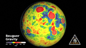
GRAIL's Gravity Tour of the Moon
PIA16622:
GRAIL's Gravity Tour of the Moon Animation Icon
Full Resolution:     TIFF (2.754 MB)     JPEG (114.8 kB)
Add Image to Favorite List 2012-12-05 Moon GRAIL
1914x1077x3
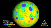
Map of Moon's Crust
PIA16621:
Map of Moon's Crust Animation Icon
Full Resolution:     TIFF (6.187 MB)     JPEG (173.7 kB)
Add Image to Favorite List 2012-12-05 Moon GRAIL
MoonKAM
364x480x1
Mare Orientale Flyover
PIA16620:
Mare Orientale Flyover Animation Icon
Full Resolution:     TIFF (175.1 kB)     JPEG (35.44 kB)
Add Image to Favorite List 2012-12-05 Moon GRAIL
Lunar Reconnaissance Orbiter (LRO)
1038x658x3
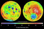
This graphic depicting the bulk density of the lunar highlands on the near and far sides of the moon was generated using gravity data from NASA's GRAIL mission and topography data from NASA's Lunar Reconnaissance Orbiter.
PIA16600:
Mapping Lunar Highlands
Full Resolution:     TIFF (2.05 MB)     JPEG (154.1 kB)
Add Image to Favorite List 2012-12-05 Moon GRAIL
Lunar Reconnaissance Orbiter (LRO)
1475x975x3
This graphic depicting the bulk density of the lunar highlands on the near and far sides of the moon was generated using gravity data from NASA's GRAIL mission and topography data from NASA's Lunar Reconnaissance Orbiter.
PIA16589:
Mapping Lunar Highlands
Full Resolution:     TIFF (4.316 MB)     JPEG (323.3 kB)
Add Image to Favorite List 2012-12-05 Moon GRAIL
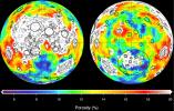
1440x919x3
This image depicting the porosity of the lunar highland crust was derived using bulk density data from NASA's GRAIL mission and independent grain density measurements from NASA's Apollo moon mission samples as well as orbital remote-sensing data.
PIA16588:
Closer Look at Lunar Highland Crust
Full Resolution:     TIFF (3.972 MB)     JPEG (312.4 kB)
Add Image to Favorite List 2012-12-05 Moon GRAIL
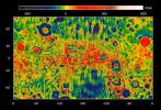
1600x1200x3
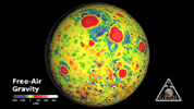
This map shows the gravity field of the moon as measured by NASA's GRAIL mission. The viewing perspective, known as a Mercator projection, shows the far side of the moon in the center and the nearside (as viewed from Earth) at either side.
PIA16587:
GRAIL's Gravity Field of the Moon
Full Resolution:     TIFF (5.762 MB)     JPEG (476 kB)
Add Image to Favorite List 2012-12-05 Moon GRAIL
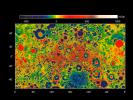
1529x1038x3
This map shows the gravity field of the moon from the Lunar Prospector mission. The viewing perspective, known as a Mercator projection, shows the far side of the moon in the center and the nearside (as viewed from Earth) at either side.
PIA16586:
Moon Gravity Field Using Prospector Data
Full Resolution:     TIFF (4.763 MB)     JPEG (406.2 kB)
Add Image to Favorite List 2012-12-05 Moon GRAIL
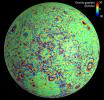
1690x1623x3
This moon map shows the gravity gradients calculated by NASA's GRAIL mission. Red and blue correspond to stronger gravity gradients.
PIA16585:
Lunar Gravity Gradients
Full Resolution:     TIFF (8.232 MB)     JPEG (613.4 kB)
Add Image to Favorite List 2012-12-05 Moon GRAIL
Lunar Reconnaissance Orbiter (LRO)
Lunar Orbiter Laser Altimeter
1690x1623x3
This map of one side of the moon shows the location of some of the giant dikes identified by NASA's GRAIL mission.
PIA16584:
Moon Dike Map
Full Resolution:     TIFF (8.232 MB)     JPEG (590.6 kB)
Add Image to Favorite List 2012-12-05 Moon GRAIL
3051x1614x3
A profile across one of the linear gravity anomalies found by NASA's GRAIL mission shows that it has higher gravity than the surroundings.
PIA16583:
GRAIL Identifies Moon Dikes
Full Resolution:     TIFF (14.78 MB)     JPEG (525.4 kB)
Add Image to Favorite List 2012-12-05 Moon GRAIL
Lunar Reconnaissance Orbiter (LRO)
1065x578x3
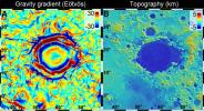
A linear gravity anomaly intersecting the Crisium basin on the nearside of the moon has been revealed by NASA's GRAIL mission. The GRAIL gravity gradient data are shown at left, with the location of the anomaly indicated.
PIA16582:
Gravity Anomaly Intersects Moon Basin
Full Resolution:     TIFF (1.848 MB)     JPEG (167.8 kB)
Add Image to Favorite List 2012-12-05 Moon GRAIL
Lunar Reconnaissance Orbiter (LRO)
1065x578x3
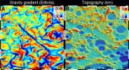
A 300-mile-long linear gravity anomaly on the far side of the moon has been revealed by gravity gradients measured by NASA's GRAIL mission. GRAIL data are shown on the left, with red and blue corresponding to stronger gravity gradients.
PIA16581:
GRAIL Spots Gravity Anomaly
Full Resolution:     TIFF (1.848 MB)     JPEG (167 kB)
Add Image to Favorite List 2012-12-05 Moon GRAIL
4532x1967x3
These maps of the near and far side of the moon show the gravity gradients as measured by NASA's GRAIL mission, highlighting a population of linear gravity anomalies.
PIA16580:
Linear Gravity Anomalies
Full Resolution:     TIFF (26.76 MB)     JPEG (1.128 MB)
Add Image to Favorite List 2012-12-05 Moon GRAIL
1169x492x3
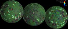
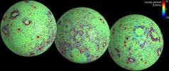
These maps of the near and far side of the moon show gravity gradients as measured by NASA's GRAIL mission. Red and blue areas indicate stronger gradients due to underlying mass anomalies.
PIA16579:
GRAIL's Gravity Gradients
Full Resolution:     TIFF (1.726 MB)     JPEG (173.3 kB)
Add Image to Favorite List 2012-12-05 Moon GRAIL
4532x1967x3
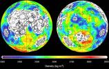
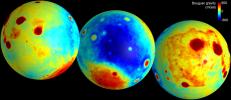
These maps of the moon show the 'Bouguer' gravity anomalies as measured by NASA's GRAIL mission. Red areas have stronger gravity, while blue areas have weaker gravity.
PIA16578:
Gravity of the Moon's Crust
Full Resolution:     TIFF (26.76 MB)     JPEG (504.8 kB)
Add Image to Favorite List 2012-12-03 Earth Terra
ASTER
2343x1862x3
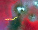
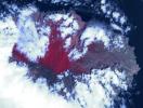
Plosky Tolbachik volcano, in Russia's far eastern Kamchatka peninsula, erupted on Nov. 27, 2012 for the first time in 35 years, sending clouds of ash almost 10,000 feet into the sky. This image was acquired by NASA's Terra spacecraft.
PIA16590:
NASA's Terra Spacecraft Captures Russian Volcano Eruption
Full Resolution:     TIFF (13.09 MB)     JPEG (690.7 kB)
Add Image to Favorite List 2012-11-29 Earth Aqua
AIRS
900x695x3
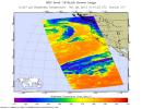
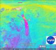
NASA's Aqua spacecraft captured this infrared image of the first of a series of storms approaching the Pacific Northwest at 2141 UTC (1:41 p.m. PST) on Nov. 28, 2012, marking the beginning of an 'atmospheric river' event.
PIA16534:
NASA's Aqua Spacecraft Captures Start of West Coast Atmospheric River Event
Full Resolution:     TIFF (1.877 MB)     JPEG (118 kB)
Add Image to Favorite List 2012-11-26 Earth Terra
ASTER
925x775x3
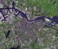
Amsterdam is the largest city and the capital of the Netherlands. Its name derives from a dam in the river Amstel. Founded in the 12th century as a fishing village, Amsterdam was one of the most important ports in the world in the 17th century.
PIA16542:
Amsterdam, Netherlands
Full Resolution:     TIFF (2.152 MB)     JPEG (221.1 kB)
Add Image to Favorite List 2012-11-12 Earth Terra
ASTER
1554x5122x3
This image, acquired by NASA's Terra spacecraft, is of the volcanic Ogasawara Islands. The islands were listed as a UNESCO World Heritage site, in recognition of an outstanding example of ongoing evolutionary processes in oceanic island ecosystems.
PIA15950:
Ogasawara Islands, Japan
Full Resolution:     TIFF (23.89 MB)     JPEG (603.3 kB)
Add Image to Favorite List 2012-10-30 Earth OSCAT
OSCAT Scatterometer
447x337x3
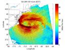
This image shows ocean surface winds for Hurricane Sandy observed by the OSCAT radar scatterometer on the Indian Space Research Organization's (ISRO) OceanSat-2 satellite. Colors indicate wind speed and arrows indicate direction.
PIA16219:
OSCAT Eyes Hurricane Sandy
Full Resolution:     TIFF (452.3 kB)     JPEG (43.27 kB)
Add Image to Favorite List 2012-10-30 Earth CloudSat
Cloud Profiling Radar (CPR)
1201x206x3
NASA's CloudSat spacecraft overpassed Hurricane Sandy on Oct. 29, 2012 just as Sandy was approaching the Atlantic coastline. Sandy contained estimated maximum sustained winds of 90 miles per hour (78 knots).
PIA16201:
CloudSat's View of Hurricane Sandy Animation Icon
Full Resolution:     TIFF (742.7 kB)     JPEG (52.4 kB)
Add Image to Favorite List 2012-10-30 Earth Aqua
AIRS
900x695x3
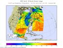
Early Tuesday, Oct. 30, 2012, Hurricane Sandy continued inland, moving to the northwest over Pennsylvania. Swaths of infrared measurements taken over two orbits of NASA's Aqua satellite by the Atmospheric Infrared Sounder are displayed here.
PIA16434:
Hurricane Sandy Moving Northwest
Full Resolution:     TIFF (1.877 MB)     JPEG (135.4 kB)
Add Image to Favorite List 2012-10-29 Earth Terra
MISR
1377x1792x3
NASA's Terra spacecraft captured this imagery and data over Hurricane Sandy as the storm approached the U.S. east coast on Oct. 28, 2012. The image at left covers an area 250 miles (400 kilometers) wide and extends from Massachusetts to Florida.
PIA16435:
NASA's Spacecraft Imagery Shows Hurricane Sandy's Wind Flow
Full Resolution:     TIFF (7.406 MB)     JPEG (286.8 kB)
Add Image to Favorite List 2012-10-29 Earth CloudSat
Cloud Profiling Radar (CPR)
1196x206x3
NASA's CloudSat passed over Sandy at 10:32 a.m. EDT on Oct. 27, 2012. Light to moderate precipitation associated with parts of the outer bands of Hurricane Sandy were moving on shore into parts of North Carolina.
PIA16436:
NASA's CloudSat Views Hurricane Sandy
Full Resolution:     TIFF (739.6 kB)     JPEG (44.93 kB)
Add Image to Favorite List 2012-10-22 Earth Terra
ASTER
800x600x3
Acquired by NASA's Terra spacecraft, this image shows ExxonMobil's Baytown refinery in Texas. With a refining capacity of over 560,000 barrels per day, it is the largest refinery in the United States.
PIA16295:
Baytown Refinery, Texas
Full Resolution:     TIFF (1.441 MB)     JPEG (103.8 kB)
Add Image to Favorite List 2012-10-17 Earth Jason-1 (Topex/Poseidon)
OSTM/Jason-2
Altimeter
1384x858x3
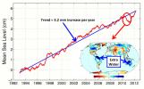
This figure shows changes in global mean sea level as measured by satellite altimetry (NASA/CNES Topex/Poseidon and Jason-1; and NASA/CNES/NOAA/EUMETSAT Jason-2) between 1992 to 2012.
PIA16294:
After Brief Dip, Global Mean Sea Level Resumes Climb
Full Resolution:     TIFF (3.564 MB)     JPEG (143.3 kB)
Add Image to Favorite List 2012-10-05 Earth Terra
ASTER
3015x2742x3
This image, acquired by NASA's Terra spacecraft, is of Brittany, a cultural region in the northwest of France.
PIA15007:
Brittany, France
Full Resolution:     TIFF (24.81 MB)     JPEG (1.091 MB)
Add Image to Favorite List 2012-10-01 Earth Terra
ASTER
InSAR
1024x575x3
This still from an animation shows, in exaggerated terms, how the surface of the southern Central Valley of California deformed from the period 2007 to 2011.
PIA16293:
InSAR Measurements of Subsidence in California's Central Valley (June 2007--December 2010) Animation Icon
Full Resolution:     TIFF (1.767 MB)     JPEG (81.67 kB)
Add Image to Favorite List 2012-09-28 Earth Terra
ASTER
988x1146x3
Baikonur, formerly Leninsk, is a city in Kazakhstan rented and administered by the Russian Federation to service the Baikonur Cosmodrome where Sputnik launched in 1957. This image was acquired by NASA's Terra spacecraft.
PIA16292:
Baikonur Cosmodrome, Kazakhstan
Full Resolution:     TIFF (3.398 MB)     JPEG (329.6 kB)
Add Image to Favorite List 2012-09-28 Earth Terra
ASTER
1447x879x3
This image, acquired by NASA's Terra spacecraft, is of the abandoned town of Centralia, in eastern Pennsylvania's anthracite coal mining country.
PIA16291:
Centralia, Pennsylvania
Full Resolution:     TIFF (3.817 MB)     JPEG (321.8 kB)
Add Image to Favorite List 2012-09-28 Earth Terra
ASTER
1124x1282x3
This image, acquired by NASA's Terra spacecraft, is of Vladivostok, the administrative center of Primorsky Krai, Russia, and home port of the Russian Pacific Fleet, situated at the head of the Golden Horn Bay, Vladivostok.
PIA16290:
Vladivostok, Russia
Full Resolution:     TIFF (4.325 MB)     JPEG (279.3 kB)
Add Image to Favorite List 2012-09-27 Earth 965x720x3
This image shows a dry streambed on an alluvial fan in the Atacama Desert, Chile, revealing the typical patchy, heterogeneous mixture of grain sizes deposited together.
PIA16191:
Dry Streambed on Alluvial Fan in Northern Chile
Full Resolution:     TIFF (2.085 MB)     JPEG (221.9 kB)
Add Image to Favorite List 2012-09-21 Earth Terra
ASTER
2512x3452x3
This image, acquired by NASA's Terra spacecraft, is of the Pole Creek fire southwest of Sisters, Ore., which had grown to 24,000 acres as of Sept. 20, 2012. No structures have been destroyed, and the fire is mostly confined to the national forest.
PIA15884:
NASA Spacecraft Images Oregon Wildfire
Full Resolution:     TIFF (26.02 MB)     JPEG (648 kB)
Add Image to Favorite List 2012-09-13 Earth ADAPT
3456x5184x3
This image was taken during a flight test of JPL's Autonomous Descent and Ascent Powered-Flight Testbed (ADAPT). The testbed was flown aboard a Masten Space System Xombie rocket.-Flight Testbed (ADAPT).
PIA16119:
ADAPT Rocket Test
Full Resolution:     TIFF (53.77 MB)     JPEG (1.477 MB)
Add Image to Favorite List 2012-09-06 Earth Terra
ASTER
2301x1207x3
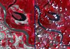
Two satellite images acquired by NASA's Terra spacecraft, obtained about 10 years apart, clearly illustrate the effects of the near-historic drought conditions in southwestern Kansas. Farmers are among the hardest hit.
PIA16102:
NASA Spacecraft Captures Effects of U.S. Drought
Full Resolution:     TIFF (8.335 MB)     JPEG (569 kB)
Add Image to Favorite List 2012-08-30 Earth Aqua
AIRS
1200x1012x3
Strong tropical storm Isaac continues to create havoc across the Gulf Coast, from eastern Texas to Florida. This infrared image from NASA's Aqua spacecraft, was acquired at 2:41 p.m. CDT on Aug. 29, 2012.
PIA16113:
A Slow-moving Isaac Brings Flooding to Gulf States
Full Resolution:     TIFF (3.645 MB)     JPEG (201.4 kB)
Add Image to Favorite List 2012-08-29 Earth Terra
MISR
875x1496x3
NASA's Terra spacecraft recorded low-level wind speeds of up to 75 miles per hour (65 knots) from cloud motion observed outside Tropical Storm Isaac's eye. The spacecraft flew over Isaac a few hours before Isaac was upgraded to a Category 1 hurricane.
PIA16017:
NASA Spacecraft Image Shows Isaac's Inflow and Outflow
Full Resolution:     TIFF (3.929 MB)     JPEG (192.2 kB)
Add Image to Favorite List 2012-08-27 Earth Mars Science Laboratory (MSL)
2896x1944x3
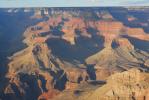
Before NASA's Curiosity rover landed on Mars, the strata exposed in Mount Sharp were compared to those in the Grand Canyon of the western United States, shown here. Scientists are surprised by just how close the similarities are.
PIA16098:
Grand Canyon Similar to Mount Sharp
Full Resolution:     TIFF (16.9 MB)     JPEG (643.9 kB)
Add Image to Favorite List 2012-08-25 Earth Terra
ASTER
2620x1850x3
NASA's Terra spacecraft acquired this image on Aug. 24, 2012, 13 miles (20 kilometers) north of Vicksburg, Miss., as drought continued to afflict the U.S. Midwest, water levels of the Mississippi River approached historic lows.
PIA16097:
NASA Spacecraft Images Drought's Impacts on the Mighty Mississippi
Full Resolution:     TIFF (14.55 MB)     JPEG (829.7 kB)
Add Image to Favorite List 2012-08-20 Earth Terra
ASTER
1588x1206x3
NASA's Terra spacecraft acquired this image, a birdseye view of the Canary Islands wildfire, on Aug. 17, 2012. The main town of San Sebastian can be seen on the eastern shore of the island.
PIA16076:
NASA Spacecraft Gets a Birdseye View of Canary Islands Wildfire
Full Resolution:     TIFF (5.748 MB)     JPEG (251.3 kB)
Add Image to Favorite List 2012-08-15 Earth UAVSAR
L-Band UAVSAR
732x652x3
This false-color, oblique perspective image of the Slumgullion landslide in southwestern Colorado depicting its surface motion was created by data acquired by NASA's UAVSAR between two airplane flights in August 2011.
PIA16059:
NASA's UAVSAR Images Colorado's Slumgullion Landslide
Full Resolution:     TIFF (1.432 MB)     JPEG (78.48 kB)
Add Image to Favorite List 2012-08-02 Earth Terra
ASTER
1086x1002x3
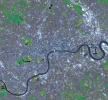
This simulated natural color image of London was acquired May 26, 2012 by NASA's Terra spacecraft. Major construction projects included the new 400-acre Olympic Park for the 2012 Summer Olympic Games.
PIA15897:
NASA Spacecraft Captures a Medal-Worthy Image of London
Full Resolution:     TIFF (3.266 MB)     JPEG (348.1 kB)
Add Image to Favorite List 2012-07-09 Earth Terra
ASTER
2201x3900x3
Acquired by NASA's Terra spacecraft on in 2011, this image shows the Wadi As-Sirhan Basin in northwest Saudi Arabia, which has been steadily developing agricultural fields using center pivot irrigation by tapping into fossil ground water.
PIA15849:
Wadi As-Sirhan, Saudi Arabia
Full Resolution:     TIFF (25.76 MB)     JPEG (1.298 MB)
Add Image to Favorite List 2012-07-09 Earth Terra
ASTER
1536x1507x3
NASA's Terra spacecraft acquired this image of Dawson, Canada. A boom town in 1898, discovery of gold in the Klondike fueled the massive influx of miners, merchants, and other support professions to this town on the Yukon River.
PIA15848:
Dawson, Canada
Full Resolution:     TIFF (6.947 MB)     JPEG (436.2 kB)
Add Image to Favorite List 2012-07-06 Earth Terra
ASTER
1200x1000x3
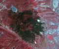
NASA's Terra spacecraft acquired this image of the Waldo Canyon Fire, west of Colorado Springs, Colo., being called the worst fire in Colorado history. Healthy vegetation is red, water is dark blue, streets and buildings are gray, and the burned areas are
PIA15847:
Colorado's Destructive Waldo Canyon Fire
Full Resolution:     TIFF (3.602 MB)     JPEG (261.3 kB)
Add Image to Favorite List 2012-07-03 Earth Terra
MISR
948x962x3
On July 2, 2012, NASA's MISR instrument on NASA's Terra spacecraft passed over the Horse Creek Fire and much larger Ash Creek Fire Complex in southeastern Montana, to the east of Billings, Mont.
PIA15839:
NASA's MISR Views Raging Wildfires in Southeastern Montana
Full Resolution:     TIFF (2.737 MB)     JPEG (129.4 kB)
Add Image to Favorite List 2012-06-29 Earth Aqua
AIRS
MODIS
1920x1070x3
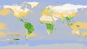
In this frame from an animation, NASA instruments show the seasonal cycle of vegetation and the concentration of carbon dioxide in the atmosphere.
PIA15838:
Effect of Seasonal Vegetation Cycle on Global Atmospheric Carbon Dioxide Animation Icon
Full Resolution:     TIFF (6.166 MB)     JPEG (200.6 kB)
Add Image to Favorite List 2012-06-25 Earth Terra
ASTER
2949x3723x3
Acquired by NASA's Terra spacecraft on June 25, 2012, this image shows the High Park fire west of Fort Collins, Colo. More than 83,000 acres have been burned and approximately 250 homes, the most in Colorado history.
PIA15832:
NASA Spacecraft Images Colorado's Most Destructive Wildfire to Date
Full Resolution:     TIFF (32.95 MB)     JPEG (1.146 MB)
Add Image to Favorite List 2012-06-12 Earth Aquarius
Aquarius
3300x2550x3
NASA's Aquarius instrument on the Aquarius/SAC-D observatory gives an unprecedented look at a key factor involved in the formation of an oceanic wave feature in the tropical Pacific and Atlantic Oceans that influences global climate patterns.
PIA15799:
NASA's Aquarius Maps Ocean Salinity Structure
Full Resolution:     TIFF (8.427 MB)     JPEG (1.08 MB)
Add Image to Favorite List 2012-06-08 Earth LDSD
5704x1697x3
Sled tests will allow NASA's Low-Density Supersonic Decelerator Project, or LDSD, to test inflatable and parachute decelerators to slow spacecraft prior to landing.
PIA15798:
NASA Tests Future Mars Landing Technology
Full Resolution:     TIFF (29.04 MB)     JPEG (641 kB)
Add Image to Favorite List 2012-06-07 Earth Terra
ASTER
678x1334x3
NASA's Terra spacecraft acquired this image on June 2, 2012 of Sheveluch, one of the most active volcanoes on the Kamchatka peninsula, with frequent explosive events that can disrupt air traffic over the northern Pacific.
PIA15792:
NASA Spacecraft Spots Large Eruption of Russian Volcano
Full Resolution:     TIFF (2.716 MB)     JPEG (101.5 kB)
Add Image to Favorite List 2012-05-30 Earth Terra
ASTER
1176x1118x3
NASA's Terra spacecraft acquired this image of Picher, Oklahoma which once boasted 20,000 people in this mining town in northeast Oklahoma. Now, after a 2009 tornado, and a federal cleanup program, the town is a modern-day ghost town.
PIA15821:
Picher, Oklahoma
Full Resolution:     TIFF (3.946 MB)     JPEG (239.4 kB)
Add Image to Favorite List 2012-05-24 Earth Terra
ASTER
1576x960x3
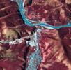
Acquired by NASA's Terra spacecraft, this image shows the Yarlung Zangpo Grand Canyon (or Tsangpo Gorge) in Tibet, the deepest canyon in the world, and longer than the Grand Canyon.
PIA15775:
Yarlung Zangpo Grand Canyon, Tibet
Full Resolution:     TIFF (4.547 MB)     JPEG (387 kB)
Add Image to Favorite List 2012-05-15 Earth Terra
ASTER
1878x1437x3
The Livermore and Spring Ranch fires near the Davis Mountain Resort, Texas, burned 13,000 and 11,000 acres respectively. When NASA's Terra spacecraft acquired this image on May 12, 2012, both fires had been contained.
PIA15657:
NASA Spacecraft Images Texas Wildfire
Full Resolution:     TIFF (8.108 MB)     JPEG (593.1 kB)
Add Image to Favorite List 2012-05-15 Earth Terra
ASTER
1441x1281x3
Acquired by NASA's Terra spacecraft, this image shows the Three Gorges Dam which spans the Yangtze River in east-central China, and is the world's largest power station in terms of installed capacity.
PIA15655:
Three Gorges Dam, China
Full Resolution:     TIFF (5.548 MB)     JPEG (405.4 kB)
Add Image to Favorite List 2012-04-30 Earth Terra
ASTER
4000x2400x3
Acquired by NASA's Terra spacecraft, this image shows the eastern end of the Gulf of Fonseca, in Honduras, originally the site of extensive wetlands ecosystem, dominated by six species of mangroves.
PIA15145:
Gulf of Fonseca, Honduras
Full Resolution:     TIFF (28.8 MB)     JPEG (1.656 MB)
Add Image to Favorite List 2012-04-27 Earth Terra
ASTER
351x827x3
NASA's Terra spacecraft shows Popocatepetl, the nearly 18.000-foot-high volcano about 40 miles southeast of Mexico City, continuing to spew water vapor, gas, ashes and glowing rocks from its latest eruption, which started in mid-April 2012.
PIA15617:
ASTER Tracks Continuing Popocatepetl Eruption
Full Resolution:     TIFF (872 kB)     JPEG (50.42 kB)
Add Image to Favorite List 2012-04-24 Earth Terra
ASTER
5800x2000x3
NASA's Terra spacecraft shows Mexico's active Popocatepetl volcano, located about 40 miles southeast of Mexico City, spewing water vapor, gas, ashes and glowing rocks since its most recent eruption period began in April 2012.
PIA14409:
NASA Spacecraft Images Mexican Volcanic Eruption
Full Resolution:     TIFF (34.8 MB)     JPEG (1.819 MB)
Add Image to Favorite List 2012-04-13 Earth Terra
ASTER
3144x2880x3
Acquired by NASA's Terra spacecraft, this image shows the west coast of Greenland, one of Earth's premiere incubators for icebergs -- large blocks of land ice that break off from glaciers or ice shelves and float in the ocean.
PIA13970:
NASA Spacecraft Images One of Earth's Iceberg Incubators
Full Resolution:     TIFF (27.16 MB)     JPEG (1.458 MB)
Add Image to Favorite List 2012-04-11 Earth Terra
ASTER
1306x1066x3
Acquired by NASA's Terra spacecraft, this image shows a mine in Baiyun Ebo, Inner Mongolia, China, the site of almost half the world's rare earth production. China is responsible for over 95% of global production of rare earth elements.
PIA13969:
Baiyun Ebo, China
Full Resolution:     TIFF (4.181 MB)     JPEG (302.1 kB)
Add Image to Favorite List 2012-04-10 Earth Terra
ASTER
1340x1156x3
This image, acquired by NASA's Terra spacecraft, shows Fiji, hard hit by heavy rains in early 2012, causing flooding and landslides. Hardest hit was the western part of the main Island of Viti Levu, Fiji, and the principal city of Nadi.
PIA15557:
NASA Spacecraft Images Fiji Flooding
Full Resolution:     TIFF (4.652 MB)     JPEG (262.5 kB)
Add Image to Favorite List 2012-04-03 Earth Terra
ASTER
2013x1573x3
This image, acquired by NASA's Terra spacecraft, shows Santo Domingo, the capital of the Dominican Republic, founded in 1496 Christopher Columbus, it is the oldest continuously inhabited European settlement in the Americas.
PIA15532:
Santo Domingo, Dominican Republic
Full Resolution:     TIFF (9.512 MB)     JPEG (909 kB)
Add Image to Favorite List 2012-03-22 Moon GRAIL
MoonKAM
485x714x3
This image of the lunar surface was taken by NASA's MoonKAM system onboard the Ebb spacecraft and shows Crater Poinsot located on the northern part of the moon's far side.
PIA15515:
Far Side of Moon Imaged by MoonKAM
Full Resolution:     TIFF (1.04 MB)     JPEG (59.81 kB)
Add Image to Favorite List 2012-03-22 Moon GRAIL
MoonKAM
486x720x3
This image of the far side of the lunar surface, with Earth in the background, is of crater De Forest and was taken by NASA's MoonKAM system onboard the Ebb spacecraft.
PIA15514:
MoonKAM Looks Homeward
Full Resolution:     TIFF (1.051 MB)     JPEG (59.59 kB)
Add Image to Favorite List 2012-03-19 Moon Lunar Reconnaissance Orbiter (LRO)
Lunar Reconnaissance Orbiter Camera (WAC)
1100x1100x3
LROC Wide Angle Camera (WAC) visible to ultraviolet portrait of Copernicus crater
PIA13964:
Absolute Time
Full Resolution:     TIFF (3.635 MB)     JPEG (203.4 kB)
Add Image to Favorite List 2012-03-16 Earth Terra
ASTER
3873x3930x3
This image from NASA's Terra spacecraft shows Nunavut, in northern Canada, the largest and newest federal territory of the country. The name means 'our land' in Inuktitut.
PIA13963:
Nunavut Territory, Canada
Full Resolution:     TIFF (45.66 MB)     JPEG (2.312 MB)
Add Image to Favorite List 2012-03-09 Earth Terra
ASTER
4038x2362x3
Extremely heavy rains fell at the end of February 2012 in the northern Algerian province of El Tarf, near the Tunisian border. The rainfall total was the greatest recorded in the last 30 years. This image is from NASA's Terra spacecraft.
PIA13962:
NASA Spacecraft Monitors Flooding in Algeria
Full Resolution:     TIFF (28.61 MB)     JPEG (1.458 MB)
Add Image to Favorite List 2012-03-01 Earth GOME-2
1403x762x3
JPL-led study shows bromine explosion on March 13, 2008 across the Alaskan North Slope looking south toward the Brooks Range at the horizon, which blocked the bromine from going further south into the Alaskan interior.
PIA13961:
NASA Finds Sea Ice Driving Arctic Air Pollutants (Alaskan North Slope)
Full Resolution:     TIFF (3.214 MB)     JPEG (138.2 kB)
Add Image to Favorite List 2012-03-01 Earth GOME-2
1403x763x3
JPL-led study shows bromine explosion on March 13, 2008 across the western Northwest Territories in Canada looking toward the Mackenzie Mountains at the horizon, which prevented the bromine from crossing over into Alaska.
PIA13960:
NASA Finds Sea Ice Driving Arctic Air Pollutants (Northwest Territories)
Full Resolution:     TIFF (3.218 MB)     JPEG (131.6 kB)
Add Image to Favorite List 2012-02-22 Earth Terra
MISR
1110x1437x3
This image of clouds over the southern Indian Ocean was acquired on July 23, 2007 was acquired by NASA's polar-orbiting Terra spacecraft.
PIA15399:
NASA Satellite Finds Earth's Clouds are Getting Lower
Full Resolution:     TIFF (4.791 MB)     JPEG (346.2 kB)
Add Image to Favorite List 2012-02-16 Earth 1201x900x3
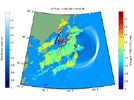
This shows how waves of energy from the Tohoku-Oki earthquake and tsunami of March 11, 2011, pierced through into Earth's upper atmosphere in the vicinity of Japan, disturbing the density of electrons in the ionosphere.
PIA14430:
NASA 'Sees' Tohoku-Oki Earthquake and Tsunami in Earth's Upper Atmosphere Animation Icon
Full Resolution:     TIFF (1.084 MB)     JPEG (136.1 kB)
Add Image to Favorite List 2012-02-08 Earth Terra
MISR
1362x1190x3
Acquired by the Multi-angle Imaging SpectroRadiometer instrument aboard NASA's Terra spacecraft, this image is from the MISR Where on Earth...? Mystery Quiz #27. The location is Jordan.
PIA13957:
Where on Earth...? MISR Mystery Image Quiz #27: Jordan
Full Resolution:     TIFF (4.867 MB)     JPEG (226.9 kB)
Add Image to Favorite List 2012-02-08 Earth Terra
ASTER
1664x1102x3
This image, from NASA's Terra spacecraft, is of the capital of Scotland, and lies along the Firth of Forth.
PIA15367:
Edinburgh, Scotland
Full Resolution:     TIFF (5.51 MB)     JPEG (405.8 kB)
Add Image to Favorite List 2012-02-06 Earth Aura
TES
1021x575x3
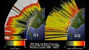
This frame from an animation depicts the distribution of O3 and CO in the atmosphere over North America. This visualization is based on data acquired by NASA's Tropospheric Emission Spectrometer (TES).
PIA15006:
O3 and CO Transects over North America Animation Icon
Full Resolution:     TIFF (1.764 MB)     JPEG (110.1 kB)
Add Image to Favorite List 2012-02-06 Earth Aura
TES
1115x560x3
This frame from a time series, from one year of Tropospheric Emission Spectrometer (TES) measurements, shows how powerful the TES data are for understanding emissions, chemistry, and transport in the troposphere.
PIA15005:
Annual Variation in Global CO and O3 Animation Icon
Full Resolution:     TIFF (1.876 MB)     JPEG (70.63 kB)
Add Image to Favorite List 2012-02-06 Earth 1023x578x3
This frame from an animation depicts the growth of the lava dome at Mount St. Helens during the most recent period of activity. Lidar data courtesy USGS.
PIA15004:
Growth of the Mount St. Helens Lava Dome, September 24-October 14, 2004 Animation Icon
Full Resolution:     TIFF (1.776 MB)     JPEG (73.99 kB)
Add Image to Favorite List 2012-02-06 Earth Shuttle Radar Topography Mission (SRTM)
1024x576x3
This frame from an animation depicts ground subsidence resulting from the extraction of oil. The oil fields are located near the community of Lost Hills, California, approximately 100 km northwest of Bakersfield.
PIA13204:
Lost Hills Subsidence Animation Animation Icon
Full Resolution:     TIFF (1.772 MB)     JPEG (116.7 kB)
Add Image to Favorite List 2012-02-06 Earth 1023x574x3
This frame from an animation, which depicts the growth of the Kamoamoa Flow Field, Kilauea Volcano, Hawaii, was generated from a sequence of ten multispectral images acquired between September 3 and 17, 1995.
PIA13203:
Kamoamoa Flow Field Animation Animation Icon
Full Resolution:     TIFF (1.764 MB)     JPEG (72.41 kB)
Add Image to Favorite List 2012-02-06 Earth European Remote Sensing Satellite Mission (ERS)
Synthetic Aperture Radar (SAR)
1023x576x3
This frame from an animation depicts variations in surface elevation resulting from the discharge and recharge of groundwater basins in Southern California.
PIA13202:
Southern California INSAR Time Series Animation Icon
Full Resolution:     TIFF (1.77 MB)     JPEG (87.02 kB)
Add Image to Favorite List 2012-02-06 Earth European Remote Sensing Satellite Mission (ERS)
Synthetic Aperture Radar (SAR)
1024x576x3
This frame from an animation depicts a time-series of ground deformation at Mount Etna Volcano between 1992 and 2001. The deformation results from changes in the volume of a shallow chamber centered approximately 5 km (3 miles) below sea level.
PIA13201:
Mount Etna InSAR Time Series Animation Animation Icon
Full Resolution:     TIFF (1.772 MB)     JPEG (100.7 kB)
Add Image to Favorite List 2012-02-06 Earth Terra
ASTER
1023x575x3
This frame is from a visualization of the rapid advance of the Esperanza Fire over the San Jacinto Mountains (Riverside County, CA) between 11:00 AM and 7:00 PM on October 26, 2006.
PIA13200:
Esperanza Wildfire Animation Animation Icon
Full Resolution:     TIFF (1.767 MB)     JPEG (141.8 kB)
Add Image to Favorite List 2012-02-02 Earth GRACE
K-Band Ranging System
1058x720x3
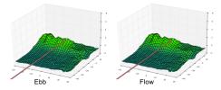
This frame from an animation based on data from NASA's Grace satellite shows dramatic changes in Greenland's ice mass from 2003 through 2011 revealing how much ice has been lost and gained each year.
PIA13955:
Ice Mass Loss on Greenland, 2003-2011 Animation Icon
Full Resolution:     TIFF (2.288 MB)     JPEG (78.67 kB)
Add Image to Favorite List 2012-01-30 Earth Suomi NPP
VIIRS
8000x8000x3
Behold one of the more stunningly detailed images of the Earth yet created. This Blue Marble Earth montage, created from photographs taken by the VIIRS instrument on board the Suomi NPP satellite, shows many stunning details of our home planet.
PIA18033:
Earth
Full Resolution:     TIFF (192.1 MB)     JPEG (7.241 MB)
Add Image to Favorite List 2012-01-23 Earth Terra
ASTER
918x791x3
This image from NASA's Terra spacecraft is of the Debra L. Friedkin archaeological site near Salado, Texas, a multicomponent site, with Clovis remains overlying pre-Clovis stone tools.
PIA15335:
Friedkin Archaeological Site, Texas
Full Resolution:     TIFF (2.182 MB)     JPEG (154.1 kB)
Add Image to Favorite List 2012-01-20 Earth Terra
ASTER
746x620x3
In December, 2011, NASA's Terra spacecraft captured this image of a new volcanic island forming in the Red Sea. This region is part of the Red Sea Rift where the African and Arabian tectonic plates are pulling apart.
PIA13954:
NASA Spacecraft Images Some of Earth's Newest "Real Estate"
Full Resolution:     TIFF (1.389 MB)     JPEG (41.59 kB)
Add Image to Favorite List 2012-01-10 Earth Terra
ASTER
1962x3309x3
This image from NASA's Terra spacecraft is of the Isle of Man (also known as Mann), a self-governing British Crown Dependency in the Irish Sea between Great Britain and Ireland.
PIA15218:
Isle of Man
Full Resolution:     TIFF (19.5 MB)     JPEG (781.7 kB)
Add Image to Favorite List 2011-12-14 Earth Terra
ASTER
1281x1218x3
NASA's Terra spacecraft captured this image of the Laguna del Maule volcanic field which straddles the Andean range crest between Chile and Argentina.
PIA15205:
Maule Volcanic Field, Chile-Argentina
Full Resolution:     TIFF (4.686 MB)     JPEG (364.2 kB)
Add Image to Favorite List 2011-12-07 Earth Aquarius
Aquarius
980x1558x3
Tropical Storm Lee made landfall over New Orleans on Sept. 2-3, 2011, with predicted rainfall of 15 to 20 inches (38 to 51 centimeters) over southern Louisiana. These charts are from NASA's Aquarius spacecraft.
PIA15185:
NASA's Aquarius Detects Possible Effects of Tropical Storm Lee in Gulf
Full Resolution:     TIFF (4.587 MB)     JPEG (186.8 kB)
Add Image to Favorite List 2011-11-30 Earth Terra
ASTER
3801x2382x3
NASA's Terra spacecraft captured this image of the province of Al Jazirah, a region of great fertility which lies in the central Sudan between the White and Blue Niles south of Khartoum.
PIA15131:
Al Jazirah Province, Sudan
Full Resolution:     TIFF (27.16 MB)     JPEG (2.372 MB)
Add Image to Favorite List 2011-11-18 Earth Terra
ASTER
3726x5932x3
The flooding from the Chao Phraya River, Thailand, was draining slowly when this image was acquired on Nov. 17, 2011, by NASA's Terra spacecraft.
PIA13952:
NASA Spacecraft Shows Continued Flooding Woes in Thailand
Full Resolution:     TIFF (66.31 MB)     JPEG (6.327 MB)
Add Image to Favorite List 2011-11-15 Earth Terra
ASTER
2952x3479x3
This image from NASA's Terra spacecraft shows a massive crack across the Pine Island Glacier, a major ice stream that drains the West Antarctic Ice Sheet. Eventually, the crack will extend all the way across the glacier.
PIA15077:
NASA Spacecraft Images Massive Crack in Antarctica's Pine Island Glacier
Full Resolution:     TIFF (30.81 MB)     JPEG (1.266 MB)
Add Image to Favorite List 2011-11-14 Earth Terra
ASTER
1243x1121x3
This image from NASA's Terra spacecraft shows the city of Tequila, Mexico. Its red volcanic soil surrounding Tequila is particularly well suited to the growing of blue agave, and more than 300 million plants are harvested each year.
PIA15073:
Tequila, Mexico
Full Resolution:     TIFF (4.185 MB)     JPEG (192.7 kB)
Add Image to Favorite List 2011-11-10 Earth Terra
ASTER
4032x7962x3
NASA's Terra spacecraft acquired this image of flooding from the Chao Phraya River, Thailand on Nov. 8, 2011. The muddy water that had overflowed the banks of the river, flooding agricultural fields and villages, is seen in dark blue and blue-gray.
PIA15072:
NASA Spacecraft Depicts More Flooding in Thailand
Full Resolution:     TIFF (96.31 MB)     JPEG (4.98 MB)
Add Image to Favorite List 2011-11-02 Earth Terra
MISR
864x812x3
This image was acquired by the Multi-angle Imaging SpectroRadiometer instrument aboard NASA's Terra spacecraft. This image is from the MISR Where on Earth...? Mystery Quiz #26.
PIA15016:
Where on Earth...? MISR Mystery Image Quiz #26: Costa Rica
Full Resolution:     TIFF (2.107 MB)     JPEG (164.7 kB)
Add Image to Favorite List 2011-11-02 Earth Terra
ASTER
2461x2376x3
Flooding from the Chao Phraya River, Thailand, had begun to ebb in this image acquired by NASA's Terra spacecraft on Nov. 1, 2011. Here, in blue-gray is the muddy water that had overflowed the banks of the river, flooding agricultural fields and villages.
PIA15018:
NASA Satellite Continues to Monitor Thailand Floods
Full Resolution:     TIFF (17.56 MB)     JPEG (1.603 MB)
Add Image to Favorite List 2011-11-02 Earth Terra
ASTER
3024x3800x3
In July 2011, volcanic tremors began on the Island of El Hierro in the Canary Islands; by September, many tourists evacuated the resort island, fearing a volcanic eruption. This image is from NASA's Terra spacecraft.
PIA15017:
NASA Satellite Tracks Underwater Volcanic Eruption in Canary Islands
Full Resolution:     TIFF (34.47 MB)     JPEG (1.318 MB)
Add Image to Favorite List 2011-11-01 Earth Terra
ASTER
3900x3308x3
This image from NASA's Terra spacecraft shows Northern Namibia, known for its widespread bare and sinuous parallel dunes, most of them red.
PIA15015:
Sand Dunes, Namibia
Full Resolution:     TIFF (38.7 MB)     JPEG (2.612 MB)
Add Image to Favorite List 2011-10-29 Earth Terra
MISR
1611x2361x3
NASA's Terra satellite presents this 'false color' view of portions of Wisconsin and Michigan, including Devil's Lake, Druid Lake, Ghost Lake, Spider Lake, and Witches Lake in Wisconsin; and Bat Lake, Corpse Pond and Witch Lake in Michigan.
PIA15009:
NASA Satellite Scares Up An Eerie Image of Haunted Lakes and Ghost Ships
Full Resolution:     TIFF (11.43 MB)     JPEG (679.4 kB)
Add Image to Favorite List 2011-10-28 Earth Terra
ASTER
2589x3870x3
On Oct. 25, 2011, the Chao Phraya River was in flood stage as NASA's Terra spacecraft imaged flooded agricultural fields and villages depicted here in dark blue, and the sediment-laden water in shades of tan.
PIA15008:
NASA Spacecraft Images Continued Thailand Flooding
Full Resolution:     TIFF (30.09 MB)     JPEG (2.393 MB)
Retrieve Previous Set  Jump to a Previous Set   Jump to a Previous Set   Jump to a Previous Set   Jump to a Previous Set   Jump to a Previous Set   Jump to a Previous Set   Jump to a Previous Set   Jump to a Previous Set   Jump to a Previous Set   Current Set   Retrieve Next Set 
 1-100   101-200   201-300   301-400   401-500   501-600   601-700   701-800   801-900   901-1000 
Currently displaying images: 901 - 1000 of 2620