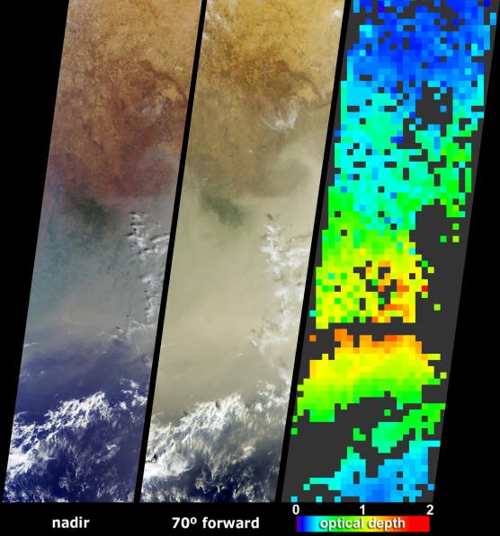
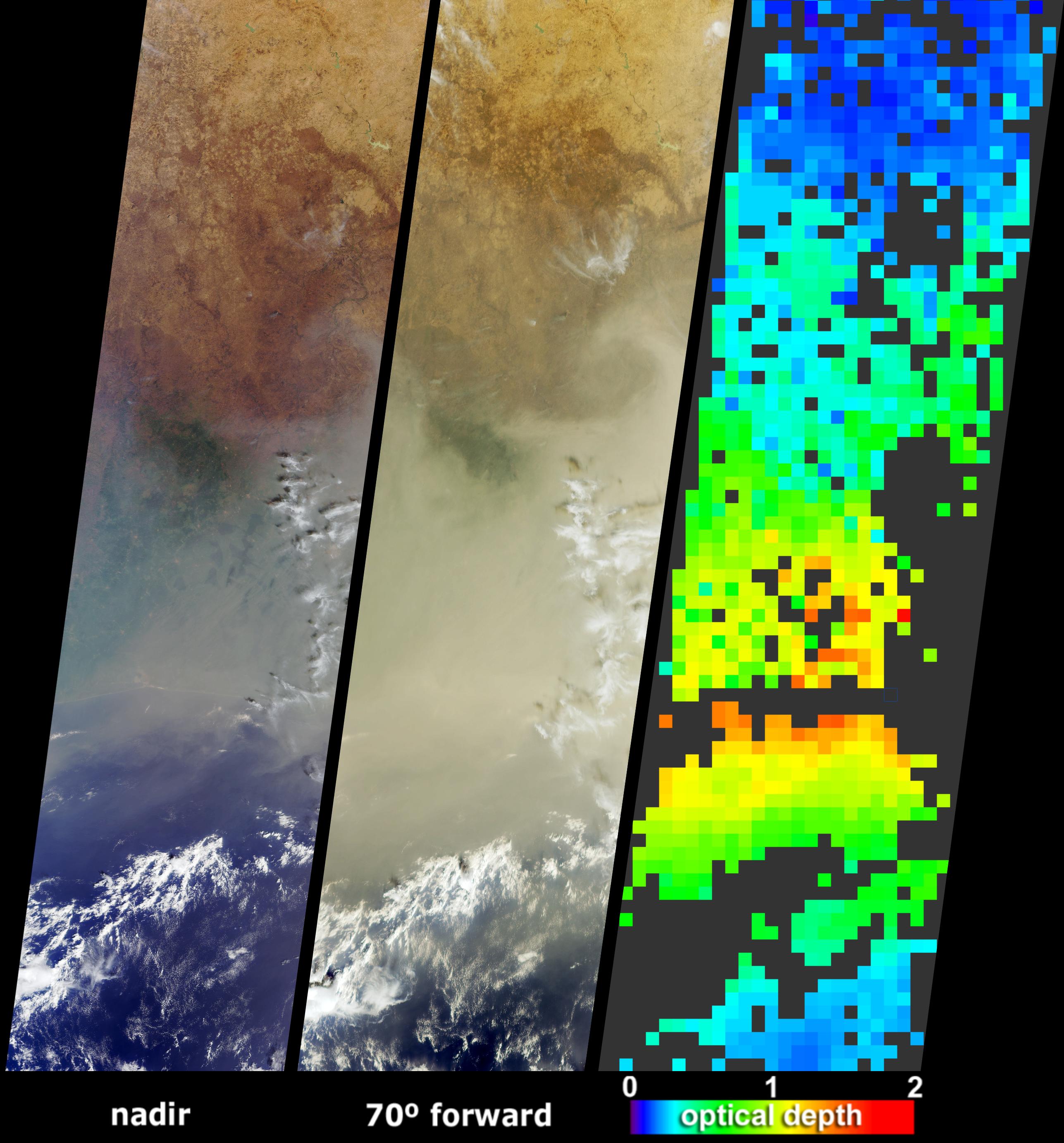
A pall of smoke and dust largely obscured the nations of Cote d'Ivoire, Ghana, Burkina Faso and southern Mali on January 12, 2004. The poor air quality in the region was a combined result of the hundreds of agricultural fires that were burning throughout western Africa during December and early January, and was likely to have been influenced by a Saharan dust storm that occurred several days earlier. These image data products from the Multi-angle Imaging SpectroRadiometer (MISR) illustrate the abundance of atmospheric particulate matter across the region.
The left-hand panels are natural-color views from MISR's downward-pointing (nadir) and most obliquely forward-pointing cameras. At the nadir view, the shoreline of the Cote d'Ivoire and many other surface features are apparent, and the haze across the region is noticeable. The distinctive area of dark green vegetation (apparent below and left of image center) is situated in the Cote d'Ivoire, near the border with Ghana, to the east of the Komoe River and southwest of the Comoe National Park. At the oblique view the aerosol appears so thick that the coastline is completely obscured, but this region of dark vegetation and hilly terrain can still be discerned.
The right-hand panel is generated through automated processing of data from multiple MISR cameras, and utilizes the change in scene brightness and contrast at different view angles to retrieve aerosol amounts, expressed as optical depth. The aerosol map indicates an optically thick atmosphere by the orange or yellow pixels, and clearer skies are indicated by blue pixels. Places where clouds or other factors precluded an aerosol retrieval are shown in dark gray. Aerosol properties are retrieved at a coarse spatial resolution of 17.6 kilometers.
The Multi-angle Imaging SpectroRadiometer observes the daylit Earth continuously and every 9 days views the entire globe between 82 degrees north and 82 degrees south latitude. These data products were generated from a portion of the imagery acquired during Terra orbit 21641. The panels cover an area of about 380 kilometers x 1425 kilometers, and utilize data from blocks 80 to 90 within World Reference System-2 path 195.
 Planetary Data System


