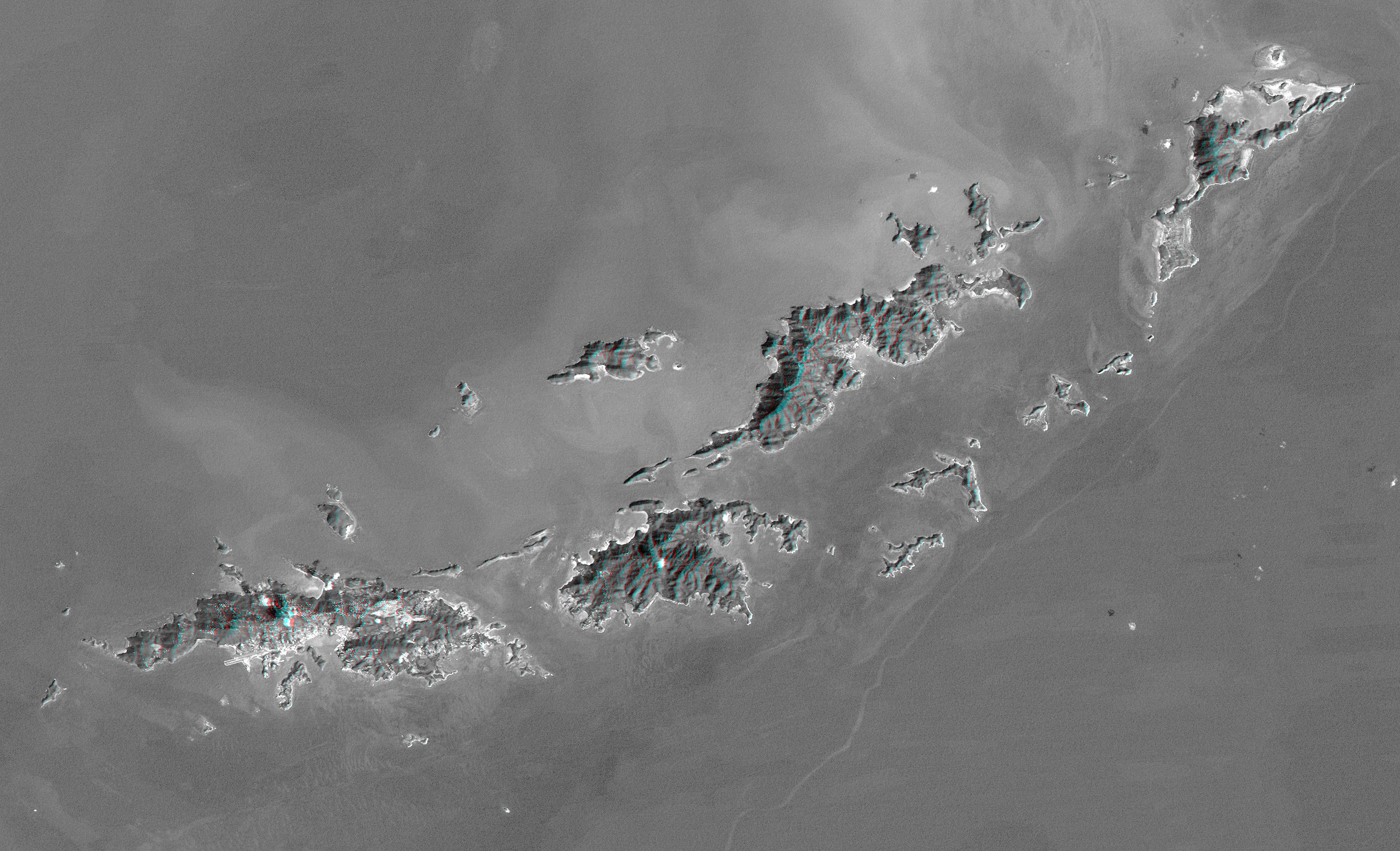
St. Thomas, St. John, Tortola, and Virgin Gorda are the four main islands (lower left to upper right) of this map-view anaglyph of the U.S. Virgin Islands and British Virgin Islands, along the northeast perimeter of the Caribbean Sea. For this view, a nearly cloud-free Landsat image was draped over elevation data from the Shuttle Radar Topography Mission (SRTM), and shading derived from the SRTM data was added to enhance the topographic expression. Coral reefs fringe the islands in many locations and appear as bright patterns in near-shore waters. Tropical vegetation appears fairly dark with smooth tones, as compared to the brighter speckled patterns of towns and other developments.
As in much of the world, topography is the primary factor in the pattern of land use development in the Virgin Islands. Topography across most of the islands is quite rugged, and although the steep slopes create a scenic setting, they crowd most development into the small areas of low relief terrain, generally along the shoreline. The topographic pattern also affects water supply, wastewater disposal, landfill locations, road construction, and most other features of the development infrastructure. Topography also defines the natural drainage pattern, which is the major consideration in anticipating tropical storm water runoff dangers, as well as the dangers of heightened sediment impacts upon the adjacent coral reefs.
Landsat has been providing visible and infrared views of the Earth since 1972. SRTM elevation data matches the 30-meter (98-foot) resolution of most Landsat images and substantially helps in analyzing the large and growing Landsat image archive.
Elevation data used in this image were acquired by the Shuttle Radar Topography Mission aboard the Space Shuttle Endeavour, launched on February 11, 2000. The mission used the same radar instrument that comprised the Spaceborne Imaging Radar-C/X-Band Synthetic Aperture Radar that flew twice on the Space Shuttle Endeavour in 1994. The Shuttle Radar Topography Mission was designed to collect three-dimensional measurements of the Earth's surface. To collect the 3-D data, engineers added a 60-meter-long (200-foot) mast, installed additional C-band and X-band antennas, and improved tracking and navigation devices. The mission is a cooperative project between NASA, the National Imagery and Mapping Agency of the U.S. Department of Defense, and the German and Italian space agencies. It is managed by NASA's Jet Propulsion Laboratory, Pasadena, Calif., for NASA's Earth Science Enterprise, Washington, D.C.
Size: 79.9 by 48.6 kilometers (49.9 by 30.1 miles)
Location: 18.25 degrees North latitude, 64.75 degrees West longitude
Orientation: North-Northeast toward the top
Image Data: Landsat Band 1 with SRTM shading
Original Data Resolution: SRTM and Landsat 30 meters (99 feet)
Date Acquired: February 2000 (SRTM), January 21, 1985 (Landsat)
 Planetary Data System


