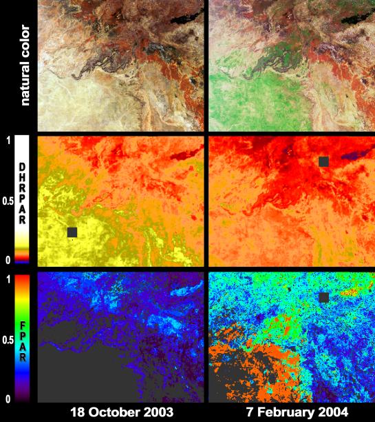
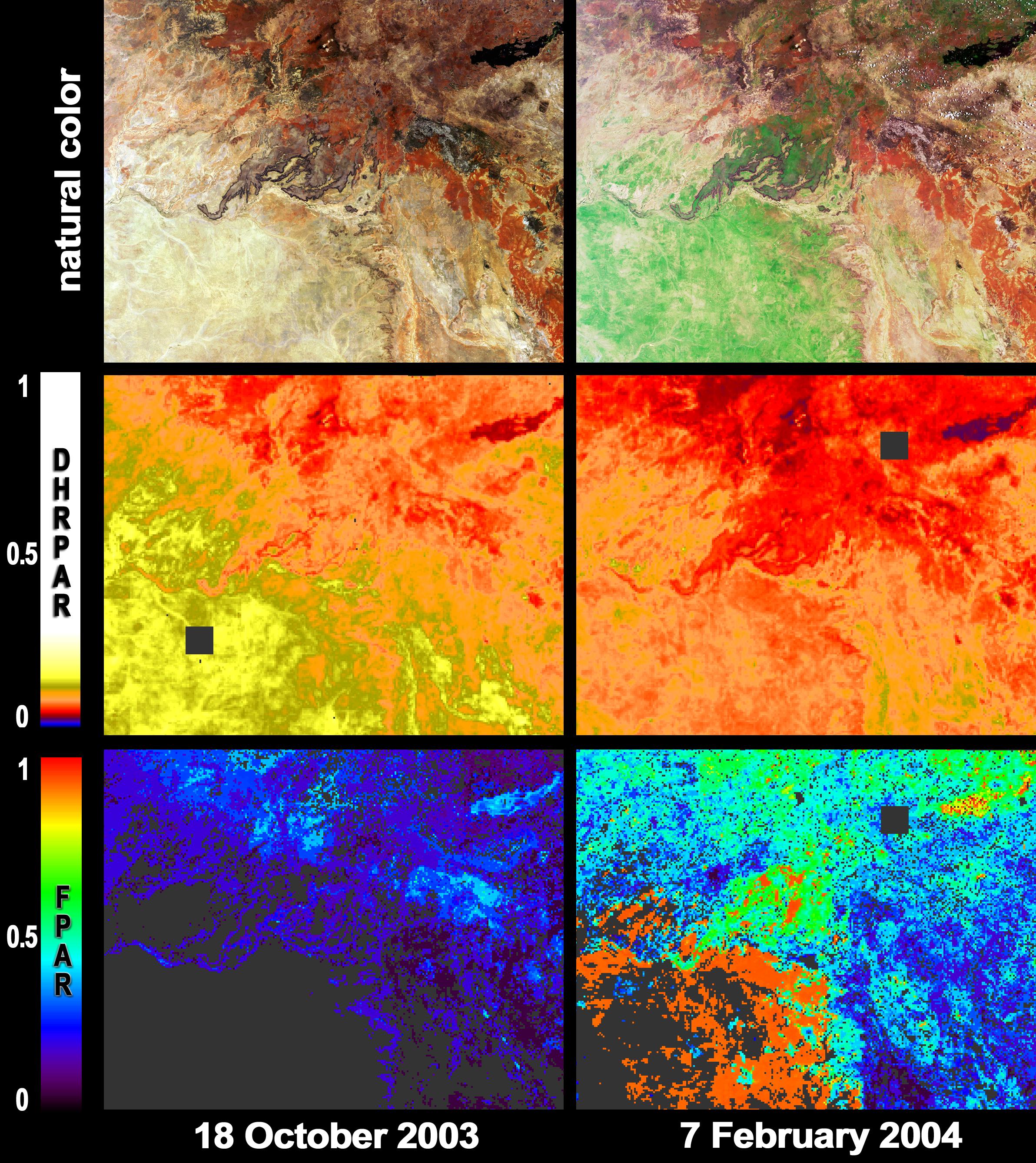
After a 19 month rainfall deficiency, heavy rainfall during January 2004 brought drought relief to much of northern Queensland. Local graziers hope for good long-term responses in pasture growth from the heavy rains. These images and maps from the Multi-angle Imaging SpectroRadiometer (MISR) portray part of Australia's Mitchell Grasslands bioregion before summer rainfall, on October 18, 2003 (left) and afterwards, on February 7, 2004 (right).
The top pair of images are natural color views from MISR's nadir camera. The green areas in the post-rainfall image highlight the growth of vegetation. The middle panels show the reflectivity of the surface over the photosynthetically active region (PAR) of visible light (400 - 700 nm), expressed as a directional-hemispherical reflectance (DHR-PAR), or albedo. That portion of the radiation that is not reflected back to the atmosphere or space is absorbed by either the vegetation or the soil. The fraction of PAR radiation absorbed by green vegetation, known as FPAR, is shown in the bottom panels. FPAR is one of the quantities that establishes the photosynthetic and carbon uptake efficiency of live vegetation. MISR's FPAR product makes use of aerosol retrievals to correct for atmospheric scattering and absorption effects, and uses plant canopy structural models to determine the partitioning of solar radiation. Both of these aspects are facilitated by the multiangular nature of the MISR measurements.
The Multi-angle Imaging SpectroRadiometer observes the daylit Earth continuously and every 9 days views the entire globe between 82 degrees north and 82 degrees south latitude. These data products were generated from a portion of the imagery acquired during Terra orbits 20397 and 22028. The panels cover an area of about 290 kilometers x 228 kilometers, and utilize data from blocks 106 to 108 within World Reference System-2 path 96.
MISR was built and is managed by NASA's Jet Propulsion Laboratory, Pasadena, CA, for NASA's Office of Earth Science, Washington, DC. The Terra satellite is managed by NASA's Goddard Space Flight Center, Greenbelt, MD. JPL is a division of the California Institute of Technology.