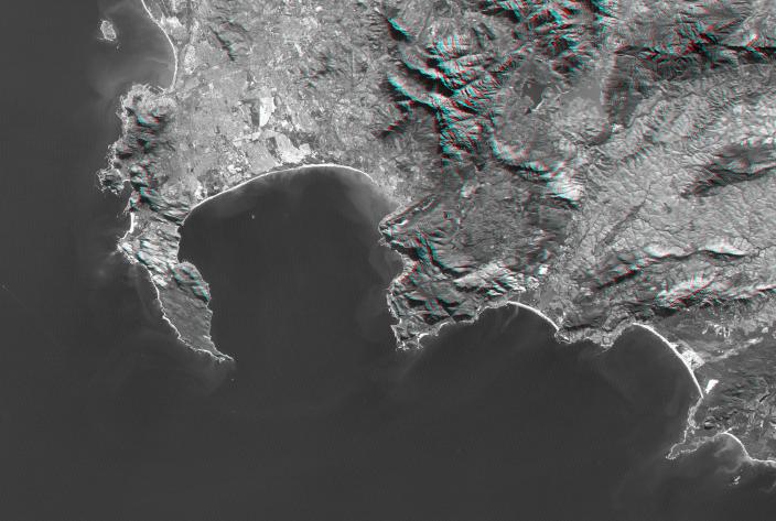
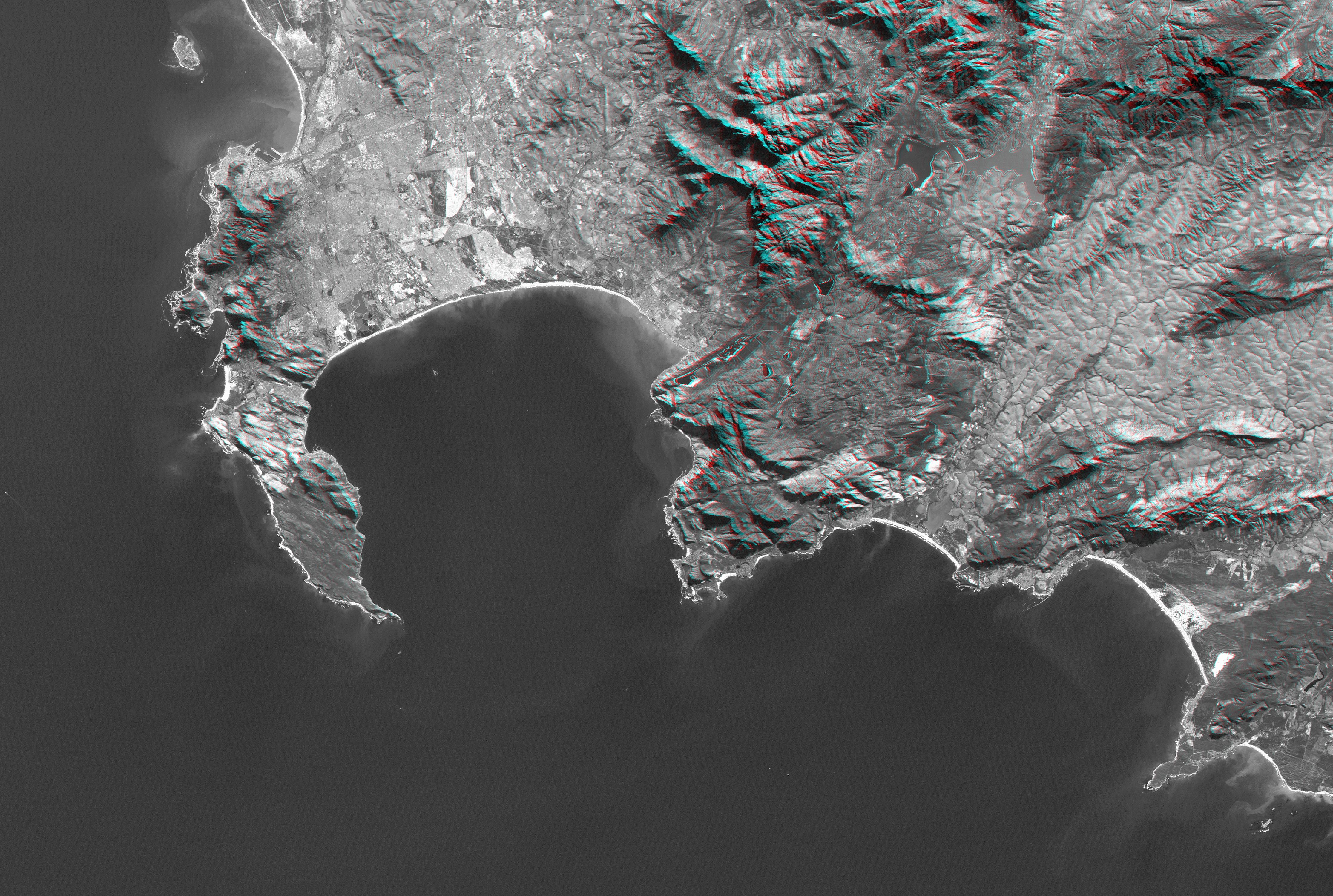
Cape Town and the Cape of Good Hope, South Africa, appear on the left (west) of this anaglyph view generated from a Landsat satellite image and elevation data from the Shuttle Radar Topography Mission (SRTM). The city center is located between Table Bay (upper left) and Table Mountain (just to the south), a 1,086-meter (3,563-foot) tall sandstone and granite natural landmark.
Cape Town enjoys a Mediterranean climate but must deal with the limited water supply characteristic of that climate. Until the 1890s the city relied upon streams and springs along the base of Table Mountain, then built a small reservoir atop Table Mountain to capture and store rainfall there (visible in this anaglyph when viewed at full resolution). Now the needs of a much larger population are met in part by much larger reservoirs such as seen well inland (upper right) at the Theewaterskloof Dam.
False Bay is the large bay to the southeast (lower right) of Cape Town, just around the Cape of Good Hope. It is one of the largest bays along the entire South African coast, but nearby Cape Town has its harbor at Table Bay. False Bay got its name because mariners approaching Cape Town from the east would see the prominent bay and falsely assume it to be the entrance to Cape Town harbor. Similarly, people often mistake the Cape of Good Hope as the southernmost point of Africa. But the southernmost point is actually Cape Agulhas, located just to the southeast (lower right) of this scene.
This anaglyph was created by draping a Landsat visible light image over an SRTM elevation model, and then generating two differing perspectives, one for each eye. When viewed through special glasses, the anaglyph is a vertically exaggerated view of the Earth's surface in its full three dimensions. Anaglyph glasses cover the left eye with a red filter and cover the right eye with a blue filter.
Elevation data used in this image was acquired by the Shuttle Radar Topography Mission (SRTM) aboard the Space Shuttle Endeavour, launched on February 11, 2000. SRTM used the same radar instrument that comprised the Spaceborne Imaging Radar-C/X-Band Synthetic Aperture Radar (SIR-C/X-SAR) that flew twice on the Space Shuttle Endeavour in 1994. SRTM was designed to collect three-dimensional measurements of the Earth's surface. To collect the 3-D data, engineers added a 60-meter-long (200-foot) mast, installed additional C-band and X-band antennas, and improved tracking and navigation devices. The mission is a cooperative project between the National Aeronautics and Space Administration (NASA), the National Geospatial-Intelligence Agency (NGA) of the U.S. Department of Defense (DoD), and the German and Italian space agencies. It is managed by NASA's Jet Propulsion Laboratory, Pasadena, Calif., for NASA's Earth Science Enterprise, Washington, D.C.
View Size: 66 kilometers (41 miles) by 134 kilometers (83 miles)
Location: 34.2 degrees South latitude, 18.7 degrees East longitude
Orientation: North-northeast at top
Image Data: Landsat Bands 1, 2, 3 merged as grey
Date Acquired: February 2000 (SRTM), June 13, 2000 (Landsat)