Your search criteria found 2555 images
Target is Earth (and available satellites)
Go to PIAxxxxx:
Refine this list of images by:
Target:
Mission:
Spacecraft:
Instrument:
Click on an image for detailed information
Click on a column heading to sort in ascending or descending order
My
List
Addition DateSort Ascending Target Mission Instrument Size
Add Image to Favorite List 2015-02-13 Earth Terra
ASTER
1826x1814x3
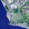
This image from NASA's Terra spacecraft shows what may be ancient Rome's greatest engineering achievement: Portus. Built in the first century A.D., Portus was Rome's principal maritime harbor.
PIA19209:
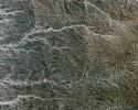
Portus, Italy
Full Resolution:     TIFF (9.941 MB)     JPEG (482.7 kB)
Add Image to Favorite List 2015-01-27 Earth Terra
ASTER
610x686x3
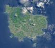
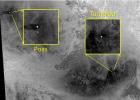
This image from NASA's Terra spacecraft shows Antikythera, a Greek island in the Aegean Sea. With a population of 44, its main settlement is the port of Patamos.
PIA19032:
Antikythera Island, Greece
Full Resolution:     TIFF (1.256 MB)     JPEG (40.88 kB)
Add Image to Favorite List 2015-01-22 Earth SPIDER
673x379x3
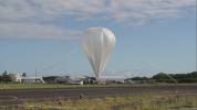
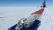
Prior to launch, the team laid out the parachute and hang lines in front of SPIDER, seen in the distance. The long-duration balloon that would carry SPIDER into the sky is attached to the end of the parachute shown here in the foreground.
PIA19177:
SPIDER Readied for Launch
Full Resolution:     TIFF (765.7 kB)     JPEG (54.71 kB)
Add Image to Favorite List 2015-01-21 Earth SMAP
3000x2000x3
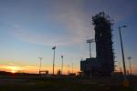
The sun sets behind Space Launch Complex 2, Vandenberg Air Force Base, California, where NASA's Soil Moisture Active Passive (SMAP) mission satellite is being prepared for liftoff. Launch is scheduled for Jan. 29.
PIA19137:
Sunset at Vandenberg
Full Resolution:     TIFF (18.01 MB)     JPEG (416.5 kB)
Add Image to Favorite List 2015-01-21 Earth SMAP
2000x3000x3
At Space Launch Complex 2 on Vandenberg Air Force Base in California, NASA's Soil Moisture Active Passive (SMAP) mission satellite is lifted up the side of a mobile service tower for mating to its Delta II rocket.
PIA19136:
Going Up
Full Resolution:     TIFF (18.01 MB)     JPEG (642.8 kB)
Add Image to Favorite List 2015-01-21 Earth SMAP
2815x1850x3
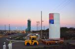
NASA's Soil Moisture Active Passive (SMAP) satellite is transported across Vandenberg Air Force Base in California to Space Launch Complex 2, where it will be mated to a Delta II rocket for launch, targeted for Jan. 29.
PIA19135:
Satellite in a Can
Full Resolution:     TIFF (15.63 MB)     JPEG (447.9 kB)
Add Image to Favorite List 2015-01-21 Earth SMAP
2002x3000x3
In the Astrotech payload processing facility on Vandenberg Air Force Base in California, technicians secure a transportation canister around NASA's Soil Moisture Active Passive (SMAP) spacecraft for its move to the launch pad.
PIA19134:
SMAP Gets Ready to Move
Full Resolution:     TIFF (18.02 MB)     JPEG (486.2 kB)
Add Image to Favorite List 2015-01-21 Earth SMAP
8192x8784x3
Artist's rendering of the Soil Moisture Active Passive (SMAP) satellite. The width of the region scanned on Earth's surface during each orbit is about 620 miles (1,000 kilometers).
PIA19133:
Soil Moisture Active Passive Satellite
Full Resolution:     TIFF (215.9 MB)     JPEG (2.761 MB)
Add Image to Favorite List 2015-01-20 Earth SMAP
3000x1996x3
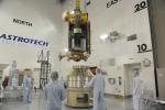
NASA's Soil Moisture Active Passive spacecraft is lowered onto the Delta II payload attach structure in the Astrotech payload processing facility at Vandenberg Air Force Base, California, in preparation for launch, to take place no sooner than Jan. 29.
PIA19132:
NASA's SMAP is Readied for Launch
Full Resolution:     TIFF (17.97 MB)     JPEG (637.1 kB)
Add Image to Favorite List 2015-01-07 Earth Terra
ASTER
1408x905x3
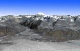
This image from NASA's Terra spacecraft shows Mt. Kailash, a peak in the Kailas Range in Tibet. It lies near the source of some of the longest Asian rivers: the Brahmaputra, the Sutlej and the Karnali.
PIA19013:
Mt. Kailash, Tibet
Full Resolution:     TIFF (3.824 MB)     JPEG (160.4 kB)
Add Image to Favorite List 2014-12-18 Earth OCO-2
OCO-2
1317x814x3
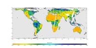
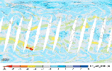
This map shows solar-induced fluorescence, a plant process that occurs during photosynthesis, from Aug. through Oct. 2014 as measured by NASA's Orbiting Carbon Observatory-2.
PIA18935:
Global Solar-Induced Fluorescence
Full Resolution:     TIFF (3.217 MB)     JPEG (178.9 kB)
Add Image to Favorite List 2014-12-18 Earth OCO-2
OCO-2
4096x2304x3
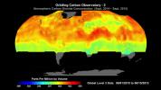
Global atmospheric carbon dioxide concentrations from Oct. 1 through Nov. 11, as recorded by NASA's Orbiting Carbon Observatory-2.
PIA18934:
Global Atmospheric Carbon Dioxide
Full Resolution:     TIFF (28.32 MB)     JPEG (639.9 kB)
Add Image to Favorite List 2014-12-09 Earth RoboSimian
4000x3000x3
Robotics researchers at NASA's Jet Propulsion Laboratory in Pasadena, California, stand with robots RoboSimian and Surrogate, both built at JPL.
PIA18793:
The JPL Team Behind RoboSimian and Surrogate
Full Resolution:     TIFF (36.01 MB)     JPEG (1.193 MB)
Add Image to Favorite List 2014-12-09 Earth RoboSimian
4000x3000x3
Surrogate, nicknamed 'Surge,' is a robot designed and built at NASA's Jet Propulsion Laboratory in Pasadena, California.
PIA18792:
JPL's Surrogate Robot
Full Resolution:     TIFF (36.01 MB)     JPEG (936.9 kB)
Add Image to Favorite List 2014-12-09 Earth RoboSimian
5202x3465x3
RoboSimian is an ape-like robot that moves around on four limbs designed. It was designed and built at NASA's Jet Propulsion Laboratory in Pasadena, California.
PIA18791:
RoboSimian Gets Ready for Competition
Full Resolution:     TIFF (54.1 MB)     JPEG (1.615 MB)
Add Image to Favorite List 2014-12-09 Earth RoboSimian
5202x3465x3
RoboSimian and Surrogate are robots that were designed and built at NASA's Jet Propulsion Laboratory in Pasadena, California.
PIA18790:
JPL's RoboSimian and Surrogate Robots
Full Resolution:     TIFF (54.1 MB)     JPEG (2.003 MB)
Add Image to Favorite List 2014-12-08 Earth Mars Science Laboratory (MSL)
5271x1865x3
This series of images reconstructs the geology of the region around Mars' Mount Sharp, where NASA's Curiosity Mars rover landed and is now driving. The images were taken on Earth and have been altered for the illustration.
PIA19078:
Sediment Accumulation in Dry and Wet Periods
Full Resolution:     TIFF (29.51 MB)     JPEG (1.212 MB)
Add Image to Favorite List 2014-11-24 Earth Terra
ASTER
4190x3322x3
This image from NASA's Terra spacecraft shows Ellesmere Island, which is part of the Qikiqtaaluk Region of the Canadian territory of Nunavut, with the most northerly point of land in Canada.
PIA18966:
Ellesmere Island, Canada
Full Resolution:     TIFF (41.78 MB)     JPEG (1.927 MB)
Add Image to Favorite List 2014-10-27 Earth Terra
ASTER
2763x1817x3
This image from NASA's Terra spacecraft shows Lake Mackay, the largest of hundreds of ephemeral lakes scattered throughout Western Australia and the Northern Territory, and is the second largest lake in Australia.
PIA18764:
Lake Mackay, Australia
Full Resolution:     TIFF (15.07 MB)     JPEG (635.8 kB)
Add Image to Favorite List 2014-10-21 Earth RapidScat
ISS-RapidScat
895x718x3
NASA's ISS-RapidScat ocean wind scatterometer viewed Hurricane Ana as it approached Hawaii. From Oct. 13 to Oct. 19, 2014, RapidScat observed Ana seven times. This frame is from a movie containing multiple days of observation.
PIA18834:
Hurricane Ana Viewed by NASA's ISS-RapidScat Animation Icon
Full Resolution:     TIFF (1.929 MB)     JPEG (136.3 kB)
Add Image to Favorite List 2014-10-20 Earth Terra
ASTER
2182x1092x3
Our planet emits energy as thermal infrared radiation at wavelengths we cannot normally see but can feel -- for example, if we stand close to a hot surface. This map is from NASA's ASTER GED.
PIA18833:
NASA Spacecraft Maps Earth's Global Emissivity
Full Resolution:     TIFF (7.151 MB)     JPEG (256.6 kB)
Add Image to Favorite List 2014-10-09 Earth Terra
ASTER
1772x2208x3
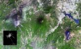
NASA's Terra spacecraft shows Mount Cameroon, an active volcano in Cameroon near the Gulf of Guinea. It is one of Africa's largest volcanoes, rising over 4,000 meters, with more than 100 small cinder cones.
PIA18825:
Mount Cameroon
Full Resolution:     TIFF (11.74 MB)     JPEG (466.7 kB)
Add Image to Favorite List 2014-10-06 Earth RapidScat
ISS-RapidScat
1200x609x3
Launched Sept. 21, 2014, to the International Space Station, NASA's newest Earth-observing mission, the International Space Station-RapidScat scatterometer to measure global ocean near-surface wind speeds and directions.
PIA18824:
NASA's New RapidScat Breezes Into Operation Aboard Space Station
Full Resolution:     TIFF (2.193 MB)     JPEG (126 kB)
Add Image to Favorite List 2014-10-01 Moon GRAIL
Lunar Reconnaissance Orbiter (LRO)
Lunar Orbit Laser Altimeter
1500x1500x3
Topography of Earth's moon generated from data NASA's LRO, with the gravity anomalies bordering the Procellarum region superimposed in blue. The border structures are shown using gravity gradients calculated with data from NASA's GRAIL mission.
PIA18822:
Gravity Gradients Frame Oceanus Procellarum
Full Resolution:     TIFF (6.753 MB)     JPEG (203.5 kB)
Add Image to Favorite List 2014-10-01 Moon GRAIL
Lunar Reconnaissance Orbiter (LRO)
Lunar Reconnaissance Orbiter Camera (WAC)
Lunar Orbit Laser Altimeter
1546x905x3
A view of Earth's moon looking south across Oceanus Procellarum, representing how the western border structures may have looked while active. This image combines gravity gradient from NASA's GRAIL and LRO.
PIA18821:
On the West Coast of the Ocean of Storms (Artist's Concept)
Full Resolution:     TIFF (4.199 MB)     JPEG (116.7 kB)
Add Image to Favorite List 2014-10-01 Earth GRACE
K-Band Ranging System
1280x755x3
This trio of images depicts satellite observations of declining water storage in California as seen by NASA's Gravity Recovery and Climate Experiment satellites in June 2002 (left), June 2008 (center) and June 2014 (right).
PIA18816:
NASA's GRACE Sees a Drying California
Full Resolution:     TIFF (2.9 MB)     JPEG (141.3 kB)
Add Image to Favorite List 2014-10-01 Earth OCO-2
OCO-2
1177x801x3
This image shows NASA's OCO-2 measurements of carbon dioxide levels over Pasadena and the northern Los Angeles, CA basin on Sept. 5, 2014. Each colored dot represents a single measurement of the greenhouse gas made during an overflight of the area.
PIA18815:
Validating Carbon Dioxide Measurements from NASA's OCO-2 Over Los Angeles
Full Resolution:     TIFF (2.83 MB)     JPEG (230.1 kB)
Add Image to Favorite List 2014-09-25 Earth Terra
ASTER
2577x2934x3
Since the end of August 2014, Iceland's Bardarbunga volcano has been pouring out lava from a growing fissure. NASA's Terra spacecraft shows the flows have been accompanied by spectacular lava fountains.
PIA18814:
Iceland's Bardarbunga Volcano Imaged by NASA Spacecraft
Full Resolution:     TIFF (22.69 MB)     JPEG (602 kB)
Add Image to Favorite List 2014-09-24 Earth Shuttle Radar Topography Mission (SRTM)
C-Band Radar
X-Band Radar
1074x651x1
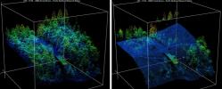
A site in the Crater Highlands of Tanzania reveals the difference between NASA's Shuttle Radar Topography Mission (SRTM) digital elevation model data as originally released in 2004 (left) and as now released at full resolution in 2014 (right).
PIA18813:
Tanzania Images Highlight Improvements in Full-Resolution SRTM Africa Data
Full Resolution:     TIFF (700.1 kB)     JPEG (64.26 kB)
Add Image to Favorite List 2014-09-24 Earth Terra
ASTER
2460x2568x3
This image from NASA's Terra spacecraft shows the Faroe Islands, an archipelago and autonomous country within the Kingdom of Denmark, comprising 18 major islands.
PIA18723:
Faroe Islands
Full Resolution:     TIFF (18.96 MB)     JPEG (680.5 kB)
Add Image to Favorite List 2014-09-24 Earth Terra
ASTER
645x316x3
On June 27, 2014, a new vent opened on Hawaii's Puu Oo vent, on the eastern flank of Kilauea volcano. NASA's Terra spacecraft shows the hot lava flow in white, extending about 11 miles (17 kilometers) from the vent.
PIA18812:
Progress of Hawaii Lava Flow Tracked by NASA Spacecraft
Full Resolution:     TIFF (611.9 kB)     JPEG (27.32 kB)
Add Image to Favorite List 2014-09-22 Earth OSTM/Jason-2
Altimeter
1650x1450x3
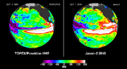
This image from NASA's European Jason-2 satellite shows Kelvin waves of high sea level (red/yellow) crossing the Pacific Ocean at the equator. The waves can be related to El Niño events.
PIA17809:
The Fickle El Niño of 2014
Full Resolution:     TIFF (7.181 MB)     JPEG (203.9 kB)
Add Image to Favorite List 2014-09-15 Earth Earth Observing-1 (EO-1)
Advanced Land Imager (ALI)
1158x879x3
On Sept. 8, 2014, NASA's Earth Observing 1 spacecraft obtained this infrared image of Kilauea volcano, Hawaii, which has been in continuous eruption since 1983. New lava flows can be seen.
PIA18211:
Hawaii Lava Threat Closely Monitored by NASA EO-1 Spacecraft
Full Resolution:     TIFF (3.055 MB)     JPEG (160.5 kB)
Add Image to Favorite List 2014-09-11 Earth Terra
ASTER
2238x2550x3
This image from NASA's Terra spacecraft shows Petropavlovsk-Kamchatsky (P-K), which is the administrative, cultural, scientific and economic center of Kamchatka Krai, Russia on the Kamchatka Peninsula.
PIA18710:
Petropavlovsk-Kamchatsky, Russia
Full Resolution:     TIFF (17.13 MB)     JPEG (959.4 kB)
Add Image to Favorite List 2014-09-09 Earth Earth Observing-1 (EO-1)
Advanced Land Imager (ALI)
1600x1155x3
On the night of Sept. 6, 2014 NASA's Earth Observing 1 (EO-1) spacecraft observed the ongoing eruption at Holuhraun, Iceland. Partially covered by clouds, this scene shows the extent of the lava flows that have been erupting.
PIA18802:
Progress of Icelandic Lava Flows Charted by NASA's EO-1 Spacecraft
Full Resolution:     TIFF (5.546 MB)     JPEG (84.23 kB)
Add Image to Favorite List 2014-09-04 Earth ARIA
X-band Interferometric Synthetic Aperture Radar
2019x2004x3
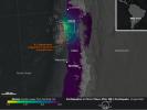
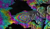
A magnitude 6.0 earthquake struck southern Napa county northeast of San Francisco, California, on Aug. 24, 2014. NASA satellite data reveal ground defomation.
PIA18798:
NASA Analyses of Global Positioning System Data and Italian Radar Satellite Data Reveal Napa Quake Ground Deformation
Full Resolution:     TIFF (12.14 MB)     JPEG (554.3 kB)
Add Image to Favorite List 2014-09-04 Earth UAVSAR
L-Band UAVSAR
1573x1181x3
NASA's UAVSAR studies ground deformation after a magnitude 6.0 South Napa earthquake on August 24, 2014.
PIA18801:
NASA's UAVSAR Studies Ground Deformation from Napa California Quake
Full Resolution:     TIFF (5.575 MB)     JPEG (472.8 kB)
Add Image to Favorite List 2014-09-03 Earth Earth Observing-1 (EO-1)
Advanced Land Imager (ALI)
Hyperion Hyperspectral Imager
2800x4000x3
This image shows Iceland's volcanic eruption monitored by NASA's EO-1 spacecraft. To the south is the edge of Dyngjujökull and to the north is the volcano called Askja.
PIA18799:
Iceland Volcanic Eruption Monitored by NASA EO-1 Spacecraft
Full Resolution:     TIFF (33.62 MB)     JPEG (643.7 kB)
Add Image to Favorite List 2014-09-03 Earth E-DECIDER
1027x698x3
A NASA-funded disaster decision support system, provided a number of rapid response map data products to decision makers at the California Earthquake Clearinghouse following its activation for the Aug. 24, 2014 magnitude 6.0 earthquake in Napa, California
PIA18797:
NASA's E-DECIDER Rapid Disaster Decision Support Products
Full Resolution:     TIFF (2.152 MB)     JPEG (144.9 kB)
Add Image to Favorite List 2014-09-03 Earth Earth Observing-1 (EO-1)
Advanced Land Imager (ALI)
1157x1024x3
On the night of Sept. 1, 2014, NASA's Earth Observing 1 (EO-1) spacecraft observed the ongoing eruption at Holuhraun, Iceland. This false-color image that emphasizes the hottest areas of the vent and resulting lava flows.
PIA18796:
NASA Spacecraft Eyes Iceland Volcanic Eruption
Full Resolution:     TIFF (3.556 MB)     JPEG (67.52 kB)
Add Image to Favorite List 2014-09-02 Earth Aqua
MODIS
6843x3890x3
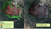
In this image from NASA's Aqua satellite, the red areas seen by the MODIS instrument revealed that live fuel moisture had excessively dried up by more than 50 percent prior to the Rim Fire in August 2013.
PIA18795:
2013 Yosemite Fire Assessed by NASA Satellite Data
Full Resolution:     TIFF (79.89 MB)     JPEG (2.397 MB)
Add Image to Favorite List 2014-08-21 Earth 1537x2148x3
The Surrogate robot ('Surge'), built at NASA's Jet Propulsion Laboratory in Pasadena, CA., is being developed in order to extend humanity's reach into hazardous environments to perform tasks such as using environmental test equipment.
PIA18667:
Surrogate Robot
Full Resolution:     TIFF (9.908 MB)     JPEG (273.9 kB)
Add Image to Favorite List 2014-08-21 Earth Terra
ASTER
3202x2709x3
This image from NASA's Terra spacecraft shows the world's largest bauxite mine found near Weipa, Queensland, Australia. The rich aluminum deposits were first recognized on the end of the Cape York Peninsula in 1955, and mining began in 1960.
PIA18686:
Weipa, Queensland, Australia
Full Resolution:     TIFF (26.03 MB)     JPEG (1.143 MB)
Add Image to Favorite List 2014-08-08 Earth LDSD
959x540x3
This frame from a video clip shows rockets fired by the test vehicle for NASA's Low-Density Supersonic Decelerator project.
PIA18644:
Firing the Saucer Animation Icon
Full Resolution:     TIFF (520.2 kB)     JPEG (91.48 kB)
Add Image to Favorite List 2014-08-08 Earth LDSD
2324x2156x3
The test vehicle for NASA's Low-Density Supersonic Decelerator is seen here before and after the balloon that helped carry it to near-space was deflated.
PIA18466:
A Balloon's Job Well Done: LDSD in Flight
Full Resolution:     TIFF (15.04 MB)     JPEG (355.6 kB)
Add Image to Favorite List 2014-08-08 Earth LDSD
4859x3239x3
Divers retrieve the test vehicle for NASA's Low-Density Supersonic Decelerator off the coast of the U.S. Navy's Pacific Missile Range Facility in Kauai, Hawaii.
PIA18465:
Fishing LDSD out of the Water
Full Resolution:     TIFF (47.24 MB)     JPEG (2.073 MB)
Add Image to Favorite List 2014-08-08 Earth LDSD
1280x720x3
Moments into its powered flight, NASA'sLow-density Supersonic Decelerator (LDSD) test vehicle captured this image of the balloon which carried it to high altitudes.
PIA18464:
Departing Saucer Snaps Balloon
Full Resolution:     TIFF (2.766 MB)     JPEG (78.75 kB)
Add Image to Favorite List 2014-08-08 Earth LDSD
732x549x3
The main structural body of the second flight test vehicle in NASA's Low-Density Supersonic Decelerator (LDSD) project is seen during its assembly in a cleanroom at NASA's Jet Propulsion Laboratory.
PIA18426:
LDSD Flight Test Vehicle 2 in Cleanroom
Full Resolution:     TIFF (1.206 MB)     JPEG (47.49 kB)
Add Image to Favorite List 2014-08-08 Earth LDSD
4850x3223x3
NASA's Supersonic Disk Sail Parachute, one of the new technologies being developed as part of NASA's Low-Density Supersonic Decelerator (LDSD) project, floats just below the surface of the Pacific Ocean on June 28, 2014.
PIA18425:
LDSD Chute Beneath the Surface
Full Resolution:     TIFF (46.92 MB)     JPEG (2.298 MB)
Add Image to Favorite List 2014-08-08 Earth LDSD
3010x1698x3
Tears are visible in the parachute from NASA's Supersonic Disk Sail Parachute, which did not deploy as expected. The photo was obtained by Navy divers during recovery of the LDSD test vehicle and parachute.
PIA18424:
LDSD Chute
Full Resolution:     TIFF (15.34 MB)     JPEG (298.7 kB)
Add Image to Favorite List 2014-08-06 Earth Terra
ASTER
1366x1307x3
NASA's Terra spacecraft captured this thermal infrared view of the spread of the forest fire in Valle Nuevo National Park near Costanza, Dominican Republic.
PIA18643:
Dominican Republic Wildfire Imaged by NASA Spacecraft
Full Resolution:     TIFF (5.358 MB)     JPEG (301.4 kB)
Add Image to Favorite List 2014-08-06 Earth ISS
OPALS
1261x945x3
NASA's Optical Communications Telescope Laboratory (OCTL) dome is located in Table Mountain, California. It is used in conjunction with The Optical PAyload for Lasercomm Science (OPALS).
PIA18663:
Optical Communications Telescope Laboratory
Full Resolution:     TIFF (3.576 MB)     JPEG (111.2 kB)
Add Image to Favorite List 2014-08-05 Earth Terra
ASTER
1412x1274x3
The star on this image from the NASA's Terra spacecraft indicates the eipcenter of a magnitude 6.1 earthquake which truck in southern China's Yunnan province, toppling thousands of homes and causing numerous casualties.
PIA18640:
Site of Destructive China Temblor Imaged by NASA Spacecraft
Full Resolution:     TIFF (5.399 MB)     JPEG (438 kB)
Add Image to Favorite List 2014-08-05 Earth Terra
ASTER
944x882x3
This image from NASA's Terra spacecraft shows the once-abandoned mining town of Silver Peak, Nevada, which began to thrive again when Foote Mineral Company began extracting lithium from brine below the floor of Clayton Valley in 1966.
PIA18553:
Lithium Mining, Nevada
Full Resolution:     TIFF (2.499 MB)     JPEG (102.8 kB)
Add Image to Favorite List 2014-07-28 Earth Terra
ASTER
922x626x3
This image from the NASA's Terra spacecraft shows extensive flooding resulting from Typhoon Rammasun in Ningming, China. This ASTER image was acquired on July 24, 2014.
PIA18628:
NASA Spacecraft Eyes China Flooding
Full Resolution:     TIFF (1.732 MB)     JPEG (118.7 kB)
Add Image to Favorite List 2014-07-28 Earth 752x564x3
Scientists at NASA's Jet Propulsion Laboratory make a rocket nozzle using a new 3-D printing technique that allows for multiple metallic properties in the same object.
PIA18570:
Laser Printing of Gradient Metals
Full Resolution:     TIFF (1.273 MB)     JPEG (44.08 kB)
Add Image to Favorite List 2014-07-28 Earth 3717x3583x3
This is a prototype of a mirror mount that scientists made using a new 3-D printing technique at NASA's Jet Propulsion Laboratory.
PIA18569:
Mirror Mount
Full Resolution:     TIFF (39.97 MB)     JPEG (553.3 kB)
Add Image to Favorite List 2014-07-24 Earth 3888x2592x3
The Optical PAyload for Lasercomm Science (OPALS) flight terminal undergoes testing in a thermal vacuum chamber at NASA's Jet Propulsion Laboratory to simulate the space environment.
PIA18651:
OPALS Thermal Vacuum Testing
Full Resolution:     TIFF (30.24 MB)     JPEG (750.2 kB)
Add Image to Favorite List 2014-07-24 Earth ISS
OPALS
2501x2831x3
This photo shows the Optical PAyload for Lasercomm Science (OPALS) flight terminal at JPL being prepared for shipment to NASA's Kennedy Space Center.
PIA18650:
OPALS Preparation
Full Resolution:     TIFF (21.25 MB)     JPEG (654.7 kB)
Add Image to Favorite List 2014-07-24 Earth ISS
OPALS
4288x2848x3
Optical PAyload for Lasercomm Science (OPALS) flight terminal undergoes final testing at NASA's Jet Propulsion Laboratory. OPALS was launched to the International Space Station from Cape Canaveral Air Force Station in Florida on April 18, 2014.
PIA18579:
OPALS Final Testing
Full Resolution:     TIFF (36.66 MB)     JPEG (969.4 kB)
Add Image to Favorite List 2014-07-24 Earth ISS
OPALS
3264x2448x3
Optical PAyload for Lasercomm Science (OPALS) is covered in white thermal blankets awaiting integration with its launch vehicle at NASA's Kennedy Space Center.
PIA18578:
OPALS Thermal Blankets
Full Resolution:     TIFF (23.98 MB)     JPEG (531 kB)
Add Image to Favorite List 2014-07-24 Earth ISS
OPALS
735x489x3
This is a 3-foot (1-meter) aperture main telescope located at the NASA Jet Propulsion Laboratory's Optical Communications Telescope Laboratory ground station.
PIA18577:
OPALS Main Telescope
Full Resolution:     TIFF (1.079 MB)     JPEG (42.53 kB)
Add Image to Favorite List 2014-07-24 Earth ISS
OPALS
1537x1024x3
The Optical PAyload for Lasercomm Science (OPALS) undergoes vibration testing at NASA's Jet Propulsion Laboratory in December 2012.
PIA18576:
OPALS Vibration Testing
Full Resolution:     TIFF (4.724 MB)     JPEG (129.8 kB)
Add Image to Favorite List 2014-07-24 Earth ISS
OPALS
1393x928x3
The Optical PAyload for Lasercomm Science (OPALS) undergoes vibration testing at NASa's Jet Propulsion Laboratory in December 2012.
PIA18575:
OPALS Vibration Testing
Full Resolution:     TIFF (3.88 MB)     JPEG (111.7 kB)
Add Image to Favorite List 2014-07-24 Earth ISS
OPALS
1107x831x3
An engineer from NASA's Jet Propulsion Laboratory oversees a fit check during the integration & testing of the Optical PAyload for Lasercomm Science (OPALS).
PIA18574:
OPALS Fit Check
Full Resolution:     TIFF (2.761 MB)     JPEG (91.79 kB)
Add Image to Favorite List 2014-07-24 Earth ISS
OPALS
3264x2448x3
The Optical PAyload for Lasercomm Science (OPALS) undergoes final inspection prior to shipment to NASA's Kennedy Space Center. OPALS was launched to the International Space Station from Cape Canaveral Air Force Station in Florida on April 18, 2014.
PIA18573:
OPALS Final Inspection
Full Resolution:     TIFF (23.98 MB)     JPEG (703.6 kB)
Add Image to Favorite List 2014-07-24 Earth ISS
OPALS
1280x720x3
This artist's rendition shows the Optical PAyload for Lasercomm Science (OPALS) operating from the International Space Station. OPALS was launched to the station from Cape Canaveral Air Force Station in Florida on April 18, 2014.
PIA18572:
OPALS on the ISS (Artist's Concept)
Full Resolution:     TIFF (2.766 MB)     JPEG (91.88 kB)
Add Image to Favorite List 2014-07-24 Earth ISS
OPALS
3168x4752x3
This photo shows the Optical PAyload for Lasercomm Science (OPALS) being installed in SpaceX's Dragon capsule prior to launching on April 18, 2014.
PIA18571:
OPALS Installation
Full Resolution:     TIFF (45.18 MB)     JPEG (1.115 MB)
Add Image to Favorite List 2014-07-23 Earth Terra
ASTER
2620x1500x3
The effects of California's severe multiyear drought are seen in this pair of images acquired by NASA's Terra spacecraft of the area northeast of Madera, in the Sierra Nevada Moutains foothills between Yosemite National Park and the San Joaquin Valley.
PIA18627:
Images Show Severity of California Drought
Full Resolution:     TIFF (11.79 MB)     JPEG (498.8 kB)
Add Image to Favorite List 2014-07-16 Earth RoboSimian
1500x1001x3
Engineers from NASA's Jet Propulsion Laboratory carry RoboSimian, a robot developed at JPL, at the DARPA Robotics Challenge Trials in Florida in December 2013.
PIA18568:
Carrying RoboSimian
Full Resolution:     TIFF (4.506 MB)     JPEG (246 kB)
Add Image to Favorite List 2014-07-16 Earth RoboSimian
1500x956x3
RoboSimian, a limbed robot developed by engineers at NASA's Jet Propulsion Laboratory in Pasadena, California, competed in the DARPA Robotics Challenge Trials in Florida in December 2013.
PIA18567:
RoboSimian's Inner Workings
Full Resolution:     TIFF (4.304 MB)     JPEG (209 kB)
Add Image to Favorite List 2014-07-16 Earth RoboSimian
2000x1335x3
Limbed robot RoboSimian was developed at NASA's Jet Propulsion Laboratory, seen here with Brett Kennedy, supervisor of the JPL Robotic Vehicles and Manipulators Group, and Chuck Bergh, a senior engineer in JPL's Robotic Hardware Systems Group.
PIA18566:
RoboSimian and Friends
Full Resolution:     TIFF (8.013 MB)     JPEG (257.5 kB)
Add Image to Favorite List 2014-07-16 Earth RoboSimian
1500x1177x3
RoboSimian, a limbed robot developed by engineers at NASA's Jet Propulsion Laboratory in Pasadena, California, competed in the DARPA Robotics Challenge (DRC) Trials in Florida in December 2013.
PIA18565:
RoboSimian Competes
Full Resolution:     TIFF (5.299 MB)     JPEG (196.5 kB)
Add Image to Favorite List 2014-07-14 Earth Terra
ASTER
1532x1469x3
This image from NASA's Terra spacecraft shows Baektu Mountain, an active volcano on the border between North Korea and China. Rising to 2744 m, its summit caldera is filled with a crater lake, Heaven Lake.
PIA18507:
Baektu Mountain, China & North Korea
Full Resolution:     TIFF (6.754 MB)     JPEG (406.7 kB)
Add Image to Favorite List 2014-07-01 Earth LDSD
5472x3648x3
Two members of the Navy's Explosive Ordinance Disposal team perch on the test vehicle used in the first flight of NASA's Low-density Supersonic Decelerator project.
PIA18522:
Mach 4 to Pacific
Full Resolution:     TIFF (59.91 MB)     JPEG (2.426 MB)
Add Image to Favorite List 2014-07-01 Earth OCO-2
OCO-2
2848x4288x3
NASA's Orbiting Carbon Observatory-2, perched atop a United Launch Alliance Delta II rocket, awaits launch at the Vandenberg Air Force Base in central California.
PIA18459:
Orbiting Carbon Observatory-2 on the Pad
Full Resolution:     TIFF (36.65 MB)     JPEG (964.8 kB)
Add Image to Favorite List 2014-06-30 Earth OCO-2
OCO-2
2232x1643x3
This illustration highlights key events in the launch of NASA's Orbiting Carbon Observatory-2, beginning with its liftoff from Vandenberg Air Force Base in central California.
PIA18458:
Key Events in the Launch of NASA's Orbiting Carbon Observatory-2
Full Resolution:     TIFF (11.01 MB)     JPEG (244.5 kB)
Add Image to Favorite List 2014-06-30 Earth OCO-2
OCO-2
4928x3280x3
The launch gantry, surrounding the United Launch Alliance Delta II rocket with the Orbiting Carbon Observatory-2 (OCO-2) satellite onboard, is seen at Space Launch Complex 2, Sunday, June 29, 2014, Vandenberg Air Force Base, Calif.
PIA18457:
Orbiting Carbon Observatory-2 Ready to Blast Off
Full Resolution:     TIFF (48.52 MB)     JPEG (1.025 MB)
Add Image to Favorite List 2014-06-29 Earth LDSD
5392x3595x3
Hours after the June 28, 2014, test of NASA's Low-Density Supersonic Decelerator over the U.S. Navy's Pacific Missile Range, the saucer-shaped test vehicle is lifted aboard the Kahana recovery vessel.
PIA18521:
Saucer Out of the Drink
Full Resolution:     TIFF (58.18 MB)     JPEG (1.783 MB)
Add Image to Favorite List 2014-06-29 Earth LDSD
5441x3627x3
Hours after the June 28, 2014, test of NASA's Low-Density Supersonic Decelerator over the U.S. Navy's Pacific Missile Range, two members of the Navy's Explosive Ordinance Disposal swim toward the test vehicle.
PIA18520:
Saturday Afternoon Swim
Full Resolution:     TIFF (59.23 MB)     JPEG (2.405 MB)
Add Image to Favorite List 2014-06-29 Earth LDSD
1543x2004x3
The first 'flown' test vehicle of NASA's Low-Density Supersonic Decelerator project relaxes aboard the recovery vessel Kahana.
PIA18519:
First Seconds of LDSD Test
Full Resolution:     TIFF (9.28 MB)     JPEG (153.2 kB)
Add Image to Favorite List 2014-06-29 Earth LDSD
5130x3420x3
The first 'flown' test vehicle of NASA's Low-Density Supersonic Decelerator project relaxes aboard the recovery vessel Kahana.
PIA18518:
LDSD Saucer Aboard
Full Resolution:     TIFF (52.66 MB)     JPEG (1.849 MB)
Add Image to Favorite List 2014-06-29 Earth LDSD
4901x3257x3
Hours after its successful engineering flight, the first test vehicle for NASA's Low-Density Supersonic Decelerator project is lifted aboard the recovery vessel Kahana.
PIA18517:
Test Vehicle Gets a Lift
Full Resolution:     TIFF (47.91 MB)     JPEG (913.9 kB)
Add Image to Favorite List 2014-06-25 Earth Terra
ASTER
2049x1824x3
This image from NASA's Terra spacecraft shows Palouse, a rich farming area of some 7,000 square kilometers, reminiscent of Tuscany. But instead of vineyards, the main crops are wheat and rapeseed.
PIA18494:
Palouse, WA
Full Resolution:     TIFF (11.22 MB)     JPEG (793.4 kB)
Add Image to Favorite List 2014-06-12 Earth Terra
ASTER
3816x2292x3
In May 2014, historic floods inundated Serbia and neighboring countries, causing major population displacements and property destruction. This image was acquired by NASA's Terra spacecraft.
PIA18051:
Historic Serbian Floods Eyed by NASA Spacecraft
Full Resolution:     TIFF (26.25 MB)     JPEG (1.819 MB)
Add Image to Favorite List 2014-06-10 Earth Terra
ASTER
1188x793x3
On May 26, 2014, an enormous landslide came roaring from above in a sparsely inhabited area of Mesa County, Arizona, near the town of Collbran. This image was acquired by NASA's Terra spacecraft.
PIA18050:
Giant Arizona Landslide Spotted by NASA Spacecraft
Full Resolution:     TIFF (2.828 MB)     JPEG (108.6 kB)
Add Image to Favorite List 2014-06-09 Earth Terra
ASTER
1336x2153x3
Lake Afrera is a hypersaline lake located in the Danakil Depression in northern Ethiopia where rock salt has been mined for centuries. This image was acquired by NASA's Terra spacecraft.
PIA18515:
Lake Afrera, Ethiopia
Full Resolution:     TIFF (8.632 MB)     JPEG (416.1 kB)
Add Image to Favorite List 2014-06-06 Earth LDSD
1280x720x3
The saucer-shaped test vehicle for NASA's Low-Density Supersonic Decelerator (LDSD) will undergo a series of events in the skies above Hawaii, with the ultimate goal of testing future landing technologies for Mars missions.
PIA18451:
Timeline of Events for Planetary Landing Test
Full Resolution:     TIFF (2.766 MB)     JPEG (63.51 kB)
Add Image to Favorite List 2014-06-04 Earth LDSD
3264x2448x3
This image shows the tower from which the test vehicle for NASA's Low-Density Supersonic Decelerator (LDSD) will hang before a balloon lifts it to high altitudes.
PIA18450:
Launch Tower for LDSD
Full Resolution:     TIFF (23.98 MB)     JPEG (658.3 kB)
Add Image to Favorite List 2014-06-04 Earth LDSD
3264x2448x3
Members of the team for NASA's Low-Density Supersonic Decelerator (LDSD) stand in front of the project's saucer-shaped test vehicle at the U.S. Navy's Pacific Missile Range Facility in Kauai, Hawaii.
PIA18019:
LDSD Team in Hawaii
Full Resolution:     TIFF (23.98 MB)     JPEG (634.1 kB)
Add Image to Favorite List 2014-05-29 Earth Aqua
MODIS
7091x5556x1
Amanda, the first named storm of the 2014 hurricane season in the Americas, is seen off the west coast of Mexico in an image acquired on May 25 by the Moderate Resolution Imaging Spectrometer (MODIS) on NASA's Aqua satellite.
PIA18097:
Hurricane Amanda
Full Resolution:     TIFF (39.44 MB)     JPEG (4.125 MB)
Add Image to Favorite List 2014-05-27 Earth UAVSAR
L-Band UAVSAR
3238x3244x3
This false-color image of Peru's Ubinas volcano was acquired on April 14, 2014, by NASA's UAVSAR. Located about 100 miles (160 kilometers) from the city of Arequipa, Ubinas is Peru's most active volcano.
PIA18049:
UAVSAR image of Ubinas Volcano
Full Resolution:     TIFF (31.53 MB)     JPEG (2.65 MB)
Add Image to Favorite List 2014-05-27 Earth Terra
ASTER
2855x2360x3
This image from NASA's Terra spacecraft shows the Kerguelen Islands (also known as the Desolation Islands), which are part of the French Southern and Antarctic lands. The islands are among the most isolated places on Earth.
PIA18253:
Kerguelen Islands
Full Resolution:     TIFF (20.22 MB)     JPEG (997.1 kB)
Add Image to Favorite List 2014-05-20 Earth Terra
ASTER
1504x1267x1
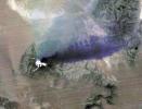
Winter still grips the volcanoes on Russia's Kamchatka peninsula. NASA's Terra spacecraft acquired this image showing the mantle of white, disturbed by dark ash entirely covering Sheveluch volcano from recent eruptions.
PIA18379:
NASA Spacecraft Spots Signs of Erupting Russian Volcano
Full Resolution:     TIFF (1.908 MB)     JPEG (297.3 kB)
Add Image to Favorite List 2014-05-16 Earth Terra
ASTER
687x798x3
This image from NASA's Terra spacecraft shows the Bangladeshi coast north of Chittagong, where ships from around the world are beached and dismantled.
PIA18258:
Shipbreaking, Bangladesh
Full Resolution:     TIFF (1.645 MB)     JPEG (124.2 kB)
Add Image to Favorite List 2014-05-09 Earth Terra
ASTER
1782x1754x3
The Nagarjuna Sagar Dam on India's Krishna River is the largest masonry dam in operation in the world. This image is from NASA's Terra spacecraft.
PIA18373:
Nagarjuna Sagar Dam, India
Full Resolution:     TIFF (9.381 MB)     JPEG (513.8 kB)
Add Image to Favorite List 2014-05-01 Earth Terra
ASTER
4400x4000x3
On April 28, 2014, NASA's Terra spacecraft spotted signs of activity at Ubinas volcano in the Peruvian Andes. The appearance of a new lava dome in March 2014 and frequent ash emissions are signs of increasing activity at this volcano.
PIA18245:
Ubinas Volcano Activity in Peruvian Andes
Full Resolution:     TIFF (52.83 MB)     JPEG (2.566 MB)
Add Image to Favorite List 2014-04-29 Earth Aqua
AIRS
900x695x3
NASA's Aqua spacecraft passed over central and southern United States on April 27-29, 2014 capturing this false-color infrared image of the slow-moving low-pressure system that spawned the strong supercell thunderstorms.
PIA18047:
NASA Satellite Spots Severe Weather Outbreak in South
Full Resolution:     TIFF (1.877 MB)     JPEG (142 kB)
Add Image to Favorite List 2014-04-28 Earth Terra
ASTER
1517x1446x3
On Friday, April 26, 2014, an avalanche on Mount Everest killed at least 13 Sherpa guides. NASA's Terra spacecraft looked toward the northeast, with Mount Everest (center), and Lhotse, the fourth-highest mountain on Earth, on the skyline to right center.
PIA18046:
Deadly Everest Avalanche Site Spotted by NASA Spacecraft
Full Resolution:     TIFF (6.583 MB)     JPEG (327.9 kB)
Add Image to Favorite List 2014-04-28 Earth Terra
ASTER
1868x2097x3
Karst topography is a geological formation shaped by the dissolution of layers of soluble rock such as limestone. A good example is found in Guangxi Province in southeast China, as seen by NASA's Terra spacecraft.
PIA18230:
Karst Landscape, China
Full Resolution:     TIFF (11.76 MB)     JPEG (857.2 kB)
Retrieve Previous Set  Jump to a Previous Set   Jump to a Previous Set   Jump to a Previous Set   Jump to a Previous Set   Jump to a Previous Set   Jump to a Previous Set   Current Set   Jump to a Following Set   Jump to a Following Set   Jump to a Following Set   Retrieve Next Set 
 1-100   101-200   201-300   301-400   401-500   501-600   601-700   701-800   801-900   901-1000 
Currently displaying images: 601 - 700 of 2555