My
List |
Addition Date
|
Target
|
Mission
|
Instrument
|
Size
|

|
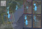
2019-11-05 |
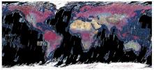
Earth
|
Terra
|
|
720x480x3 |
|
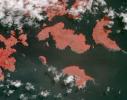
-
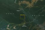
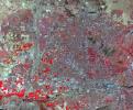
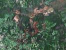
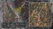
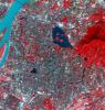
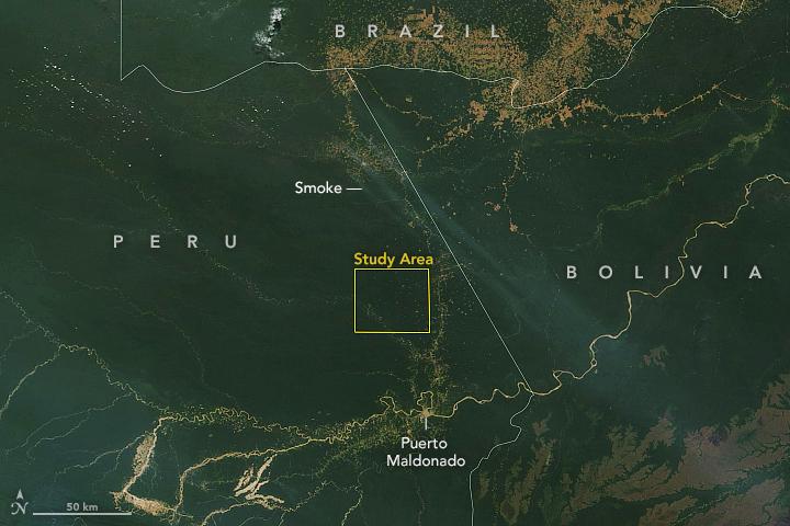
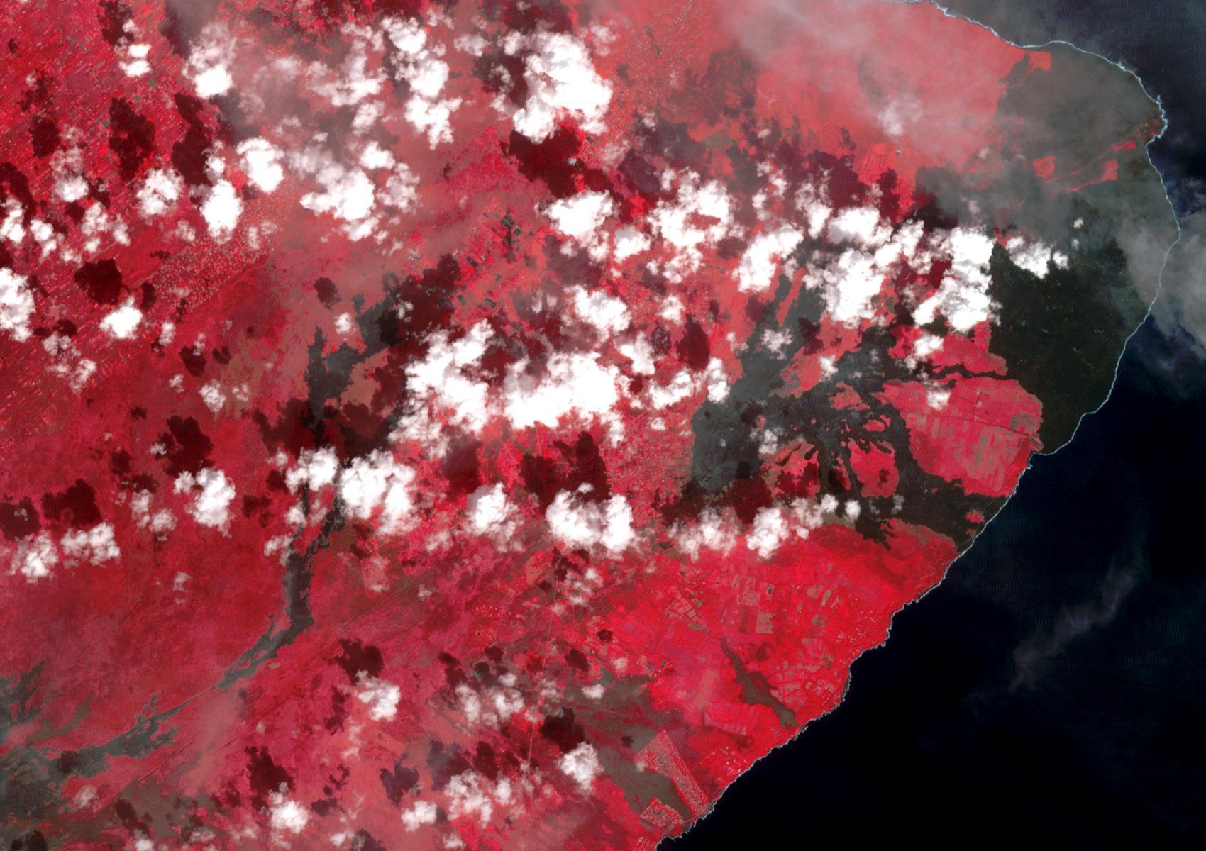
PIA23546:
-
NASA Terra Satellite Sees Amazon Fires in Peru
Full Resolution:
TIFF
(855.7 kB)
JPEG
(51.57 kB)
|
|
|
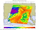
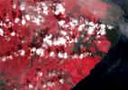
2019-11-05 |
Earth
|
ECOSTRESS
|
|
720x715x3 |
|
-
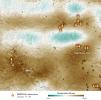
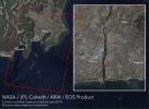
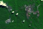
PIA23432:
-
Drought-Stressed Forest Fueled Amazon Fires
Full Resolution:
TIFF
(1.545 MB)
JPEG
(112.1 kB)
|
|
|
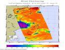
2019-11-05 |
Earth
|
|
|
1440x960x3 |

|
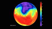
-
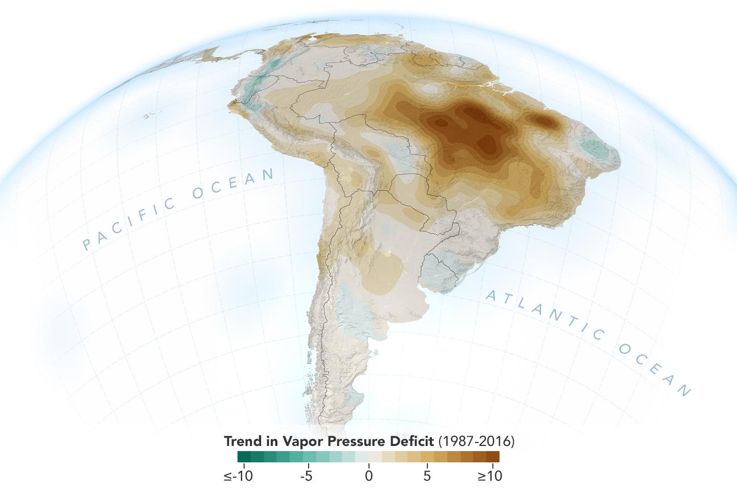
PIA23425:
-
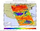
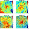
New Study Shows Atmosphere in the Amazon Drying Out
Full Resolution:
TIFF
(1.789 MB)
JPEG
(96.3 kB)
|
|
|
2019-11-04 |
Earth
|
Terra
|
ASTER
|
2590x2185x3 |

|
-
PIA23426:
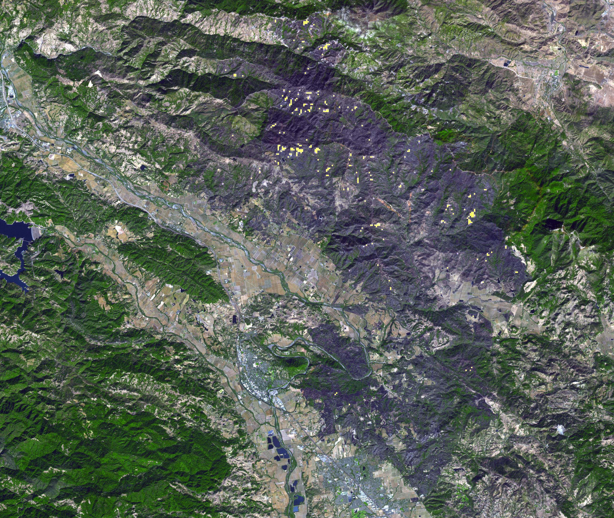
-
ASTER Sees Kincade Fire Damage From Space
Full Resolution:
TIFF
(16.98 MB)
JPEG
(1.333 MB)
|
|
|
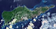
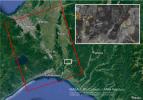
2019-10-31 |
Earth
|
Terra
|
ASTER
|
1165x1520x3 |
|
-
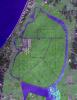
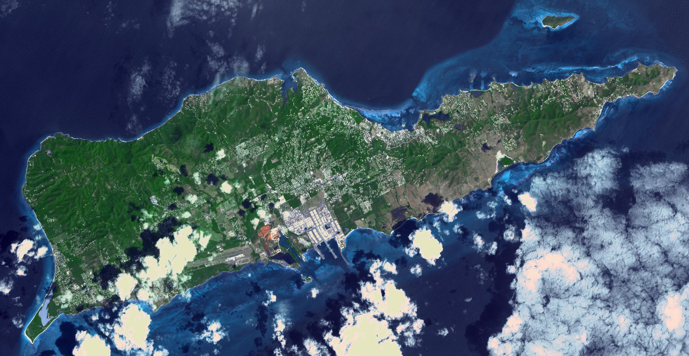
PIA23531:
-
Okata, Japan
Full Resolution:
TIFF
(5.314 MB)
JPEG
(352.6 kB)
|
|
|
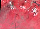
2019-10-21 |
Earth
|
Terra
|
ASTER
|
2847x3903x3 |
|
-
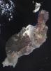
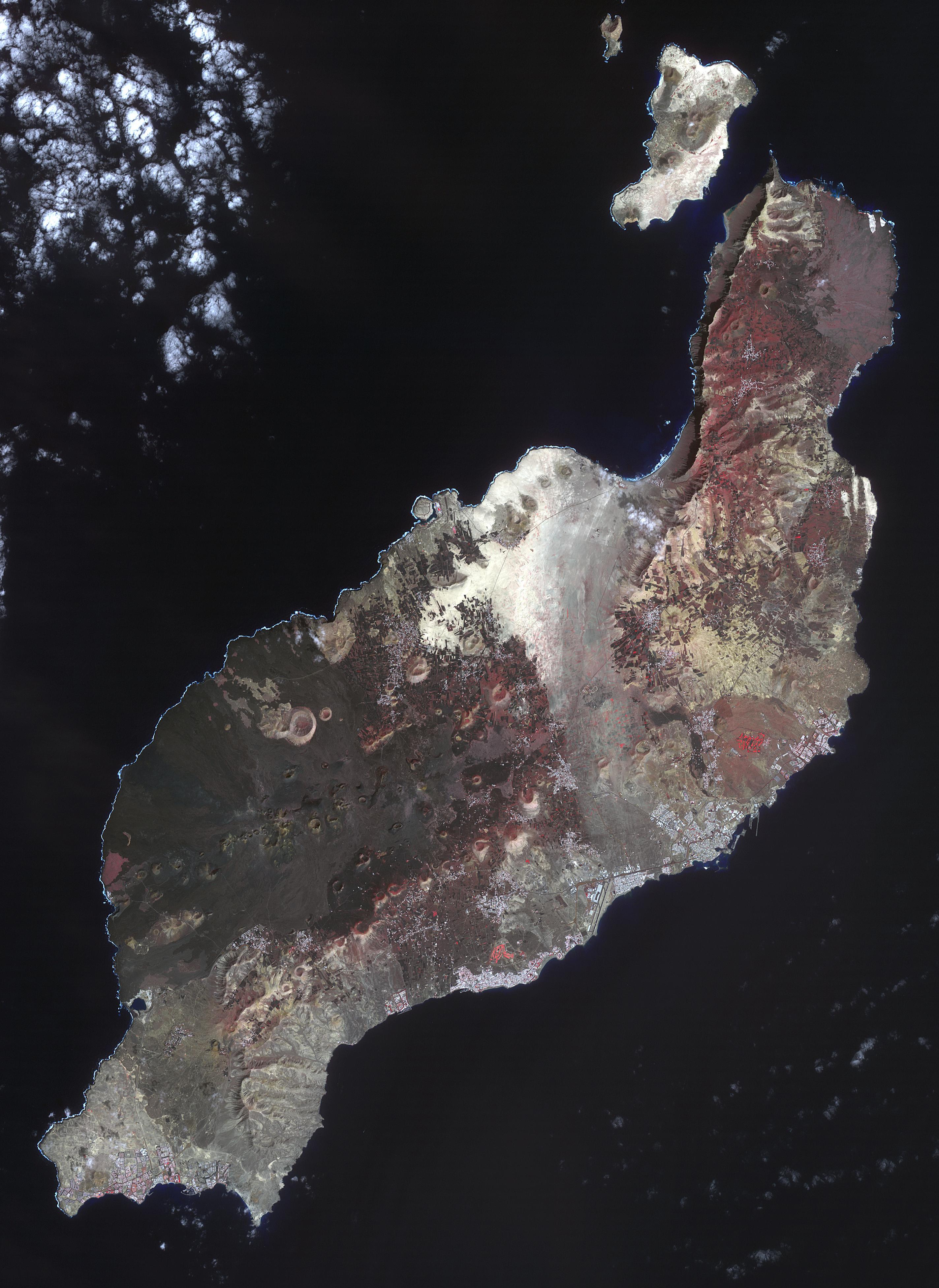
PIA23526:
-
Lanzarote, Spanish Canary Islands
Full Resolution:
TIFF
(22.01 MB)
JPEG
(1.189 MB)
|
|
|
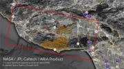
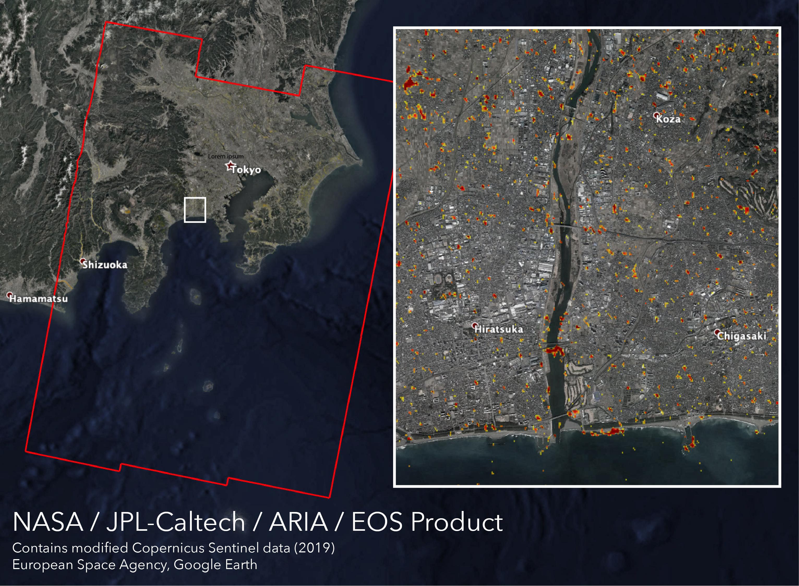
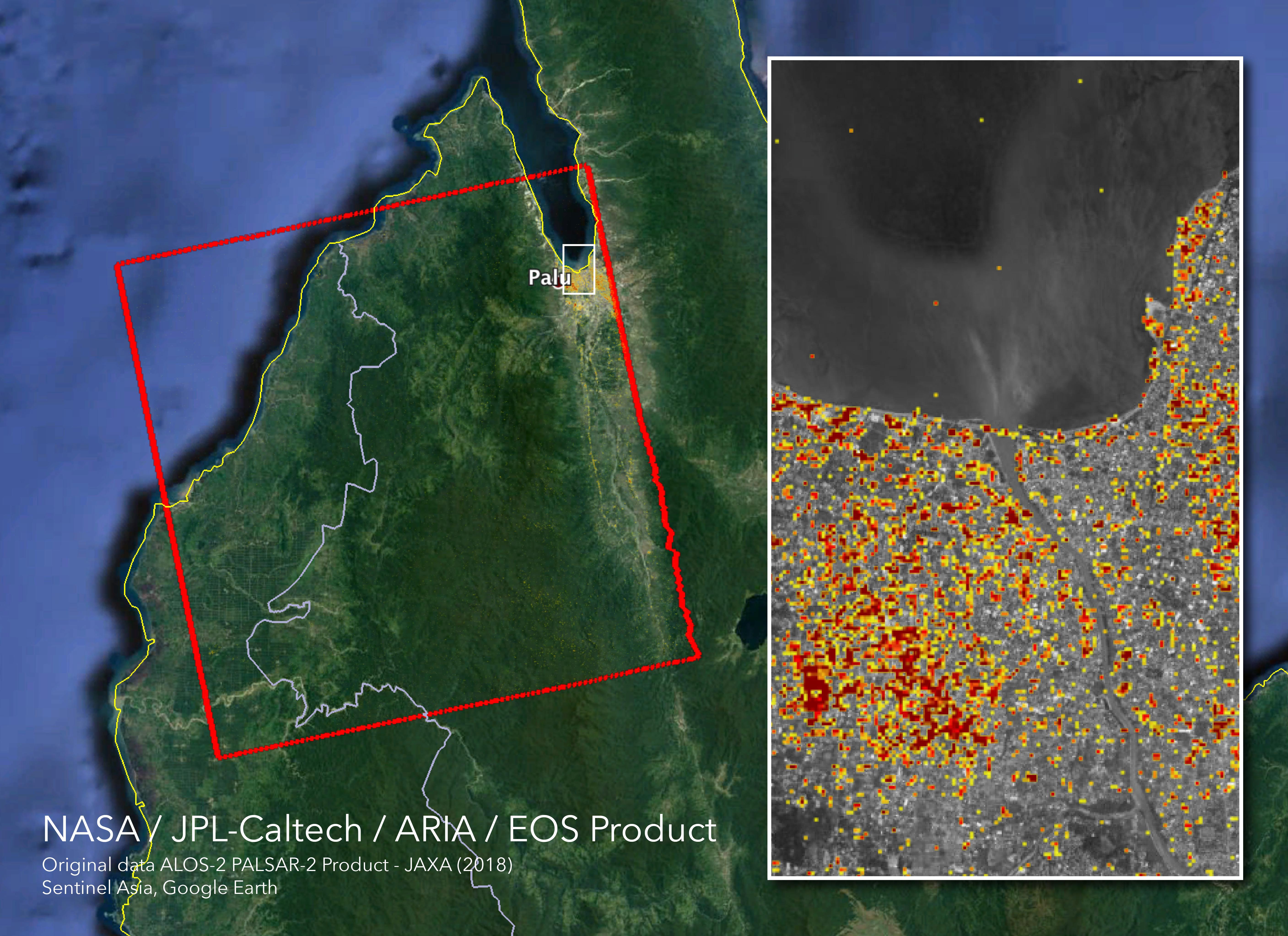
2019-10-15 |
Earth
|
ARIA
|
SAR
|
3063x2249x3 |
|
-
PIA23424:
-
New ARIA Map Shows Damage from Typhoon Hagibis
Full Resolution:
TIFF
(13.95 MB)
JPEG
(960.9 kB)
|
|
|
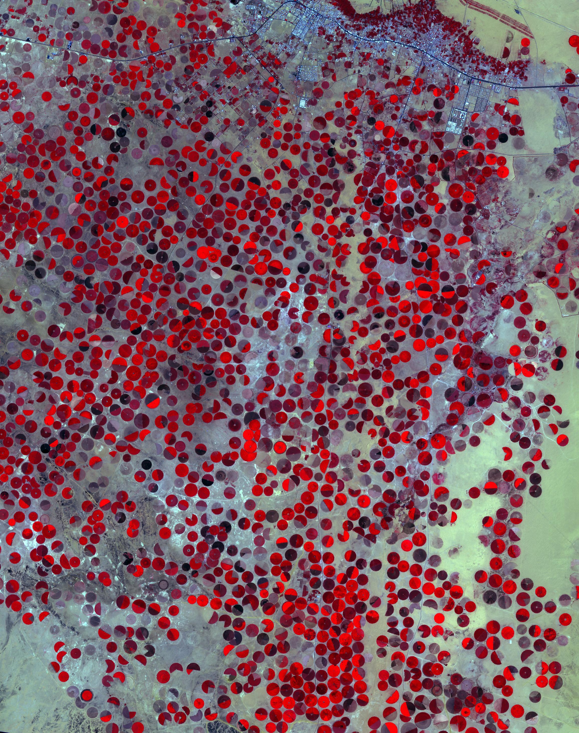
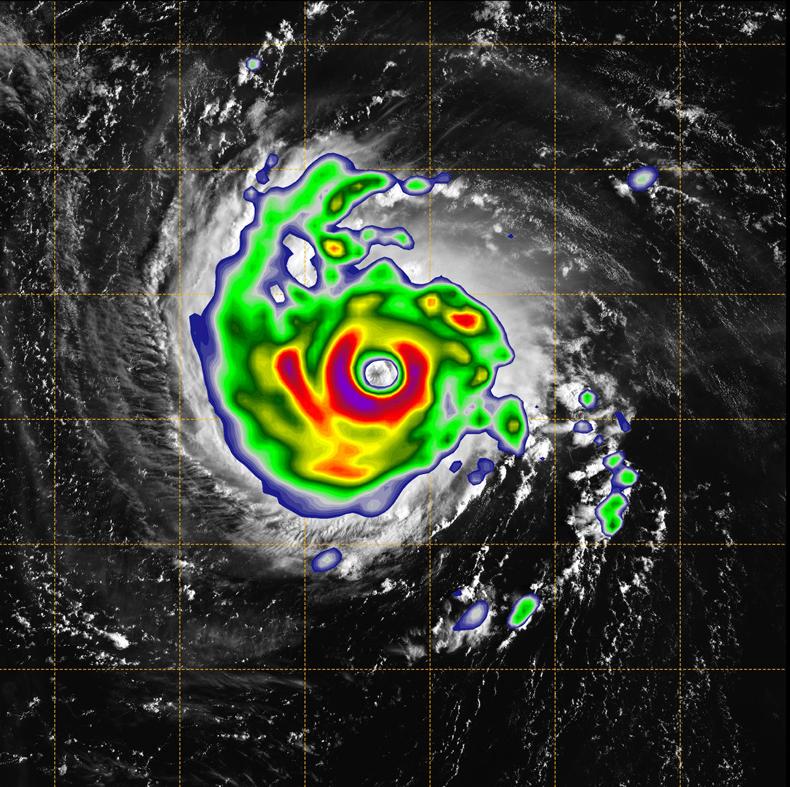
2019-10-09 |
Earth
|
Terra
|
ASTER
|
2314x2930x3 |
|
-
PIA23490:
-
Wadi Al Dawasir, Saudi Arabia
Full Resolution:
TIFF
(20.35 MB)
JPEG
(1.282 MB)
|
|
|
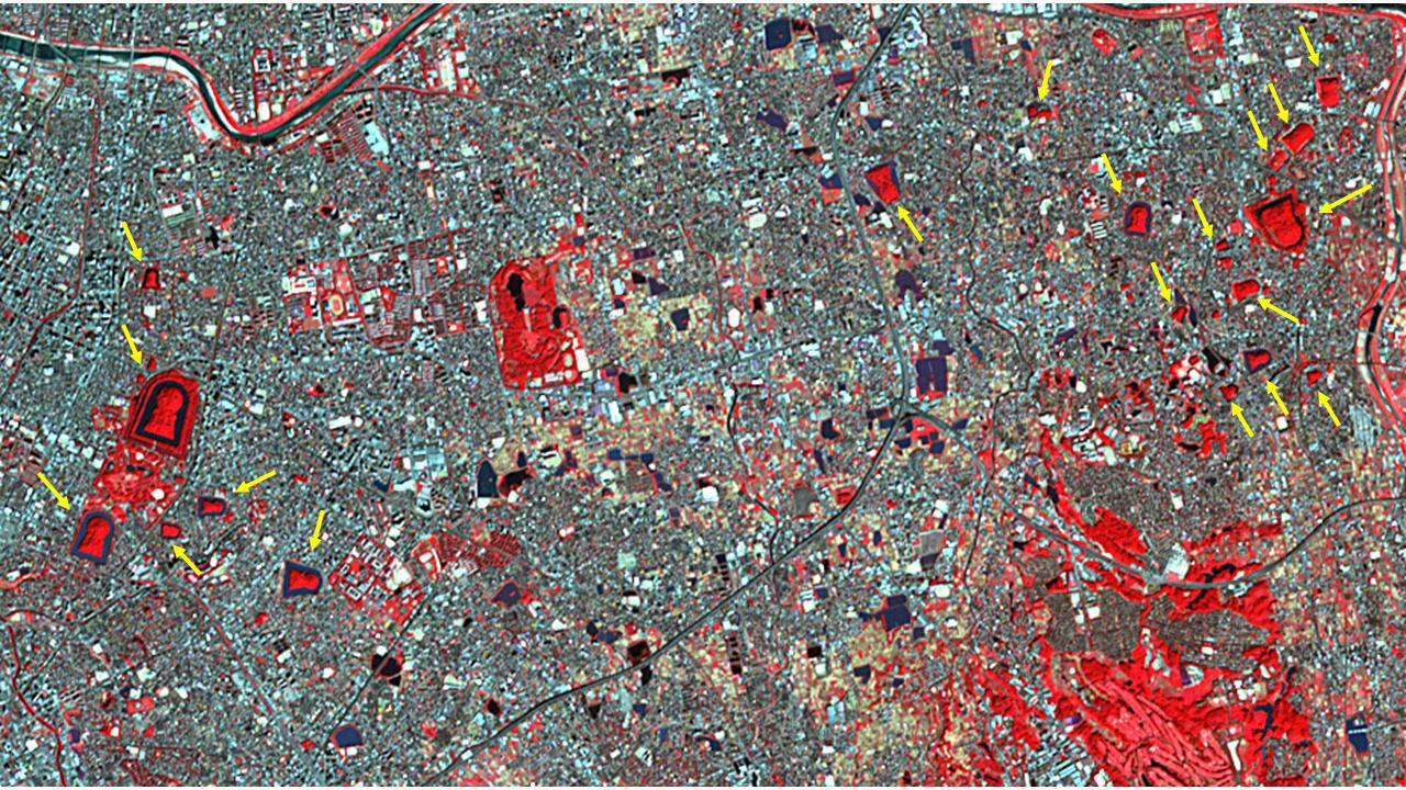
2019-09-19 |
Earth
|
Terra
|
ASTER
|
1280x720x3 |
|
-
PIA23460:
-
Mozu Tombs, Japan
Full Resolution:
TIFF
(2.766 MB)
JPEG
(315.1 kB)
|
|
|
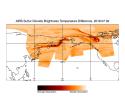
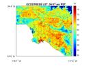
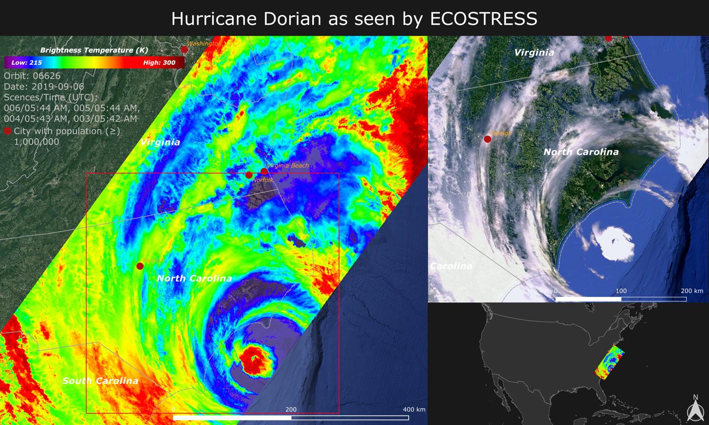
2019-09-18 |
Earth
|
ECOSTRESS
|
|
1430x857x3 |

|
-
PIA23422:
-
NASA Images Hurricane Dorian's Temperature from Space
Full Resolution:
TIFF
(3.196 MB)
JPEG
(252.8 kB)
|
|
|
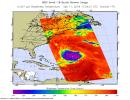
2019-09-10 |
Earth
|
Terra
|
MISR
|
2550x3150x3 |
|
-
PIA23423:
-
NASA's MISR Observes Hurricane Dorian off the South Carolina Coast
Full Resolution:
TIFF
(12.86 MB)
JPEG
(1.031 MB)
|
|
|
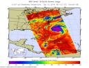
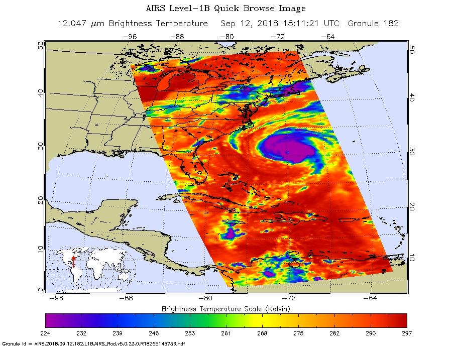
2019-09-05 |
Earth
|
Aqua
|
AIRS
|
3994x3194x3 |
|
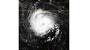
-
PIA23421:
-
NASA's AIRS Displays Sulfur Dioxide Plumes After Raikoke Eruption, June 2019
Full Resolution:
TIFF
(8.331 MB)
JPEG
(713.6 kB)
|
|
|
2019-09-05 |
Earth
|
Terra
|
ASTER
|
1508x1856x3 |
|
-
PIA23420:
-
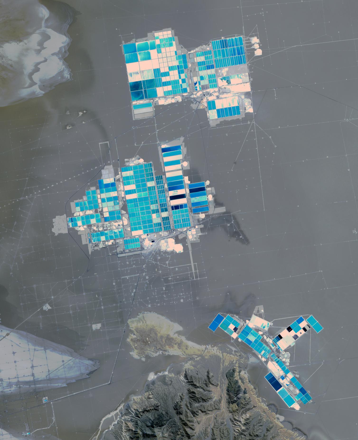
Salar de Atacama, Chile
Full Resolution:
TIFF
(5.488 MB)
JPEG
(250 kB)
|
|
|
2019-09-04 |
Earth
|
CubeSat
|
|
1400x788x3 |
|
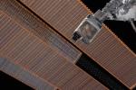
-
PIA23431:
-
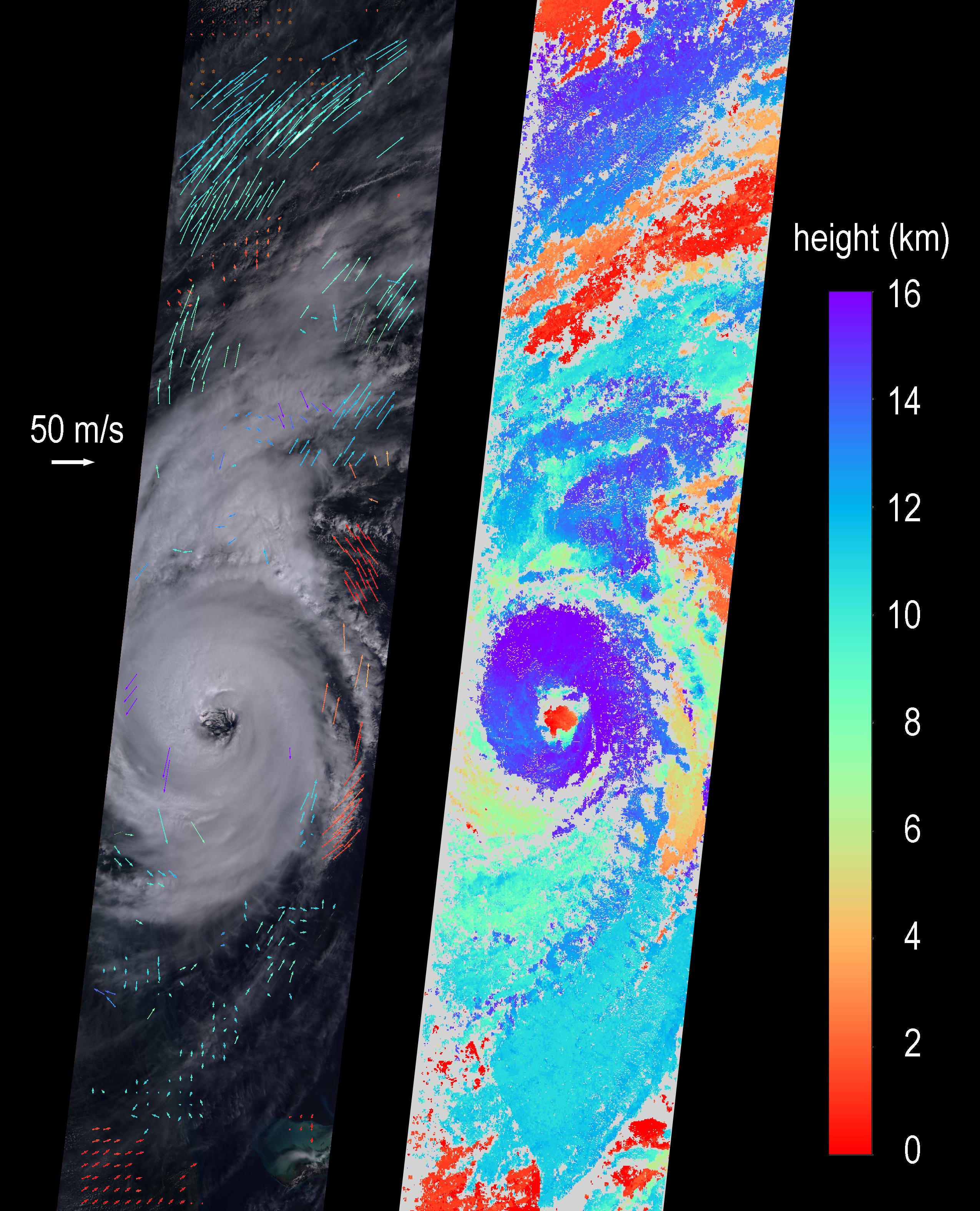
TEMPEST-D CubeSat Sees Hurricane Dorian in 3D
Full Resolution:
TIFF
(1.581 MB)
JPEG
(105.9 kB)
|
|
|
2019-09-03 |
Earth
|
ARIA
|
SAR
|
6900x4772x3 |
|
-
PIA23360:
-
Flooding from Dorian Seen from Space
Full Resolution:
TIFF
(71.04 MB)
JPEG
(2.466 MB)
|
|
|
2019-08-29 |
Earth
|
CubeSat
|
|
1400x778x3 |
|
-
PIA23414:
-
Small Satellite TEMPEST-D Sees Hurricane Dorian off Coast
Full Resolution:
TIFF
(1.738 MB)
JPEG
(121.2 kB)
|
|
|
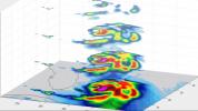
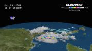
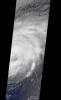
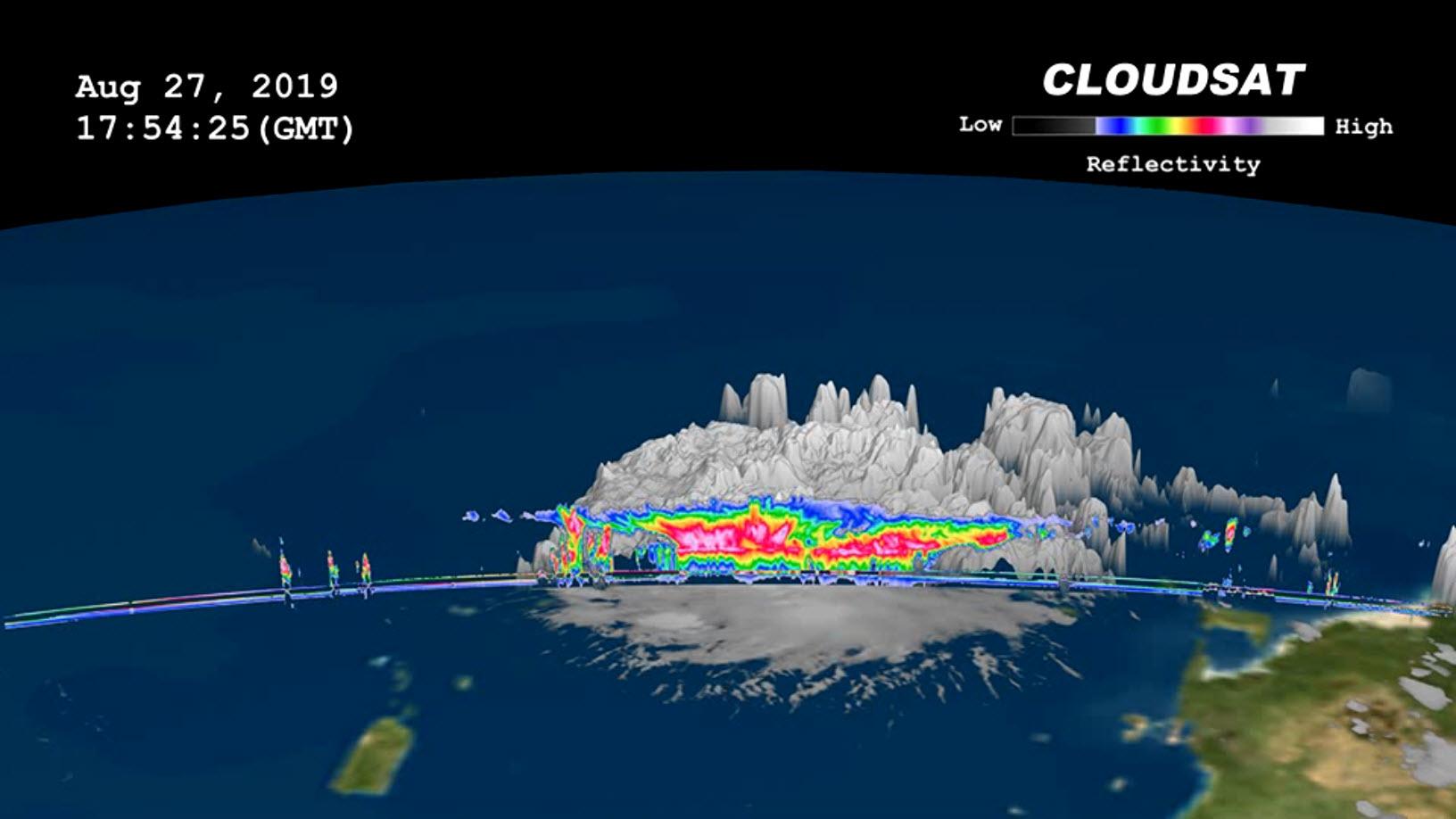
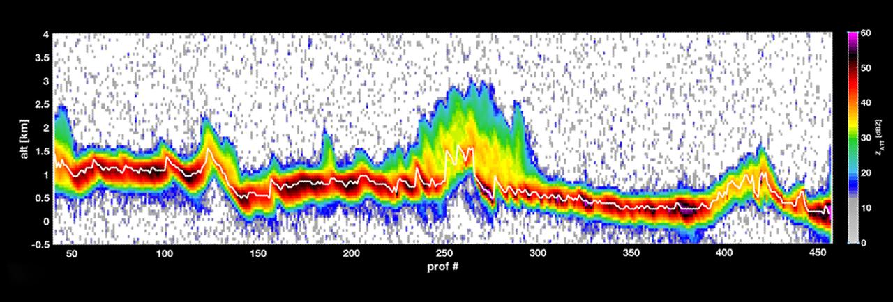
2019-08-29 |
Earth
|
CloudSat
|
Cloud Profiling Radar (CPR)
|
1632x918x3 |

|
-
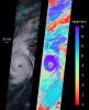
PIA23359:
-
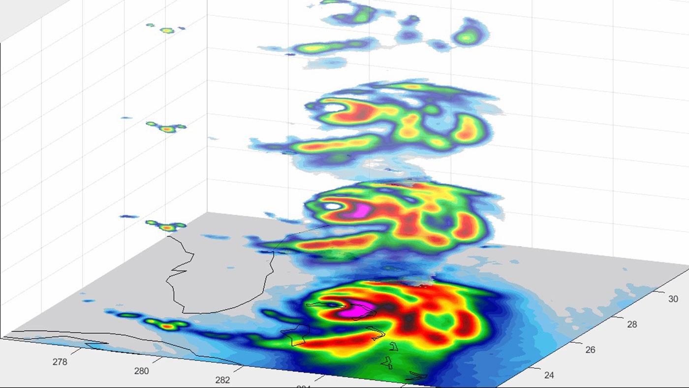
NASA's CloudSat Images Dorian in 3D
Full Resolution:
TIFF
(1.707 MB)
JPEG
(97.89 kB)
|
|
|
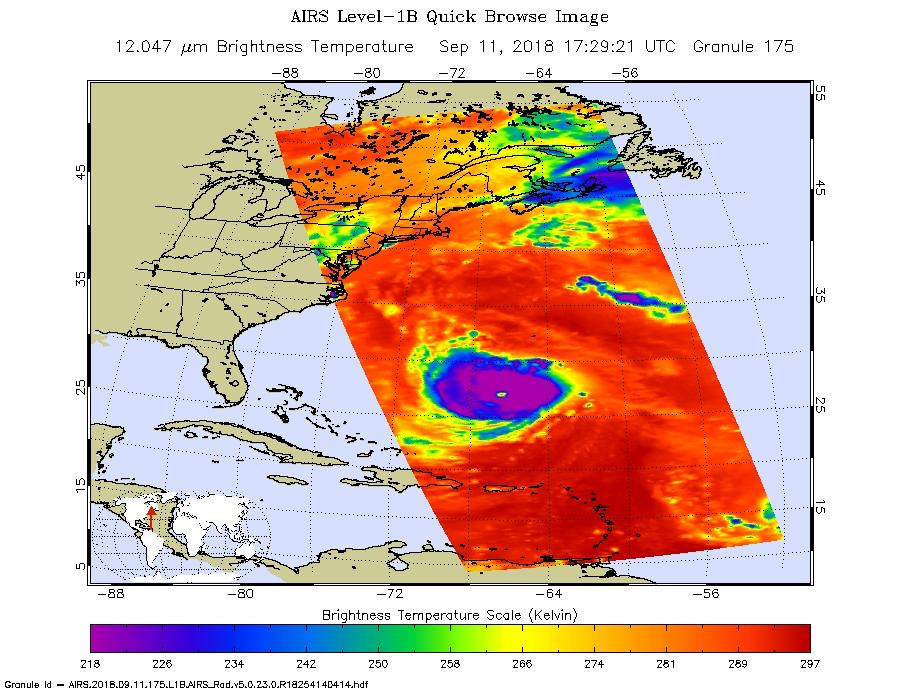
2019-08-29 |
Earth
|
Aqua
|
AIRS
|
900x695x3 |
|
-
PIA23358:
-
AIRS Measures the Clouds in Hurricane Dorian
Full Resolution:
TIFF
(746.3 kB)
JPEG
(105.8 kB)
|
|
|
2019-08-28 |
Earth
|
ECOSTRESS
|
|
1867x1132x3 |
|
-
PIA23357:
-
Amazon Fires Seen by NASA's ECOSTRESS
Full Resolution:
TIFF
(6.142 MB)
JPEG
(260.2 kB)
|
|
|
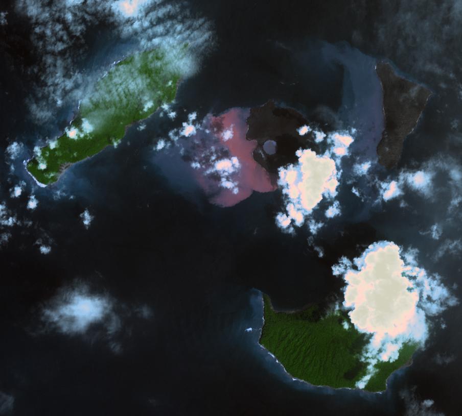
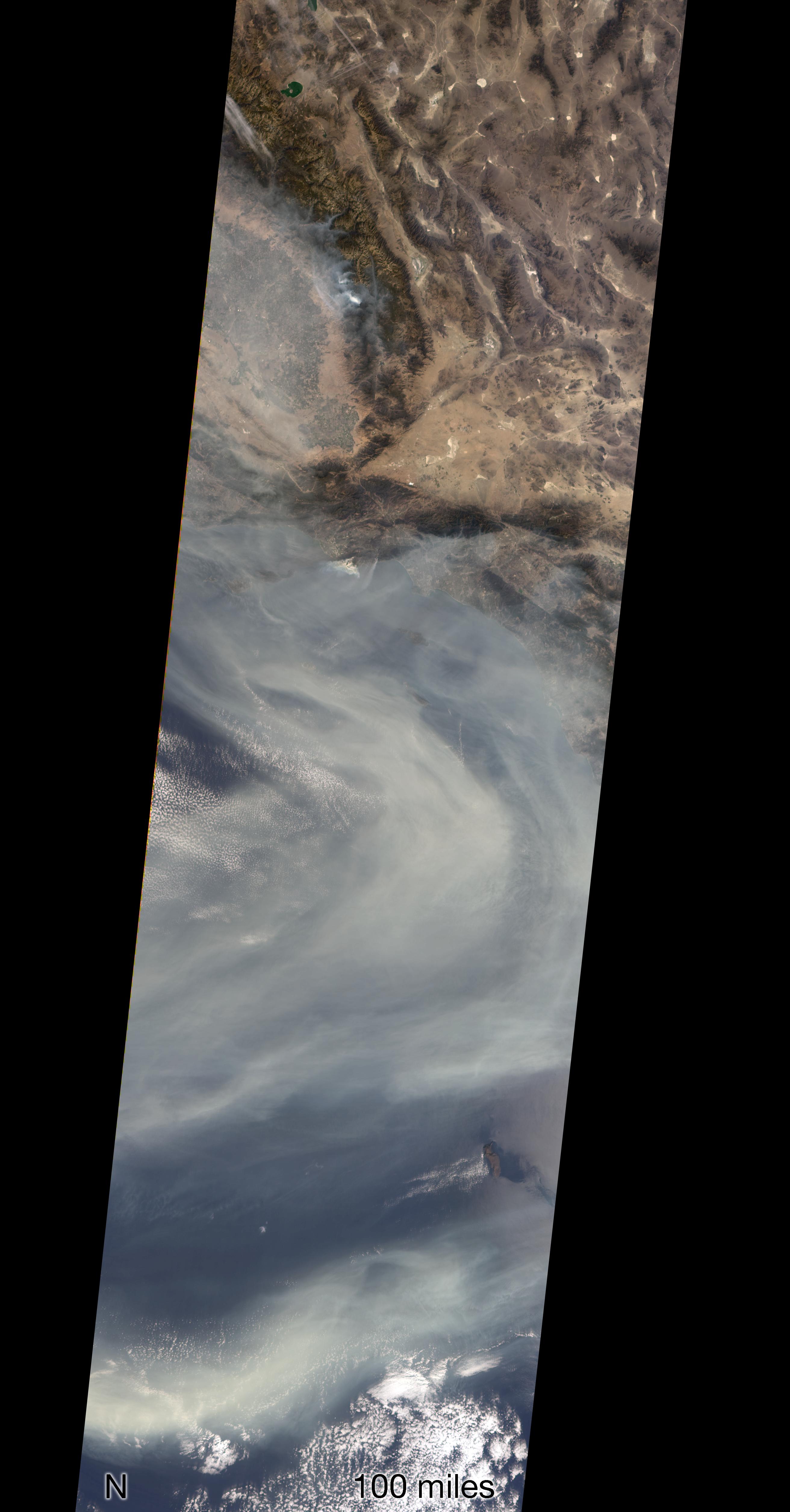
2019-08-23 |
Earth
|
Aqua
|
AIRS
|
1400x787x3 |
|
-
PIA23356:
-
NASA's AIRS Maps Carbon Monoxide from Brazil Fires
Full Resolution:
TIFF
(879.2 kB)
JPEG
(63.62 kB)
|
|
|
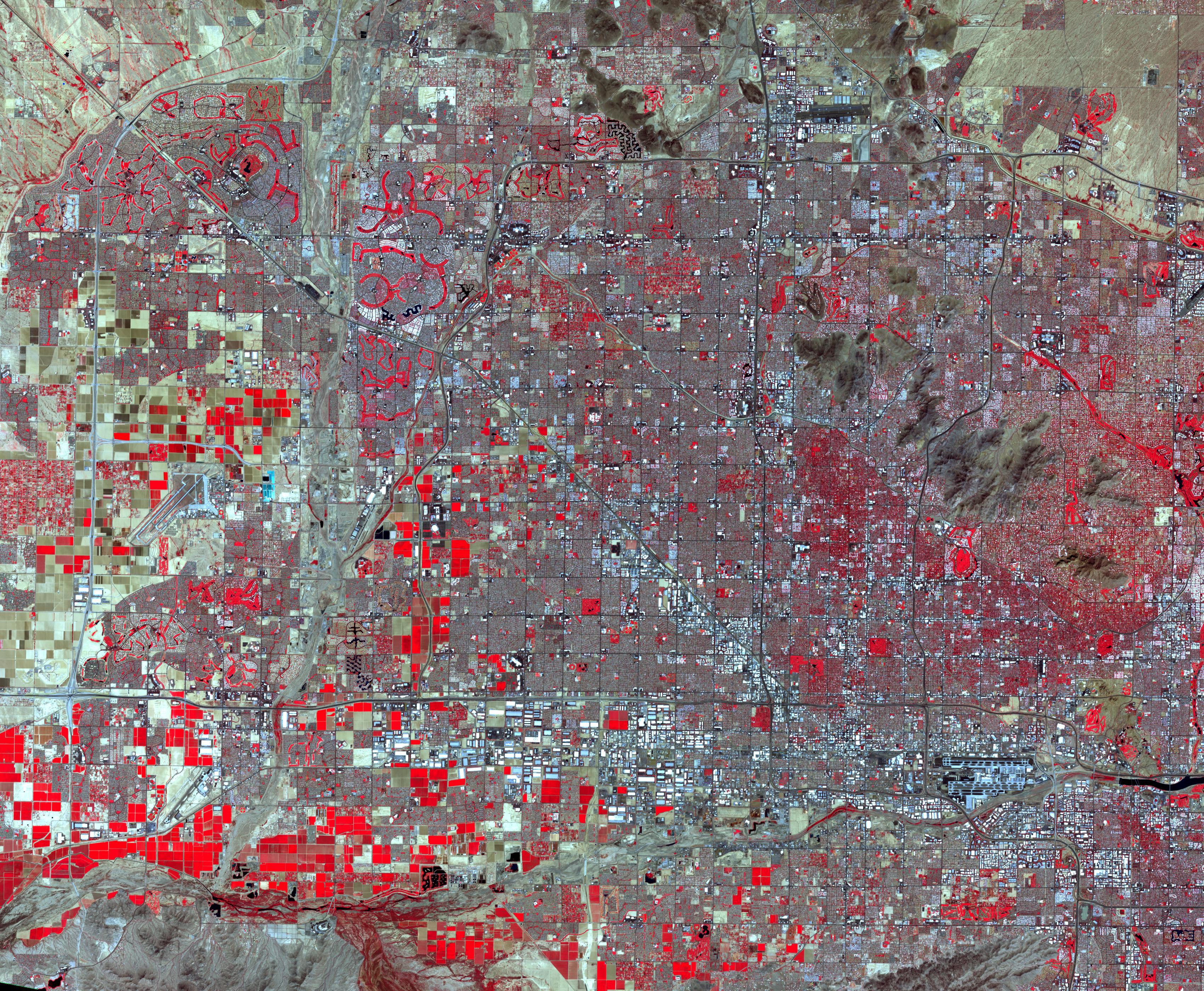
2019-08-20 |
Earth
|
Terra
|
ASTER
|
3400x2800x3 |
|
-
PIA23411:
-
Phoenix, AZ
Full Resolution:
TIFF
(28.57 MB)
JPEG
(2.744 MB)
|
|
|
2019-08-20 |
Earth
|
GRACE-FO
|
Microwave Ranging Instrument
|
2454x1516x3 |
|
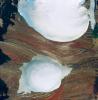
-
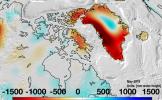
PIA23340:
-
Changes in Mass, Greenland
Full Resolution:
TIFF
(6.486 MB)
JPEG
(458.8 kB)
|
|
|
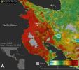
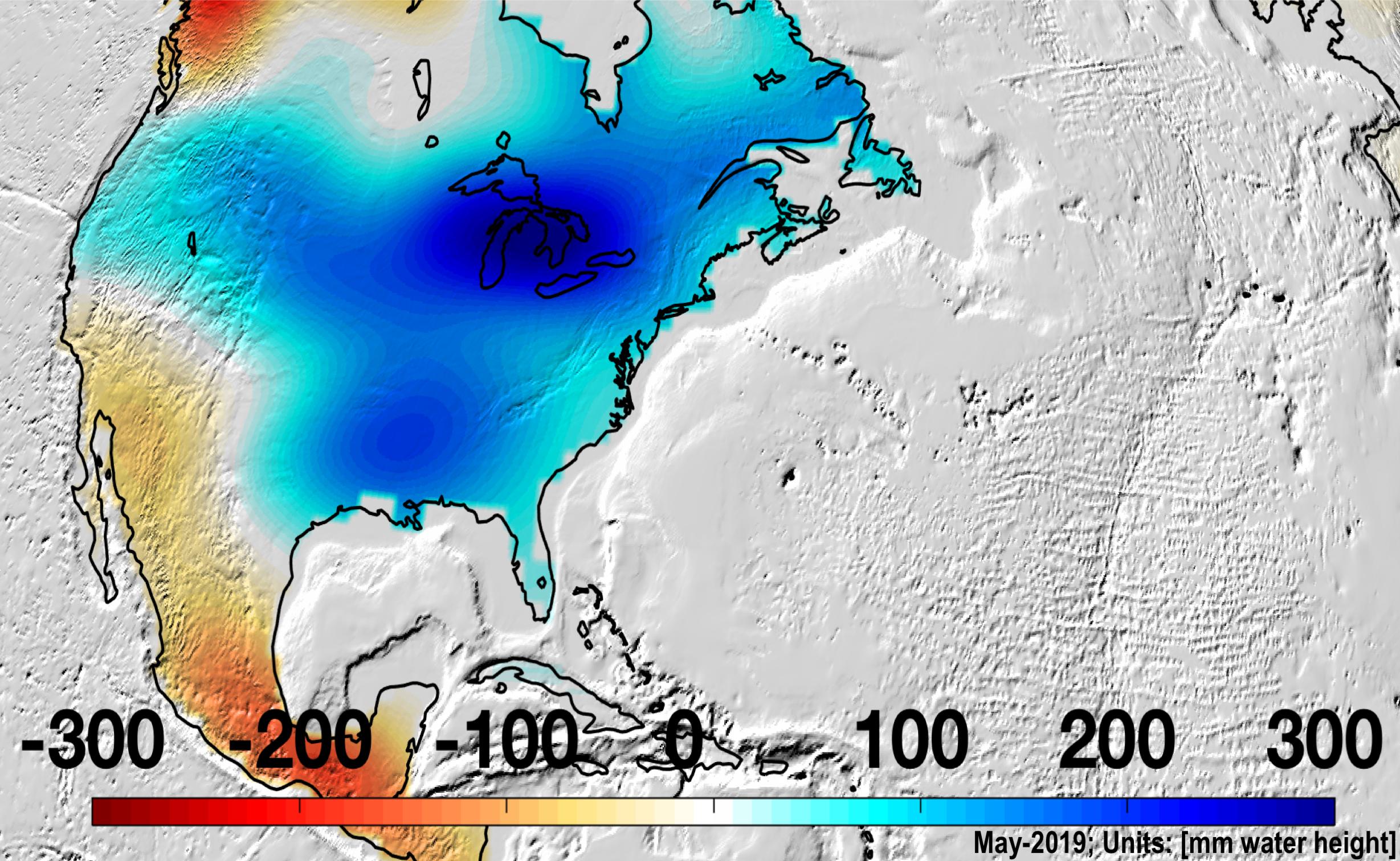
2019-08-20 |
Earth
|
GRACE-FO
|
Microwave Ranging Instrument
|
2457x1513x3 |

|
-
PIA22840:
-
Changes in Mass, North America
Full Resolution:
TIFF
(6.842 MB)
JPEG
(582.4 kB)
|
|
|
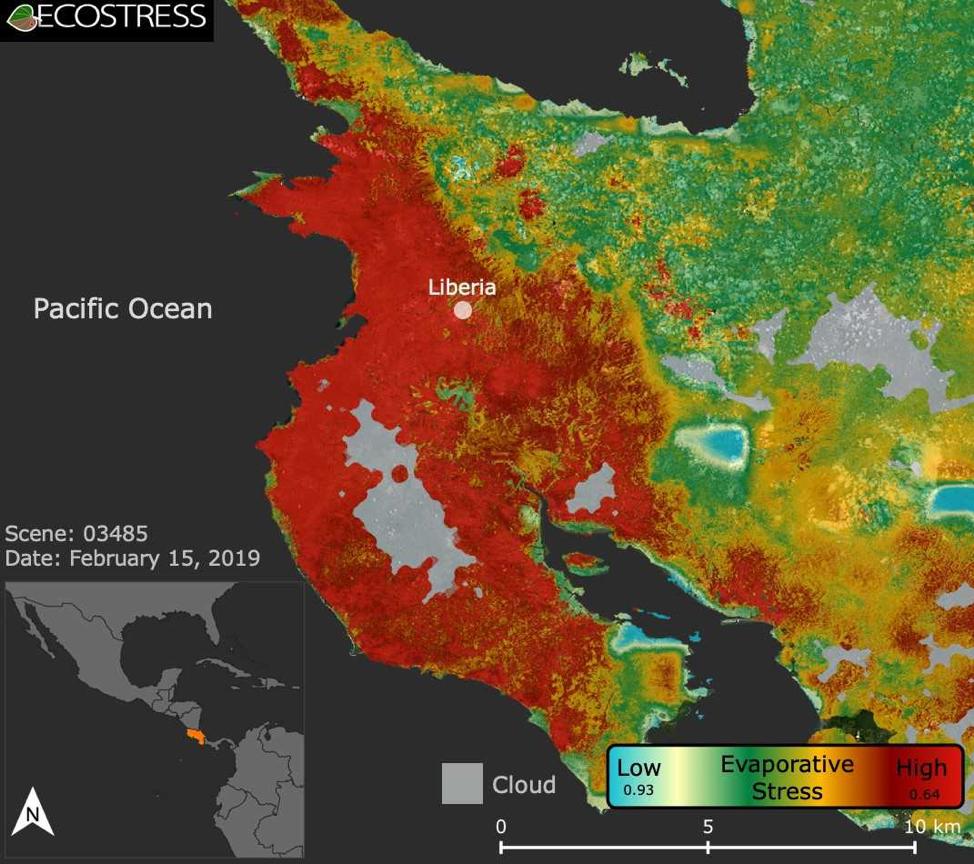
2019-08-08 |
Earth
|
ECOSTRESS
|
|
974x864x3 |
|
-
PIA22839:
-
ECOSTRESS Focuses on Costa Rican Drought
Full Resolution:
TIFF
(1.922 MB)
JPEG
(129.8 kB)
|
|
|
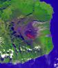
2019-08-07 |
Earth
|
Terra
|
ASTER
|
2134x1447x3 |
|
-
PIA23339:
-
Mauna Kea volcano, Hawaii
Full Resolution:
TIFF
(8.003 MB)
JPEG
(372.9 kB)
|
|
|
2019-07-17 |
Earth
|
Terra
|
ASTER
|
2603x1600x3 |

|
-
PIA23338:
-
Panguna Copper Deposit, Papua New Guinea
Full Resolution:
TIFF
(12.5 MB)
JPEG
(678 kB)
|
|
|
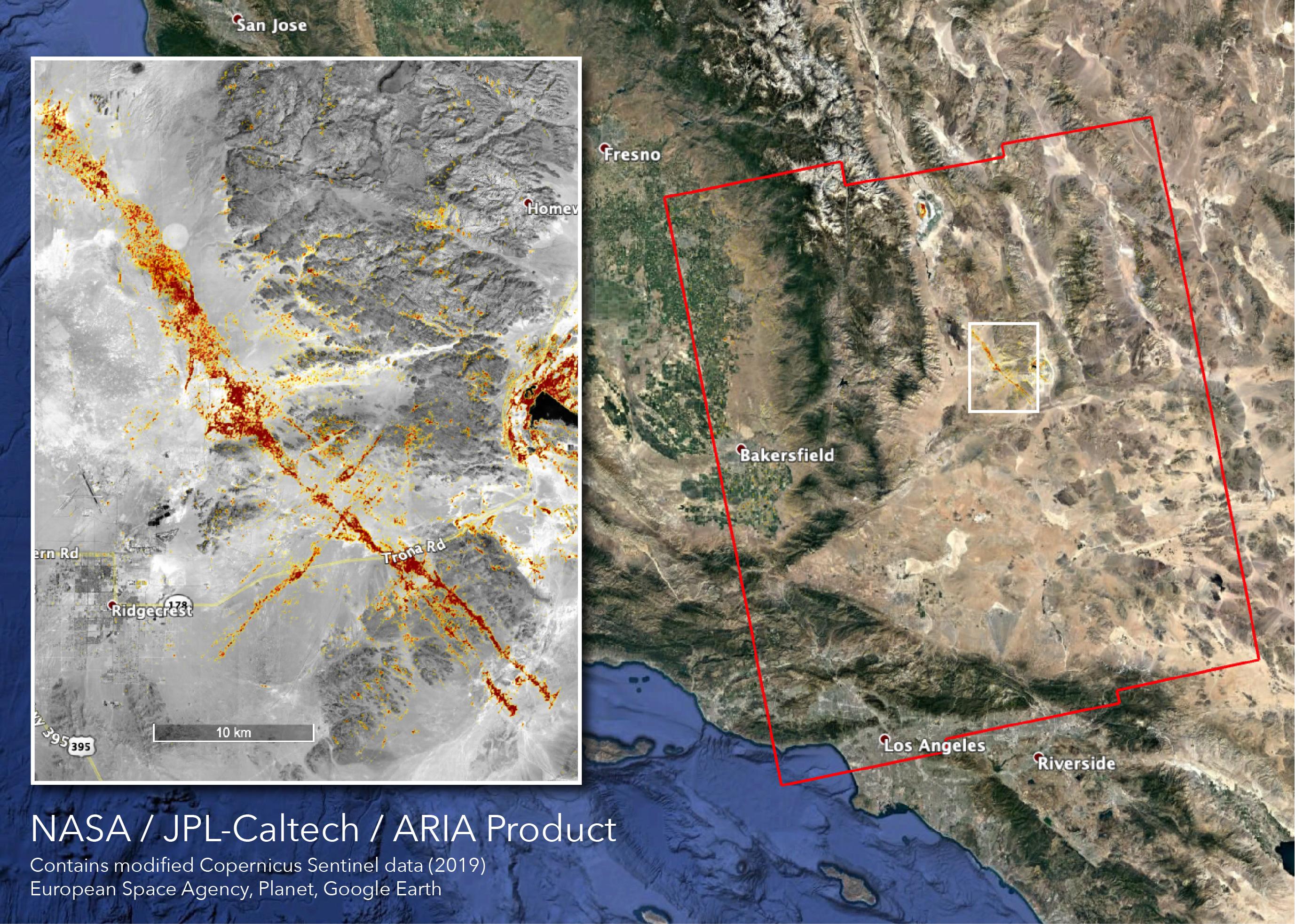
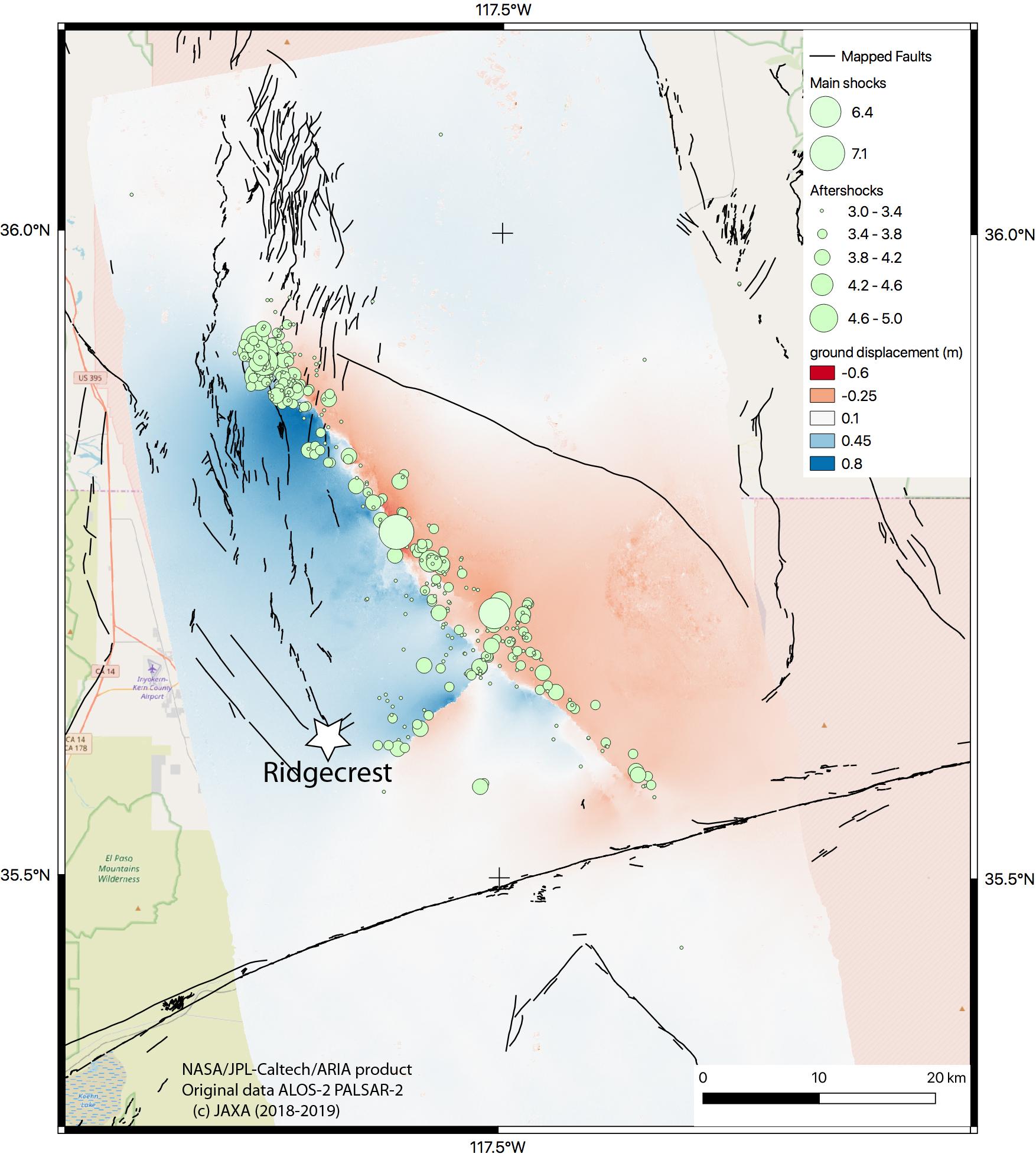
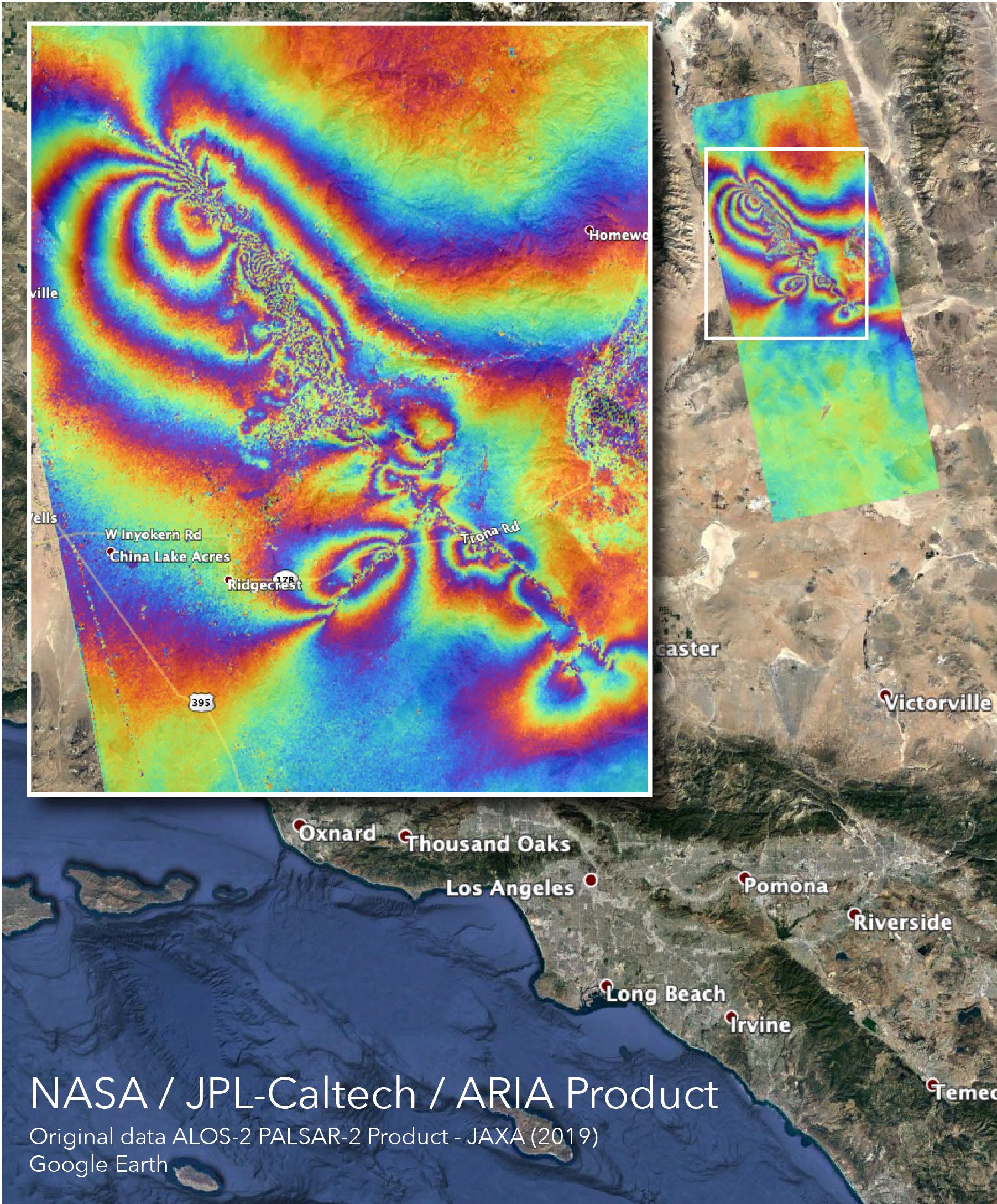
2019-07-12 |
Earth
|
ARIA
|
SAR
|
2754x1965x3 |

|
-
PIA23354:
-
NASA's ARIA Team Maps California Quake Damage
Full Resolution:
TIFF
(15.93 MB)
JPEG
(1.011 MB)
|
|
|
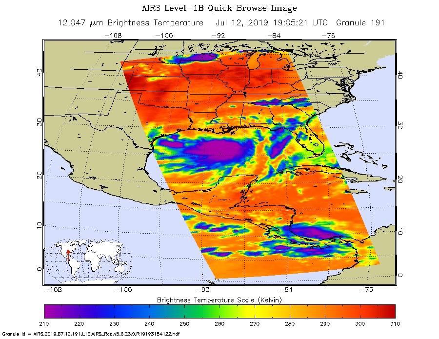
2019-07-12 |
Earth
|
Aqua
|
AIRS
|
900x695x3 |
|
-
PIA23355:
-
NASA's AIRS Images Tropical Storm Barry Before Landfall
Full Resolution:
TIFF
(1.069 MB)
JPEG
(134.4 kB)
|
|
|
2019-07-12 |
Earth
|
Orbiting Carbon Observatory (OCO-3)
|
OCO-3
|
1440x841x3 |
|
-
PIA23353:
-
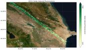
OCO-3's First Solar-Induced Fluorescence Measurements
Full Resolution:
TIFF
(3.003 MB)
JPEG
(203.5 kB)
|
|
|
2019-07-12 |
Earth
|
Orbiting Carbon Observatory (OCO-3)
|
OCO-3
|
1007x701x3 |

|
-
PIA23352:
-
OCO-3's First CO2 Measurements
Full Resolution:
TIFF
(1.255 MB)
JPEG
(99.61 kB)
|
|
|
2019-07-11 |
Earth
|
ARIA
|
|
1754x1959x3 |
|
-
PIA23351:
-
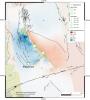
NASA Map Shows Ground Movement from California Quakes
Full Resolution:
TIFF
(4.263 MB)
JPEG
(292.6 kB)
|
|
|
2019-07-10 |
Earth
|
Terra
|
MISR
|
4200x3444x3 |
|
-
PIA23332:
-
MISR Where on Earth ...? MISR Mystery Image Quiz #31
Full Resolution:
TIFF
(33.45 MB)
JPEG
(962.9 kB)
|
|
|
2019-07-09 |
Earth
|
ARIA
|
SAR
|
1803x2176x3 |

|
-
PIA23150:
-
NASA's ARIA Maps Southern California Quake Damage
Full Resolution:
TIFF
(11.77 MB)
JPEG
(703 kB)
|
|
|
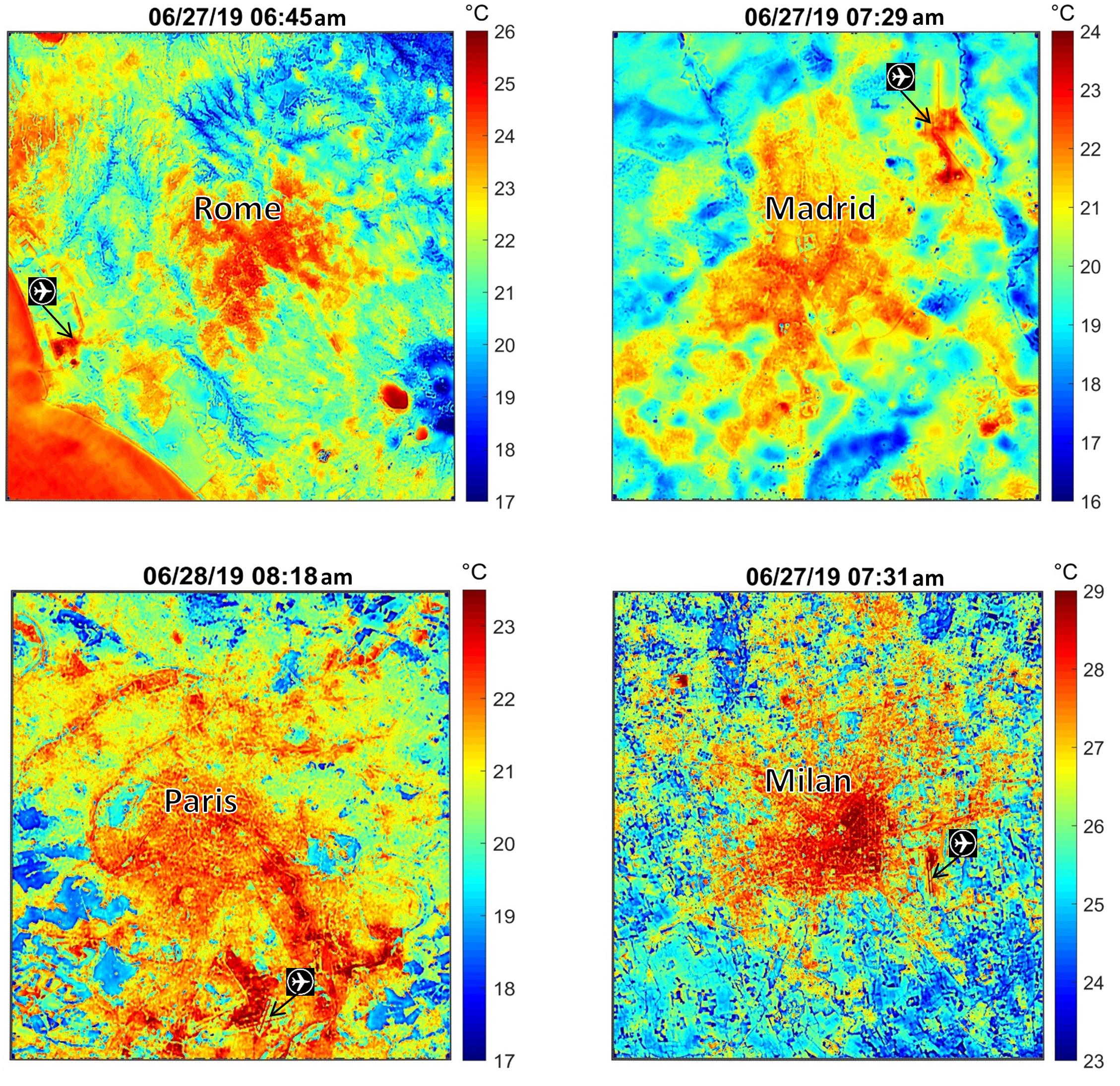
2019-07-02 |
Earth
|
ECOSTRESS
|
|
2258x2190x3 |
|
-
PIA23148:
-
NASA's ECOSTRESS Maps Europe Heat Wave
Full Resolution:
TIFF
(13.41 MB)
JPEG
(928.6 kB)
|
|
|
2019-07-01 |
Earth
|
Terra
|
ASTER
|
4200x1919x3 |
|
-
PIA23326:
-
Raikoke Island, Kuril Islands
Full Resolution:
TIFF
(19.62 MB)
JPEG
(623.5 kB)
|
|
|
2019-05-23 |
Earth
|
Terra
|
ASTER
|
3426x3501x3 |
|
-
PIA23234:
-
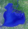
Lake St. Clair, US and Canada
Full Resolution:
TIFF
(33.91 MB)
JPEG
(1.468 MB)
|
|
|
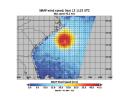
2019-05-17 |
Earth
|
SMAP
|
|
1400x787x3 |
|
-
PIA23146:
-
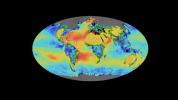
SMAP Sea Surface Salinity and Soil Moisture Time Lapse
Full Resolution:
TIFF
(1.025 MB)
JPEG
(82.57 kB)
|
|
|
2019-05-16 |
Earth
|
CubeSat
|
|
2592x2192x1 |
|
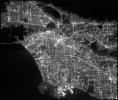
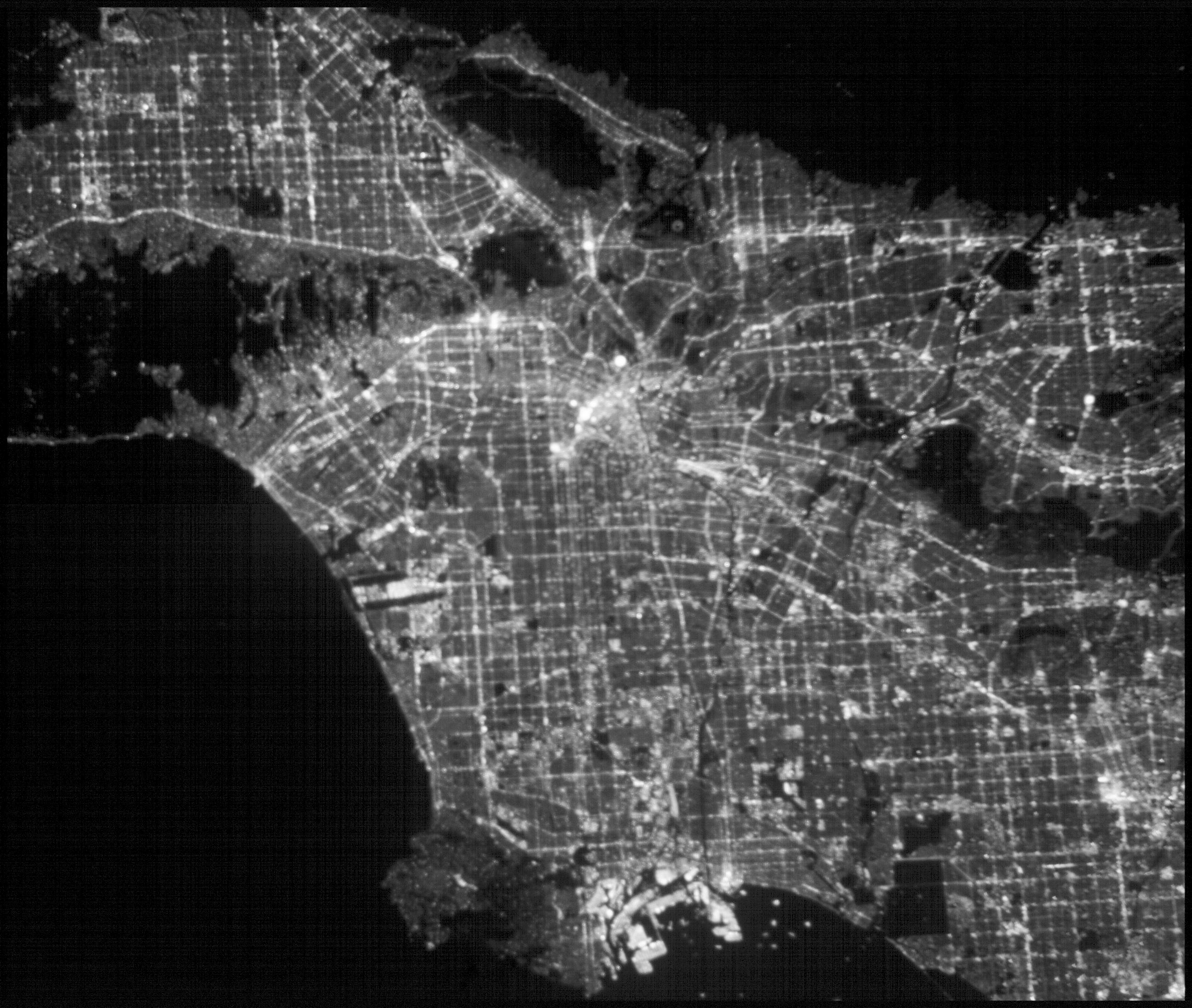
-
PIA23125:
-
ASTERIA Image of Los Angeles 2
Full Resolution:
TIFF
(4.963 MB)
JPEG
(831.4 kB)
|
|
|
2019-05-16 |
Earth
|
CubeSat
|
|
2592x2192x1 |
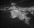
|
-
PIA23124:
-
ASTERIA Image of Los Angeles 1
Full Resolution:
TIFF
(4.729 MB)
JPEG
(440.4 kB)
|
|
|
2019-05-13 |
Moon
|
Lunar Reconnaissance Orbiter (LRO)
|
|
1222x988x1 |

|
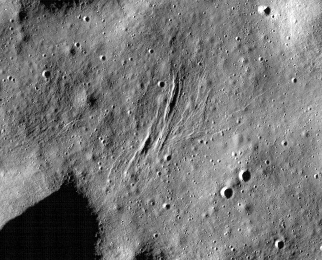
-
PIA23237:
-
Graben on the Moon
Full Resolution:
TIFF
(1.209 MB)
JPEG
(200.8 kB)
|
|
|
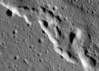
2019-05-13 |
Moon
|
Lunar Reconnaissance Orbiter (LRO)
|
|
1631x1010x1 |

|
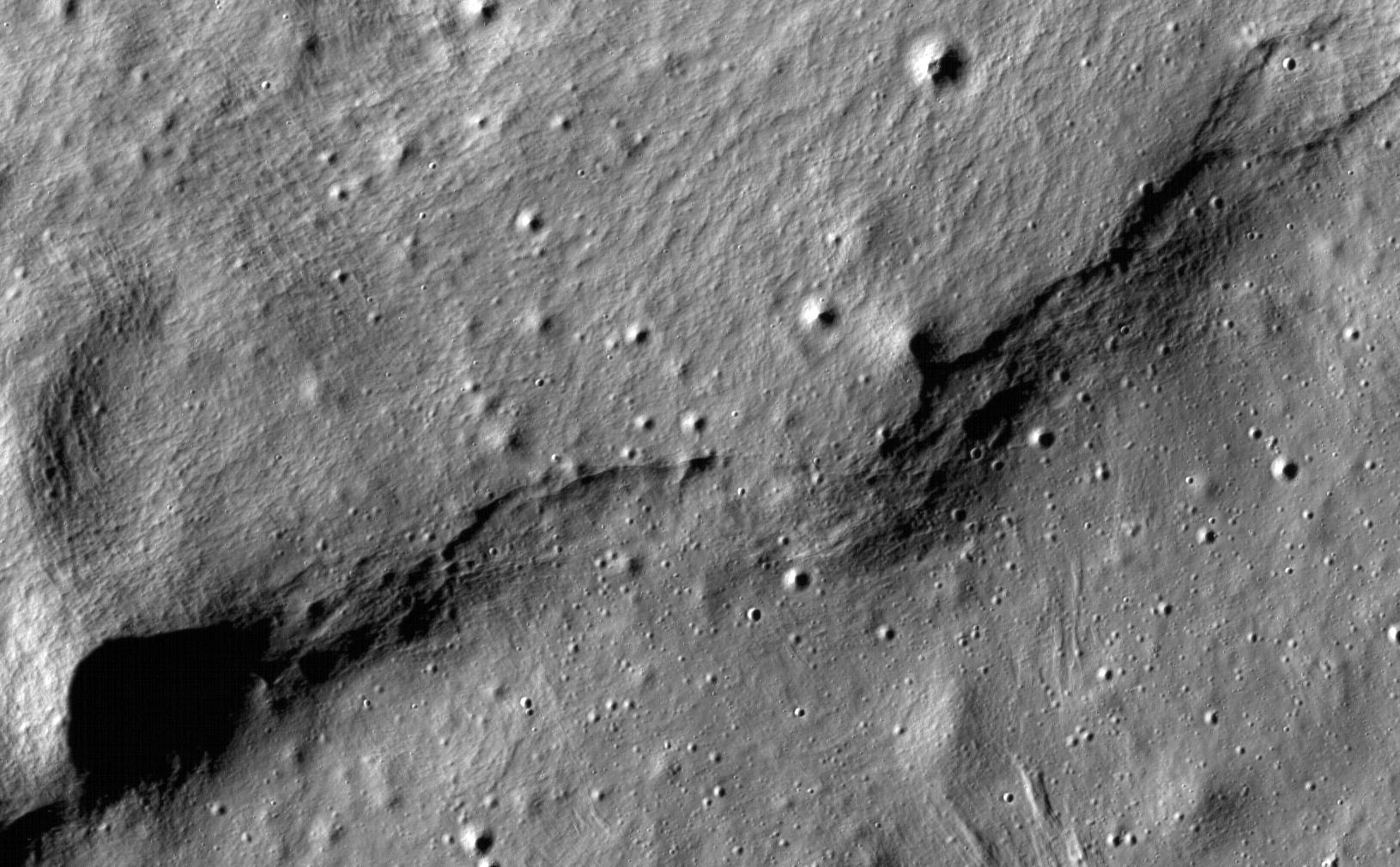
-
PIA23236:
-
Lobate Scarps on the Moon
Full Resolution:
TIFF
(1.649 MB)
JPEG
(267.7 kB)
|
|
|
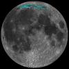
2019-05-13 |
Moon
|
Lunar Reconnaissance Orbiter (LRO)
|
|
1407x1009x1 |
|
-
PIA23210:
-
Wrinkle Ridges on the Moon
Full Resolution:
TIFF
(1.421 MB)
JPEG
(195.6 kB)
|
|
|
2019-05-13 |
Moon
|
Lunar Reconnaissance Orbiter (LRO)
|
|
1100x1100x3 |
|
-
PIA23209:
-
The Moon's Mare Frigoris
Full Resolution:
TIFF
(1.288 MB)
JPEG
(268 kB)
|
|
|
2019-05-02 |
Earth
|
Aqua
|
AIRS
|
900x695x3 |
|
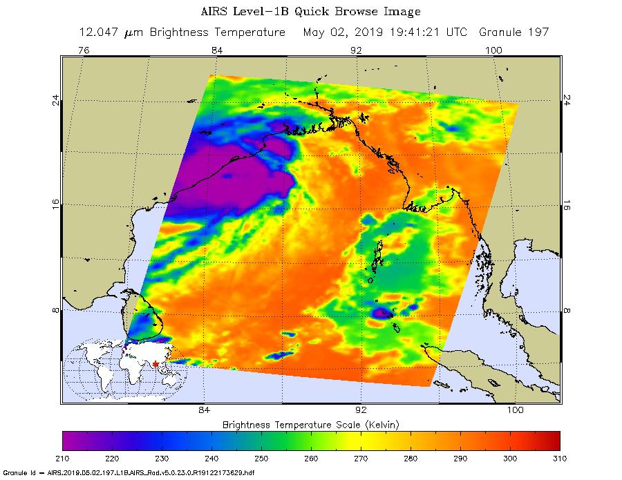
-
PIA22838:
-
NASA's AIRS Images Cyclone Fani Before Landfall
Full Resolution:
TIFF
(821.5 kB)
JPEG
(110.5 kB)
|
|
|
2019-04-29 |
Earth
|
Terra
|
ASTER
|
1849x2418x3 |
|
-
PIA23196:
-
Alluvial Fan, China and Mongolia
Full Resolution:
TIFF
(12.95 MB)
JPEG
(734.2 kB)
|
|
|
2019-04-25 |
Earth
|
Aqua
|
AIRS
|
900x695x3 |
|
-
PIA23144:
-
NASA's AIRS Images Cyclone Kenneth over Mozambique
Full Resolution:
TIFF
(986.1 kB)
JPEG
(113.3 kB)
|
|
|
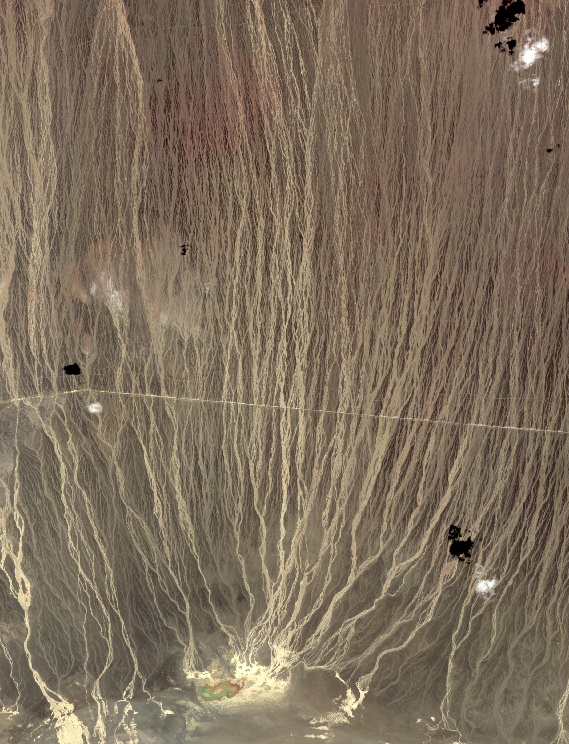
2019-04-15 |
Earth
|
Terra
|
ASTER
|
2397x1885x3 |
|
-
PIA23118:
-
Cape Horn, Chile
Full Resolution:
TIFF
(12.19 MB)
JPEG
(534.4 kB)
|
|
|
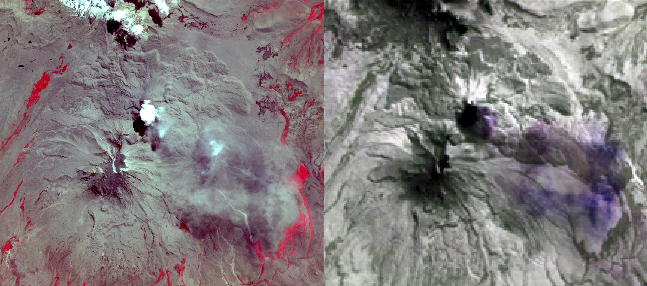
2019-04-12 |
Earth
|
Terra
|
ASTER
|
2600x1151x3 |

|
-
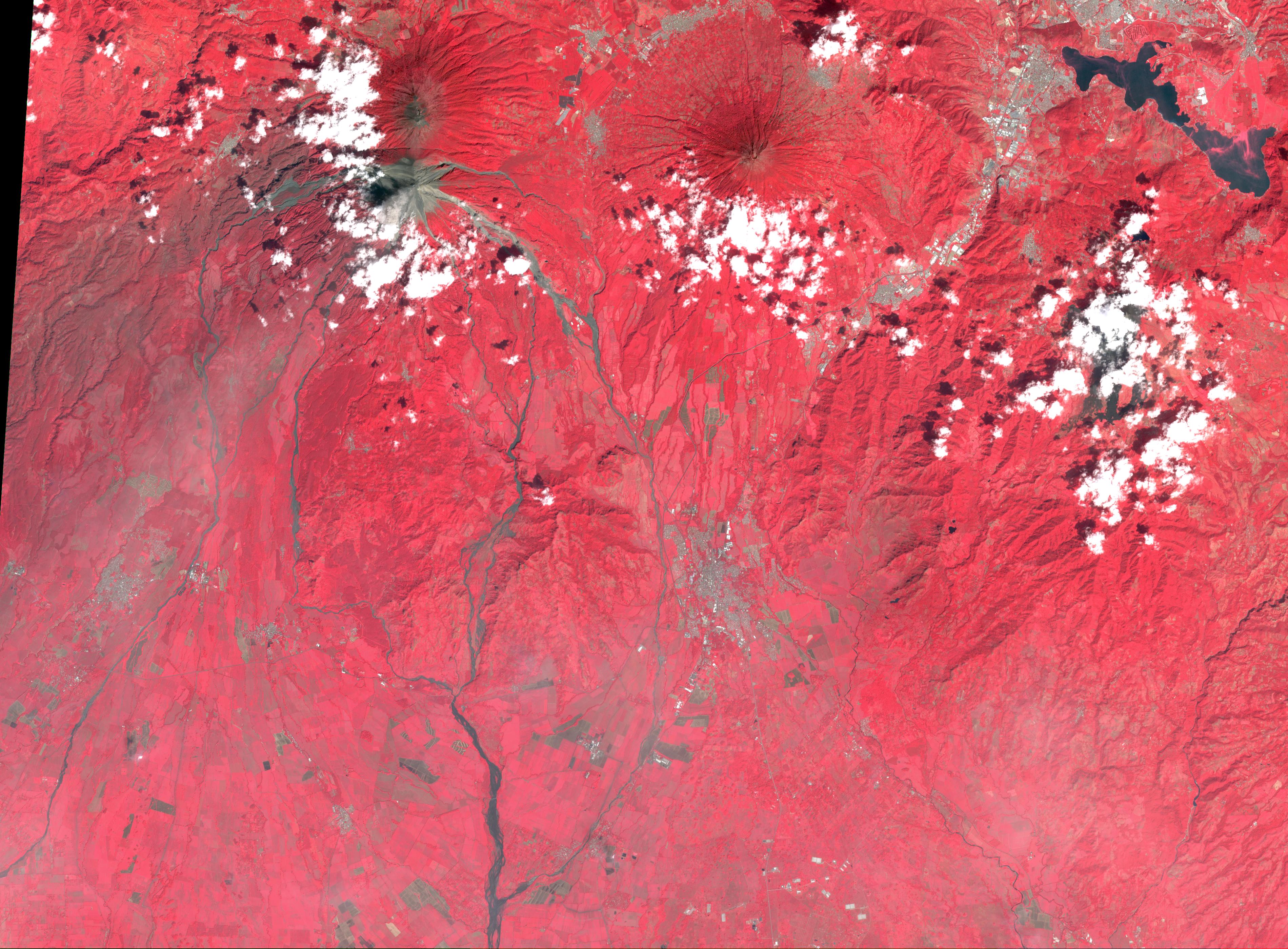
PIA23143:
-
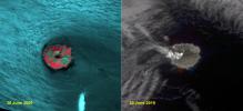
NASA's ASTER Images Sabancaya Volcano
Full Resolution:
TIFF
(8.687 MB)
JPEG
(443.8 kB)
|
|
|
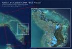
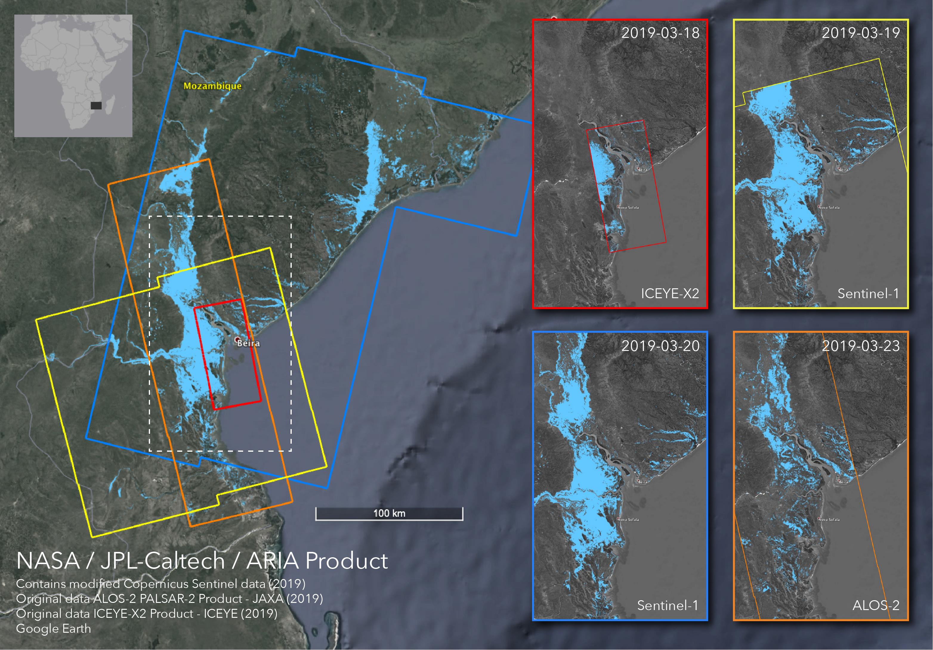
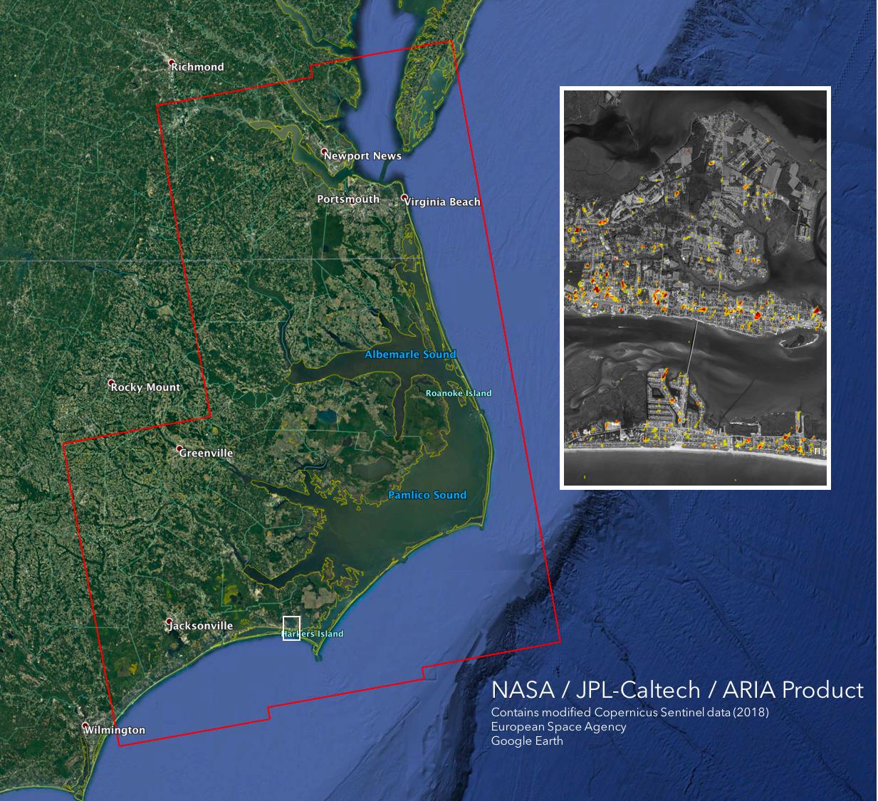
2019-04-01 |
Earth
|
ARIA
|
SAR
|
3128x2180x3 |
|
-
PIA23142:
-
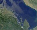
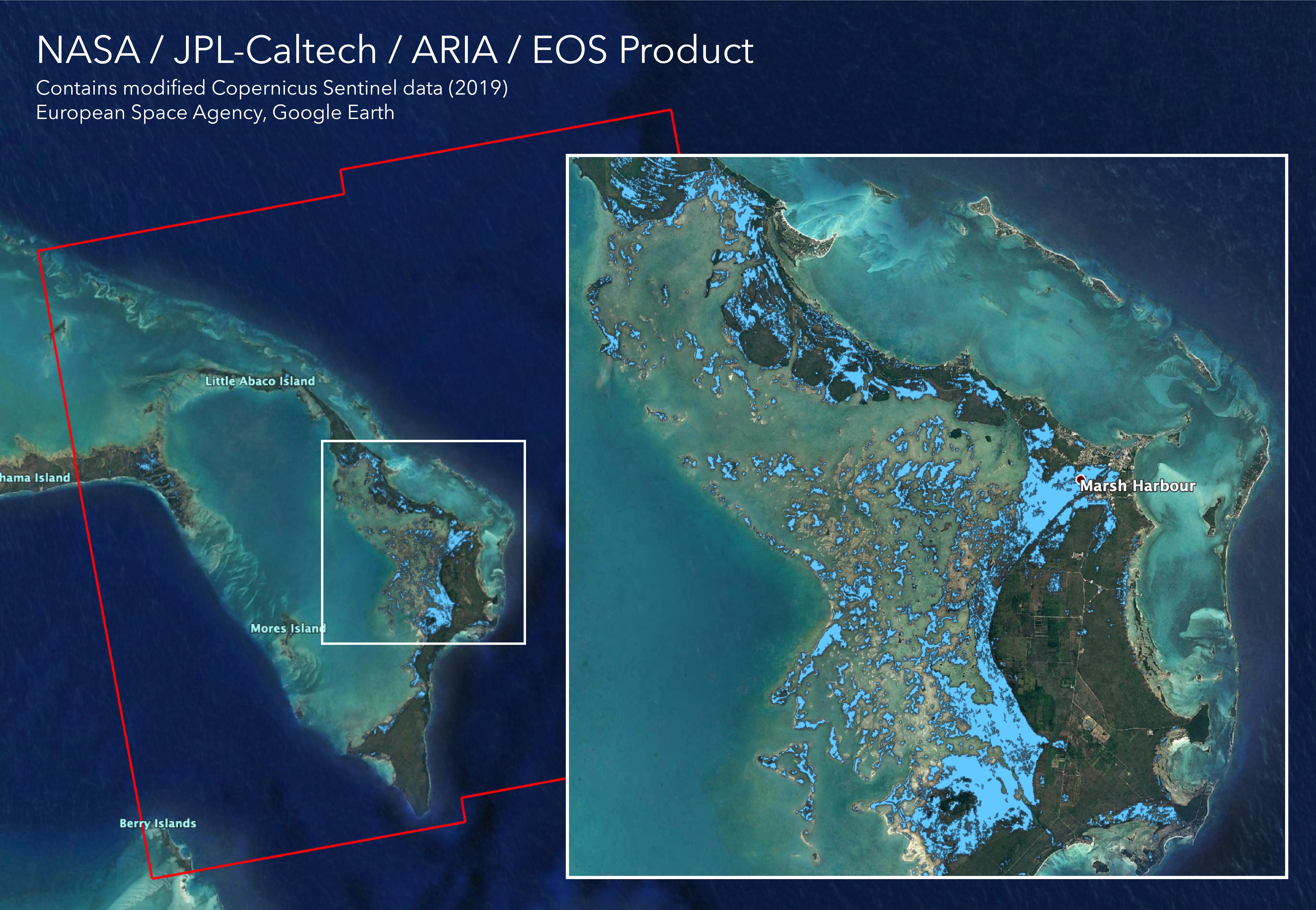
Satellites Image Mozambique Flooding after Cyclone Idai
Full Resolution:
TIFF
(13 MB)
JPEG
(778.9 kB)
|
|
|
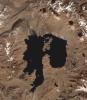
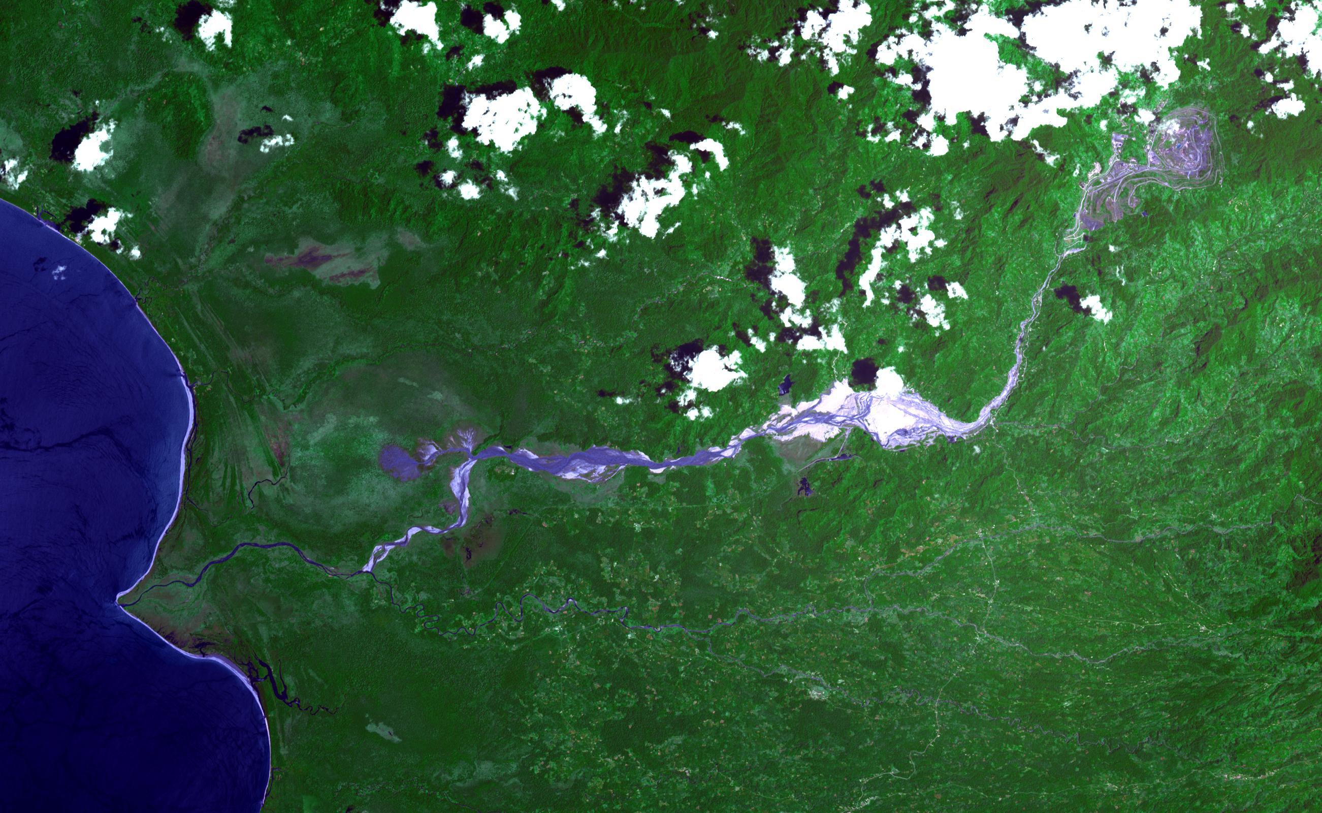
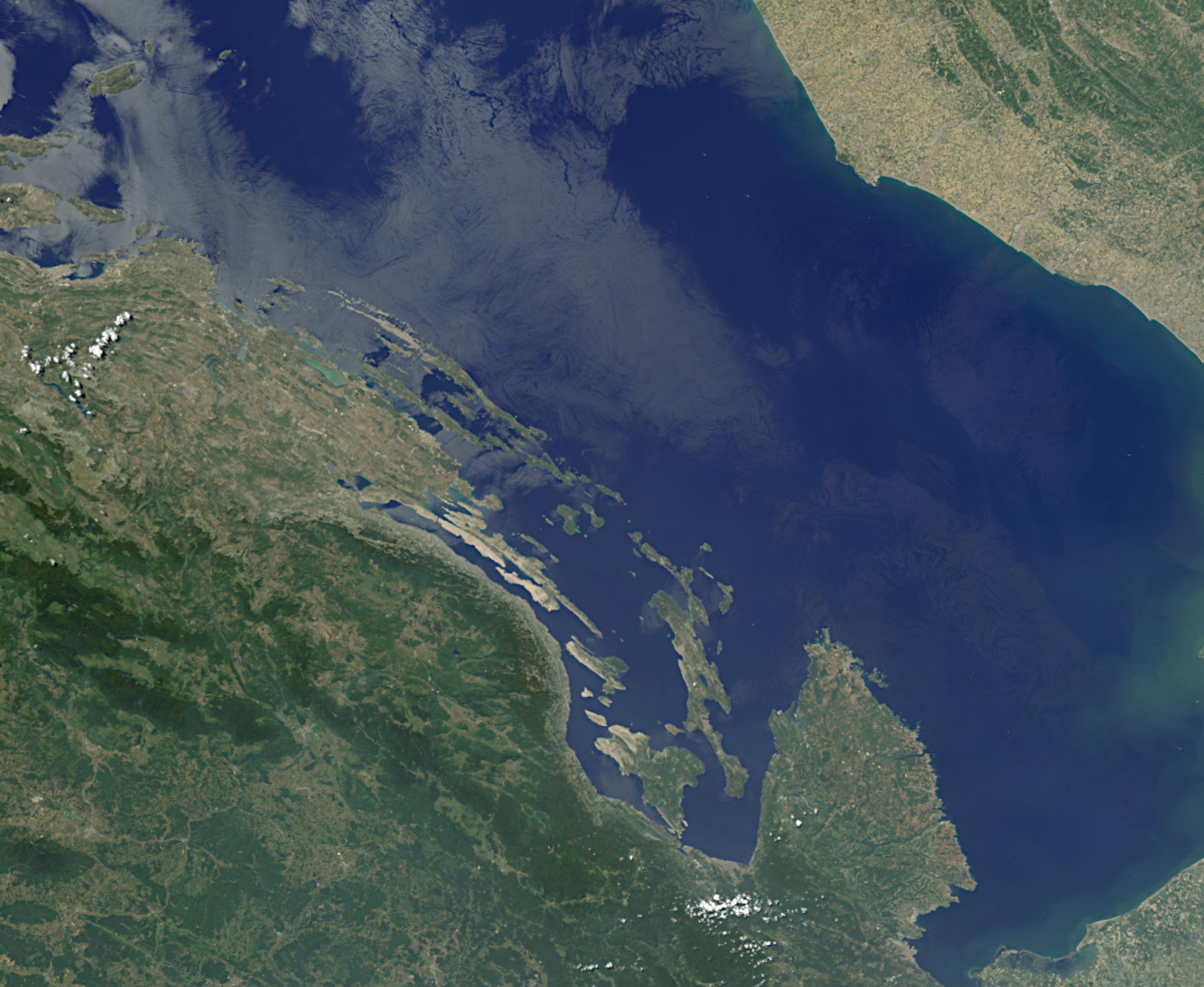
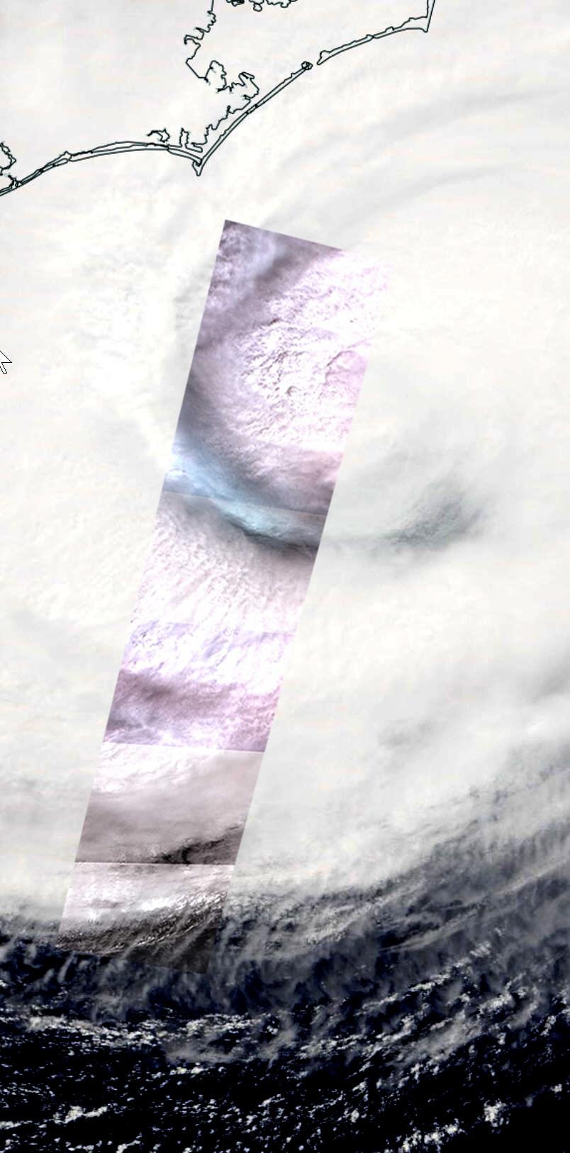
2019-03-28 |
Earth
|
Terra
|
ASTER
|
3202x3673x3 |
|
-
PIA23102:
-
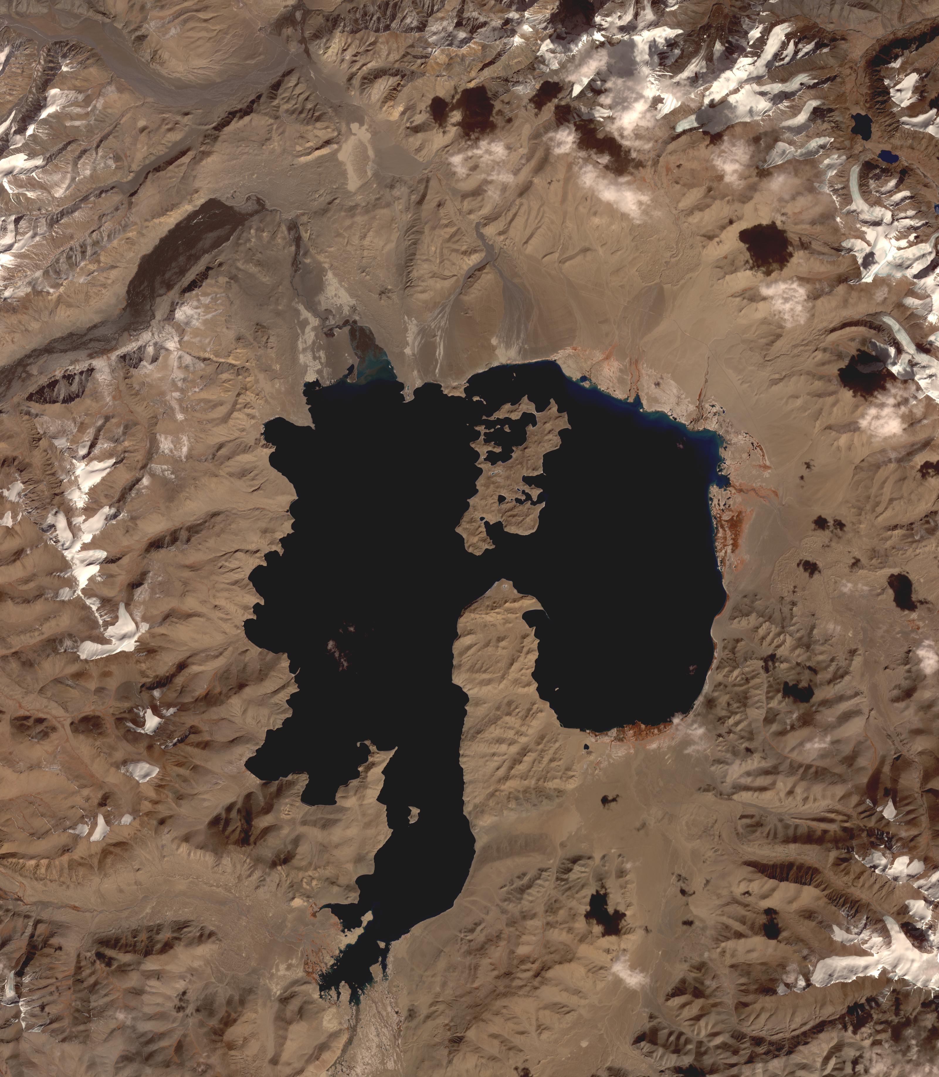
Lake Karakul, Tajikistan
Full Resolution:
TIFF
(26.71 MB)
JPEG
(1.209 MB)
|
|
|
2019-03-21 |
Earth
|
Terra
|
MODIS
|
3289x2252x3 |
|
-
PIA23141:
-
MODIS Images Fireball over Bering Sea
Full Resolution:
TIFF
(16.58 MB)
JPEG
(853.1 kB)
|
|
|
2019-03-21 |
Earth
|
Terra
|
MISR
|
1429x1354x3 |
|
-
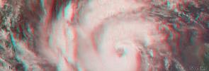
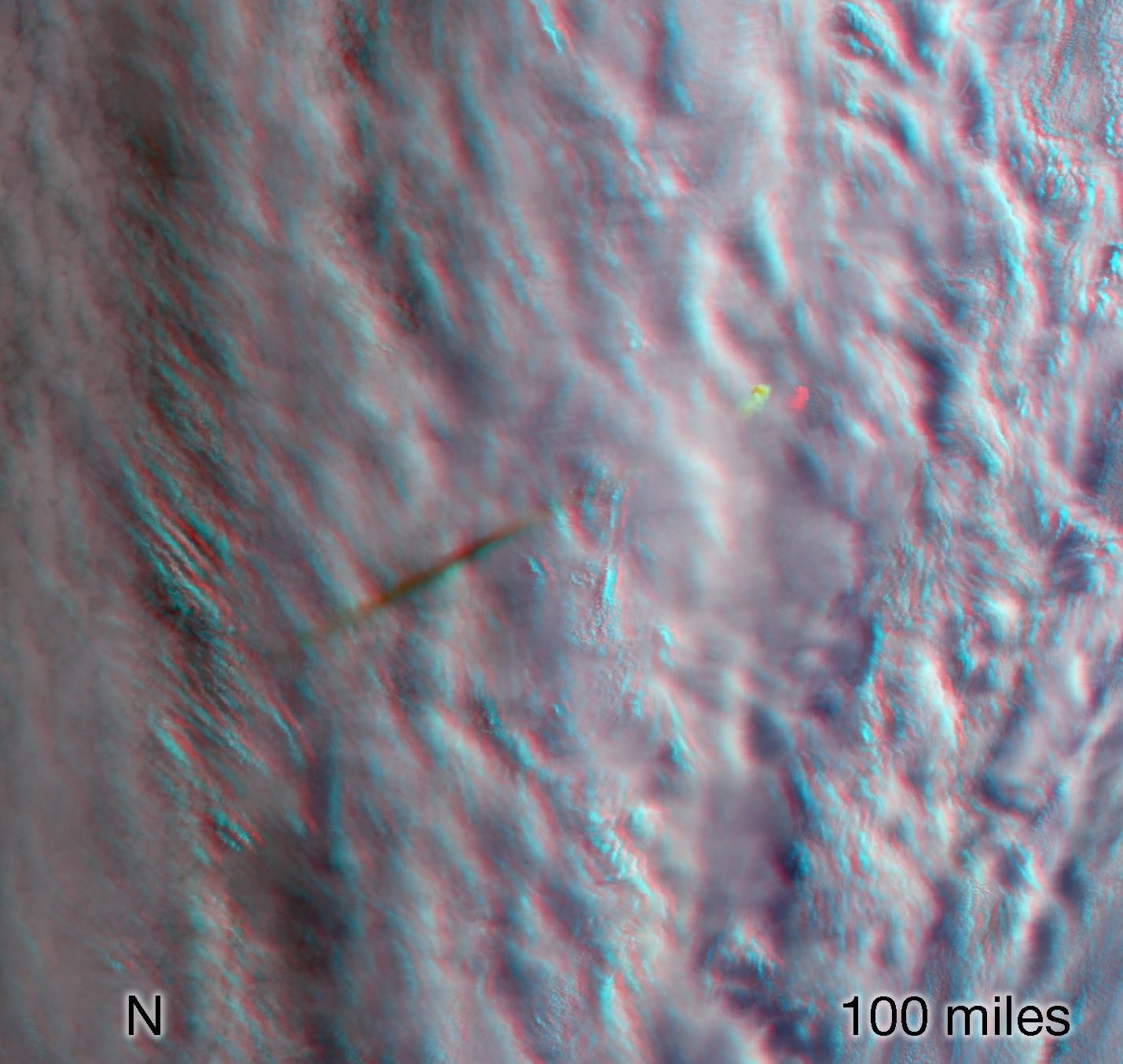
PIA23050:
-
MISR Images Fireball Over Bering Sea (Anaglyph)
Full Resolution:
TIFF
(5.807 MB)
JPEG
(178.9 kB)
|
|
|
2019-03-21 |
Earth
|
Terra
|
MISR
|
1830x1830x3 |
|
-
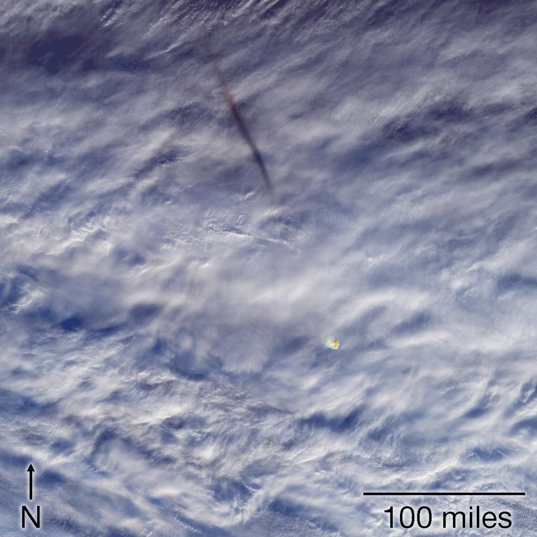
PIA22825:
-
MISR Images Fireball Over Bering Sea
Full Resolution:
TIFF
(10.05 MB)
JPEG
(369 kB)
|
|
|
2019-03-14 |
Earth
|
Terra
|
ASTER
|
789x590x3 |
|
-
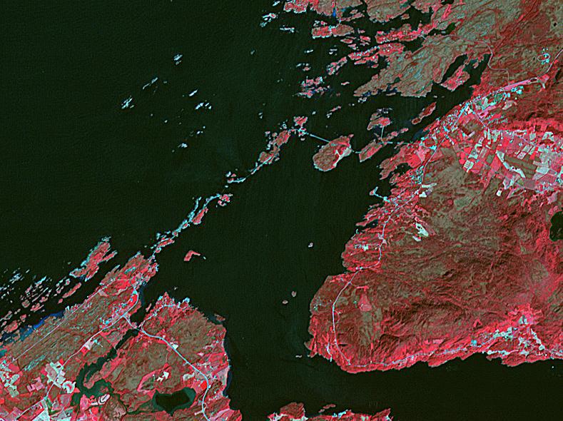
PIA23096:
-
Atlantic Ocean Road, Norway
Full Resolution:
TIFF
(1.36 MB)
JPEG
(110.5 kB)
|
|
|
2019-02-21 |
Earth
|
Terra
|
ASTER
|
2427x2400x3 |
|
-
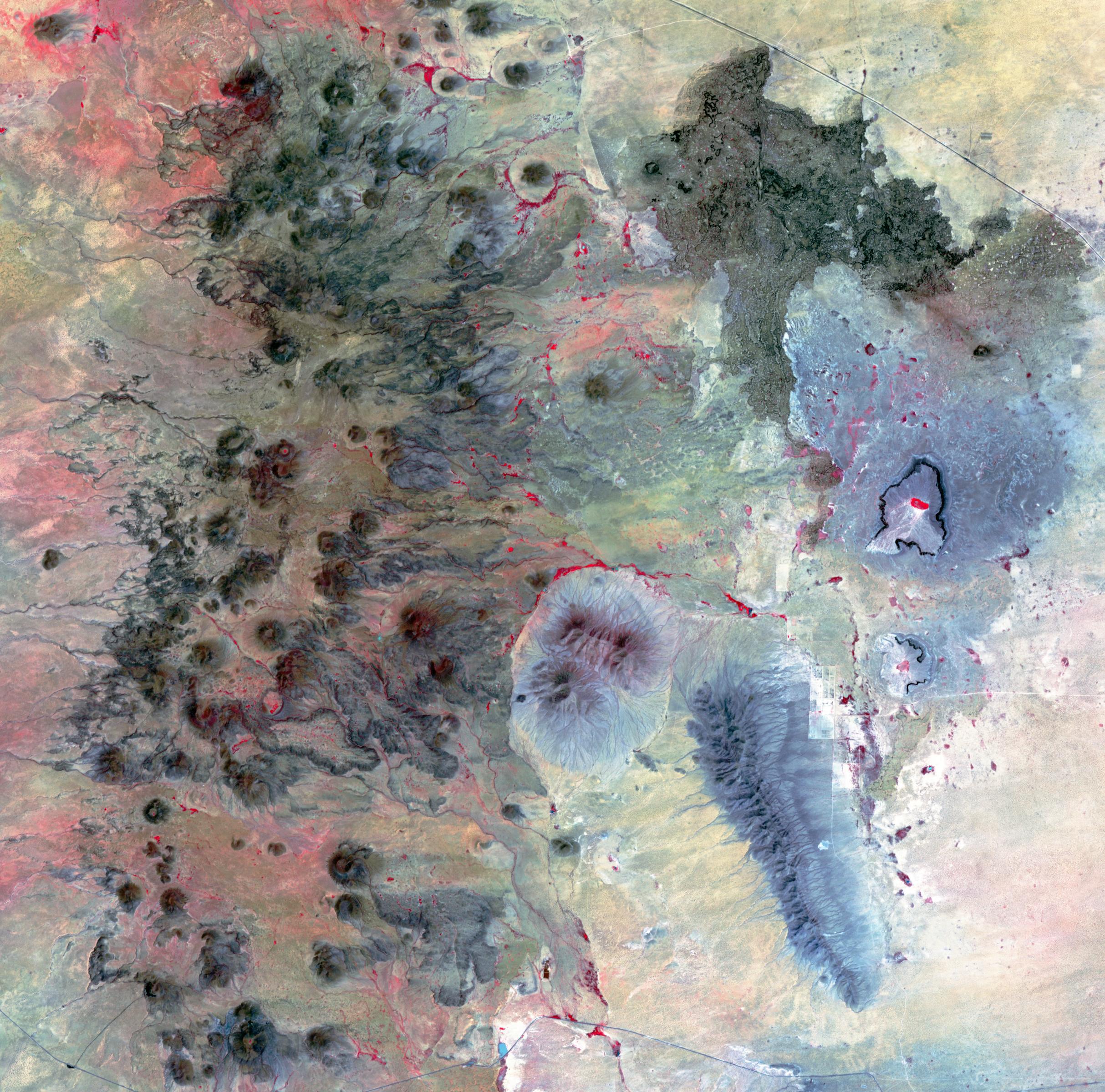
PIA23065:
-
Potrillo Volcanic Field, New Mexico
Full Resolution:
TIFF
(17.48 MB)
JPEG
(997.1 kB)
|
|
|
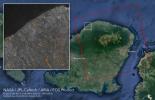
2019-02-07 |
Earth
|
Terra
|
ASTER
|
1284x1056x3 |
|
-
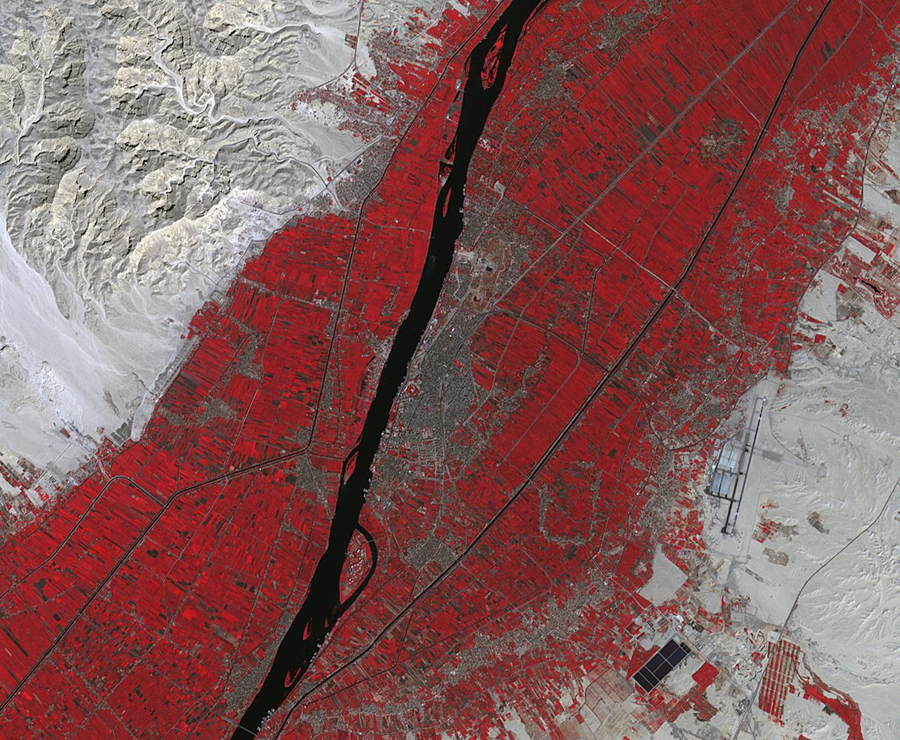
PIA23060:
-
Luxor, Egypt
Full Resolution:
TIFF
(4.069 MB)
JPEG
(308.9 kB)
|
|
|
2019-02-06 |
Earth
|
Terra
|
ASTER
|
1152x864x3 |
|
-
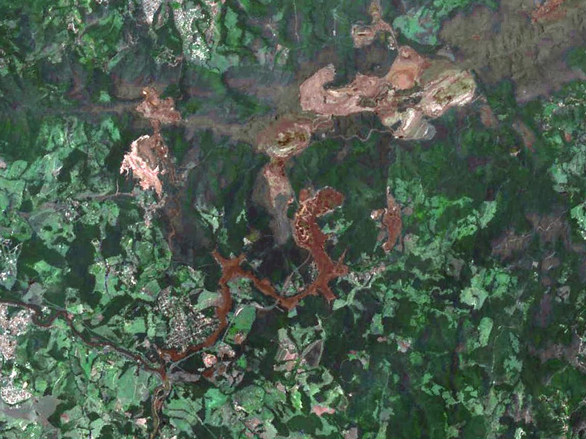
PIA22824:
-
NASA's ASTER Shows Brazilian City After Dam Disaster
Full Resolution:
TIFF
(2.987 MB)
JPEG
(176.7 kB)
|
|
|
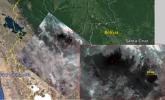
2019-01-31 |
Earth
|
Aqua
|
AIRS
|
1395x783x3 |
|
-
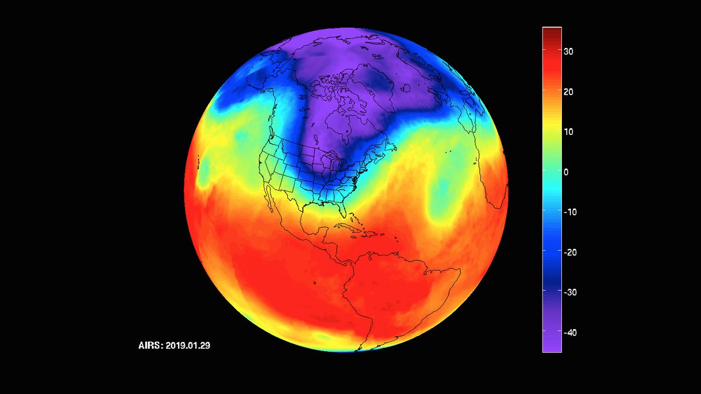
PIA22823:
-
AIRS Captures Polar Vortex
Full Resolution:
TIFF
(1.034 MB)
JPEG
(81.95 kB)
|
|
|
2019-01-23 |
Earth
|
Terra
|
ASTER
|
3198x3258x3 |
|
-
PIA23018:
-
October Revolution Island, Russia
Full Resolution:
TIFF
(28.69 MB)
JPEG
(1.255 MB)
|
|
|
2019-01-17 |
Earth
|
Terra
|
ASTER
|
904x815x3 |
|
-
PIA22821:
-
ASTER Images Post-eruption Anak Krakatau Volcano
Full Resolution:
TIFF
(1.844 MB)
JPEG
(64.95 kB)
|
|
|
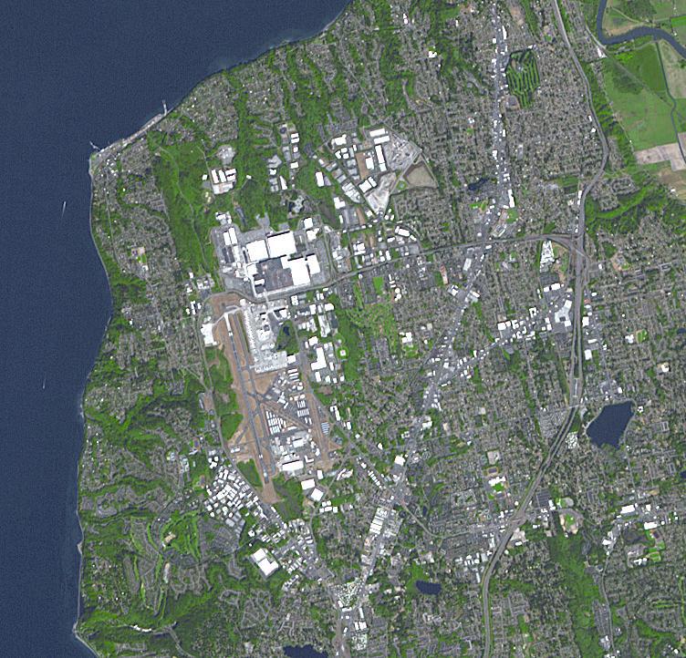
2019-01-08 |
Earth
|
Terra
|
ASTER
|
752x722x3 |

|
-
PIA23000:
-
Boeing Plant, Everett WA
Full Resolution:
TIFF
(1.63 MB)
JPEG
(147.1 kB)
|
|
|
2018-12-21 |
Earth
|
Terra
|
ASTER
|
2772x1252x3 |
|
-
PIA22979:
-
ASTER Global Mosaic
Full Resolution:
TIFF
(7.881 MB)
JPEG
(746.2 kB)
|
|
|
2018-12-13 |
Earth
|
Terra
|
ASTER
|
1700x1200x3 |
|
-
PIA22899:
-
2018 Kilauea East Rift Zone Eruption
Full Resolution:
TIFF
(6.123 MB)
JPEG
(272.4 kB)
|
|
|
2018-12-04 |
Earth
|
Terra
|
ASTER
|
2408x1247x3 |
|
-
PIA22894:
-
St. Croix, US Virgin Islands
Full Resolution:
TIFF
(8.784 MB)
JPEG
(453.6 kB)
|
|
|
2018-12-03 |
Earth
|
Terra
|
ASTER
|
3800x2800x3 |
|
-
PIA22820:
-
NASA's ASTER Captures Lava Flow, Ash from Guatemala Volcano
Full Resolution:
TIFF
(29.07 MB)
JPEG
(1.594 MB)
|
|
|
2018-11-19 |
Earth
|
ARIA
|
SAR
|
5949x3249x3 |
|
-
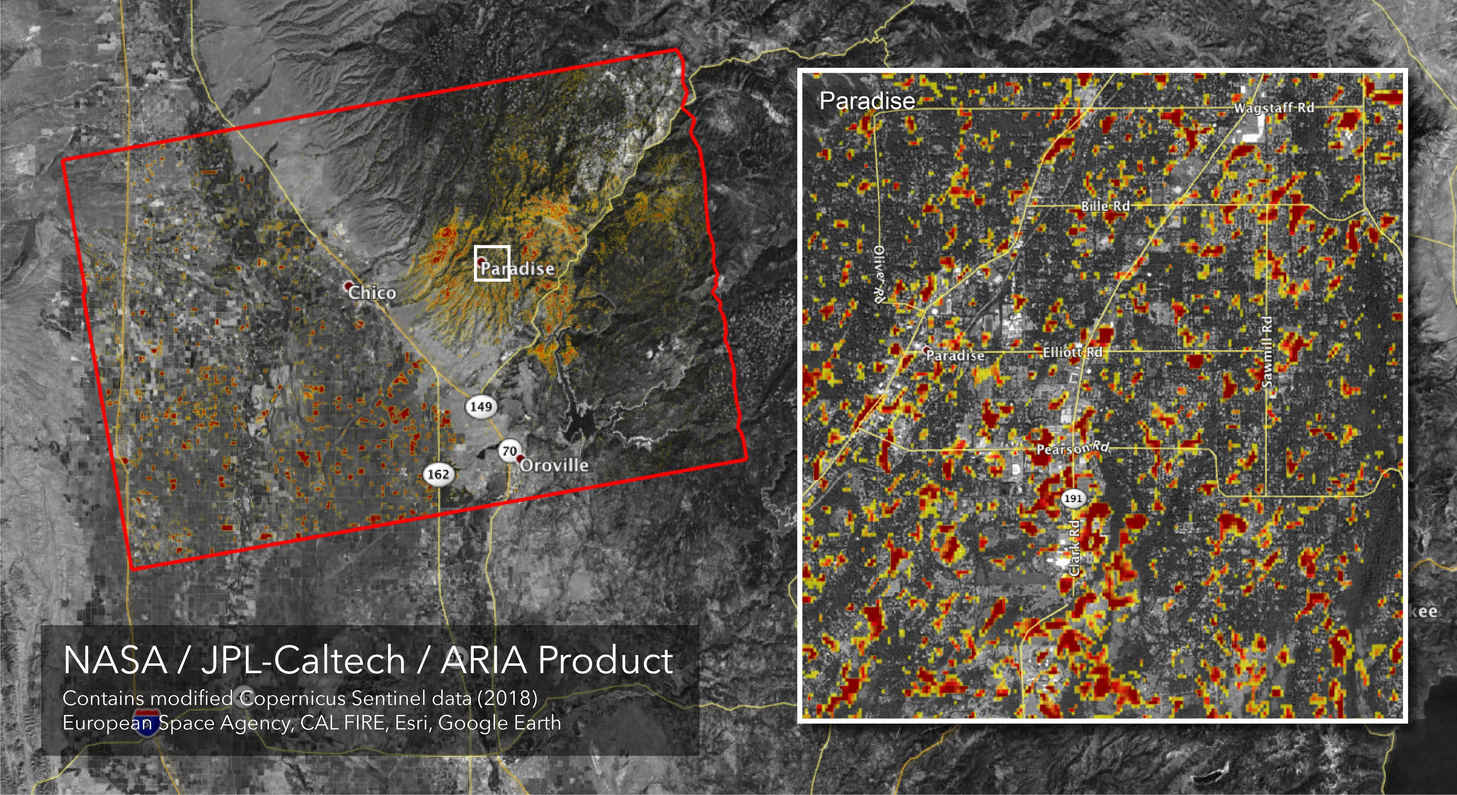
PIA22819:
-
Updated ARIA Map of CA Camp Fire Damage
Full Resolution:
TIFF
(21.68 MB)
JPEG
(3.068 MB)
|
|
|
2018-11-13 |
Earth
|
Terra
|
ASTER
|
1800x1200x3 |
|
-
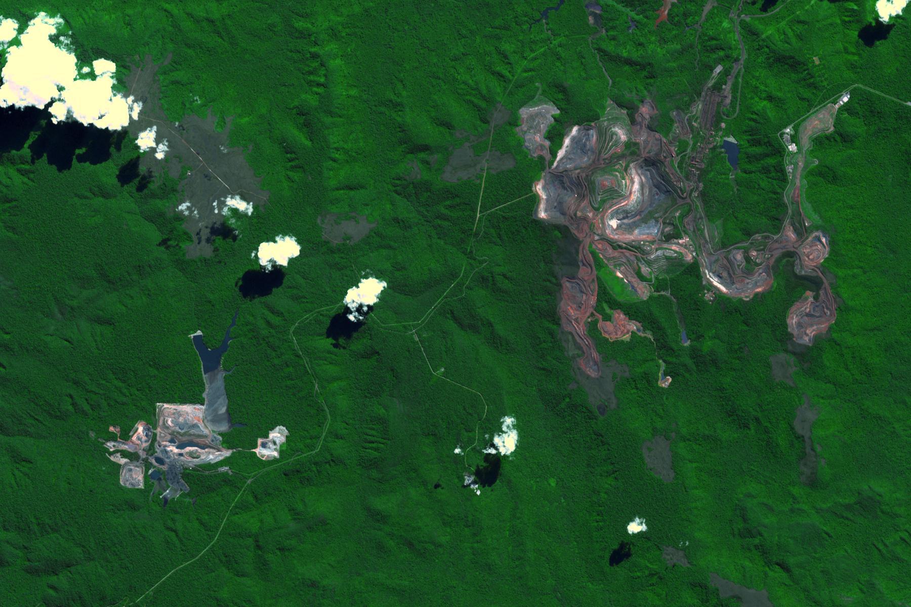
PIA22861:
-
Carajas Mine, Brazil
Full Resolution:
TIFF
(6.362 MB)
JPEG
(326.4 kB)
|
|
|
2018-11-12 |
Earth
|
Terra
|
MISR
|
2624x5022x3 |
|
-
PIA22818:
-
NASA's MISR Sees California's Woolsey Fire From Space
Full Resolution:
TIFF
(19.09 MB)
JPEG
(766.6 kB)
|
|
|
2018-11-12 |
Earth
|
Terra
|
MISR
|
4499x1423x3 |
|
-
PIA22817:
-
NASA's MISR Captures 3D Image of Smoke from California's Woolsey Fire
Full Resolution:
TIFF
(17.19 MB)
JPEG
(574.8 kB)
|
|
|
2018-11-12 |
Earth
|
ARIA
|
SAR
|
5176x2873x3 |
|
-
PIA22816:
-
NASA's ARIA Maps California Fire Damage
Full Resolution:
TIFF
(16.43 MB)
JPEG
(2.572 MB)
|
|
|
2018-11-02 |
Earth
|
Terra
|
ASTER
|
1929x2283x3 |
|
-
PIA22755:
-
NASA's ASTER Captures Piton de la Fournaise Eruption
Full Resolution:
TIFF
(10.21 MB)
JPEG
(703.5 kB)
|
|
|
2018-10-31 |
Earth
|
Terra
|
ASTER
|
2274x1917x3 |
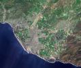
|
-
PIA22841:
-
Ventura, CA
Full Resolution:
TIFF
(13.08 MB)
JPEG
(1.297 MB)
|
|
|
2018-10-17 |
Earth
|
Terra
|
ASTER
|
4000x3069x3 |
|
-
PIA22795:
-
Air Mountains, Niger
Full Resolution:
TIFF
(32.05 MB)
JPEG
(2.448 MB)
|
|
|
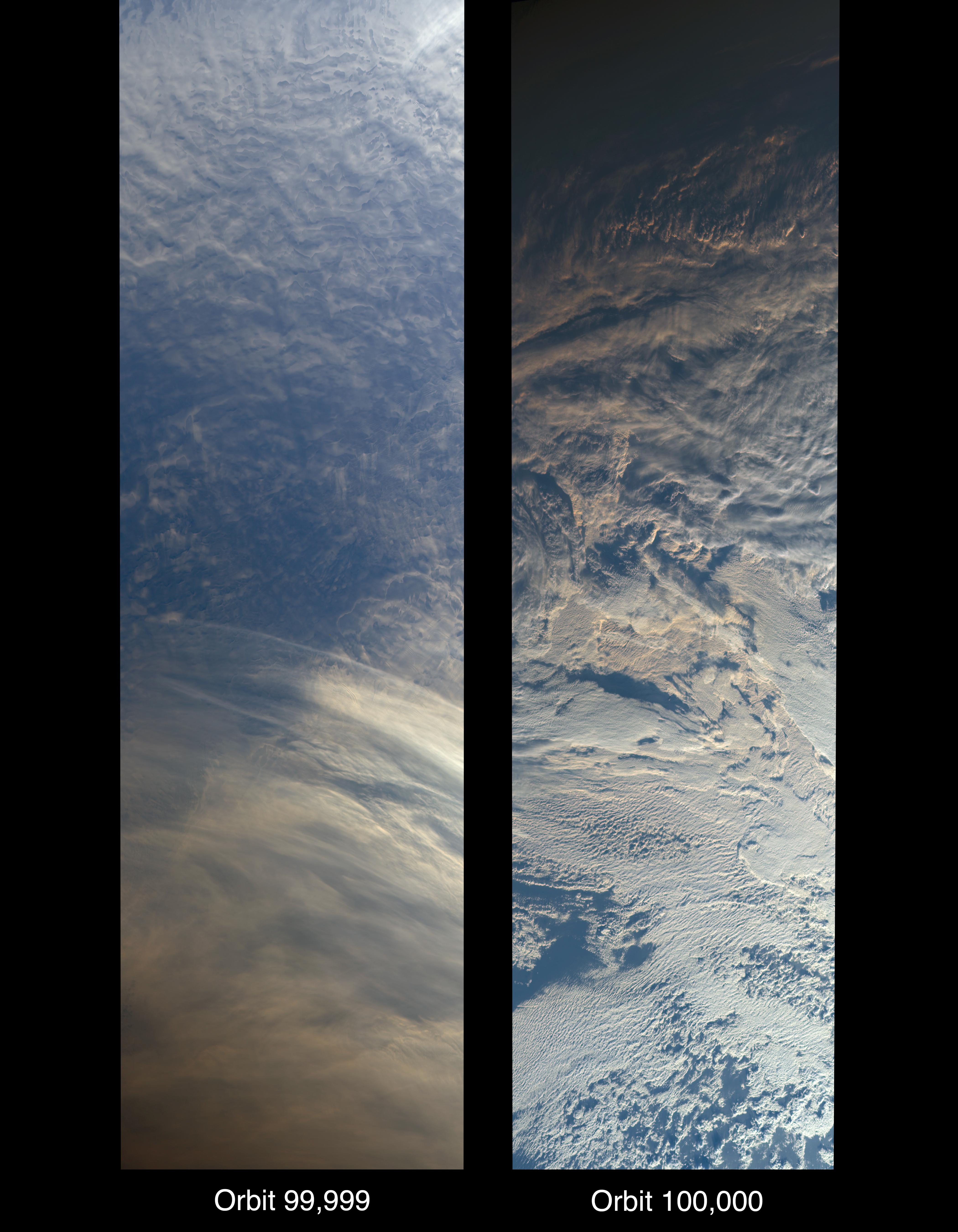
2018-10-16 |
Earth
|
Terra
|
MISR
|
4200x5400x3 |
|
-
PIA22836:
-
MISR Records the View as NASA's Terra Satellite Passes Its 100,000th Orbit
Full Resolution:
TIFF
(41.59 MB)
JPEG
(1.508 MB)
|
|
|
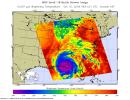
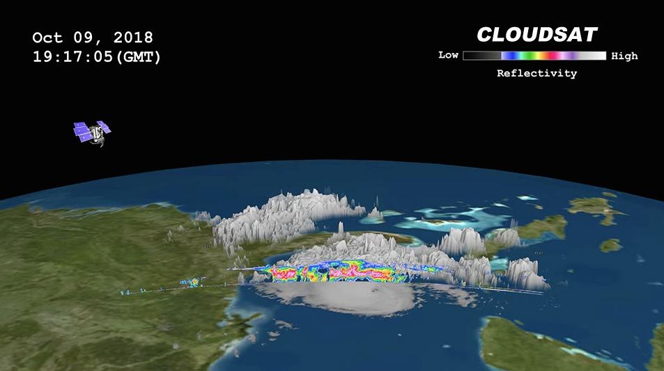
2018-10-11 |
Earth
|
CloudSat
|
Cloud Profiling Radar (CPR)
|
953x533x3 |
|
-
PIA22753:
-
NASA's CloudSat Passes Over Hurricane Michael
Full Resolution:
TIFF
(720.4 kB)
JPEG
(50.54 kB)
|
|
|
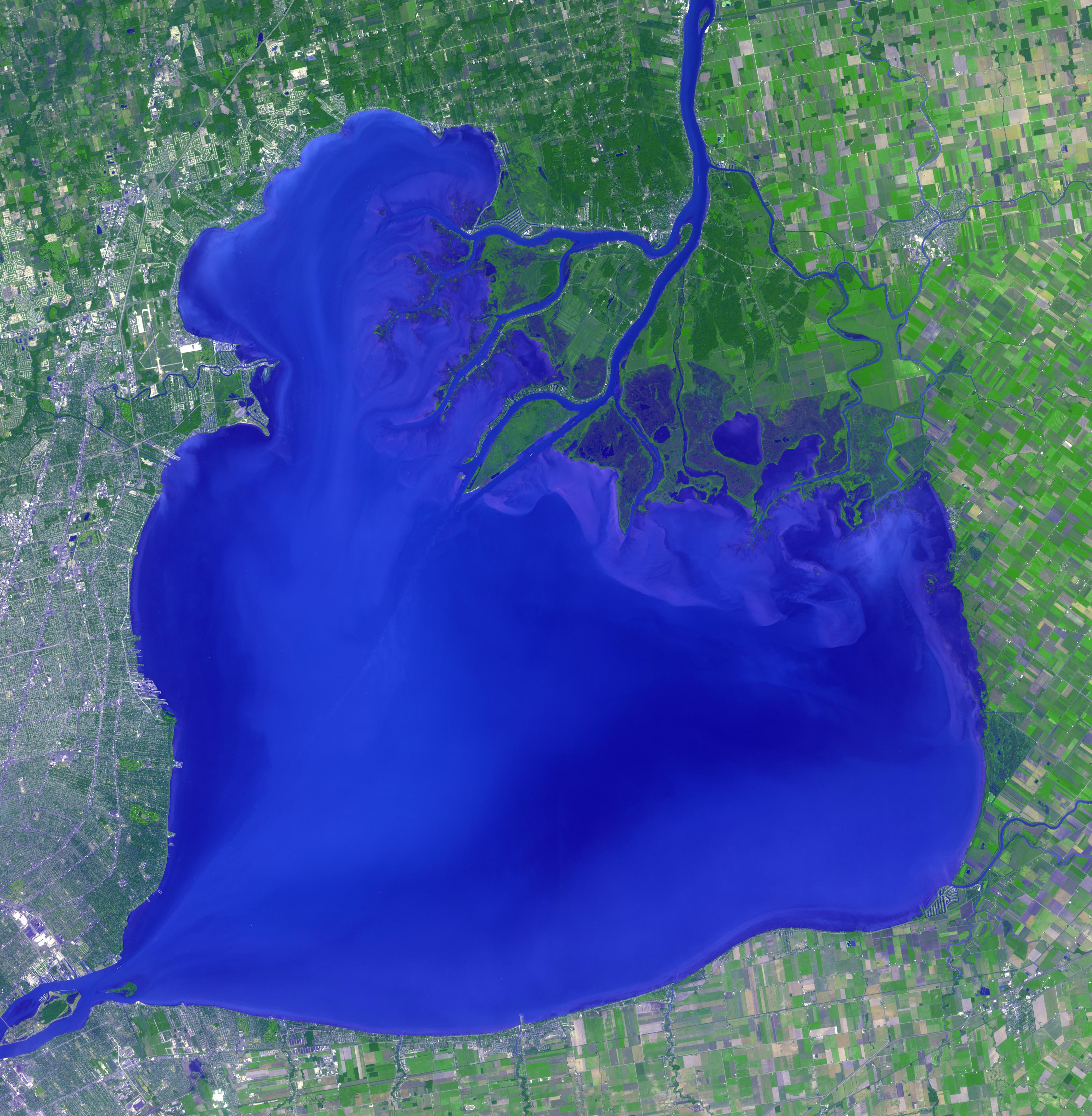
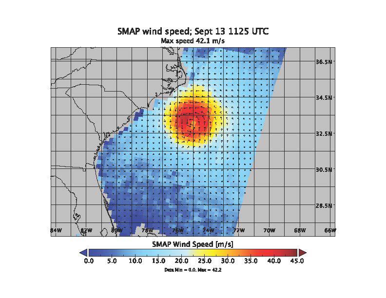
2018-10-11 |
Earth
|
SMAP
|
|
2991x1065x3 |
|
-
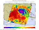
PIA22754:
-
NASA's SMAP Detects Flooding from Hurricane Michael
Full Resolution:
TIFF
(1.747 MB)
JPEG
(255.8 kB)
|
|
|
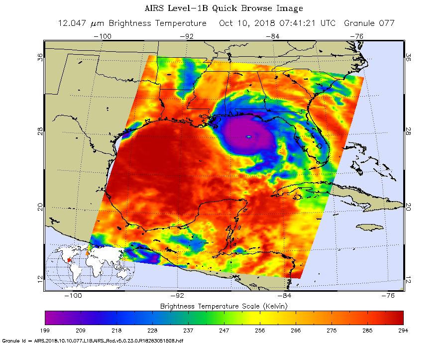
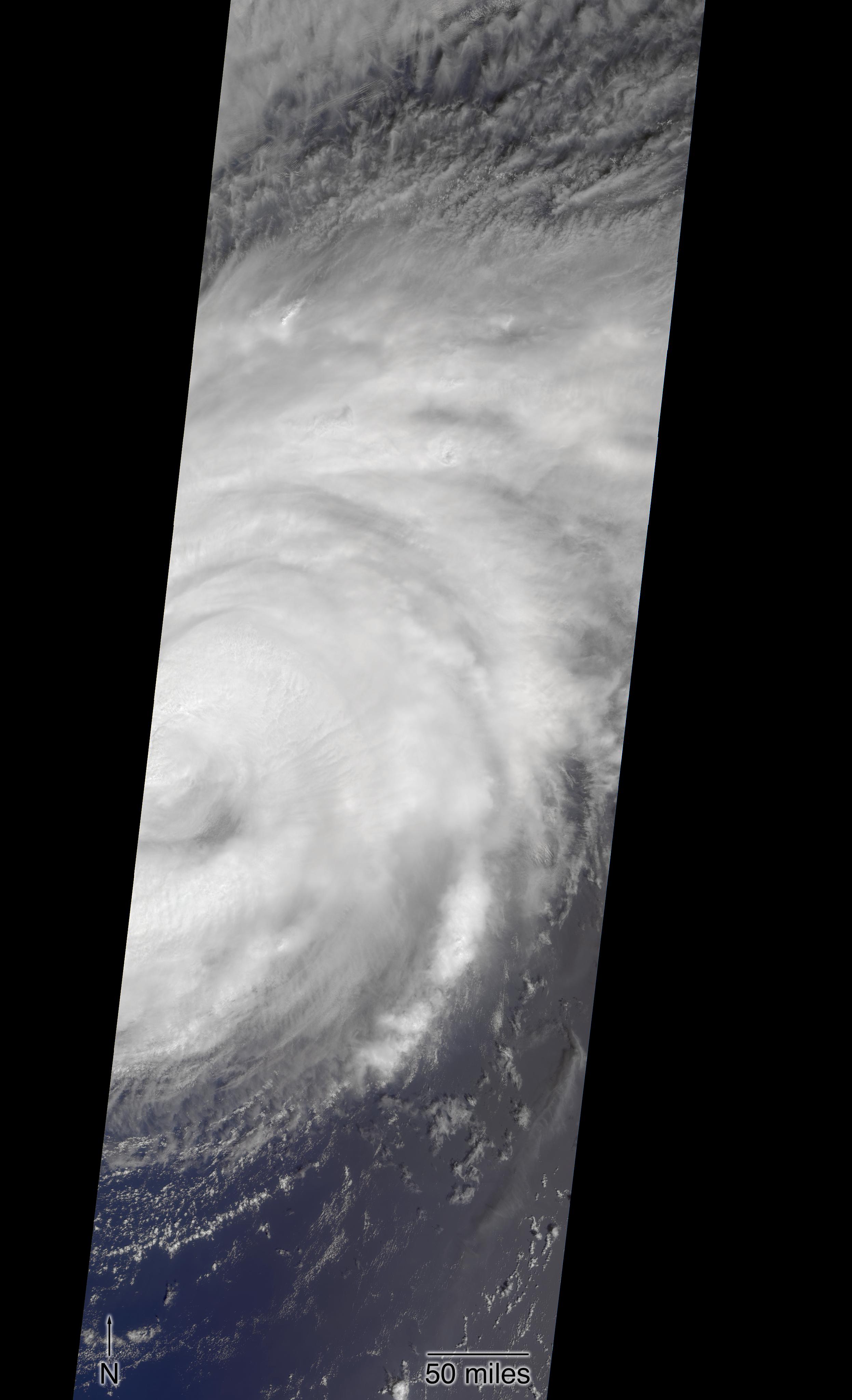
2018-10-10 |
Earth
|
Aqua
|
AIRS
|
900x695x3 |
|
-
PIA22752:
-
NASA's AIRS captures Hurricane Michael's Landfall
Full Resolution:
TIFF
(810.2 kB)
JPEG
(132.6 kB)
|
|
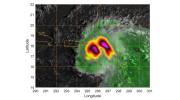
|
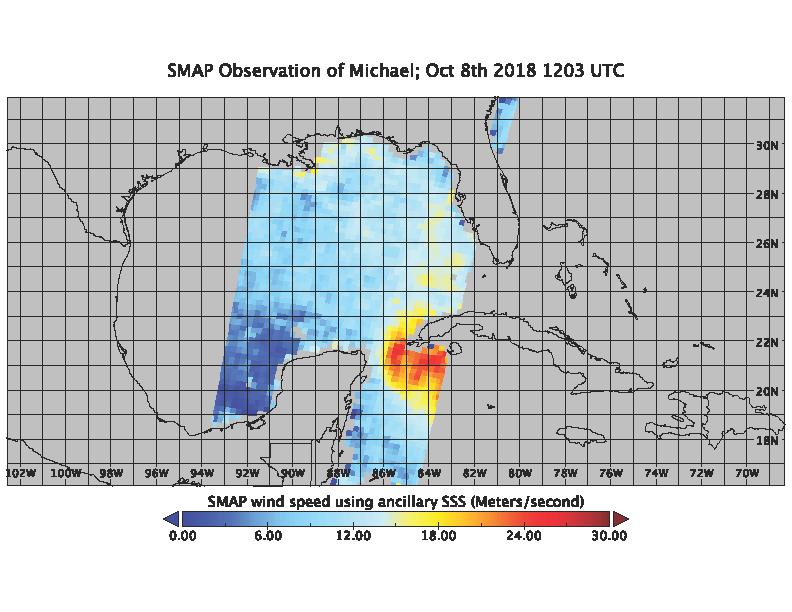
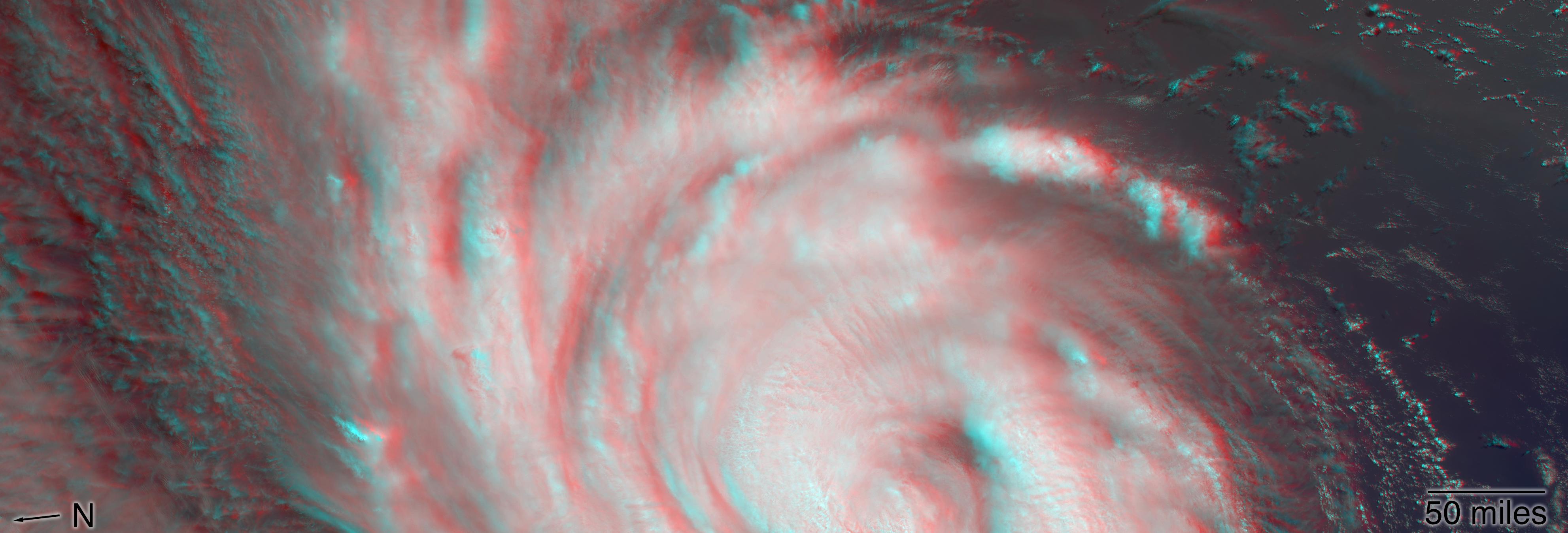
2018-10-10 |
Earth
|
SMAP
|
|
792x612x3 |

|
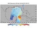
-
PIA22751:
-
Hurricane Michael as seen by SMAP
Full Resolution:
TIFF
(202.1 kB)
JPEG
(62.84 kB)
|
|
|
2018-10-10 |
Earth
|
Terra
|
MISR
|
3957x1343x3 |
|
-
PIA22748:
-
MISR Captures Hurricane Michael's Eye in 3D
Full Resolution:
TIFF
(15.95 MB)
JPEG
(502.6 kB)
|
|
|
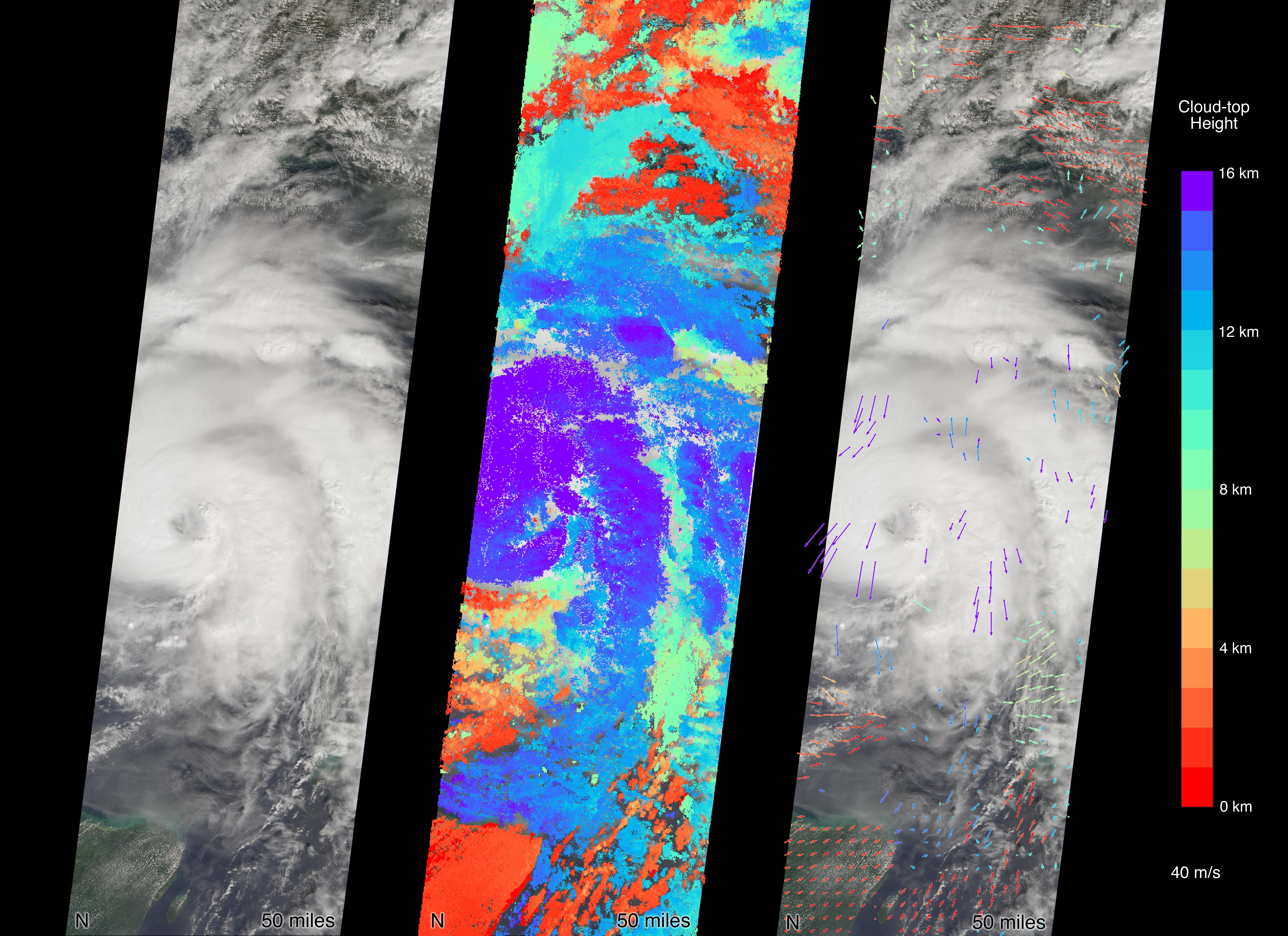
2018-10-10 |
Earth
|
Terra
|
MISR
|
6500x4726x3 |

|
-
PIA22750:
-
MISR Captures Hurricane Michael Near Florida Panhandle
Full Resolution:
TIFF
(50.27 MB)
JPEG
(2.681 MB)
|
|
|
2018-10-10 |
Earth
|
Aqua
|
AIRS
|
900x695x3 |
|
-
PIA22749:
-
NASA's AIRS captures Hurricane Michael off Florida coast
Full Resolution:
TIFF
(747.2 kB)
JPEG
(123.4 kB)
|
|
|
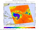
2018-10-09 |
Earth
|
SMAP
|
|
792x612x3 |
|
-
PIA22747:
-
SMAP Captures Hurricane Michael
Full Resolution:
TIFF
(209 kB)
JPEG
(89.97 kB)
|
|
|
2018-10-05 |
Earth
|
Terra
|
ASTER
|
3426x4083x3 |

|
-
PIA22705:
-
NASA's ASTER Instrument Sees Aftermath of Typhoon Mangkhut
Full Resolution:
TIFF
(31.83 MB)
JPEG
(2.201 MB)
|
|
|
2018-10-05 |
Earth
|
ARIA
|
SAR
|
5630x4092x3 |
|
-
PIA22746:
-
NASA's ARIA Maps Indonesia Quake, Tsunami Damage
Full Resolution:
TIFF
(38.03 MB)
JPEG
(1.997 MB)
|
|
|
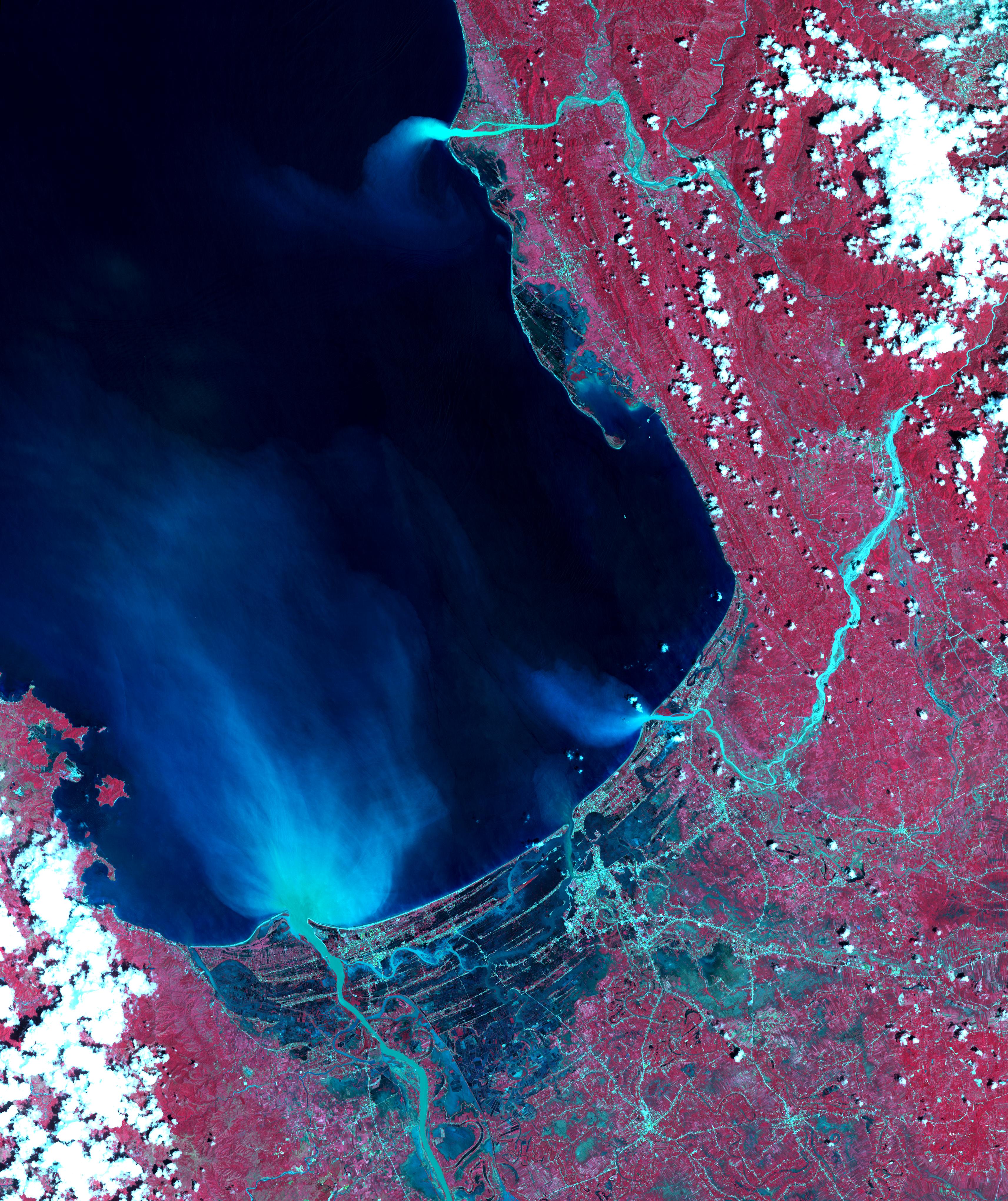
2018-10-04 |
Earth
|
Terra
|
ASTER
|
1368x1440x3 |
|
-
PIA22735:
-
Nanjing, China City Walls
Full Resolution:
TIFF
(5.912 MB)
JPEG
(576.4 kB)
|
|
|
2018-09-25 |
Earth
|
CubeSat
|
|
1280x434x3 |

|
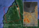
-
PIA22654:
-
RainCube Collects First Storm Data
Full Resolution:
TIFF
(759.9 kB)
JPEG
(106.9 kB)
|
|
|
2018-09-25 |
Earth
|
CubeSat
|
|
478x318x3 |
|
-
PIA22653:
-
Mini Mission RainCube is Sent into Earth Orbit
Full Resolution:
TIFF
(330.8 kB)
JPEG
(210.5 kB)
|
|
|
2018-09-20 |
Earth
|
CubeSat
|
|
790x787x3 |
|
-
PIA22652:
-
Hurricane Florence as Seen from a CubeSat

Full Resolution:
TIFF
(1.357 MB)
JPEG
(144.5 kB)
|
|
|
2018-09-19 |
Earth
|
Terra
|
ASTER
|
1917x1468x3 |
|
-
PIA22721:
-
Llullaillaco Volcano, Chile/Argentina
Full Resolution:
TIFF
(7.77 MB)
JPEG
(333.2 kB)
|
|
|
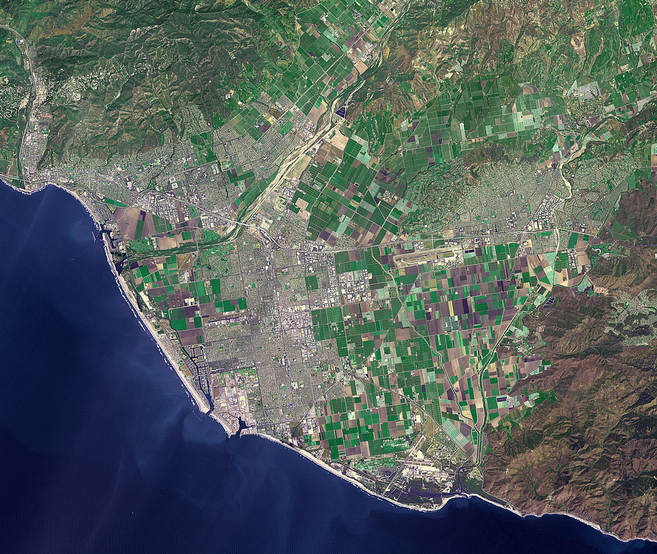
2018-09-18 |
Earth
|
ECOSTRESS
|
|
1473x1105x3 |
|
-
PIA22703:
-
NASA's ECOSTRESS Detects Surface Temperature Variations in Los Angeles
Full Resolution:
TIFF
(2.25 MB)
JPEG
(180.7 kB)
|
|
|
2018-09-18 |
Earth
|
ARIA
|
SAR
|
1231x1077x3 |
|
-
PIA22704:
-
NASA's ARIA Maps Aftermath from Florence
Full Resolution:
TIFF
(3.318 MB)
JPEG
(194.2 kB)
|
|
|
2018-09-17 |
Earth
|
ARIA
|
SAR
|
1233x1125x3 |

|
-
PIA22702:
-
NASA's ARIA Maps Damage from Florence
Full Resolution:
TIFF
(3.944 MB)
JPEG
(269.1 kB)
|
|
|
2018-09-14 |
Earth
|
Terra
|
ASTER
MODIS
|
804x1627x3 |

|
-
PIA22651:
-
Hurricane Florence Swath seen by NASA Spacecraft
Full Resolution:
TIFF
(2.219 MB)
JPEG
(125.9 kB)
|
|
|
2018-09-14 |
Earth
|
Terra
|
MISR
|
3966x1349x3 |

|
-
PIA22701:
-
NASA's MISR captures Hurricane Florence in 3D
Full Resolution:
TIFF
(14.61 MB)
JPEG
(386.3 kB)
|
|
|
2018-09-14 |
Earth
|
Terra
|
MISR
|
2493x4095x3 |
|
-
PIA22700:
-
Hurricane Florence as Viewed by NASA's MISR Instrument
Full Resolution:
TIFF
(11.96 MB)
JPEG
(506.9 kB)
|
|
|
2018-09-13 |
Earth
|
SMAP
|
|
792x612x3 |
|
-
PIA22699:
-
Hurricane Florence seen by SMAP Imagery
Full Resolution:
TIFF
(573.5 kB)
JPEG
(81.67 kB)
|
|
|
2018-09-12 |
Earth
|
Aqua
|
AIRS
|
900x695x3 |
|
-
PIA22698:
-
Hurricane Florence as seen by NASA's AIRS Instrument
Full Resolution:
TIFF
(791 kB)
JPEG
(140 kB)
|
|
|
2018-09-12 |
Earth
|
Aqua
|
AIRS
|
900x695x3 |
|
-
PIA22697:
-
Hurricane Florence Captured on Tuesday by NASA's AIRS Instrument
Full Resolution:
TIFF
(752.6 kB)
JPEG
(132.1 kB)
|
|
|
2018-09-10 |
Earth
|
ARIA
|
SAR
|
1377x964x3 |
|
-
PIA22696:
-
Japan Earthquakes (ARIA Damage Proxy Map)
Full Resolution:
TIFF
(3.89 MB)
JPEG
(229.1 kB)
|
|
|
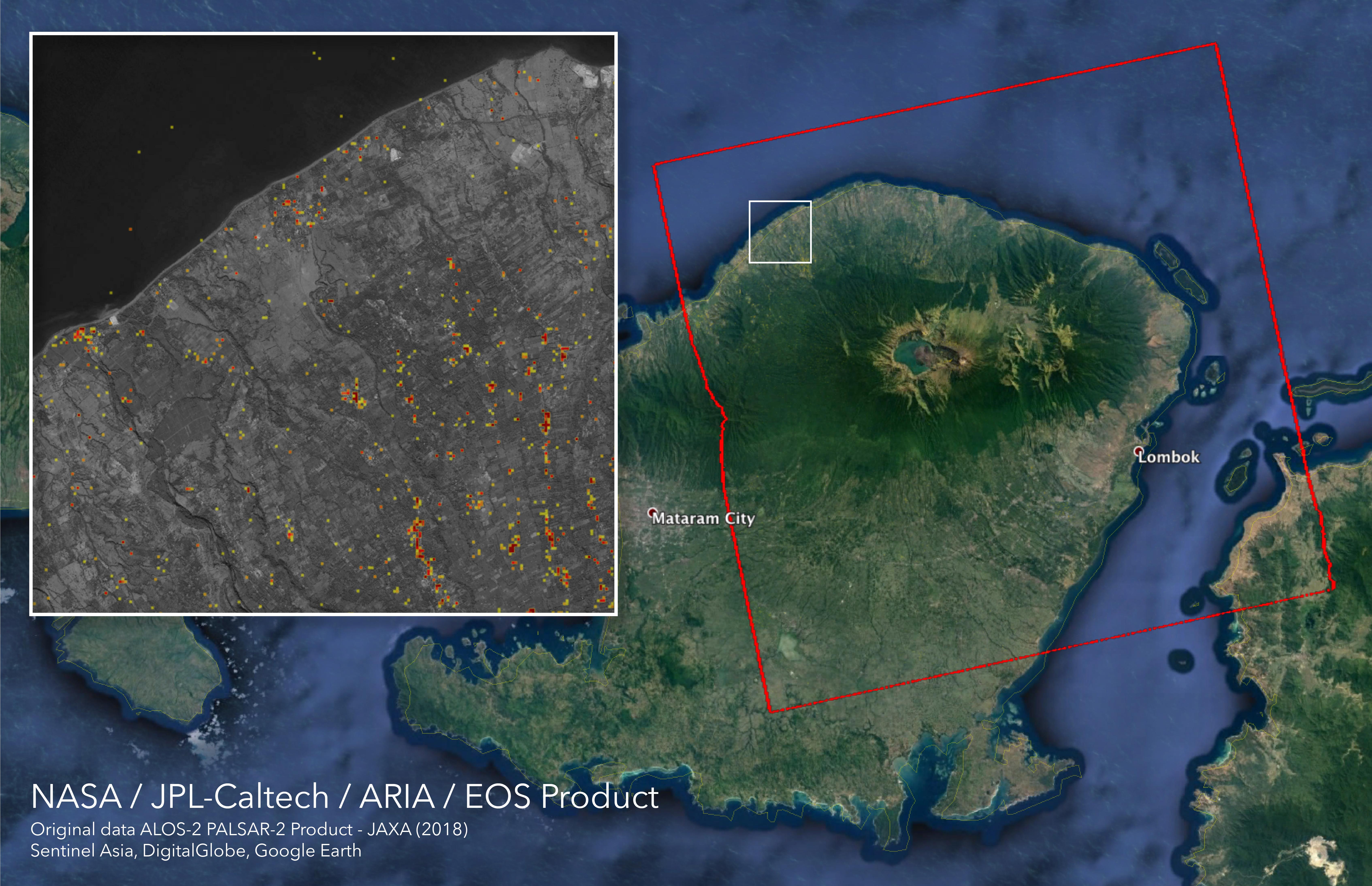
2018-09-05 |
Earth
|
ARIA
|
SAR
|
6776x4377x3 |
|
-
PIA22495:
-
ARIA Damage Proxy Map of Lombok, Indonesia Earthquakes
Full Resolution:
TIFF
(47.99 MB)
JPEG
(2.341 MB)
|
 Planetary Data System


