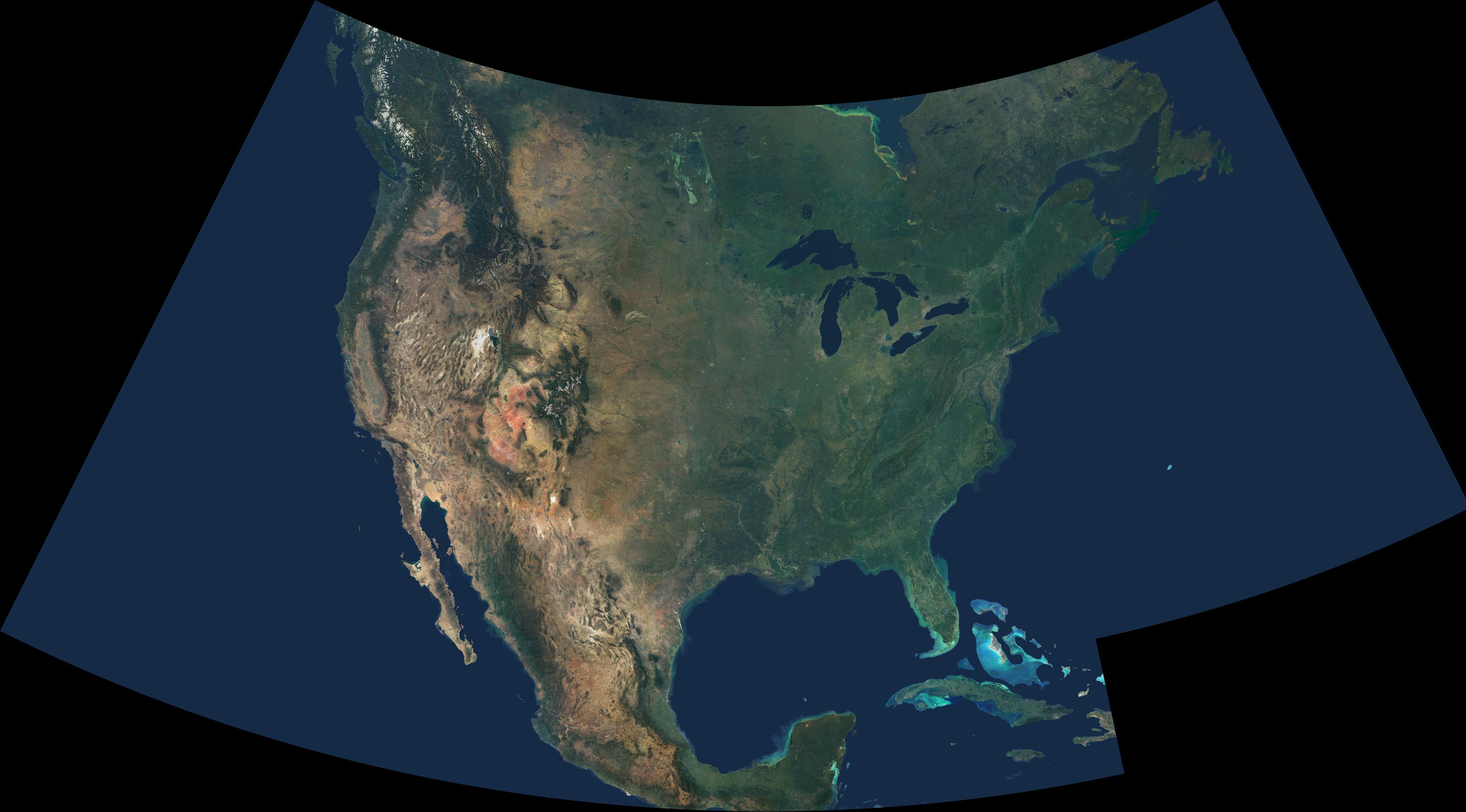
This natural-color image combines cloud-free data from over 500 Multi-angle Imaging SpectroRadiometer (MISR) orbits with shaded relief Digital Terrain Elevation models from the Shuttle Radar Topography Mission (SRTM) and other sources. An astonishing diversity of geological features, ecological systems and human landscapes across North America is indicated within the image, which spans from 56N, 136W at the upper left to 16N 48W at lower right.
In addition to the contiguous United States, the scene spans from British Columbia in the northwest to Newfoundland in the northeast, and extends eastward to the lonely Bermuda Islands and southward to the Bahamas, Cuba and Mexico. Draped in green, the eastern and central United States and Canada contrast with the vibrant geology that is laid bare across the arid portions of the southwestern United States and central Mexico. Along Mexico's east coast, the lush vegetation to the east of the Sierra Madre mountain range indicates the orographic rainfall gradient along this subtropical-tropical coast. In the high Rocky Mountains and in British Columbia's Coast Range, many peaks remain snow-covered year-round.
The Multi-angle Imaging SpectroRadiometer observes the daylit Earth continuously and every 9 days views the entire globe between 82 north and 82 south latitude. This data product was generated from a portion of the imagery acquired during years 2000 - 2004. The image is displayed in an Albers Conic Equal Area projection with the projection center at 36 North, 92 West.
MISR was built and is managed by NASA's Jet Propulsion Laboratory, Pasadena, CA, for NASA's Office of Earth Science, Washington, DC. The Terra satellite is managed by NASA's Goddard Space Flight Center, Greenbelt, MD. JPL is a division of the California Institute of Technology.
