My
List |
Addition Date
|
Target
|
Mission
|
Instrument
|
Size
|

|
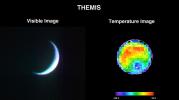
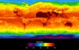
2001-04-26 |
Earth
|
2001 Mars Odyssey
|
THEMIS
|
3000x1681x3 |
|
-
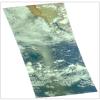
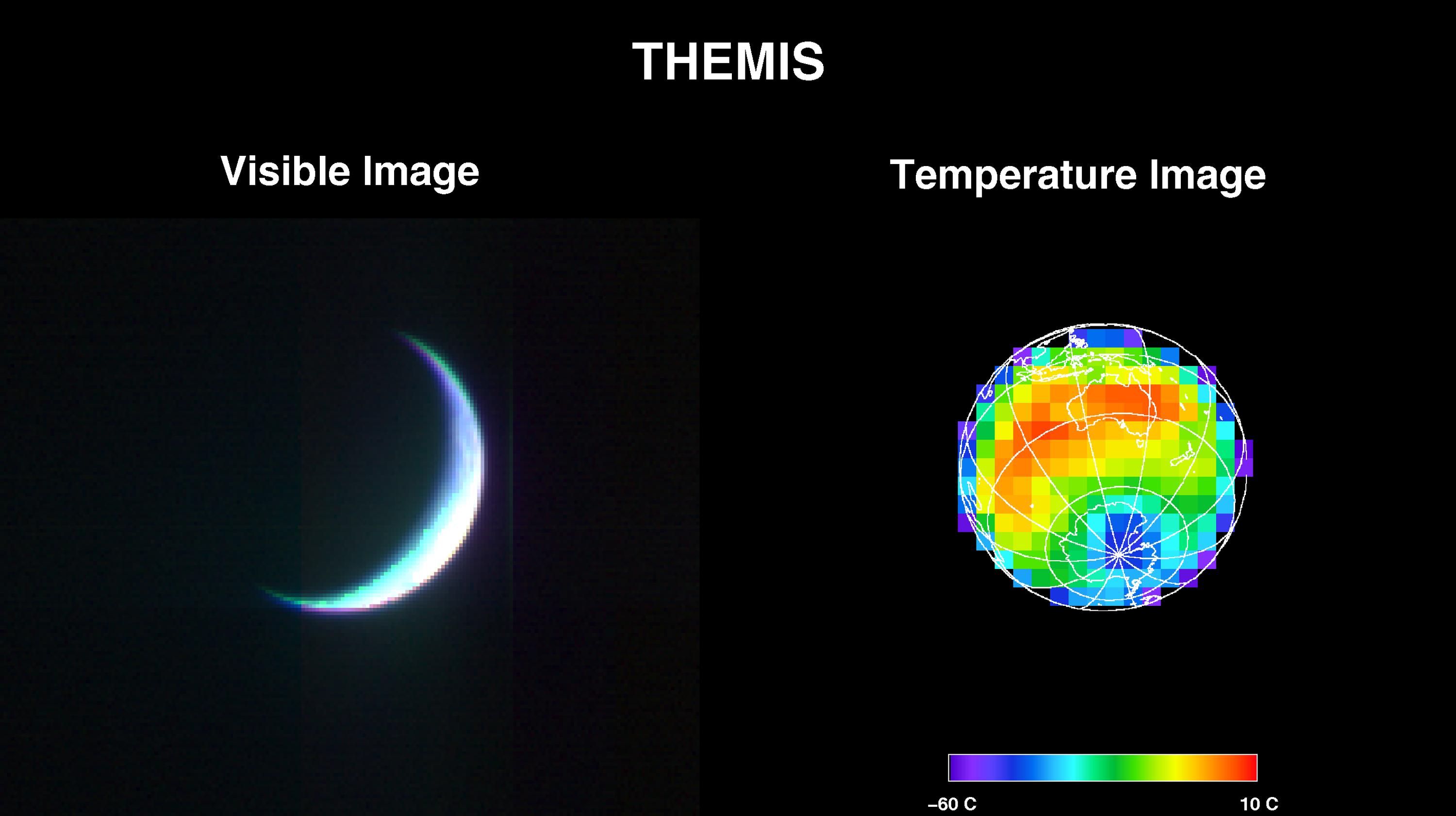
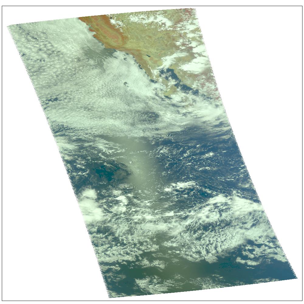
PIA00558:
-
2001 Mars Odyssey Images Earth (Visible and Infrared)
Full Resolution:
TIFF
(2.994 MB)
JPEG
(217.5 kB)
|
|
|
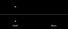
2001-05-01 |
Earth
|
2001 Mars Odyssey
|
THEMIS
|
3124x1342x1 |
|
-
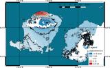
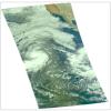
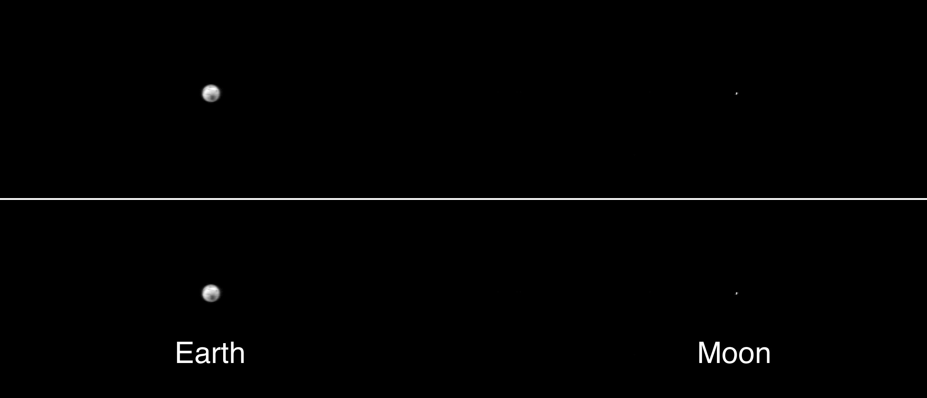
PIA00559:
-
The Earth and Moon As Seen by 2001 Mars Odyssey's Thermal Emission Imaging System
Full Resolution:
TIFF
(101.6 kB)
JPEG
(69.4 kB)
|
|
|
2012-09-13 |
Earth
|
ADAPT
|
|
3456x5184x3 |
|
-
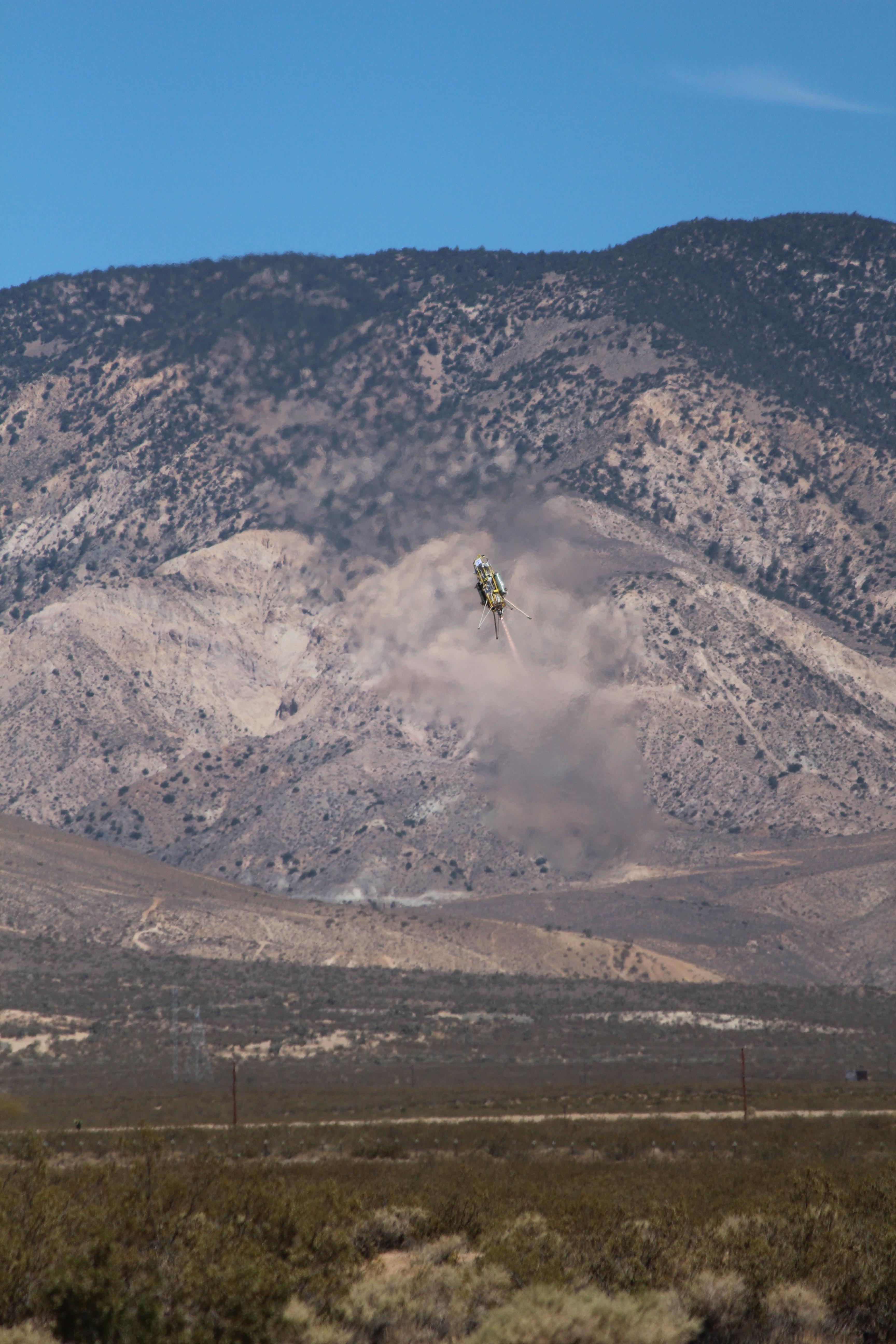
PIA16119:
-
ADAPT Rocket Test
Full Resolution:
TIFF
(53.77 MB)
JPEG
(1.477 MB)
|
|
|
1998-07-03 |
Earth
|
Advanced Earth Observing Satellite (ADEOS)
|
MLS
|
1152x849x3 |
|
-
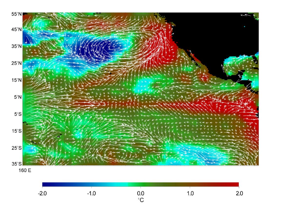
PIA01452:
-
Microwave Limb Sounder/El Niño Watch - 1997 Research Data Reveal Clues about El Niño's Influence
Full Resolution:
TIFF
(1.189 MB)
JPEG
(234.5 kB)
|
|
|
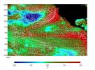
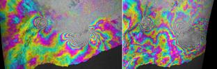
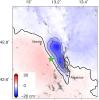
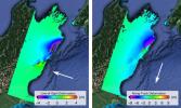
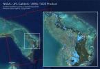
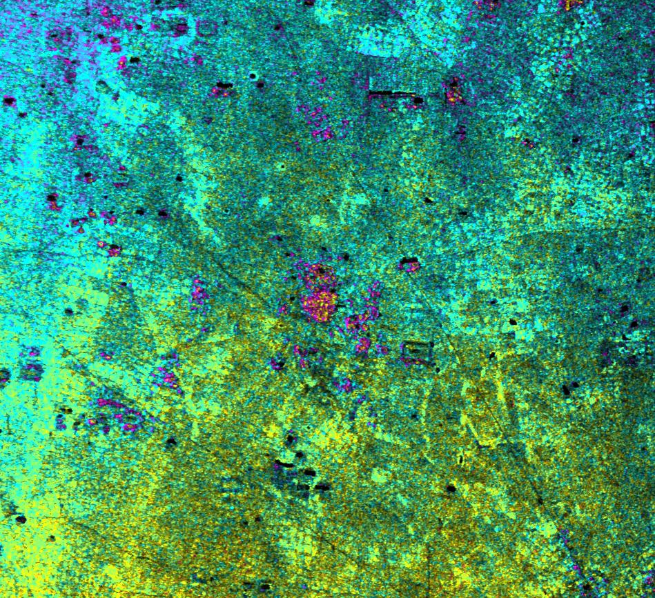
2011-03-10 |
Earth
|
ARIA
|
X-band interferometric synthetic aperture radar
|
2692x863x3 |
|
-
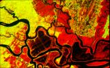
PIA13910:
-
INSAR Images Hawaii's Kilauea Volcano
Full Resolution:
TIFF
(6.977 MB)
JPEG
(732.1 kB)
|
|
|
2018-06-15 |
Earth
|
ARIA
|
|
5493x3209x3 |
|
-
PIA22532:
-
NASA Damage Map Shows Effects of Destructive Guatemala Volcano Eruption
Full Resolution:
TIFF
(11.55 MB)
JPEG
(1.777 MB)
|
|
|
2013-11-13 |
Earth
|
ARIA
|
X-band interferometric synthetic aperture radar
|
1623x956x3 |
|
-
PIA17687:
-
NASA-Generated Damage Map To Assist With Typhoon Haiyan Disaster Response
Full Resolution:
TIFF
(4.657 MB)
JPEG
(212.5 kB)
|
|
|
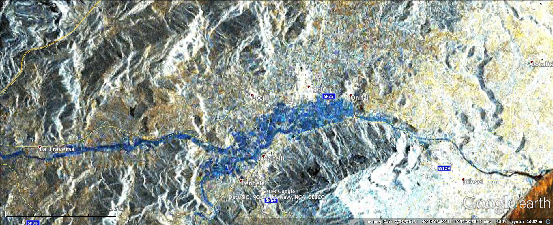
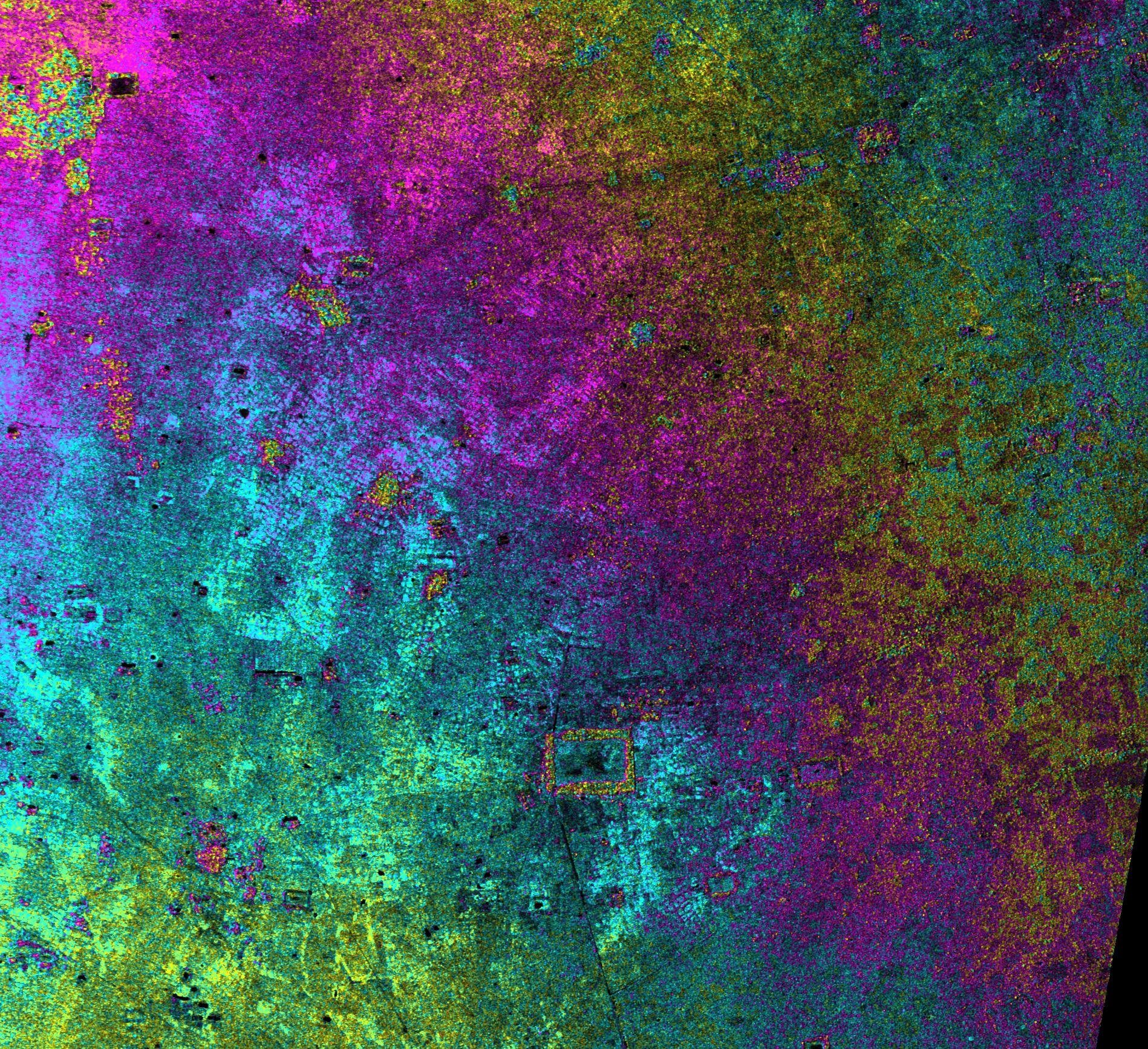
2013-11-26 |
Earth
|
ARIA
|
X-band Interferometric Synthetic Aperture Radar
|
1916x780x3 |

|
-
PIA17738:
-
NASA Produces Map to Aid in Italian Flood Response
Full Resolution:
TIFF
(4.485 MB)
JPEG
(344.8 kB)
|
|
|
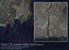
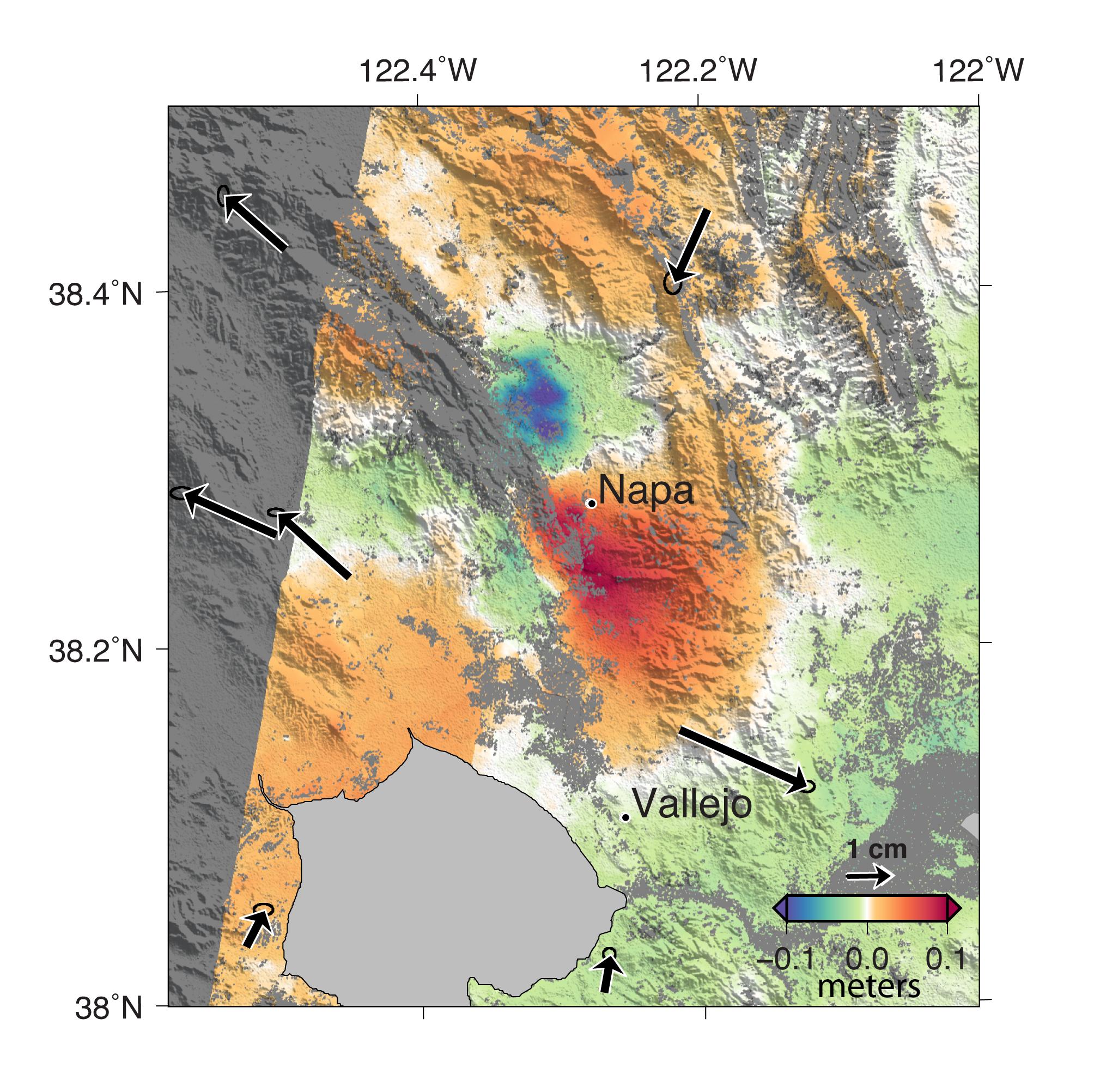
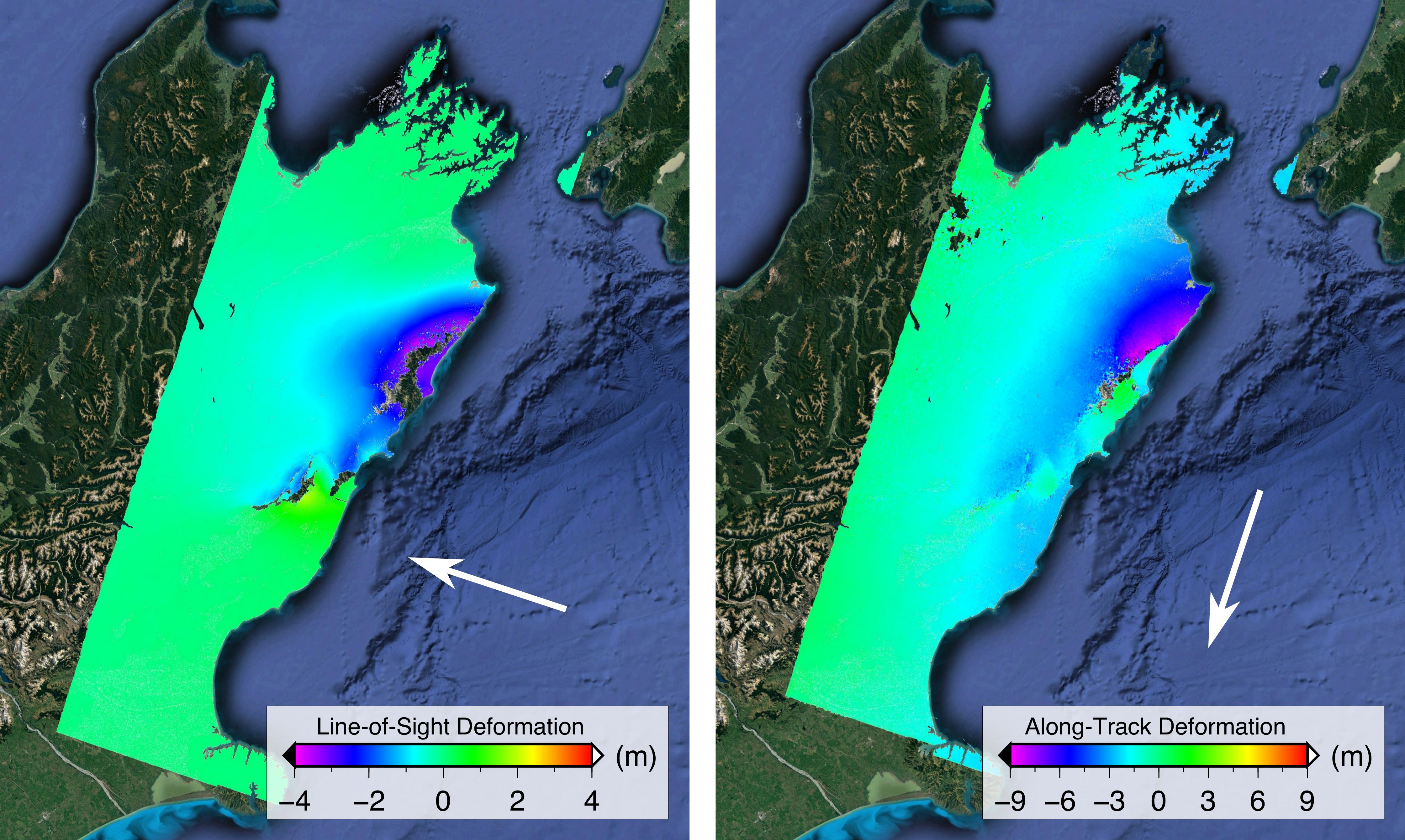
2014-09-04 |
Earth
|
ARIA
|
X-band Interferometric Synthetic Aperture Radar
|
2019x2004x3 |
|
-
PIA18798:
-
NASA Analyses of Global Positioning System Data and Italian Radar Satellite Data Reveal Napa Quake Ground Deformation
Full Resolution:
TIFF
(12.14 MB)
JPEG
(554.3 kB)
|
|
|
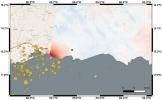
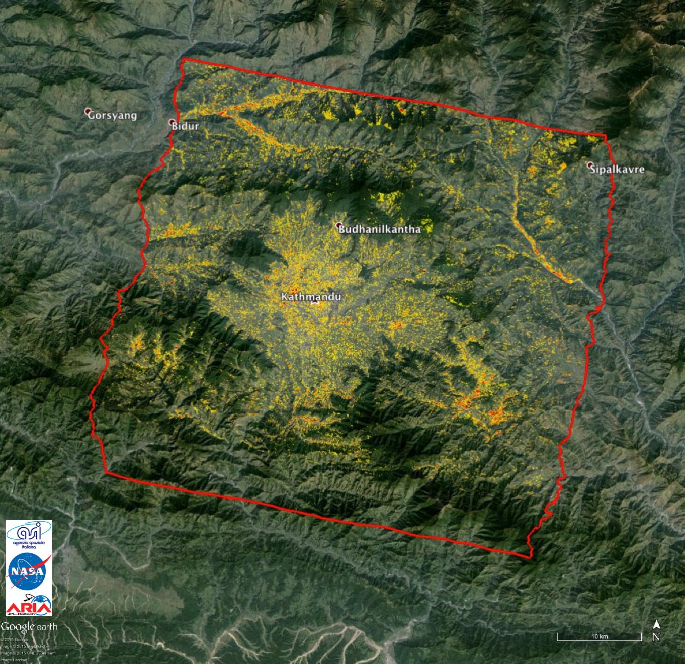
2015-05-01 |
Earth
|
ARIA
|
X-band Interferometric Synthetic Aperture Radar
|
1362x1320x3 |
|
-
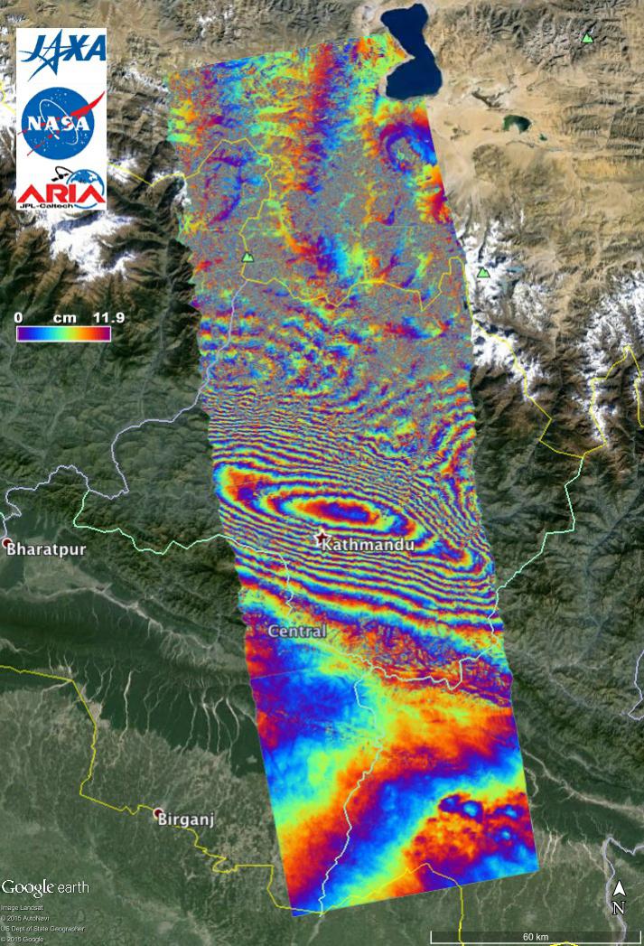
PIA13911:
-
NASA-Generated Damage Map to Assist with 2015 Gorkha, Nepal Earthquake Disaster Response
Full Resolution:
TIFF
(5.396 MB)
JPEG
(349.8 kB)
|
|
|
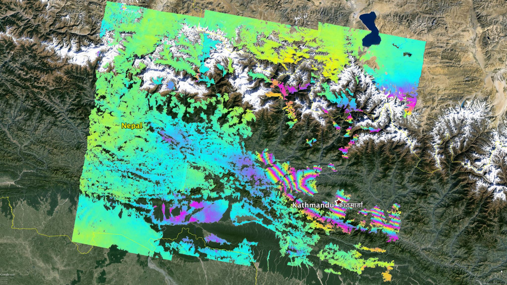
2015-05-02 |
Earth
|
ARIA
|
C-SAR Sensor
|
2048x1152x3 |

|
-
PIA19535:
-
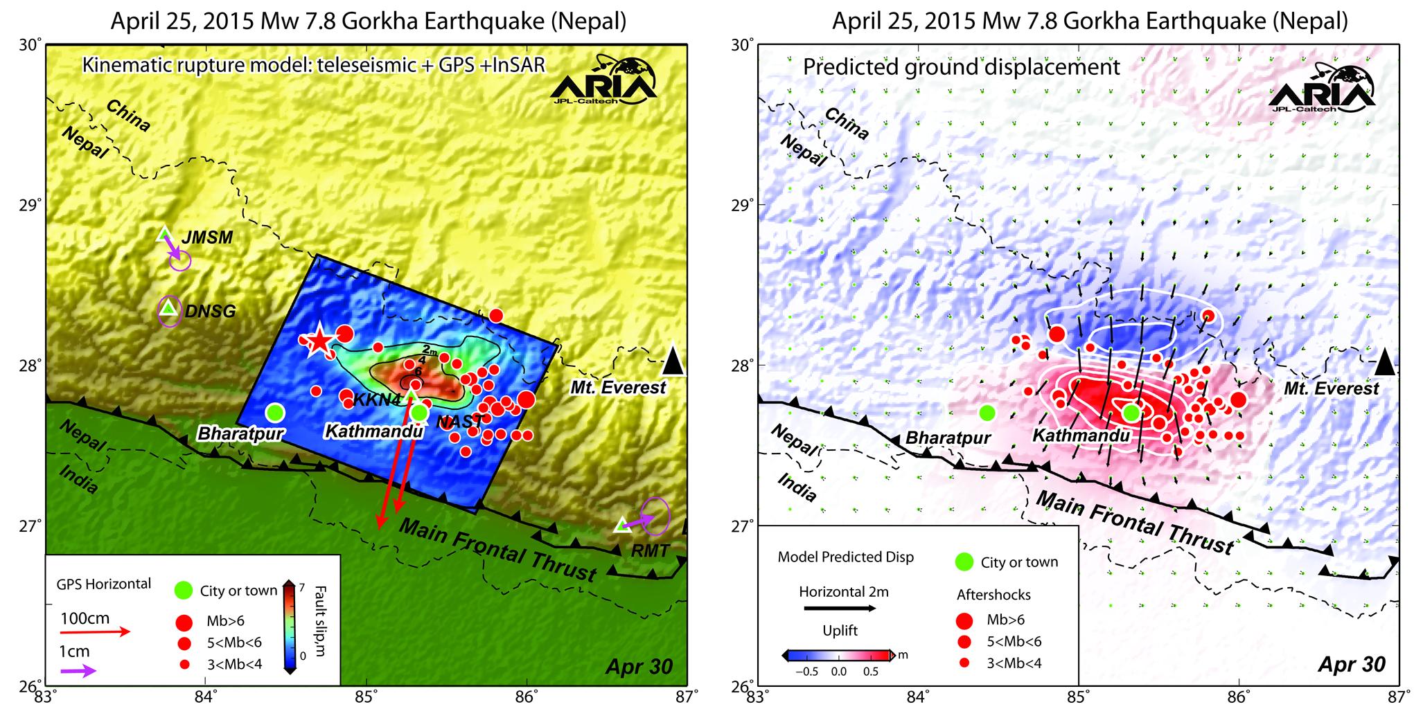
NASA's ARIA Project Maps Deformation of Earth's Surface from Nepal Quake
Full Resolution:
TIFF
(7.08 MB)
JPEG
(600.1 kB)
|
|
|
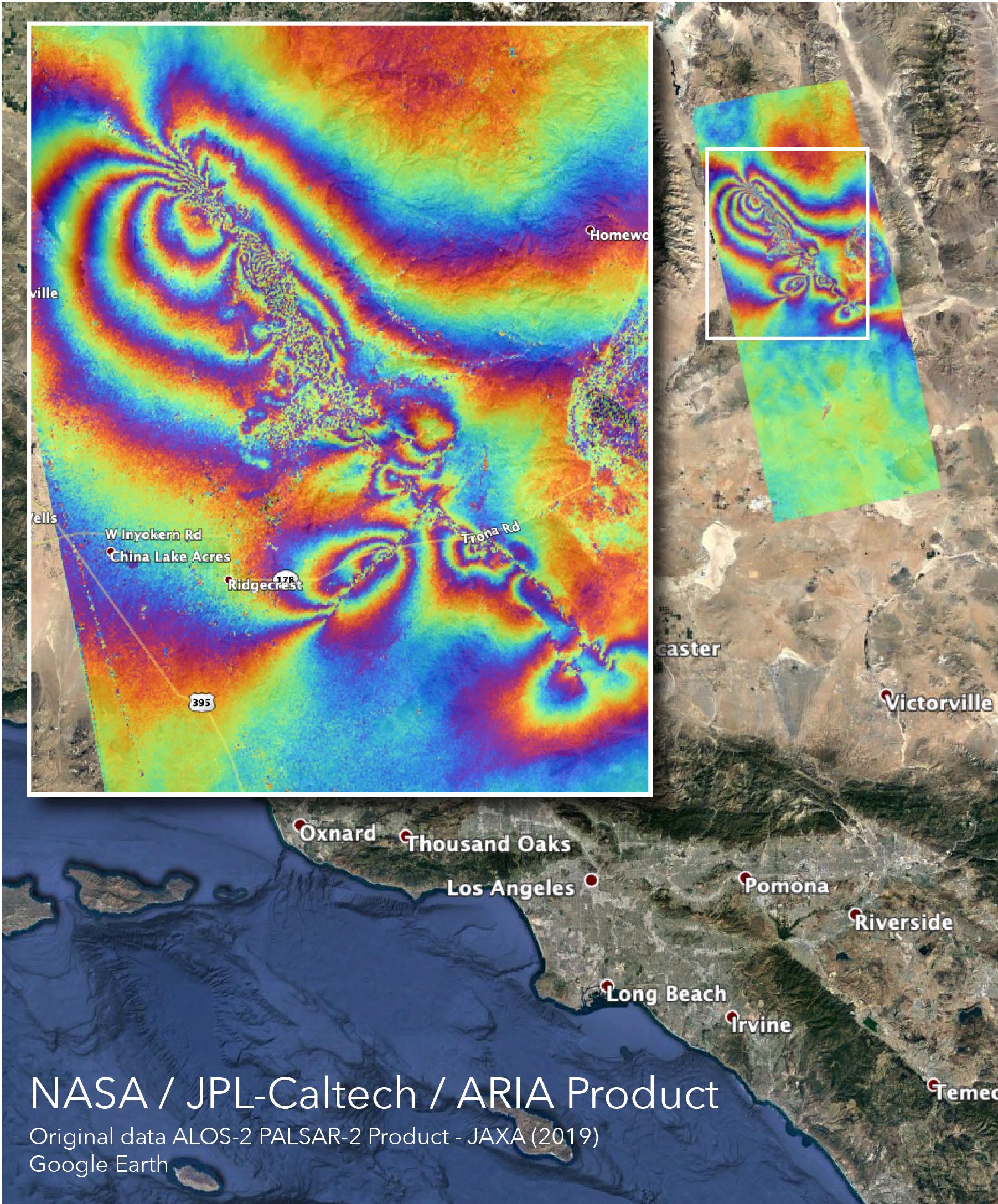
2015-05-04 |
Earth
|
ARIA
|
PALSAR-2
|
713x1047x3 |
|
-
PIA19383:
-
NASA's ARIA Project Provides New Look at Earth Surface Deformation from Nepal Quake
Full Resolution:
TIFF
(2.241 MB)
JPEG
(179.7 kB)
|
|
|
2015-05-04 |
Earth
|
ARIA
|
|
2054x1024x3 |

|
-
PIA19384:
-
NASA/Caltech Team Images Nepal Quake Fault Rupture, Surface Movements
Full Resolution:
TIFF
(6.313 MB)
JPEG
(364.2 kB)
|
|
|
2015-05-07 |
Earth
|
ARIA
|
PALSAR-2
|
1402x2048x3 |
|
-
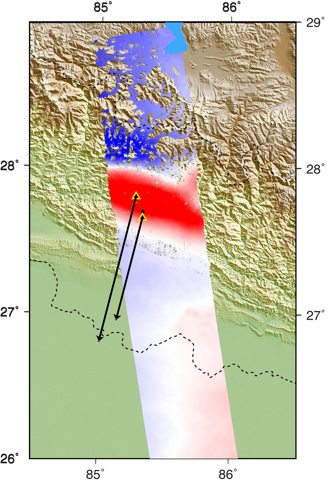
PIA14708:
-
Radar Shows Kathmandu Area Uplifted 5 Feet by Gorkha, Nepal Earthquake
Full Resolution:
TIFF
(8.617 MB)
JPEG
(460.9 kB)
|
|
|
2015-05-11 |
Earth
|
ARIA
|
PALSAR-2
|
822x1263x3 |
|
-
PIA14710:
-
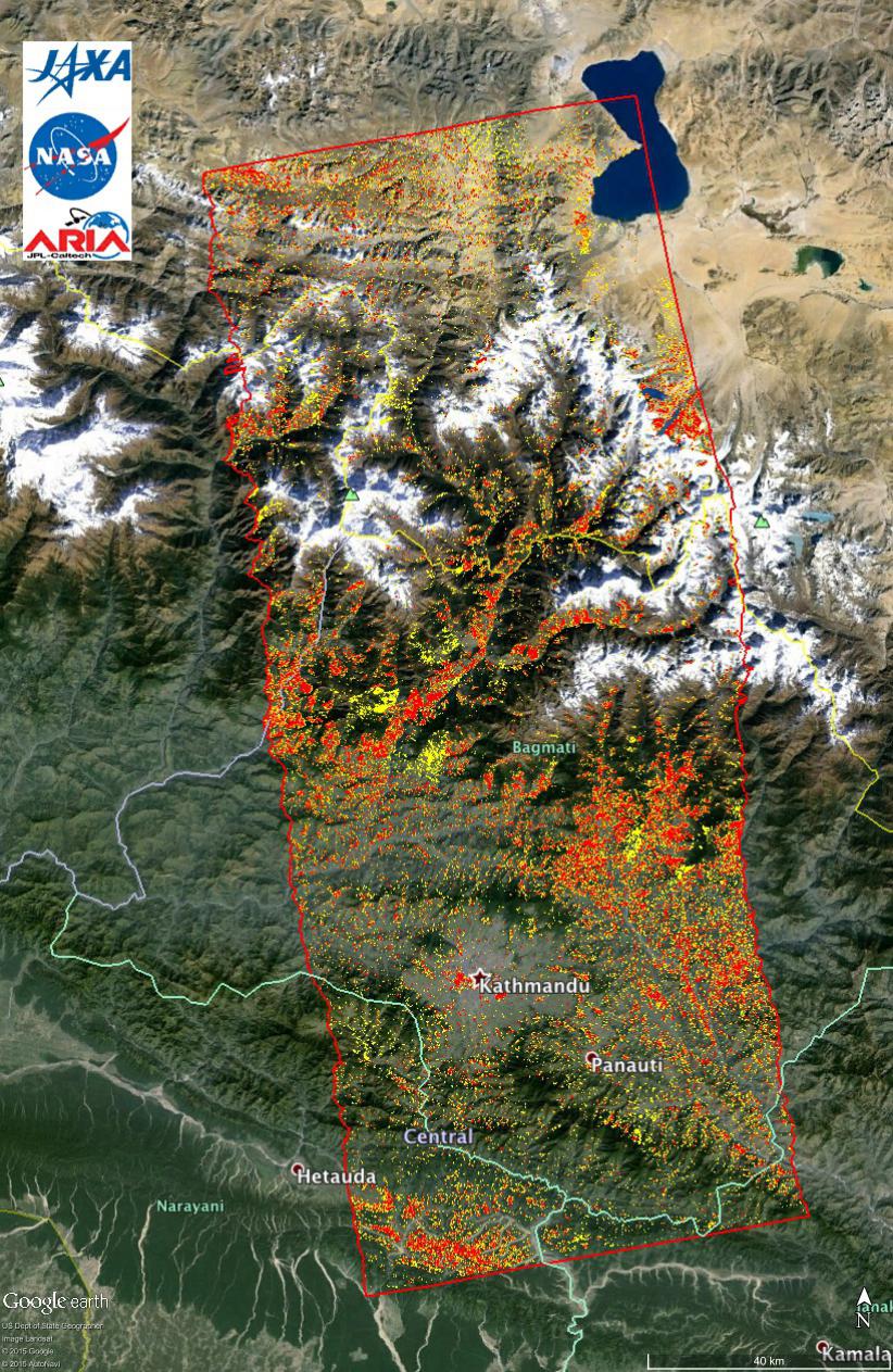
New ALOS-2 Damage Map Assists 2015 Gorkha, Nepal Disaster Response
Full Resolution:
TIFF
(3.116 MB)
JPEG
(307.4 kB)
|
|
|
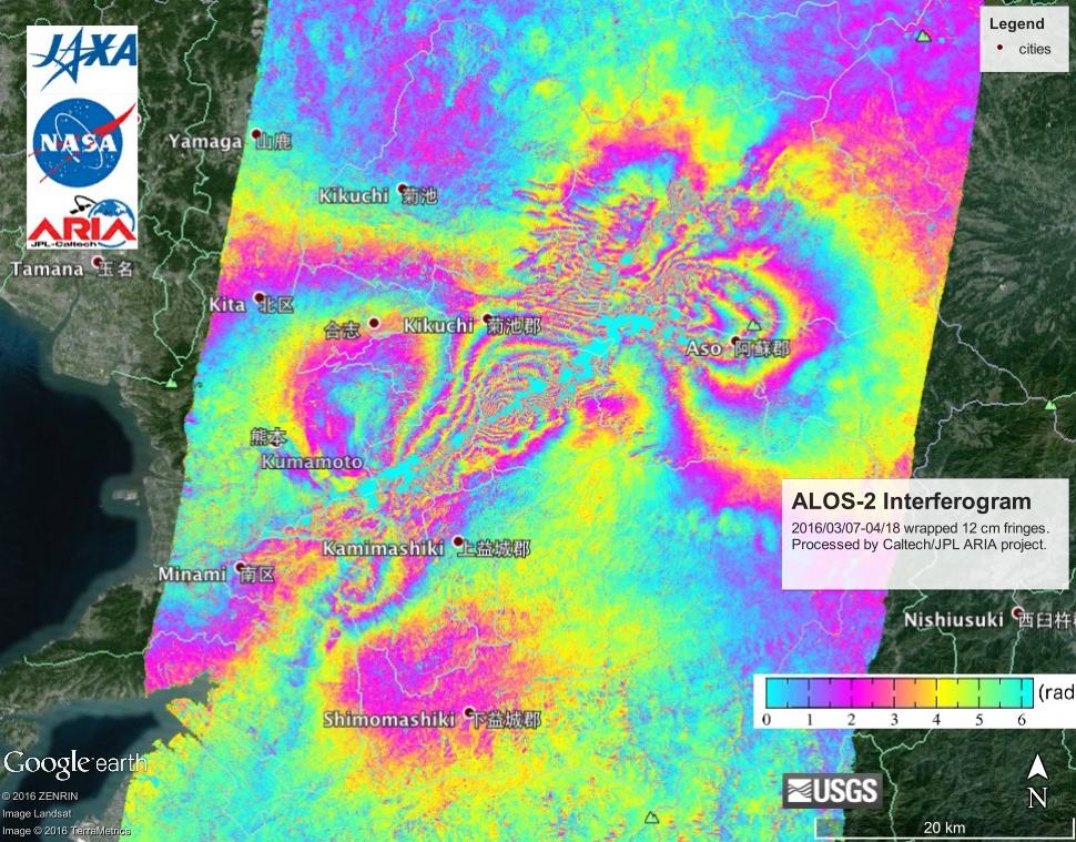
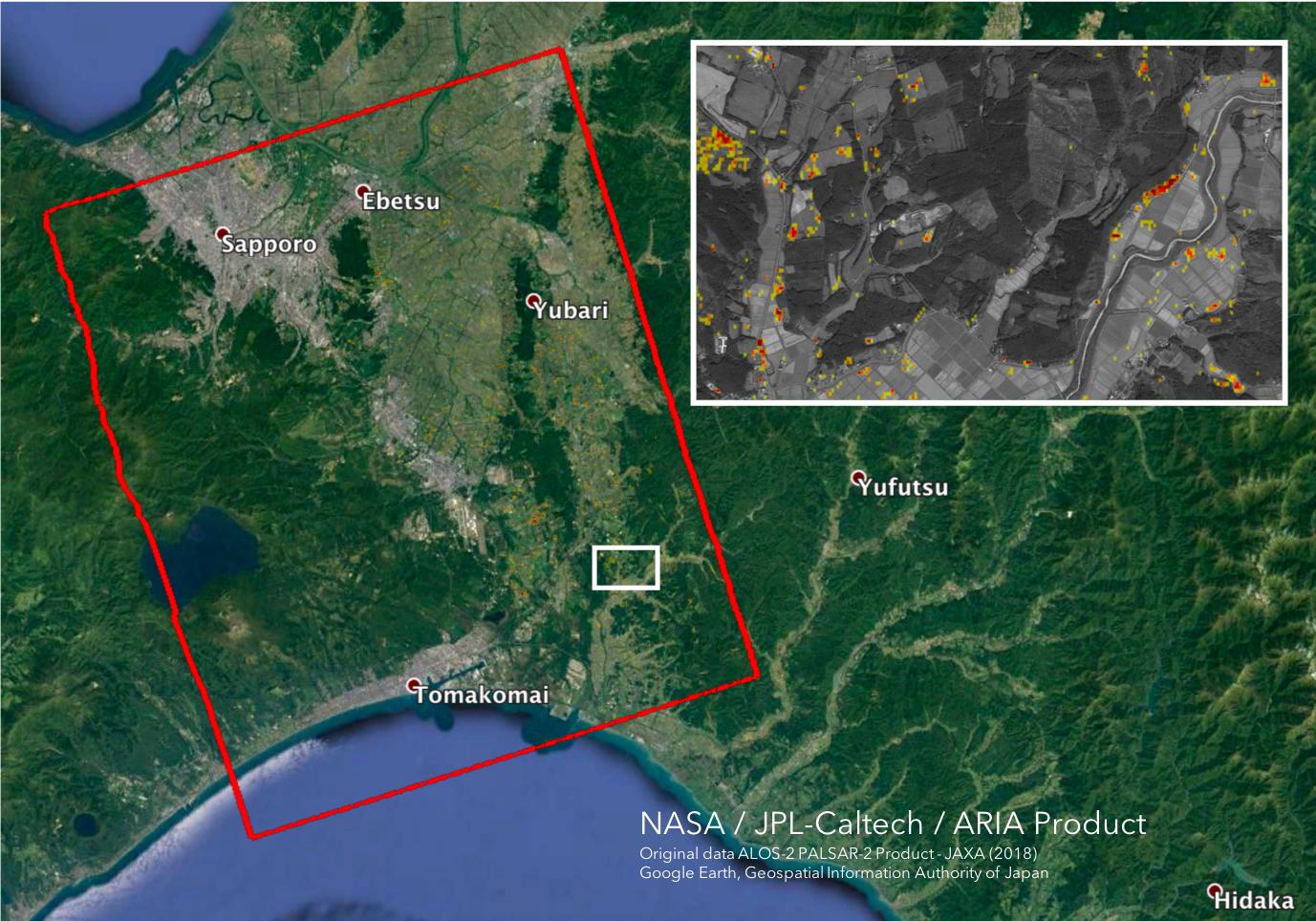
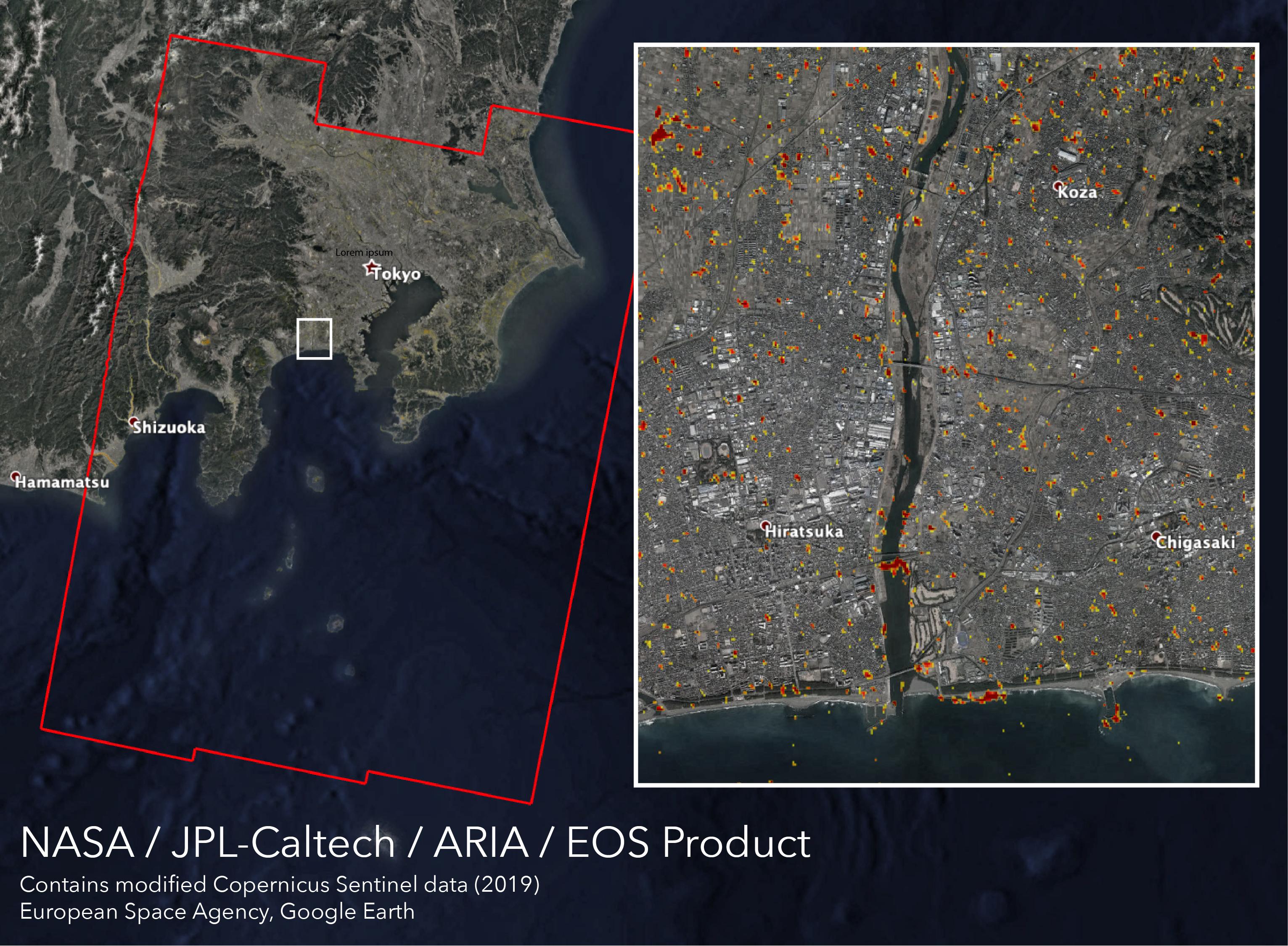
2016-04-20 |
Earth
|
ARIA
|
PALSAR-2
|
970x759x3 |

|
-
PIA20460:
-
NASA's ARIA Project, JAXA Examine Earth Surface Deformation from Kumamoto, Japan Quakes
Full Resolution:
TIFF
(2.21 MB)
JPEG
(165.3 kB)
|
|
|
2016-08-27 |
Earth
|
ARIA
|
PALSAR-2
|
1002x1011x3 |

|
-
PIA20893:
-
Radar Shows Italy Area Moved 8 Inches by Amatrice Earthquake
Full Resolution:
TIFF
(1.094 MB)
JPEG
(99.43 kB)
|
|
|
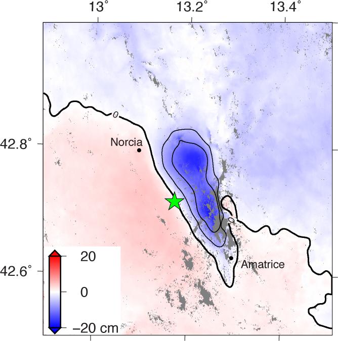
2016-08-31 |
Earth
|
ARIA
|
|
668x675x3 |
|
-
PIA20896:
-
Automated Radar Image of Deformation for Amatrice, Italy Earthquake
Full Resolution:
TIFF
(588.1 kB)
JPEG
(58.05 kB)
|
|
|
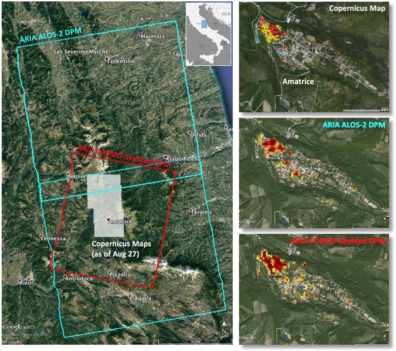
2016-09-01 |
Earth
|
ARIA
|
|
1390x1231x3 |

|
-
PIA20897:
-
New Satellite Damage Maps Assist Italy's Earthquake Disaster Response
Full Resolution:
TIFF
(5.135 MB)
JPEG
(388.6 kB)
|
|
|
2016-10-05 |
Earth
|
ARIA
|
|
1313x1164x3 |
|
-
PIA21091:
-
NASA-Produced Maps Help Gauge Italy Earthquake Damage
Full Resolution:
TIFF
(4.587 MB)
JPEG
(324.8 kB)
|
|
|
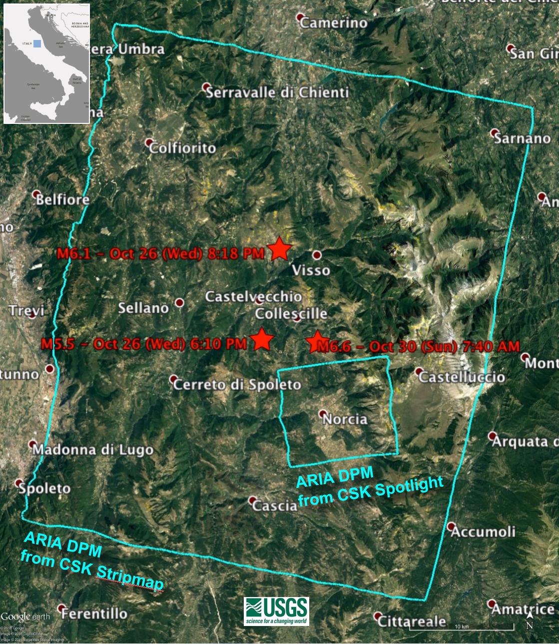
2016-11-16 |
Earth
|
ARIA
|
|
1119x1289x3 |

|
-
PIA15374:
-
NASA’s Damage Proxy Map to Assist with Italy Earthquake Disaster Response
Full Resolution:
TIFF
(4.329 MB)
JPEG
(322.2 kB)
|
|
|
2017-03-23 |
Earth
|
ARIA
|
PALSAR-2
|
4481x2682x3 |
|
-
PIA21210:
-
Satellite Radar Show Complex Set of Faults Moved in 2016 New Zealand Earthquake
Full Resolution:
TIFF
(32.2 MB)
JPEG
(1.209 MB)
|
|
|
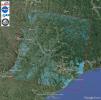
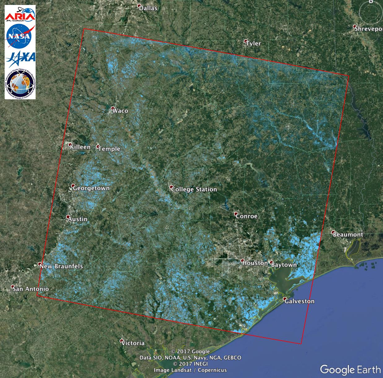
2017-08-30 |
Earth
|
ARIA
|
PALSAR-2
|
1237x1222x3 |
|
-
PIA21928:
-
Extent of Texas Flooding Shown in New NASA Map
Full Resolution:
TIFF
(4.537 MB)
JPEG
(367.5 kB)
|
|
|
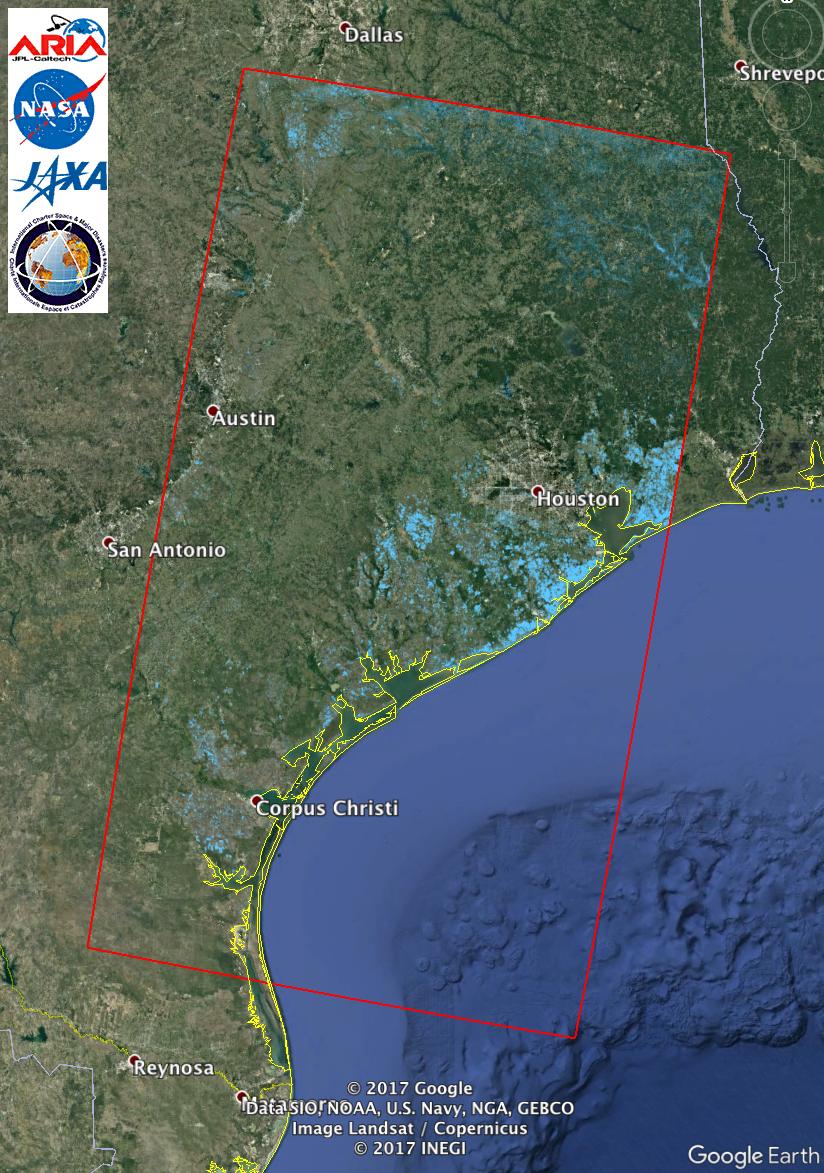
2017-08-31 |
Earth
|
ARIA
|
|
824x1173x3 |
|
-
PIA21931:
-
Updated NASA Satellite Flood Map of Southeastern Texas (ALOS-2 Data)
Full Resolution:
TIFF
(2.819 MB)
JPEG
(194.7 kB)
|
|
|
2017-08-31 |
Earth
|
ARIA
|
|
811x1174x3 |
|
-
PIA21932:
-
New NASA Satellite Flood Map of Southeastern Texas (Sentinel-1 Data)
Full Resolution:
TIFF
(2.858 MB)
JPEG
(210.2 kB)
|
|
|
2017-09-19 |
Earth
|
ARIA
|
|
3174x2707x3 |

|
-
PIA21956:
-
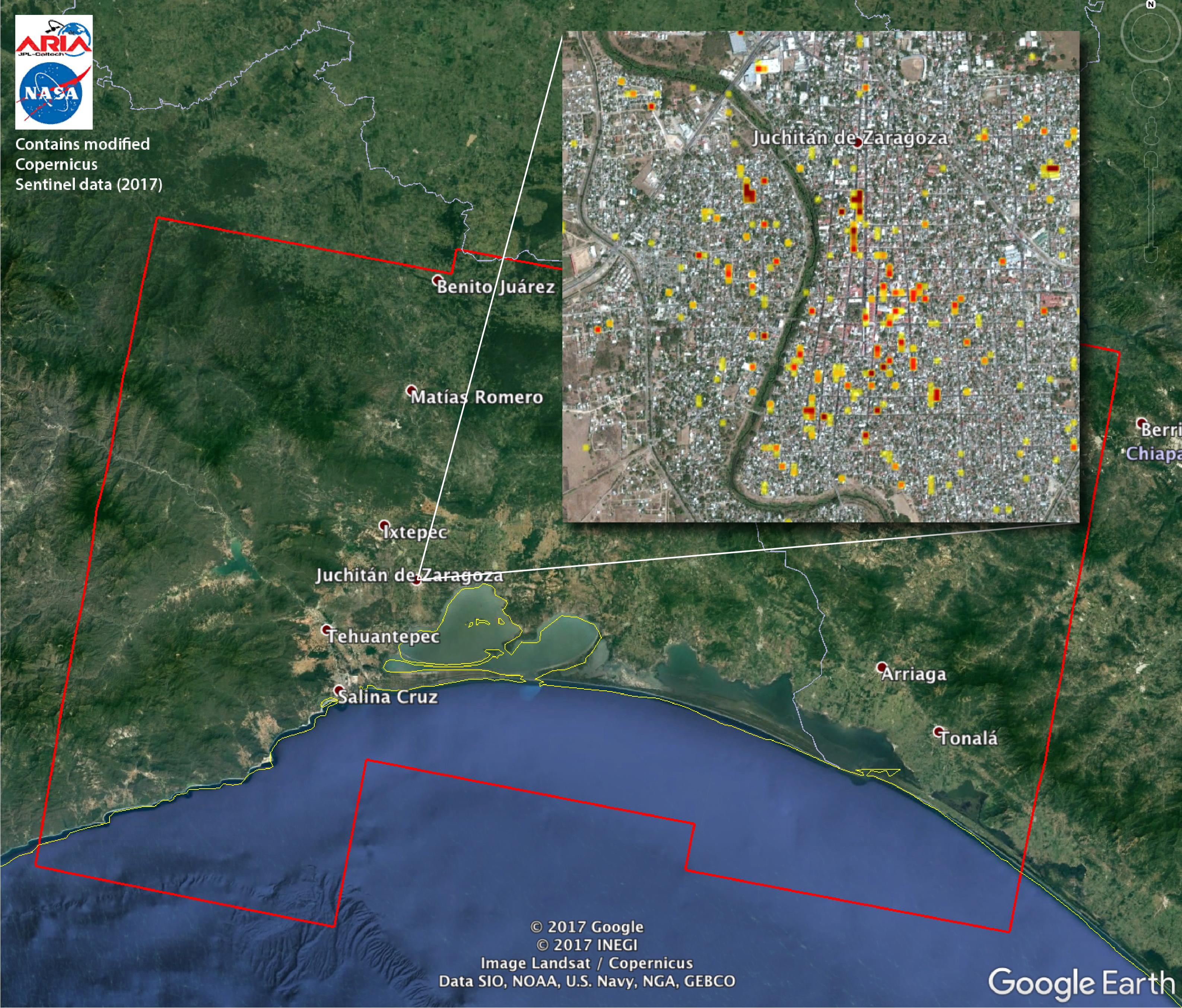
Satellite Radar Detects Damage from Sept. 2017 Chiapas, Mexico Quake
Full Resolution:
TIFF
(22.41 MB)
JPEG
(1.302 MB)
|
|
|
2017-09-20 |
Earth
|
ARIA
|
|
1860x1896x3 |
|
-
PIA21962:
-
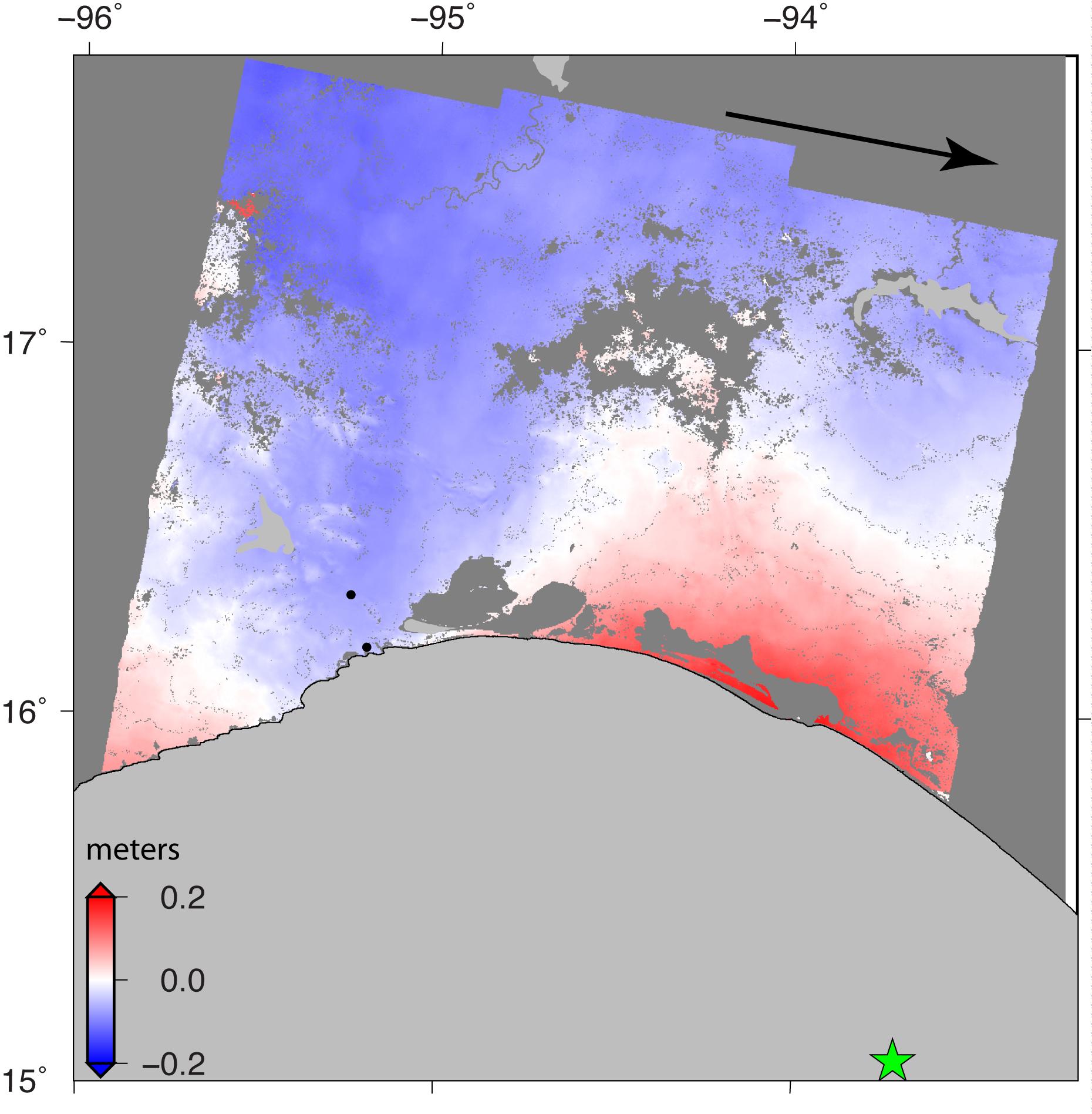
Sentinel-1 Radar Shows Ground Motion From Sept. 2017 Oaxaca-Chiapas, Mexico Quake
Full Resolution:
TIFF
(2.292 MB)
JPEG
(259.6 kB)
|
|
|
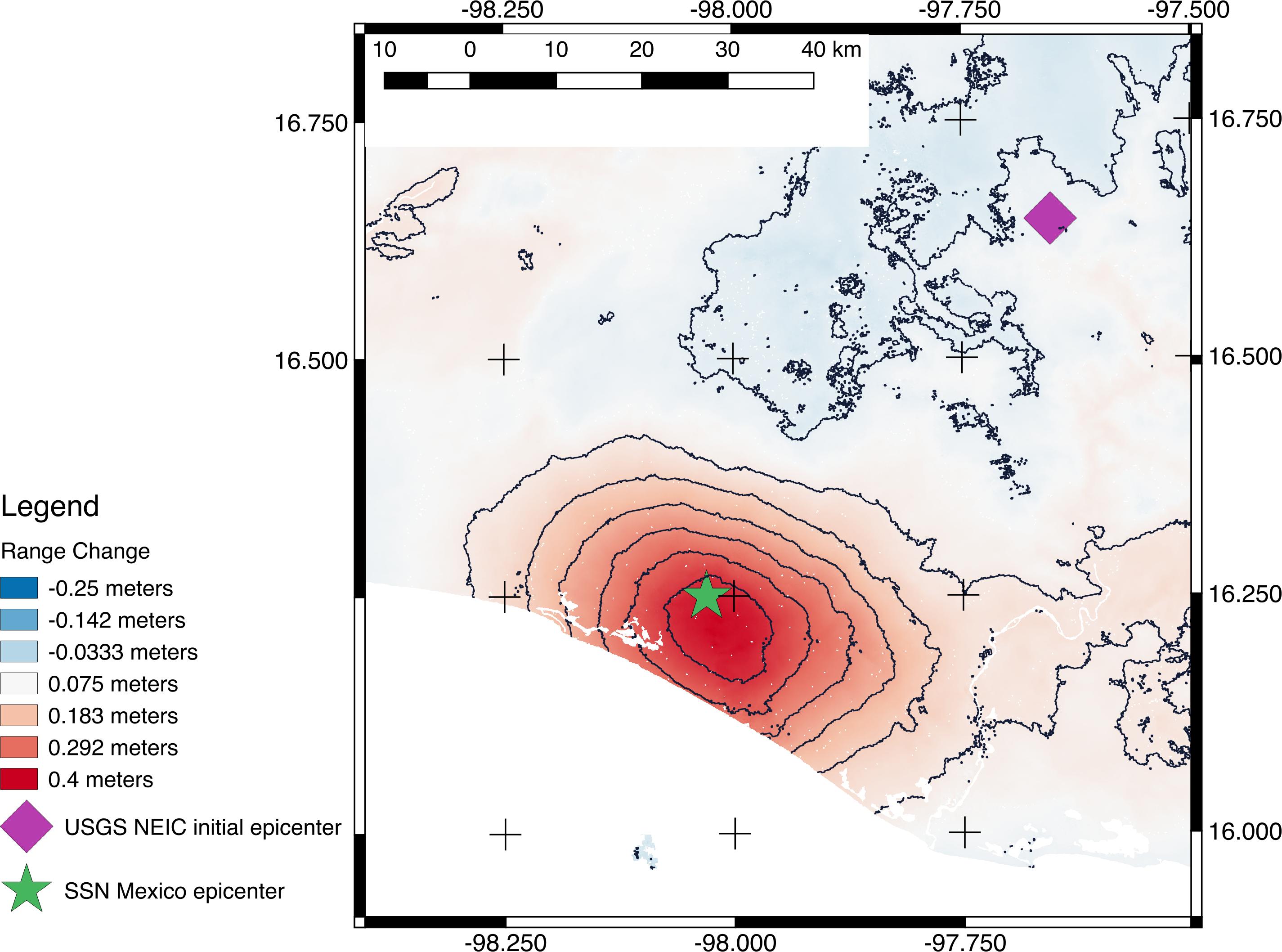
2017-09-20 |
Earth
|
ARIA
|
|
2512x2290x3 |
|
-
PIA21963:
-
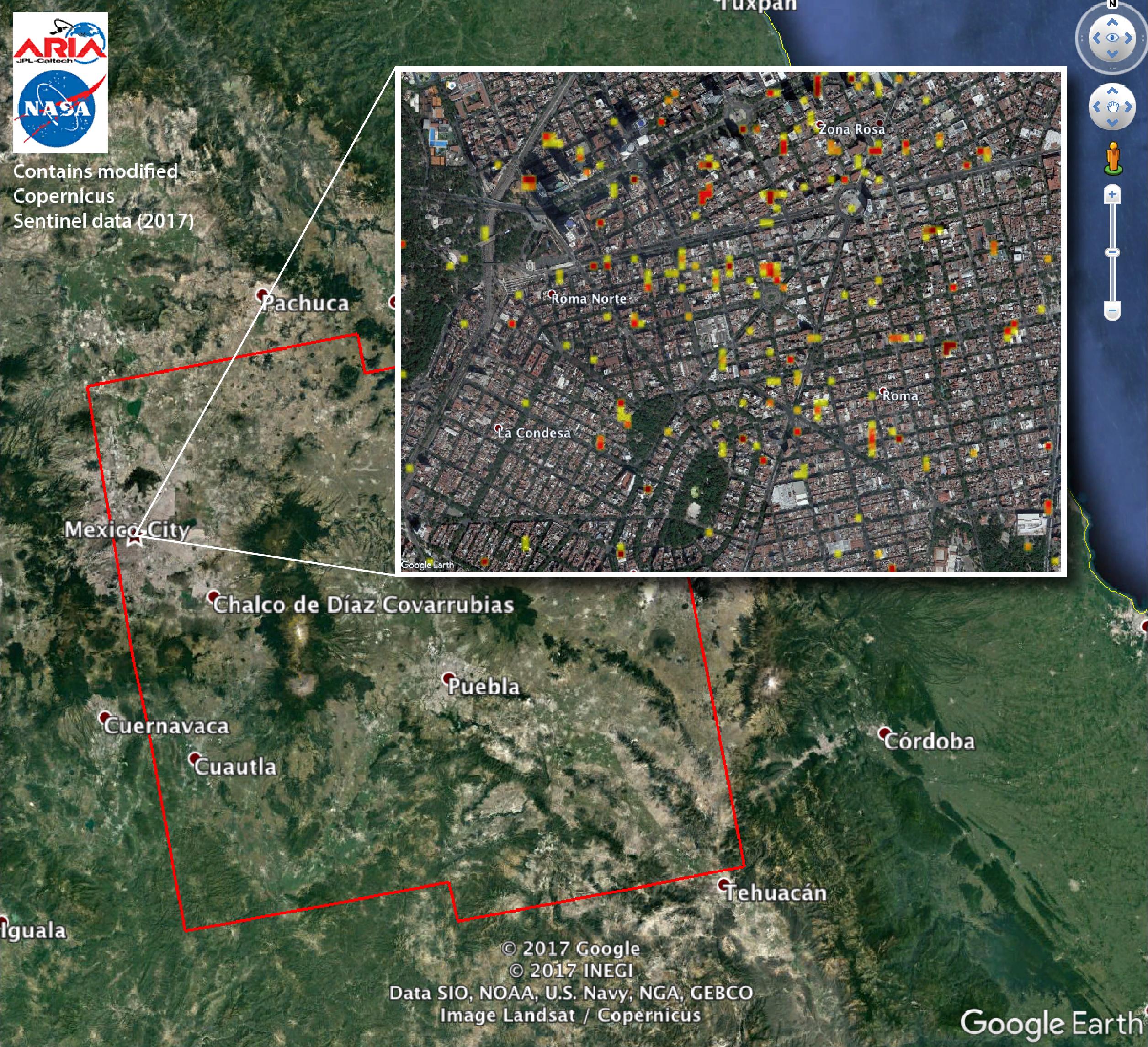
Satellite Radar Detects Damage from Sept. 19, 2017 Raboso, Mexico, Quake
Full Resolution:
TIFF
(16.67 MB)
JPEG
(1.194 MB)
|
|
|
2017-09-26 |
Earth
|
ARIA
|
|
1600x900x3 |

|
-
PIA21964:
-
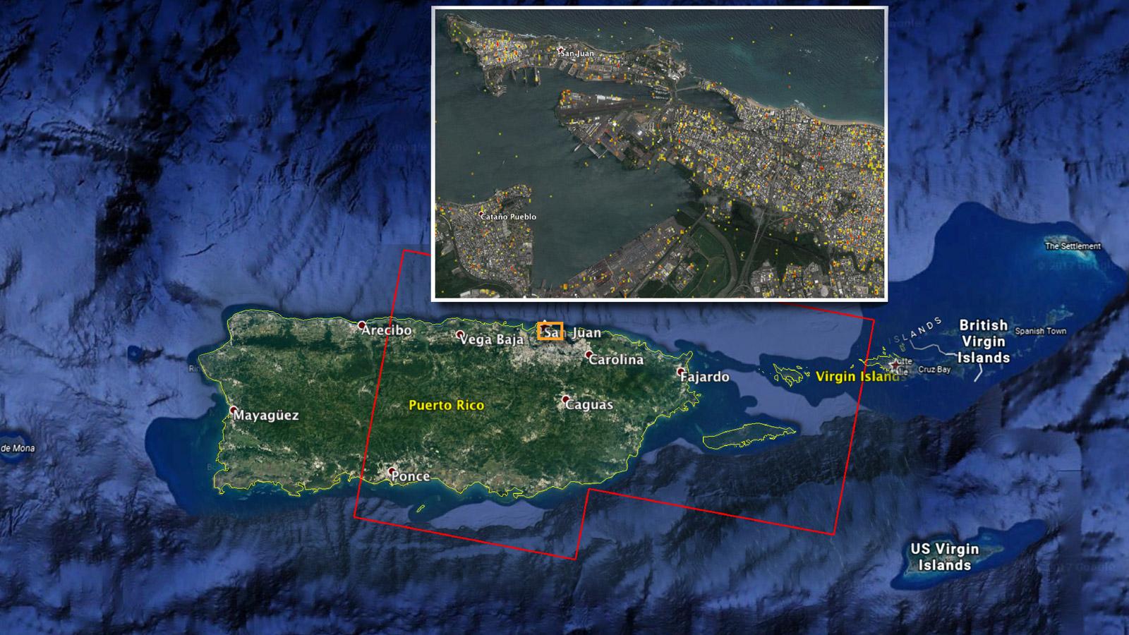
NASA Damage Map Aids FEMA's Hurricane Maria Rescue Operation in Puerto Rico
Full Resolution:
TIFF
(4.322 MB)
JPEG
(223.4 kB)
|
|
|
2017-09-29 |
Earth
|
ARIA
|
|
2206x2112x3 |

|
-
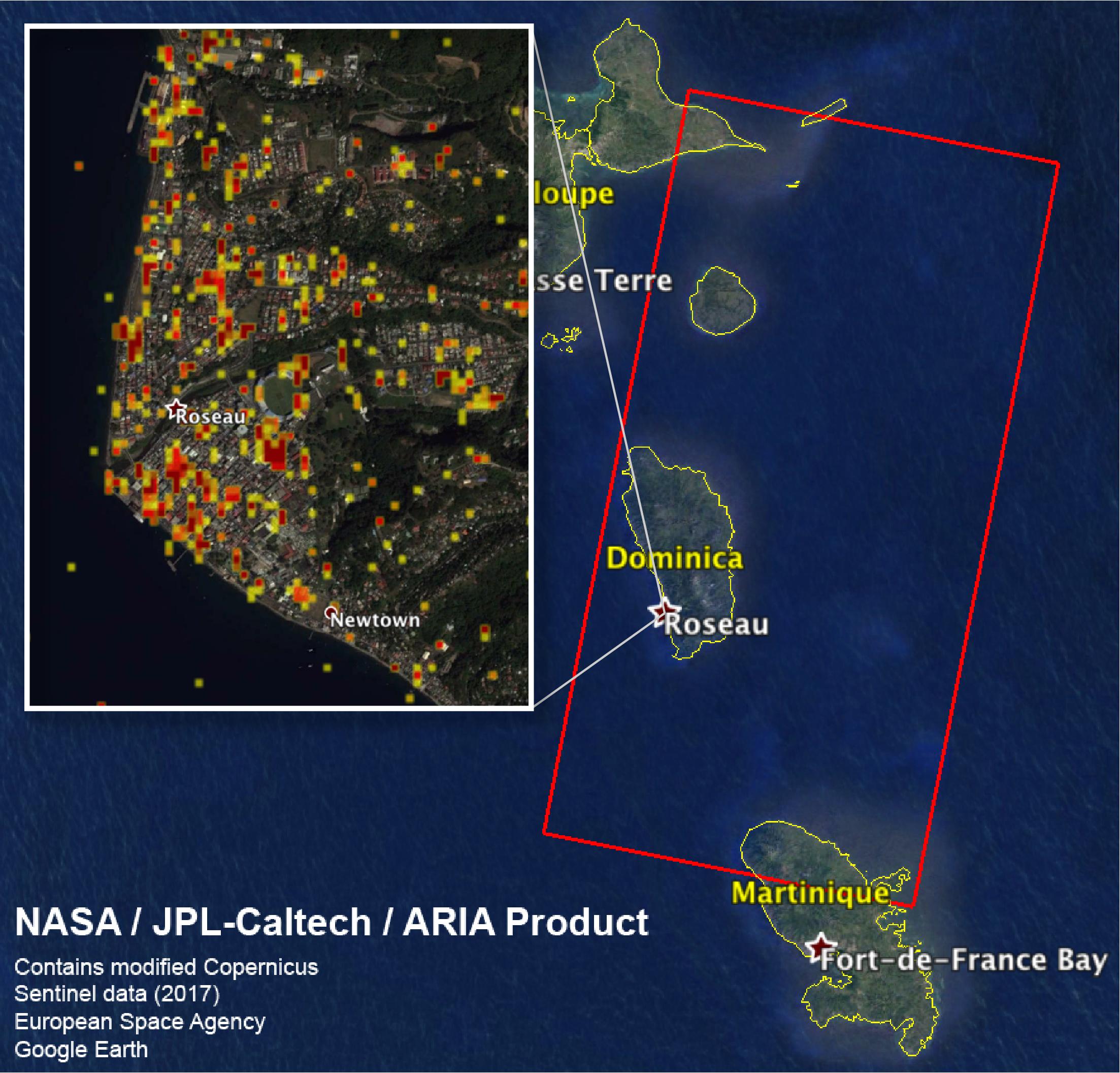
PIA22037:
-
Dominica Hurricane Damage Mapped by NASA's ARIA Team
Full Resolution:
TIFF
(9.583 MB)
JPEG
(474.4 kB)
|
|
|
2017-10-18 |
Earth
|
ARIA
|
|
2041x2471x3 |
|
-
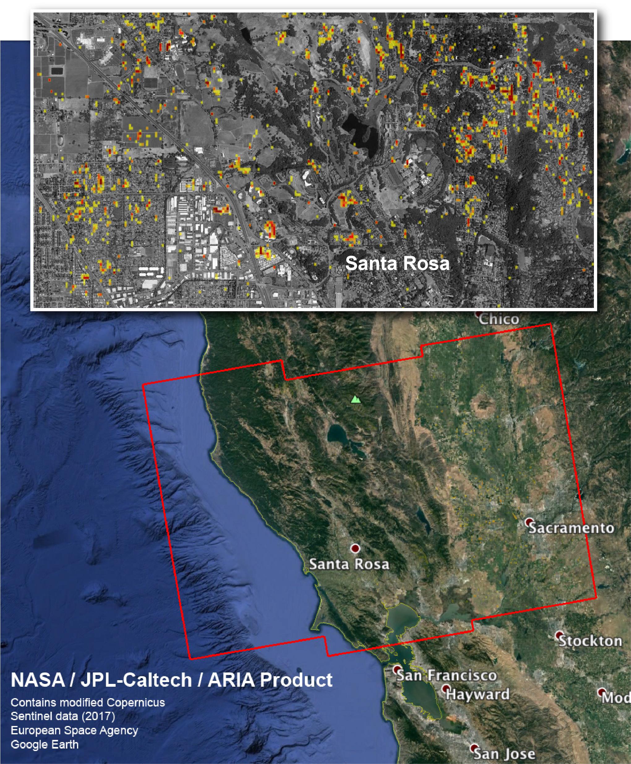
PIA22048:
-
NASA Damage Map Aids Northern California Wildfire Response
Full Resolution:
TIFF
(11.3 MB)
JPEG
(920.9 kB)
|
|
|
2017-12-14 |
Earth
|
ARIA
|
|
1786x1008x3 |
|
-
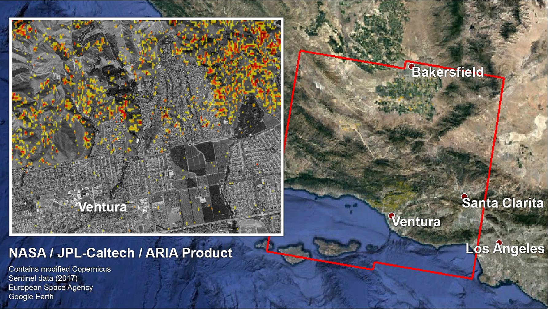
PIA22191:
-
NASA-Produced Map Shows Extent of Southern California Wildfire Damage
Full Resolution:
TIFF
(4.691 MB)
JPEG
(384.9 kB)
|
|
|
2018-02-21 |
Earth
|
ARIA
|
|
4568x3022x3 |

|
-
PIA22257:
-
Tonga Cyclone Damage Mapped by NASA's ARIA Team
Full Resolution:
TIFF
(22.99 MB)
JPEG
(1.141 MB)
|
|
|
2018-02-22 |
Earth
|
ARIA
|
|
2850x2116x3 |
|
-
PIA22258:
-
NASA's ARIA Project Generates New Satellite-Derived Map of Ground Deformation from Latest Mexico Quake
Full Resolution:
TIFF
(3.572 MB)
JPEG
(449.5 kB)
|
|
|
2018-11-12 |
Earth
|
ARIA
|
SAR
|
5176x2873x3 |
|
-
PIA22816:
-
NASA's ARIA Maps California Fire Damage
Full Resolution:
TIFF
(16.43 MB)
JPEG
(2.572 MB)
|
|
|
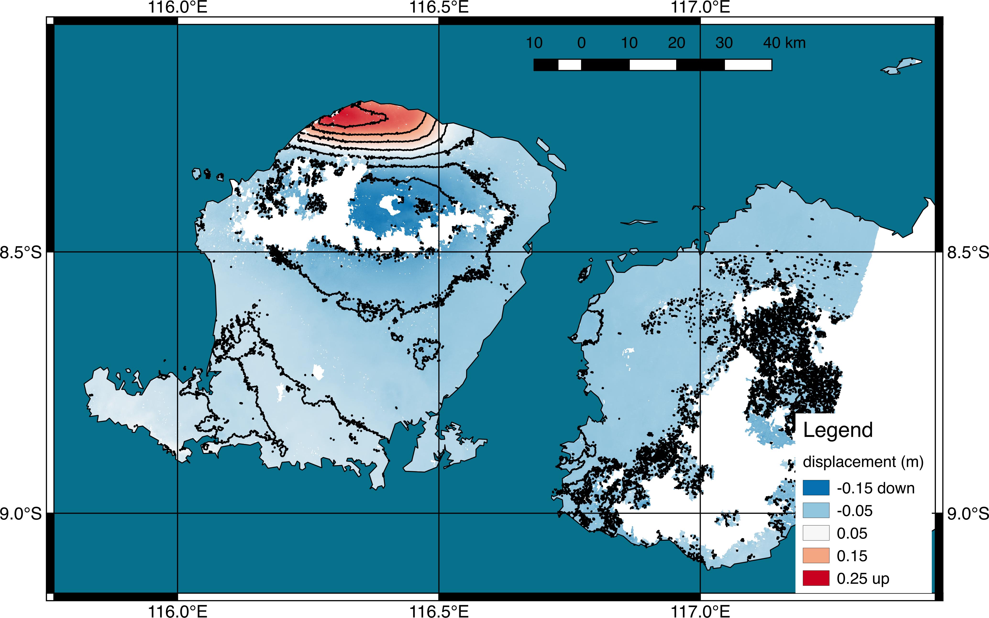
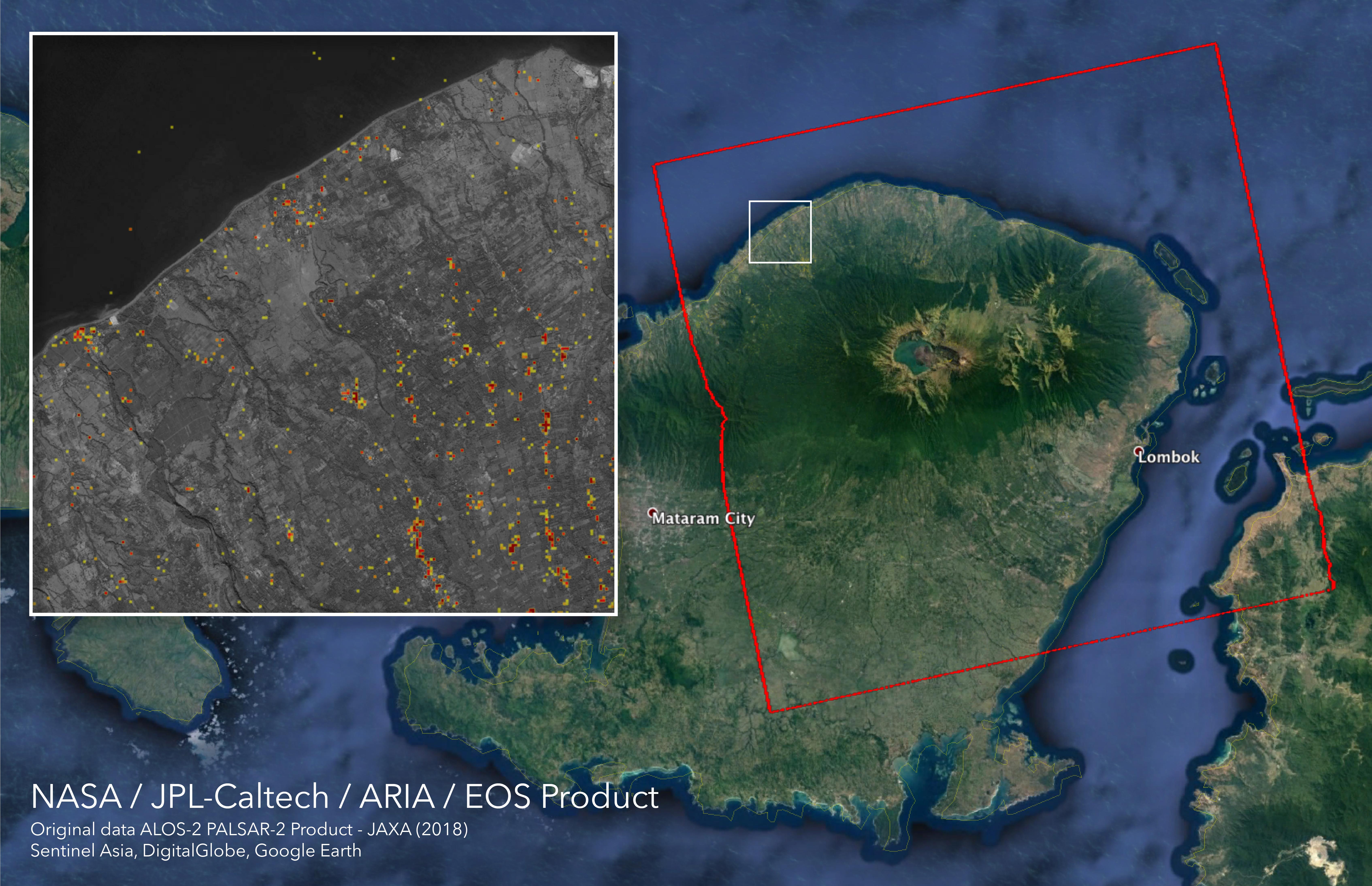
2018-08-08 |
Earth
|
ARIA
|
|
4135x2584x3 |
|
-
PIA22491:
-
NASA's ARIA Project Generates Satellite-Derived Map of Ground Deformation from Earthquake beneath Lombok, Indonesia
Full Resolution:
TIFF
(4.273 MB)
JPEG
(840 kB)
|
|
|
2018-09-05 |
Earth
|
ARIA
|
SAR
|
6776x4377x3 |
|
-
PIA22495:
-
ARIA Damage Proxy Map of Lombok, Indonesia Earthquakes
Full Resolution:
TIFF
(47.99 MB)
JPEG
(2.341 MB)
|
|
|
2018-09-10 |
Earth
|
ARIA
|
SAR
|
1377x964x3 |
|
-
PIA22696:
-
Japan Earthquakes (ARIA Damage Proxy Map)
Full Resolution:
TIFF
(3.89 MB)
JPEG
(229.1 kB)
|
|
|
2018-09-17 |
Earth
|
ARIA
|
SAR
|
1233x1125x3 |

|
-
PIA22702:
-
NASA's ARIA Maps Damage from Florence
Full Resolution:
TIFF
(3.944 MB)
JPEG
(269.1 kB)
|
|
|
2018-09-18 |
Earth
|
ARIA
|
SAR
|
1231x1077x3 |
|
-
PIA22704:
-
NASA's ARIA Maps Aftermath from Florence
Full Resolution:
TIFF
(3.318 MB)
JPEG
(194.2 kB)
|
|
|
2018-10-05 |
Earth
|
ARIA
|
SAR
|
5630x4092x3 |
|
-
PIA22746:
-
NASA's ARIA Maps Indonesia Quake, Tsunami Damage
Full Resolution:
TIFF
(38.03 MB)
JPEG
(1.997 MB)
|
|
|
2018-11-19 |
Earth
|
ARIA
|
SAR
|
5949x3249x3 |
|
-
PIA22819:
-
Updated ARIA Map of CA Camp Fire Damage
Full Resolution:
TIFF
(21.68 MB)
JPEG
(3.068 MB)
|
|
|
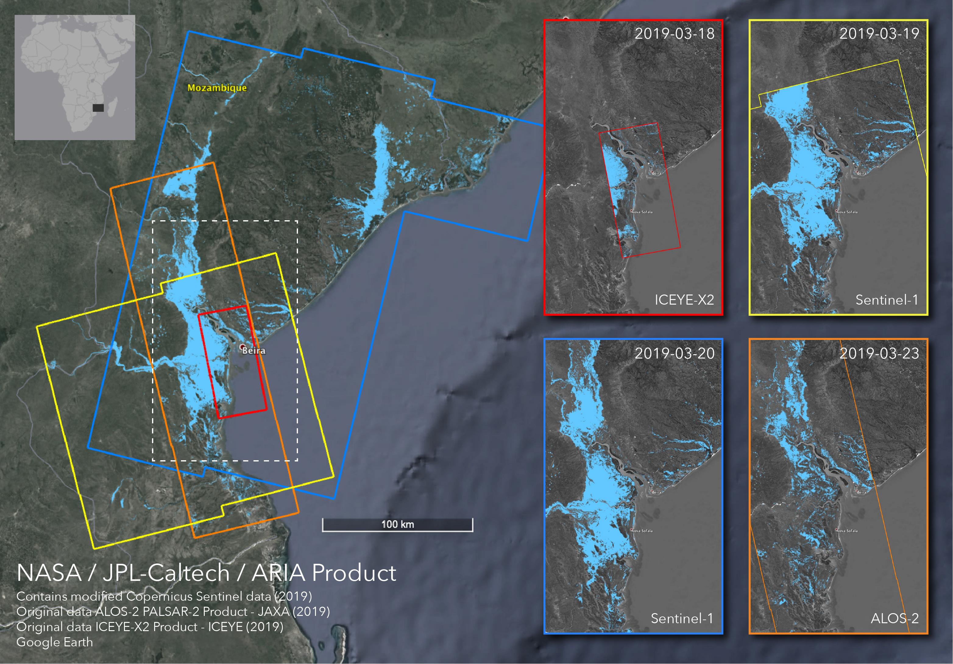
2019-04-01 |
Earth
|
ARIA
|
SAR
|
3128x2180x3 |
|
-
PIA23142:
-
Satellites Image Mozambique Flooding after Cyclone Idai
Full Resolution:
TIFF
(13 MB)
JPEG
(778.9 kB)
|
|
|
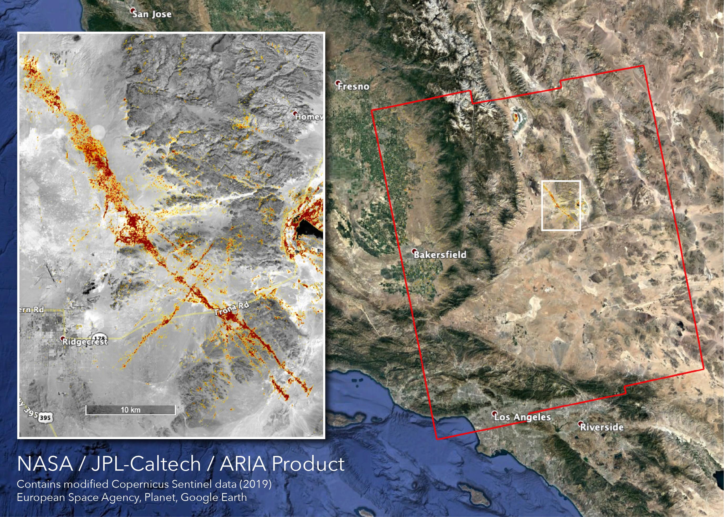
2019-07-09 |
Earth
|
ARIA
|
SAR
|
1803x2176x3 |

|
-
PIA23150:
-
NASA's ARIA Maps Southern California Quake Damage
Full Resolution:
TIFF
(11.77 MB)
JPEG
(703 kB)
|
|
|
2019-07-11 |
Earth
|
ARIA
|
|
1754x1959x3 |
|
-
PIA23351:
-
NASA Map Shows Ground Movement from California Quakes
Full Resolution:
TIFF
(4.263 MB)
JPEG
(292.6 kB)
|
|
|
2019-07-12 |
Earth
|
ARIA
|
SAR
|
2754x1965x3 |

|
-
PIA23354:
-
NASA's ARIA Team Maps California Quake Damage
Full Resolution:
TIFF
(15.93 MB)
JPEG
(1.011 MB)
|
|
|
2019-09-03 |
Earth
|
ARIA
|
SAR
|
6900x4772x3 |
|
-
PIA23360:
-
Flooding from Dorian Seen from Space
Full Resolution:
TIFF
(71.04 MB)
JPEG
(2.466 MB)
|
|
|
2019-10-15 |
Earth
|
ARIA
|
SAR
|
3063x2249x3 |
|
-
PIA23424:
-
New ARIA Map Shows Damage from Typhoon Hagibis
Full Resolution:
TIFF
(13.95 MB)
JPEG
(960.9 kB)
|
|
|
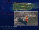
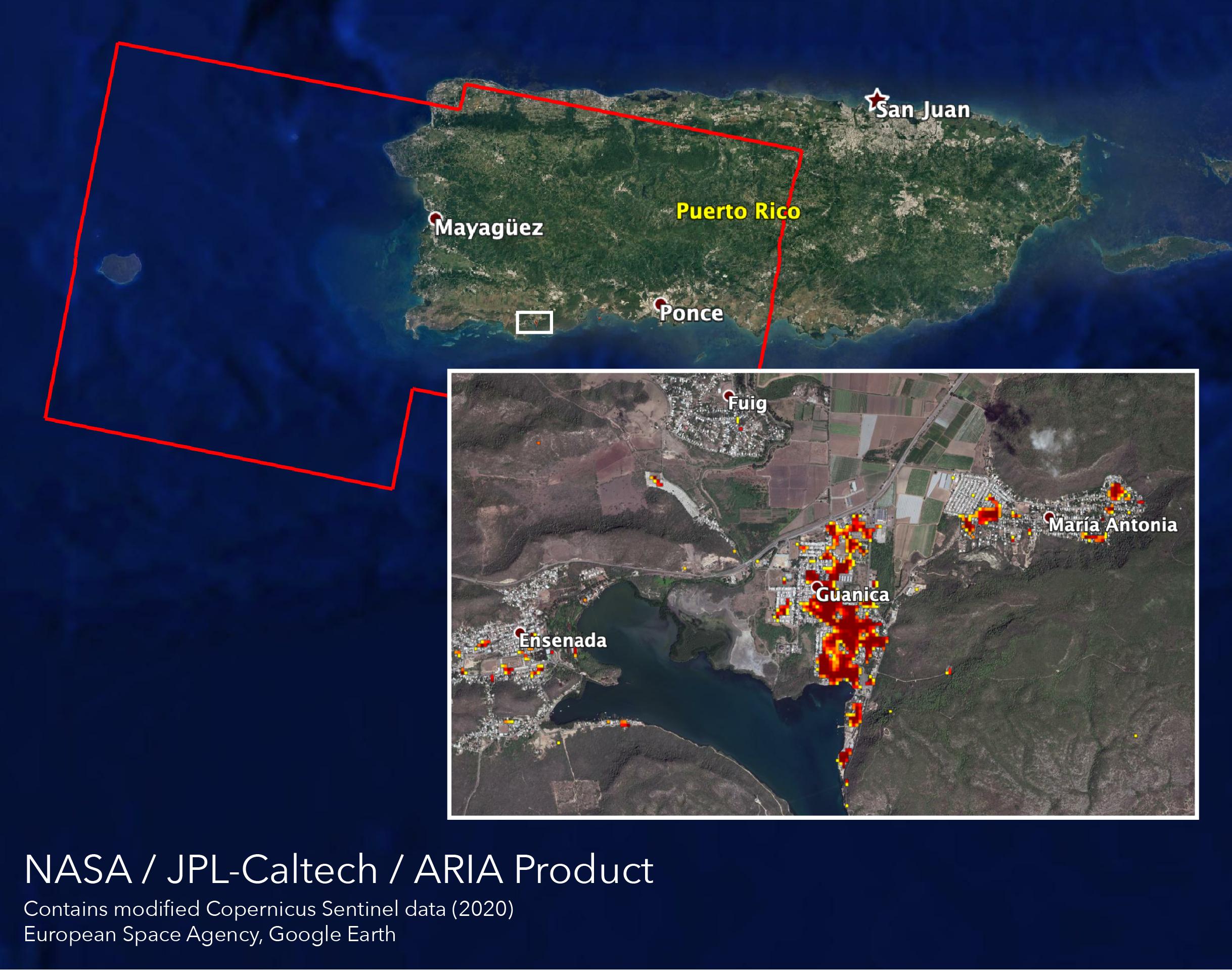
2020-01-10 |
Earth
|
ARIA
|
|
1710x1055x3 |
|
-
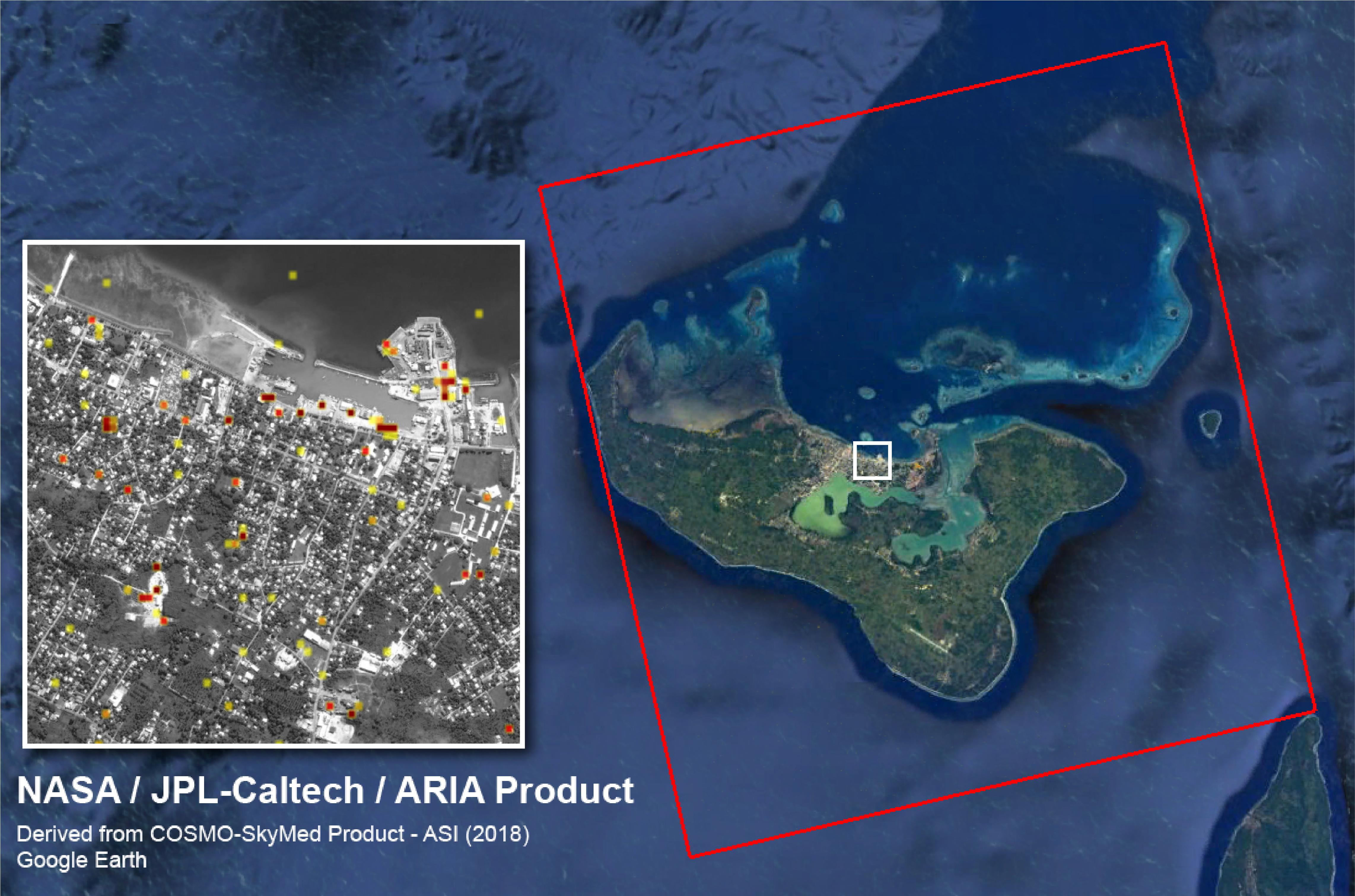
PIA23428:
-
Puerto Rico Quake Damage Visible From Space
Full Resolution:
TIFF
(2.476 MB)
JPEG
(189 kB)
|
|
|
2020-01-15 |
Earth
|
ARIA
|
SAR
|
2437x1918x3 |
|
-
PIA23429:
-
ARIA Maps Damage of Western Puerto Rico After Quakes
Full Resolution:
TIFF
(8.865 MB)
JPEG
(483.7 kB)
|
|
|
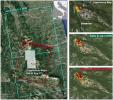
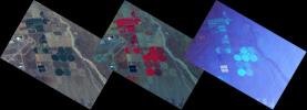
2020-08-07 |
Earth
|
ARIA
|
|
2944x2480x3 |
|
-
PIA23692:
-
ARIA Damage Map: Beirut Explosion Aftermath
Full Resolution:
TIFF
(19.6 MB)
JPEG
(1.471 MB)
|
|
|
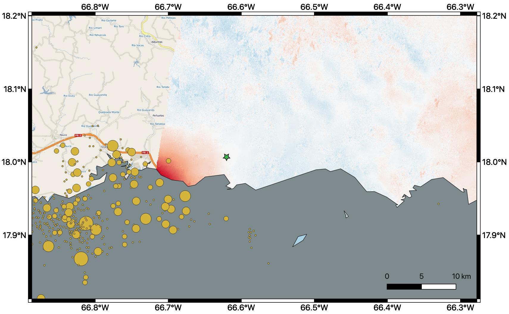
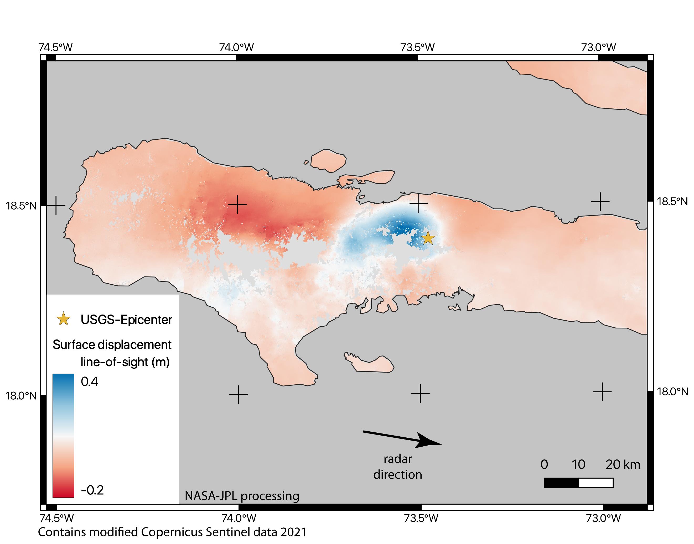
2021-08-17 |
Earth
|
ARIA
|
|
2642x2072x3 |
|
-
PIA23697:
-
Satellite Data Shows Ground Motion from August 2021 Haiti Earthquake
Full Resolution:
TIFF
(2.886 MB)
JPEG
(298.8 kB)
|
|
|
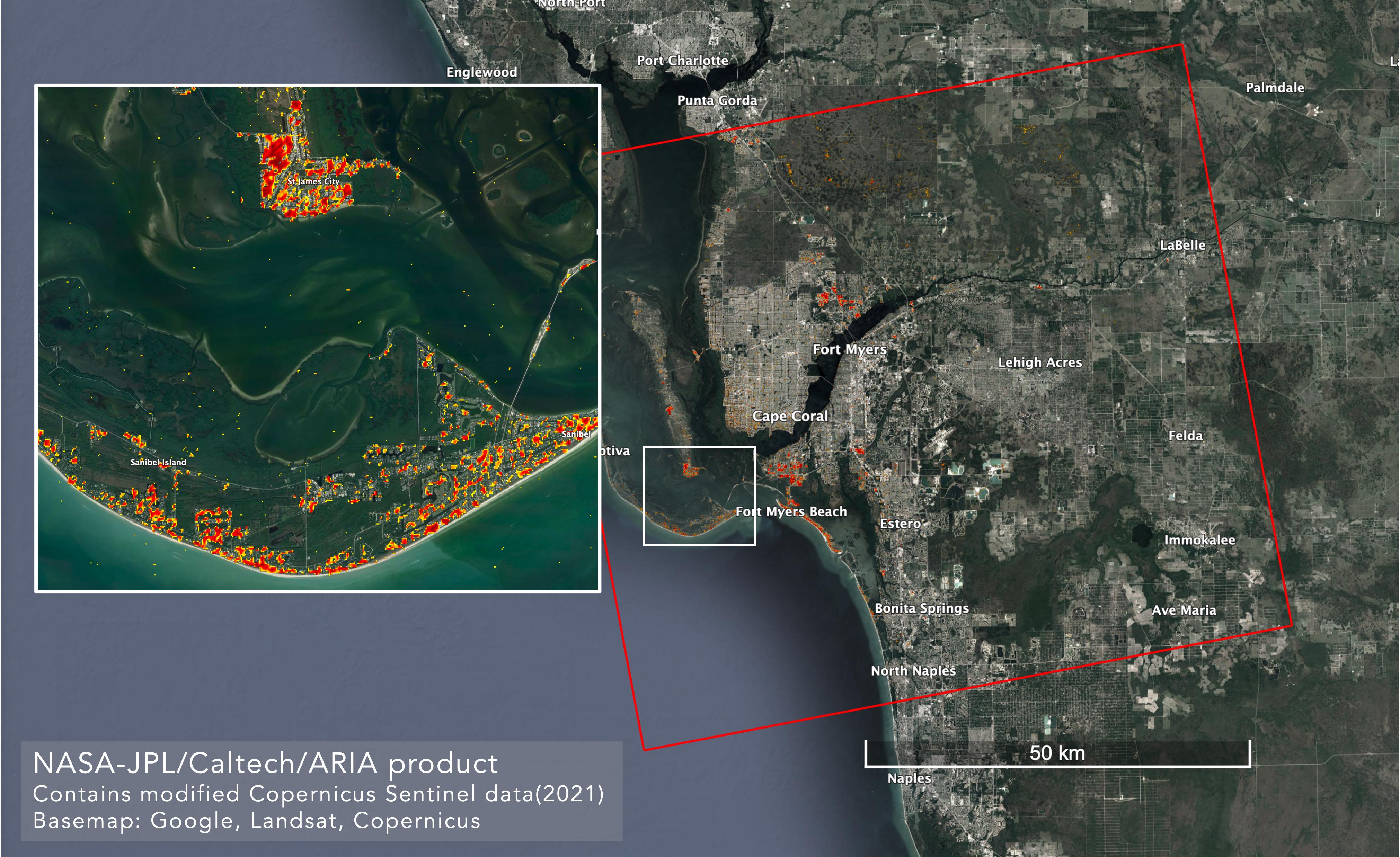
2022-10-06 |
Earth
|
ARIA
|
SAR
|
4042x2475x3 |
|
-
PIA25426:
-
ARIA Maps Damage in Fort Myers From Hurricane Ian
Full Resolution:
TIFF
(22.59 MB)
JPEG
(1.165 MB)
|
|
|
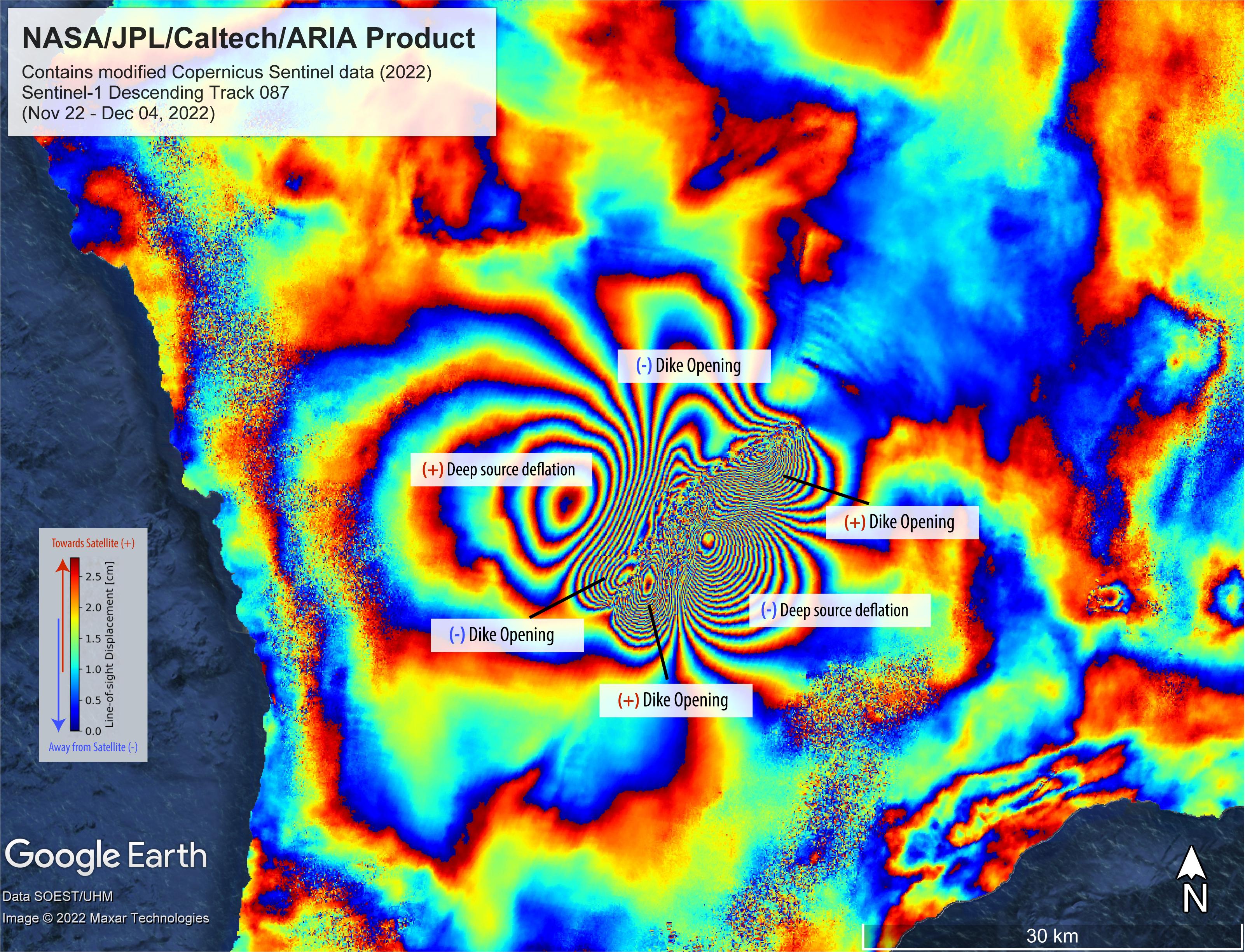
2022-12-09 |
Earth
|
ARIA
|
SAR
|
3203x2451x3 |
|
-
PIA25525:
-
Satellite Data Shows Ground Motion From Mauna Loa Volcano Eruption
Full Resolution:
TIFF
(23.12 MB)
JPEG
(1.331 MB)
|
|
|
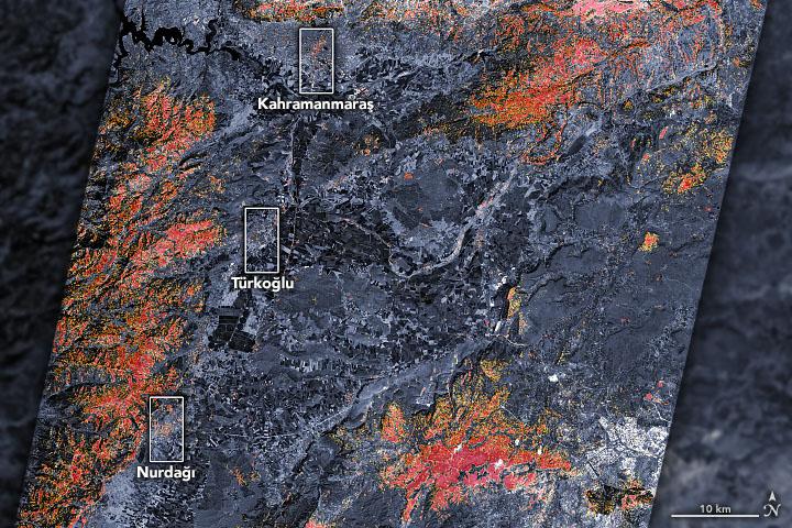
2023-02-09 |
Earth
|
ARIA
|
SAR
|
720x480x3 |

|
-
PIA25564:
-
Satellites Assess Earthquake Damage in Turkey
Full Resolution:
TIFF
(1.037 MB)
JPEG
(126.3 kB)
|
|
|
2010-10-25 |
Earth
|
Aerosol-Cloud-Ecosystem (ACE)
|
AirMSPI
|
1053x380x3 |
|
-
PIA13338:
-
NASA's ER-2 Checks Out New Airborne Multiangle Polarizing Imager
Full Resolution:
TIFF
(1.202 MB)
JPEG
(44.72 kB)
|
|
|
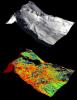
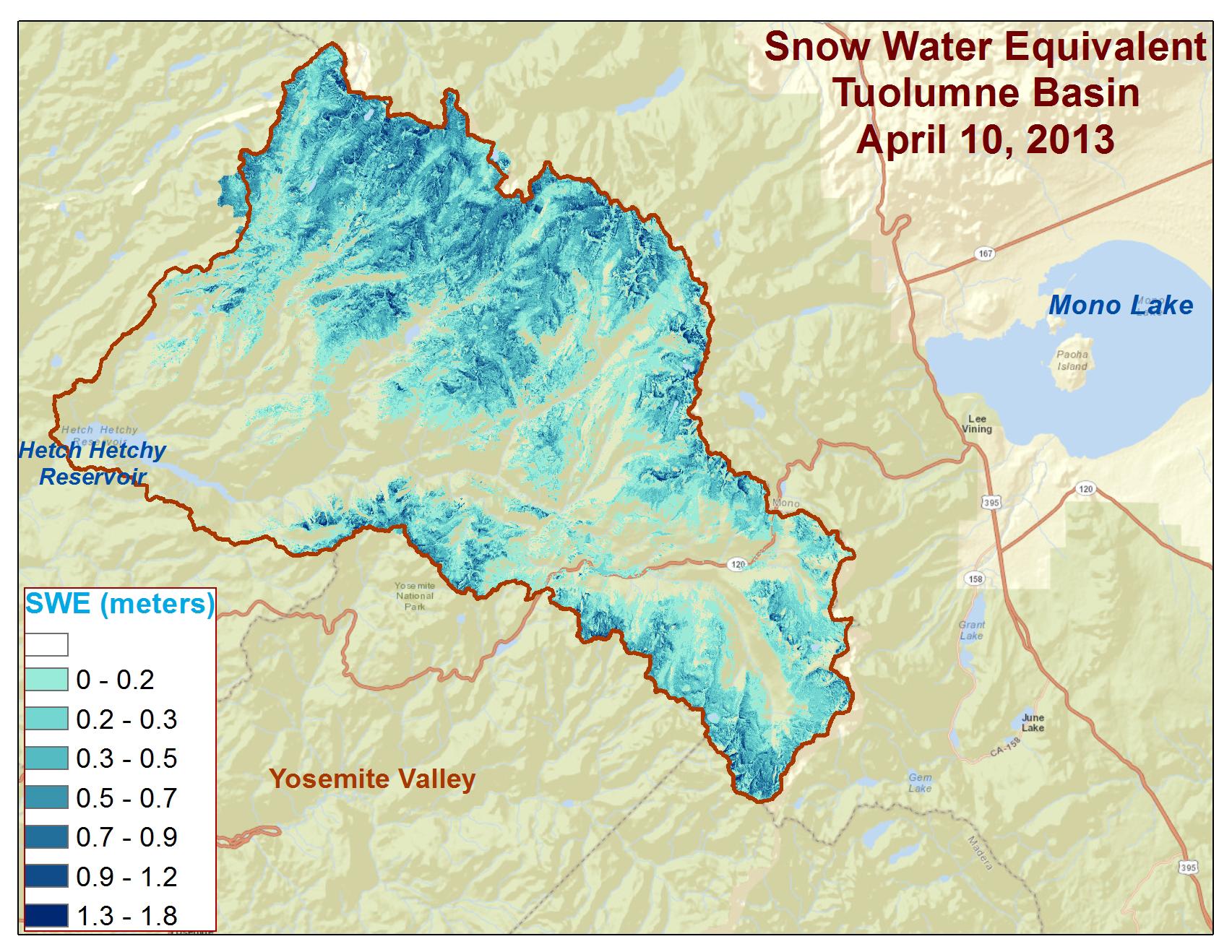
2013-05-02 |
Earth
|
Airborne Snow Observatory
|
|
4000x3000x3 |
|
-
PIA17771:
-
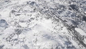
Tuolumne River Basin seen by NASA's Airborne Snow Observatory
Full Resolution:
TIFF
(36.01 MB)
JPEG
(1.478 MB)
|
|
|
2013-05-02 |
Earth
|
Airborne Snow Observatory
|
|
910x1178x3 |
|
-
PIA17772:
-
Snow Depth Depicted on Mt. Lyell by NASA's Airborne Snow Observatory
Full Resolution:
TIFF
(3.217 MB)
JPEG
(170 kB)
|
|
|
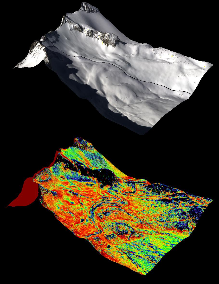
2013-05-02 |
Earth
|
Airborne Snow Observatory
|
|
1648x2546x3 |
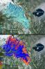
|
-
PIA17773:
-
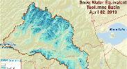
Snow Water Equivalent for Tuolumne River Basin
Full Resolution:
TIFF
(12.59 MB)
JPEG
(1.068 MB)
|
|
|
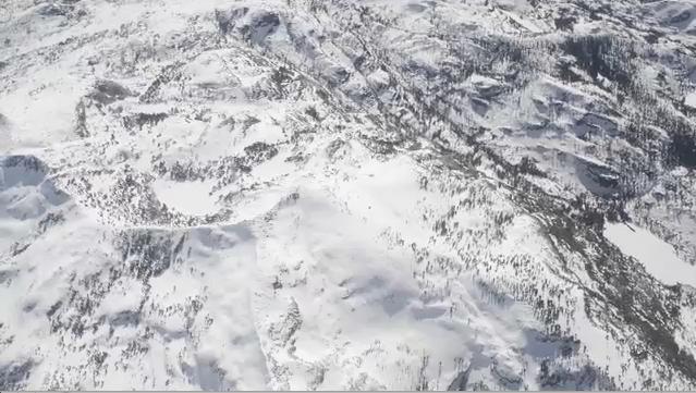
2013-12-09 |
Earth
|
Airborne Snow Observatory
|
|
639x361x3 |
|
-
PIA17774:
-
Measuring Snowpack from the Sky

Full Resolution:
TIFF
(692.5 kB)
JPEG
(55.78 kB)
|
|
|
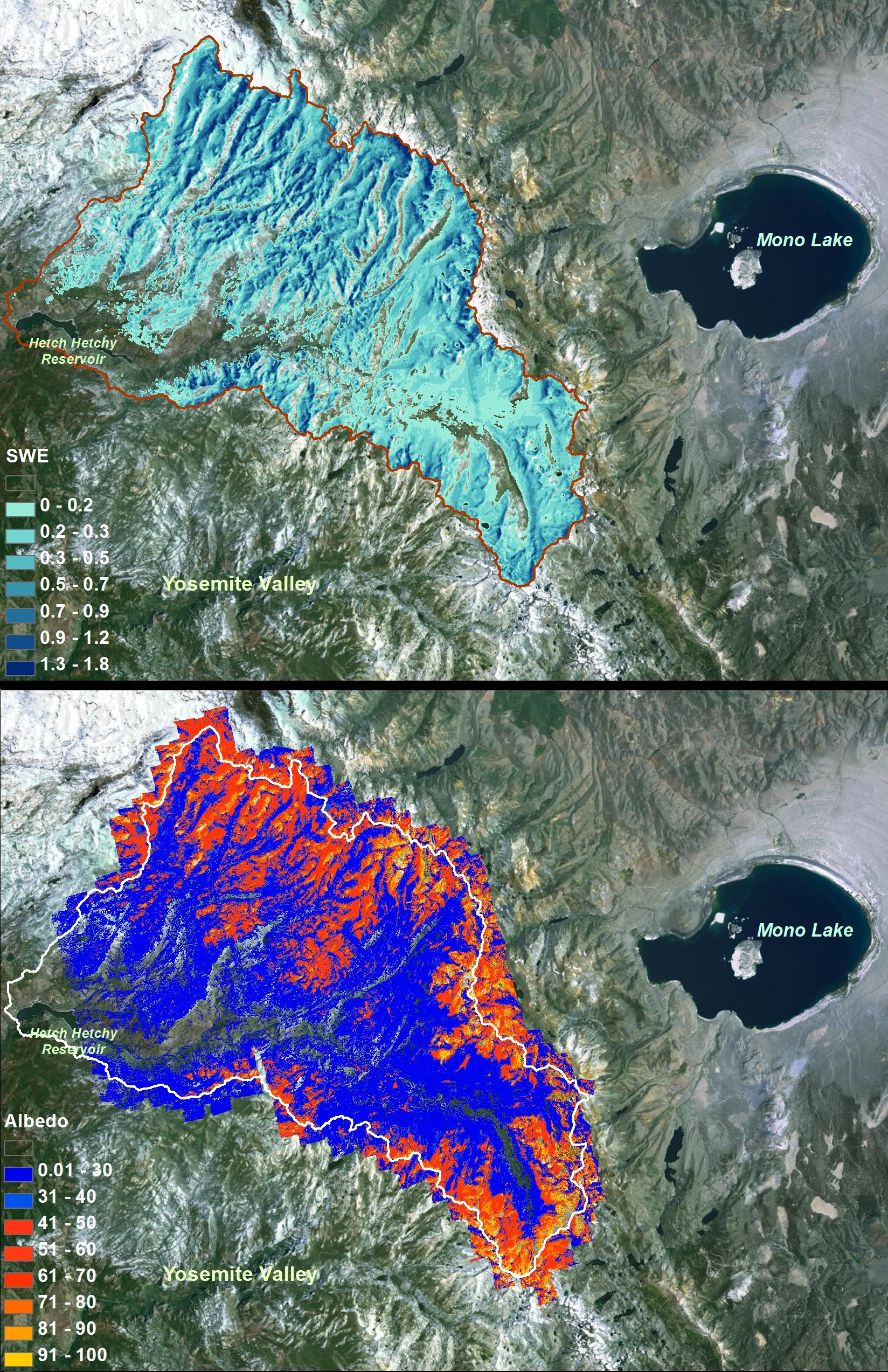
2013-12-09 |
Earth
|
Airborne Snow Observatory
|
|
1705x1318x3 |
|
-
PIA17775:
-
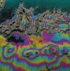
Spatial Distribution of Tuolumne River Basin Mapped by Airborne Snow Observatory
Full Resolution:
TIFF
(6.744 MB)
JPEG
(340.4 kB)
|
|
|
1999-04-15 |
Earth
|
Airborne Synthetic Aperture Radar (AIRSAR)
|
AirSAR
|
1081x2137x3 |
|
-
PIA01806:
-
Space Radar Image of Missouri River - TOPSAR
Full Resolution:
TIFF
(2.212 MB)
JPEG
(780.9 kB)
|
|
|
2000-12-11 |
Earth
|
Airborne Synthetic Aperture Radar (AIRSAR)
|
AirSAR
|
1992x2018x3 |
|
-
PIA02853:
-
Upolu Island, Western Samoa
Full Resolution:
TIFF
(3.49 MB)
JPEG
(1.528 MB)
|
|
|
2000-12-11 |
Earth
|
Airborne Synthetic Aperture Radar (AIRSAR)
|
AirSAR
|
2401x11984x3 |

|
-
PIA02854:
-
Upolu Island, Western Samoa
Full Resolution:
TIFF
(23.9 MB)
JPEG
(10.24 MB)
|
|
|
2001-03-07 |
Earth
|
Airborne Synthetic Aperture Radar (AIRSAR)
|
AirSAR
|
1321x825x3 |
|
-
PIA03157:
-
Altamaha River Delta, Georgia Sea Islands
Full Resolution:
TIFF
(2.847 MB)
JPEG
(205.7 kB)
|
|
|
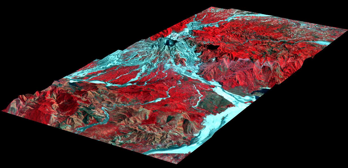
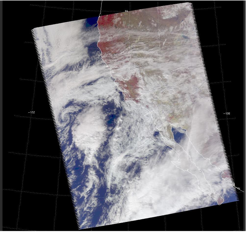
2001-11-04 |
Earth
|
Airborne Synthetic Aperture Radar (AIRSAR)
|
AirSAR
|
899x630x3 |
|
-
PIA03507:
-
Perspective View of Umnak Island, Aleutian Islands, Alaska (#1)
Full Resolution:
TIFF
(1.274 MB)
JPEG
(141.8 kB)
|
|
|
2001-11-04 |
Earth
|
Airborne Synthetic Aperture Radar (AIRSAR)
|
AirSAR
|
899x630x3 |
|
-
PIA03508:
-
Perspective View of Umnak Island, Aleutian Islands, Alaska (#2)
Full Resolution:
TIFF
(918.8 kB)
JPEG
(96 kB)
|
|
|
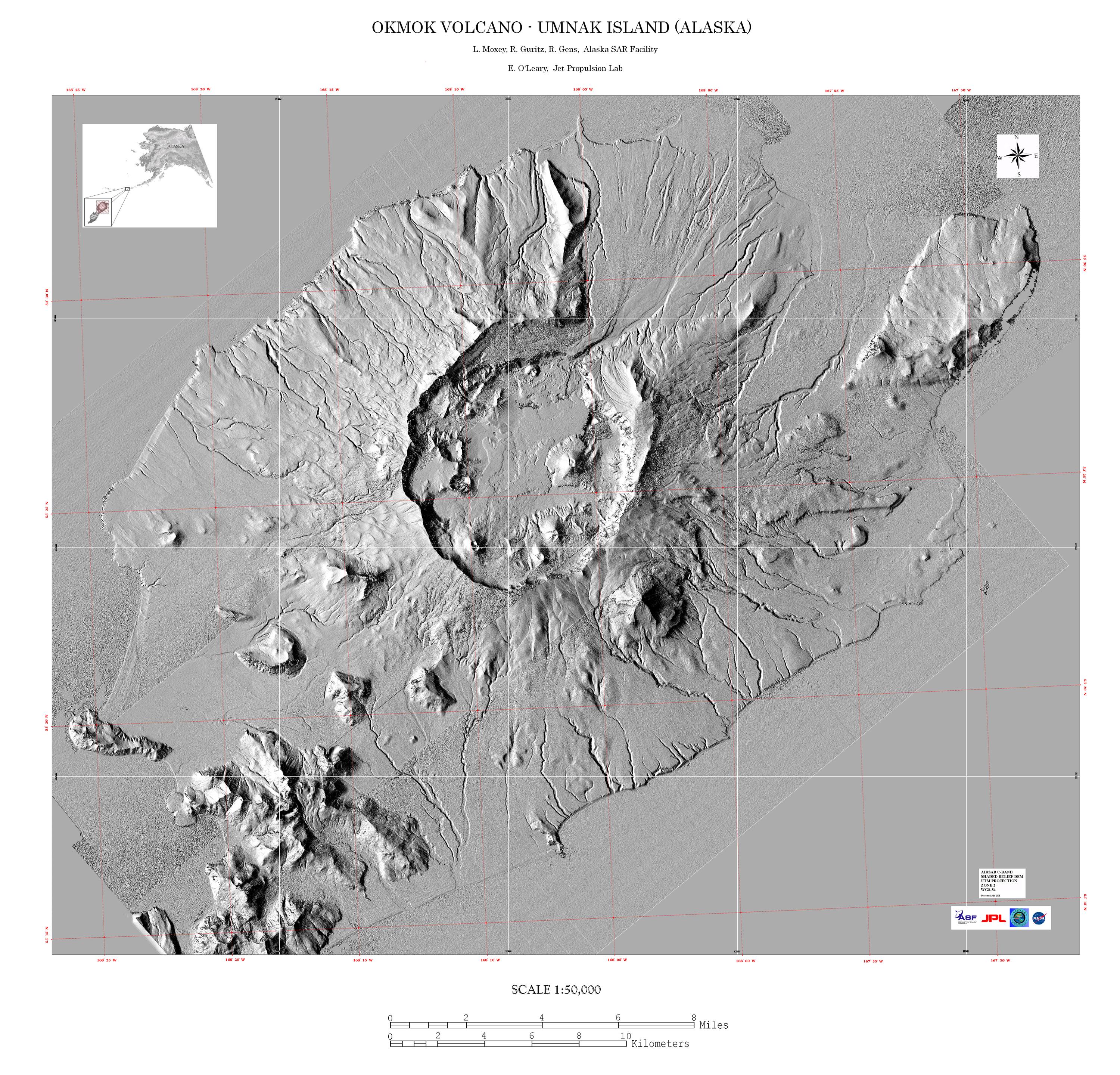
2001-11-04 |
Earth
|
Airborne Synthetic Aperture Radar (AIRSAR)
|
AirSAR
|
3000x2878x3 |
|
-
PIA03509:
-
Shaded Relief Mosaic of Umnak Island, Aleutian Islands, Alaska
Full Resolution:
TIFF
(8.667 MB)
JPEG
(1.659 MB)
|
|
|
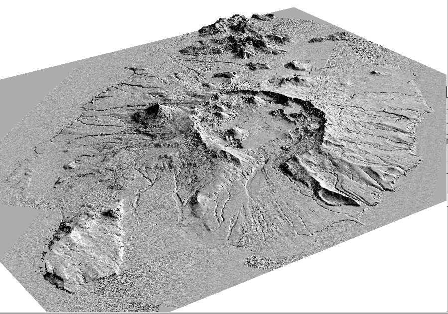
2001-11-04 |
Earth
|
Airborne Synthetic Aperture Radar (AIRSAR)
|
AirSAR
|
597x597x1 |
|
-
PIA03510:
-
Perspective View of Okmok Volcano, Aleutian Islands, Alaska (#1)
Full Resolution:
TIFF
(435.5 kB)
JPEG
(120.8 kB)
|
|
|
2001-11-04 |
Earth
|
Airborne Synthetic Aperture Radar (AIRSAR)
|
AirSAR
|
899x630x1 |
|
-
PIA03511:
-
Perspective View of Okmok Volcano, Aleutian Islands, Alaska (#2)
Full Resolution:
TIFF
(511.1 kB)
JPEG
(149.9 kB)
|
|
|
2001-11-04 |
Earth
|
Airborne Synthetic Aperture Radar (AIRSAR)
|
AirSAR
|
1467x711x3 |
|
-
PIA03512:
-
Mt. Pinatubo, Phillippines - Perspective View
Full Resolution:
TIFF
(1.938 MB)
JPEG
(172.5 kB)
|
|
|
2001-11-04 |
Earth
|
Airborne Synthetic Aperture Radar (AIRSAR)
|
AirSAR
|
1000x875x3 |
|
-
PIA03513:
-
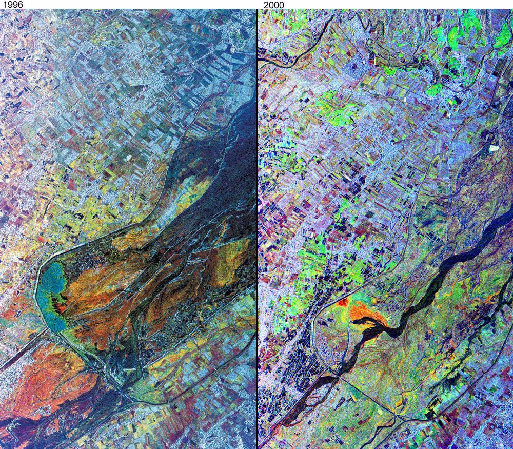
Mt. Pinatubo, Phillipines - Comparison of November, 1996 and September, 2000
Full Resolution:
TIFF
(3.403 MB)
JPEG
(366.2 kB)
|
|
|
2002-10-11 |
Earth
|
Airborne Synthetic Aperture Radar (AIRSAR)
|
AirSAR
|
1064x976x3 |
|
-
PIA03866:
-
Radar Image with Color as Height, Sman Teng, Temple, Cambodia
Full Resolution:
TIFF
(3.122 MB)
JPEG
(295.3 kB)
|
|
|
2002-10-11 |
Earth
|
Airborne Synthetic Aperture Radar (AIRSAR)
|
AirSAR
|
670x671x3 |
|
-
PIA03867:
-
Radar Image with Color as Height, Old Khmer Road, Cambodia
Full Resolution:
TIFF
(1.356 MB)
JPEG
(127.8 kB)
|
|
|
2002-10-11 |
Earth
|
Airborne Synthetic Aperture Radar (AIRSAR)
|
AirSAR
|
1288x976x3 |
|
-
PIA03868:
-
Radar Image with Color as Height, Lovea, Cambodia
Full Resolution:
TIFF
(3.777 MB)
JPEG
(360.3 kB)
|
|
|
2002-10-11 |
Earth
|
Airborne Synthetic Aperture Radar (AIRSAR)
|
AirSAR
|
1288x976x3 |
|
-
PIA03869:
-
Radar Image with Color as Height, Hariharalaya, Cambodia
Full Resolution:
TIFF
(3.778 MB)
JPEG
(440.6 kB)
|
|
|
2002-10-11 |
Earth
|
Airborne Synthetic Aperture Radar (AIRSAR)
|
AirSAR
|
949x867x3 |

|
-
PIA03870:
-
Radar Image with Color as Height, Ancharn Kuy, Cambodia
Full Resolution:
TIFF
(2.476 MB)
JPEG
(312.7 kB)
|
|
|
2002-10-11 |
Earth
|
Airborne Synthetic Aperture Radar (AIRSAR)
|
AirSAR
|
1898x1734x3 |

|
-
PIA03871:
-
Radar Image with Color as Height, Nokor Pheas Trapeng, Cambodia
Full Resolution:
TIFF
(3.296 MB)
JPEG
(1.12 MB)
|
|
|
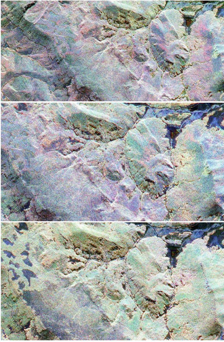
2003-03-25 |
Earth
|
Airborne Synthetic Aperture Radar (AIRSAR)
|
AirSAR
|
783x1192x3 |
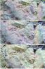
|
-
PIA04266:
-
Fraser, Colorado
Full Resolution:
TIFF
(2.803 MB)
JPEG
(339 kB)
|
|
|
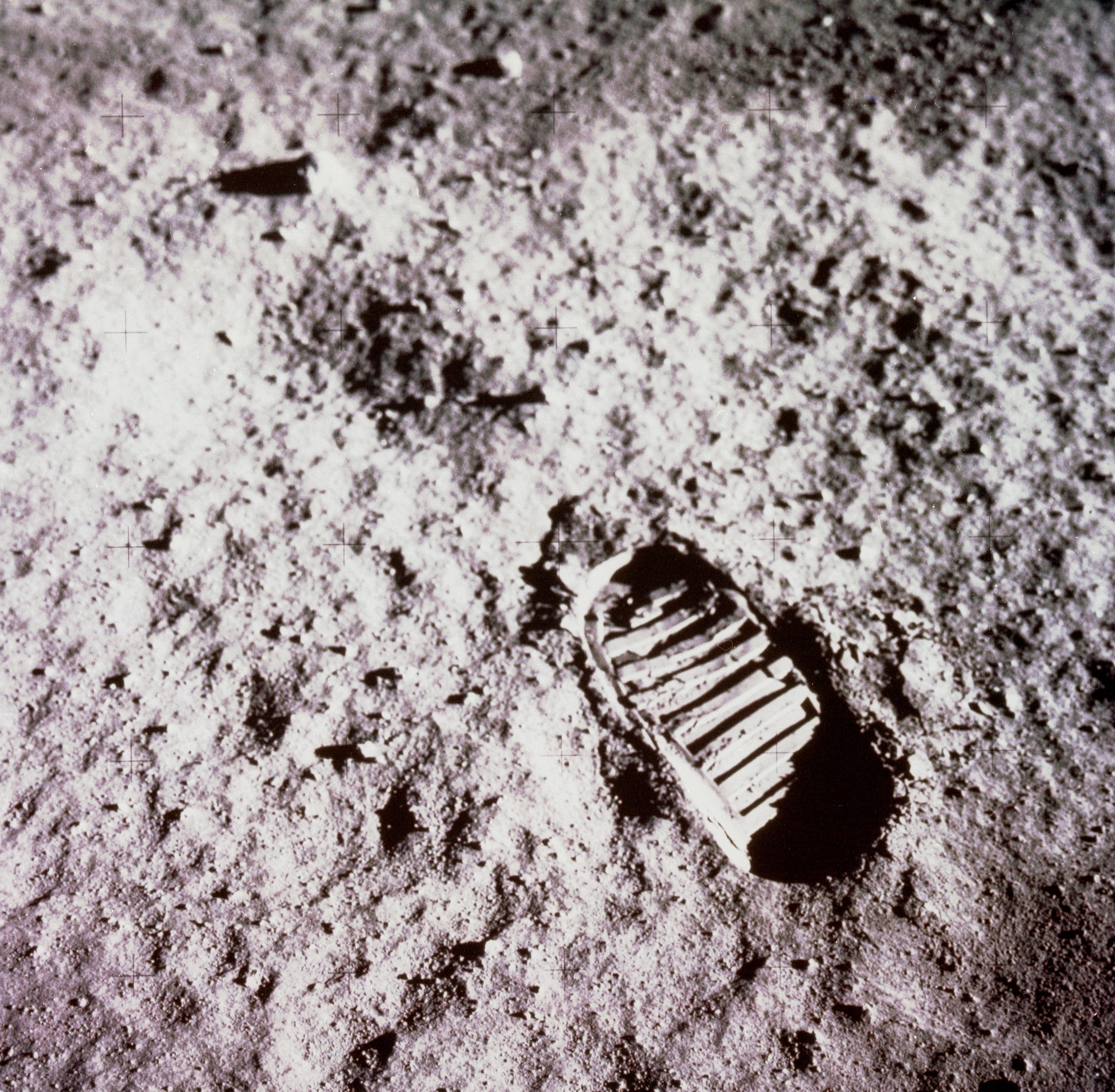
2021-04-21 |
Moon
|
Apollo
|
|
3294x3226x3 |
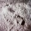
|
-
PIA24439:
-
Apollo Footprint
Full Resolution:
TIFF
(31.89 MB)
JPEG
(1.648 MB)
|
|
|
2019-11-20 |
Moon
|
Apollo 12
|
|
711x1113x3 |
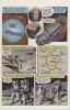
|
-
PIA23552:
-
Apollo 12 Graphic Novel
Full Resolution:
TIFF
(2.375 MB)
JPEG
(165.5 kB)
|
|
|
2002-06-14 |
Earth
|
Aqua
|
AIRS
|
2144x1184x3 |
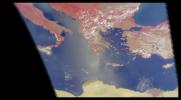
|
-
PIA00326:
-
AIRS First Light Data: Eastern Mediterranean, June 14, 2002
Full Resolution:
TIFF
(4.752 MB)
JPEG
(184.6 kB)
|
|
|
2002-07-03 |
Earth
|
Aqua
|
AIRS
|
362x814x3 |
|
-
PIA00341:
-
AIRS First Light Data: Typhoon Ramasun, July 3, 2002
Full Resolution:
TIFF
(680 kB)
JPEG
(54.25 kB)
|
|
|
2002-07-13 |
Earth
|
Aqua
|
AIRS
|
1536x1536x3 |

|
-
PIA00345:
-
AIRS First Light Data: Northern Europe, July 20, 2002
Full Resolution:
TIFF
(3.093 MB)
JPEG
(182.1 kB)
|
|
|
2002-09-26 |
Earth
|
Aqua
|
AIRS
|
674x740x3 |
|
-
PIA00350:
-
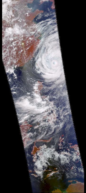
Hurricane Isadore
Full Resolution:
TIFF
(1.498 MB)
JPEG
(83.06 kB)
|
|
|
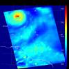
2002-11-13 |
Earth
|
Aqua
|
AIRS
|
960x1076x3 |
|
-
PIA00355:
-
Mt. Etna Eruption
Full Resolution:
TIFF
(2.131 MB)
JPEG
(120 kB)
|
|
|
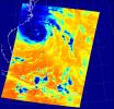
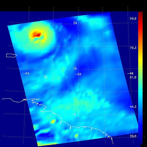
2002-10-02 |
Earth
|
Aqua
|
AIRS
|
699x419x3 |

|
-
PIA00365:
-
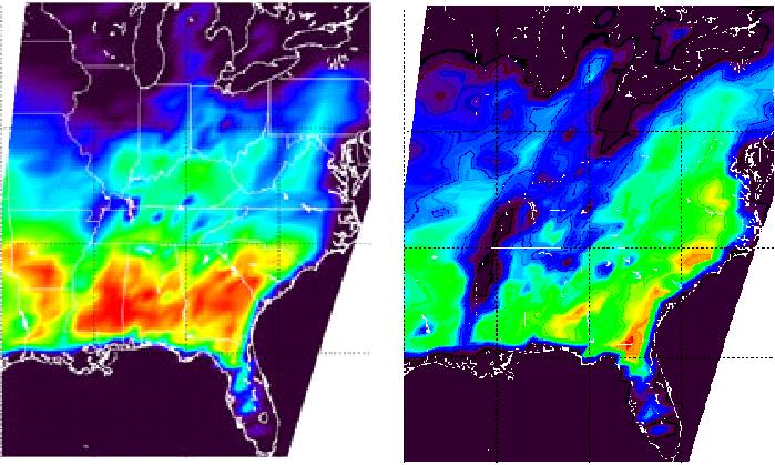
Flooding Resulting From Hurricane Isidore, Comparing Data from September 12 and 28, 2002
Full Resolution:
TIFF
(327.8 kB)
JPEG
(71.12 kB)
|
|
|
2002-12-19 |
Earth
|
Aqua
|
AIRS
|
1280x1280x3 |
|
-
PIA00367:
-
Supertyphoon Pongsona
Full Resolution:
TIFF
(2.6 MB)
JPEG
(132.5 kB)
|
|
|
2003-03-11 |
Earth
|
Aqua
|
AIRS
|
1003x946x3 |

|
-
PIA00402:
-
Viewing a California Storm
Full Resolution:
TIFF
(1.767 MB)
JPEG
(140.5 kB)
|
|
|
2003-06-02 |
Earth
|
Aqua
|
AIRS
|
1437x921x3 |
|
-
PIA00427:
-
Global Average Brightness Temperature for April 2003
Full Resolution:
TIFF
(2.867 MB)
JPEG
(158.1 kB)
|
|
|
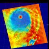
2003-09-18 |
Earth
|
Aqua
|
AIRS
|
489x471x3 |
|
-
PIA00428:
-
Hurricane Isabel
Full Resolution:
TIFF
(393.3 kB)
JPEG
(50.8 kB)
|
|
|
2003-09-20 |
Earth
|
Aqua
|
AIRS
Scatterometer (SeaWinds)
|
500x500x3 |
|
-
PIA00429:
-
Hurricane Isabel, AIRS Infrared and SeaWinds
Scatterometer Data Combined
Full Resolution:
TIFF
(252 kB)
JPEG
(521 kB)
|
|
|
2003-09-20 |
Earth
|
Aqua
|
AIRS
|
500x500x3 |
|
-
PIA00430:
-
Hurricane Isabel, Amount of Atmospheric Water Vapor Observed By AIRS
Full Resolution:
TIFF
(482.7 kB)
JPEG
(37.55 kB)
|
|
|
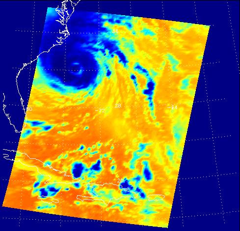
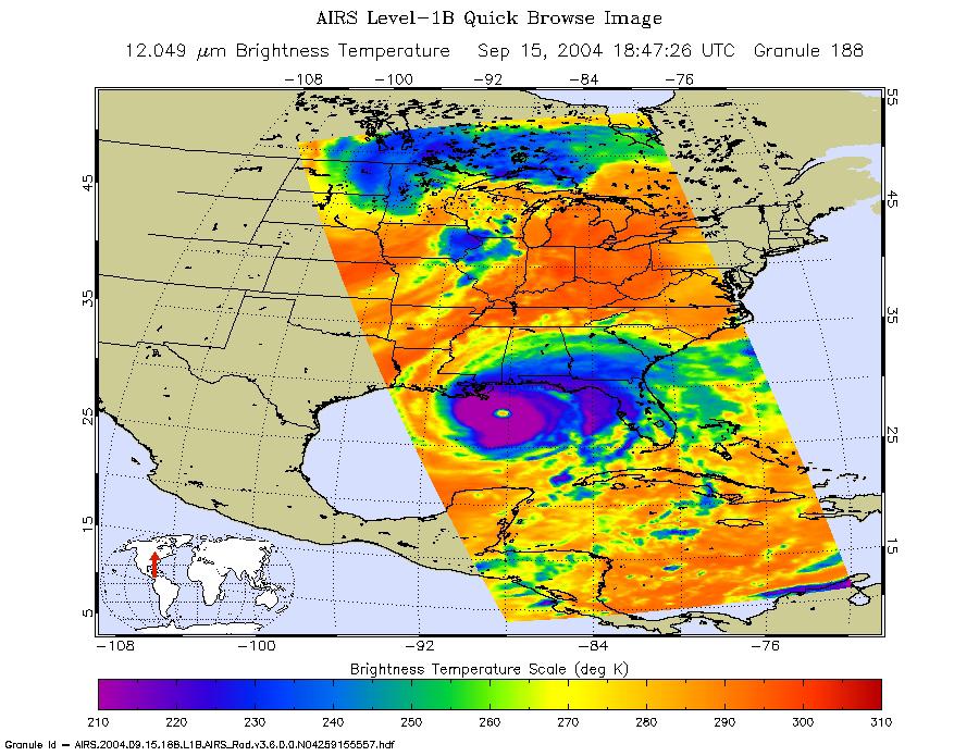
2004-09-15 |
Earth
|
Aqua
|
AIRS
|
900x695x3 |
|
-
PIA00431:
-
Hurricane Ivan as Observed by NASA's Spaceborne Atmospheric Infrared
Sounder (AIRS)
Full Resolution:
TIFF
(708.9 kB)
JPEG
(149.8 kB)
|
|
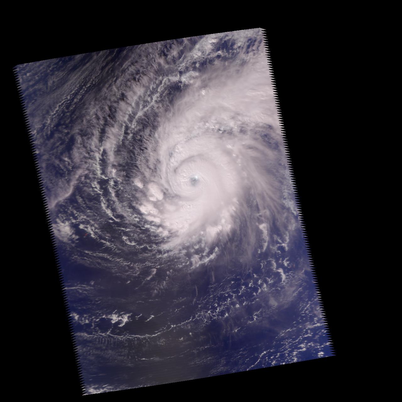
|
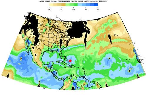
2004-08-30 |
Earth
|
Aqua
|
AIRS
|
500x342x3 |
|
-
PIA00433:
-
Hurricane Frances as Observed by NASA's Spaceborne Atmospheric Infrared
Sounder (AIRS) - Total Water Vapor Time Series
Full Resolution:
TIFF
(344.8 kB)
JPEG
(36.3 kB)
|
|
|
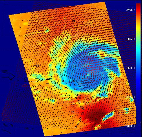
2004-08-30 |
Earth
|
Aqua
|
AIRS
|
490x471x3 |
|
-
PIA00435:
-
Hurricane Frances as Observed by NASA's Spaceborne Atmospheric Infrared Sounder (AIRS) and SeaWinds Scatterometer
Full Resolution:
TIFF
(693.4 kB)
JPEG
(88.32 kB)
|
|
|
2004-07-14 |
Earth
|
Aqua
|
AIRS
|
1000x1000x3 |
|
-
PIA00436:
-
Tropical Storm Blas off the Pacific Coast of Mexico
Full Resolution:
TIFF
(3.004 MB)
JPEG
(121.3 kB)
|
|
|
2004-07-23 |
Earth
|
Aqua
|
AIRS
|
1000x1000x3 |
|
-
PIA00438:
-
Hurricane Celia off the Pacific Coast of Mexico
Full Resolution:
TIFF
(3.004 MB)
JPEG
(140.8 kB)
|
|
|
2004-07-26 |
Earth
|
Aqua
|
AIRS
|
1000x1000x3 |
|
-
PIA00439:
-
Hurricane Darby off the Pacific Coast of Mexico
Full Resolution:
TIFF
(3.004 MB)
JPEG
(139 kB)
|
|
|
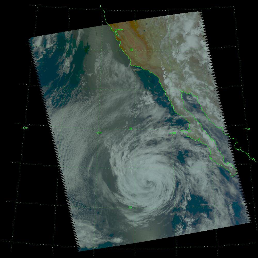
2005-08-24 |
Earth
|
Aqua
|
AIRS
|
3200x2400x3 |
|
-
PIA07938:
-
AIRS Storm Front Approaching California (animation)
Full Resolution:
TIFF
(23.04 MB)
JPEG
(629.5 kB)
|
 Planetary Data System


