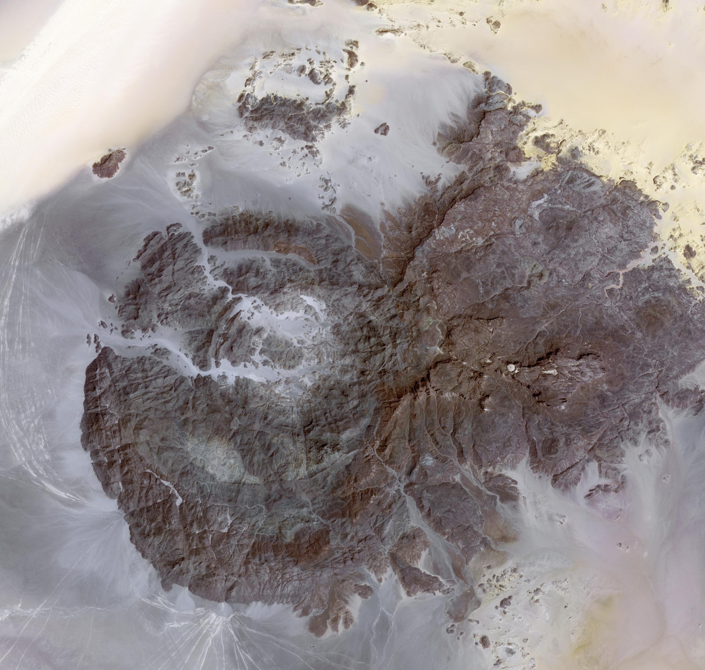
Jebel Uweinat (1,934 meters, mountain of sourcelets) is a mountain range in the area of the Egyptian-Sudanese-Libyan border. In general, the west slope constitutes an oasis, with wells, bushes and grass. The area is notable for its prehistoric petroglyphs. Engraved in sandstone, petroglyphs of Bushmen style are visible, representing giraffes, lions, ostriches, gazelles, and human figures. The western part of the massive consists of intrusive granite, arranged in a ring shape of some 25 km diameter. Its eastern part consists of sandstone; four plateaus emerge from the level of the surrounding desert. One of the driest places on earth, it reportedly hasn't rained since 1998 (Wikipedia). The image was acquired March 17, 2012, covers an area of 40 x 43 km, and is located at 22 degrees north latitude, 24.9 degrees east longitude.
With its 14 spectral bands from the visible to the thermal infrared wavelength region and its high spatial resolution of 15 to 90 meters (about 50 to 300 feet), ASTER images Earth to map and monitor the changing surface of our planet. ASTER is one of five Earth-observing instruments launched Dec. 18, 1999, on Terra. The instrument was built by Japan's Ministry of Economy, Trade and Industry. A joint U.S./Japan science team is responsible for validation and calibration of the instrument and data products.
The broad spectral coverage and high spectral resolution of ASTER provides scientists in numerous disciplines with critical information for surface mapping and monitoring of dynamic conditions and temporal change. Example applications are: monitoring glacial advances and retreats; monitoring potentially active volcanoes; identifying crop stress; determining cloud morphology and physical properties; wetlands evaluation; thermal pollution monitoring; coral reef degradation; surface temperature mapping of soils and geology; and measuring surface heat balance.
The U.S. science team is located at NASA's Jet Propulsion Laboratory, Pasadena, Calif. The Terra mission is part of NASA's Science Mission Directorate, Washington, D.C.
More information about ASTER is available at http://asterweb.jpl.nasa.gov/.
 Planetary Data System


