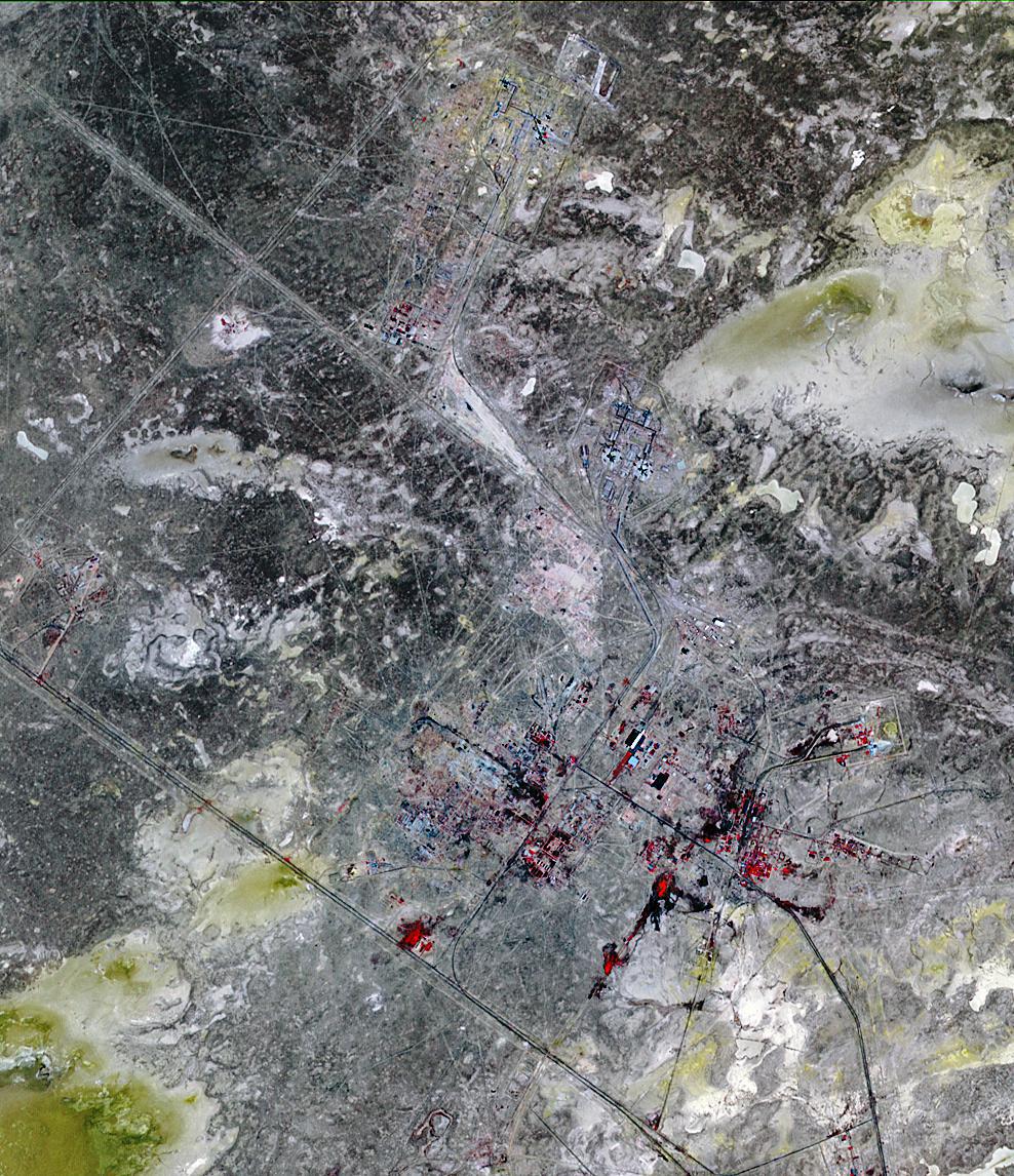
Baikonur, formerly Leninsk, is a city in Kazakhstan rented and administered by the Russian Federation to service the Baikonur Cosmodrome. The Soviet government established the site as a missile test range, and launched Sputnik from here in 1957. Baikonur was photographed by the U.S. U-2 plane in 1957 (according to Wikipedia). The site is used for launch of all Russian crewed missions, as well as geostationary, lunar, planetary and ocean observing missions. The U.S. uses the Russian launch capabilities to send our astronauts to the Space Station while we are developing our own heavy launch vehicle to replace the Space Shuttle. The image covers 15 x 23 km, was acquired on July 27, 2010, and is located at 46 degrees north latitude, 63.6 degrees east longitude.
With its 14 spectral bands from the visible to the thermal infrared wavelength region and its high spatial resolution of 15 to 90 meters (about 50 to 300 feet), ASTER images Earth to map and monitor the changing surface of our planet. ASTER is one of five Earth-observing instruments launched Dec. 18, 1999, on Terra. The instrument was built by Japan's Ministry of Economy, Trade and Industry. A joint U.S./Japan science team is responsible for validation and calibration of the instrument and data products.
The broad spectral coverage and high spectral resolution of ASTER provides scientists in numerous disciplines with critical information for surface mapping and monitoring of dynamic conditions and temporal change. Example applications are: monitoring glacial advances and retreats; monitoring potentially active volcanoes; identifying crop stress; determining cloud morphology and physical properties; wetlands evaluation; thermal pollution monitoring; coral reef degradation; surface temperature mapping of soils and geology; and measuring surface heat balance.
The U.S. science team is located at NASA's Jet Propulsion Laboratory, Pasadena, Calif. The Terra mission is part of NASA's Science Mission Directorate, Washington, D.C.
More information about ASTER is available at http://asterweb.jpl.nasa.gov/.
