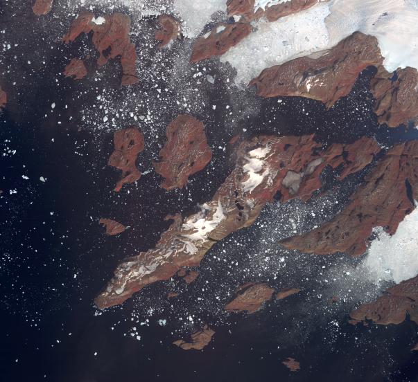
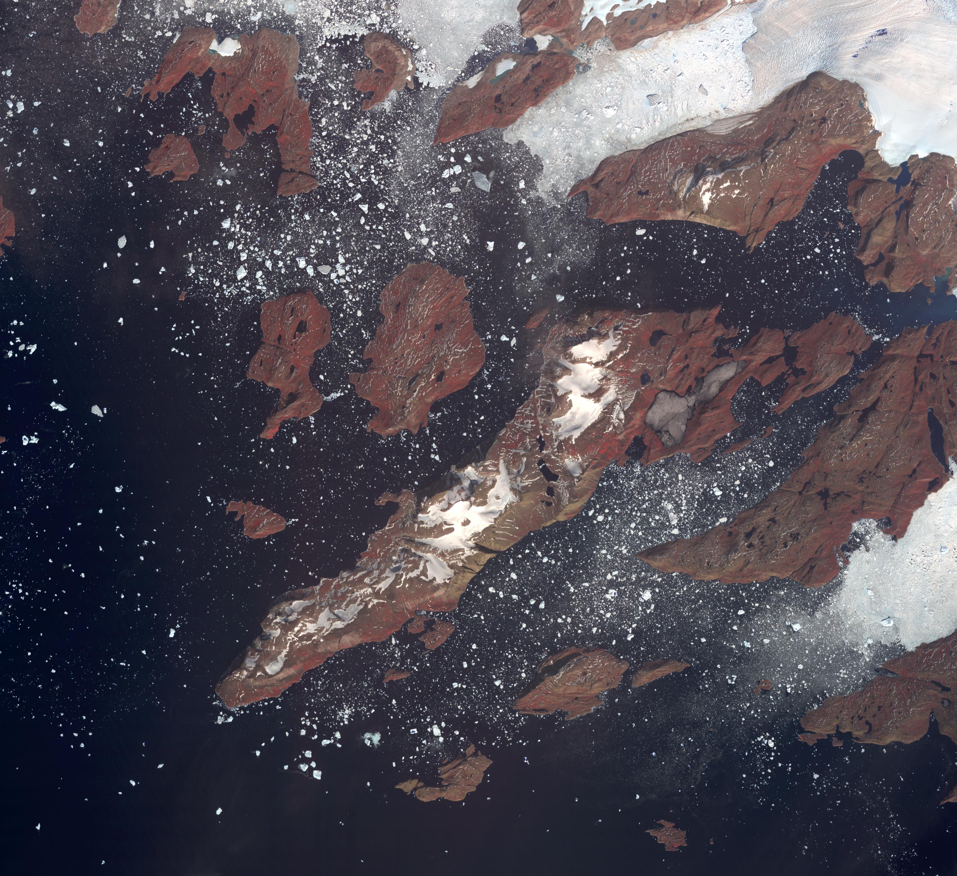
The west coast of Greenland is one of Earth's premiere incubators for icebergs, large blocks of land ice that break off from glaciers or ice shelves and float in the ocean, where they are transported by winds and currents and can pose potential threats to shipping. The Advanced Spaceborne Thermal Emission and Reflection Radiometer (ASTER) instrument on NASA's Terra spacecraft captured this image of icebergs off the west coast of Greenland, on July 17, 2005. The largest iceberg in the image, seen in the top center of the image coming off of a glacier, is about 4,128 feet (1,270 meters) in length. The image covers an area of 26.8 by 29.3 miles (43.2 by 47.2 kilometers), and is located at 74.6 degrees north latitude, 56.7 degrees west longitude. The reddish color on land is vegetation.
With its 14 spectral bands from the visible to the thermal infrared wavelength region and its high spatial resolution of 15 to 90 meters (about 50 to 300 feet), ASTER images Earth to map and monitor the changing surface of our planet. ASTER is one of five Earth-observing instruments launched Dec. 18, 1999, on Terra. The instrument was built by Japan's Ministry of Economy, Trade and Industry. A joint U.S./Japan science team is responsible for validation and calibration of the instrument and data products.
The broad spectral coverage and high spectral resolution of ASTER provides scientists in numerous disciplines with critical information for surface mapping and monitoring of dynamic conditions and temporal change. Example applications are: monitoring glacial advances and retreats; monitoring potentially active volcanoes; identifying crop stress; determining cloud morphology and physical properties; wetlands evaluation; thermal pollution monitoring; coral reef degradation; surface temperature mapping of soils and geology; and measuring surface heat balance.
The U.S. science team is located at NASA's Jet Propulsion Laboratory, Pasadena, Calif. The Terra mission is part of NASA's Science Mission Directorate, Washington, D.C.
More information about ASTER is available at http://asterweb.jpl.nasa.gov/.