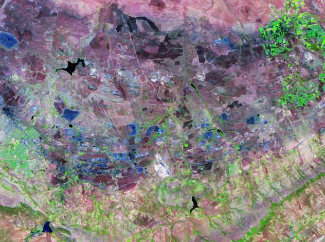
The Bushveld Igneous Complex (BIC) is a large layered igneous intrusion within the earth's crust, exposed at the edge of the Transvaal Basin in South Africa. The complex contains the world's largest reserves of the platinum group metals, platinum, palladium, osmium, indium, rhodium and rhenium, along with vast quantities of iron, tin, chromium, titanium and vanadium (Wikipedia). Numerous mines, tailings piles, and leach ponds are shown in blue in the ASTER image. The image was acquired October 24, 2006, covers an area of 38 by 52 km, and is located at 25.6 degrees south latitude, 27.4 degrees east longitude.
With its 14 spectral bands from the visible to the thermal infrared wavelength region and its high spatial resolution of 15 to 90 meters (about 50 to 300 feet), ASTER images Earth to map and monitor the changing surface of our planet. ASTER is one of five Earth-observing instruments launched Dec. 18, 1999, on Terra. The instrument was built by Japan's Ministry of Economy, Trade and Industry. A joint U.S./Japan science team is responsible for validation and calibration of the instrument and data products.
The broad spectral coverage and high spectral resolution of ASTER provides scientists in numerous disciplines with critical information for surface mapping and monitoring of dynamic conditions and temporal change. Example applications are: monitoring glacial advances and retreats; monitoring potentially active volcanoes; identifying crop stress; determining cloud morphology and physical properties; wetlands evaluation; thermal pollution monitoring; coral reef degradation; surface temperature mapping of soils and geology; and measuring surface heat balance.
The U.S. science team is located at NASA's Jet Propulsion Laboratory, Pasadena, Calif. The Terra mission is part of NASA's Science Mission Directorate, Washington, D.C.
More information about ASTER is available at http://asterweb.jpl.nasa.gov/.
 Planetary Data System


