Originally released June 19, 2012.
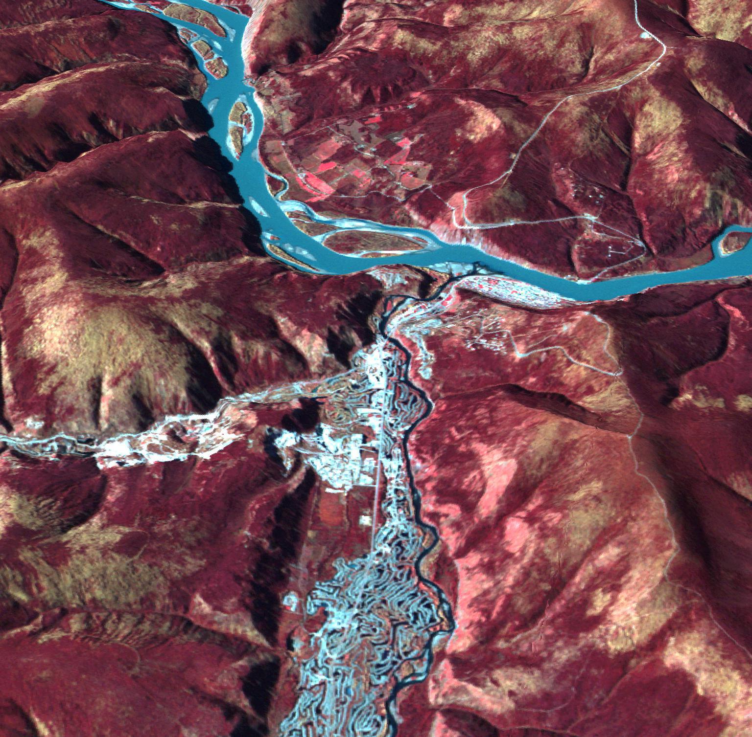
Dawson, Canada was a boom town in 1898, with a population of 40,000. Discovery of gold in the Klondike fueled the massive influx of miners, merchants, and other support professions to this town on the Yukon River. The current population is just over 1,000, with over 60,000 tourists invading the town each summer. Shortly after gold discovery, large gold dredges began an industrial mining operation, leaving large tailings piles in their wake. These can be clearly seen along the creek east of Dawson. The image was acquired September 19, 2010, and is located at 64.1 degrees north latitude, 136.4 degrees west longitude.
With its 14 spectral bands from the visible to the thermal infrared wavelength region and its high spatial resolution of 15 to 90 meters (about 50 to 300 feet), ASTER images Earth to map and monitor the changing surface of our planet. ASTER is one of five Earth-observing instruments launched Dec. 18, 1999, on Terra. The instrument was built by Japan's Ministry of Economy, Trade and Industry. A joint U.S./Japan science team is responsible for validation and calibration of the instrument and data products.
The broad spectral coverage and high spectral resolution of ASTER provides scientists in numerous disciplines with critical information for surface mapping and monitoring of dynamic conditions and temporal change. Example applications are: monitoring glacial advances and retreats; monitoring potentially active volcanoes; identifying crop stress; determining cloud morphology and physical properties; wetlands evaluation; thermal pollution monitoring; coral reef degradation; surface temperature mapping of soils and geology; and measuring surface heat balance.
The U.S. science team is located at NASA's Jet Propulsion Laboratory, Pasadena, Calif. The Terra mission is part of NASA's Science Mission Directorate, Washington, D.C.
More information about ASTER is available at http://asterweb.jpl.nasa.gov/.
 Planetary Data System


