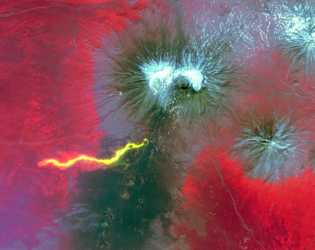
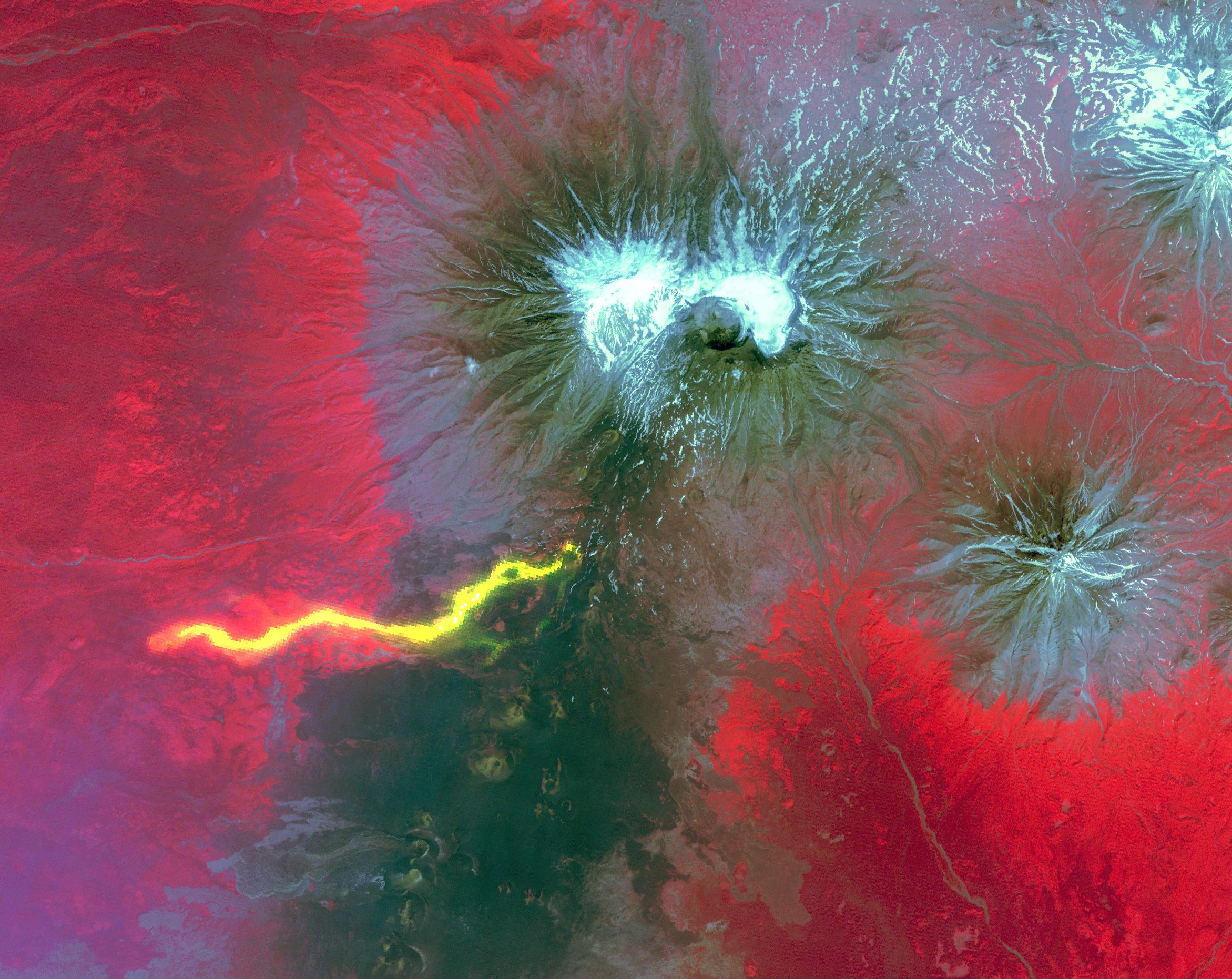
Plosky Tolbachik volcano, in Russia's far eastern Kamchatka peninsula, erupted on Nov. 27, 2012 for the first time in 35 years, sending clouds of ash almost 10,000 feet (about 3,000 meters) into the sky. Two nearby scientific camps were destroyed by lava flows, and schools in nearby villages were closed as a precaution. In this composite image from the Advanced Spaceborne Thermal Emission and Reflection Radiometer (ASTER) instrument on NASA's Terra spacecraft, a scene from July 19, 2012 provides the background, with vegetation in red, older lava flows in dark gray and snow in white. A nighttime thermal infrared image, acquired Dec. 3, 2012, is overlaid on the visible image, and highlights the hot lava flows in bright yellow. The image covers an area of 20.5 by 17.4 miles (33 by 28 kilometers) and is located at 55.7 degrees north latitude, 160.2 degrees east longitude.
With its 14 spectral bands from the visible to the thermal infrared wavelength region and its high spatial resolution of 15 to 90 meters (about 50 to 300 feet), ASTER images Earth to map and monitor the changing surface of our planet. ASTER is one of five Earth-observing instruments launched Dec. 18, 1999, on Terra. The instrument was built by Japan's Ministry of Economy, Trade and Industry. A joint U.S./Japan science team is responsible for validation and calibration of the instrument and data products.
The broad spectral coverage and high spectral resolution of ASTER provides scientists in numerous disciplines with critical information for surface mapping and monitoring of dynamic conditions and temporal change. Example applications are: monitoring glacial advances and retreats; monitoring potentially active volcanoes; identifying crop stress; determining cloud morphology and physical properties; wetlands evaluation; thermal pollution monitoring; coral reef degradation; surface temperature mapping of soils and geology; and measuring surface heat balance.
The U.S. science team is located at NASA's Jet Propulsion Laboratory, Pasadena, Calif. The Terra mission is part of NASA's Science Mission Directorate, Washington, D.C.
More information about ASTER is available at http://asterweb.jpl.nasa.gov/.