Click on an image for detailed information
Click on a column heading to sort in ascending or descending order

My
List |
Addition Date
|
Target
|
Mission
|
Instrument
|
Size
|

|
2008-09-05 |
Earth
|
ISS EarthKam
|
Electronic Still Camera
|
3060x2036x3 |
|
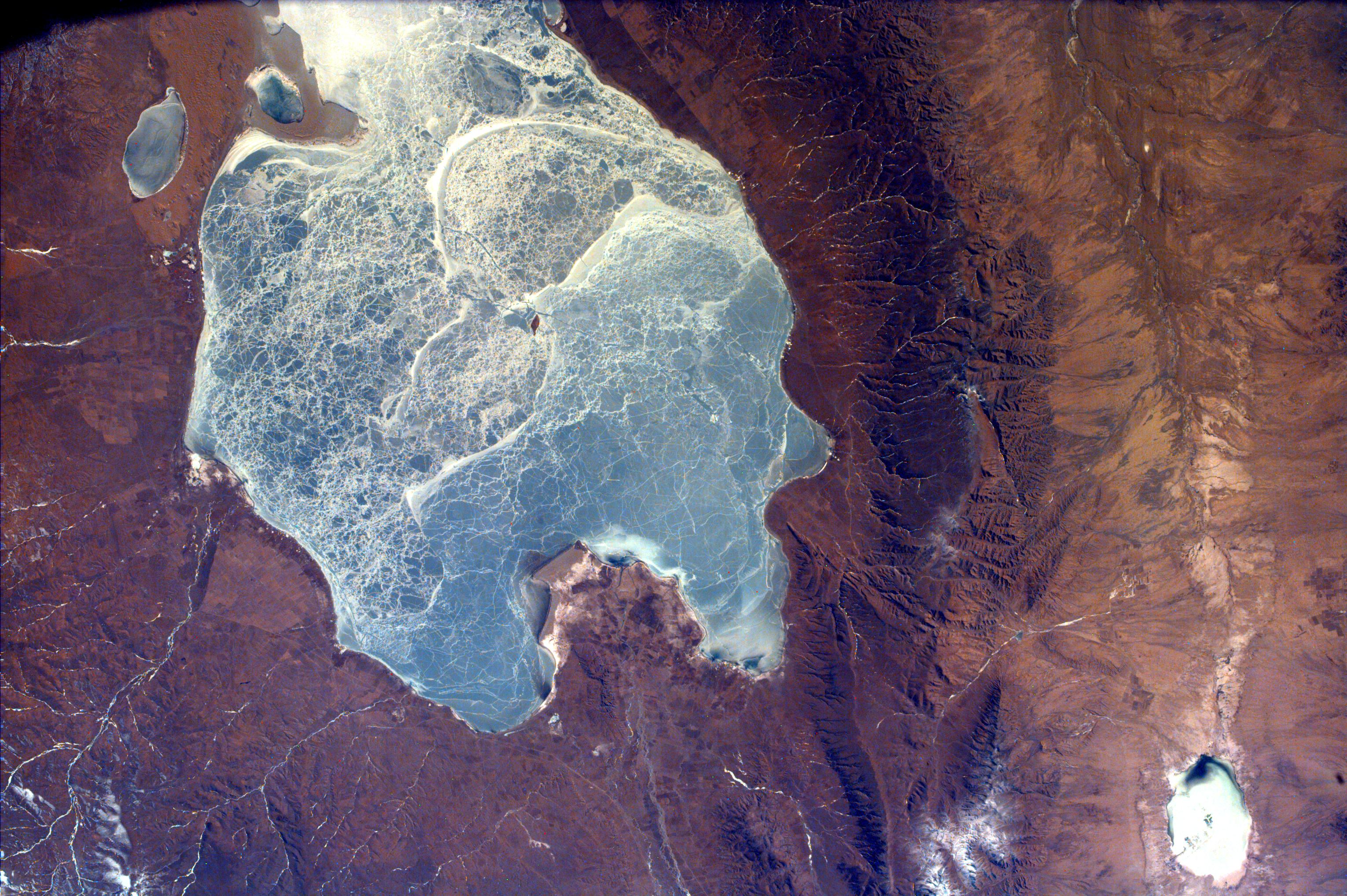
-
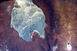
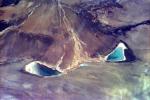
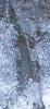
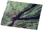
PIA11061:
-
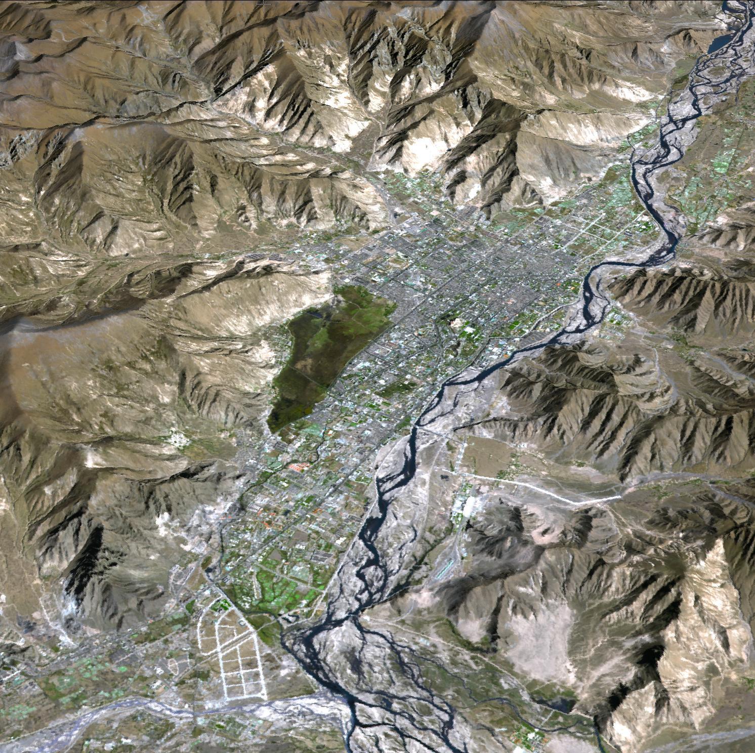
Frozen Lake Quinghai Nanshan, Northern China
Full Resolution:
TIFF
(18.69 MB)
JPEG
(1.217 MB)
|
|
|
2008-09-05 |
Earth
|
ISS EarthKam
|
Electronic Still Camera
|
3060x2036x3 |
|
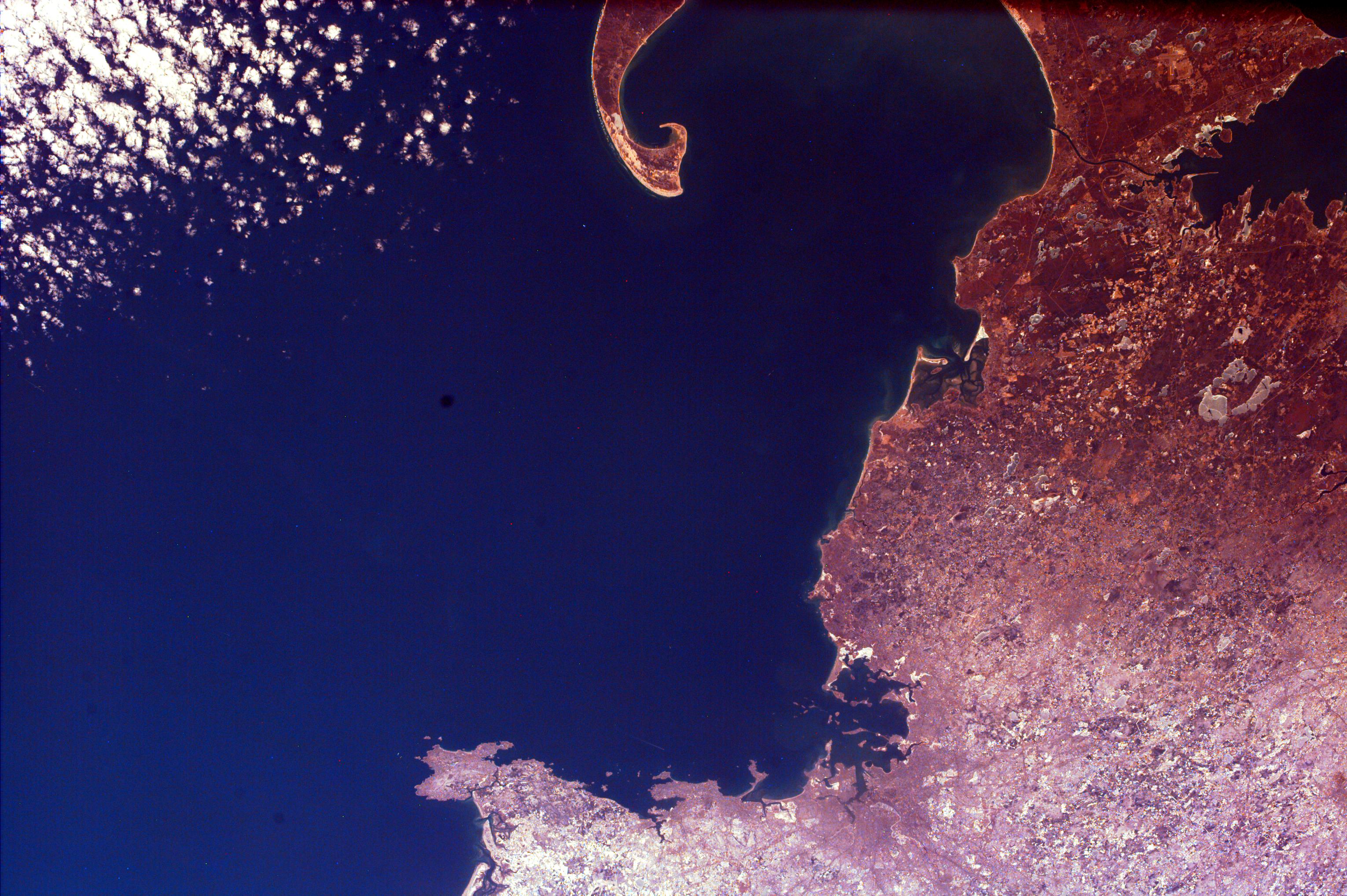
-
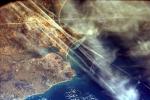
PIA11062:
-
Contrails over Lisbon, Portugal
Full Resolution:
TIFF
(18.69 MB)
JPEG
(1.138 MB)
|
|
|
2008-09-05 |
Earth
|
ISS EarthKam
|
Electronic Still Camera
|
3060x2036x3 |
|
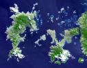
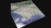
-
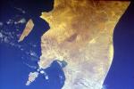
PIA11063:
-
Southern Tip of Baja California, Mexico
Full Resolution:
TIFF
(18.69 MB)
JPEG
(1.229 MB)
|
|
|
2008-09-05 |
Earth
|
ISS EarthKam
|
Electronic Still Camera
|
3060x2036x3 |

|
-
PIA11064:
-
Cape Cod, Massachusetts
Full Resolution:
TIFF
(18.69 MB)
JPEG
(1.008 MB)
|
|
|
2008-09-05 |
Earth
|
ISS EarthKam
|
Electronic Still Camera
|
3060x2036x3 |
|
-
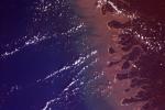
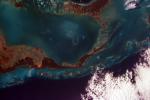
PIA11065:
-
Delta of the Gurupi, Maracacume, and Tiriacu Rivers, Brazil
Full Resolution:
TIFF
(18.69 MB)
JPEG
(731 kB)
|
|
|
2008-09-05 |
Earth
|
ISS EarthKam
|
Electronic Still Camera
|
3060x2036x3 |
|
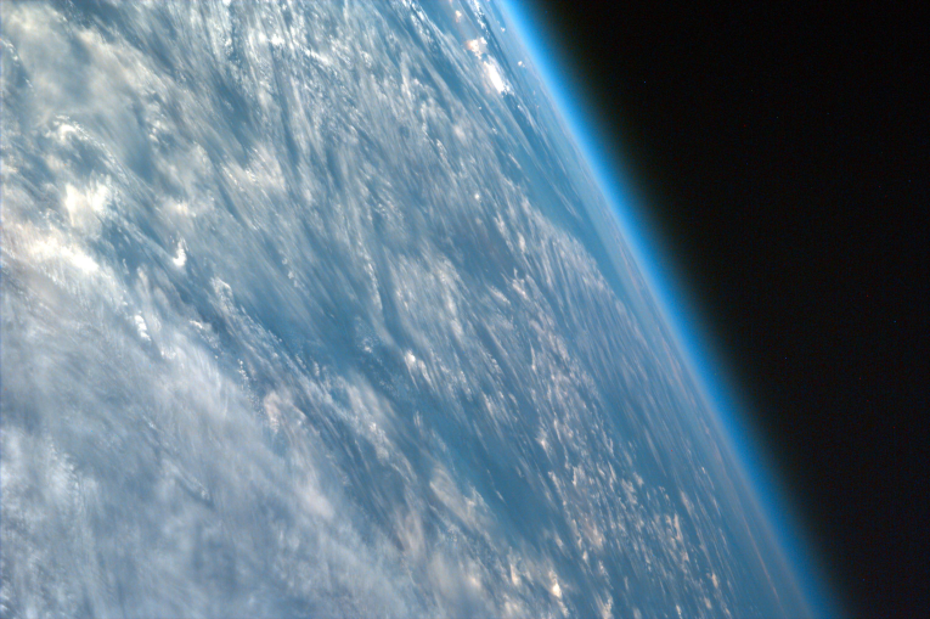
-
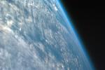
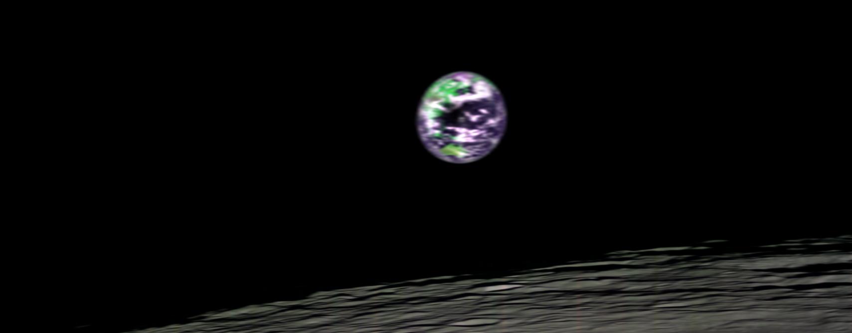
PIA11066:
-
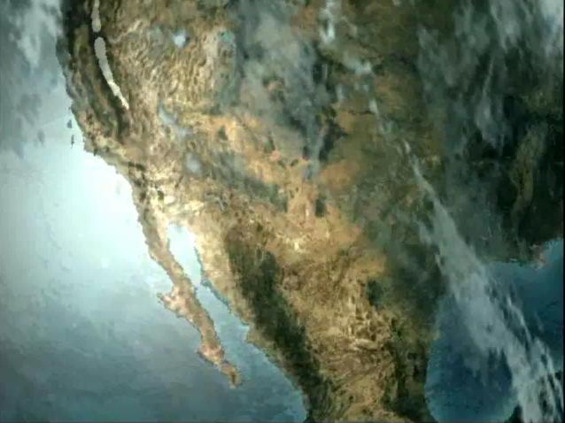
Oblique Shot of Earth
Full Resolution:
TIFF
(18.69 MB)
JPEG
(460.9 kB)
|
|
|
2008-09-05 |
Earth
|
ISS EarthKam
|
Electronic Still Camera
|
3060x2036x3 |
|
-
PIA11067:
-
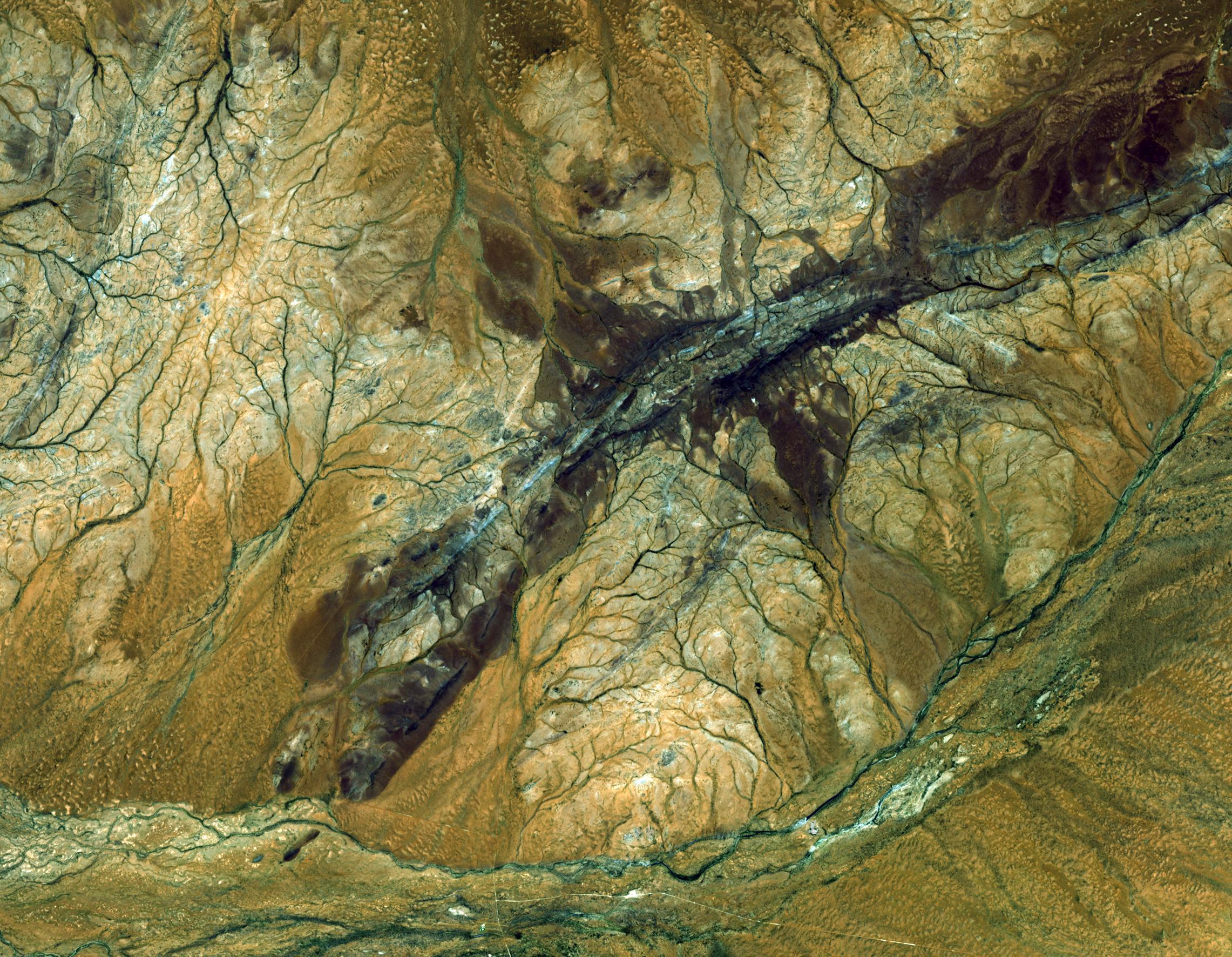
Alluvial fan in China
Full Resolution:
TIFF
(18.69 MB)
JPEG
(854 kB)
|
|
|
2008-09-05 |
Earth
|
ISS EarthKam
|
Electronic Still Camera
|
3060x2036x3 |
|
-
PIA11068:
-
Atlantic (maybe Caribbean Sea) Ocean and Islands
Full Resolution:
TIFF
(18.69 MB)
JPEG
(475.3 kB)
|
|
|
2008-09-05 |
Earth
|
ISS EarthKam
|
Electronic Still Camera
|
3060x2036x3 |

|
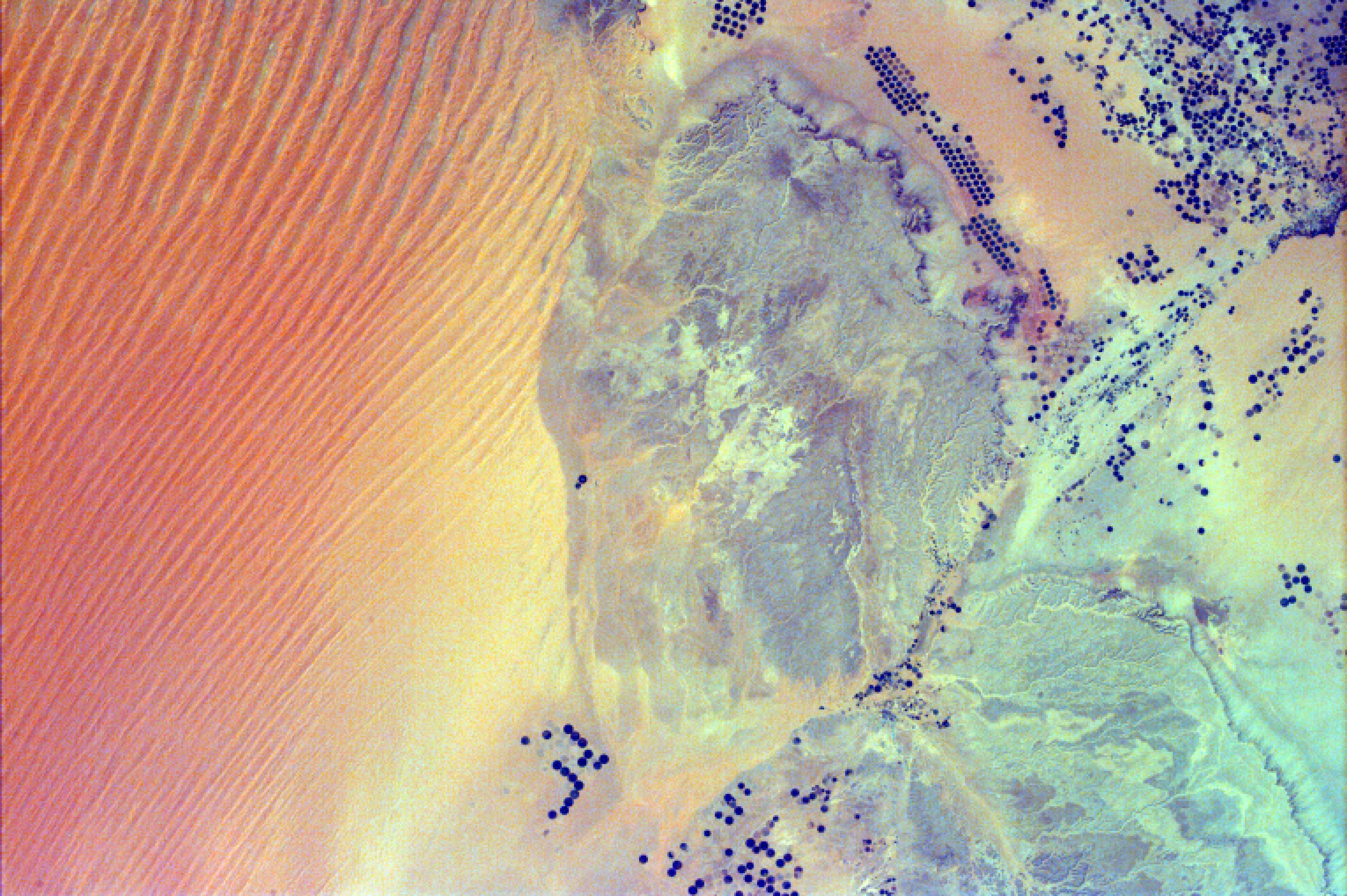
-
PIA11069:
-
Sand Dunes and Center-Pivot Irrigation in Saudi Arabia
Full Resolution:
TIFF
(18.69 MB)
JPEG
(886.2 kB)
|
|
|
2008-09-05 |
Earth
|
ISS EarthKam
|
Electronic Still Camera
|
3060x2036x3 |

|
-
PIA11070:
-
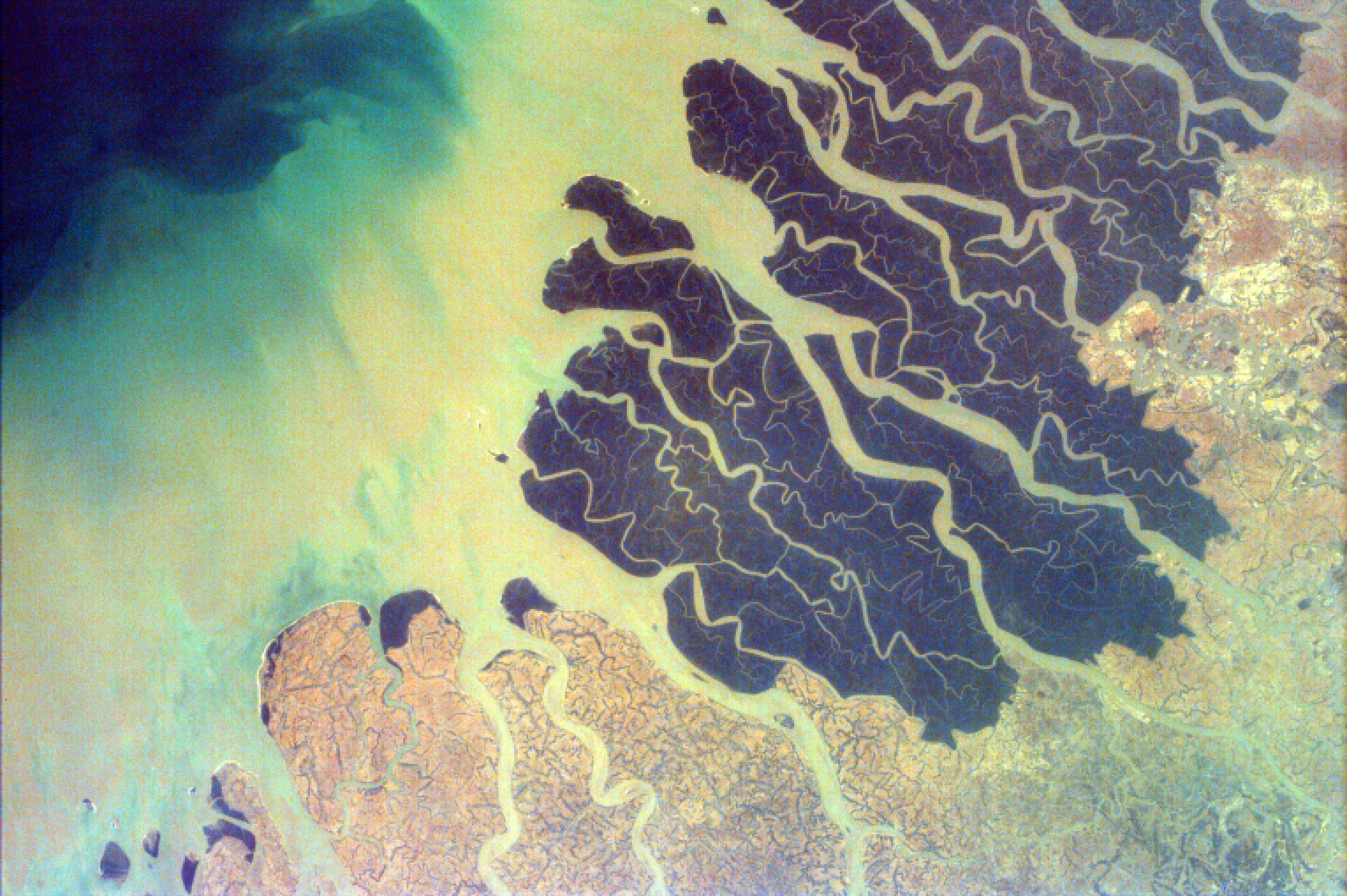
Ganges River Delta
Full Resolution:
TIFF
(18.69 MB)
JPEG
(852 kB)
|
|
|
2008-09-11 |
Earth
|
QuikScat
|
SeaWinds Scatterometer
|
2344x926x3 |
|
-
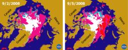
PIA11086:
-
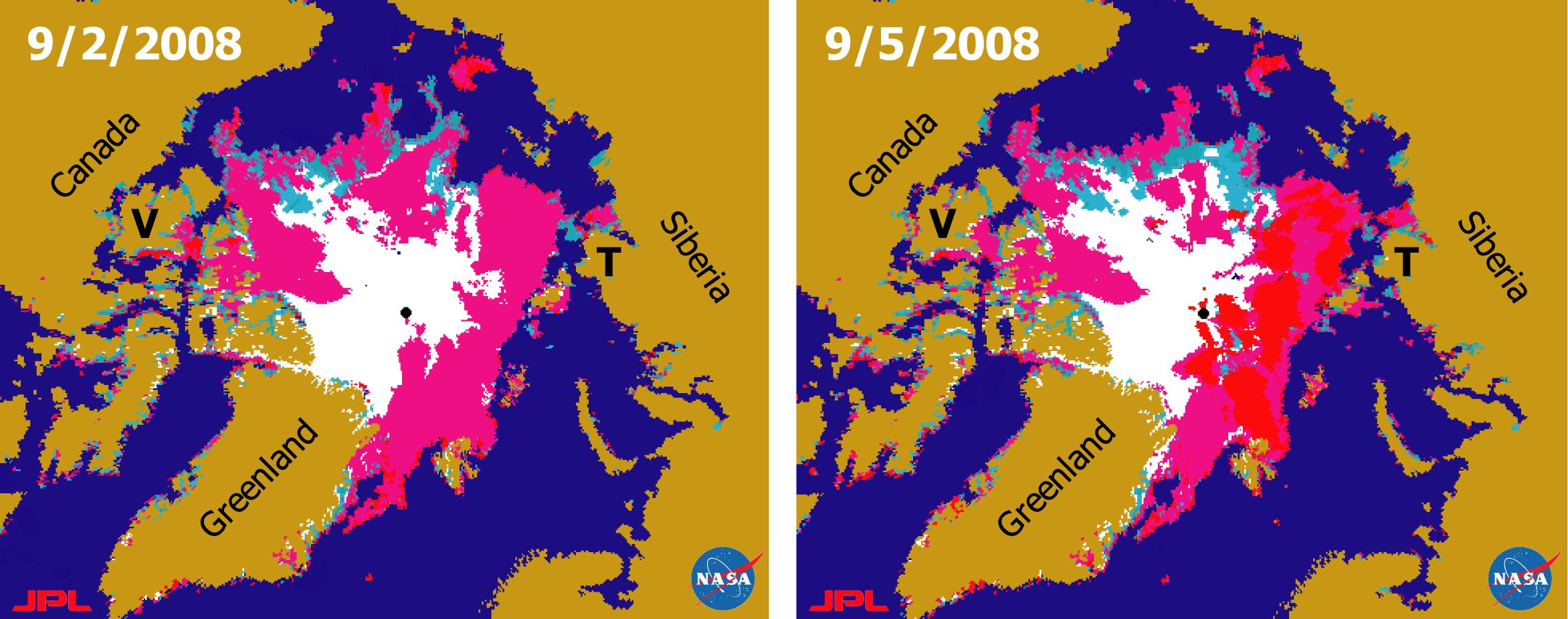
Recent State of Arctic Sea Ice
Full Resolution:
TIFF
(6.519 MB)
JPEG
(290.8 kB)
|
|
|
2008-09-16 |
Earth
|
Terra
|
ASTER
|
3190x2810x3 |
|
-
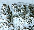
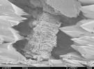
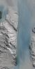
PIA11169:
-
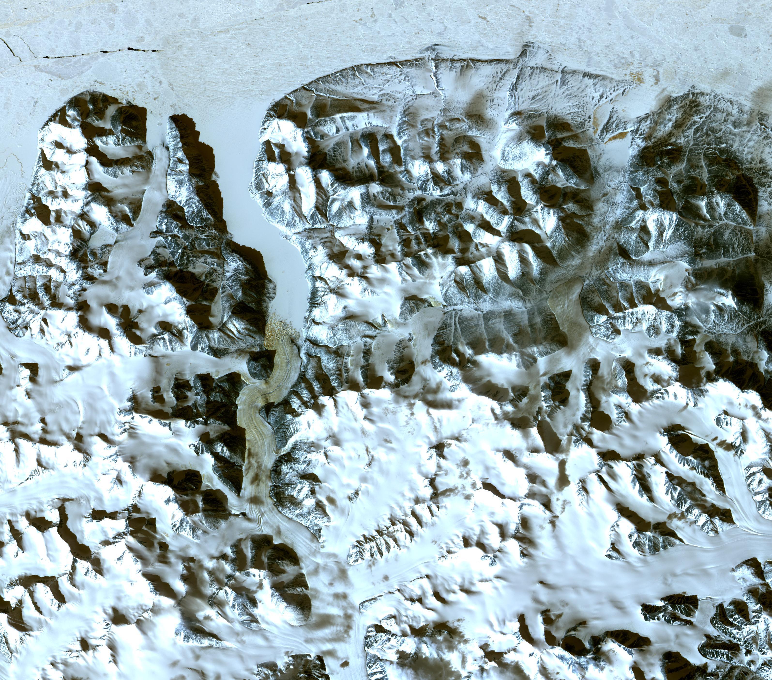
Northern Greenland
Full Resolution:
TIFF
(26.89 MB)
JPEG
(1.555 MB)
|
|
|
2008-09-17 |
Earth
|
Aqua
|
AIRS
|
638x478x3 |

|
-
PIA11171:
-
AIRS Collects Data and Creates a Temperature Profile

Full Resolution:
TIFF
(916.1 kB)
JPEG
(39.04 kB)
|
|
|
2008-09-22 |
Earth
|
Aqua
|
AIRS
|
1777x948x3 |
|
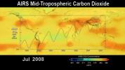
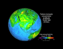
-
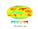
PIA11186:
-
AIRS Global Distribution of Mid-Tropospheric Carbon Dioxide at 8-13 km Altitudes
Full Resolution:
TIFF
(5.062 MB)
JPEG
(146.6 kB)
|
|
|
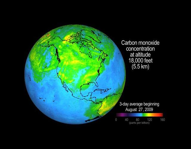
2008-09-24 |
Earth
|
Aqua
|
AIRS
|
5000x3750x3 |
|
-
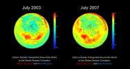
PIA11194:
-
Global Carbon Dioxide Transport from AIRS Data, July 2008
Full Resolution:
TIFF
(56.25 MB)
JPEG
(715.3 kB)
|
|
|
2008-09-24 |
Earth
|
OSTM/Jason-2
|
Altimeter
|
1225x710x3 |
|
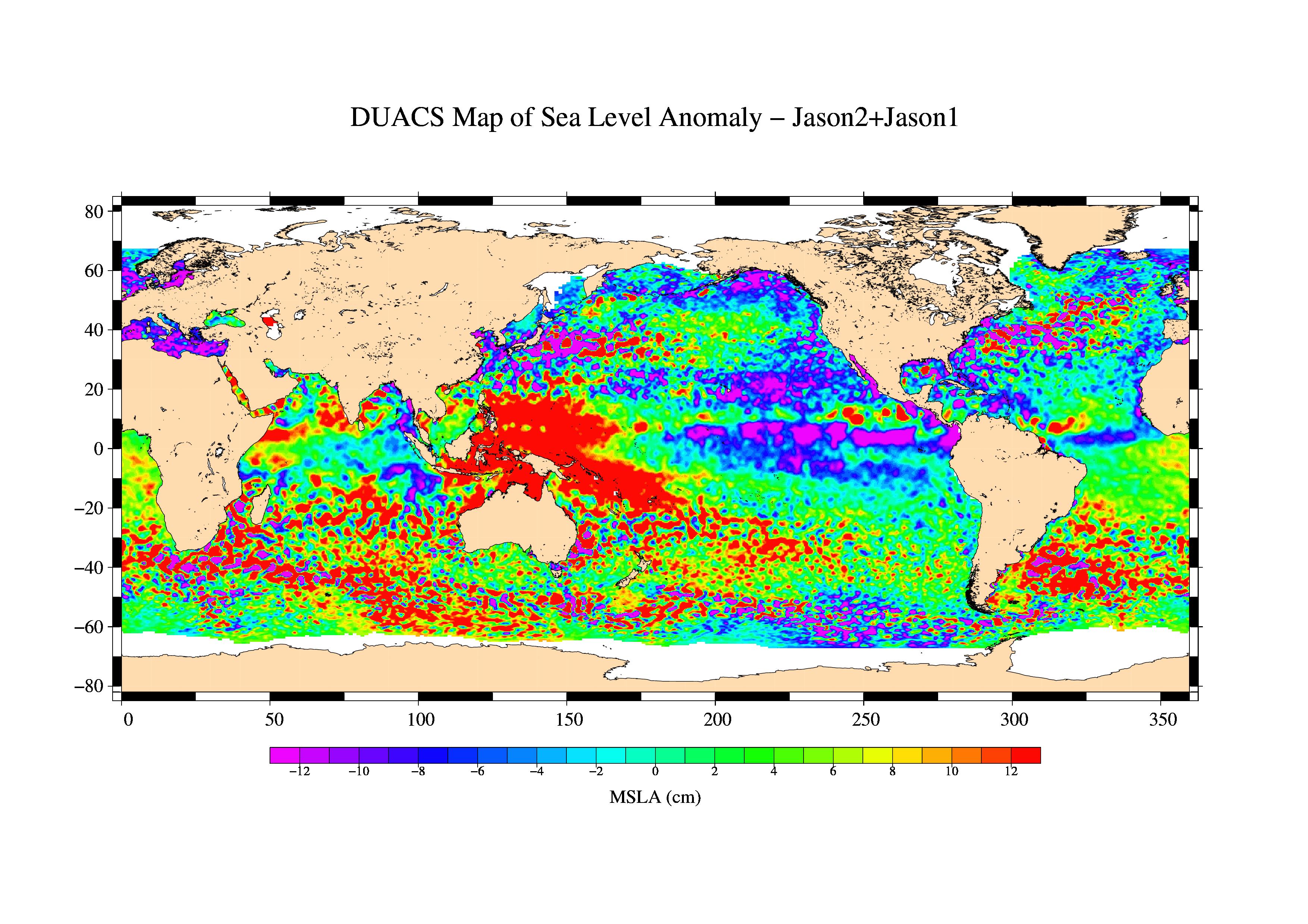
-
PIA11197:
-
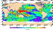
Newest Ocean-Observing Satellite Records Recent Sea Level Changes
Full Resolution:
TIFF
(872.5 kB)
JPEG
(211.1 kB)
|
|
|
2008-09-30 |
Earth
|
Phoenix
|
|
1228x910x1 |
|
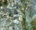
-
PIA11207:
-
Terrestrial Clay under Microscope
Full Resolution:
TIFF
(1.119 MB)
JPEG
(140.7 kB)
|
|
|
2008-10-16 |
Earth
|
Terra
|
ASTER
|
1922x2982x3 |
|
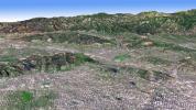
-
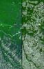
PIA11420:
-
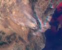
Mato Grosso, Brazil
Full Resolution:
TIFF
(17.22 MB)
JPEG
(1.446 MB)
|
|
|
2008-11-03 |
Earth
|
Terra
|
ASTER
|
6630x5000x3 |
|
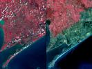
-
PIA11394:
-
Aftermath of Hurricane Ike along Texas Coast
Full Resolution:
TIFF
(99.45 MB)
JPEG
(4.42 MB)
|
|
|
2008-11-03 |
Earth
|
Aqua
|
AIRS
|
3840x2160x3 |
|
-
PIA11395:
-
AIRS Carbon Dioxide with Mauna Loa Carbon Dioxide Overlaid
Full Resolution:
TIFF
(24.88 MB)
JPEG
(534 kB)
|
|
|
2008-11-17 |
Earth
|
Terra
|
ASTER
|
4070x8024x3 |
|
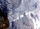
-
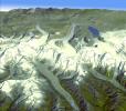
PIA11419:
-
Byrd Glacier, Antarctica
Full Resolution:
TIFF
(97.97 MB)
JPEG
(7.07 MB)
|
|
|
2008-11-18 |
Earth
|
Aqua
|
AIRS
|
1024x576x3 |
|
-
PIA11424:
-
Water Vapor Transport, June through November 2005 (Movie)
Full Resolution:
TIFF
(1.772 MB)
JPEG
(54.12 kB)
|
|
|
2008-12-13 |
Earth
|
Jason-1
|
Altimeter
|
900x900x3 |
|
-
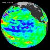
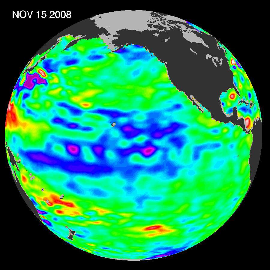
PIA11710:
-
Oscillation Rules as the Pacific Cools
Full Resolution:
TIFF
(2.433 MB)
JPEG
(102.9 kB)
|
|
|
2008-12-17 |
Moon
|
Chandrayaan-1
|
Moon Mineralogy Mapper
|
631x635x3 |
|
-
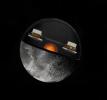
PIA11727:
-
NASA's Moon Mineralogy Mapper
Full Resolution:
TIFF
(1.204 MB)
JPEG
(65.59 kB)
|
|
|
2009-01-09 |
Earth
|
Terra
|
ASTER
|
3136x1656x3 |
|
-
PIA11752:
-
Bodele Sand Dunes, Chad
Full Resolution:
TIFF
(15.58 MB)
JPEG
(879.5 kB)
|
|
|
2009-02-06 |
Earth
|
Jason-1
OSTM/Jason-2
|
Altimeter
|
1074x1074x3 |

|
-
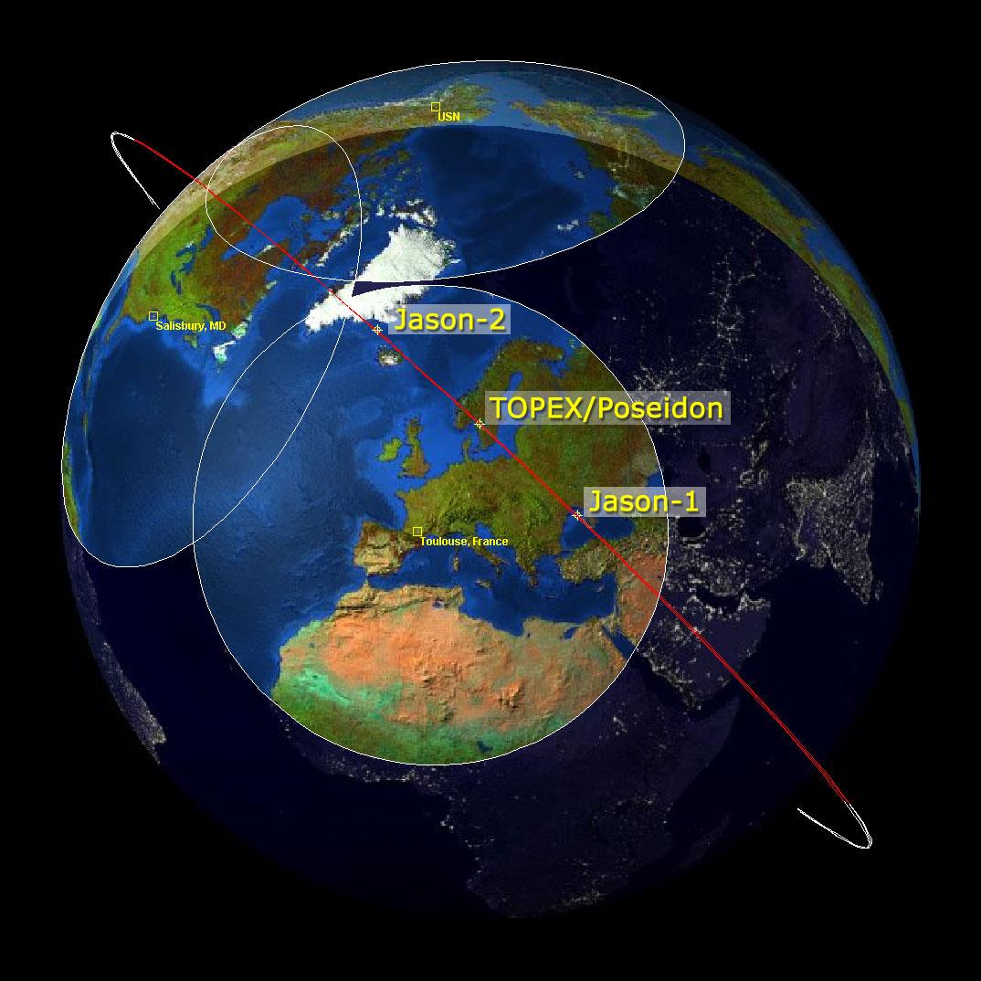
PIA11794:
-
Altimeter Family Portrait: Topex/Poseidon, Jason-1 and OSTM/Jason-2
Full Resolution:
TIFF
(3.465 MB)
JPEG
(131 kB)
|
|
|
2009-02-09 |
Earth
|
Terra
|
ASTER
|
2468x1992x3 |
|
-
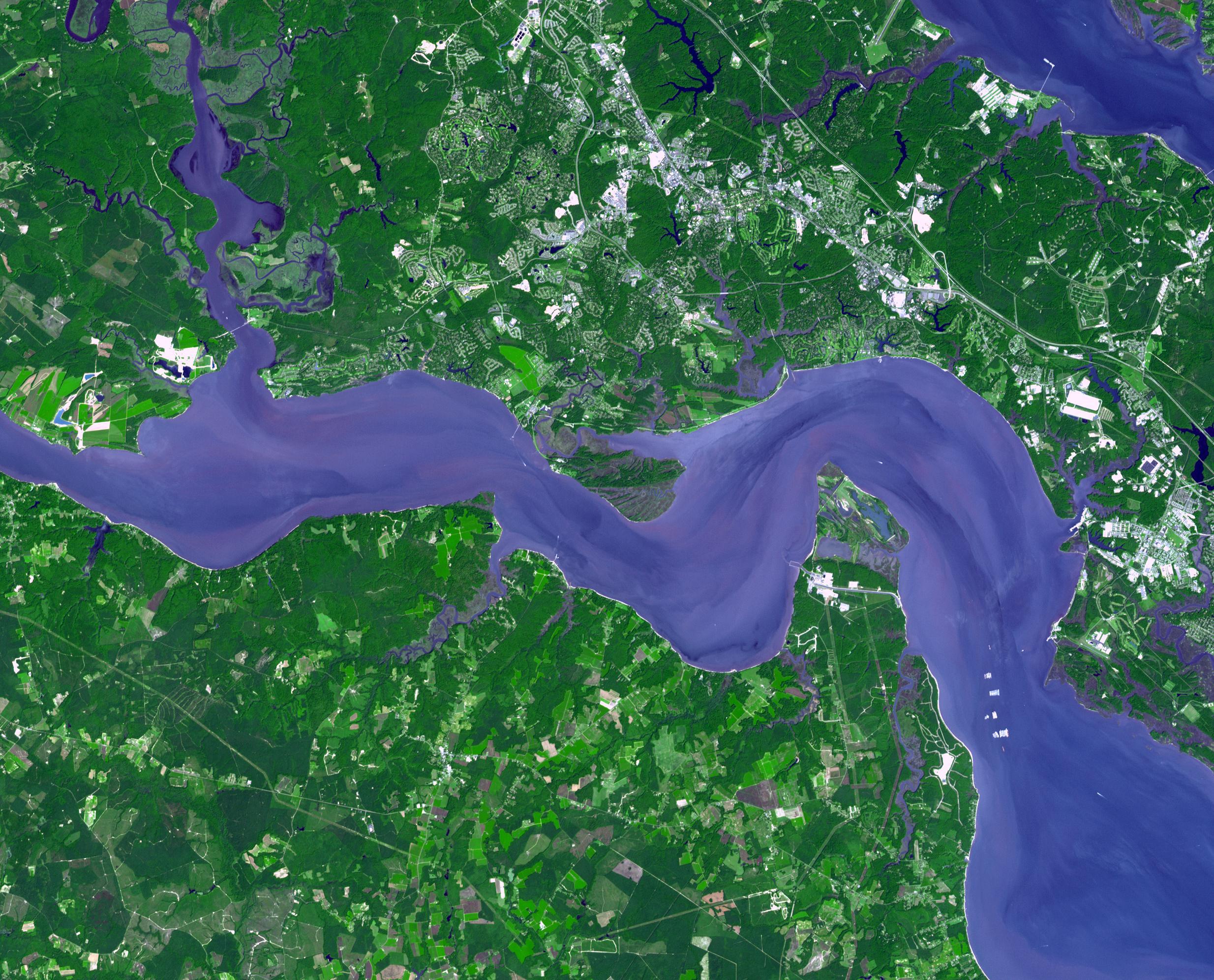
PIA12055:
-
Jamestown, VA
Full Resolution:
TIFF
(14.76 MB)
JPEG
(918.7 kB)
|
|
|
2009-02-18 |
Earth
|
Terra
|
ASTER
|
3315x3324x3 |

|
-
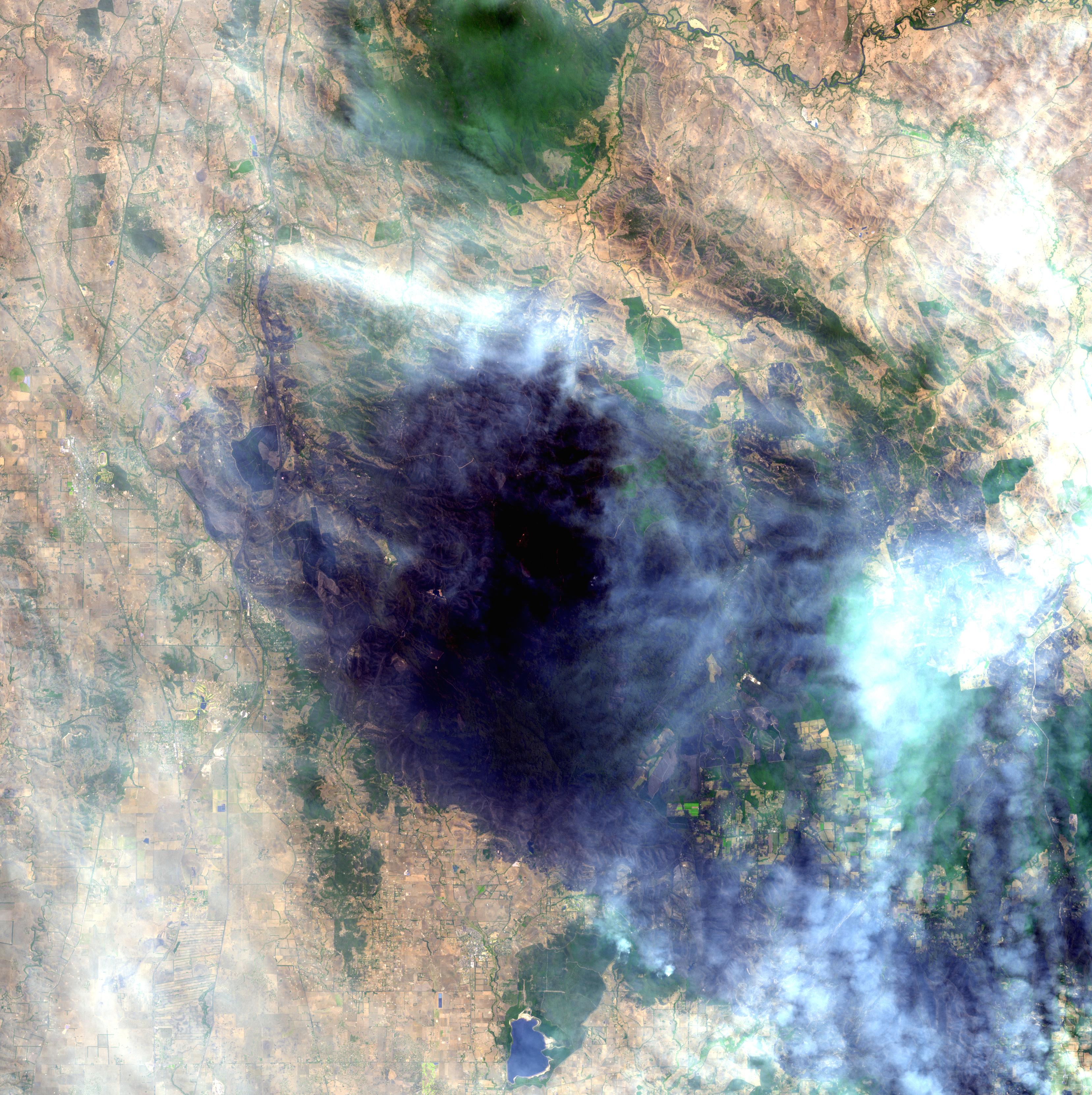
PIA11806:
-
Australia Wildfires Extract a Heavy Toll in Lives, Land
Full Resolution:
TIFF
(33.06 MB)
JPEG
(1.678 MB)
|
|
|
2009-02-19 |
Earth
|
Aqua
|
AIRS
|
764x522x3 |
|
-
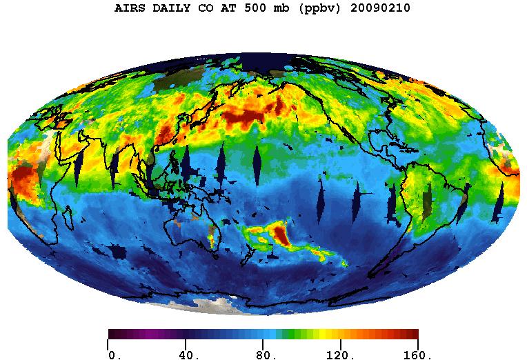
PIA11807:
-
Carbon Monoxide from the Australian Fires of Feb 2009 as seen by AIRS
Full Resolution:
TIFF
(1.198 MB)
JPEG
(92.37 kB)
|
|
|
2009-02-20 |
Earth
|
Terra
|
ASTER
|
3900x3764x3 |
|
-
PIA12056:
-
Hokkaido, Japan
Full Resolution:
TIFF
(44.04 MB)
JPEG
(1.775 MB)
|
|
|
2009-03-02 |
Earth
|
Terra
|
ASTER
|
2368x3020x3 |
|
-
PIA12057:
-
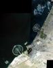
Palm Islands, Dubai, UAE
Full Resolution:
TIFF
(21.48 MB)
JPEG
(700.7 kB)
|
|
|
2009-03-16 |
Earth
|
Terra
|
ASTER
|
2676x1918x3 |
|
-
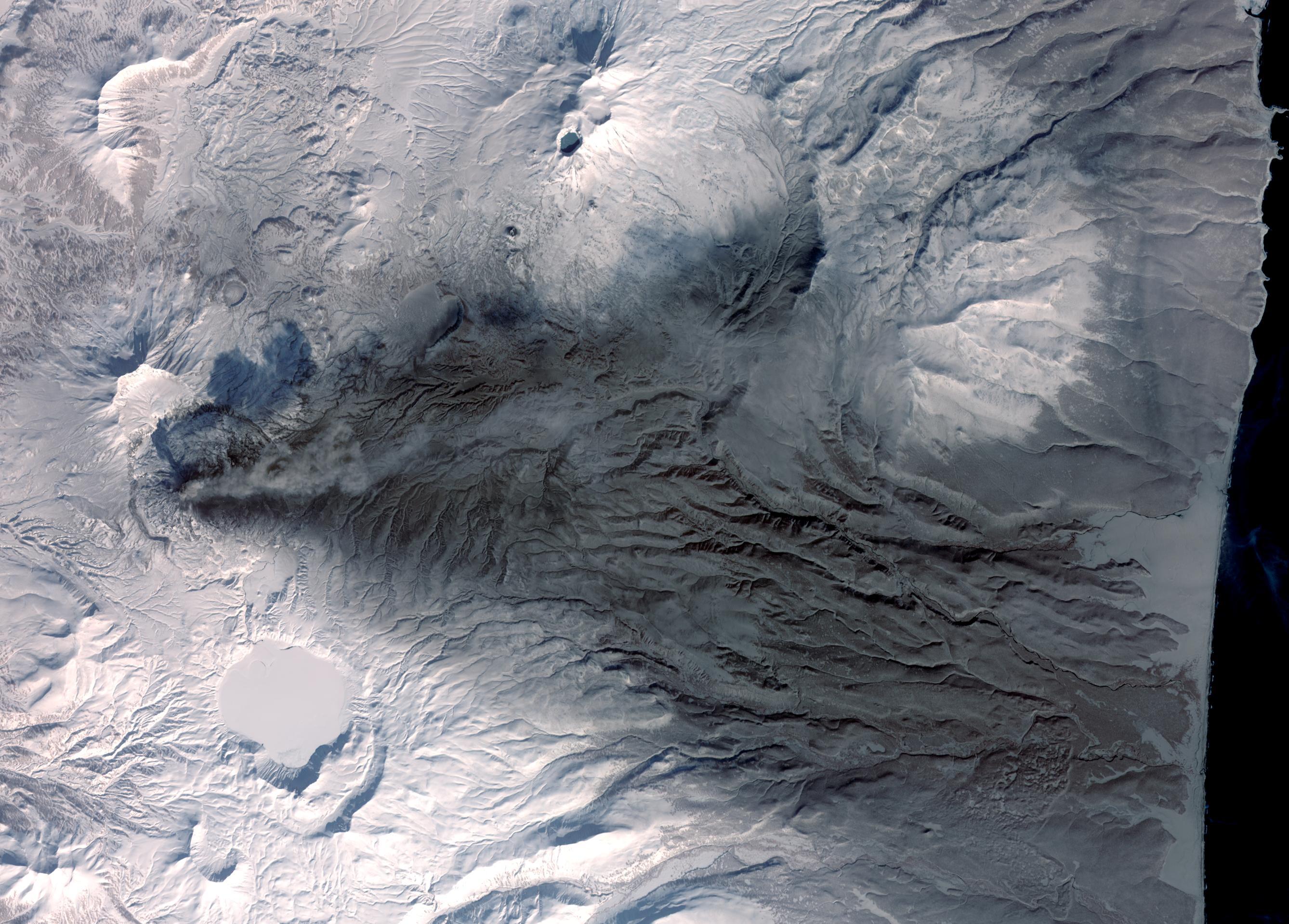
PIA12058:
-
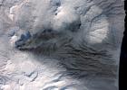
Karymsky Volcano, Kamchatka
Full Resolution:
TIFF
(15.41 MB)
JPEG
(726.5 kB)
|
|
|
2009-03-26 |
Earth
|
Terra
|
ASTER
|
1949x2646x3 |

|
-
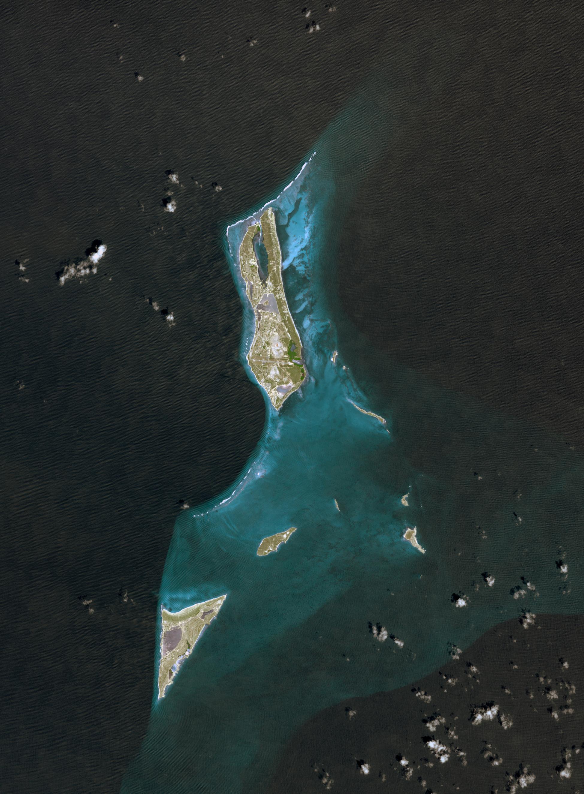
PIA12059:
-
Grand Turk Island
Full Resolution:
TIFF
(15.49 MB)
JPEG
(591.2 kB)
|
|
|
2009-03-26 |
Earth
|
Jason-1
OSTM/Jason-2
|
Altimeter
|
3508x2479x3 |

|
-
PIA11859:
-
First Jason-1 and OSTM/Jason-2 Tandem Global View
Full Resolution:
TIFF
(26.09 MB)
JPEG
(1.128 MB)
|
|
|
2009-04-01 |
Earth
|
Shuttle Radar Topography Mission (SRTM)
|
C-Band Radar
|
1250x1440x1 |
|
-
PIA11964:
-
Fargo, North Dakota, USA
Full Resolution:
TIFF
(1.802 MB)
JPEG
(353.4 kB)
|
|
|
2009-04-03 |
Earth
|
Terra
|
ASTER
|
3108x4319x3 |
|
-
PIA12060:
-
Musandam Peninsula, Oman
Full Resolution:
TIFF
(40.27 MB)
JPEG
(1.593 MB)
|
|
|
2009-04-19 |
Earth
|
Terra
|
ASTER
|
2508x5460x3 |
|
-
PIA11989:
-
North Dakota Floods
Full Resolution:
TIFF
(41.12 MB)
JPEG
(3.296 MB)
|
|
|
2009-04-20 |
Earth
|
Terra
|
ASTER
|
3708x2920x3 |
|
-
PIA12061:
-
Komodo National Park, Indonesia
Full Resolution:
TIFF
(32.48 MB)
JPEG
(1.387 MB)
|
|
|
2009-04-20 |
Earth
|
Terra
|
ASTER
|
3235x2351x3 |
|
-
PIA11991:
-
Wilkins Ice Shelf
Full Resolution:
TIFF
(22.82 MB)
JPEG
(984.9 kB)
|
|
|
2009-04-27 |
Earth
|
Jason-1
OSTM/Jason-2
|
Altimeter
|
1010x654x3 |
|
-
PIA11997:
-
OSTM/Jason-2 and Jason-1 Tandem Mission View of the Gulf Stream
Full Resolution:
TIFF
(663 kB)
JPEG
(187.6 kB)
|
|
|
2009-05-01 |
Earth
|
Terra
|
ASTER
|
1446x803x3 |
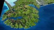
|
-
PIA12062:
-
Banks Peninsula, New Zealand
Full Resolution:
TIFF
(3.49 MB)
JPEG
(214.8 kB)
|
|
|
2009-05-08 |
Earth
|
QuikScat
|
SeaWinds Scatterometer
|
2367x2916x3 |
|
-
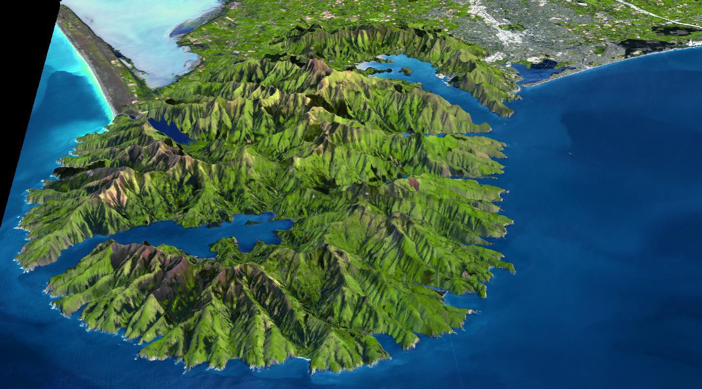
PIA12006:
-
Disaster Management: Rapid Dry-Up of Rainwater on Land Surface Leading to the Santa Barbara Wildfire
Full Resolution:
TIFF
(20.73 MB)
JPEG
(727.8 kB)
|
|
|
2009-05-15 |
Earth
|
Terra
|
ASTER
|
3456x2736x3 |
|
-
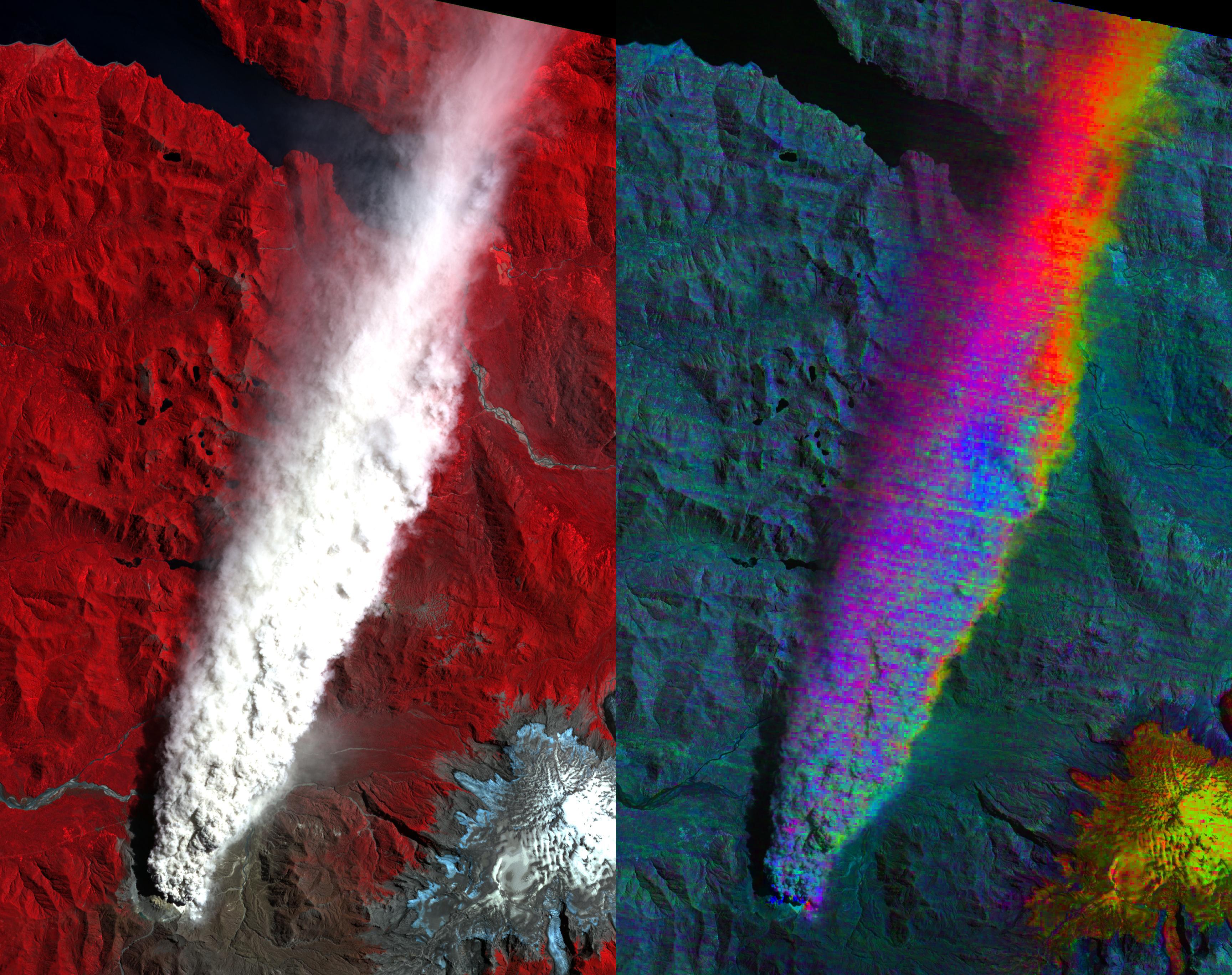
PIA12063:
-
Volcano Chaiten, Chile
Full Resolution:
TIFF
(28.37 MB)
JPEG
(1.285 MB)
|
|
|
2009-05-18 |
Moon
|
GRAIL
|
|
6000x4000x3 |
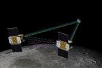
|
-
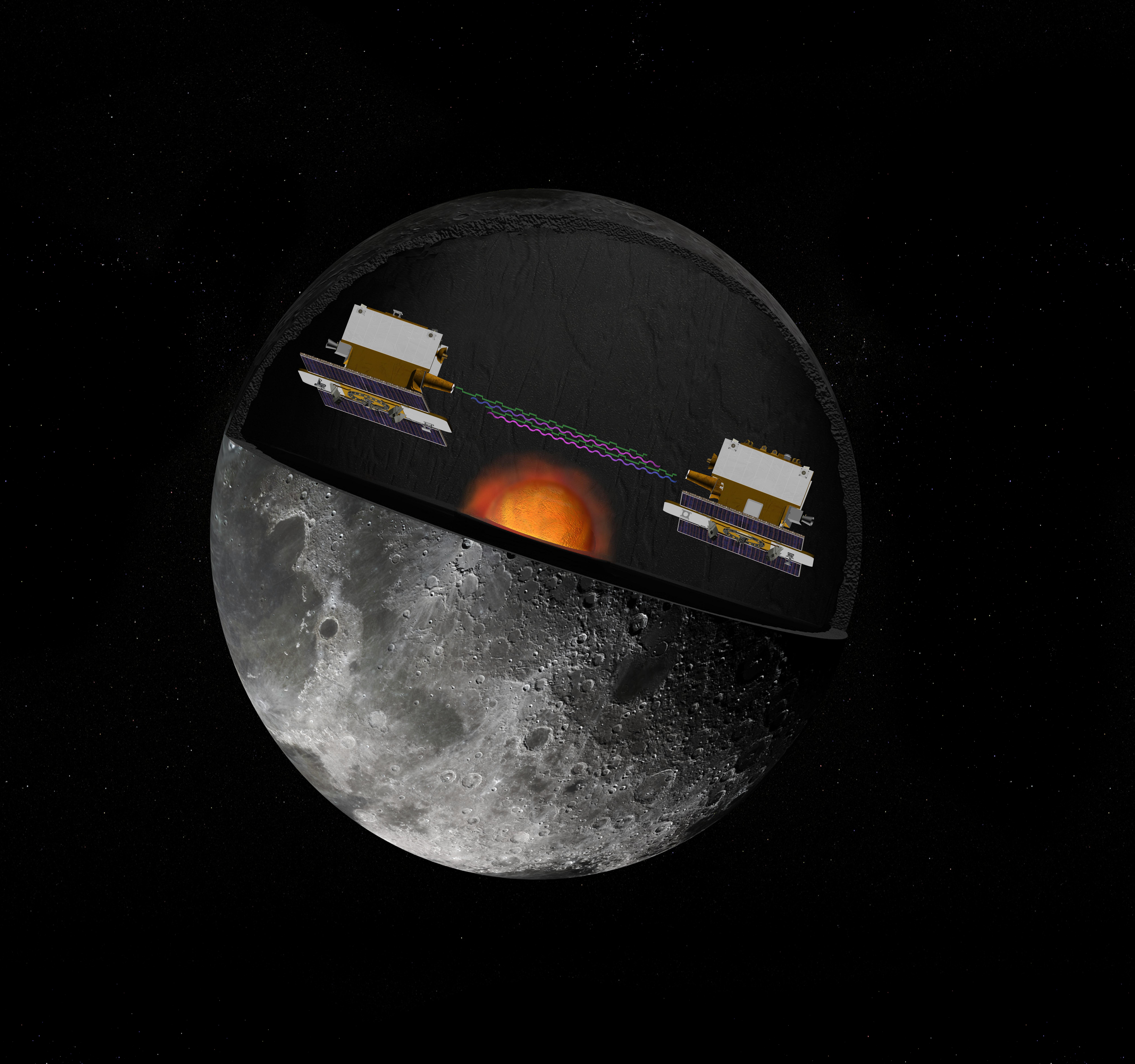
PIA12009:
-
GRAIL's Twin Spacecraft fly in Tandem Around the Moon (Artist's Concept)
Full Resolution:
TIFF
(72 MB)
JPEG
(1.186 MB)
|
|
|
2009-05-18 |
Moon
|
GRAIL
|
|
8000x7500x3 |
|
-
PIA12010:
-
GRAIL's Twin Spacecraft -- Crust to Core (Artist's Concept)
Full Resolution:
TIFF
(180 MB)
JPEG
(2.615 MB)
|
|
|
2009-06-02 |
Earth
|
Terra
|
ASTER
|
2282x1772x3 |

|
-
PIA12064:
-
Jack Hills, Australia
Full Resolution:
TIFF
(12.15 MB)
JPEG
(877.8 kB)
|
|
|
2009-06-18 |
Earth
|
UAVSAR
|
L-Band UAVSAR
|
2984x2737x3 |
|
-
PIA12075:
-
Scientists Search for a Pulse in Skies Above Earthquake Country
Full Resolution:
TIFF
(24.5 MB)
JPEG
(3.571 MB)
|
|
|
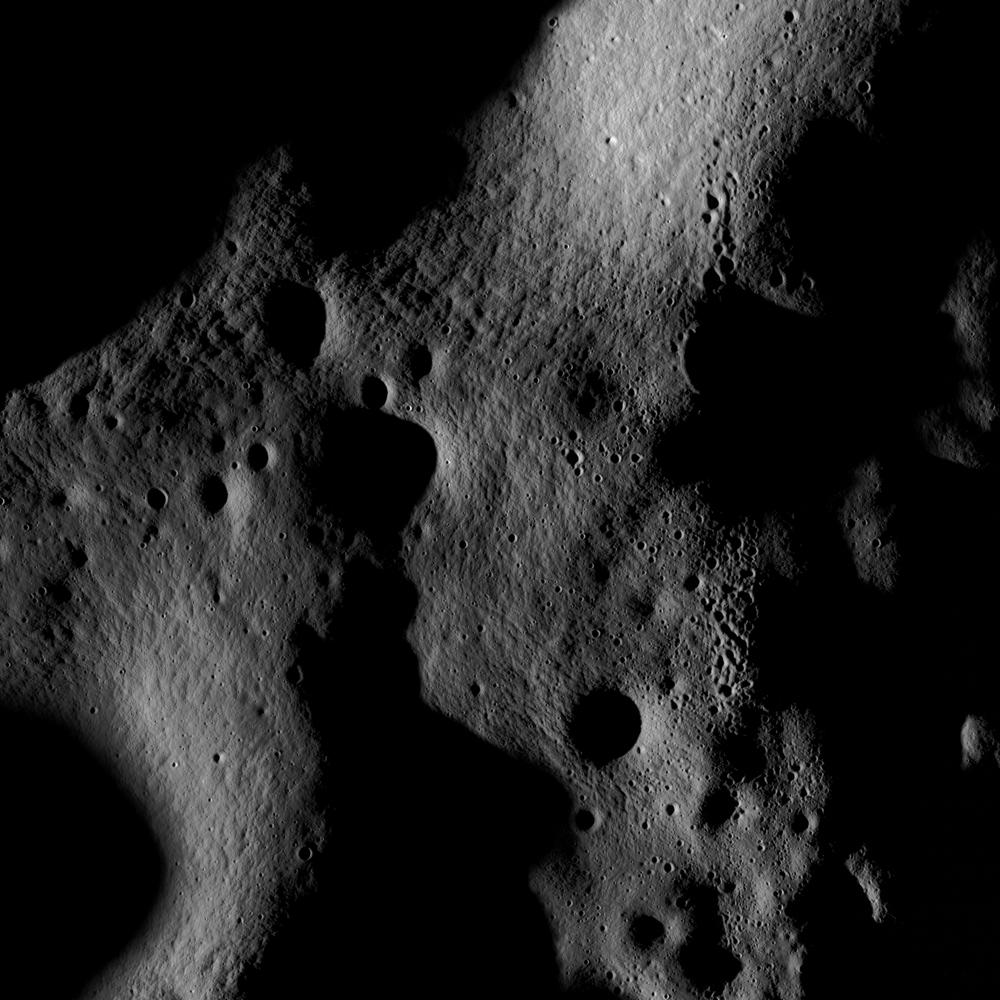
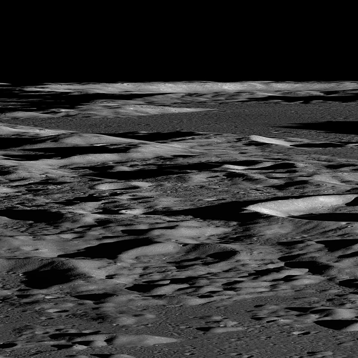
2009-06-18 |
Moon
|
Goldstone Deep Space Network (DSN)
|
Goldstone Solar System Radar
|
4000x3796x3 |
|
-
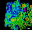
PIA12077:
-
Moon's Rugged South Polar Region Composite
Full Resolution:
TIFF
(45.55 MB)
JPEG
(1.896 MB)
|
|
|
2009-06-29 |
Earth
|
Terra
|
ASTER
|
4320x2160x3 |
|
-
PIA12090:
-
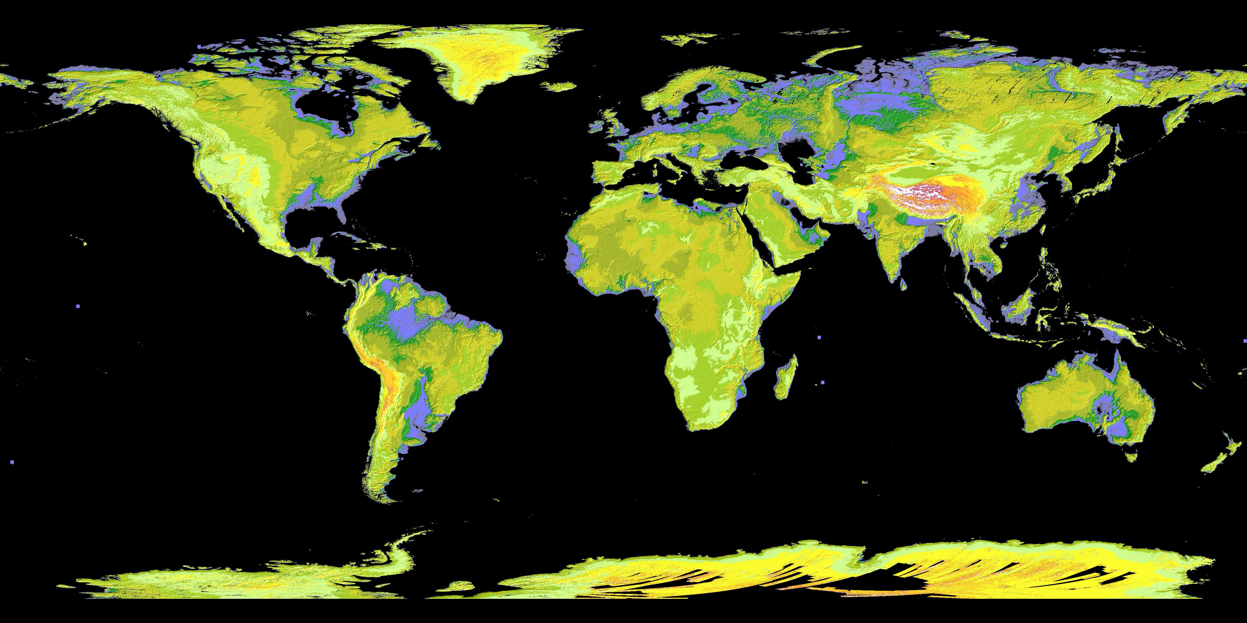
ASTER's Global Digital Elevation Model (GDEM)
Full Resolution:
TIFF
(27.99 MB)
JPEG
(1.153 MB)
|
|
|
2009-06-29 |
Earth
|
Terra
|
ASTER
|
1488x1493x3 |

|
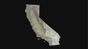
-
PIA12091:
-
Death Valley, California
Full Resolution:
TIFF
(6.677 MB)
JPEG
(506.6 kB)
|
|
|
2009-06-29 |
Earth
|
Terra
|
ASTER
|
1556x1370x3 |
|
-
PIA12092:
-
Himalayan Glaciers in Bhutan
Full Resolution:
TIFF
(6.406 MB)
JPEG
(432.9 kB)
|
|
|
2009-06-29 |
Earth
|
Terra
|
ASTER
|
1280x720x3 |
|
-
PIA12093:
-
Los Angeles Basin
Full Resolution:
TIFF
(2.768 MB)
JPEG
(316.6 kB)
|
|
|
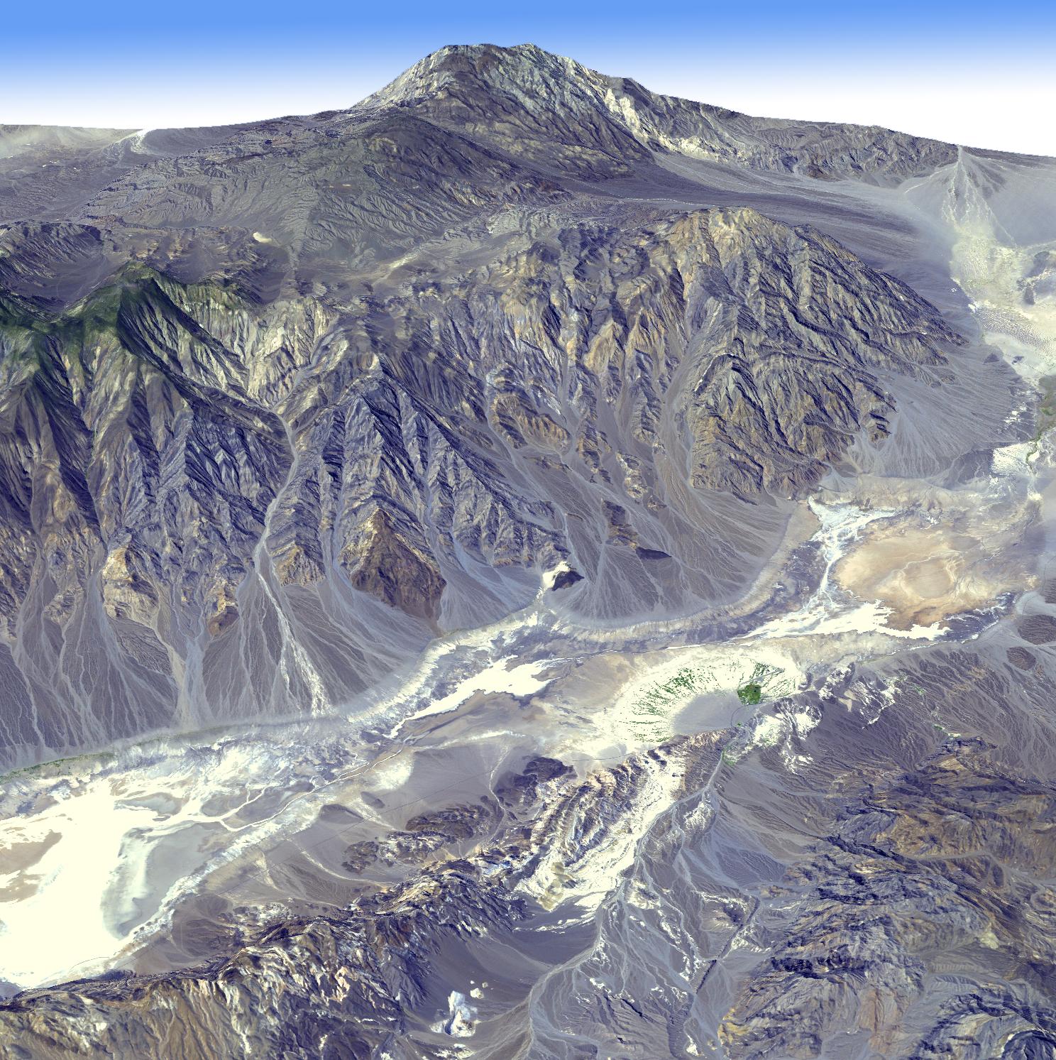
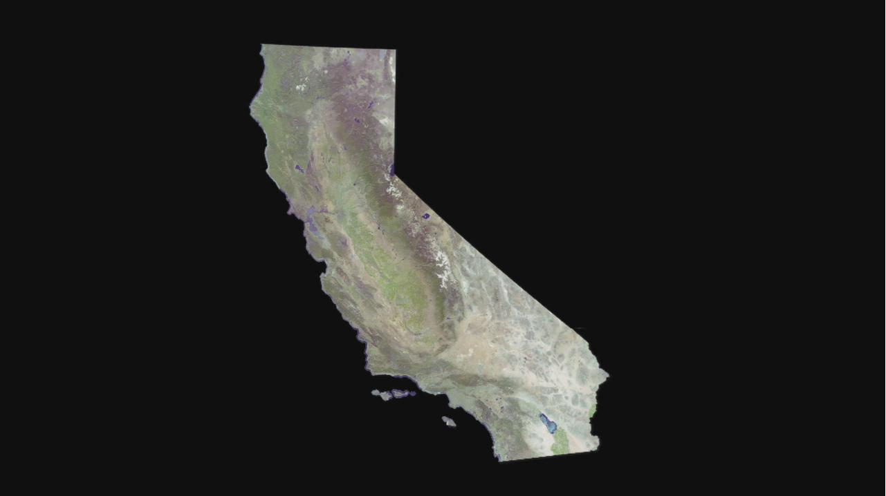
2009-06-29 |
Earth
|
Terra
|
ASTER
|
1281x718x3 |
|
-
PIA12094:
-
Cruising Over California
Full Resolution:
TIFF
(2.762 MB)
JPEG
(37.04 kB)
|
|
|
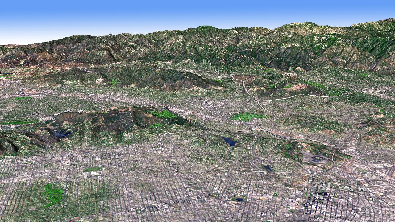
2009-06-29 |
Earth
|
Terra
|
ASTER
|
1280x720x3 |
|
-
PIA12095:
-
Cruising Over Los Angeles
Full Resolution:
TIFF
(2.768 MB)
JPEG
(86.7 kB)
|
|
|
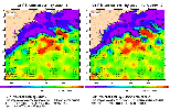
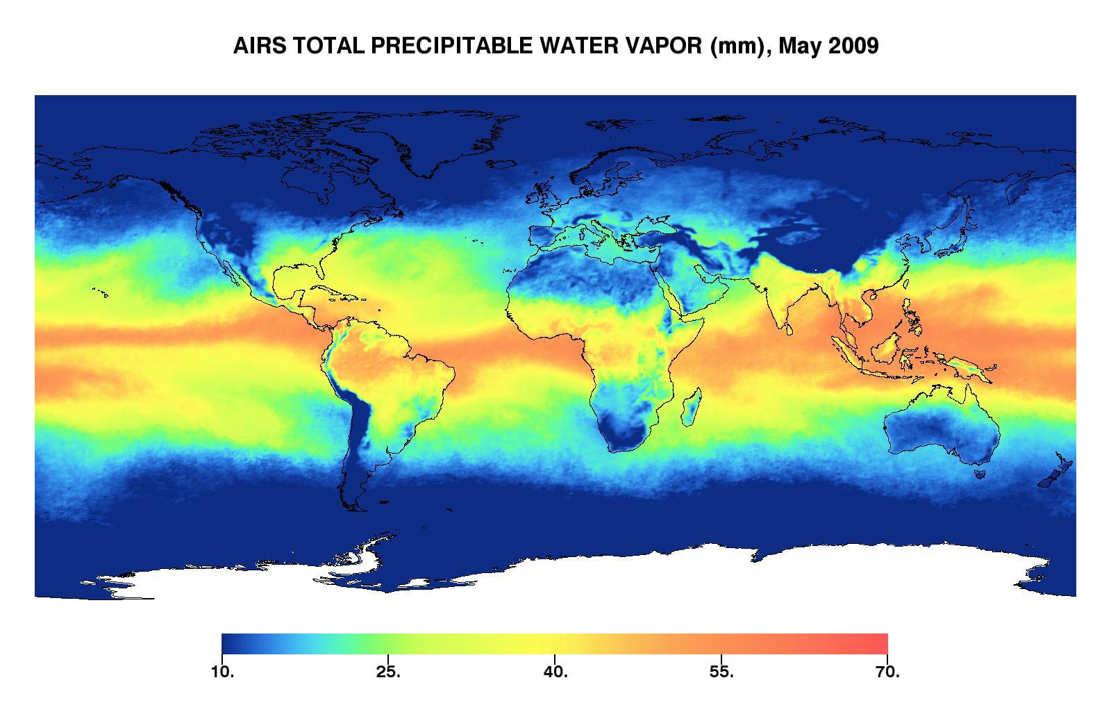
2009-06-30 |
Earth
|
Aqua
|
AIRS
|
1600x1025x3 |
|
-
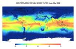
PIA12096:
-
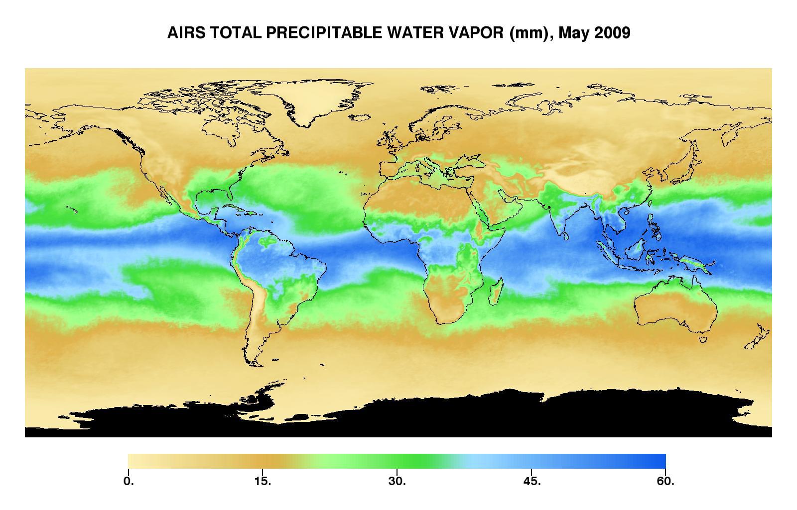
Global Total Precipitable Water Vapor for May 2009
Full Resolution:
TIFF
(4.928 MB)
JPEG
(173.4 kB)
|
|
|
2009-06-30 |
Earth
|
Aqua
|
AIRS
|
1600x1025x3 |
|
-
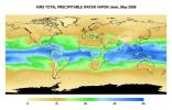
PIA12097:
-
Global Total Precipitable Water Vapor for May 2009
Full Resolution:
TIFF
(4.928 MB)
JPEG
(187.7 kB)
|
|
|
2009-06-30 |
Earth
|
Aqua
|
AIRS
|
1600x1025x3 |
|
-
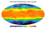
PIA12098:
-
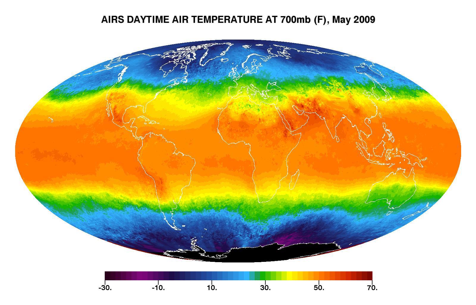
Global Daytime Air Temperature for May 2009
Full Resolution:
TIFF
(4.928 MB)
JPEG
(198.8 kB)
|
|
|
2009-07-02 |
Moon
|
Lunar Reconnaissance Orbiter (LRO)
|
Lunar Reconnaissance Orbiter Camera (NAC)
|
1000x1000x1 |
|
-
PIA12884:
-
First LROC Images
Full Resolution:
TIFF
(1.001 MB)
JPEG
(160.3 kB)
|
|
|
2009-07-03 |
Moon
|
Lunar Reconnaissance Orbiter (LRO)
|
Lunar Reconnaissance Orbiter Camera (NAC)
|
1000x1000x1 |
|
-
PIA12885:
-
Swooping over the Lunar Highlands
Full Resolution:
TIFF
(1.001 MB)
JPEG
(192.9 kB)
|
|
|
2009-07-07 |
Moon
|
Lunar Reconnaissance Orbiter (LRO)
|
Lunar Reconnaissance Orbiter Camera (NAC)
|
1000x1000x1 |

|
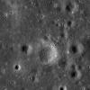
-
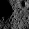
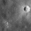
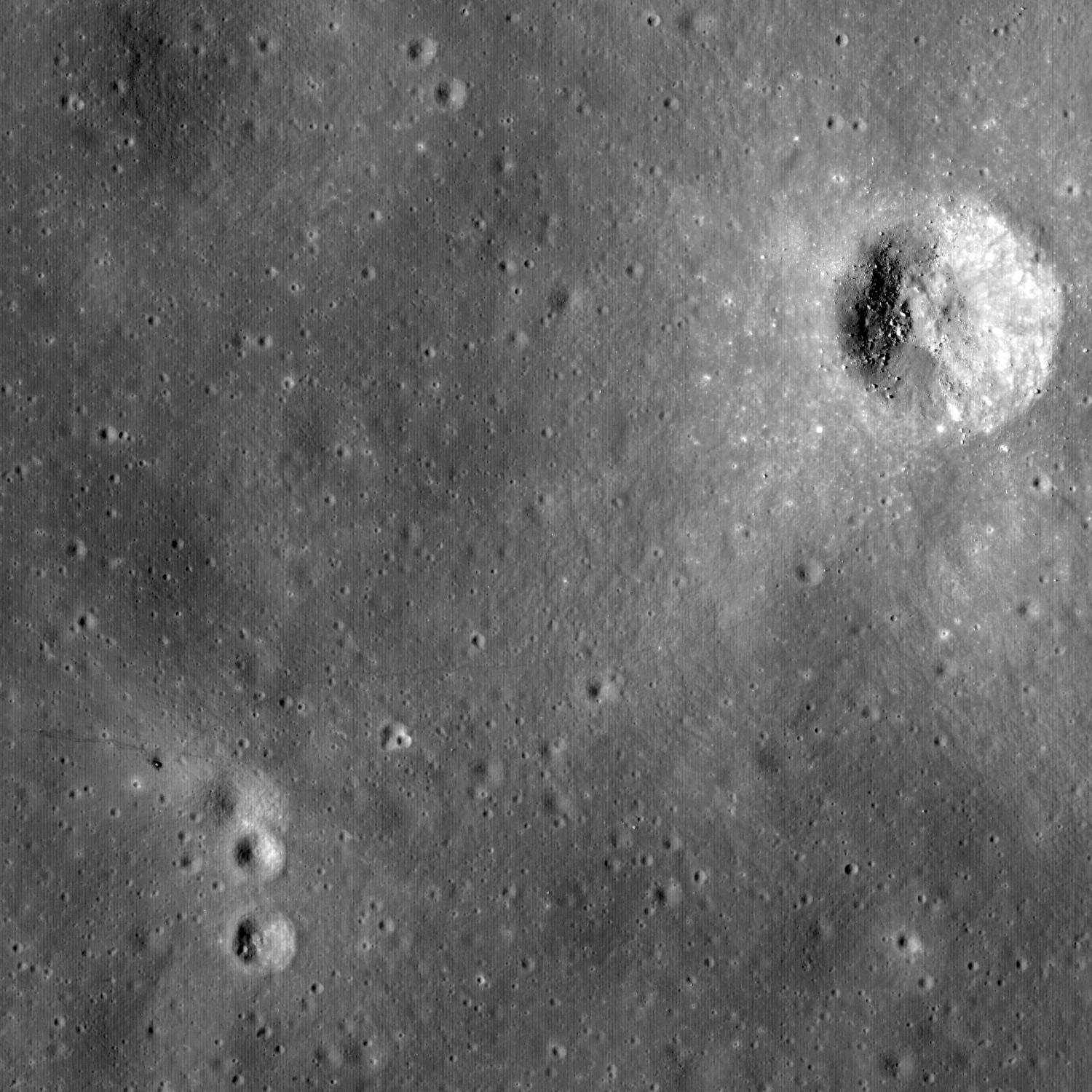
PIA12886:
-
Scanning Towards the North Pole
Full Resolution:
TIFF
(1.001 MB)
JPEG
(128.2 kB)
|
|
|
2009-07-10 |
Moon
|
Lunar Reconnaissance Orbiter (LRO)
|
Lunar Reconnaissance Orbiter Camera (NAC)
|
1000x1000x1 |
|
-
PIA12887:
-
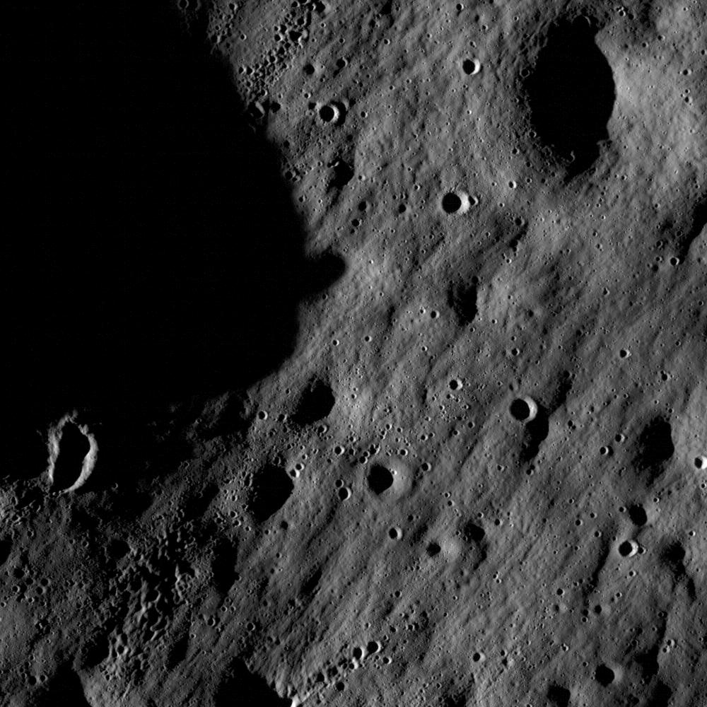
The Fractured Floor of Compton
Full Resolution:
TIFF
(1.001 MB)
JPEG
(146.3 kB)
|
|
|
2009-07-13 |
Moon
|
Lunar Reconnaissance Orbiter (LRO)
|
Lunar Reconnaissance Orbiter Camera (WAC)
|
1000x1000x1 |
|
-
PIA12888:
-
Mapping the Moon with the Wide Angle Camera
Full Resolution:
TIFF
(1.001 MB)
JPEG
(147.6 kB)
|
|
|
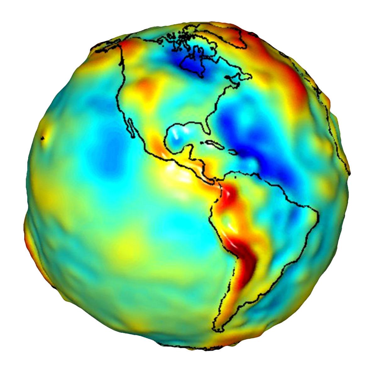
2009-07-15 |
Earth
|
GRACE
|
K-Band Ranging System
|
1200x1200x3 |
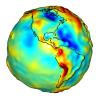
|
-
PIA12132:
-
Global Gravity: North and South America
Full Resolution:
TIFF
(4.325 MB)
JPEG
(105.9 kB)
|
|
|
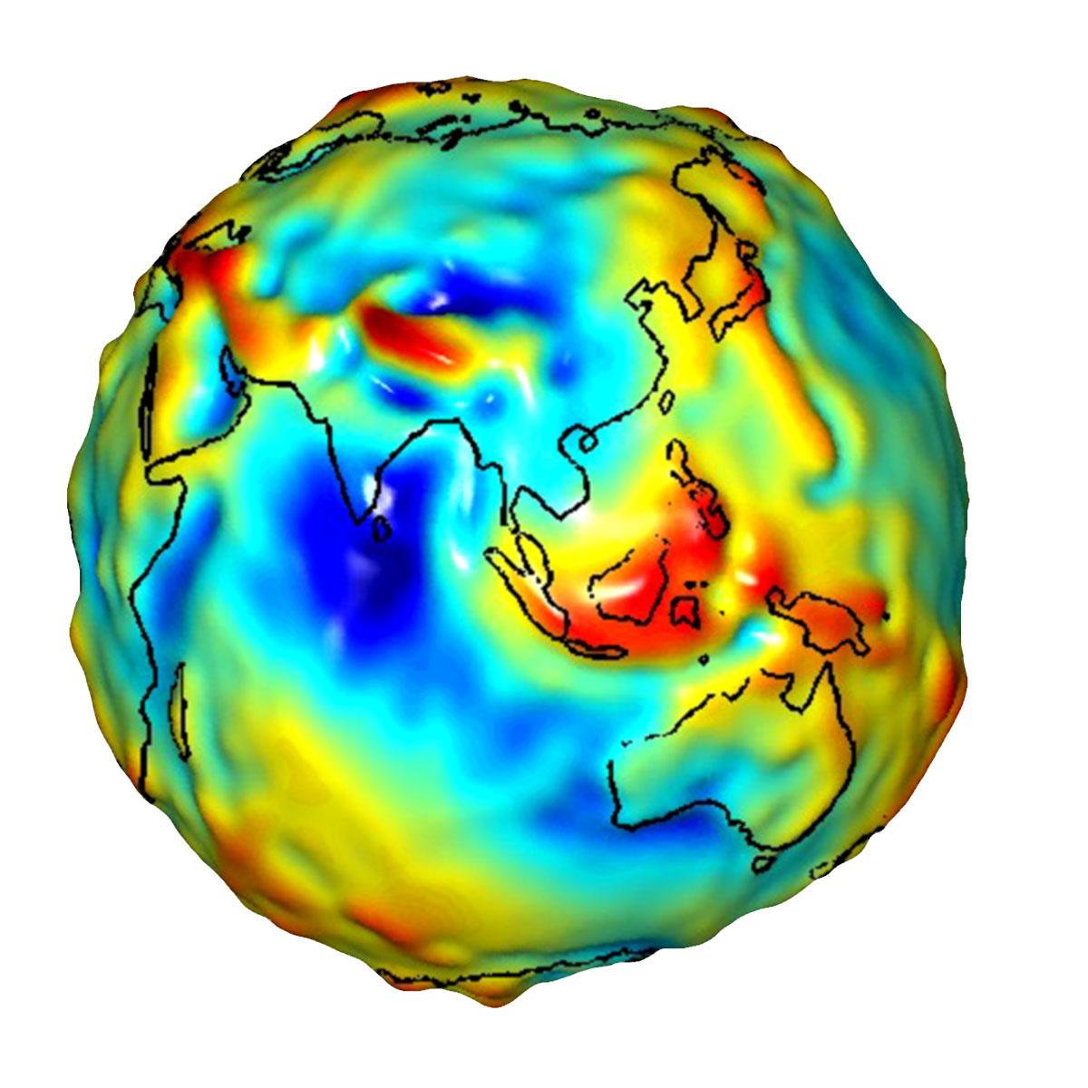
2009-07-15 |
Earth
|
GRACE
|
K-Band Ranging System
|
1200x1200x3 |
|
-
PIA12133:
-
Global Gravity: Asia and Australia
Full Resolution:
TIFF
(4.325 MB)
JPEG
(118.3 kB)
|
|
|
2009-07-17 |
Moon
|
Lunar Reconnaissance Orbiter (LRO)
|
Lunar Reconnaissance Orbiter Camera (NAC)
|
936x592x1 |
|
-
PIA12889:
-
LROC's First Look at the Apollo Landing Sites
Full Resolution:
TIFF
(554.9 kB)
JPEG
(40.3 kB)
|
|
|
2009-07-17 |
Earth
|
GRACE
|
K-Band Ranging System
|
455x455x3 |
|
-
PIA12146:
-
GRACE Global Gravity Animation
Full Resolution:
TIFF
(209 kB)
JPEG
(35.98 kB)
|
|
|
2009-07-21 |
Moon
|
Lunar Reconnaissance Orbiter (LRO)
|
Lunar Reconnaissance Orbiter Camera (NAC)
|
1000x1000x3 |
|
-
PIA12890:
-
The Moon in 3-D
Full Resolution:
TIFF
(3.004 MB)
JPEG
(145.4 kB)
|
|
|
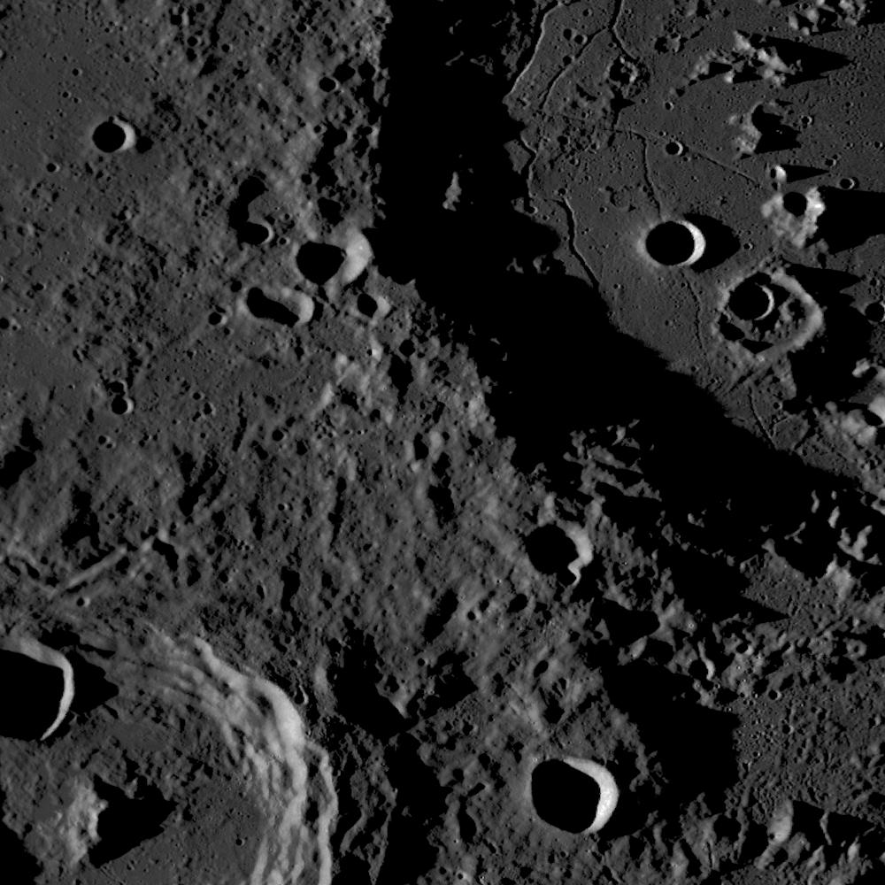
2009-07-27 |
Moon
|
Lunar Reconnaissance Orbiter (LRO)
|
Lunar Reconnaissance Orbiter Camera (NAC)
|
1000x1000x1 |

|
-
PIA12891:
-
Relative Timing of Geologic Events in Mare Frigoris
Full Resolution:
TIFF
(1.001 MB)
JPEG
(104.6 kB)
|
|
|
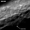
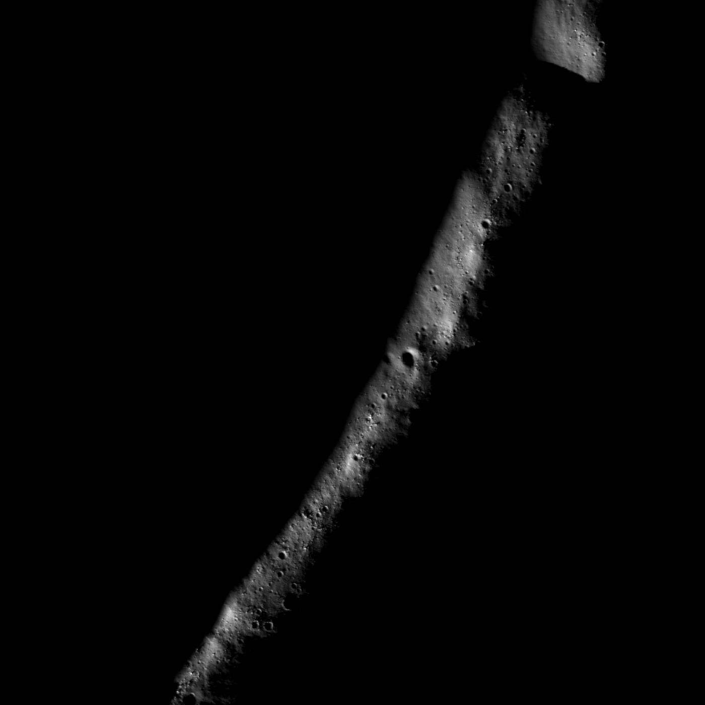
2009-07-28 |
Moon
|
Lunar Reconnaissance Orbiter (LRO)
|
Lunar Reconnaissance Orbiter Camera (NAC)
|
1500x1500x1 |

|
-
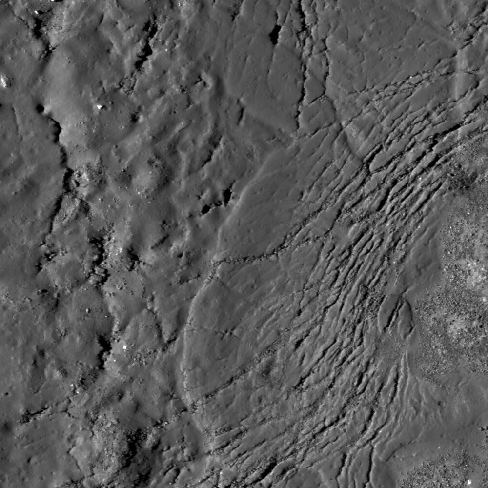
PIA12892:
-
Terraced Wall in B�rg Crater
Full Resolution:
TIFF
(2.253 MB)
JPEG
(213.6 kB)
|
|
|
2009-08-03 |
Moon
|
Lunar Reconnaissance Orbiter (LRO)
|
Lunar Reconnaissance Orbiter Camera (NAC)
|
1000x1000x1 |
|
-
PIA12893:
-
Bright Crater Rays and Boulders
Full Resolution:
TIFF
(1.001 MB)
JPEG
(109.6 kB)
|
|
|
2009-08-03 |
Moon
|
Chandrayaan-1
|
Moon Mineralogy Mapper
|
1709x669x3 |

|
-
PIA12158:
-
Moon Mapper Looks Homeward
Full Resolution:
TIFF
(3.436 MB)
JPEG
(43.77 kB)
|
|
|
2009-08-04 |
Moon
|
Lunar Reconnaissance Orbiter (LRO)
|
Lunar Reconnaissance Orbiter Camera (NAC)
|
1000x1000x1 |

|
-
PIA12894:
-
Hummocks and Blocks and Craters
Full Resolution:
TIFF
(1.001 MB)
JPEG
(170.8 kB)
|
|
|
2009-08-05 |
Moon
|
Lunar Reconnaissance Orbiter (LRO)
|
Lunar Reconnaissance Orbiter Camera (NAC)
|
1000x1000x1 |
|
-
PIA12895:
-
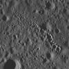
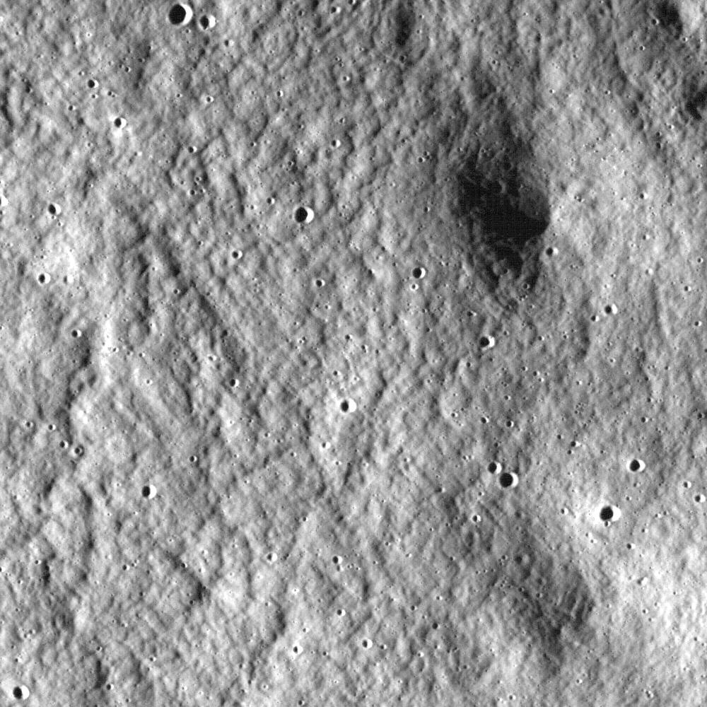
Stream of Secondary Craters
Full Resolution:
TIFF
(1.001 MB)
JPEG
(181.3 kB)
|
|
|
2009-08-13 |
Earth
|
Aura
|
TES
|
800x600x3 |

|
-
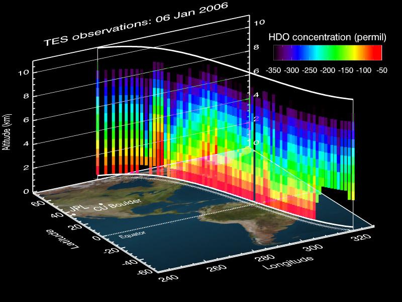
PIA12170:
-
A NASA Space Sleuth Hunts the Trail of Earth's Water
Full Resolution:
TIFF
(1.442 MB)
JPEG
(75.35 kB)
|
|
|
2009-08-18 |
Moon
|
Lunar Reconnaissance Orbiter (LRO)
|
Lunar Reconnaissance Orbiter Camera (NAC)
|
1200x1200x1 |
|
-
PIA12896:
-
Rille within a Rille
Full Resolution:
TIFF
(1.442 MB)
JPEG
(166.3 kB)
|
|
|
2009-08-18 |
Earth
|
Terra
|
ASTER
|
1492x1488x3 |
|
-
PIA12177:
-
Lhasa, Tibet, China
Full Resolution:
TIFF
(6.672 MB)
JPEG
(548.2 kB)
|
|
|
2009-08-19 |
Moon
|
Lunar Reconnaissance Orbiter (LRO)
|
Lunar Reconnaissance Orbiter Camera (NAC)
|
1500x1500x1 |
|
-
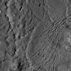
PIA12897:
-
Trail of Discovery at Fra Mauro
Full Resolution:
TIFF
(2.253 MB)
JPEG
(315 kB)
|
|
|
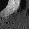
2009-08-21 |
Moon
|
Lunar Reconnaissance Orbiter (LRO)
|
Lunar Reconnaissance Orbiter Camera (NAC)
|
1000x1000x1 |
|
-
PIA12898:
-
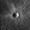
Necho Crater
Full Resolution:
TIFF
(1.001 MB)
JPEG
(152 kB)
|
|
|
2009-08-21 |
Earth
|
CloudSat
|
AMSR-E
Cloud Profiling Radar (CPR)
MODIS
|
1728x1108x3 |
|
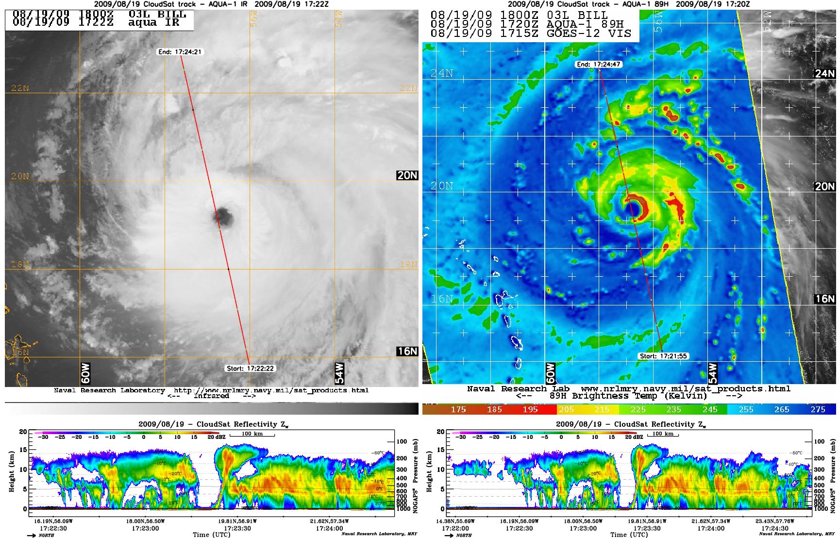
-
PIA12179:
-
Hurricane Bill Eye Overpass
Full Resolution:
TIFF
(5.753 MB)
JPEG
(381.1 kB)
|
|
|
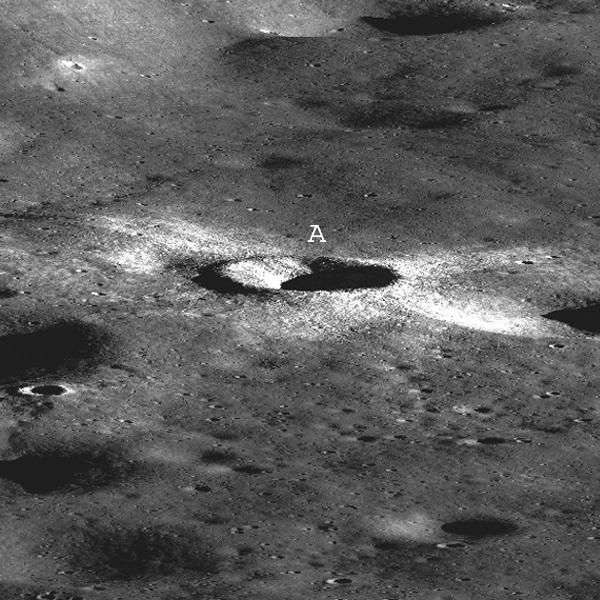
2009-08-24 |
Moon
|
Lunar Reconnaissance Orbiter (LRO)
|
Lunar Reconnaissance Orbiter Camera (NAC)
|
1400x1400x1 |

|
-
PIA12899:
-
Eternal Darkness Near the North Pole
Full Resolution:
TIFF
(1.962 MB)
JPEG
(51.46 kB)
|
|
|
2009-08-25 |
Moon
|
Lunar Reconnaissance Orbiter (LRO)
|
Lunar Reconnaissance Orbiter Camera (NAC)
|
600x600x1 |

|
-
PIA12900:
-
First LROC Stereo Results
Full Resolution:
TIFF
(360.6 kB)
JPEG
(76.02 kB)
|
|
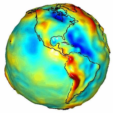
|
2009-08-27 |
Earth
|
GRACE
|
K-Band Ranging System
|
778x778x3 |

|
-
PIA12188:
-
New Look at Gravity Data Sheds Light on Ocean and Climate
Full Resolution:
TIFF
(1.818 MB)
JPEG
(96.21 kB)
|
|
|
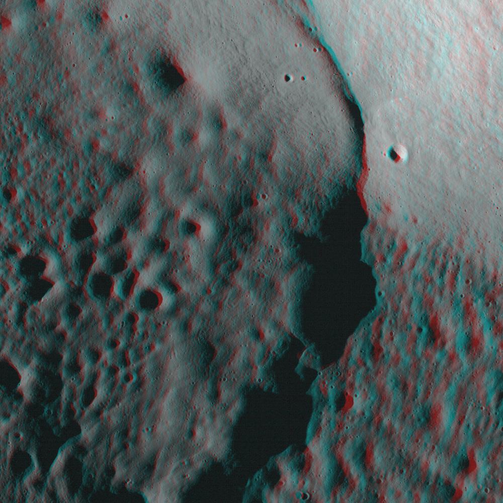
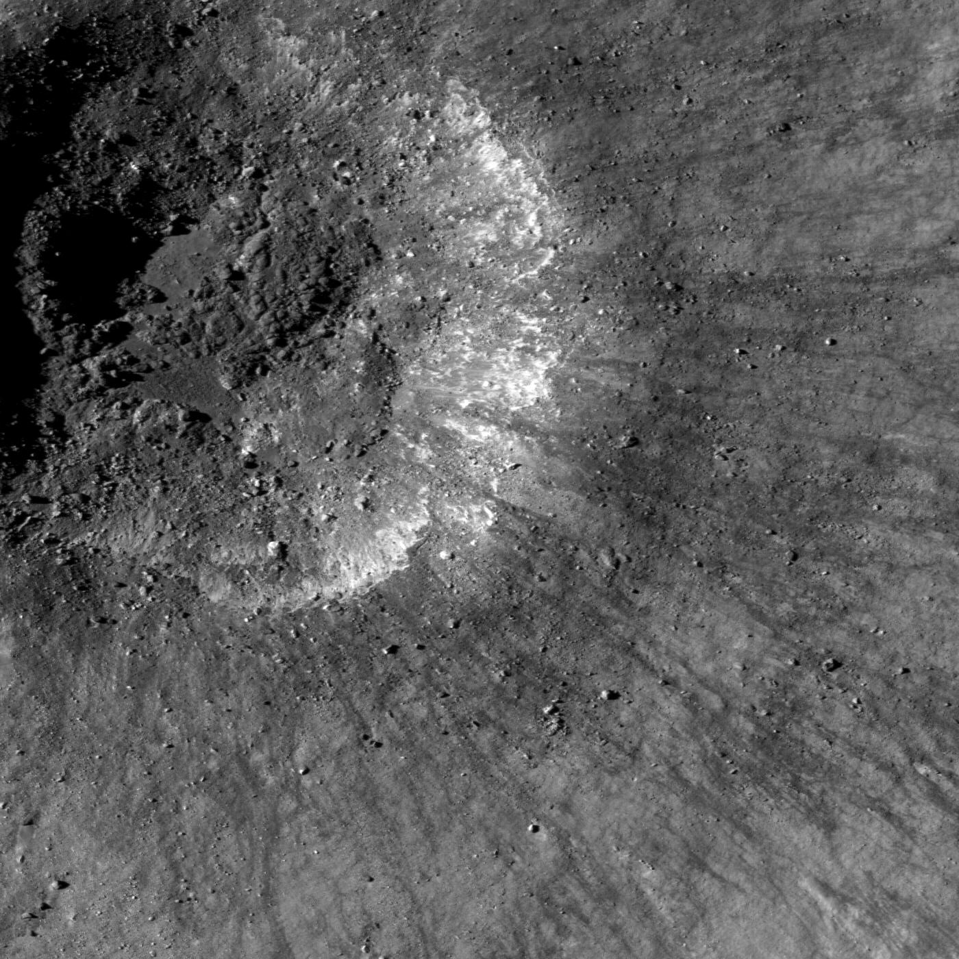
2009-08-31 |
Moon
|
Lunar Reconnaissance Orbiter (LRO)
|
Lunar Reconnaissance Orbiter Camera (NAC)
|
1400x1400x1 |

|
-
PIA12901:
-
Recent Impact
Full Resolution:
TIFF
(1.962 MB)
JPEG
(359.5 kB)
|
|
|
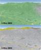
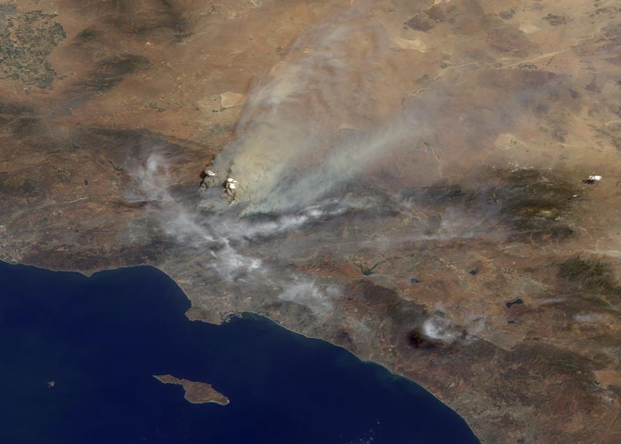
2009-09-01 |
Earth
|
Terra
|
MISR
|
891x638x3 |

|
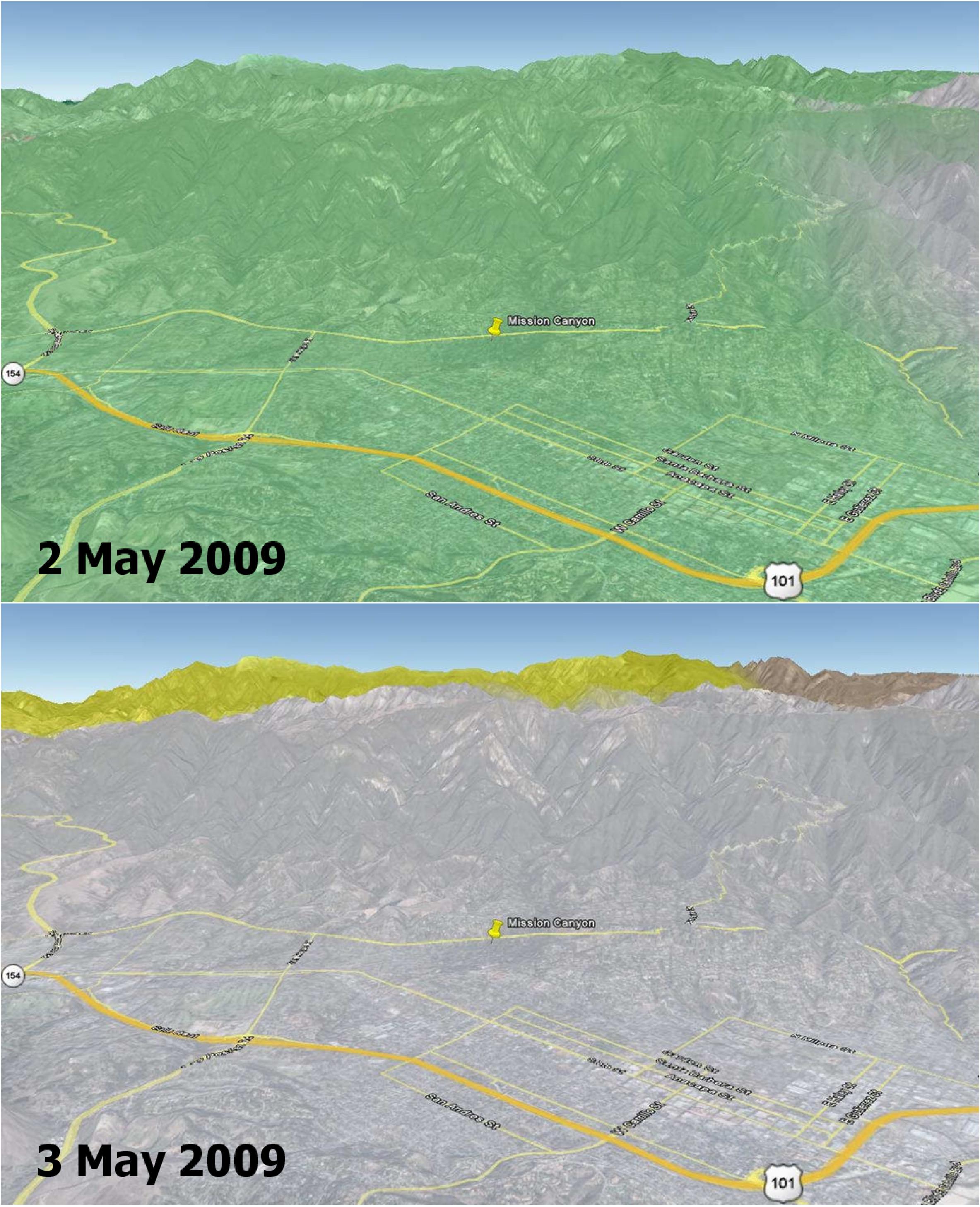
-
PIA12190:
-
Smoke from Station Fire Blankets Southern California
Full Resolution:
TIFF
(1.707 MB)
JPEG
(63.24 kB)
|
|
|
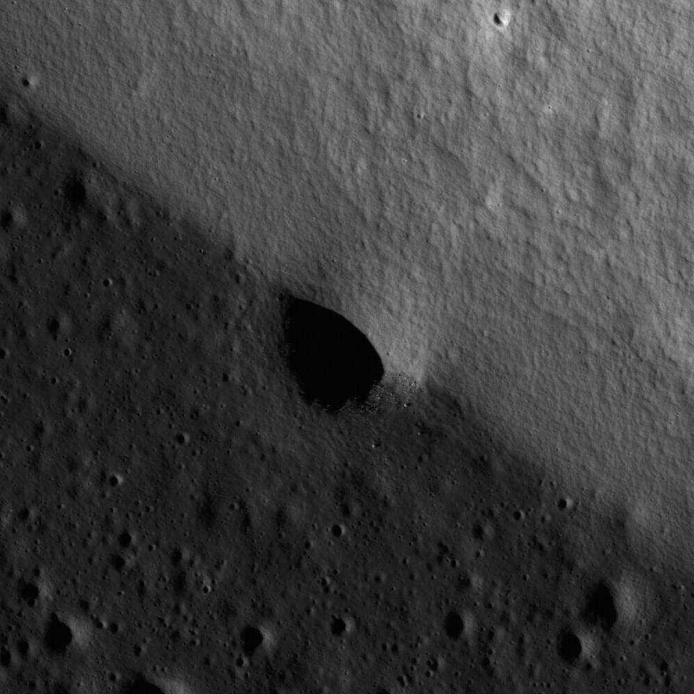
2009-09-01 |
Moon
|
Lunar Reconnaissance Orbiter (LRO)
|
Lunar Reconnaissance Orbiter Camera (NAC)
|
1600x1600x1 |
|
-
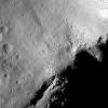
PIA12902:
-
Uplift, Boulders of Tsiolkovskiy
Full Resolution:
TIFF
(2.563 MB)
JPEG
(333.7 kB)
|
|
|
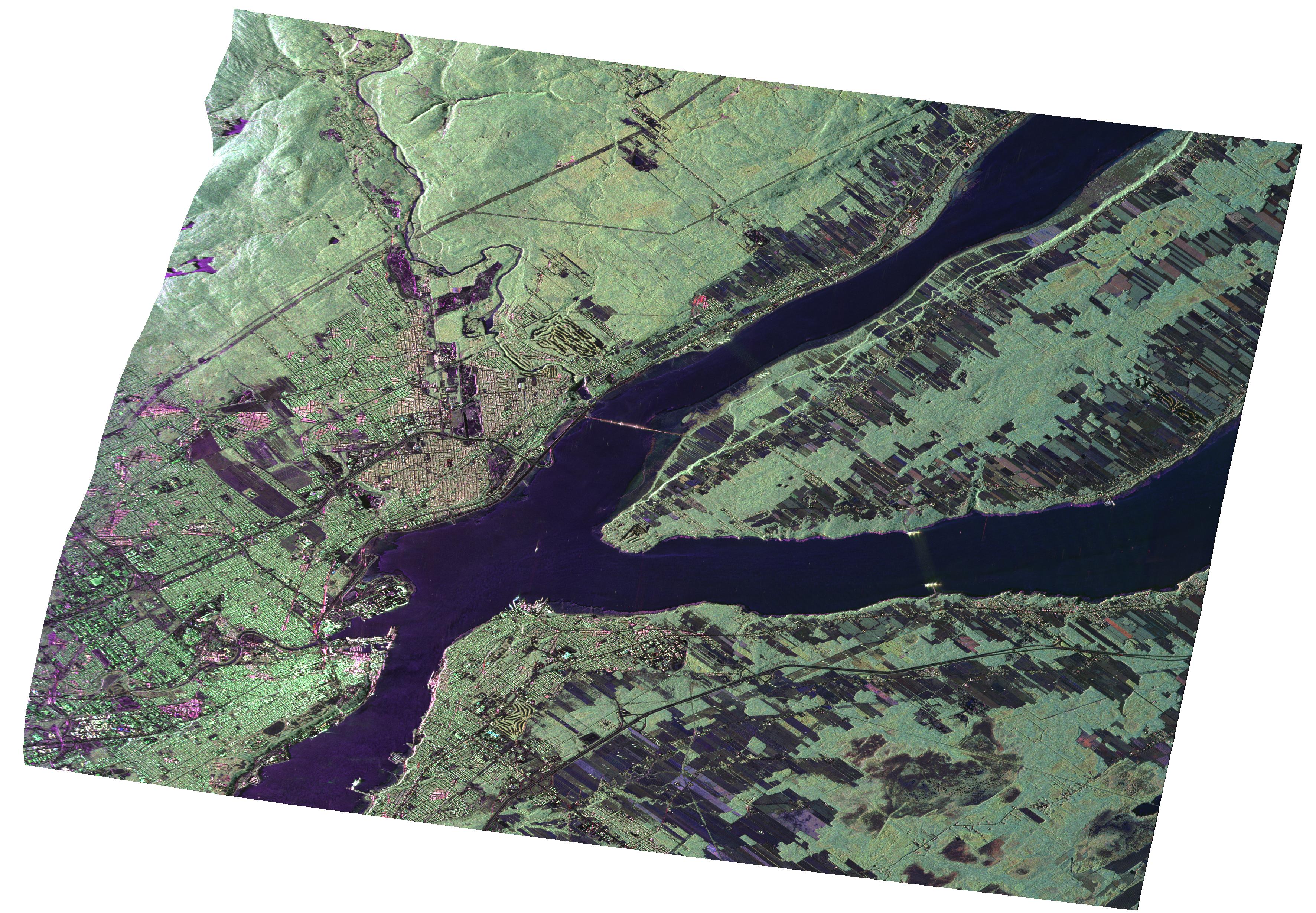
2009-09-01 |
Earth
|
UAVSAR
|
L-Band UAVSAR
|
3544x2458x3 |
|
-
PIA12189:
-
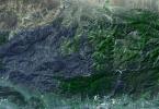
UAVSAR Radar Imagery of Boreal Forests Around Quebec City, Canada
Full Resolution:
TIFF
(26.13 MB)
JPEG
(1.734 MB)
|
|
|
2009-09-01 |
Earth
|
Terra
|
ASTER
|
1200x1000x3 |
|
-
PIA12303:
-
Solar Power, Seville, Spain
Full Resolution:
TIFF
(3.604 MB)
JPEG
(314.5 kB)
|
|
|
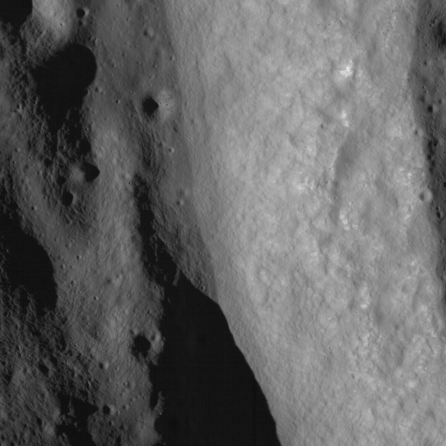
2009-09-03 |
Moon
|
Lunar Reconnaissance Orbiter (LRO)
|
Lunar Reconnaissance Orbiter Camera (NAC)
|
800x800x1 |
|
-
PIA12903:
-
First Look: Apollo 12 and Surveyor 3
Full Resolution:
TIFF
(640.9 kB)
JPEG
(100.5 kB)
|
|
|
2009-09-04 |
Earth
|
Aqua
|
AIRS
|
640x500x3 |
|
-
PIA12195:
-
Concentration and Transport of Carbon Monoxide from the California Wildfires
Full Resolution:
TIFF
(961.2 kB)
JPEG
(32.29 kB)
|
|
|
2009-09-04 |
Earth
|
Terra
|
MISR
|
1014x810x3 |
|
-
PIA12196:
-
Smoke from Station Fire Blankets Southern California (Anaglyph)
Full Resolution:
TIFF
(2.467 MB)
JPEG
(90.65 kB)
|
|
|
2009-09-08 |
Earth
|
Terra
|
ASTER
|
3416x3492x3 |
|
-
PIA12197:
-
Extent of Station Fire Burn Seen in New NASA Image
Full Resolution:
TIFF
(35.79 MB)
JPEG
(2.482 MB)
|
|
|
2009-09-15 |
Earth
|
CloudSat
|
AMSR-E
Cloud Profiling Radar (CPR)
MODIS
|
960x616x3 |
|
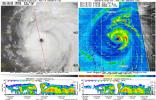
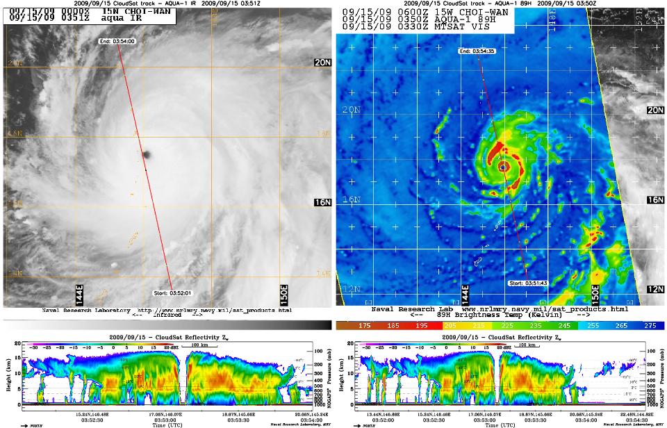
-
PIA12198:
-
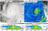
CloudSat Peers Into the Heart of a Super Typhoon
Full Resolution:
TIFF
(1.777 MB)
JPEG
(143.8 kB)
|
|
|
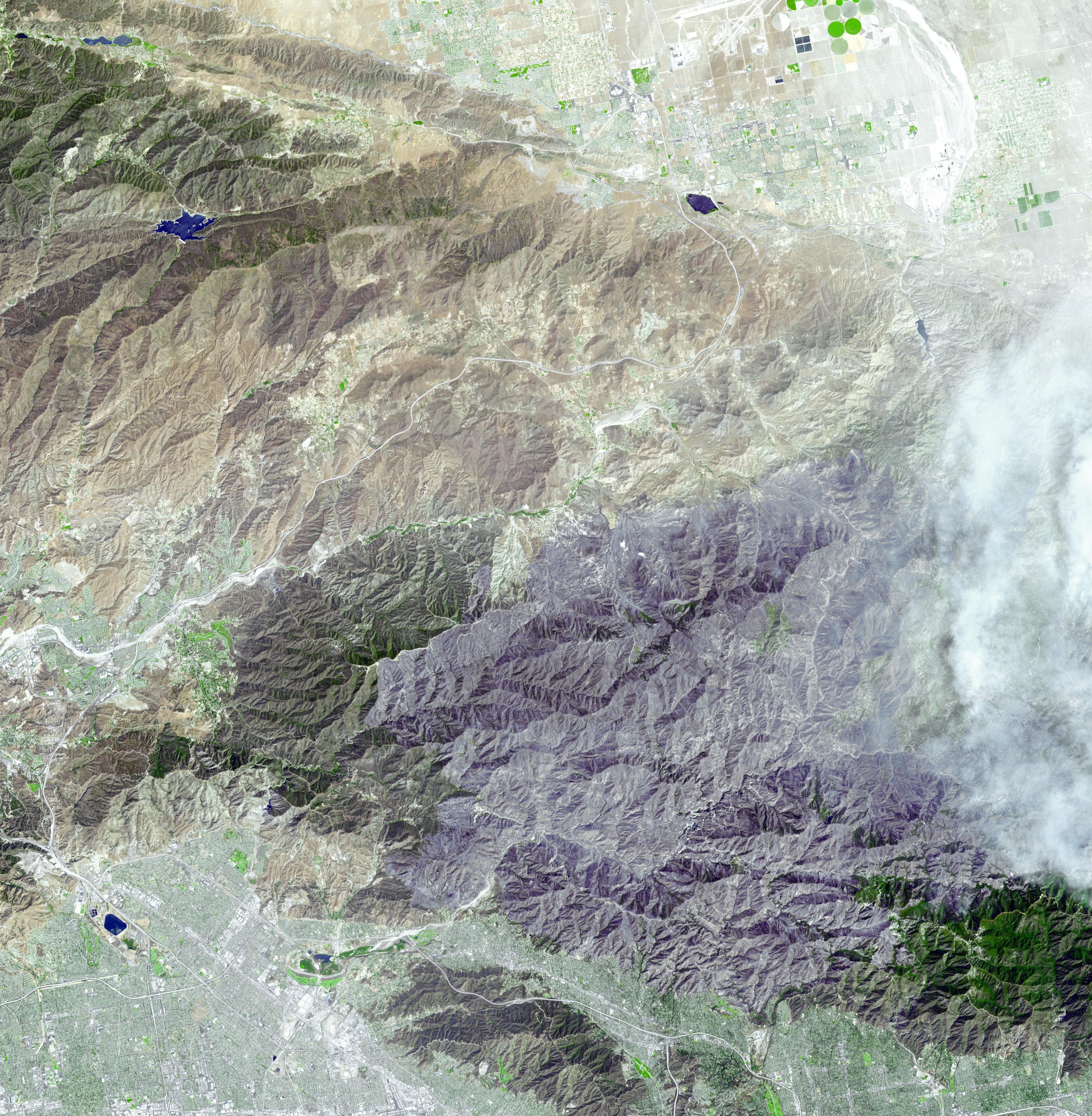
2009-09-15 |
Earth
|
Terra
|
ASTER
|
3920x2709x3 |
|
-
PIA12199:
-
Station Fire Burns in the San Gabriel Mountains Above Los Angeles
Full Resolution:
TIFF
(31.86 MB)
JPEG
(2.289 MB)
|
|
|
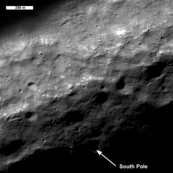
2009-09-17 |
Moon
|
Lunar Reconnaissance Orbiter (LRO)
|
Lunar Reconnaissance Orbiter Camera (NAC)
|
350x350x1 |
|
-
PIA12905:
-
Lunar South Pole - Out of the Shadows
Full Resolution:
TIFF
(122.9 kB)
JPEG
(19.07 kB)
|
|
|
2009-09-18 |
Moon
|
Lunar Reconnaissance Orbiter (LRO)
|
Lunar Reconnaissance Orbiter Camera (NAC)
|
350x350x1 |
|
-
PIA12906:
-
Milichius A
Full Resolution:
TIFF
(122.9 kB)
JPEG
(21.63 kB)
|
|
|
2009-09-21 |
Moon
|
Lunar Reconnaissance Orbiter (LRO)
|
Lunar Reconnaissance Orbiter Camera (NAC)
|
1200x1200x1 |

|
-
PIA12907:
-
Commissioning Sequences Pave the Way
Full Resolution:
TIFF
(1.442 MB)
JPEG
(217.4 kB)
|
|
|
2009-09-21 |
Earth
|
Terra
|
ASTER
|
6230x3300x3 |
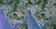
|
-
PIA12304:
-
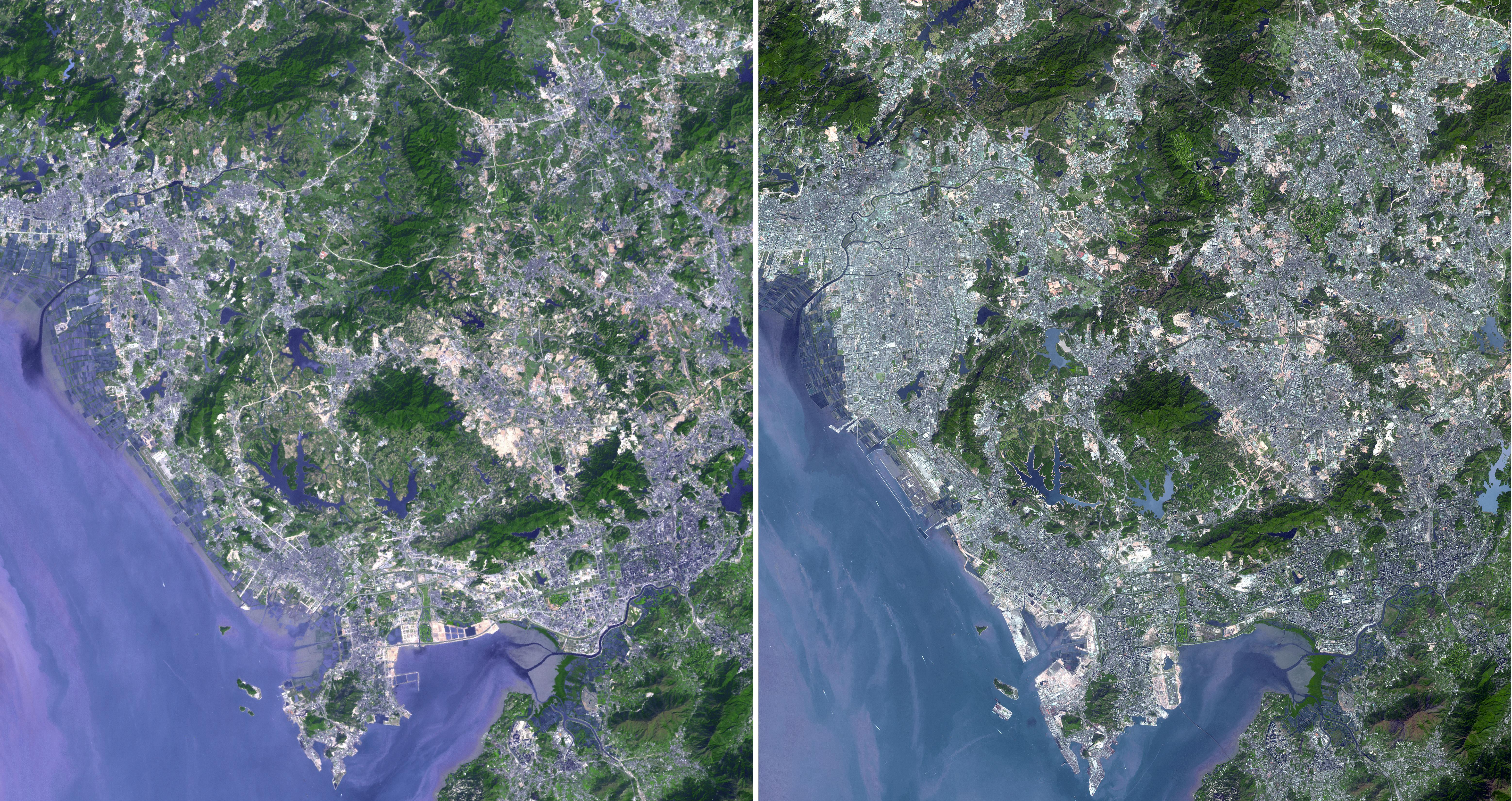
Shenzhen, PRC
Full Resolution:
TIFF
(61.68 MB)
JPEG
(4.722 MB)
|
|
|
2009-09-24 |
Moon
|
Deep Impact
|
|
1000x750x3 |
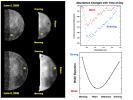
|
-
PIA12222:
-
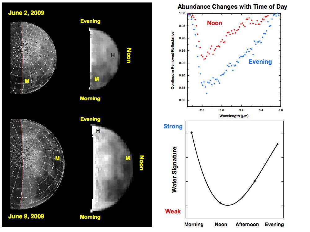
Water Abundances Change with Time of Day
Full Resolution:
TIFF
(2.253 MB)
JPEG
(86.12 kB)
|
|
|
2009-09-24 |
Moon
|
Deep Impact
|
|
1000x750x3 |

|
-
PIA12223:
-
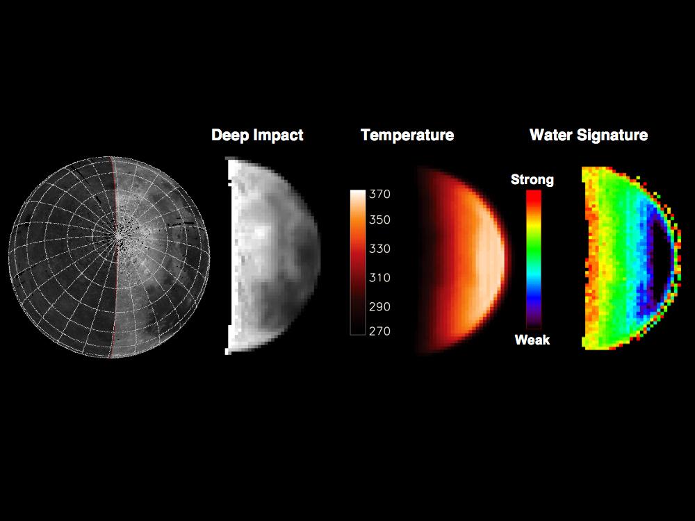
Water Abundance Dependent on Temperature
Full Resolution:
TIFF
(2.253 MB)
JPEG
(61.51 kB)
|
|
|
2009-09-24 |
Moon
|
Deep Impact
|
|
1000x495x3 |

|
-
PIA12224:
-
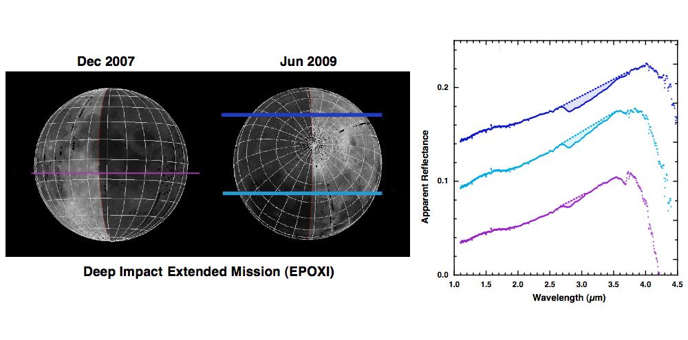
Deep Impact Identifies Water on the Lunar Surface
Full Resolution:
TIFF
(1.487 MB)
JPEG
(60.06 kB)
|


