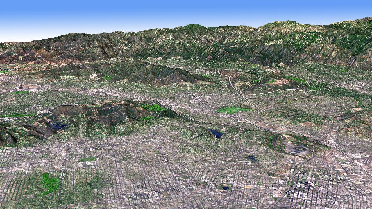
The Los Angeles Basin is bordered on the north by the San Gabriel Mountains. Other smaller basins are separated by smaller mountain ranges, like the Verdugo Hills, and the Santa Monica Mountains. In this perspective view looking to the northwest, Advanced Spaceborne Thermal Emission and Reflection Radiometer (ASTER) simulated natural color image data were draped over digital topography from the ASTER Global Digital Elevation Model (GDEM) data set. Dodger Stadium is visible in the lower right, and NASA's Jet Propulsion Laboratory is the light- colored area at the foot of the mountains in the upper right of the image. The ASTER data were acquired August 15, 2006, and are located near 34.1 degrees north latitude, 118.2 degrees west longitude.
With its 14 spectral bands from the visible to the thermal infrared wavelength region and its high spatial resolution of 15 to 90 meters (about 50 to 300 feet), ASTER images Earth to map and monitor the changing surface of our planet. ASTER is one of five Earth-observing instruments launched December 18, 1999, on NASA's Terra satellite. The instrument was built by Japan's Ministry of Economy, Trade and Industry. A joint U.S./Japan science team is responsible for validation and calibration of the instrument and the data products.
The broad spectral coverage and high spectral resolution of ASTER provides scientists in numerous disciplines with critical information for surface mapping and monitoring of dynamic conditions and temporal change. Example applications are: monitoring glacial advances and retreats; monitoring potentially active volcanoes; identifying crop stress; determining cloud morphology and physical properties; wetlands evaluation; thermal pollution monitoring; coral reef degradation; surface temperature mapping of soils and geology; and measuring surface heat balance.
The U.S. science team is located at NASA's Jet Propulsion Laboratory, Pasadena, Calif. The Terra mission is part of NASA's Science Mission Directorate.
More information about ASTER is available at http://asterweb.jpl.nasa.gov/.
 Planetary Data System


