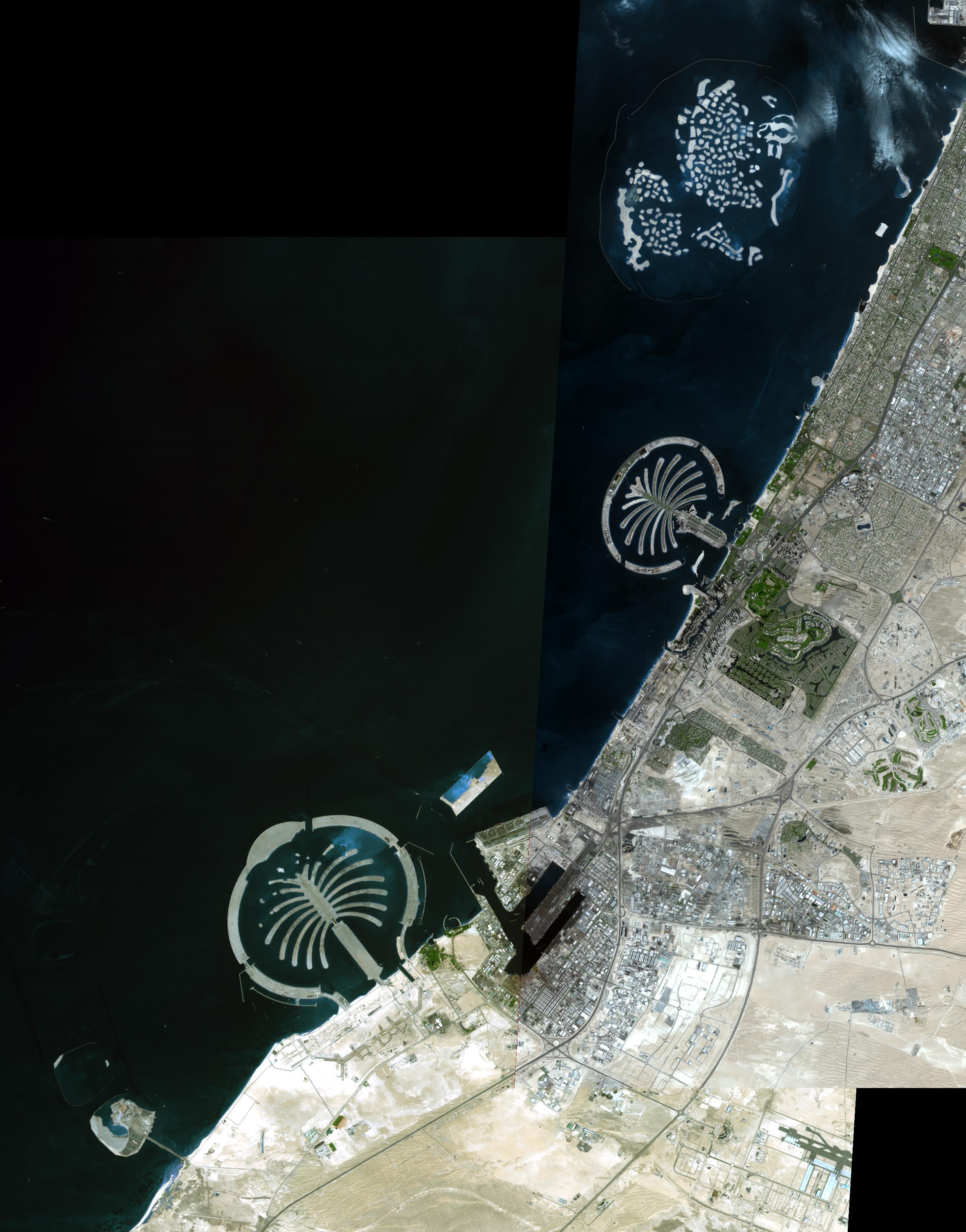
The Palm Islands are artificial islands in Dubai, United Arab emirates on which major commercial and residential structures are being built. Palm Jumeirah was the first completed, followed by Palm Jebel Ali. The third, Palm Deira, is still under development. All together the three islands will add 520 km of beaches to the city of Dubai. To the north is The World, an archipelago of 300 islands constructed in the shape of the world map. Each island is individually for sale, and over two-thirds have been sold for residential and commercial use.
The image is a mosaic of two scenes, acquired November 17 and December 10, 2008. They cover an area of 16.6 x 21.2 km, and are located near 25.1 degrees north latitude, 55.4 east longitude.
With its 14 spectral bands from the visible to the thermal infrared wavelength region and its high spatial resolution of 15 to 90 meters (about 50 to 300 feet), ASTER images Earth to map and monitor the changing surface of our planet. ASTER is one of five Earth-observing instruments launched December 18, 1999, on NASA's Terra satellite. The instrument was built by Japan's Ministry of Economy, Trade and Industry. A joint U.S./Japan science team is responsible for validation and calibration of the instrument and the data products.
The broad spectral coverage and high spectral resolution of ASTER provides scientists in numerous disciplines with critical information for surface mapping and monitoring of dynamic conditions and temporal change. Example applications are: monitoring glacial advances and retreats; monitoring potentially active volcanoes; identifying crop stress; determining cloud morphology and physical properties; wetlands evaluation; thermal pollution monitoring; coral reef degradation; surface temperature mapping of soils and geology; and measuring surface heat balance.
The U.S. science team is located at NASA's Jet Propulsion Laboratory, Pasadena, Calif. The Terra mission is part of NASA's Science Mission Directorate.
More information about ASTER is available at http://asterweb.jpl.nasa.gov/.
