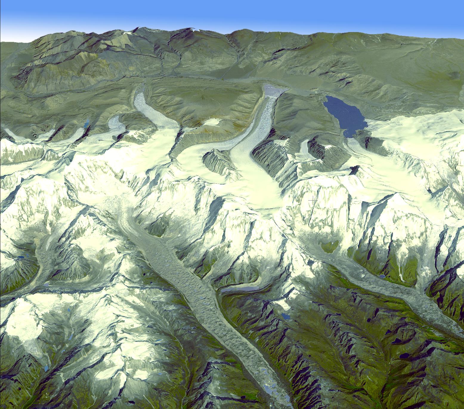
In the Bhutan Himalayas, Advanced Spaceborne Thermal Emission and Reflection Radiometer data have revealed significant spatial variability in glacier flow, such that the glacier velocities in the end zones on the south side exhibit significantly lower velocities (9 to 18 meters, or 30 to60 feet per year), versus much higher flow velocities on the north side (18 to 183 meters, or 60 to600 feet per year). The higher velocity for the northern glaciers suggests that the southern glaciers have substantially stagnated ice. This view looking towards the northwest was created by draping an ASTER simulated natural color image over digital topography from the ASTER Global Digital Elevation Model (GDEM) data set. The ASTER scene was acquired November 20, 2001, and is centered near 28.3 degrees north latitude, 90.1 degrees east longitude.
With its 14 spectral bands from the visible to the thermal infrared wavelength region and its high spatial resolution of 15 to 90 meters (about 50 to 300 feet), ASTER images Earth to map and monitor the changing surface of our planet. ASTER is one of five Earth-observing instruments launched December 18, 1999, on NASA's Terra satellite. The instrument was built by Japan's Ministry of Economy, Trade and Industry. A joint U.S./Japan science team is responsible for validation and calibration of the instrument and the data products.
The broad spectral coverage and high spectral resolution of ASTER provides scientists in numerous disciplines with critical information for surface mapping and monitoring of dynamic conditions and temporal change. Example applications are: monitoring glacial advances and retreats; monitoring potentially active volcanoes; identifying crop stress; determining cloud morphology and physical properties; wetlands evaluation; thermal pollution monitoring; coral reef degradation; surface temperature mapping of soils and geology; and measuring surface heat balance.
The U.S. science team is located at NASA's Jet Propulsion Laboratory, Pasadena, Calif. The Terra mission is part of NASA's Science Mission Directorate.
More information about ASTER is available at http://asterweb.jpl.nasa.gov/.
 Planetary Data System


