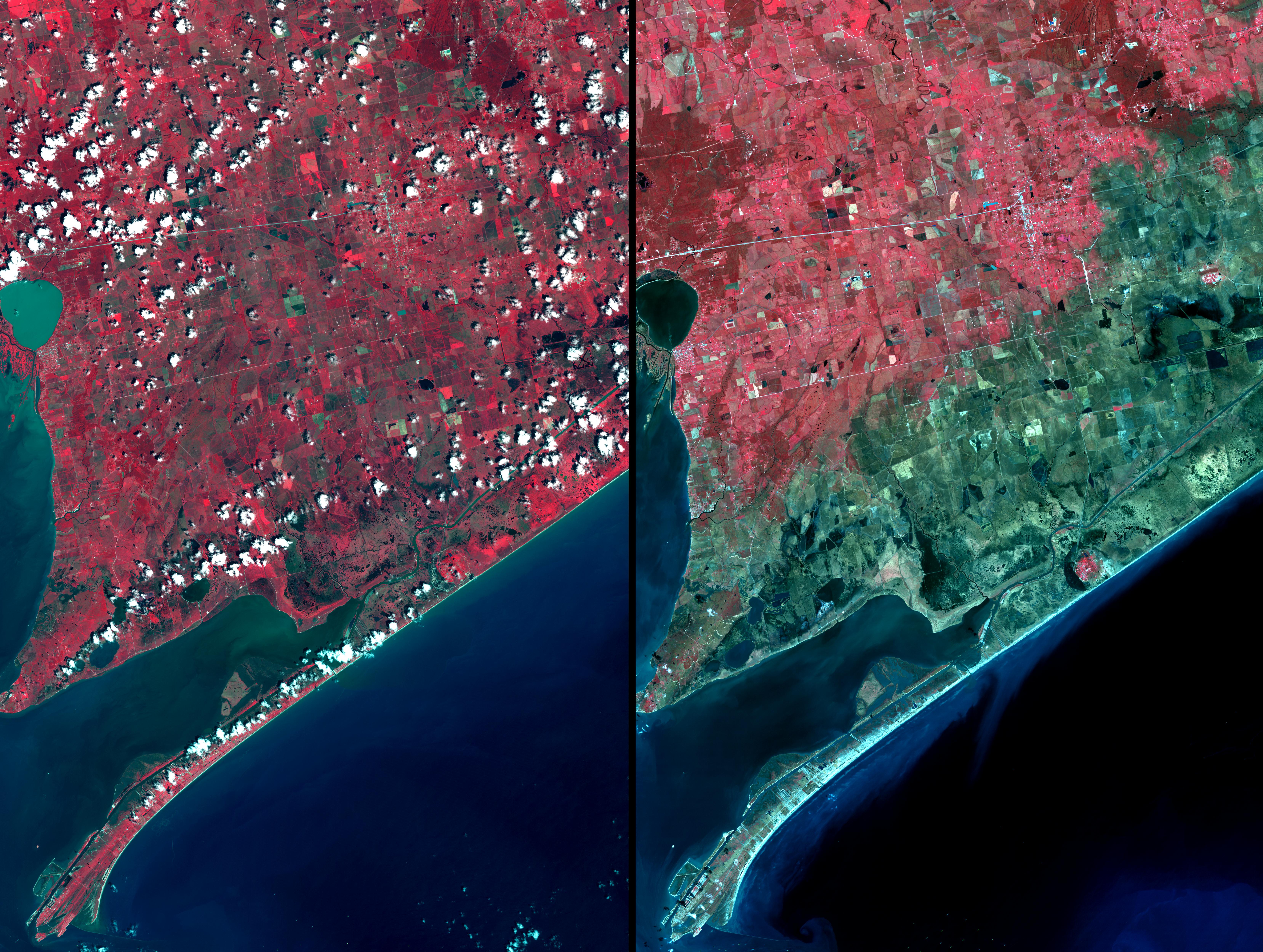
Three weeks after Hurricane Ike came ashore near Galveston, TX, residents returned to find their houses in ruins. From the coast to over 15 km inland, salt water saturated the soil as a result of the 7m storm surge pushed ashore by the force of the hurricane. The right image was acquired on September 28; the left image was acquired August 15, 2006. Vegetation is displayed in red, and inundated areas are in blue-green. Within the inundated area are several small "red islands" of high ground where salt domes raised the level of the land, and protected the vegetation.
With its 14 spectral bands from the visible to the thermal infrared wavelength region, and its high spatial resolution of 15 to 90 meters (about 50 to 300 feet), ASTER images Earth to map and monitor the changing surface of our planet.
ASTER is one of five Earth-observing instruments launched December 18, 1999, on NASA's Terra satellite. The instrument was built by Japan's Ministry of Economy, Trade and Industry. A joint U.S./Japan science team is responsible for validation and calibration of the instrument and the data products.
The broad spectral coverage and high spectral resolution of ASTER provides scientists in numerous disciplines with critical information for surface mapping, and monitoring of dynamic conditions and temporal change. Example applications are: monitoring glacial advances and retreats; monitoring potentially active volcanoes; identifying crop stress; determining cloud morphology and physical properties; wetlands evaluation; thermal pollution monitoring; coral reef degradation; surface temperature mapping of soils and geology; and measuring surface heat balance.
The U.S. science team is located at NASA's Jet Propulsion Laboratory, Pasadena, Calif. The Terra mission is part of NASA's Science Mission Directorate.
Size: 37 by 49.5 kilometers (22.8 by 30.6 miles)
Location: 29.8 degrees North latitude, 94.4 degrees West longitude
Orientation: North at top
Image Data: ASTER Bands 3, 2, and 1
Original Data Resolution: 15 meters (49.2 feet)
Date Acquired: September 28, 2008
