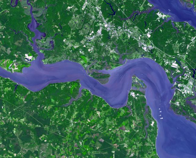
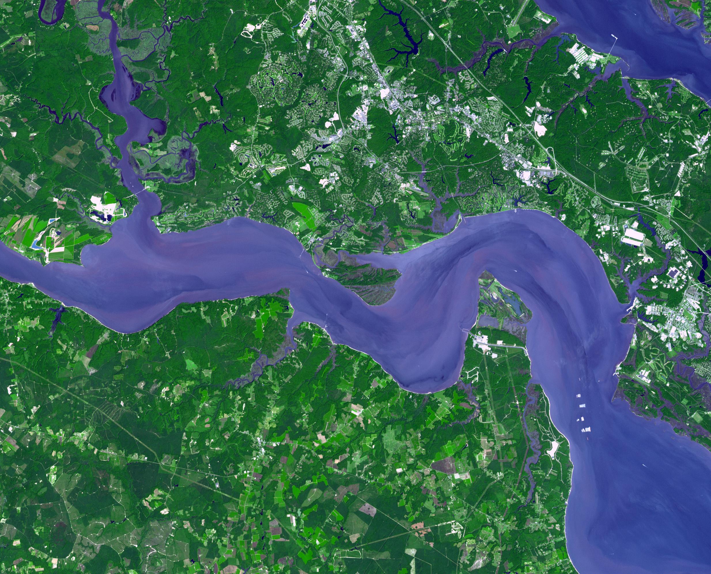
Jamestown, located on Jamestown Island in the Virginia Colony, was founded on May 14, 1607. It is commonly regarded as the first permanent English settlement in what is now the United States, following several earlier failed attempts. It was founded by the Virginia Company, headquartered in London. The location at Jamestown Island was selected primarily because it offered a favorable strategic defensive position against other European forces which might approach by water. However, the colonists soon discovered that the swampy and isolated site was plagued by mosquitoes and tidal river water unsuitable for drinking, and offered limited opportunities for hunting and little space for farming. The area was also inhabited by Native Americans. What became known as the Starving Time in the Virginia Colony occurred during the winter of 1609–10. Only 60 of 214 English colonists survived. Throughout the 17th century, Jamestown was the capital of the Virginia Colony. On October 20, 1698, the statehouse (capitol building) in Jamestown burned for the fourth time. In 1699, the capital of the Virginia Colony was officially relocated to Williamsburg, and the old town of Jamestown disappeared.
The image was acquired on September 4, 2007, covers an area of 29.9 x 37 km, and is located at 37.2 degrees north latitude, 76.8 degrees west longitude.
With its 14 spectral bands from the visible to the thermal infrared wavelength region and its high spatial resolution of 15 to 90 meters (about 50 to 300 feet), ASTER images Earth to map and monitor the changing surface of our planet. ASTER is one of five Earth-observing instruments launched December 18, 1999, on NASA's Terra satellite. The instrument was built by Japan's Ministry of Economy, Trade and Industry. A joint U.S./Japan science team is responsible for validation and calibration of the instrument and the data products.
The broad spectral coverage and high spectral resolution of ASTER provides scientists in numerous disciplines with critical information for surface mapping and monitoring of dynamic conditions and temporal change. Example applications are: monitoring glacial advances and retreats; monitoring potentially active volcanoes; identifying crop stress; determining cloud morphology and physical properties; wetlands evaluation; thermal pollution monitoring; coral reef degradation; surface temperature mapping of soils and geology; and measuring surface heat balance.
The U.S. science team is located at NASA's Jet Propulsion Laboratory, Pasadena, Calif. The Terra mission is part of NASA's Science Mission Directorate.
More information about ASTER is available at http://asterweb.jpl.nasa.gov/.