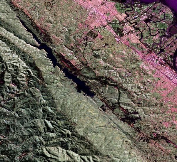
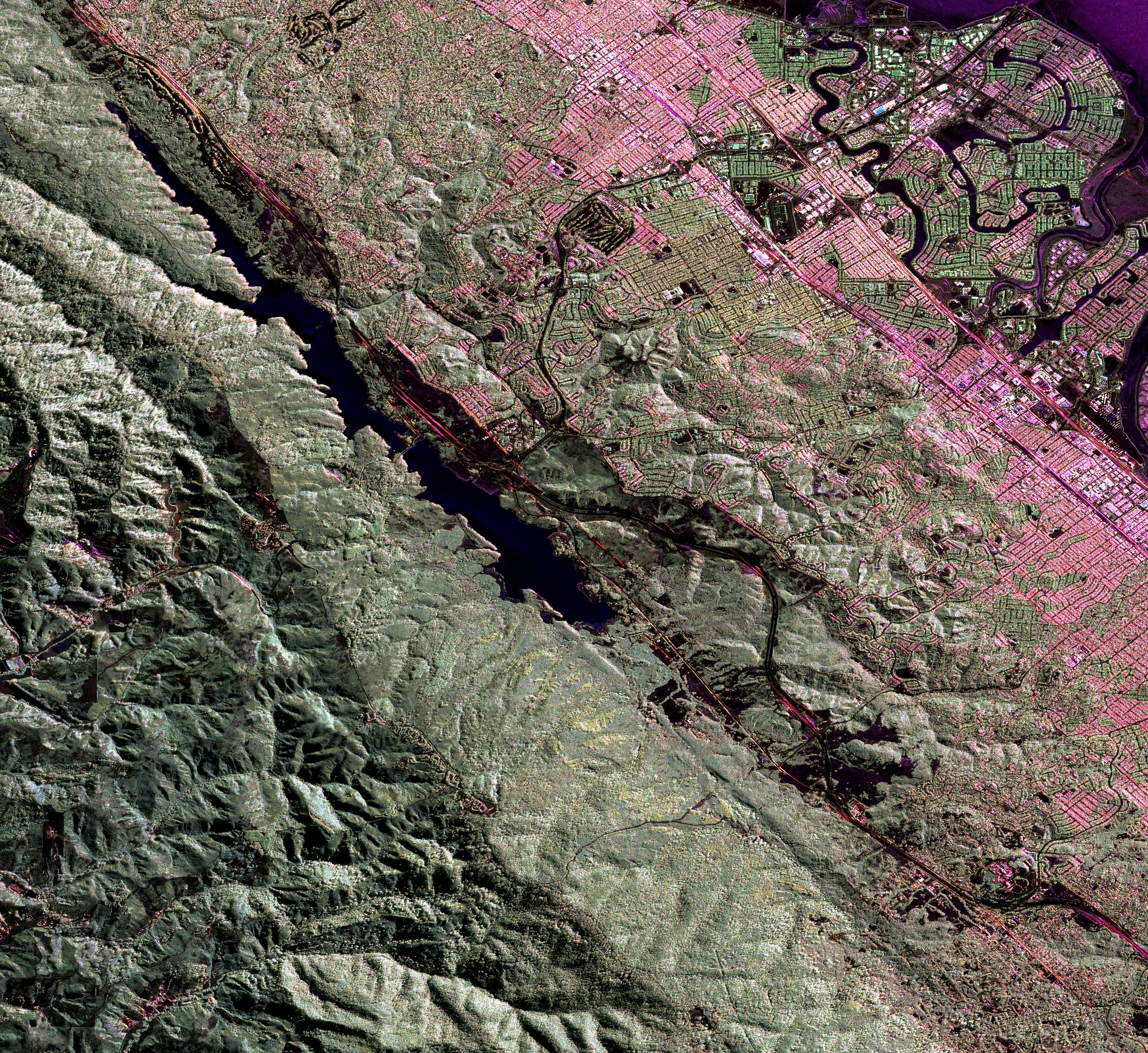
This image is a false-color composite of three channels of the UAVSAR polarimetric data acquired over the San Andreas Fault west of San Mateo, California. The fault runs from the top left to bottom right corner, partly beneath the Crystal Springs Reservoir shown in black. The black line curving along the east side of the fault is the freeway I-280, and California highway 91 runs from the top right across to the center left of the image, heading towards Half Moon Bay to the west. San Mateo and Burlingame are parts of the large urbanized area in various tones of pink and green, and Foster City is the area of curved streets extending out into the San Francisco Bay at the top right. This image will be combined with another image acquired at a later time to measure the motion of the Earth's surface between the two images using the technique called interferometry. The interferometric measurements will allow us to study the pressures building up on the faults at depth. The image is about 15 km (10 miles) across and north is up.
UAVSAR is a reconfigurable polarimetric L-band synthetic aperture radar (SAR) specifically designed to acquire airborne repeat track SAR data for differential interferometric measurements. For more information about radar polarimetry, see http://www.ccrs.nrcan.gc.ca/resource/tutor/polarim/index_e.php. The radar is currently operating on a NASA Gulfstream-III aircraft based at Dryden Flight Research Center and will eventually be ported to fly on an uninhabited, remote-piloted aircraft such as the Northrop Grumman Global Hawk. The radar was built at the Jet Propulsion Laboratory (JPL) with funding by the NASA Earth Science Technology Office (ESTO). UAVSAR is managed and operated by JPL under contract with the NASA Science Directorate.