Your search criteria found 2608 images
Target is Earth (and available satellites)
Go to PIAxxxxx:
Refine this list of images by:
Target:
Mission:
Spacecraft:
Instrument:
Click on an image for detailed information
Click on a column heading to sort in ascending or descending order
My
List
Addition Date Target MissionSort Ascending Instrument Size
Add Image to Favorite List 2013-09-24 Earth Terra
ASTER
1540x1472x3
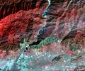
This image, acquired by NASA's Terra spacecraft, shows the epicenter of a magnitude 7.7 earthquake which struck south-central Pakistan on Sept. 24, 2013, in Pakistan's Makran fold belt.
PIA17505:
Region Hit by Large Pakistan Quake as Shown by NASA Spacecraft
Full Resolution:     TIFF (6.803 MB)     JPEG (654.9 kB)
Add Image to Favorite List 2013-09-26 Earth Terra
ASTER
1460x1470x3
This image, acquired by NASA's Terra spacecraft, shows Kathmandu, the capital of Nepal, with a population of about 2.5 million inhabitants for the greater metropolitan area.
PIA17513:
Kathmandu, Nepal
Full Resolution:     TIFF (6.441 MB)     JPEG (572.8 kB)
Add Image to Favorite List 2013-10-17 Earth Terra
ASTER
1866x1632x3
This image, acquired by NASA's Terra spacecraft, is of Canyonlands National Park, Utah, a showcase of geology in the southwest desert of the United States.
PIA17539:
Canyonlands National Park, Utah
Full Resolution:     TIFF (9.139 MB)     JPEG (910.1 kB)
Add Image to Favorite List 2013-10-23 Earth Terra
ASTER
1063x932x3
This image, acquired by NASA's Terra spacecraft, is of the ancient city of Uruk is located in present-day Iraq, on an abandoned channel of the Euphrates River.
PIA17576:
Ancient Uruk, Iraq
Full Resolution:     TIFF (2.973 MB)     JPEG (306.8 kB)
Add Image to Favorite List 2013-10-24 Earth Terra
MISR
1013x795x3
NASA's Terra spacecraft passed over the Blue Mountains to the west and north of Sydney, A mild winter and an extremely hot September in Australia have led to an early start to the fire season.
PIA17577:
MISR Stereo Imagery of Blue Mountain Fires in New South Wales, Australia
Full Resolution:     TIFF (2.417 MB)     JPEG (114.4 kB)
Add Image to Favorite List 2013-11-05 Earth Terra
ASTER
3684x3780x3
This image, acquired by NASA's Terra spacecraft, shows the Namib Desert, a coastal desert in southern Africa. This portion in central Namibia consists entirely of linear and longitudinal sand dunes.
PIA17632:
Namib Desert, Namibia
Full Resolution:     TIFF (41.79 MB)     JPEG (2.037 MB)
Add Image to Favorite List 2013-11-15 Earth Terra
MISR
1943x976x3
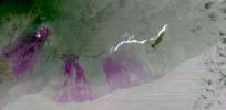
NASA's Terra satellite passed over the Pine Island Glacier in Antarctica around Oct. 27, 2013, just days before iceberg B-31 broke completely free. B-31 is finally moving away from the coast, with open water between the iceberg and the glacier.
PIA17694:
Pine Island Glacier, Antarctica, MISR Multi-angle Composite
Full Resolution:     TIFF (5.691 MB)     JPEG (178.7 kB)
Add Image to Favorite List 2013-11-19 Earth Terra
ASTER
1553x1483x3
This image, acquired by NASA's Terra spacecraft, shows the mountains of Chattanooga, Tennessee.
PIA17696:
150th Anniversary of the Battle of Chattanooga, Tennessee
Full Resolution:     TIFF (6.912 MB)     JPEG (532.9 kB)
Add Image to Favorite List 2013-11-20 Earth Terra
ASTER
960x900x3
On Nov. 8, 2013, NASA's Terra spacecraft acquired this image of Super Typhoon Haiyan as it tore across the central Philippines, leaving a trail of destruction in its path. Among the worst-hit areas is eastern Leyte island and the city of Tacloban.
PIA17700:
NASA Spacecraft Shows Before/After of Typhoon Haiyan's Devastation
Full Resolution:     TIFF (2.593 MB)     JPEG (137.3 kB)
Add Image to Favorite List 2013-11-22 Earth Terra
ASTER
2598x2147x3
On Nov. 14, 2013, NASA's Terra spacecraft spied a fire scar west of Wollongong, New South Wales, from the Hall Road fire in New South Wales, Australia. October 2013 brought the worst fires seen in Australia's New South Wales in many decades.
PIA17721:
Australian Wildfire, NASA Spacecraft Image Aftermath
Full Resolution:     TIFF (16.74 MB)     JPEG (1.057 MB)
Add Image to Favorite List 2013-12-05 Earth Terra
ASTER
1054x959x3
On May 30, 2013, NASA's Terra spacecraft acquired this image of the largest solar plant of its kind in the world started producing power in southern California's Mojave Desert near the Nevada border.
PIA17746:
Ivanpah Solar Energy Plant, California
Full Resolution:     TIFF (3.034 MB)     JPEG (129.6 kB)
Add Image to Favorite List 2013-12-18 Earth Terra
ASTER
350x350x1
This image acquired by NASA's Terra spacecraft is of Mount Etna, on the Italian island of Sicily, Europe's most active volcano, where its latest series of eruptions has continued for weeks.
PIA17789:
Lava Flows from Latest Eruption of Mount Etna Spotted by NASA's Terra Spacecraft
Full Resolution:     TIFF (122.8 kB)     JPEG (16.98 kB)
Add Image to Favorite List 2013-12-16 Earth Terra
ASTER
1330x1554x3
Logging operations have left a striking checkerboard pattern in the landscape along the Idaho-Montana border, sandwiched between Clearwater and Bitterroot National Forests as seen in this image acquired by NASA's Terra spacecraft.
PIA17788:
Idaho-Montana Logging
Full Resolution:     TIFF (6.203 MB)     JPEG (583 kB)
Add Image to Favorite List 2014-01-08 Earth Terra
ASTER
1466x1347x3
This image acquired by NASA's Terra spacecraft is of Kalgoorlie-Boulder, a city in the Goldfields-Esperance region of Western Australia.
PIA17852:
Kalgoorlie-Boulder, Australia
Full Resolution:     TIFF (5.926 MB)     JPEG (526.7 kB)
Add Image to Favorite List 2014-01-18 Earth Terra
MISR
901x721x3
On Jan. 16, 2014, NASA's Terra satellite passed over Glendora, Calif., where a large wildfire has claimed several homes, causing mandatory evacuations and prompting an air quality alert by public health officials.
PIA17883:
NASA Spacecraft Sees Dispersion of Smoke and Ash Across LA Basin from Colby Fire
Full Resolution:     TIFF (1.95 MB)     JPEG (74.68 kB)
Add Image to Favorite List 2014-01-22 Earth Terra
ASTER
1097x3072x3
This image acquired by NASA's Terra spacecraft is of the Kingdom of Bahrain, a small island country near the western shore of the Persian Gulf.
PIA17899:
Kingdom of Bahrain
Full Resolution:     TIFF (10.11 MB)     JPEG (356.5 kB)
Add Image to Favorite List 2014-01-28 Earth Terra
ASTER
1200x1000x3
On Jan. 16, 2014, NASA's Terra spacecraft acquired this image of a wildfire broke that out in the mountains above the Los Angeles suburbs of Glendora and Azusa.
PIA17923:
NASA's Terra Spacecraft Images Destructive Colby Fire East of Los Angeles
Full Resolution:     TIFF (3.602 MB)     JPEG (342.4 kB)
Add Image to Favorite List 2014-02-05 Earth Terra
ASTER
1509x1447x3
This image acquired by NASA's Terra spacecraft shows the Sochi Olympic Park Coastal Cluster, the circular area on the shoreline in the bottom center of the image, which was built for Olympic indoor sports.
PIA17970:
Sochi, Russia Winter Olympic Sites (Coastal Cluster)
Full Resolution:     TIFF (6.553 MB)     JPEG (367.7 kB)
Add Image to Favorite List 2014-02-05 Earth Terra
ASTER
1512x1458x3
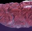
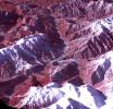
The 2014 Winter Olympic ski runs may be rated double black diamond, but they're not quite as steep as they appear in this image acquired by NASA's Terra spacecraft, of the skiing and snowboarding sites for the Sochi Winter Olympic Games.
PIA17971:
Sochi, Russia Winter Olympic Sites (Mountain Cluster)
Full Resolution:     TIFF (6.616 MB)     JPEG (438.9 kB)
Add Image to Favorite List 2014-02-05 Earth Terra
ASTER
2974x2147x3
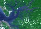
This image acquired by NASA's Terra spacecraft is of the Sierra Leone estuary, which became a focal point for trade and interaction between Africans and Europeans because of its exceptional harbor, starting in the mid-15th century.
PIA17977:
Sierra Leone Estuary
Full Resolution:     TIFF (19.16 MB)     JPEG (856.5 kB)
Add Image to Favorite List 2014-02-11 Earth Terra
ASTER
2100x2210x3
This image acquired by NASA's Terra spacecraft is of Mount Sinabung, a stratovolcano located in Indonesia. In late 2013, a lava dome formed on the summit. In early January 2014, the volcano erupted, and it erupted again in early February.
PIA17978:
Angry Indonesian Volcano Imaged by NASA Spacecraft
Full Resolution:     TIFF (13.93 MB)     JPEG (800.8 kB)
Add Image to Favorite List 2014-02-11 Earth Terra
ASTER
1459x1318x3
This image acquired by NASA's Terra spacecraft is of Mt. Etna, Europe's most active volcano, as it continued its latest eruptive activity with a new lava flow from the recently formed southeast crater.
PIA17979:
Latest Activity at Europe's Most Active Volcano Captured by NASA Spacecraft
Full Resolution:     TIFF (5.771 MB)     JPEG (317.1 kB)
Add Image to Favorite List 2014-02-19 Earth Terra
ASTER
3114x1915x3
This image acquired by NASA's Terra spacecraft depicts the high water levels and flooding along the Thames River west of London as record-breaking rains covered the United Kingdom in January and February.
PIA17989:
U.K. Flooding Captured by NASA Spacecraft
Full Resolution:     TIFF (17.9 MB)     JPEG (1.517 MB)
Add Image to Favorite List 2014-02-23 Earth Terra
ASTER
1767x1536x3
On Feb. 13, 2014, violent eruption of Kelud stratovolcano in Java, Indonesia sent volcanic ash covering an area of 70,000 square miles, prompting the evacuation of tens of thousands of people. This image is from NASA's Terra spacecraft.
PIA18020:
Ashy Aftermath of Indonesian Volcano Eruption seen by NASA Spacecraft
Full Resolution:     TIFF (8.146 MB)     JPEG (462.6 kB)
Add Image to Favorite List 2014-02-26 Earth Terra
ASTER
2244x2334x3
NASA's Terra spacecraft shows that extremely heavy seasonal rains have fallen on northern Bolivia since October 2013. The worst affected province is Beni in the northeastern part of the country.
PIA18031:
NASA Spacecraft Eyes Bolivian Flooding
Full Resolution:     TIFF (15.72 MB)     JPEG (1.011 MB)
Add Image to Favorite List 2014-03-05 Earth Terra
MODIS
2410x935x3
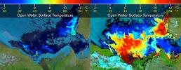
Beaufort Sea surface temperatures where Canada's Mackenzie River discharges into the Arctic Ocean, measured by NASA's MODIS instrument; warm river waters had broken through a shoreline sea ice barrier to enhance sea ice melt.
PIA18034:
Warm Rivers Play Role in Arctic Sea Ice Melt
Full Resolution:     TIFF (6.763 MB)     JPEG (430.9 kB)
Add Image to Favorite List 2014-03-05 Earth Terra
MODIS
436x348x3
This frame from a NASA MODIS animation depicts warming sea surface temperatures in the Arctic's Beaufort Sea after warm waters from Canada's Mackenzie River broke through a shoreline sea ice barrier in summer 2012, enhancing the melting of sea ice.
PIA18035:
Warm Rivers Play Role in Arctic Sea Ice Melt (Animation) Animation Icon
Full Resolution:     TIFF (455.6 kB)     JPEG (23.57 kB)
Add Image to Favorite List 2014-02-12 Earth Terra
ASTER
504x336x3
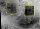
Ambrym volcano in Vanuatu is one of the most active volcanoes in the world. A large summit caldera contains two active vent complexes, Marum and Benbow is seen in this February 12, 2014 nighttime thermal infrared image from NASA's Terra spacecraft.
PIA18067:
Nighttime Look at Ambrym Volcano, Vanuatu by NASA Spacecraft
Full Resolution:     TIFF (508.4 kB)     JPEG (19.25 kB)
Add Image to Favorite List 2014-03-04 Earth Terra
ASTER
832x677x3
This image from NASA's Terra spacecraft shows the Vatican City State, a sovereign city-state, whose area is a 44 hectare walled enclave west of the Tiber River, within the city of Rome.
PIA18068:
Vatican City State
Full Resolution:     TIFF (1.691 MB)     JPEG (217.4 kB)
Add Image to Favorite List 2014-03-17 Earth Terra
ASTER
1451x1919x3
This image acquired by NASA's Terra spacecraft shows Arizona, Calif., which produces 60% of the total copper mined in the United States.
PIA18136:
Arizona Copper
Full Resolution:     TIFF (8.357 MB)     JPEG (539.6 kB)
Add Image to Favorite List 2014-03-26 Earth Terra
ASTER
1382x1386x3
NASA's Terra spacecraft views central South Dakota, where the Missouri River forms a meander bend, creating Lake Sharpe. Eventually, the Missouri River will cut through the skinny peninsula, creating a shorter path.
PIA18204:
Lake Sharpe, South Dakota
Full Resolution:     TIFF (5.749 MB)     JPEG (313.2 kB)
Add Image to Favorite List 2014-04-07 Earth Terra
ASTER
861x720x3
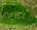
Located in the fertile agricultural region of Argentina's Pampas is a guitar-shaped forest made up of cypress and eucalyptus trees as seen by NASA's Terra spacecraft.
PIA18207:
Argentina Forest
Full Resolution:     TIFF (1.861 MB)     JPEG (98.52 kB)
Add Image to Favorite List 2014-04-28 Earth Terra
ASTER
1868x2097x3
Karst topography is a geological formation shaped by the dissolution of layers of soluble rock such as limestone. A good example is found in Guangxi Province in southeast China, as seen by NASA's Terra spacecraft.
PIA18230:
Karst Landscape, China
Full Resolution:     TIFF (11.76 MB)     JPEG (857.2 kB)
Add Image to Favorite List 2014-04-28 Earth Terra
ASTER
1517x1446x3
On Friday, April 26, 2014, an avalanche on Mount Everest killed at least 13 Sherpa guides. NASA's Terra spacecraft looked toward the northeast, with Mount Everest (center), and Lhotse, the fourth-highest mountain on Earth, on the skyline to right center.
PIA18046:
Deadly Everest Avalanche Site Spotted by NASA Spacecraft
Full Resolution:     TIFF (6.583 MB)     JPEG (327.9 kB)
Add Image to Favorite List 2014-05-01 Earth Terra
ASTER
4400x4000x3
On April 28, 2014, NASA's Terra spacecraft spotted signs of activity at Ubinas volcano in the Peruvian Andes. The appearance of a new lava dome in March 2014 and frequent ash emissions are signs of increasing activity at this volcano.
PIA18245:
Ubinas Volcano Activity in Peruvian Andes
Full Resolution:     TIFF (52.83 MB)     JPEG (2.566 MB)
Add Image to Favorite List 2014-05-09 Earth Terra
ASTER
1782x1754x3
The Nagarjuna Sagar Dam on India's Krishna River is the largest masonry dam in operation in the world. This image is from NASA's Terra spacecraft.
PIA18373:
Nagarjuna Sagar Dam, India
Full Resolution:     TIFF (9.381 MB)     JPEG (513.8 kB)
Add Image to Favorite List 2014-06-12 Earth Terra
ASTER
3816x2292x3
In May 2014, historic floods inundated Serbia and neighboring countries, causing major population displacements and property destruction. This image was acquired by NASA's Terra spacecraft.
PIA18051:
Historic Serbian Floods Eyed by NASA Spacecraft
Full Resolution:     TIFF (26.25 MB)     JPEG (1.819 MB)
Add Image to Favorite List 2014-05-20 Earth Terra
ASTER
1504x1267x1
Winter still grips the volcanoes on Russia's Kamchatka peninsula. NASA's Terra spacecraft acquired this image showing the mantle of white, disturbed by dark ash entirely covering Sheveluch volcano from recent eruptions.
PIA18379:
NASA Spacecraft Spots Signs of Erupting Russian Volcano
Full Resolution:     TIFF (1.908 MB)     JPEG (297.3 kB)
Add Image to Favorite List 2014-05-16 Earth Terra
ASTER
687x798x3
This image from NASA's Terra spacecraft shows the Bangladeshi coast north of Chittagong, where ships from around the world are beached and dismantled.
PIA18258:
Shipbreaking, Bangladesh
Full Resolution:     TIFF (1.645 MB)     JPEG (124.2 kB)
Add Image to Favorite List 2014-05-27 Earth Terra
ASTER
2855x2360x3
This image from NASA's Terra spacecraft shows the Kerguelen Islands (also known as the Desolation Islands), which are part of the French Southern and Antarctic lands. The islands are among the most isolated places on Earth.
PIA18253:
Kerguelen Islands
Full Resolution:     TIFF (20.22 MB)     JPEG (997.1 kB)
Add Image to Favorite List 2014-06-10 Earth Terra
ASTER
1188x793x3
On May 26, 2014, an enormous landslide came roaring from above in a sparsely inhabited area of Mesa County, Arizona, near the town of Collbran. This image was acquired by NASA's Terra spacecraft.
PIA18050:
Giant Arizona Landslide Spotted by NASA Spacecraft
Full Resolution:     TIFF (2.828 MB)     JPEG (108.6 kB)
Add Image to Favorite List 2014-06-09 Earth Terra
ASTER
1336x2153x3
Lake Afrera is a hypersaline lake located in the Danakil Depression in northern Ethiopia where rock salt has been mined for centuries. This image was acquired by NASA's Terra spacecraft.
PIA18515:
Lake Afrera, Ethiopia
Full Resolution:     TIFF (8.632 MB)     JPEG (416.1 kB)
Add Image to Favorite List 2014-06-25 Earth Terra
ASTER
2049x1824x3
This image from NASA's Terra spacecraft shows Palouse, a rich farming area of some 7,000 square kilometers, reminiscent of Tuscany. But instead of vineyards, the main crops are wheat and rapeseed.
PIA18494:
Palouse, WA
Full Resolution:     TIFF (11.22 MB)     JPEG (793.4 kB)
Add Image to Favorite List 2014-07-14 Earth Terra
ASTER
1532x1469x3
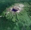
This image from NASA's Terra spacecraft shows Baektu Mountain, an active volcano on the border between North Korea and China. Rising to 2744 m, its summit caldera is filled with a crater lake, Heaven Lake.
PIA18507:
Baektu Mountain, China & North Korea
Full Resolution:     TIFF (6.754 MB)     JPEG (406.7 kB)
Add Image to Favorite List 2014-07-23 Earth Terra
ASTER
2620x1500x3
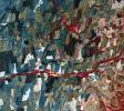
The effects of California's severe multiyear drought are seen in this pair of images acquired by NASA's Terra spacecraft of the area northeast of Madera, in the Sierra Nevada Moutains foothills between Yosemite National Park and the San Joaquin Valley.
PIA18627:
Images Show Severity of California Drought
Full Resolution:     TIFF (11.79 MB)     JPEG (498.8 kB)
Add Image to Favorite List 2014-07-28 Earth Terra
ASTER
922x626x3
This image from the NASA's Terra spacecraft shows extensive flooding resulting from Typhoon Rammasun in Ningming, China. This ASTER image was acquired on July 24, 2014.
PIA18628:
NASA Spacecraft Eyes China Flooding
Full Resolution:     TIFF (1.732 MB)     JPEG (118.7 kB)
Add Image to Favorite List 2014-08-05 Earth Terra
ASTER
1412x1274x3
The star on this image from the NASA's Terra spacecraft indicates the eipcenter of a magnitude 6.1 earthquake which truck in southern China's Yunnan province, toppling thousands of homes and causing numerous casualties.
PIA18640:
Site of Destructive China Temblor Imaged by NASA Spacecraft
Full Resolution:     TIFF (5.399 MB)     JPEG (438 kB)
Add Image to Favorite List 2014-08-05 Earth Terra
ASTER
944x882x3
This image from NASA's Terra spacecraft shows the once-abandoned mining town of Silver Peak, Nevada, which began to thrive again when Foote Mineral Company began extracting lithium from brine below the floor of Clayton Valley in 1966.
PIA18553:
Lithium Mining, Nevada
Full Resolution:     TIFF (2.499 MB)     JPEG (102.8 kB)
Add Image to Favorite List 2014-08-06 Earth Terra
ASTER
1366x1307x3
NASA's Terra spacecraft captured this thermal infrared view of the spread of the forest fire in Valle Nuevo National Park near Costanza, Dominican Republic.
PIA18643:
Dominican Republic Wildfire Imaged by NASA Spacecraft
Full Resolution:     TIFF (5.358 MB)     JPEG (301.4 kB)
Add Image to Favorite List 2014-08-21 Earth Terra
ASTER
3202x2709x3
This image from NASA's Terra spacecraft shows the world's largest bauxite mine found near Weipa, Queensland, Australia. The rich aluminum deposits were first recognized on the end of the Cape York Peninsula in 1955, and mining began in 1960.
PIA18686:
Weipa, Queensland, Australia
Full Resolution:     TIFF (26.03 MB)     JPEG (1.143 MB)
Add Image to Favorite List 2014-09-11 Earth Terra
ASTER
2238x2550x3
This image from NASA's Terra spacecraft shows Petropavlovsk-Kamchatsky (P-K), which is the administrative, cultural, scientific and economic center of Kamchatka Krai, Russia on the Kamchatka Peninsula.
PIA18710:
Petropavlovsk-Kamchatsky, Russia
Full Resolution:     TIFF (17.13 MB)     JPEG (959.4 kB)
Add Image to Favorite List 2014-09-24 Earth Terra
ASTER
645x316x3
On June 27, 2014, a new vent opened on Hawaii's Puu Oo vent, on the eastern flank of Kilauea volcano. NASA's Terra spacecraft shows the hot lava flow in white, extending about 11 miles (17 kilometers) from the vent.
PIA18812:
Progress of Hawaii Lava Flow Tracked by NASA Spacecraft
Full Resolution:     TIFF (611.9 kB)     JPEG (27.32 kB)
Add Image to Favorite List 2014-09-24 Earth Terra
ASTER
2460x2568x3
This image from NASA's Terra spacecraft shows the Faroe Islands, an archipelago and autonomous country within the Kingdom of Denmark, comprising 18 major islands.
PIA18723:
Faroe Islands
Full Resolution:     TIFF (18.96 MB)     JPEG (680.5 kB)
Add Image to Favorite List 2014-09-25 Earth Terra
ASTER
2577x2934x3
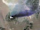
Since the end of August 2014, Iceland's Bardarbunga volcano has been pouring out lava from a growing fissure. NASA's Terra spacecraft shows the flows have been accompanied by spectacular lava fountains.
PIA18814:
Iceland's Bardarbunga Volcano Imaged by NASA Spacecraft
Full Resolution:     TIFF (22.69 MB)     JPEG (602 kB)
Add Image to Favorite List 2014-10-09 Earth Terra
ASTER
1772x2208x3
NASA's Terra spacecraft shows Mount Cameroon, an active volcano in Cameroon near the Gulf of Guinea. It is one of Africa's largest volcanoes, rising over 4,000 meters, with more than 100 small cinder cones.
PIA18825:
Mount Cameroon
Full Resolution:     TIFF (11.74 MB)     JPEG (466.7 kB)
Add Image to Favorite List 2014-10-20 Earth Terra
ASTER
2182x1092x3
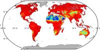
Our planet emits energy as thermal infrared radiation at wavelengths we cannot normally see but can feel -- for example, if we stand close to a hot surface. This map is from NASA's ASTER GED.
PIA18833:
NASA Spacecraft Maps Earth's Global Emissivity
Full Resolution:     TIFF (7.151 MB)     JPEG (256.6 kB)
Add Image to Favorite List 2014-10-27 Earth Terra
ASTER
2763x1817x3
This image from NASA's Terra spacecraft shows Lake Mackay, the largest of hundreds of ephemeral lakes scattered throughout Western Australia and the Northern Territory, and is the second largest lake in Australia.
PIA18764:
Lake Mackay, Australia
Full Resolution:     TIFF (15.07 MB)     JPEG (635.8 kB)
Add Image to Favorite List 2014-11-24 Earth Terra
ASTER
4190x3322x3
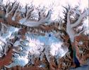
This image from NASA's Terra spacecraft shows Ellesmere Island, which is part of the Qikiqtaaluk Region of the Canadian territory of Nunavut, with the most northerly point of land in Canada.
PIA18966:
Ellesmere Island, Canada
Full Resolution:     TIFF (41.78 MB)     JPEG (1.927 MB)
Add Image to Favorite List 2015-01-07 Earth Terra
ASTER
1408x905x3
This image from NASA's Terra spacecraft shows Mt. Kailash, a peak in the Kailas Range in Tibet. It lies near the source of some of the longest Asian rivers: the Brahmaputra, the Sutlej and the Karnali.
PIA19013:
Mt. Kailash, Tibet
Full Resolution:     TIFF (3.824 MB)     JPEG (160.4 kB)
Add Image to Favorite List 2015-01-27 Earth Terra
ASTER
610x686x3
This image from NASA's Terra spacecraft shows Antikythera, a Greek island in the Aegean Sea. With a population of 44, its main settlement is the port of Patamos.
PIA19032:
Antikythera Island, Greece
Full Resolution:     TIFF (1.256 MB)     JPEG (40.88 kB)
Add Image to Favorite List 2015-02-13 Earth Terra
ASTER
1826x1814x3
This image from NASA's Terra spacecraft shows what may be ancient Rome's greatest engineering achievement: Portus. Built in the first century A.D., Portus was Rome's principal maritime harbor.
PIA19209:
Portus, Italy
Full Resolution:     TIFF (9.941 MB)     JPEG (482.7 kB)
Add Image to Favorite List 2015-02-26 Earth Terra
ASTER
1844x1469x3
This image from NASA's Terra spacecraft shows Prince Patrick Island, which is located in the Canadian Arctic Archipelago, and is the westernmost Elizabeth Island in the Northwest Territories of Canada.
PIA19222:
Prince Patrick Island, Canada
Full Resolution:     TIFF (8.13 MB)     JPEG (867.6 kB)
Add Image to Favorite List 2015-03-10 Earth Terra
ASTER
2855x1538x3
This image from NASA's Terra spacecraft shows Lake Ilopango, a crater lake which fills a volcanic caldera in central El Salvador, immediately east of the capital city San Salvador.
PIA19237:
Lake Ilopango, El Salvador
Full Resolution:     TIFF (13.18 MB)     JPEG (1.159 MB)
Add Image to Favorite List 2015-03-13 Earth Terra
ASTER
2200x900x3
On March 3, 2015, Chile's Villarrica volcano erupted, forcing the evacuation of thousands of people. The eruption and its effects were captured by NASA's Terra spacecraft on March 9.
PIA19241:
NASA Spacecraft Views Erupting Chilean Volcano
Full Resolution:     TIFF (5.943 MB)     JPEG (238.2 kB)
Add Image to Favorite List 2015-03-16 Earth Terra
ASTER
2490x1120x3
In southern California, the combined ports of Los Angeles and Long Beach account for 33% of the nation's containerized imports. This image from NASA's Terra spacecraft shows the large backlog of waiting cargo ships being slowly unloaded.
PIA19249:
Los Angeles - Long Beach Harbors, CA
Full Resolution:     TIFF (8.37 MB)     JPEG (333.3 kB)
Add Image to Favorite List 2016-08-02 Earth Terra
ASTER
2085x1716x3
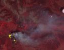
This image, captured by NASA's Terra spacecraft in July, 2016, shows the Sand fire, in the mountains northwest of Los Angeles, CA which burned more than 39,000 acres, destroyed 18 houses, and caused one fatality.
PIA20723:
NASA Spacecraft Spots Aftermath of Destructive Wildfire in LA's Backyard
Full Resolution:     TIFF (9.242 MB)     JPEG (832.7 kB)
Add Image to Favorite List 2015-04-02 Earth Terra
ASTER
1618x694x3
On February 15, 2015 the Desert Sunlight solar project in California's Mojave Desert became operational. This image from NASA's Terra spacecraft shows the 550-megawatt plant generates enough electricity to power 160,000 average homes.
PIA19268:
California Solar Farms
Full Resolution:     TIFF (3.37 MB)     JPEG (194.4 kB)
Add Image to Favorite List 2015-04-06 Earth Terra
ASTER
1255x897x3
The March, 2015 eruption of Turrialba Volcano in Costa Rica caught everyone by surprise as seen in this image from the ASTER instrument onboard NASA's Terra spacecraft.
PIA19355:
Costa Rica's Turrialba Volcano, Continued Activity seen by NASA Spacecraft
Full Resolution:     TIFF (3.379 MB)     JPEG (167.9 kB)
Add Image to Favorite List 2016-07-28 Earth Terra
ASTER
2820x2240x3
This image, captured by NASA's Terra spacecraft on July 27, 2016, shows the Lava Mountain fire in Wyoming where several small towns have been evacuated.
PIA20721:
Wyoming Wildfire Spotted by NASA Spacecraft
Full Resolution:     TIFF (17.15 MB)     JPEG (537.7 kB)
Add Image to Favorite List 2015-06-17 Earth Terra
ASTER
535x365x3
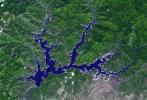
This image from NASA's Terra spacecraft shows Shasta Lake in northern California, which has an area of 12,000 ha, making it the state's largest reservoir.
PIA19492:
Lake Shasta, California
Full Resolution:     TIFF (586.2 kB)     JPEG (53.4 kB)
Add Image to Favorite List 2015-04-24 Earth Terra
ASTER
3547x2896x3
This image from NASA's Terra spacecraft shows the Turtle Mountains, which straddle the US-Canada border in central North Dakota.
PIA19435:
Turtle Mtns., ND
Full Resolution:     TIFF (30.83 MB)     JPEG (2.203 MB)
Add Image to Favorite List 2015-04-27 Earth Terra
ASTER
439x336x3
The April 18, 2015 eruption of Calbuco Volcano in Chile, as seen by NASA's Terra spacecraft, led to the evacuation of thousands of citizens near the summit, blanketed nearby towns with a layer of ash, and disrupted air traffic.
PIA19382:
Chilean Volcanic Eruption Nighttime View
Full Resolution:     TIFF (442.9 kB)     JPEG (26.21 kB)
Add Image to Favorite List 2015-05-13 Earth Terra
ASTER
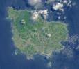
710x623x3
Situated 1670 km northeast of Sydney, this image from NASA's Terra spacecraft shows Norfolk Island, an Australian Territory.
PIA19463:
Norfolk Island, Australia
Full Resolution:     TIFF (1.328 MB)     JPEG (85.01 kB)
Add Image to Favorite List 2015-05-27 Earth Terra
ASTER
3108x4504x3
In southern Syria, the Azraq-Wadi as Sirhan Depression is the site of young volcanic activity, producing an extensive basaltic volcanic field, as shown in this image from NASA's Terra spacecraft.
PIA19479:
Lava Field, Syria
Full Resolution:     TIFF (42.01 MB)     JPEG (3.043 MB)
Add Image to Favorite List 2015-06-02 Earth Terra
ASTER
2448x1380x3
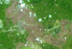
This image, acquired June 1, 2015 by NASA's Terra spacecraft shows evidence of the excessive water caused by widespread flooding from torrential rains. Located south of San Antonio, the Nueces River was one of many that overflowed its banks.
PIA19681:
NASA Spacecraft Views Aftermath of Texas Floods
Full Resolution:     TIFF (10.14 MB)     JPEG (531.8 kB)
Add Image to Favorite List 2015-06-12 Earth Terra
ASTER
3192x1972x3
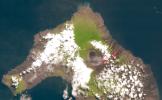
On May 26, 2015, Wolf Volcano on Isabela Island in the Galapagos Islands erupted for the first time in 33 years. This image was acquired by NASA's Terra spacecraft on June 11, 2015, after the eruption had quieted.
PIA18564:
NASA Spacecraft Peers Into the Mouth of the Galapagos' Wolf Volcano
Full Resolution:     TIFF (18.89 MB)     JPEG (754.3 kB)
Add Image to Favorite List 2015-06-29 Earth Terra
ASTER
535x685x3
North Korea's state news agency reported the country is facing its worst drought in a century. This image from NASA's Terra spacecraft shows how rice-growing provinces have been badly affected and more than 30% of rice paddies are parching up.
PIA19501:
North Korea Drought
Full Resolution:     TIFF (1.1 MB)     JPEG (90.65 kB)
Add Image to Favorite List 2015-07-20 Earth Terra
ASTER
1900x1500x3
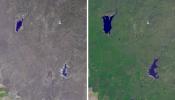
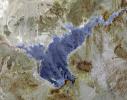
Lake Mead supplies water for Arizona, California, Mexico, and other western states. This image from NASA's Terra spacecraft shows the water level fell to 1075 feet, a record low.
PIA19731:
Lake Mead and Drought
Full Resolution:     TIFF (8.553 MB)     JPEG (506.7 kB)
Add Image to Favorite List 2015-07-27 Earth Terra
ASTER
992x834x3
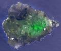
Two hundred years ago, Ascension Island was a barren volcanic edifice. This image from NASA's Terra spacecraft shows that today its peaks are covered by lush tropical cloud forest.
PIA19738:
Ascension Island
Full Resolution:     TIFF (2.366 MB)     JPEG (138.3 kB)
Add Image to Favorite List 2015-08-10 Earth Terra
ASTER
540x749x3
This image from NASA's Terra spacecraft shows the Akashi Kaikyo Bridge in Japan, which has the longest central span of any suspension bridge in the world at 1991 m.
PIA19747:
Akashi-Kaikyo Bridge, Japan
Full Resolution:     TIFF (1.183 MB)     JPEG (88.22 kB)
Add Image to Favorite List 2015-08-19 Earth Terra
ASTER
1734x1928x3
Northwest of Buenos Aires, Argentina, seven straight days of torrential rains of up to 16 inches (40 centimeters) in August 2015 resulted in flooding between the cities of Escobar and Campana as seen by NASA's Terra spacecraft.
PIA19871:
NASA Spacecraft Tracks Argentine Flooding
Full Resolution:     TIFF (8.542 MB)     JPEG (640.1 kB)
Add Image to Favorite List 2015-08-21 Earth Terra
ASTER
1260x1134x3
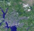
This image from NASA's Terra spacecraft shows the Drakelands Mine (previously known as the Hemerdon Mine), a historic tungsten and tin mine located northeast of Plymouth, England.
PIA19757:
Drakelands Mine, England
Full Resolution:     TIFF (4.288 MB)     JPEG (371.1 kB)
Add Image to Favorite List 2015-08-25 Earth Terra
ASTER
4236x9873x3
NASA's Terra spacecraft acquired this image of the region north of Lake Baikal on Aug. 22, 2015. For weeks, forest fires have been raging in Siberia around Russia's Lake Baikal.
PIA15150:
Wildfires Threatening Ancient Siberian Lake
Full Resolution:     TIFF (78.82 MB)     JPEG (2.448 MB)
Add Image to Favorite List 2015-08-25 Earth Terra
ASTER
1821x2333x3
After lying dormant for 70 years, Cotopaxi volcano in Ecuador started erupting the week of Aug. 17, 2015. NASA's Terra spacecraft acquired this image on August 22, showing huge columns of ash that affected towns in the region.
PIA15151:
Angry Ecuadorian Volcano Imaged by NASA Spacecraft
Full Resolution:     TIFF (10.73 MB)     JPEG (558.1 kB)
Add Image to Favorite List 2015-09-10 Earth Terra
ASTER
2574x2109x3
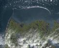
Point Barrow or Nuvuk, Alaska is the northernmost point of all territory of the United States, as captured in this image from NASA's Terra spacecraft.
PIA19775:
Point Barrow, Alaska
Full Resolution:     TIFF (12.47 MB)     JPEG (655.8 kB)
Add Image to Favorite List 2015-09-23 Earth Terra
ASTER
1700x2100x3
This image from NASA's Terra spacecraft shows the Salton Sea in south California, which was created in 1905 when spring flooding on the Colorado River breached a canal.
PIA19786:
Salton Sea, California
Full Resolution:     TIFF (5.858 MB)     JPEG (360.4 kB)
Add Image to Favorite List 2015-10-06 Earth Terra
ASTER
535x829x3
This image from NASA's Terra spacecraft shows the Ural Mountains, which run 2500 km north-south through western Russia, and form the boundary between Europe and Asia.
PIA19795:
Ural Mountains, Russia
Full Resolution:     TIFF (1.331 MB)     JPEG (92.24 kB)
Add Image to Favorite List 2015-10-21 Earth Terra
MISR
1356x1682x3
The worst forest fires in nearly two decades are burning out of control on Borneo, creating the thick blanket of smoke in this Oct. 14, 2015 image from NASA's Terra spacecraft.
PIA11218:
Borneo on Fire
Full Resolution:     TIFF (6.253 MB)     JPEG (246.6 kB)
Add Image to Favorite List 2015-10-20 Earth Terra
ASTER
2034x3059x3
In the middle of the Arabian desert the city Green Oasis Wadi Al Dawasir is being developed as a new urban center for the Wadi Al Dawasir region of Saudi Arabia, as shown in this image from NASA's Terra spacecraft.
PIA20077:
Wadi Al Dawasir, Saudi Arabia
Full Resolution:     TIFF (18.67 MB)     JPEG (1.025 MB)
Add Image to Favorite List 2015-10-27 Earth Terra
ASTER
732x734x3
On Oct. 26, 2015, NASA's Terra spacecraft acquired this image of northeastern Afghanistan where a magnitude 7.5 earthquake struck the Hindu Kush region.
PIA20035:
Earthquake in Hindu Kush Region, Afghanistan
Full Resolution:     TIFF (1.479 MB)     JPEG (143.1 kB)
Add Image to Favorite List 2015-11-02 Earth Terra
ASTER
1678x2134x3
This image from NASA's Terra spacecraft shows Cancun, a resort city on the east side of Mexico's Yucatan Peninsula.
PIA20086:
Cancun, Mexico
Full Resolution:     TIFF (10.75 MB)     JPEG (711.6 kB)
Add Image to Favorite List 2015-11-14 Earth Terra
ASTER
1583x749x3
On Nov. 5, 2015, a dam at an iron-ore mine in southeastern Brazil burst, sending a wall of water, clay-red mud and debris downstream, overwhelming several villages in the path as seen by NASA's Terra spacecraft.
PIA20156:
Flooding at Iron-Ore Mine, SE Brazil
Full Resolution:     TIFF (3.558 MB)     JPEG (217.6 kB)
Add Image to Favorite List 2015-11-16 Earth Terra
ASTER
2997x1845x3
This image from NASA's Terra spacecraft shows the Orapa diamond mine, the world's largest diamond mine by area. The mine is located in Botswana.
PIA20104:
Orapa Diamond Mine, Botswana
Full Resolution:     TIFF (16.6 MB)     JPEG (972.6 kB)
Add Image to Favorite List 2015-12-09 Earth Terra
ASTER
1600x1200x3
This image from NASA's Terra spacecraft shows that Egypt has greatly expanded its aquaculture industry along the northeast coast of the Nile Delta compared to 1987.
PIA20216:
Nile Delta Fisheries, Egypt
Full Resolution:     TIFF (5.762 MB)     JPEG (253 kB)
Add Image to Favorite List 2016-01-07 Earth Terra
ASTER
3640x3300x3
On Jan. 6, 2016, NASA's Terra spacecraft flew over Rosario, Argentina located northwest of Buenos Aires, on the western shore of the Parana River where the floodplain is still under water or wet.
PIA20295:
Argentine Flooding Observed by NASA Satellite
Full Resolution:     TIFF (27.22 MB)     JPEG (1.895 MB)
Add Image to Favorite List 2016-01-19 Earth Terra
ASTER
3592x2652x3
NASA's Terra spacecraft acquired this image of the remote town of Yarloop, about 75 miles (120 km) south of the Western Australian capital of Perth, was destroyed as part of a 100,000-acre (405-square km) blaze that started on January 7, 2016.
PIA20363:
Effects of Devastating Australian Bushfires Seen by NASA Spacecraft
Full Resolution:     TIFF (27.43 MB)     JPEG (1.902 MB)
Add Image to Favorite List 2016-01-15 Earth Terra
ASTER
4224x4846x3
This image from NASA's Terra spacecraft shows Mount Erebus, the world's southernmost historically active volcano.
PIA20239:
Mt. Erebus, Antarctica
Full Resolution:     TIFF (39.98 MB)     JPEG (2.048 MB)
Add Image to Favorite List 2016-01-20 Earth Terra
ASTER
2532x2544x3
This image acquired on Jan. 17, 2016 by NASA's Terra spacecraft shows major flooding along the Mississippi River, affecting Missouri, Illinois, Arkansas and Tennessee; flood warnings were issued for the area around Baton Rouge, Louisiana.
PIA20364:
Flooding on the Mississippi River Captured by NASA Spacecraft
Full Resolution:     TIFF (19.33 MB)     JPEG (1.766 MB)
Add Image to Favorite List 2016-02-16 Earth Terra
ASTER
3790x3400x3
This image from NASA's Terra spacecraft shows Poyang Lake, which was once China's largest freshwater lake.
PIA20263:
Poyang Lake, China
Full Resolution:     TIFF (38.67 MB)     JPEG (1.709 MB)
Add Image to Favorite List 2016-02-29 Earth Terra
ASTER
1800x2304x3
This image from NASA's Terra spacecraft shows Beihai, a city in the south of Guangxi, People's republic of China.
PIA20421:
Beihai, Guanxi, China
Full Resolution:     TIFF (12.45 MB)     JPEG (701.6 kB)
Retrieve Previous Set  Jump to a Previous Set   Jump to a Previous Set   Jump to a Previous Set   Jump to a Previous Set   Jump to a Previous Set   Jump to a Previous Set   Jump to a Previous Set   Current Set   Jump to a Following Set   Jump to a Following Set   Retrieve Next Set 
 1-100   101-200   201-300   301-400   401-500   501-600   601-700   701-800   801-900   901-1000 
Currently displaying images: 701 - 800 of 2608