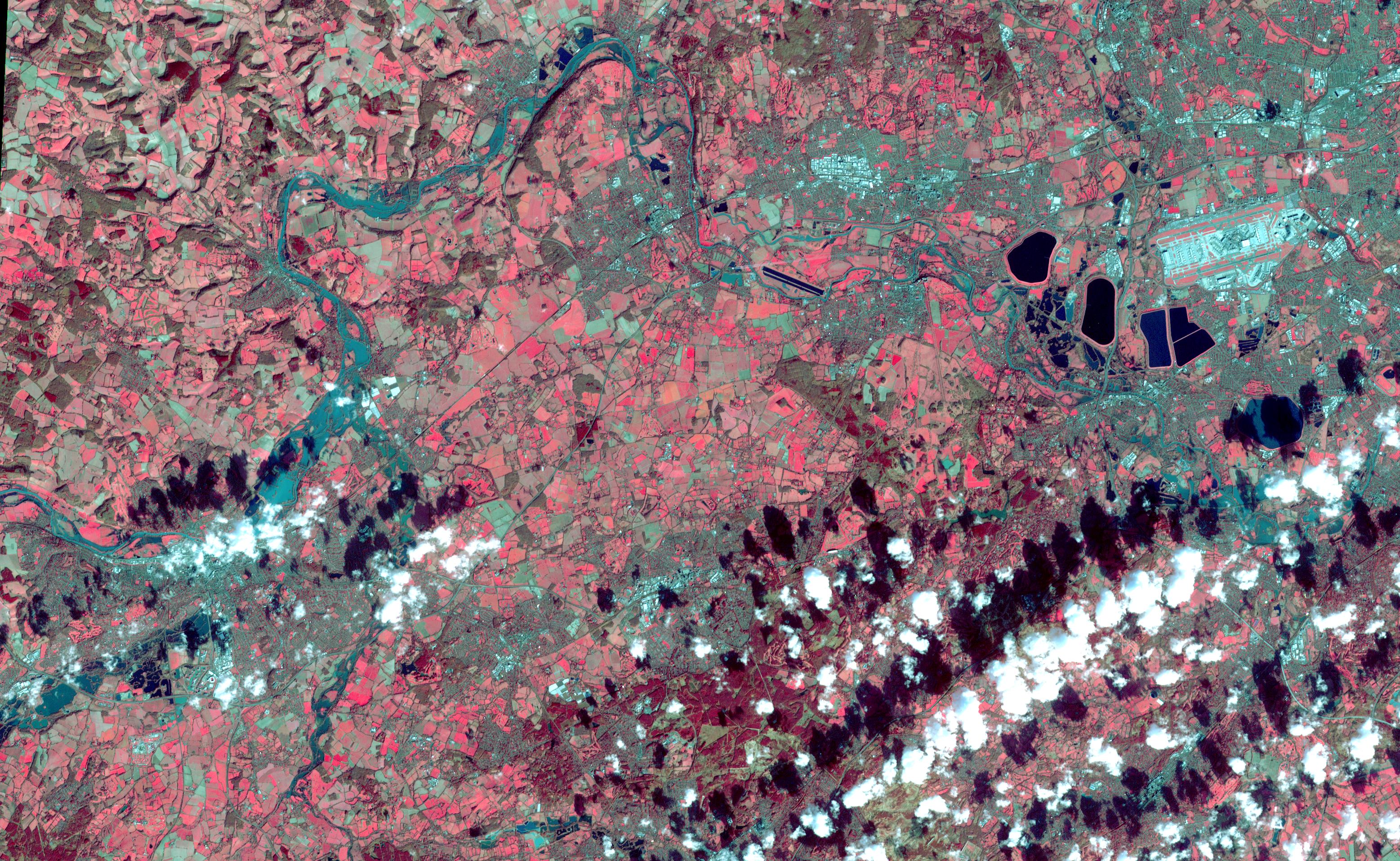
On Feb. 17, 2014, the United Kingdom Environment Agency had issued flood warnings for the area from Walton-on-Thames in the east to Reading in the west, as depicted in this image acquired by the Advanced Spaceborne Thermal Emission and Reflection Radiometer (ASTER) instrument on NASA's Terra spacecraft on Feb. 16, 2014. High water levels and flooding along the Thames River west of London were part of a larger picture of devastation throughout southwest England and Wales, as record-breaking rains covered the United Kingdom in January and February. In this image, vegetation is red; clouds are white and their shadows are black; the Thames River flows across the image in dark cyan color. The image covers an area of 17.7 by 28.5 miles (28.5 by 46 kilometers), and is located near 51.5 degrees north, 0.7 degrees west.
With its 14 spectral bands from the visible to the thermal infrared wavelength region and its high spatial resolution of 15 to 90 meters (about 50 to 300 feet), ASTER images Earth to map and monitor the changing surface of our planet. ASTER is one of five Earth-observing instruments launched Dec. 18, 1999, on Terra. The instrument was built by Japan's Ministry of Economy, Trade and Industry. A joint U.S./Japan science team is responsible for validation and calibration of the instrument and data products.
The broad spectral coverage and high spectral resolution of ASTER provides scientists in numerous disciplines with critical information for surface mapping and monitoring of dynamic conditions and temporal change. Example applications are: monitoring glacial advances and retreats; monitoring potentially active volcanoes; identifying crop stress; determining cloud morphology and physical properties; wetlands evaluation; thermal pollution monitoring; coral reef degradation; surface temperature mapping of soils and geology; and measuring surface heat balance.
The U.S. science team is located at NASA's Jet Propulsion Laboratory, Pasadena, Calif. The Terra mission is part of NASA's Science Mission Directorate, Washington, D.C.
More information about ASTER is available at http://asterweb.jpl.nasa.gov/.
 Planetary Data System


