- Original Caption Released with Image:
-
 |  | | Figure 1 | Figure 2 |
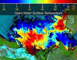
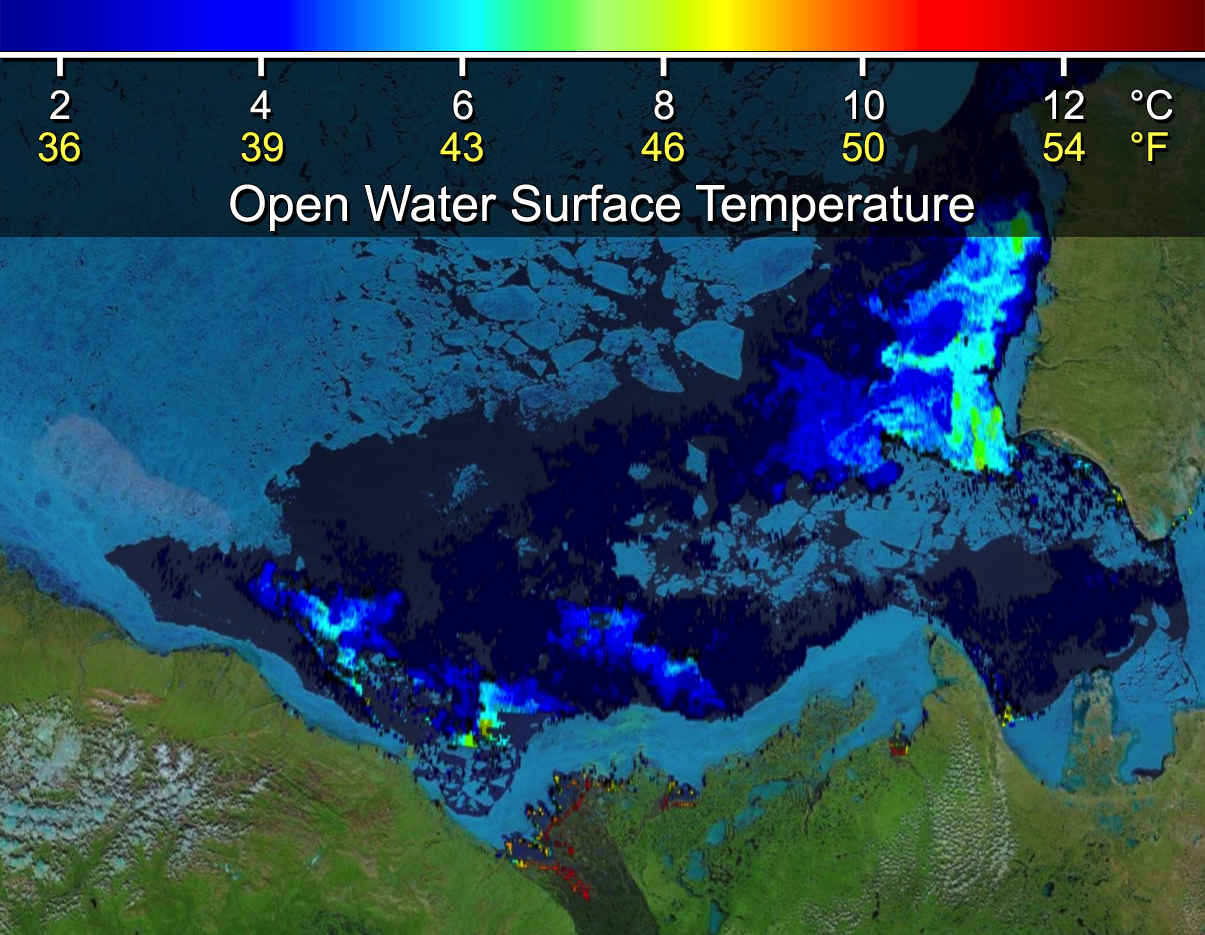
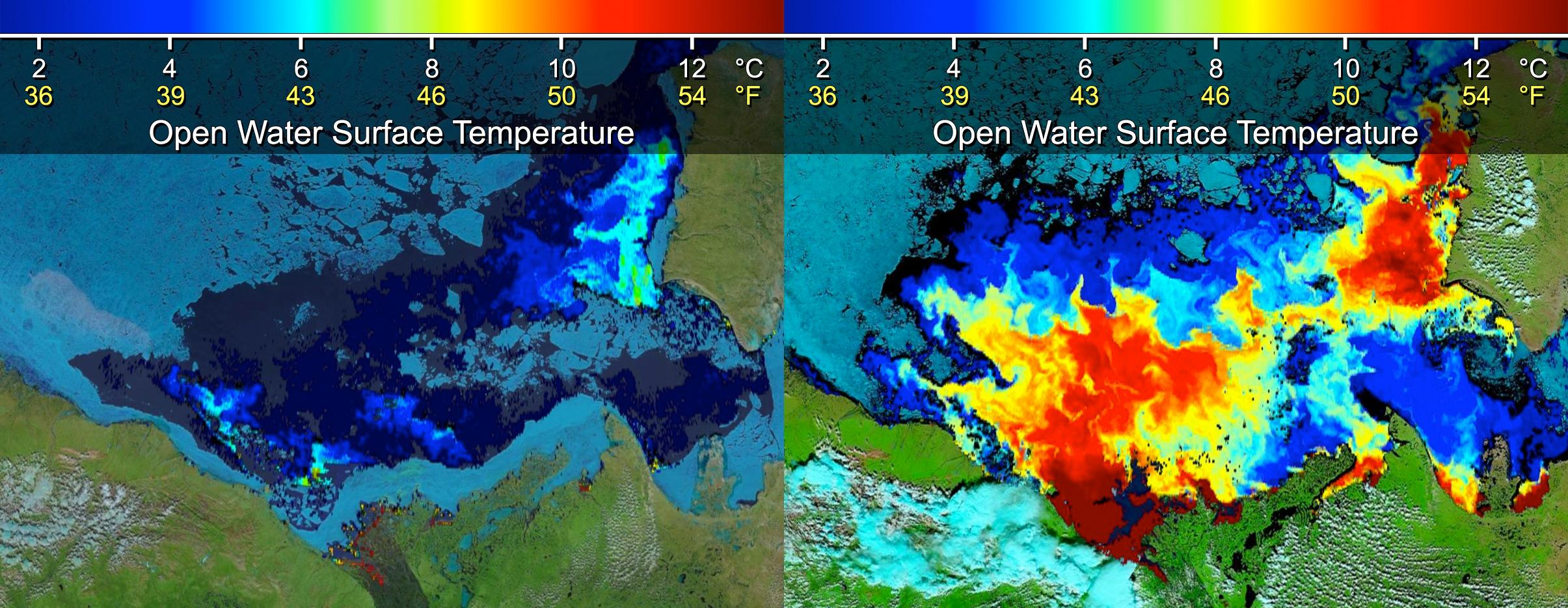
Click on an individual image for full resolution imageThese images show sea surface temperatures of the Beaufort Sea where Canada's Mackenzie River discharges into the Arctic Ocean, as measured by the Moderate Resolution Imaging Spectroradiometer (MODIS) instrument on NASA's Terra spacecraft. The image at left was obtained June 14, 2012, before discharged waters from the Mackenzie River (located in the bottom center of the image) broke through the adjacent sea ice barrier (shown in light blue) stuck along the shore of the Mackenzie River delta. The image at right, acquired July 5, 2012, shows the extensive intrusion of heat carried by the river waters once they breached the sea ice barrier (shown in yellow, orange and red). Scientists saw an increase of 11.7 degrees Fahrenheit (6.5 degrees Celsius) in the surface temperature of the open water, which enhanced sea ice melt.
- Image Credit:
-
NASA
Image Addition Date: -
2014-03-05
|

