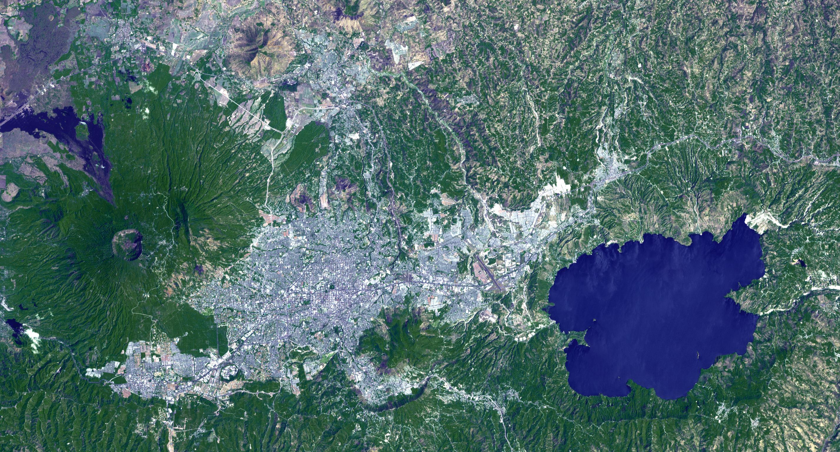
Lake Ilopango is a crater lake which fills a volcanic caldera in central El Salvador, immediately east of the capital city San Salvador. The caldera collapsed most recently in about 500 AD, producing 20 times as much ash as the Mount St. Helens eruption, and blanketing an area of at least 10,000 square kilometers waist-deep in ash. The only historical eruption occurred in 1879, forming lava domes, now islets in the lake. Quetzaltepec is the stratovolcano just west of the city. Its last eruption in 1917 produced lavas flowing down the northwest flank, and evaporated the crater lake. The image was acquired March 5, 2006, covers an area of 27 by 42 km, and is located at 13.7 degrees north, 89.1 degrees west.
With its 14 spectral bands from the visible to the thermal infrared wavelength region and its high spatial resolution of 15 to 90 meters (about 50 to 300 feet), ASTER images Earth to map and monitor the changing surface of our planet. ASTER is one of five Earth-observing instruments launched Dec. 18, 1999, on Terra. The instrument was built by Japan's Ministry of Economy, Trade and Industry. A joint U.S./Japan science team is responsible for validation and calibration of the instrument and data products.
The broad spectral coverage and high spectral resolution of ASTER provides scientists in numerous disciplines with critical information for surface mapping and monitoring of dynamic conditions and temporal change. Example applications are: monitoring glacial advances and retreats; monitoring potentially active volcanoes; identifying crop stress; determining cloud morphology and physical properties; wetlands evaluation; thermal pollution monitoring; coral reef degradation; surface temperature mapping of soils and geology; and measuring surface heat balance.
The U.S. science team is located at NASA's Jet Propulsion Laboratory, Pasadena, Calif. The Terra mission is part of NASA's Science Mission Directorate, Washington, D.C.
More information about ASTER is available at http://asterweb.jpl.nasa.gov/.
 Planetary Data System


