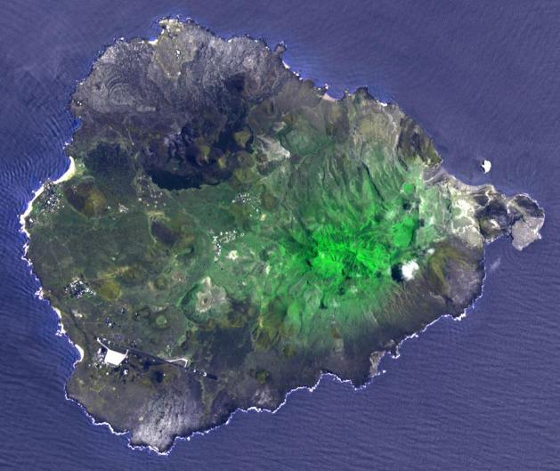
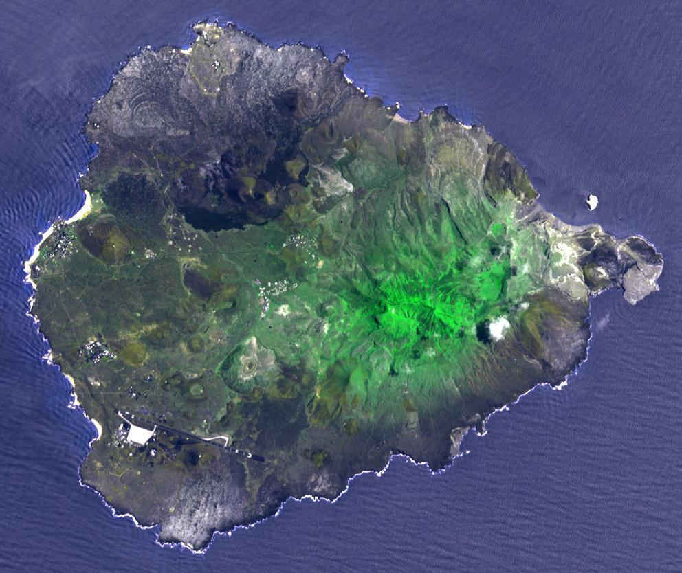
Two hundred years ago, Ascension Island was a barren volcanic edifice. Today its peaks are covered by lush tropical cloud forest. The small island is located in the mid-Atlantic, between South America and Africa. Charles Darwin visited the barren island and hatched a plot with Joseph Hooker, botanist and explorer. Beginning in 1850, ships stopping deposited an assortment of plants from botanical gardens in Europe, Argentina, and South Africa. Soon the island was "terra-formed". The image was acquired March 11, 2010, covers an area of 13 by 15 km, and is located at 8 degrees south, 14.4 degrees west.
With its 14 spectral bands from the visible to the thermal infrared wavelength region and its high spatial resolution of 15 to 90 meters (about 50 to 300 feet), ASTER images Earth to map and monitor the changing surface of our planet. ASTER is one of five Earth-observing instruments launched Dec. 18, 1999, on Terra. The instrument was built by Japan's Ministry of Economy, Trade and Industry. A joint U.S./Japan science team is responsible for validation and calibration of the instrument and data products.
The broad spectral coverage and high spectral resolution of ASTER provides scientists in numerous disciplines with critical information for surface mapping and monitoring of dynamic conditions and temporal change. Example applications are: monitoring glacial advances and retreats; monitoring potentially active volcanoes; identifying crop stress; determining cloud morphology and physical properties; wetlands evaluation; thermal pollution monitoring; coral reef degradation; surface temperature mapping of soils and geology; and measuring surface heat balance.
The U.S. science team is located at NASA's Jet Propulsion Laboratory, Pasadena, Calif. The Terra mission is part of NASA's Science Mission Directorate, Washington, D.C.
More information about ASTER is available at http://asterweb.jpl.nasa.gov/.
 Planetary Data System


