
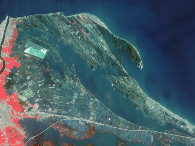
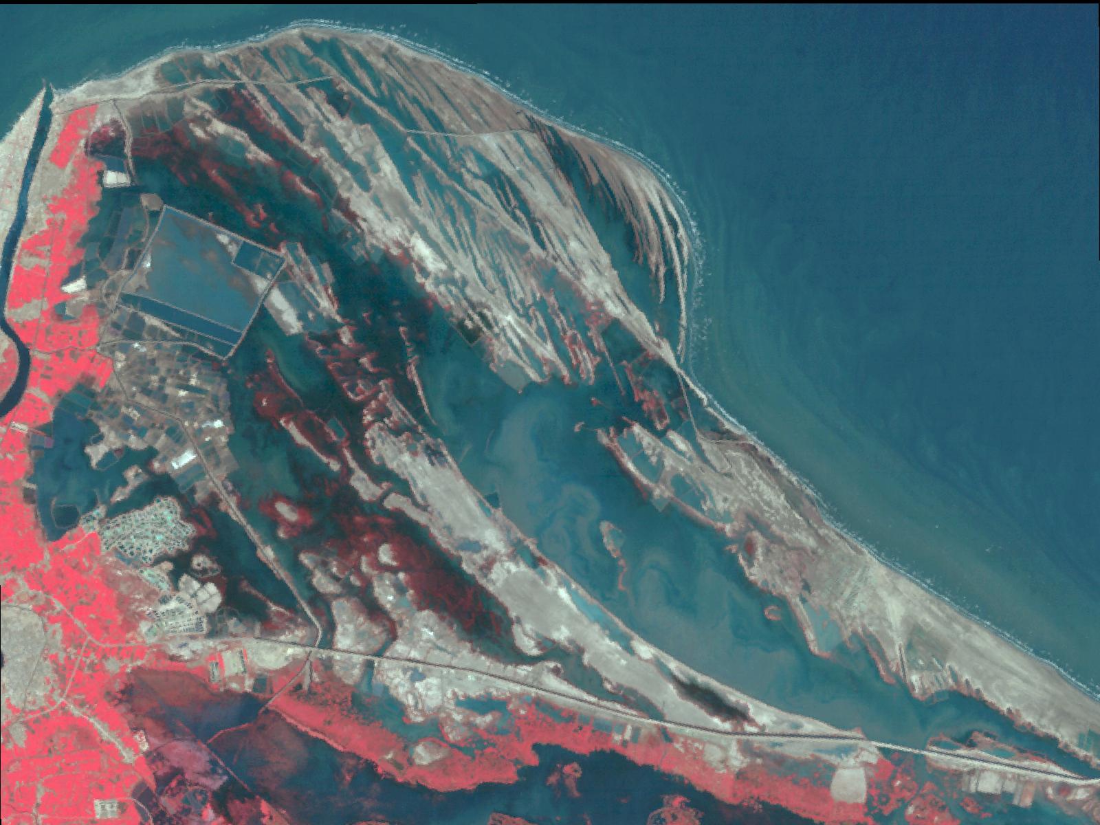
Nile Delta Fisheries 1987In the last three decades, Egypt has greatly expanded its aquaculture industry along the northeast coast of the Nile Delta, mainly for fish production. The shores of the Musallas lagoon are occupied by hundreds of aquaculture ponds enclosed by a series of short dikes. The 8,000 hectares of fish ponds contribute to over half of Egypt's aquaculture production, raising species such as mullet, seabass and sea bream. The two images were acquired by Landsat on April 22, 1987, and by ASTER on March 11, 2013. The area covered is 18 by 24 km, and is located at 31.3 degrees north, 32.1 degrees east.
With its 14 spectral bands from the visible to the thermal infrared wavelength region and its high spatial resolution of 15 to 90 meters (about 50 to 300 feet), ASTER images Earth to map and monitor the changing surface of our planet. ASTER is one of five Earth-observing instruments launched Dec. 18, 1999, on Terra. The instrument was built by Japan's Ministry of Economy, Trade and Industry. A joint U.S./Japan science team is responsible for validation and calibration of the instrument and data products.
The broad spectral coverage and high spectral resolution of ASTER provides scientists in numerous disciplines with critical information for surface mapping and monitoring of dynamic conditions and temporal change. Example applications are: monitoring glacial advances and retreats; monitoring potentially active volcanoes; identifying crop stress; determining cloud morphology and physical properties; wetlands evaluation; thermal pollution monitoring; coral reef degradation; surface temperature mapping of soils and geology; and measuring surface heat balance.
The U.S. science team is located at NASA's Jet Propulsion Laboratory, Pasadena, Calif. The Terra mission is part of NASA's Science Mission Directorate, Washington, D.C.
More information about ASTER is available at http://asterweb.jpl.nasa.gov/.
 Planetary Data System


