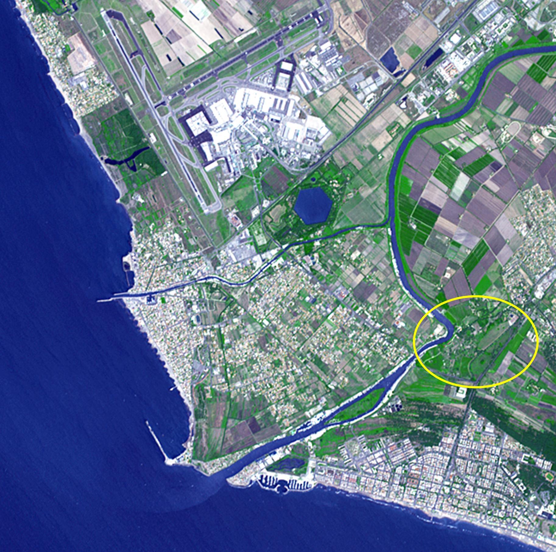
Thirty kilometers southwest of Rome lies what may be ancient Rome's greatest engineering achievement: Portus. Built in the first century A.D., Portus was Rome's principal maritime harbor, replacing the port city of Ostia on the Tiber River (circled area) that had become inadequate to handle the hundreds of ships loaded with food stuffs to feed Rome's 1 million+ inhabitants. The hexagonal Trajanic Basin and the outer Claudian Basin (now silted up) formed a port complex without equal. In 2000 years, the coastline has moved seaward, and the Trajanic Basin is now a private lake. The image was acquired June 29, 2014, covers an area of 10 by 10 km, and is located at 41.7 degrees north, 12.3 degrees east.
With its 14 spectral bands from the visible to the thermal infrared wavelength region and its high spatial resolution of 15 to 90 meters (about 50 to 300 feet), ASTER images Earth to map and monitor the changing surface of our planet. ASTER is one of five Earth-observing instruments launched Dec. 18, 1999, on Terra. The instrument was built by Japan's Ministry of Economy, Trade and Industry. A joint U.S./Japan science team is responsible for validation and calibration of the instrument and data products.
The broad spectral coverage and high spectral resolution of ASTER provides scientists in numerous disciplines with critical information for surface mapping and monitoring of dynamic conditions and temporal change. Example applications are: monitoring glacial advances and retreats; monitoring potentially active volcanoes; identifying crop stress; determining cloud morphology and physical properties; wetlands evaluation; thermal pollution monitoring; coral reef degradation; surface temperature mapping of soils and geology; and measuring surface heat balance.
The U.S. science team is located at NASA's Jet Propulsion Laboratory, Pasadena, Calif. The Terra mission is part of NASA's Science Mission Directorate, Washington, D.C.
More information about ASTER is available at http://asterweb.jpl.nasa.gov/.
