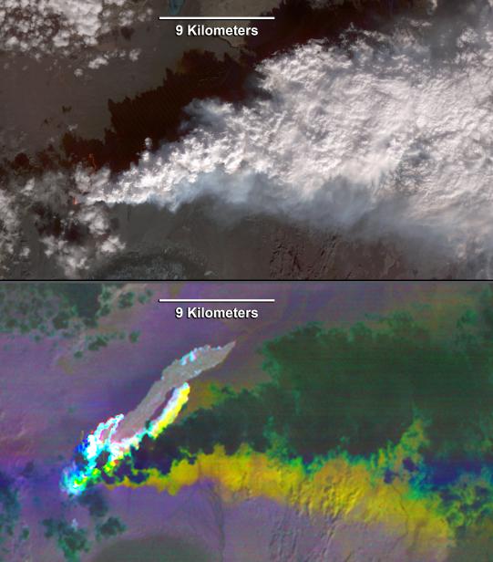
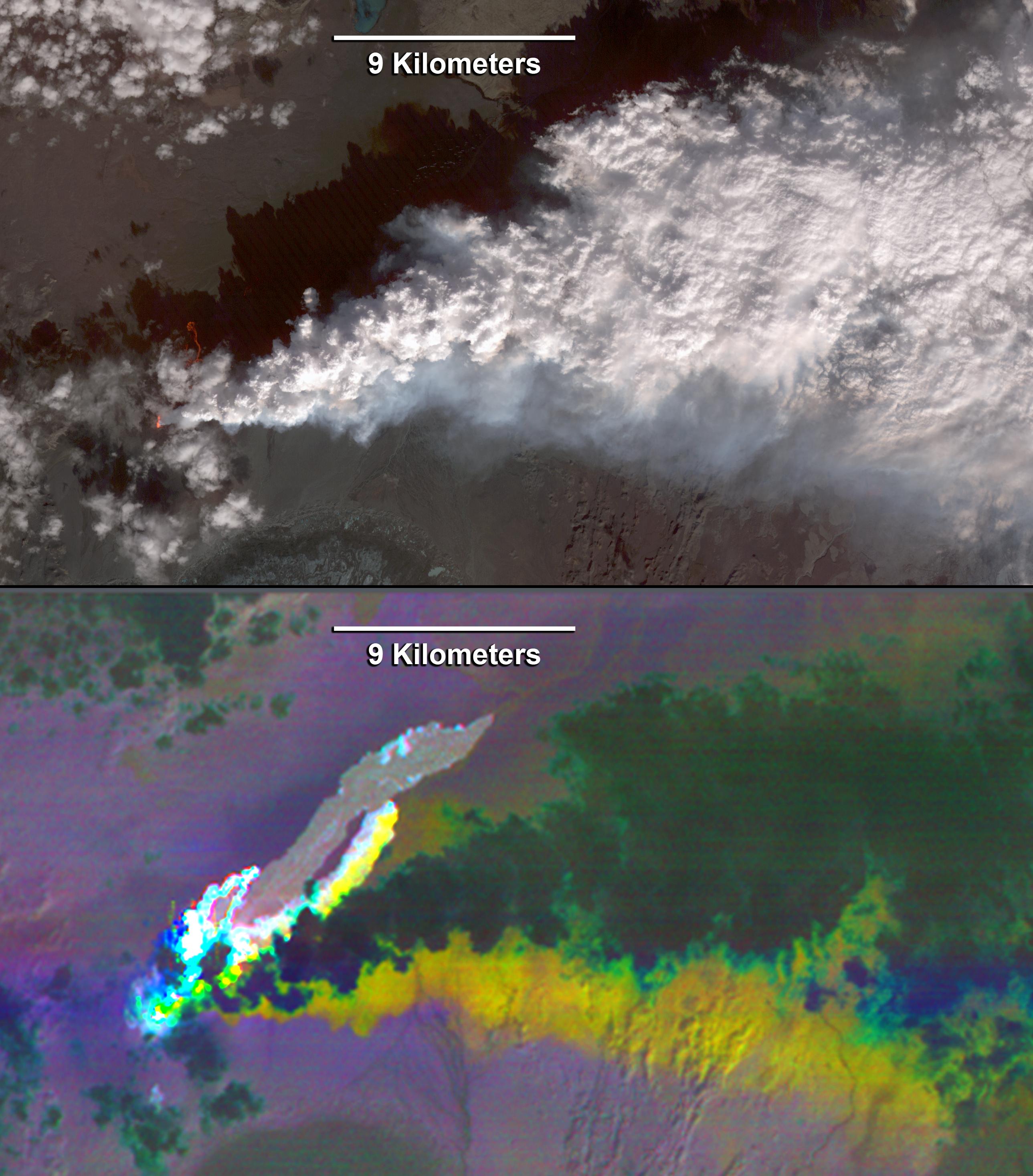
Since the end of August 2014, Iceland's Bardarbunga volcano has been pouring out lava from a growing fissure. The flows have been accompanied by spectacular lava fountains. So far, the flows have covered 14 square miles (36 square kilometers); and the eruption shows no signs of stopping. The eruption is caused by the spreading of the Eurasian Plate and the North American Plate moving apart from each other. Molten rock flows into the gap and erupts at the surface. On Sept. 23, The Advanced Spaceborne Thermal Emission and Reflection Radiometer (ASTER) instrument on NASA's Terra spacecraft captured these images of the eruption. The top, visible image shows the parts of the flows and fissure that are active and have fresh incandescent lava glowing in red. A white cloud of steam trails off to the east. The bottom, thermal image composite shows the hottest lava in white; cooler, older lava flows are in light gray. The steam plume is opaque, and appears dark due to its low temperature. The thermal data reveal a plume of sulfur dioxide (SO2), depicted in yellow, beneath the steam plume. The SO2 plume is best exposed along the southern margin of the steam plume. Other SO2 sources are seen along the fissure as bright yellow spots. The images cover an area of 24 by 14 miles (38.7 by 22 kilometers), and are located at 64.9 degrees north, 16.8 degrees west.
With its 14 spectral bands from the visible to the thermal infrared wavelength region and its high spatial resolution of 15 to 90 meters (about 50 to 300 feet), ASTER images Earth to map and monitor the changing surface of our planet. ASTER is one of five Earth-observing instruments launched Dec. 18, 1999, on Terra. The instrument was built by Japan's Ministry of Economy, Trade and Industry. A joint U.S./Japan science team is responsible for validation and calibration of the instrument and data products.
The broad spectral coverage and high spectral resolution of ASTER provides scientists in numerous disciplines with critical information for surface mapping and monitoring of dynamic conditions and temporal change. Example applications are: monitoring glacial advances and retreats; monitoring potentially active volcanoes; identifying crop stress; determining cloud morphology and physical properties; wetlands evaluation; thermal pollution monitoring; coral reef degradation; surface temperature mapping of soils and geology; and measuring surface heat balance.
The U.S. science team is located at NASA's Jet Propulsion Laboratory, Pasadena, Calif. The Terra mission is part of NASA's Science Mission Directorate, Washington, D.C.
More information about ASTER is available at http://asterweb.jpl.nasa.gov/.
 Planetary Data System


