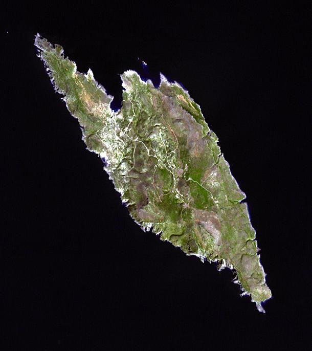
Antikythera is a Greek island in the Aegean Sea. With a population of 44, its main settlement is the port of Patamos. In 1900 sponge divers found a 1st century BC shipwreck, yielding numerous bronze and marble statues, as well as the corroded remnants of the oldest known analog computer. Known as the Antikythera Mechanism, it is a complicated device of dials and wheels that plotted the positions of the sun, five planets, phases of the moon, and solar and lunar eclipses. The image was acquired on 29 September 2013, covers an area of 9.2 x 10.3 km, and is located at 35.9 degrees north, 23.3 degrees south.
With its 14 spectral bands from the visible to the thermal infrared wavelength region and its high spatial resolution of 15 to 90 meters (about 50 to 300 feet), ASTER images Earth to map and monitor the changing surface of our planet. ASTER is one of five Earth-observing instruments launched Dec. 18, 1999, on Terra. The instrument was built by Japan's Ministry of Economy, Trade and Industry. A joint U.S./Japan science team is responsible for validation and calibration of the instrument and data products.
The broad spectral coverage and high spectral resolution of ASTER provides scientists in numerous disciplines with critical information for surface mapping and monitoring of dynamic conditions and temporal change. Example applications are: monitoring glacial advances and retreats; monitoring potentially active volcanoes; identifying crop stress; determining cloud morphology and physical properties; wetlands evaluation; thermal pollution monitoring; coral reef degradation; surface temperature mapping of soils and geology; and measuring surface heat balance.
The U.S. science team is located at NASA's Jet Propulsion Laboratory, Pasadena, Calif. The Terra mission is part of NASA's Science Mission Directorate, Washington, D.C.
More information about ASTER is available at http://asterweb.jpl.nasa.gov/.
 Planetary Data System


